The document provides background information on Mughal history and architecture. It discusses:
1) The Mughal dynasty was founded by Babur in 1526 and major emperors included Akbar, Shah Jahan, and Aurangzeb.
2) Mughal architecture is known for its domes, arches, and use of marble. Iconic buildings include the Taj Mahal and Humayun's Tomb.
3) Shah Jahan founded Shahjahanabad in the 1600s, laying out the city with a geometric plan centered around the Red Fort and Jama Masjid mosque.
Aurangzeb - The Mughal Emperor - History India – Mocomi.comMocomi Kids
Aurangzeb, born in 1618, was considered as the last great Mughal emperor. He was the third son of Shah Jahan and Mumtaz Mahal. By the time he turned 16, Shah Jahan gave him the post of the governor of Deccan. Aurangzeb moved to Kirki in the Deccan region, which he renamed, Aurangabad, after him.
Learn about Aurangzeb, son of Shah Jahan and Mumtaz Mahal, visit: http://mocomi.com/aurangzeb/
Mughal art and architecture - Thesmi ThomasThesmi Thomas
The slide give a basic idea about the lifestyle of during Mughal rule. This slide mainly focus on Mughal architecture, Mughal music, Mughal literature and Mughal paintings.
Rise of British Rule and other International powers in India; Positive and Negative reforms of British in Indian System, Rebellions and Mutiny, Effects of World War on India under British Rule. Independent Kashmir Issue and other outcomes of end of British rule.
Phases of Harappan Civilization; Town planning system; Important cities of Indus Valley Civilization: Harappa & Mohenjodaro; Economic life; Decline of Civilization..
The life of plazas and sitting spaces; Sun ,wind ,trees ,water, food, The street; The “undesirables”. Effective capacity. Indoor spaces. Concourse and mega-structures; Smaller cities and places.
Syllabus Overview
•To study the Evolution of Culture and Aesthetics in India and Abroad.
•Understanding of fundamentals of Aesthetics, Culture and Technology.
•To develop the ability to relate the historic lessons imparted by the evolution cycle in Planning.
What is Aesthetics? Why study Aesthetics?
Concept of Beauty
What do u understand by Aesthetics?
Aesthetics Experience: Visual, Tactile, Kinesthetic, Olfactory, Lyricism, Auditory, Gustatory, 2D Art, Digital Art..
How philosophers have said it…Classical theories of Aesthetics.
Relationship of Aesthetics with other Cultural values.
Book Review: “The Culture of Cities” by Lewis Mumford;
Protection and the Medieval town
Court, Parade, and Capital
The Insensate Industrial town
Rise and fall of Megalopolis
The Regional framework of Civilization
The politics of Regional Development
Social basis of the New Urban Order
Ism's as an expression of built form and planning.
◦ Mannerism (mid 1500s)
◦ Neo classism (mid 1700s)
◦ Romanticism (late 1700s- early 1800s)
◦ Realism (France, mid 1800s)
◦ Impressionism (late 1800s)
◦ Post Impressionism (very late 1800s and into the turn of the 20th century)
◦ Symbolism (Turn of the twentieth century)
◦ Cubism (first two decades of 1900s)
◦ Surrealism (birth in 1924)
◦ Abstract Expressionism (birth in 1940s)
Importance of Creative, Visual Arts.
Art as a medium of Communication and Social Expression.
Human Habitat as an artistic expression.
Classification of various Art forms as per global location and time frame.
Importance of Creativity and Interdisciplinary Symbiotic relation with other disciplines of Art forms.
Art as a Communicative system/Theory of Communication.
The fundamentals of Art / Principles of Art and its relation with City Planning.
Various Ism's and their relation with evolution of Culture and Art.
Francesca Gottschalk - How can education support child empowerment.pptxEduSkills OECD
Francesca Gottschalk from the OECD’s Centre for Educational Research and Innovation presents at the Ask an Expert Webinar: How can education support child empowerment?
How to Make a Field invisible in Odoo 17Celine George
It is possible to hide or invisible some fields in odoo. Commonly using “invisible” attribute in the field definition to invisible the fields. This slide will show how to make a field invisible in odoo 17.
Model Attribute Check Company Auto PropertyCeline George
In Odoo, the multi-company feature allows you to manage multiple companies within a single Odoo database instance. Each company can have its own configurations while still sharing common resources such as products, customers, and suppliers.
Synthetic Fiber Construction in lab .pptxPavel ( NSTU)
Synthetic fiber production is a fascinating and complex field that blends chemistry, engineering, and environmental science. By understanding these aspects, students can gain a comprehensive view of synthetic fiber production, its impact on society and the environment, and the potential for future innovations. Synthetic fibers play a crucial role in modern society, impacting various aspects of daily life, industry, and the environment. ynthetic fibers are integral to modern life, offering a range of benefits from cost-effectiveness and versatility to innovative applications and performance characteristics. While they pose environmental challenges, ongoing research and development aim to create more sustainable and eco-friendly alternatives. Understanding the importance of synthetic fibers helps in appreciating their role in the economy, industry, and daily life, while also emphasizing the need for sustainable practices and innovation.
Palestine last event orientationfvgnh .pptxRaedMohamed3
An EFL lesson about the current events in Palestine. It is intended to be for intermediate students who wish to increase their listening skills through a short lesson in power point.
The Roman Empire A Historical Colossus.pdfkaushalkr1407
The Roman Empire, a vast and enduring power, stands as one of history's most remarkable civilizations, leaving an indelible imprint on the world. It emerged from the Roman Republic, transitioning into an imperial powerhouse under the leadership of Augustus Caesar in 27 BCE. This transformation marked the beginning of an era defined by unprecedented territorial expansion, architectural marvels, and profound cultural influence.
The empire's roots lie in the city of Rome, founded, according to legend, by Romulus in 753 BCE. Over centuries, Rome evolved from a small settlement to a formidable republic, characterized by a complex political system with elected officials and checks on power. However, internal strife, class conflicts, and military ambitions paved the way for the end of the Republic. Julius Caesar’s dictatorship and subsequent assassination in 44 BCE created a power vacuum, leading to a civil war. Octavian, later Augustus, emerged victorious, heralding the Roman Empire’s birth.
Under Augustus, the empire experienced the Pax Romana, a 200-year period of relative peace and stability. Augustus reformed the military, established efficient administrative systems, and initiated grand construction projects. The empire's borders expanded, encompassing territories from Britain to Egypt and from Spain to the Euphrates. Roman legions, renowned for their discipline and engineering prowess, secured and maintained these vast territories, building roads, fortifications, and cities that facilitated control and integration.
The Roman Empire’s society was hierarchical, with a rigid class system. At the top were the patricians, wealthy elites who held significant political power. Below them were the plebeians, free citizens with limited political influence, and the vast numbers of slaves who formed the backbone of the economy. The family unit was central, governed by the paterfamilias, the male head who held absolute authority.
Culturally, the Romans were eclectic, absorbing and adapting elements from the civilizations they encountered, particularly the Greeks. Roman art, literature, and philosophy reflected this synthesis, creating a rich cultural tapestry. Latin, the Roman language, became the lingua franca of the Western world, influencing numerous modern languages.
Roman architecture and engineering achievements were monumental. They perfected the arch, vault, and dome, constructing enduring structures like the Colosseum, Pantheon, and aqueducts. These engineering marvels not only showcased Roman ingenuity but also served practical purposes, from public entertainment to water supply.
The French Revolution, which began in 1789, was a period of radical social and political upheaval in France. It marked the decline of absolute monarchies, the rise of secular and democratic republics, and the eventual rise of Napoleon Bonaparte. This revolutionary period is crucial in understanding the transition from feudalism to modernity in Europe.
For more information, visit-www.vavaclasses.com
Operation “Blue Star” is the only event in the history of Independent India where the state went into war with its own people. Even after about 40 years it is not clear if it was culmination of states anger over people of the region, a political game of power or start of dictatorial chapter in the democratic setup.
The people of Punjab felt alienated from main stream due to denial of their just demands during a long democratic struggle since independence. As it happen all over the word, it led to militant struggle with great loss of lives of military, police and civilian personnel. Killing of Indira Gandhi and massacre of innocent Sikhs in Delhi and other India cities was also associated with this movement.
A Strategic Approach: GenAI in EducationPeter Windle
Artificial Intelligence (AI) technologies such as Generative AI, Image Generators and Large Language Models have had a dramatic impact on teaching, learning and assessment over the past 18 months. The most immediate threat AI posed was to Academic Integrity with Higher Education Institutes (HEIs) focusing their efforts on combating the use of GenAI in assessment. Guidelines were developed for staff and students, policies put in place too. Innovative educators have forged paths in the use of Generative AI for teaching, learning and assessments leading to pockets of transformation springing up across HEIs, often with little or no top-down guidance, support or direction.
This Gasta posits a strategic approach to integrating AI into HEIs to prepare staff, students and the curriculum for an evolving world and workplace. We will highlight the advantages of working with these technologies beyond the realm of teaching, learning and assessment by considering prompt engineering skills, industry impact, curriculum changes, and the need for staff upskilling. In contrast, not engaging strategically with Generative AI poses risks, including falling behind peers, missed opportunities and failing to ensure our graduates remain employable. The rapid evolution of AI technologies necessitates a proactive and strategic approach if we are to remain relevant.
How libraries can support authors with open access requirements for UKRI fund...
10 Mughal period in India
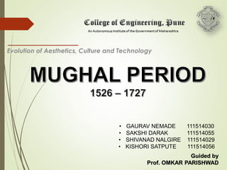
1. • GAURAV NEMADE 111514030
• SAKSHI DARAK 111514055
• SHIVANAD NALGIRE 111514029
• KISHORI SATPUTE 111514056
Guided by
Prof. OMKAR PARISHWAD
Evolution of Aesthetics, Culture and Technology
2.
3. INDIA BEFORE MUGHALS
• Before the Mughal invasion of 1526, the north of the subcontinent was
divided up into several independent Hindu and Muslim kingdoms.
• Many of these were culturally very sophisticated, and paintings and
architecture from many different areas survive to illustrate this.
• Hindu painting at this time in northern India dealt mainly with mythical and
religious subjects such as the exploits of the god Krishna.
• Another important group of patrons of medieval Indian manuscript painting
was the Jain merchant community of western India.
• Jainism is a religion similar to Buddhism in its commitment to non-violence
and its lack of an individual deity.
• Wealthy Jain businessmen were (and still are) pious patrons of devotional
art, and many of the most beautiful manuscripts and temples of the pre-
Mughal period were commissioned by them.
4. MUGHAL HISTORY
1. Family Tree Of Mughals
2. Growth of Mughal Empire
3. Mughals, their history and Architecture
4. Culture
5. Economy
6. Classes in Mughal Empire
7. BABUR
1483 - 1530
• The Mughal Empire was founded by Babur.
• He was born on 14 Feb, 1483.
• Founded the Mughal Empire after his victories
at the Battle of Panipat (1526) and the Battle
of Kanwa.
• Defeated the Delhi Sultanate & established
the Mughal Empire.
• Gained control of the whole Northen India.
• Died at the age 47 in 1530.
8. A portrait of Babur, from an early illustrated
manuscript of the Baburnama 1589-90
The First Battle of Panipat, on 21 April 1526, was fought
between the invading forces of Babur and the Lodi
Empire
10. • Humayun, was born on 17 March 1508.
• Succeeded his father in 1531 as ruler of
Mughal territories in India.
• At the age of 23, he was an inexperienced
ruler when he came to power.
• In 1540,Sher Shah of Bengal defeated
him & took over the Mughal Empire.
• Humayun conqurred the Punjab, Delhi,
Agra, and reoccupied the throne of Delhi
after an interval of 15 years.
• He died on 26 Jan, 1556.
12. • He was born on 14 Oct,1542 also
known as Akbar the Great or Akbar.
• Mughal Emperor from 1556 at the age
of 14. He was one of the greatest rulers
of the Mughal Dynasty in India.
• An ambitious, noble commander and
the Great administrator.
• Tolerant of religions.
• Famous for his patronage of the arts.
• Died in 1605.
14. • Jahangir was born on 30 Aug, 1569.
• He was the fourth Mughal Emperor who ruled
from 1605.
• He was the eldest son of Akbar and was
declared successor to his father from an early
age.
• Died in1627.
16. • Shah Jahan was born on 5 Jan, 1594. Also known as Shah Jahan I.
• He assumed the Mughal throne on 24 Jan, 1628 in Agra, after the death of
Jahangir.
• He has left behind an extraordinary architectural legacy.
• Taj Mahal was built in Agra in the memory oh his favourite wife, Mumtaz.
• Died on 22 Jan, 1666.
17.
18. AURANGZEB
• Aurangzeb was born on 24th Oct, 1618 at
Dohad in M.P.
• He wrested India’s crown from his father in
June 1658, after defeating his brother Prince
Dara Shukoh’s armies.
• Dara Shikoh, the eldest son of Shah Jahan
was the Governer of Bengal, Bihar, and
Orissa; Aurangzeb governed the Deccan;
and Murad was Governor of Gujarat and
Malwa.
• Aurangzeb took his own father prisoner, and
also kill his brothers and took all the Empire
from them.
• Died on 20 Feb, 1707 in Ahmednagar.
21. CULTURE
•Rulers also worked to spread Muslim culture through
India.
•Invited artists, scholars from other parts of Islamic world to
Delhi.
•New culture formed, blending Muslim, Indian elements.
•Example: new language, Urdu, formed from
combination of Arabic, Sanskrit.
•Religious tolerance was a new idea that Akbar brought
with him, but this declined as other emperors came to
power.
•The Mughal empire also merged their beliefs on the role
of women and social classes into daily Indian life.
22. ECONOMY
• The Mughals used the Mansabdar system to generate
land revenue.
• The emperor would grant revenue rights to a
Mansabdar in exchange for promises of soldiers in war-
time.
• The greater the size of the land the emperor granted,
the greater the number of soldiers the Mansabdar had
to promise.
• The Mansab was both revocable and non-hereditary.
• This gave the center a fairly large degree of control
over the Mansabdars.
23. ECONOMY
• The Indian economy boomed under the Mughals,
because of the creation of a road system and a
uniform currency, together with the unification of the
country
• Cities and towns boomed under the Mughals
• however, for the most part, they were military and
political centres, not manufacturing or commerce
centres.
24. CLASSES IN MUGHAL
EMPIRE
• Society in Mughal times was organized on a feudal
basis and the head of the social system was
Emperor.
• He enjoyed an unparallel status. He was the
ultimate authority in everything.
• Next in rank were the nobility along the zamindar.
• Socially and economically the Mughal nobility
formed a privileged class. There were men of every
type and nationality among the Mughal nobles.
• Clan or family links were the most important
considerations for recruitment and admission to the
aristocratic class of the society.
• There was a large class of merchants and traders.
They had their own rights based on tradition and
protection of life and property. They also maintained a
high standard of living.
27. The Mughal Period in Indian
history is one of the glorious
periods that have enriched
India in multifarious ways. Art
and architecture has
received a great fillip during
Mughal period that has
gifted us with architectural
gems that have defined the
passage of time in there
appeal and splendor.
28. SPECIFICATIONS OF MUGHAL
ARCHITECTURE
DOMES
One of the attractive features of
Mughal architecture were the
domes.
It is found that domes in pre-
Mughal India have a standard
squat circular shape with a lotus
design and bulbous finial at the
top.
These dome structures were
derived from hindu architecture.
34. TAJ MAHAL
Taj Mahal, one of the seven wonders of the world is a ivory-white
marble structure present in Agra.
It was commissioned in 1632 by the Mughal emperor Shah
Jahan to house the tomb of his favorite wife Mumtaz.
The tomb is the centerpiece of a 42-acre complex, which
includes a mosque and a guest house and a set of formal
gardens bounded on three sides by a wall.
Construction of Taj mahal is believed to be completed in 1653 at
a cost of 32 million rupees estimated at that time.
The construction project employed some 20,000 artisans under
the guidance of a board of architects led by the court architect
Ustad Ahmad Lahauri.
Taj Mahal was designated as a UNESCO World Heritage site for
being “the jewel of Muslim art in India and one of universally
admired masterpieces of the world’s heritage”.
36. HUMAYUN’S TOMB
The first Mughal building
to be constructed in
India in A.D 1564.
It was constructed by
Persian architect .
The mausoleum is
placed in a spacious,
square park like
enclosure.
There is a garden laid in
form of rectangles nd
squares compartments.
38. BULAND DARWAZA
Also known as “gate of
magnificence”.
Buland Darwaza is the
highest gateway in the
world.
It is made up of red and
buff sandstone,
decorated with white and
black marble.
Total height of structure is
54 meters from ground.
40. DELHI – THE MUGHAL CAPITAL
Delhi is a city that has seen both glory and destruction in its long. It has been
plundered, ruined time and again only to spring from its ashes to become the
capital of powerful dynasties.
Fortunately, the resilient and
enduring culture and heritage has
withstood the test of time and the
city continues to live.
The heart of Delhi can be found in
Old Delhi, 350 yrs old, yet strong
and beating. Its many-branched
arteries are narrow with age, its
veins jostle for space, and its
lifeblood is bound to get clotted at
some places at any time.
No city reflects the endless drama of
change better.
41. Introduction - SHAHJAHANABAD
By the time the emperor
Shah Jahan (1928-58) came
to the throne, the Mughal
empire had ruled
continuously over northern
India for almost a century
and the artistic tradition of
Mughals had reached a
stage of maturity and
refinement. During Shah
Jahan’s rein the
architectural development
was remarkable due to his
interest and patronage of
architecture. His buildings
were characterized by
sensitivity and delicateness.
42. Background
The Mughal period from Akbar ( 1566-
1605) to Shah Jahan was comparatively
long and peaceful; it was marked by the
development of cities. Shah Jahan
established residences in Lahore, Agra
and Delhi. In 1638, he laid the foundations
of new capital, centered around Lal Qila
or Red Fort. This was an improvement on
the citadel in Agra, because of the
experienced gained by Shah Jahan,
where limited space and narrow streets
made it difficult for the processions of his
troupes.
Shahahan
1627 - 1658
43. The site for the new capital in Delhi was
ideally suited as a convergence point of
land routes, being centrally located
geographical. The site was situated on the
western bank of river Yamuna where a
natural projection formed a triangle with the
land and the river.
GEOGRAPHICAL IMPORTANCE
OF SHAHAJAHANABAD
44. Muslim Urban Life
By Shah Jahan’s time, the Muslims in India had partially Indianized.
Under the Mughals, they were mainly an urban community, and they disliked
village. Muslim life was closely linked to religious event, as well as to
ceremonies and festivals or ritual events.
Shah Jahan was a religious person and was very particular about observing
ceremonies. On the morning of the most important Muslim festival Eid-i-Qurba
(the fest of the sacrificed), Muslims go to Id-gah, or place of prayer, generally
situated outside the city or village in an open space. The Id-gah of
Shahjahanabad is located on the crest of the ridge, west of the city.
45. Spatial Structure
Urban spatial structure of Shahjahanabad was different from that of the other Mughal
Capitals, because it was planned and built by one concentrated planning effort.
Creation of architectural expression of what has often been called the patrimonial
system in its climax.
The shurafa usually were situated to the west of the place, along one of the two
boulevards at Chandni Chowk, & originated from the employer’s palace, thus
furnishing the city with an unequivocal structure.
Those professional groups delivering fresh agrarian products to the city must have
settled along the southern and south-south-western rim of the city walls (Delhi gate &
Turkman gate): this is where institutions , such as Masjid gadarion (shephered’s
mosque), Masjid kasai (butcher’s mosque) were located. They all represent “low
ranking traders”.
The closer to the core of the city the more socially recognized are the professional
settled there: weavers, producers of wool, traders of saddle- horses, oil- extractors &
manufacturers of straw goods, each of them represented by their respective mosques.
Further, in the direction of Chandni Chowk, mostly representative of the trading
professions, e.g. traders of fabrics, fish, meats and luxury goods, but also some of the
professional groups processing goods, e.g. producers of water pipes can be found, all
of them are characterized by the spatial proximity to the imperial house.
46.
47.
48. Planning of Shahjahanabad
The city was planned according
to hind planning principles of
shilpashastra from vastushastra.
The site was placed on a high
land as in the shastra and was
kamukha or bow shaped, for this
ensured its prosperity.
The arm of the archer was
Chandni Chowk.
The string was Yamuna river.
The junction of the two main
axes is the most auspicious point
in the whole region and was
therefore the red fort.
49.
50. The city form- morphology elements
• The urban infrastructure was laid out in a geometric pattern.
• Shows traces of both Persian and Hindu traditions of town planning
and architecture with the Persian influence largely accounting for
the formalism and symmetry of the palaces gardens and
boulevards.
The designed infrastructure of Shahjahanabad comprised-
• The fort
• The Friday mosque.
• The other major mosques, including the corresponding waqf
properties.
• The two main boulevards.
• The bazaars around the Friday mosque.
• The elaborate system of water channels.
• The major gardens and the city wall.
• The arrangement of these planned elements was influenced by
certain site features, which precluded absolute geometry.
51. The Fort & The Mosque
The Red Fort and Jama Masjid
were thorough fares that framed
the city.
From Lahore Gate ran a broad
avenue with a covered arcade
designed and paid for by Jahan
Ara- that housed over 1500 shops.
Today known as Chatta Bazaar.
The remainder of Shahjahanabad
took shape within the city walls
with its havelis mansions, mosques,
temples, Sikh shrines and the
gardens of the nobility.
The walled and guarded
establishments of these grandees
included private living quarters for
the nobles and their harem.
52.
53. The Red Fort (Palace Complex)
The plan of the fort was made by Shah Jahan and two Muslim
architects. The foundation stone of the fortified place was laid in 1638.
Construction work began in 1639 and was complete in just nine year.
The palace complex, located along the western river front was built as
an ideal residence for the emperor, it was conceived and designed as
a paradise on Earth. The layout of the fort was drawn on a formal
geometrical plan actually an irregular octagon with two long sides on
east and west. It had two gates, that on the west was called the Lahori
Darwaza, while that on the south was the Delhi Darwaza. Bearing on the
cardinal points, the elements of the fort were arranged in the
geometrical pattern that reflected the life and customs of Mughal
court.
54. Jami Masjid
The Jami Masjid was the principal
mosque of the capital, the
congregational centre and one of the
most important institutions for the
Muslims in Shahjahanabad. Shah Jahan
commenced building the mosque in
1650, and completed it 6years later. It
was located at the central part of the
city and on a raised foundation at the
top of a hill 9mts above the street level.
The mosque dominated the walled city
as a visual as well as a spiritual symbol of
supreme god. Its architectural design
followed by traditional style, but
improvements were made here as well.
Te courtyard was large and was
enclosed by pillared corridors. Its
layouts, having a main entrance on the
east, was geometric and the whole
mosque faced west towards Mecca.
Muslim urban life was closely evolved
around the Jami Masjid.
55. Major Streets
The streets in Mughal capital were usually narrow and crooked. However, the
major streets in the new capital were designed as wide and straight. The east-
west street called Chandni Chowk connected the Lahori Darwaza of the fort
to the Lahori Darwaza of the city wall. It ran in a straight line forming a wide
boulevard with broad vista. The Fort was visible from any place on the street.
This perspective view marked a new concept of town planning for the
Mughal capital. Chandni Chowk is 1.4km in length and jogged right at the
Fatehpuri Begum Mosque. It was built as the central axis of the city..
56. MAJOR STREETS
Another main street the Faiz Bazaar or Akkarabadi
Bazaar, was also wide and straight. It had a north-
south axis and connected Delhi gate of the fort with
the city walls Delhi gate and is about 1km in length.
These major two streets developed as processional
routes, as well as commercial arteries. The streets also
assumed importance for ritual events.
57. Five Main Streets
The basic network of the five main streets extended from Chandni Chowk and
Faiz Bazaar to other gates and to different part of the walled city. The streets were
built as the spines of major activities and developed as commercial thorough
affairs. They connected the Ajmeri Darwaza with the Jami Masjid and Turkman
and Lahori Darwazas. Their intersections formed a landmark. Important buildings
were located on these arteries. The other streets were less significant and were
mainly built as access roads to the residential areas.
58. MAHALLA / KATRA
There was a tendency of the cities' population to settle by
ethnic affiliations and to live in the same neighborhoods.
The urban community and the Mughal capital was
formed by such districts or wards, known as mahallas
and katras. These homogeneous units also define
cultural as well as socio-economic activities. There were
36 mahallas in the walled city. Each katra had an
enclosed space created between residential and
commercial buildings having entry to a katra made
through a gate.
These courtyards were environmentally sound and acted
as main ventilation shafts in a hot and arid climate.
Communal open space was conspicuously absent as it is
so today. There was not much need for communal open
space, other than for worship which is why the Jami
Masjid was provided with a spacious courtyard.
Thus, it is clear that planning of a residential area in the
Mughal capital did not provide for social units.
59. Streets, Bazaars, Chowks
The city was separated from the surrounding land by a wall and a moat.
The main thoroughfares , the secondary roads and the bazaars were
public space.
Havellis
The members of the imperial household whio lived outside the fort/
palace built large mansions (havellis) on the model of the imperial
design of the red fort. As a rule these city palaces accommodated not
only the owner and his family, but also their numerous followers,
servants, and craftsmen with their workshops. The internal organisation
of the space within the havellis was therefore also based on the strict
distinction between the public, semi private and private spaces.
Interior courtyard of a Havelli in the walled city
Notice the spill out of day to day activities in the courtyard- thus the
typology was not only suited climatically but also enhanced the living.
60.
61. Streetscapes
There emerges a hierarchy of
streets in the layout of the city.
The secondary streets were
the ones which entered the
south of the city from Chandni
Chowk. (thus they were
perpendicular for some
distance and then assumed
an organic form once deep in
the city).
The secondary street structure
also includes the streets that
are parallel to the city walls-
forming a concentric ring so to
say, in the southern part of the
city. They then intermingle at
chowks with the third layering
of streets, which derive their
character from the fact that
they are perpendicular to the
main mosque, Jama Masjid.
62. Bagh
The north area of Chandni Chowk was occupied by a bagh called
the Jahanara Begumi’s Garden. It was laid out in a planned fashion,
in addition to the road planning of Chandni Chowk.
CITY WALLS
The layout o the city walls was based on a geometrical planning; i.e. to say,
a polygonal plan with gateways. The four main gates were Delhi Darwaza
on south, the Ajmeri Darwaza on the south-west, the Lahori Darwaza on
the west and the Kashmiri Darwaza on the north. These important gates
were positioned according to the basic network of the city, being laced on
the cardinal points. The graphic representation of the city was indicated
geometric planning and the geometric placement of the main gates.
63. Conclusion
The new Mughal capital and the fort were designed as an ideal city and a
paradise on Earth.
The design and planning methods were geometric and provided for green
areas (gardens) and water facilities.
Principal elements in the town planning were the fort, the Jami Masjid, two
major streets, city wall and gates, the Bagh, the Id-gah and the Karawan
Sarai.
The Red fort was designed as a symbol of Muslim power and as an ideal living
space on a formal geometrical plan.
The Jami Masjid was designed as a symbol of Muslim power and of the
capital.
Two major streets were developed as the central axis and as processional
routes and they were new elements in the capital; the design and the
planning method was a new concept in town planning in the Mughal capital.
Planning in the capital did not provide planning of residential areas.
The city wall and gateways were drawn on a geometrical plan.
Urban forms and patterns developed on there own in response to the
emperor’s basic need and idea and little attention was paid to the social
planning.