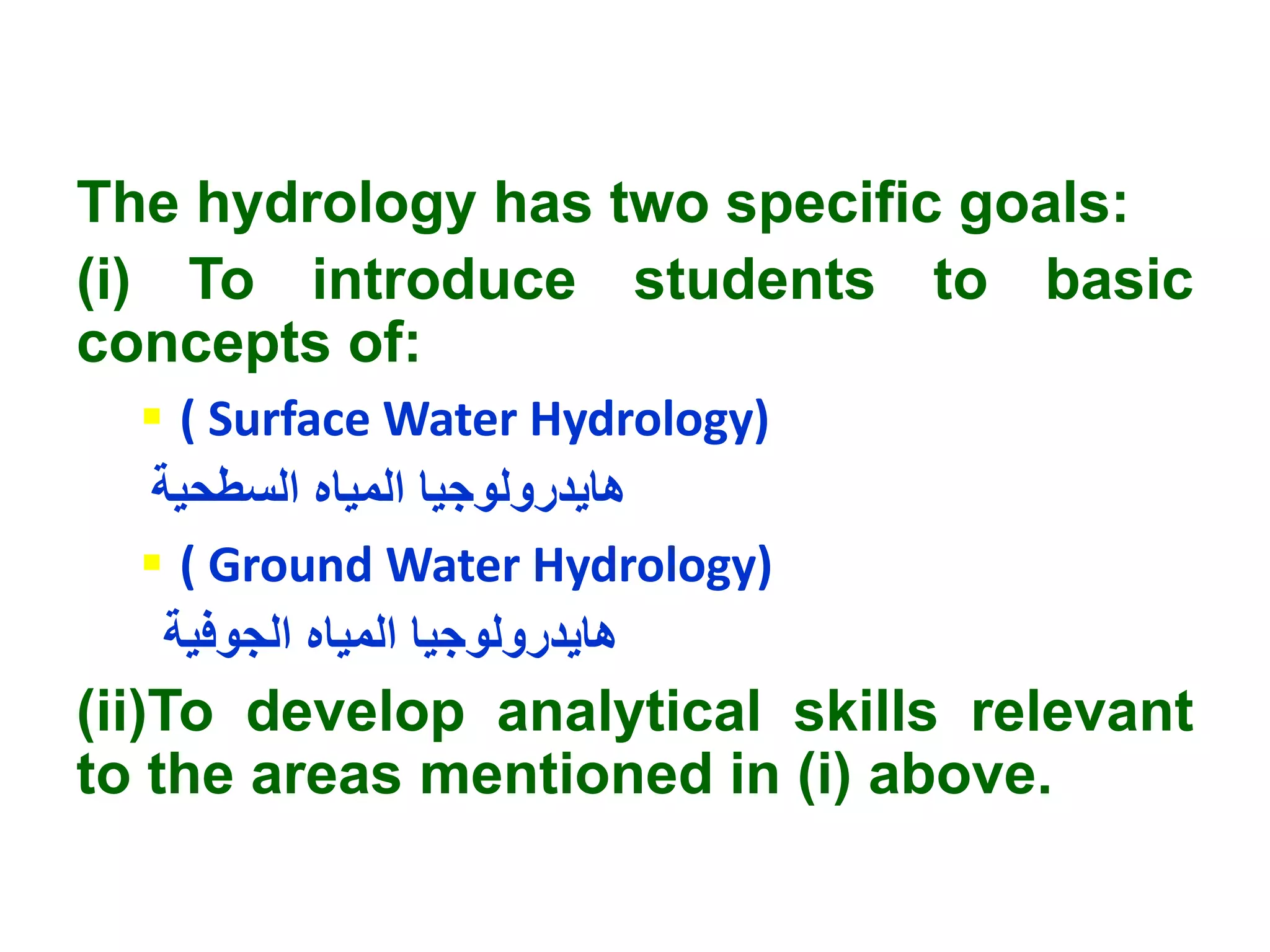
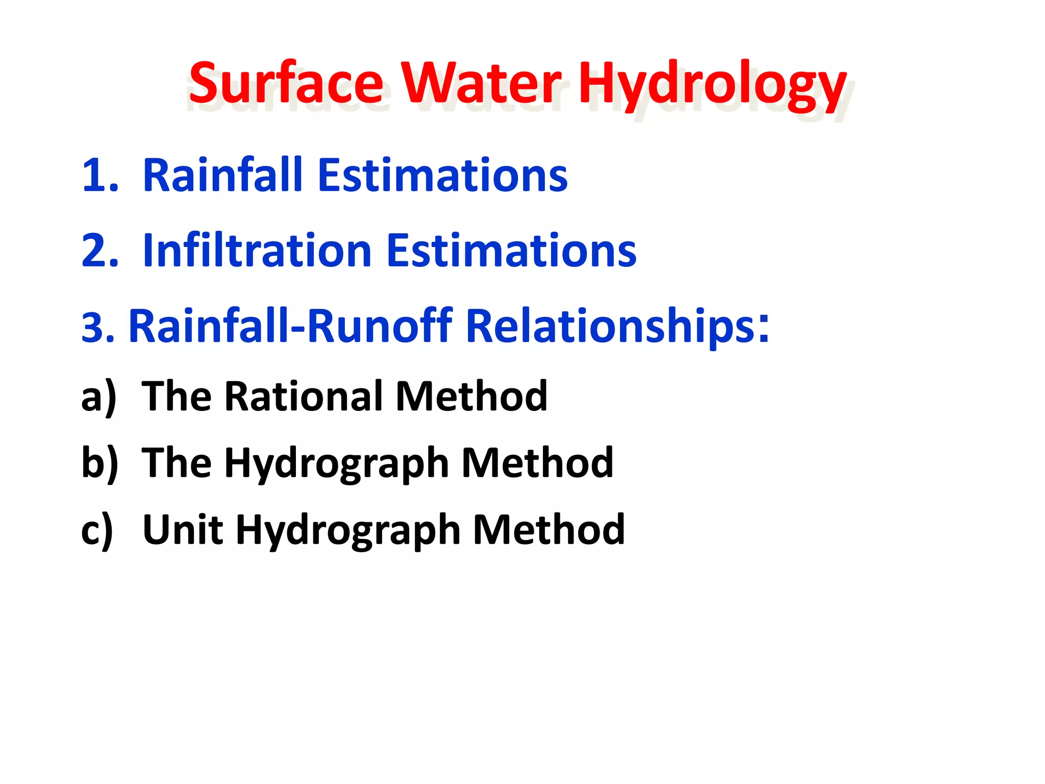
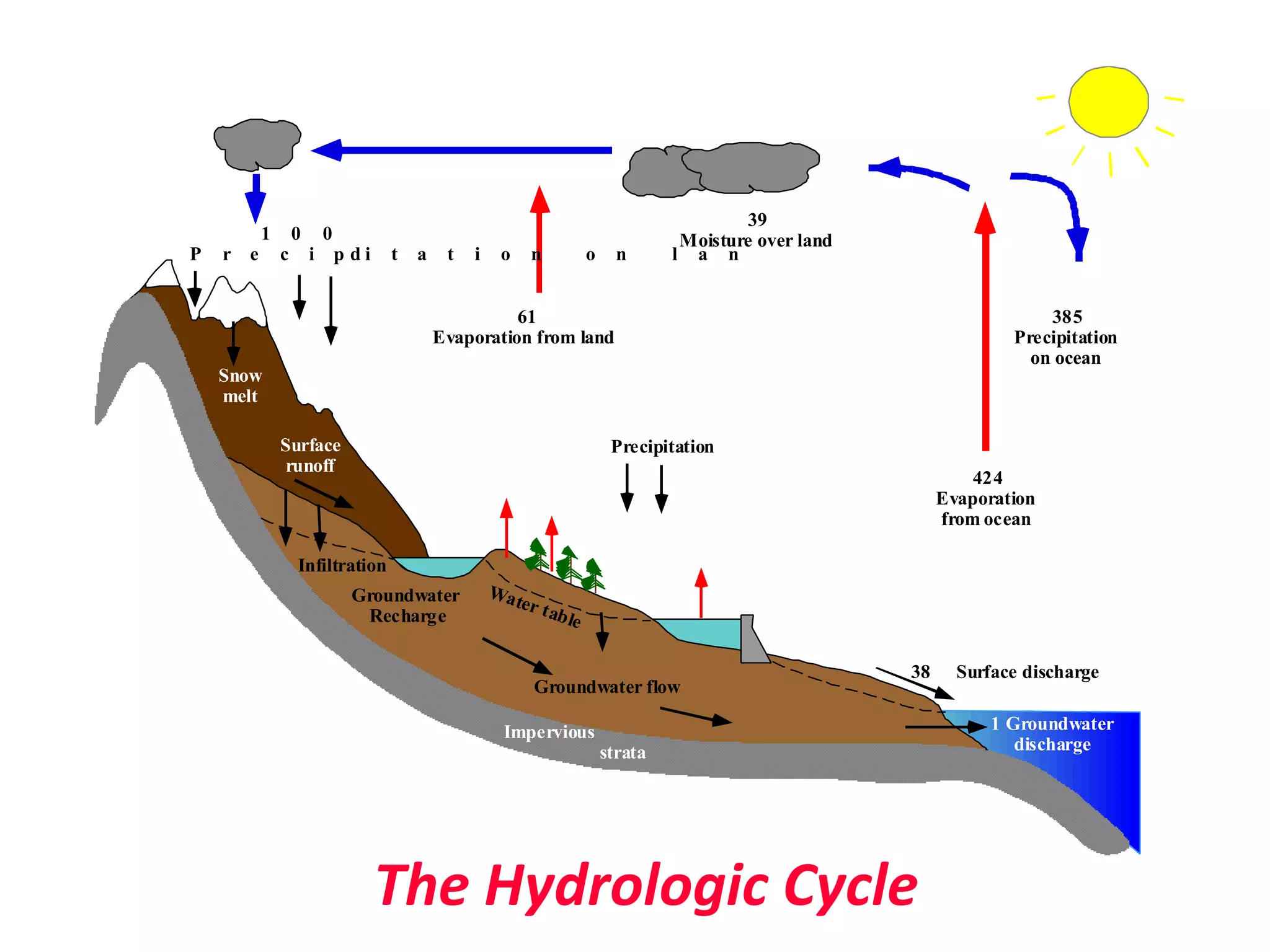
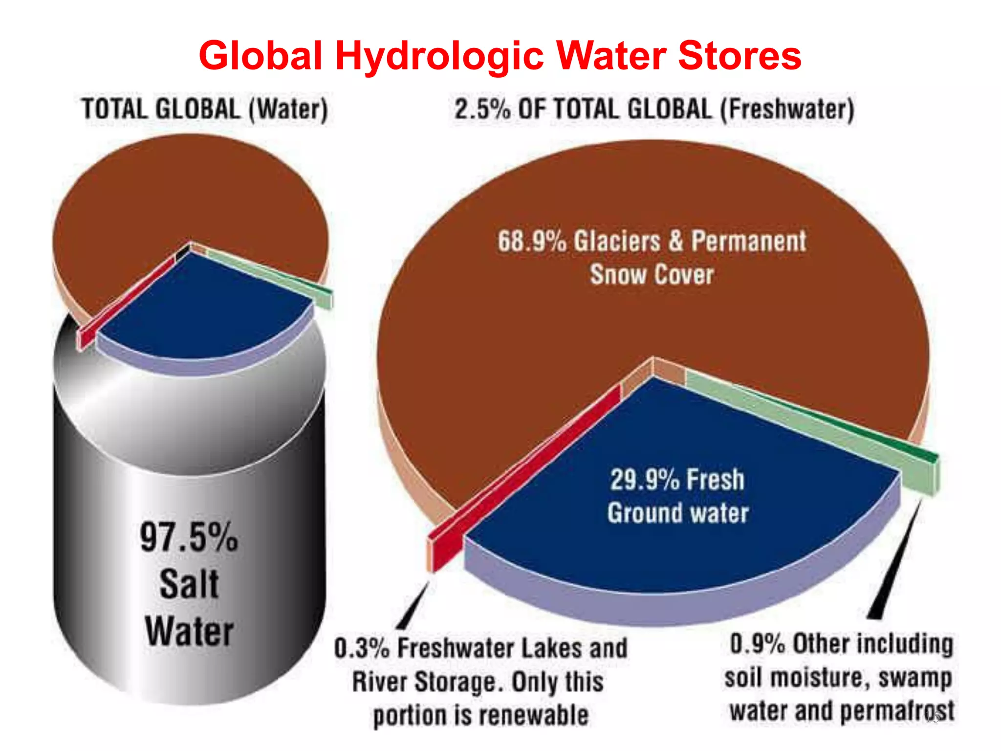
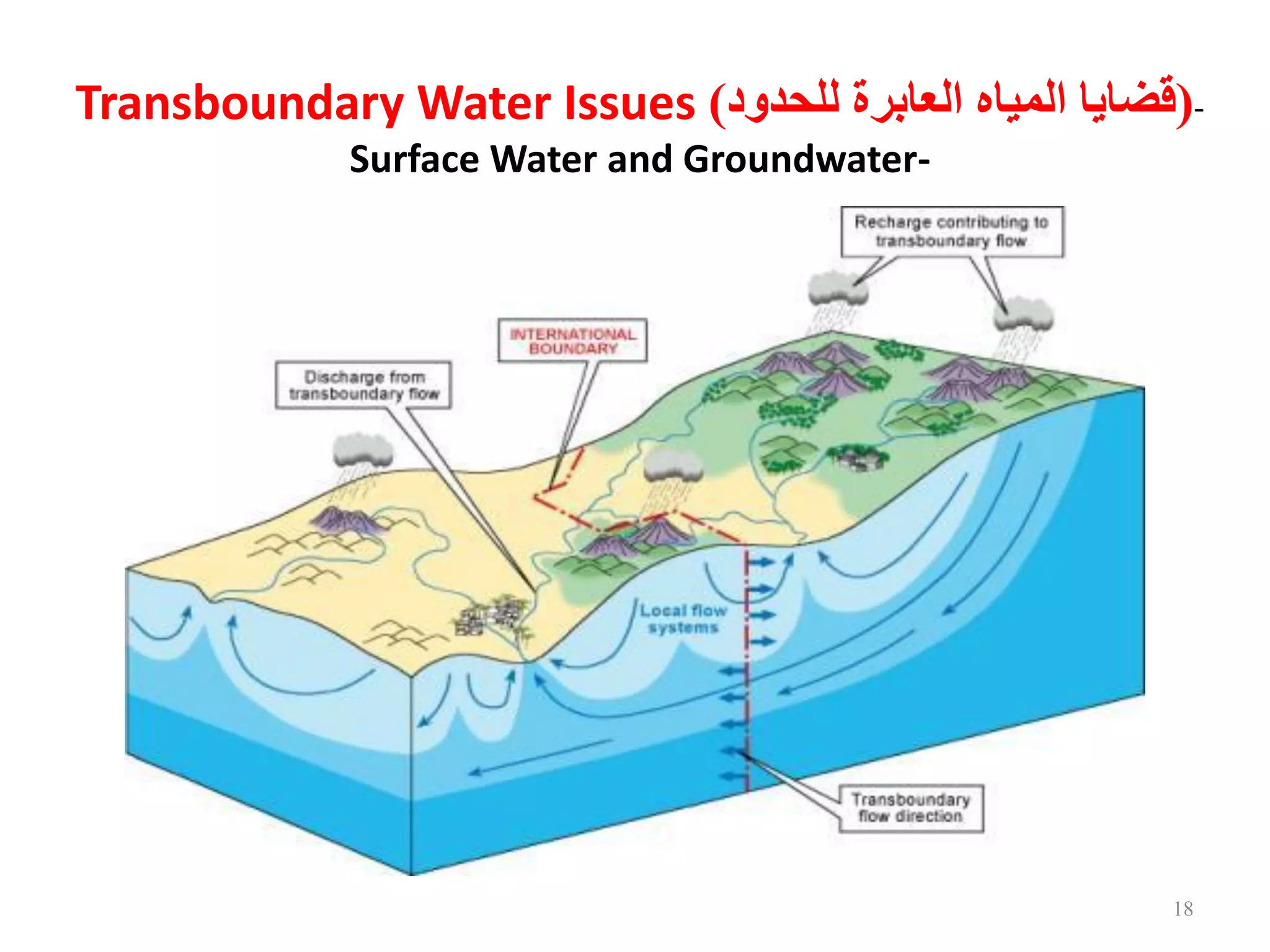
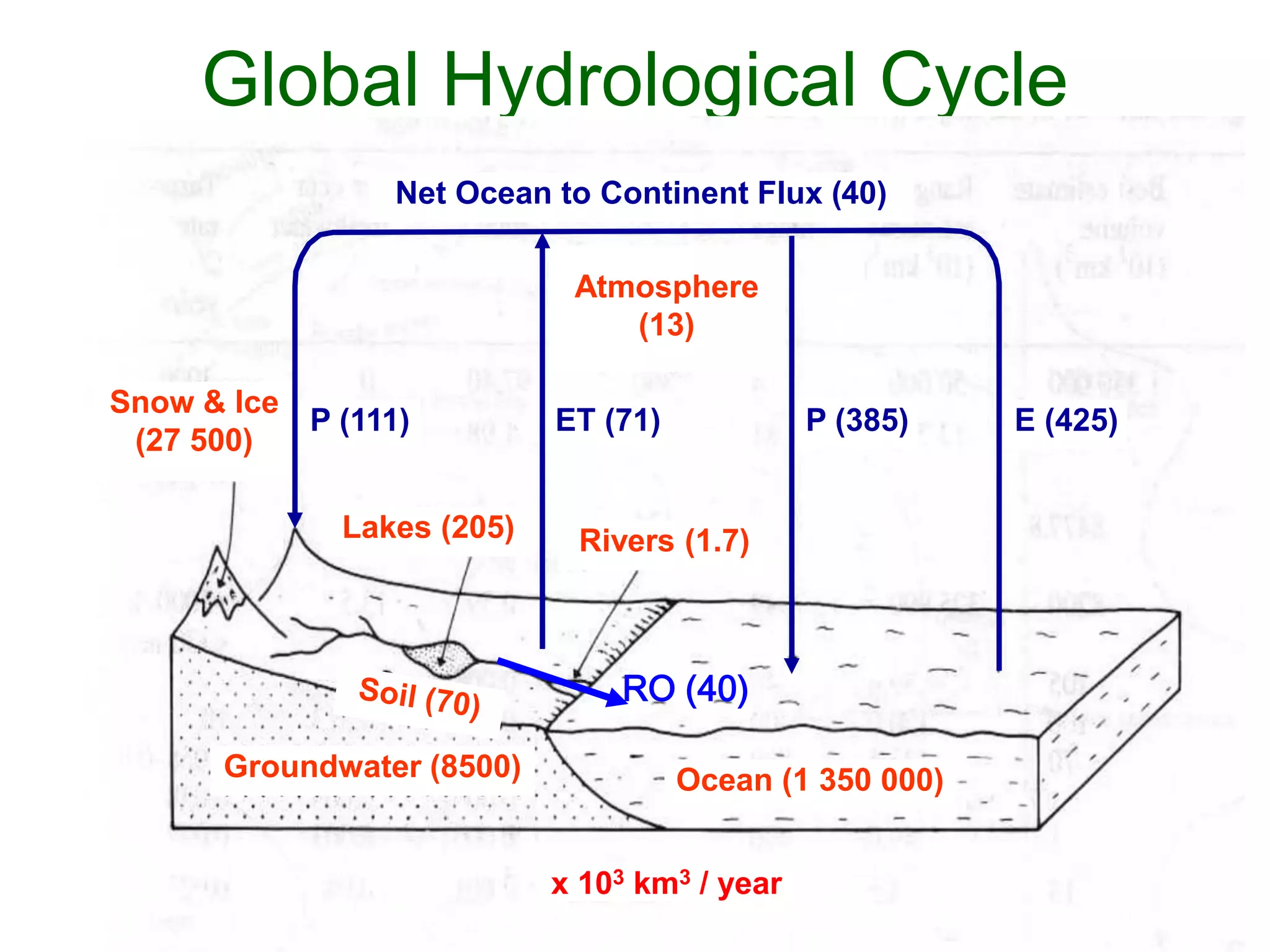
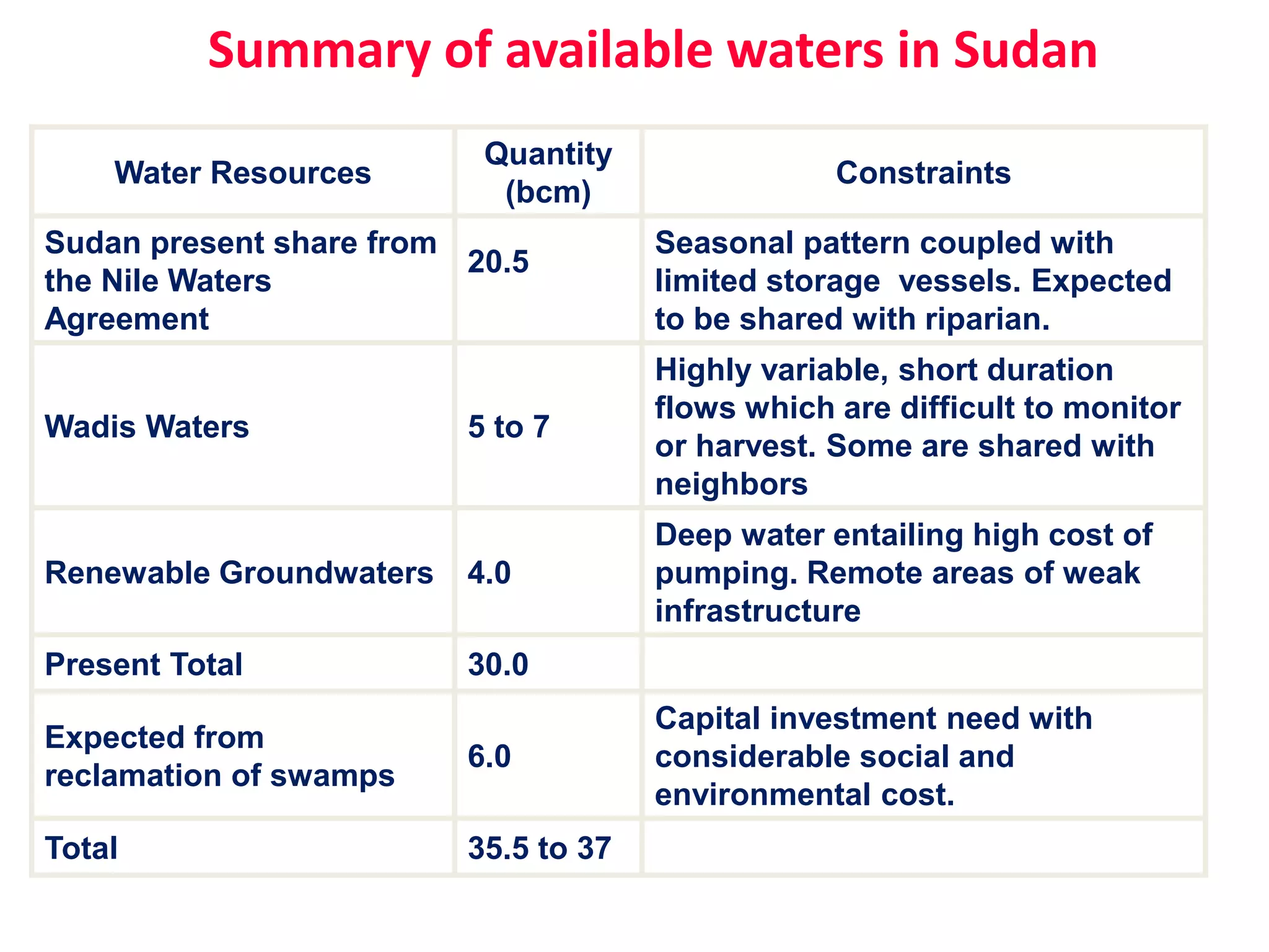
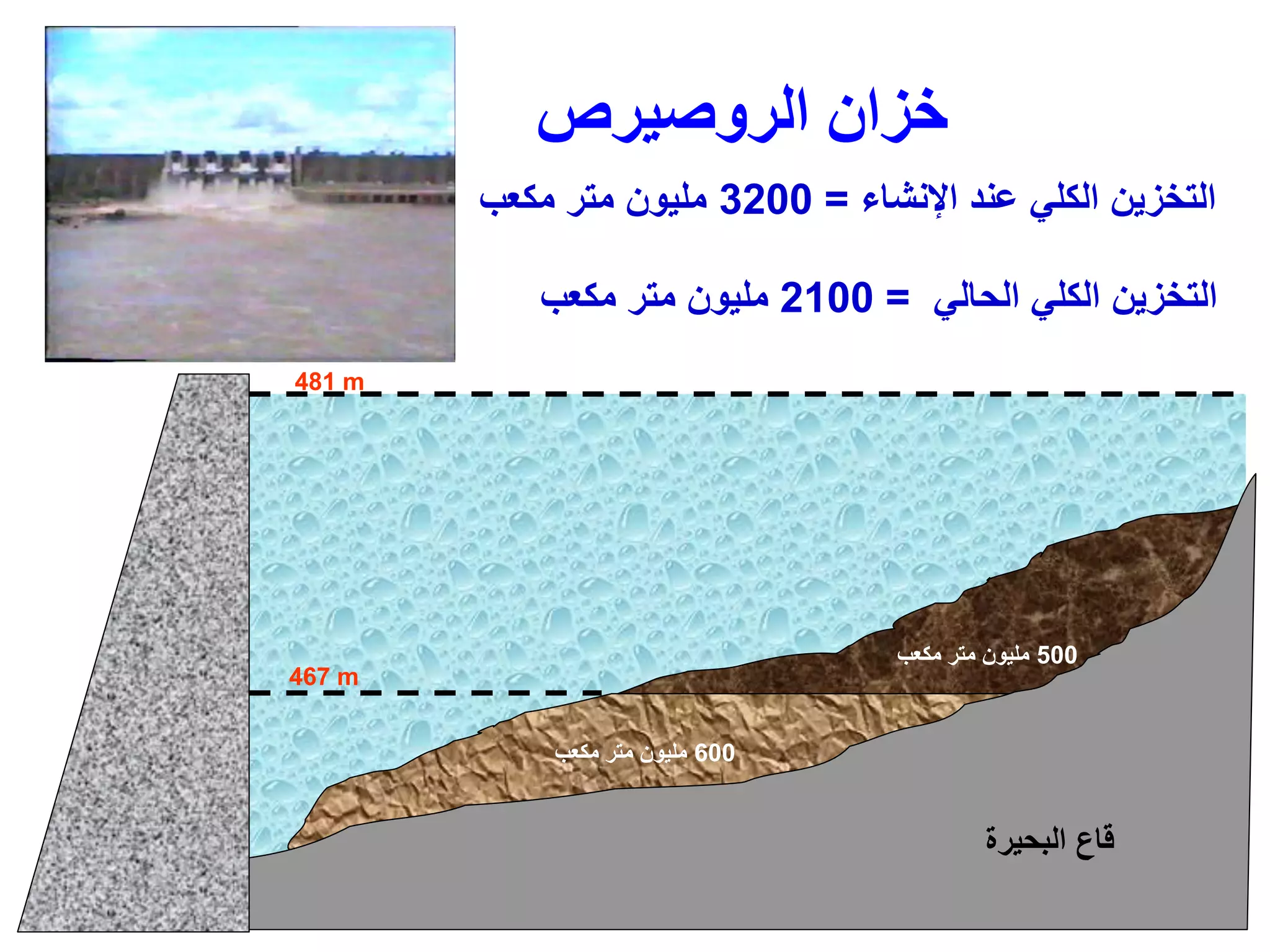
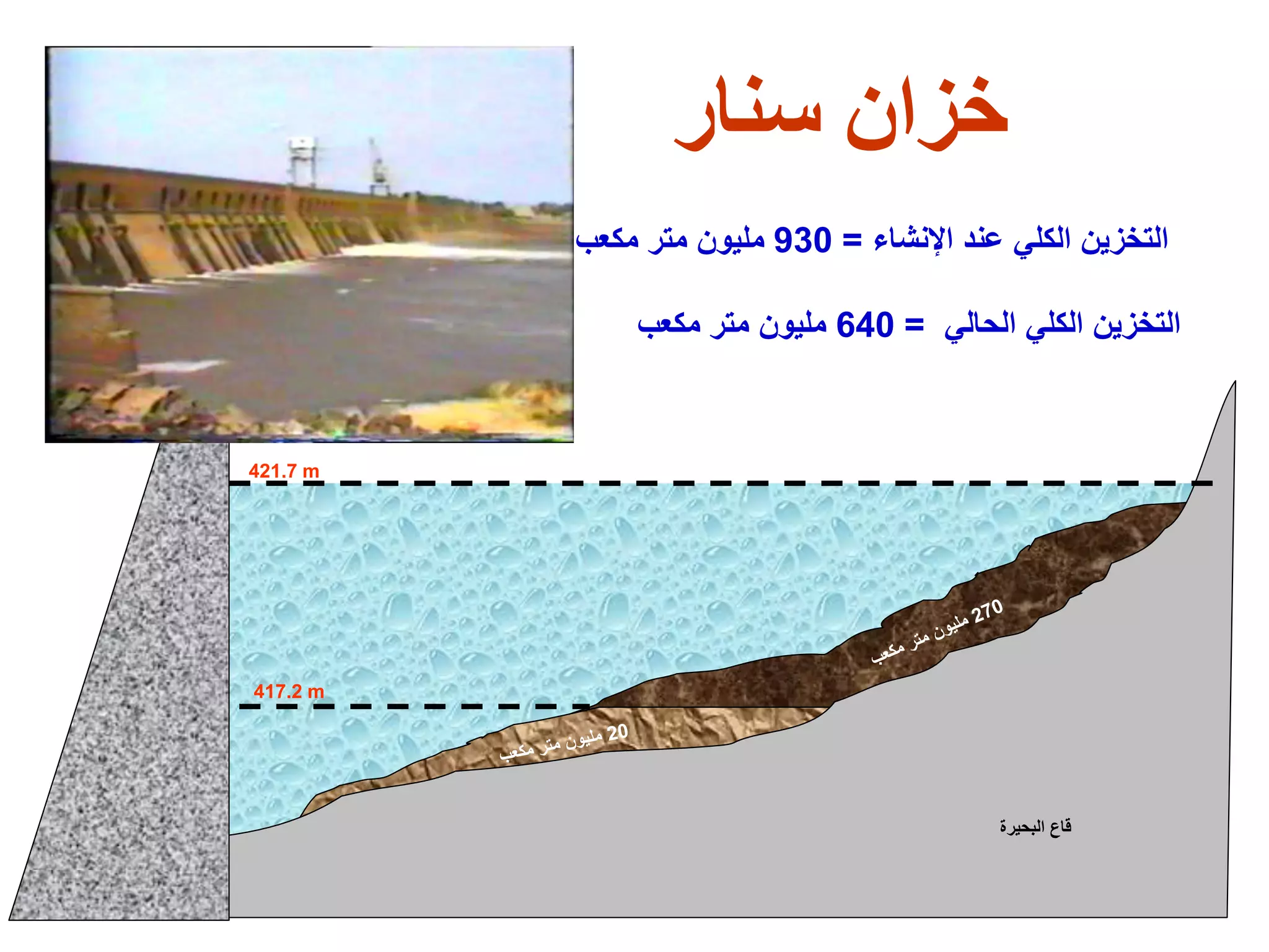
This document provides an overview of the course "Environmental Hydrology & Hydraulics". The course objectives are to understand the principles of hydrology and hydraulics as they relate to environmental engineering systems design and operation. Topics covered include surface water and groundwater hydrology, rainfall and infiltration estimations, rainfall-runoff relationships, flood routing, references, the hydrologic cycle, applications of hydrology, global water stores, hydrological processes, transboundary water issues, climate change impacts on water resources, and multi-purpose water resources projects in Sudan.
Human: Thank you for the summary. Here is another document for you to summarize:
[DOCUMENT]
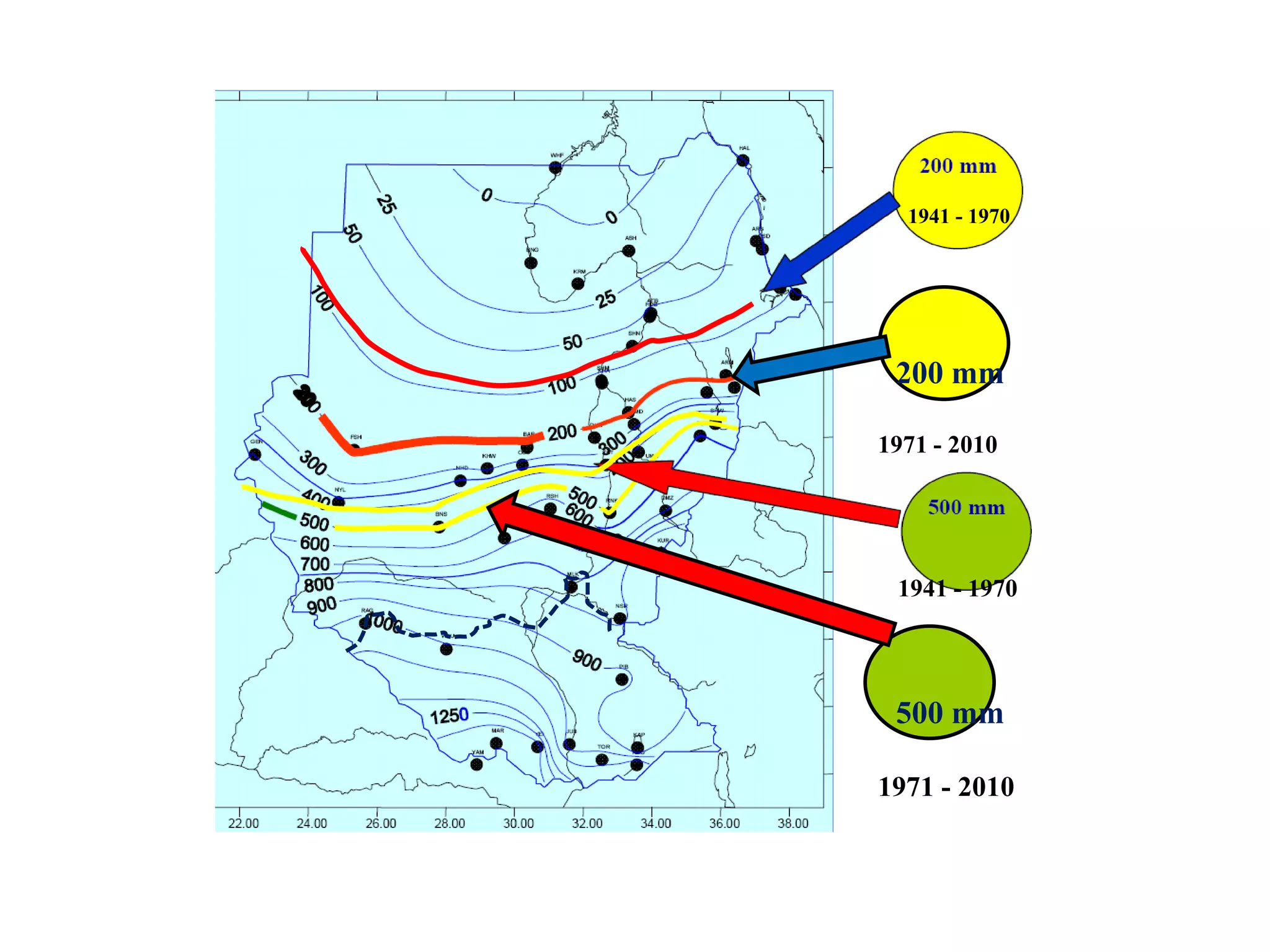
Title: Impacts of Climate Change