Sci 7 Q4W1 - canva.pptx
•Download as PPTX, PDF•
0 likes•35 views

Presentation of Lesson in Science 7 Quarter 4 Week 1

Recommended
More Related Content
Similar to Sci 7 Q4W1 - canva.pptx
Similar to Sci 7 Q4W1 - canva.pptx (20)
Recently uploaded
Recently uploaded (20)
Sci 7 Q4W1 - canva.pptx
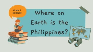
- 1. Where on Earth is the Philippines? Grade 7 SCIENCE
- 2. Lesson Outline Landmasses and Bodies of water The Coordinate System Latitude and Longitude
- 3. At the end of this lesson, we should be able to: • Demonstrate how places on earth may be located using a coordinate system • Identify the location of the Philippines using latitude and longitude • Determine the location of the Philippines relative to the surrounding landmasses and bodies of water Learning Outcomes
- 8. Share your map reading experience! Describe a map that you've seen. What was the reason why you were observing the map? What is the story of the map? Have you ever been on a hiking expedition and used a map as a guide? Are you familiar with a compass?
- 9. MAP is a two- dimensional graphical representation of an area, land or sea, depicting physical features What is a MAP?
- 10. a GLOBE is a three-dimensional spherical model of the earth. What is a GLOBE?
- 14. LATITUDES horizontal imaginary lines that run from east to west of a map or a globe.
- 15. DEGREE (º)
- 19. EQUATOR 0° SOUTHERN HEMISPHERE 30° 60° 90° N 90° S 30° 60°
- 22. ACTIVITY 1 A – WEST B – NORTH C – EAST D – SOUTH
- 23. ACTIVITY 2 1. South China Sea 2. Pacific Ocean 3. (Bonus) 4. .. 5. Archipelago – land / area surrounded by bodies of water
- 24. ACTIVITY 3 1. Davao City 2. Puerto Princesa 3. Manila 4. Cebu 5. Cagayan de Oro City
- 25. ACTIVITY 4 1. Equator, North, South 2. Cancer 3. Capricorn 4. 66.5°N 5. 66.5°S 6. Eastern, Western
- 26. ACTIVITY 4 7. Meridians 8. North, South 9. Winter, Spring, Summer, Autumn
- 27. ACTIVITY 4 10. Prime Meridian, International Date Line 11. 0° 12. Greenwich
- 28. Let's have a wonderful discussion about Map Scales in our next session. Thank you!
- 29. Resource Page Use these icons and illustrations in your Canva Presentation. Happy designing! Don't forget to delete this page before presenting.