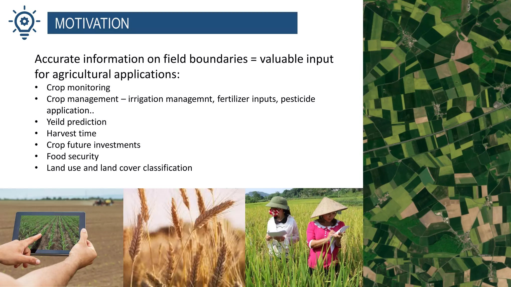
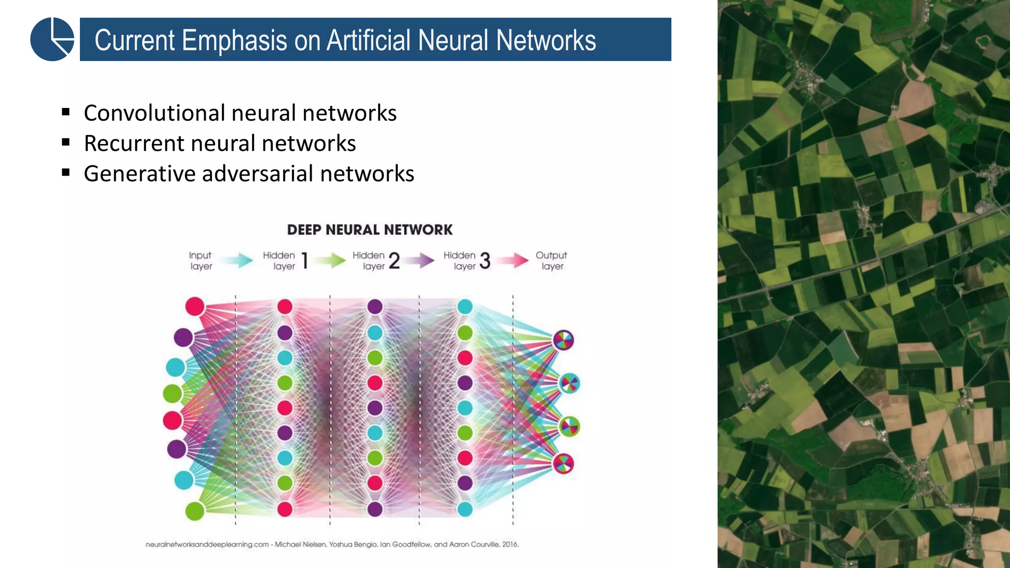
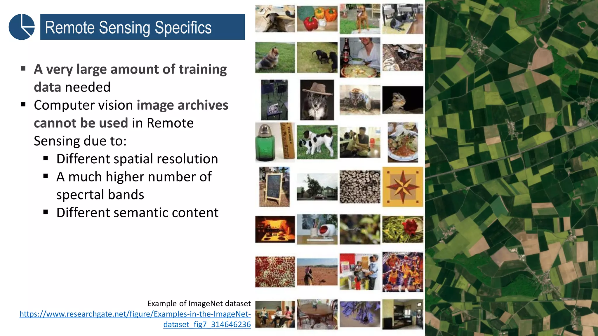
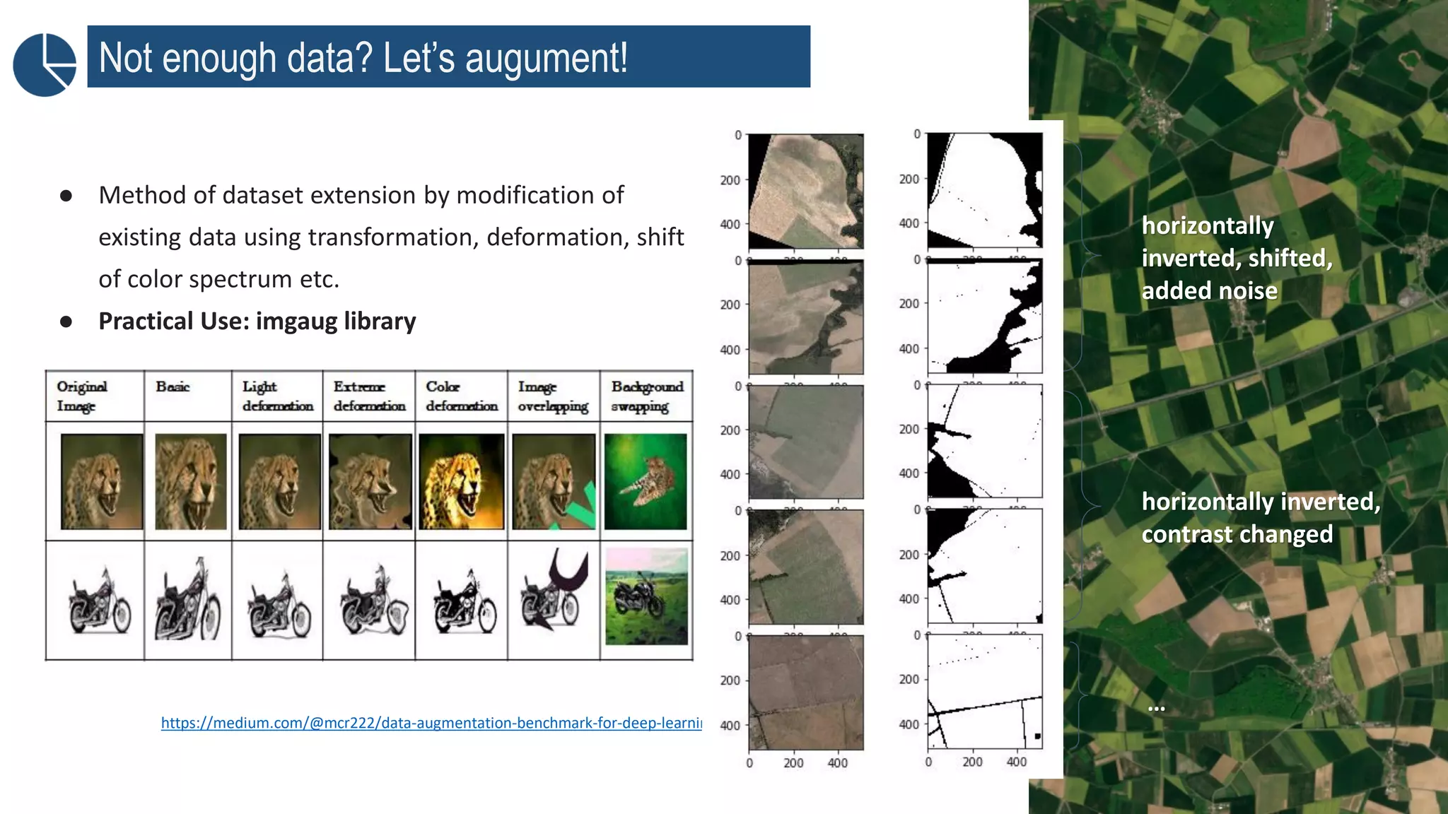
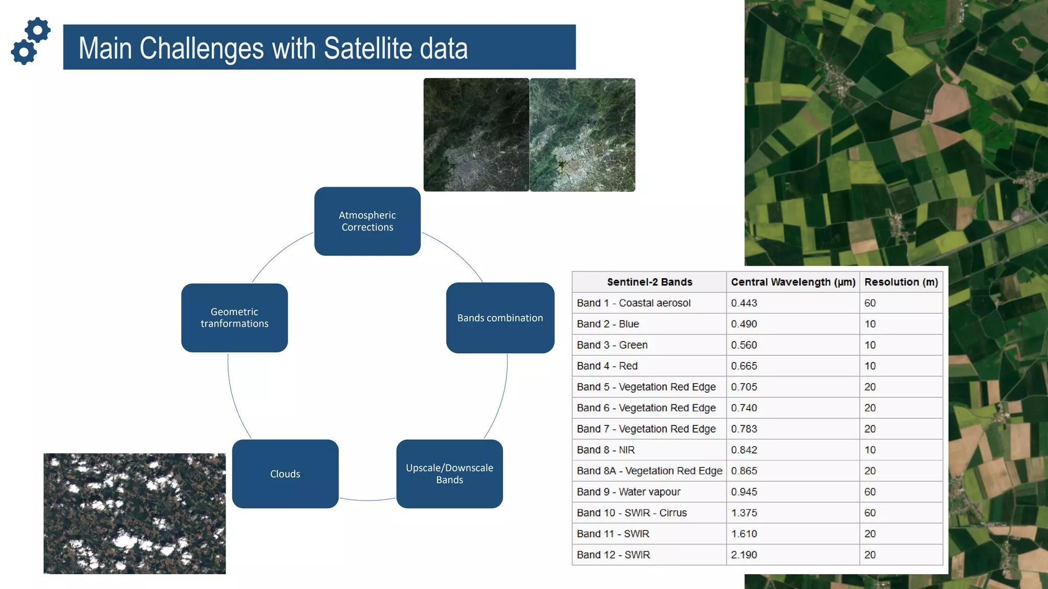
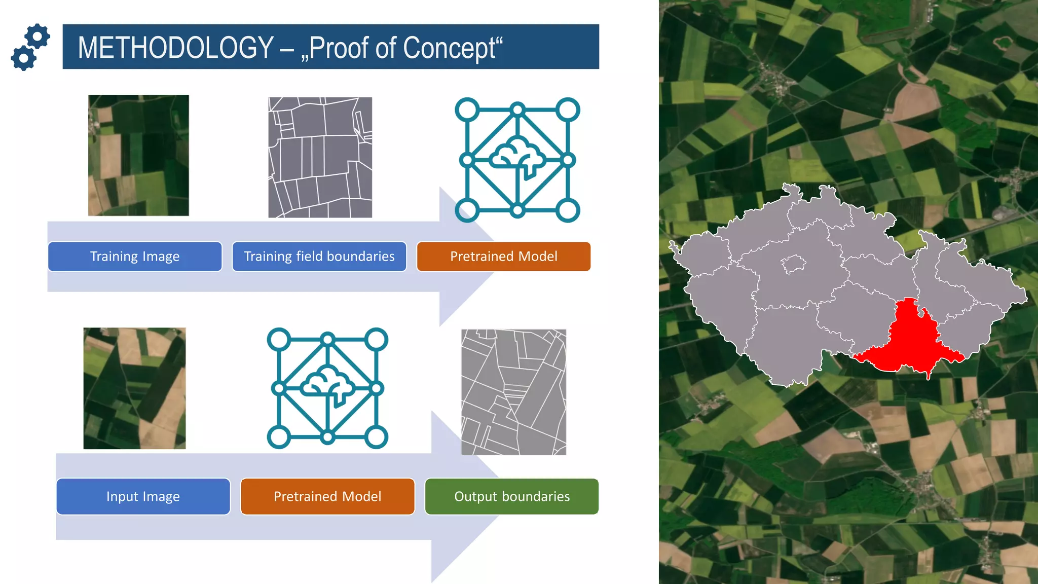
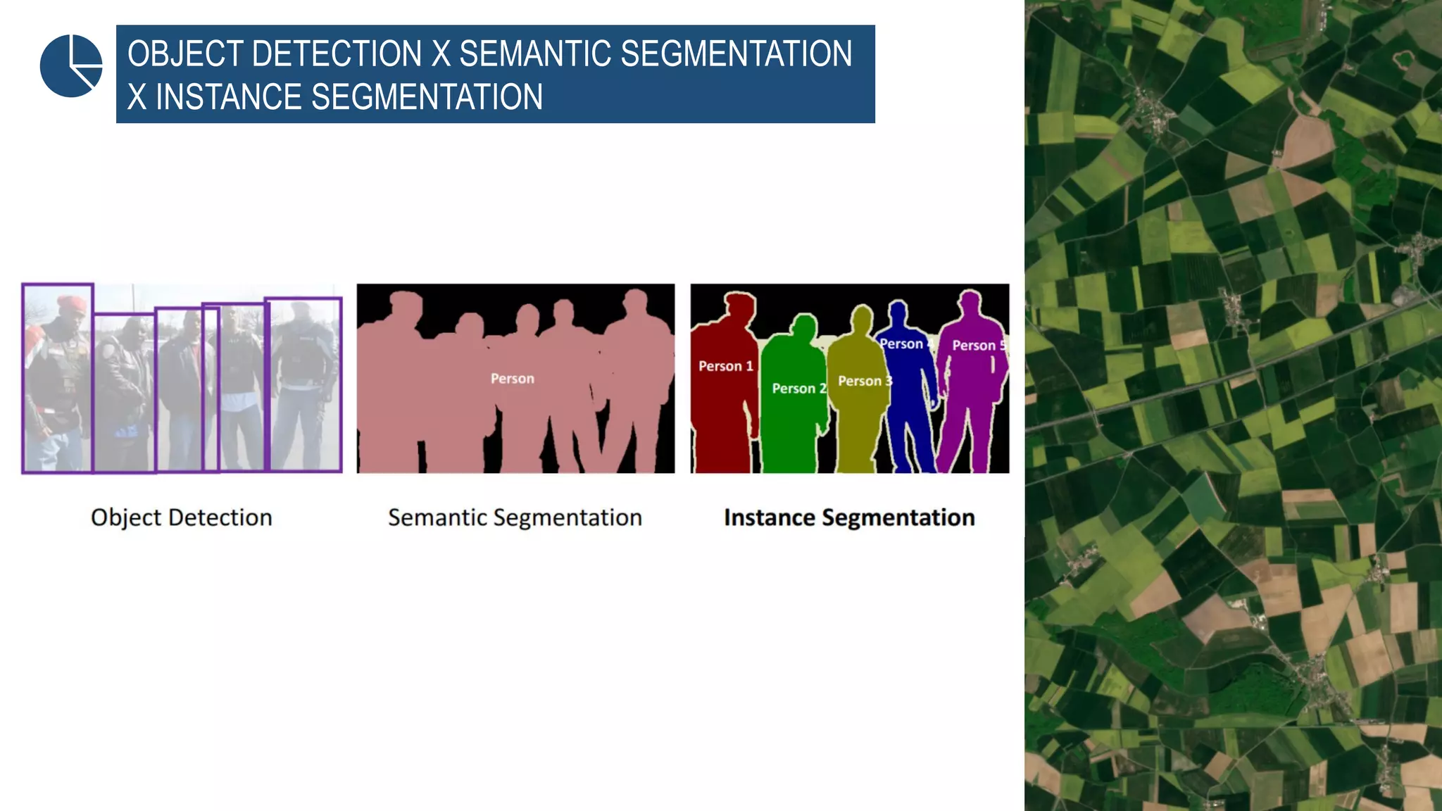
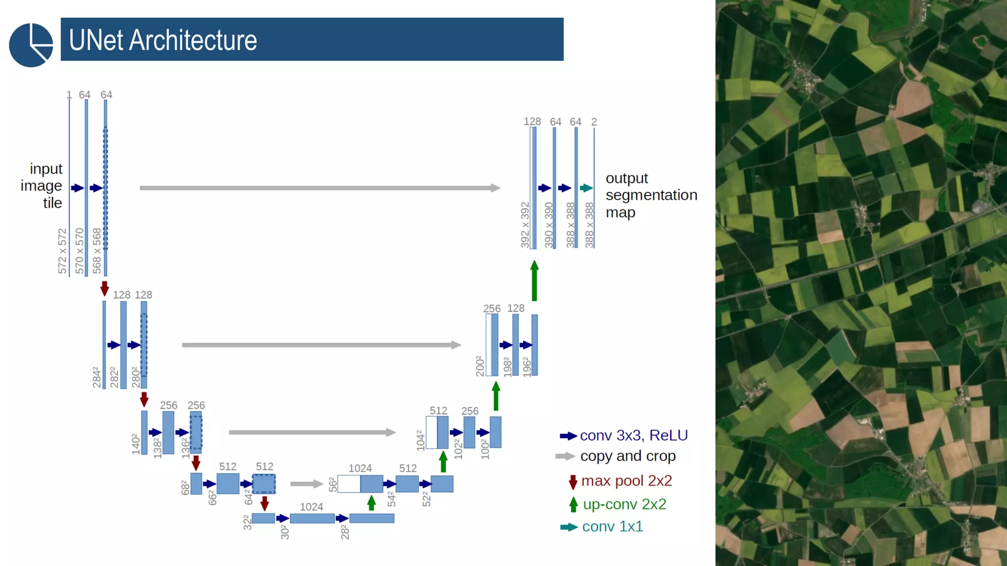
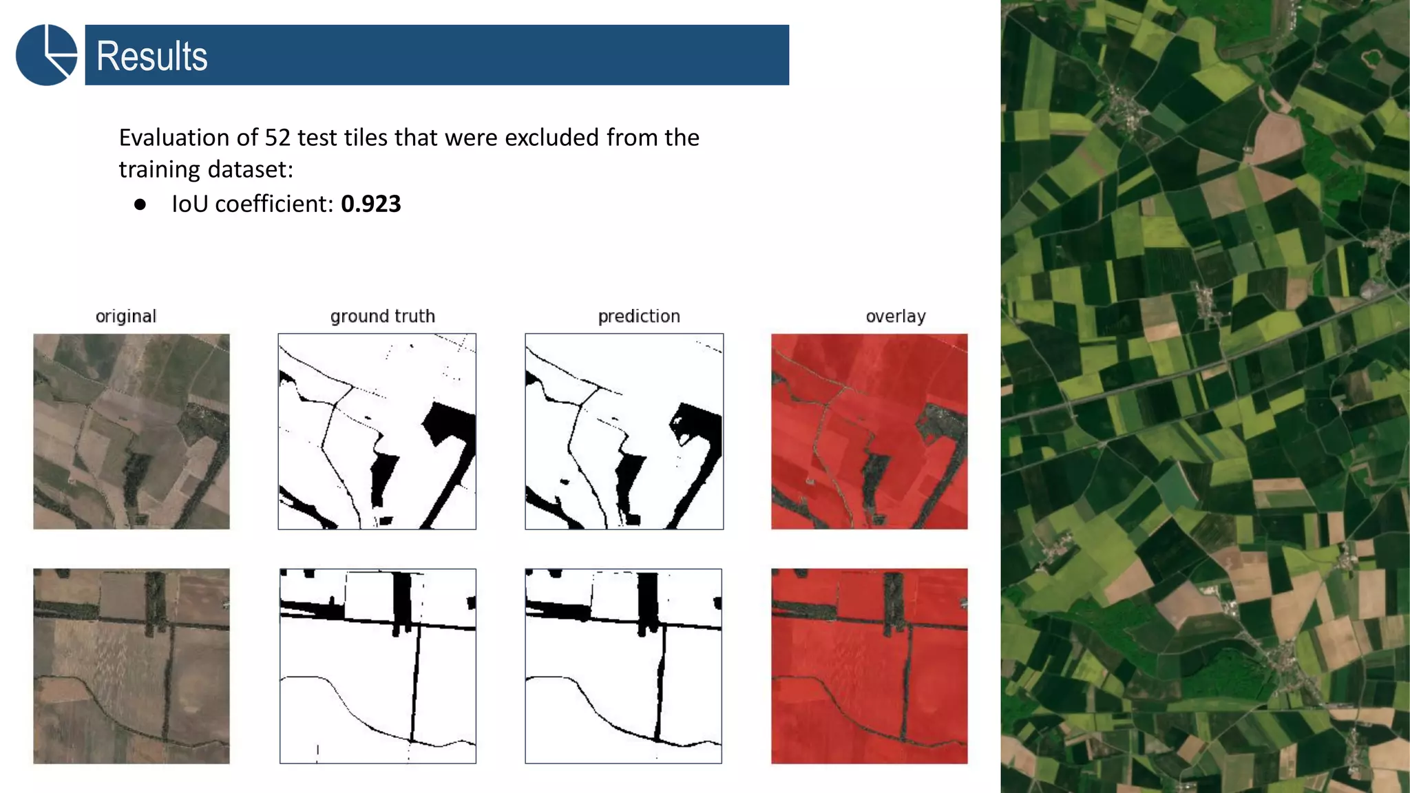
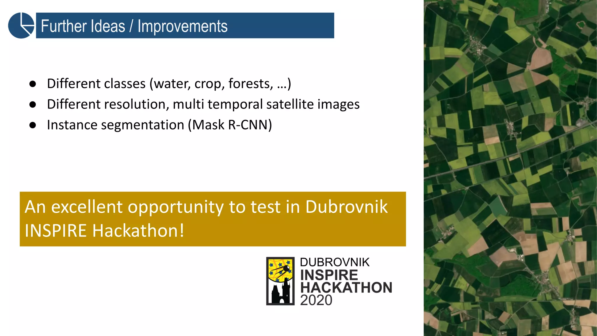
DEEP LEARNING TECHNIQUES FOR BOUNDARIES DETECTION
Hana Kubickova (Plan4All), Jan Horak, Ondrej Kaas
MOTIVATION
Accurate information on field boundaries = valuable input
for agricultural applications:
• Crop monitoring
• Crop management – irrigation managemnt, fertilizer inputs, pesticide
application..
• Yeild prediction
• Harvest time
• Crop future investments
• Food security
• Land use and land cover classification
Field boundary detection techniques
▪ Supervised classification: Support Vector Machine
(SVM), Random Forest (RF)
▪ Edge-based methods: Sobel, Canny operator, Prewit
▪ Region-based methods: multi-resolutional segmentation
(MRS), Watershed segmentation (WS)
▪ Hybrid methods: Canny edge detection + Watershed
segmentation (CEWS)
Current Emphasis on Artificial Neural Networks
▪ Convolutional neural networks
▪ Recurrent neural networks
▪ Generative adversarial networks
Current Emphasis on Artificial Neural Networks
▪ Convolutional neural networks
▪ Recurrent neural networks
▪ Generative adversarial networks
Remote Sensing Specifics
▪ A very large amount of training
data needed
▪ Computer vision image archives
cannot be used in Remote
Sensing due to:
▪ Different spatial resolution
▪ A much higher number of
specrtal bands
▪ Different semantic content
Example of ImageNet dataset
https://www.researchgate.net/figure/Examples-in-the-ImageNet-
dataset_fig7_314646236
Not enough data? Let’s augument!
● Method of dataset extension by modification of
existing data using transformation, deformation, shift
of color spectrum etc.
● Practical Use: imgaug library
https://medium.com/@mcr222/data-augmentation-benchmark-for-deep-learning-2db712c6eb3e
horizontally
inverted, shifted,
added noise
horizontally inverted,
contrast changed
…
Main Challenges with Satellite data
Atmospheric
Corrections
Bands combination
Upscale/Downscale
Bands
Clouds
Geometric
tranformations
METHODOLOGY – „Proof of Concept“
Training Image Training field boundaries Pretrained Model
Input Image Pretrained Model Output boundaries
OBJECT DETECTION X SEMANTIC SEGMENTATION
X INSTANCE SEGMENTATION
UNet Architecture
Results
Evaluation of 52 test tiles that were excluded from the
training dataset:
● IoU coefficient: 0.923
Further Ideas / Improvements
● Different classes (water, crop, forests, …)
● Different resolution, multi temporal satellite images
● Instance segmentation (Mask R-CNN)
An excellent opportunity to test in Dubrovnik
INSPIRE Hackathon!

Deep Learning techniques for boundaries detection

  • 1.
    DEEP LEARNING TECHNIQUESFOR BOUNDARIES DETECTION Hana Kubickova (Plan4All), Jan Horak, Ondrej Kaas
  • 2.
    MOTIVATION Accurate information onfield boundaries = valuable input for agricultural applications: • Crop monitoring • Crop management – irrigation managemnt, fertilizer inputs, pesticide application.. • Yeild prediction • Harvest time • Crop future investments • Food security • Land use and land cover classification
  • 3.
    Field boundary detectiontechniques ▪ Supervised classification: Support Vector Machine (SVM), Random Forest (RF) ▪ Edge-based methods: Sobel, Canny operator, Prewit ▪ Region-based methods: multi-resolutional segmentation (MRS), Watershed segmentation (WS) ▪ Hybrid methods: Canny edge detection + Watershed segmentation (CEWS)
  • 4.
    Current Emphasis onArtificial Neural Networks ▪ Convolutional neural networks ▪ Recurrent neural networks ▪ Generative adversarial networks
  • 5.
    Current Emphasis onArtificial Neural Networks ▪ Convolutional neural networks ▪ Recurrent neural networks ▪ Generative adversarial networks
  • 6.
    Remote Sensing Specifics ▪A very large amount of training data needed ▪ Computer vision image archives cannot be used in Remote Sensing due to: ▪ Different spatial resolution ▪ A much higher number of specrtal bands ▪ Different semantic content Example of ImageNet dataset https://www.researchgate.net/figure/Examples-in-the-ImageNet- dataset_fig7_314646236
  • 7.
    Not enough data?Let’s augument! ● Method of dataset extension by modification of existing data using transformation, deformation, shift of color spectrum etc. ● Practical Use: imgaug library https://medium.com/@mcr222/data-augmentation-benchmark-for-deep-learning-2db712c6eb3e horizontally inverted, shifted, added noise horizontally inverted, contrast changed …
  • 8.
    Main Challenges withSatellite data Atmospheric Corrections Bands combination Upscale/Downscale Bands Clouds Geometric tranformations
  • 9.
    METHODOLOGY – „Proofof Concept“ Training Image Training field boundaries Pretrained Model Input Image Pretrained Model Output boundaries
  • 10.
    OBJECT DETECTION XSEMANTIC SEGMENTATION X INSTANCE SEGMENTATION
  • 11.
  • 12.
    Results Evaluation of 52test tiles that were excluded from the training dataset: ● IoU coefficient: 0.923
  • 13.
    Further Ideas /Improvements ● Different classes (water, crop, forests, …) ● Different resolution, multi temporal satellite images ● Instance segmentation (Mask R-CNN) An excellent opportunity to test in Dubrovnik INSPIRE Hackathon!