STUDY OF WATER MANAGEMENT SYSTEM USING GEOGRAPHIC INFORMATION SYSTEM
•
0 likes•13 views

https://www.irjet.net/archives/V10/i5/IRJET-V10I597.pdf
![International Research Journal of Engineering and Technology (IRJET) e-ISSN: 2395-0056
Volume: 10 Issue: 05 | May 2023 www.irjet.net p-ISSN: 2395-0072
© 2023, IRJET | Impact Factor value: 8.226 | ISO 9001:2008 Certified Journal | Page 621
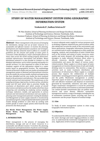
1.3 Methodology
Fig 1 methodology
2. LITERATURE STUDY
The review of existing literature and case studies
has identified important indicators pertaining to land use
changes and population density analysis using GIS. Togaina
deeper understanding of howtheseindicatorsinfluenceland
use changes and population density, further research is
needed. Additionally, it is crucial to explore how GIS can be
effectively utilized to facilitate informed decision-making in
these domains.
2.1 Water Supply Management
GIS is a powerful tool that combines spatial data
with analytical capabilities to enable users to visualize and
analyse complex data sets. When applied to water supply
systems, GIS can provide valuable insights that can help to
identify and solve problems related to water supply [1]. For
example, using GIS real-world maps the water supply
managers can identify areas with low water pressure or
water quality issues which may require maintenance or
repair. By pinpointing the location of these problems on a
map, managers can quickly identify the cause of the issue
and allocate resources to fix it. Moreover, GIS models can
also predict future problems based on the analysis of
historical data and help managers take pre-emptive
measures to avoid future issues [2]. Additionally, GIS can
help in reducing the working time requiredforanalysingand
managing water supply networks. It provides real-time
monitoring of the network whichcanhelpmanagersquickly
identify any issues that arise and take corrective actions in
real-time. Furthermore using GIS maps with statistical
indicatorsn such as water demandandsupply,water quality,
and distribution network efficiency, can help identify issues
related to water supply management. These indicators can
assist in determining the optimal locations for new water
sources, improving water network efficiency,andidentifying
demand and supply gaps[3].
GIS is a powerful tool for water supply management,
enabling real-time monitoring and predictive modelling of
the water supply network. It also enables data-driven
decision making by identifying issues related to water
supply management such as water demand and supply,
water quality and network efficiency. Additionally, GIS can
help in identifying the optimal locations for new water
sources, improving the overall efficiency of thewatersupply
network.
2.2 Waste Water Management
The use of statistical indicators and sewer network maps
with GIS software can be a powerful tool for identifying
problems and developing planning policies related to sewer
networks. By analysing data on parameters such as the flow
of wastewater, the location of sewer lines, and the
performance of the Sewage Treatment Plant (STP), GIS can
help identify areas of concern and develop effective
strategies for improving the overall efficiency and
functionality of the sewer network [2].
GPS technology can be used to track the flow of wastewater
and map the sewer line to the STP, providing valuable
information for planning and decision-making. By
integrating this data with GIS software, managers cancreate
digital maps and reports that can be used to identify areasof
high demand and low supply, track performance metrics,
and analyse trends over time. This can help in predicting
future issues and planning for maintenance and repair
activities [4].
GIS models use queries to create digital maps and report for
the sewer network, allowing managers to analyse data on
various parameters and identify areas of concern. These
models can also predict future problems and help in
developing effectivestrategiestoaddress them.Forexample,
GIS models can help in identifying optimal locations for new
sewer lines or STPs improving the overall efficiency and
functionality of the sewer network. [3]
In summary, the use of statistical indicators, sewer network
maps, GPS technology, and GIS software can provide
valuable insights into sewer network problems and help in
developing effective planning policies. By analysing data on
various parameters and creating digital maps and reports,
managers can identify areas of concern, predict future
problems and develop strategies for improving the overall
functionality of the sewer network .
Introduction to
Topic
Aim, Objective
Identification of
literature study
Identification of
Case study (National
and International)
Findings
Conclusion](data:image/gif;base64,R0lGODlhAQABAIAAAAAAAP///yH5BAEAAAAALAAAAAABAAEAAAIBRAA7)
Recommended
Recommended
More Related Content
Similar to STUDY OF WATER MANAGEMENT SYSTEM USING GEOGRAPHIC INFORMATION SYSTEM
Similar to STUDY OF WATER MANAGEMENT SYSTEM USING GEOGRAPHIC INFORMATION SYSTEM (20)
More from IRJET Journal
More from IRJET Journal (20)
Recently uploaded
Recently uploaded (20)
STUDY OF WATER MANAGEMENT SYSTEM USING GEOGRAPHIC INFORMATION SYSTEM
- 1. International Research Journal of Engineering and Technology (IRJET) e-ISSN: 2395-0056 Volume: 10 Issue: 05 | May 2023 www.irjet.net p-ISSN: 2395-0072 © 2023, IRJET | Impact Factor value: 8.226 | ISO 9001:2008 Certified Journal | Page 620 STUDY OF WATER MANAGEMENT SYSTEM USING GEOGRAPHIC INFORMATION SYSTEM Venkatesh.U1, Sudhan Srinivas.N2 1M. Plan Student, School of Planning Architecture and Design Excellence, Hindustan Institute of Technology and Science, Chennai, Tamilnadu, India. 2 Assistant Professor, School of Planning Architecture and Design Excellence, Hindustan Institute of Technology and Science, Chennai, Tamilnadu, India ---------------------------------------------------------------------***--------------------------------------------------------------------- Abstract - Water management is the process of managing the distribution, storage and use of water resources in a sustainable and efficient manner. It involves the planning, development and implementation of policies and strategies. The water delivery networks need to adhere to a number of guidelines for the amount and quality of water given to consumers. Urban flooding is a major catastrophic feature of many cities across the world causing property destruction, essential infrastructure interruption and facilities. Water distribution network it is also possible to combine in a GIS database information such as water quantity and quality in a specific territory. It is thus important to collect in the same computer support all the information related to a water system based on geographical location. The methodology consists of literature studies and case studies of existingwater management system in National and International countries from the studies the various models, methods and approaches has been identified and the case studies has been analyzed based on the parameters and indicators. Thecasestudiesdone on both national and international. The study focuses on the sampling technique, Approaches, Location survey, calculation model and GIS tools which help to priorities Finally, the conclusion of dissertation part which consists of overall observations and inferences from the studies which have been comparing and concluding by analysing various sampling technique, indicators, models, and approaches in various national and international of Literature and case studies to planning water management systemforcreatingthedatabase and Management of water supply networks is monitored by specialized programs usingGeospatialinformationsystemGIS models identify problems to solve them by working with models specific to water supply systems which lead the way forward to the thesis project. Key Words: Water Management, GIS, Water supply, Waste Water, Strom Water, Water Resources Management 1. INTRODUCTION Water management is the process of managing the distribution, storage and use of water resources in a sustainable and efficient manner. It involves the planning, development and implementation of policies and strategies to ensure adequate water supply for various purposes such as drinking, irrigation, industrial uses, and recreation, while also taking into account the needs of the environment and future generations. Geographic Information Systems (GIS) are essential tools in water management as they enable the mapping, analysis, and visualization of water-related data such as the location and extent of water resources, water quality and water demand. GIS technology allows water managers to make informed decisions about where to allocate resources, identify potential sources of contamination and assess the impact of various water- related projects. Water supply is a critical aspect of water management as it involves the provision of safe and reliable drinking water to communities. This involves a range of activities such as water treatment, distribution and maintenance of infrastructure. Water supply is a complex process that requires the collaboration of multiple stakeholders including governmentagencies,waterutilities, and the public. Wastewater management is another important aspect of water management as it involves the safe and effective treatment and disposal of wastewater generated by households, industries and other sources. Proper wastewater management is crucial for protecting public health and the environment as untreated wastewater can contain harmful contaminants that can pollute water sources and cause disease. Effective wastewater management involves a range of strategies,includingthe use of wastewater treatment plants, recycling and reuse of wastewater and the proper disposal of residual sludge. 1.1 Aim To Study of water management system in cities using Geographic Information System. 1.2 Objective To understand the different water supplynetworks tostudy the water shortage and water logging problems in urban area to understand the wastewater management in urban area. Application of GIS in water management system.
- 2. International Research Journal of Engineering and Technology (IRJET) e-ISSN: 2395-0056 Volume: 10 Issue: 05 | May 2023 www.irjet.net p-ISSN: 2395-0072 © 2023, IRJET | Impact Factor value: 8.226 | ISO 9001:2008 Certified Journal | Page 621 1.3 Methodology Fig 1 methodology 2. LITERATURE STUDY The review of existing literature and case studies has identified important indicators pertaining to land use changes and population density analysis using GIS. Togaina deeper understanding of howtheseindicatorsinfluenceland use changes and population density, further research is needed. Additionally, it is crucial to explore how GIS can be effectively utilized to facilitate informed decision-making in these domains. 2.1 Water Supply Management GIS is a powerful tool that combines spatial data with analytical capabilities to enable users to visualize and analyse complex data sets. When applied to water supply systems, GIS can provide valuable insights that can help to identify and solve problems related to water supply [1]. For example, using GIS real-world maps the water supply managers can identify areas with low water pressure or water quality issues which may require maintenance or repair. By pinpointing the location of these problems on a map, managers can quickly identify the cause of the issue and allocate resources to fix it. Moreover, GIS models can also predict future problems based on the analysis of historical data and help managers take pre-emptive measures to avoid future issues [2]. Additionally, GIS can help in reducing the working time requiredforanalysingand managing water supply networks. It provides real-time monitoring of the network whichcanhelpmanagersquickly identify any issues that arise and take corrective actions in real-time. Furthermore using GIS maps with statistical indicatorsn such as water demandandsupply,water quality, and distribution network efficiency, can help identify issues related to water supply management. These indicators can assist in determining the optimal locations for new water sources, improving water network efficiency,andidentifying demand and supply gaps[3]. GIS is a powerful tool for water supply management, enabling real-time monitoring and predictive modelling of the water supply network. It also enables data-driven decision making by identifying issues related to water supply management such as water demand and supply, water quality and network efficiency. Additionally, GIS can help in identifying the optimal locations for new water sources, improving the overall efficiency of thewatersupply network. 2.2 Waste Water Management The use of statistical indicators and sewer network maps with GIS software can be a powerful tool for identifying problems and developing planning policies related to sewer networks. By analysing data on parameters such as the flow of wastewater, the location of sewer lines, and the performance of the Sewage Treatment Plant (STP), GIS can help identify areas of concern and develop effective strategies for improving the overall efficiency and functionality of the sewer network [2]. GPS technology can be used to track the flow of wastewater and map the sewer line to the STP, providing valuable information for planning and decision-making. By integrating this data with GIS software, managers cancreate digital maps and reports that can be used to identify areasof high demand and low supply, track performance metrics, and analyse trends over time. This can help in predicting future issues and planning for maintenance and repair activities [4]. GIS models use queries to create digital maps and report for the sewer network, allowing managers to analyse data on various parameters and identify areas of concern. These models can also predict future problems and help in developing effectivestrategiestoaddress them.Forexample, GIS models can help in identifying optimal locations for new sewer lines or STPs improving the overall efficiency and functionality of the sewer network. [3] In summary, the use of statistical indicators, sewer network maps, GPS technology, and GIS software can provide valuable insights into sewer network problems and help in developing effective planning policies. By analysing data on various parameters and creating digital maps and reports, managers can identify areas of concern, predict future problems and develop strategies for improving the overall functionality of the sewer network . Introduction to Topic Aim, Objective Identification of literature study Identification of Case study (National and International) Findings Conclusion
- 3. International Research Journal of Engineering and Technology (IRJET) e-ISSN: 2395-0056 Volume: 10 Issue: 05 | May 2023 www.irjet.net p-ISSN: 2395-0072 © 2023, IRJET | Impact Factor value: 8.226 | ISO 9001:2008 Certified Journal | Page 622 2.3 Water Resources Management Water quality is an important factor to consider when managing water resources, as it affects the health and wellbeing of communities and ecosystems. By analysingand evaluating the tap water quality and groundwater hydrogeochemistry, it is possible to determine the quality and hardness of the water, which can help inform decisions on treatment methods or water usage. [5] The observation is that water quality is a critical factor to consider when managing water resources because it has direct impacts on both human health and the environment. By analysing and evaluating the quality of tap water and groundwater hydro geochemistry,itispossibletodetermine the quality and hardness of the water. This information can be used to make informed decisions on treatment methods or water usage, which can help ensure the availabilityofsafe and clean water for communities and ecosystems. Proper management of water resources is crucial for sustainable development and the long-term well-being of our planet INFERENCE The use of GIS and other data-driven tools is critical for effective water supply management particularly in monitoring and predicting network performance and identifying optimal locations for new water sources. Additionally, monitoring water quality and evaluating hydrogeochemistry are essential for ensuring safeandclean water for communitiesand ecosystems.Propermanagement of water resources is vital for sustainable development and the long-term well-being of our planet and the use of advanced technology can help us achieve this goal. By leveraging GIS and other data-driven tools, managers can make informed decisions and develop effective planning policies to improve the overall functionality of the water supply network and address issues related towaterdemand and supply, water quality, and network efficiency. 3 CASE STUDY ( NATIONAL AND INTERNATIONAL ) 3.1 Study Area- Shollinganallur Taluk Kanchipuram District , India Shollinganallur Taluk comes under the administrative boundary of Kancheepuram district. The study area is located between latitudes 12 15’ 20”N and 12 58’ 12”N and longitudes 80 9’12” and 80 16’9”E, covering a total area of 118 km2 . The physiographic units present in the study area are alluvial plain, hard rock areas and coastal plain. The present population of Shollinganallur Taluk as per 2011 Census [6] Fig 2 study area The study used a GIS-based approach to select the most suitable wastewater treatment technology by evaluating various factors such as cost, energy requirements,reliability, and environmental impact.ThestudyalsousedGISmodeling to integrate and analyze spatial data related to the selection criteria, allowing for the identification of potential sites for wastewater treatment plants. The study concluded that the sequencing batch reactor (SBR) system was the most suitable wastewater treatment technology basedonitscost- effectiveness, low energy requirements, reliability, and environmental impact. The use of a GIS-based approach can be a useful tool in selecting appropriate wastewater treatment technology and can contribute to the sustainable management of wastewater resources. [6] The study suggests that the selection of suitable wastewater treatment technology depends on factors such as wastewater quality, availability of land and climatic conditions. Considering the semi-arid climatic conditions of the study area, the upflow anaerobic sludge blanket (UASB) system was recommended for urban areas, while constructed wetlands were suggested for rural areas. Overall, the case study highlights the usefulness of GIS in identifying suitable wastewater treatment technologiesand determining favorable sites for their implementation. 3.2 Damodar Canal Command of west Bengal, Eastern India Damodar Canal Command that is situated in the upper Damodar River basin of West Bengal, Eastern India is considered as a case study area . Thestudyarea comprisesof forty administrative blocks falling under four districts namely Burdwan 20 blocks, Hooghly 12 blocks, Howrah 4 blocks and Bankura 4 blocks. Geographically, the studyarea is situated between 22°31ʹ25ʺ N to 23°42ʹ48ʺ N latitudeand 87°15ʹ14ʺ E to 88°26ʹ22ʺ E longitude and occupies nearly 7470 km2 [7].
- 4. International Research Journal of Engineering and Technology (IRJET) e-ISSN: 2395-0056 Volume: 10 Issue: 05 | May 2023 www.irjet.net p-ISSN: 2395-0072 © 2023, IRJET | Impact Factor value: 8.226 | ISO 9001:2008 Certified Journal | Page 623 Fig 3 study area map [7] GIS modeling can be used to integrate spatial data into the decision-making process. The data can be collected through field surveys, remote sensing, and existing databases. The data layers can include topography, land use, soil type, and existing water sources. GIS can help identify areas that are suitable for water harvesting and artificial recharge by overlaying different data layers and analysing the results. The identified prospective sites can then be evaluated using MCA to select the most suitable options based on the identified criteria. The selected sites can then be further assessed for their technical feasibility and environmental sustainability [7] . GIS-based MCDA help full to make a decision analysis process with the help of thematic layers. Using Thematic layers to identify the problem related to water supply management. The layer help full to identify sustainablesites for rainwater harvesting and artificial recharge area 4.1 Dhuleil-HalabatWell-Field/Jordan, Asia Dhuleil-Halabat well-field (260 to 290 East and 165 to 180 North) according to the Palestine Grid, which is situated to the northeast of the capital Amman and covers an area of approximately 450 km2. This area is mainly located in the AZB and stretches from Khirbet As-Samra in the west to Khanna in the east [8] . Fig 4 study area [8] GIS can be used to analyse and visualize the spatial data related to the site such as land use, soil type and topography. This informationcanbeusedtoidentifysuitable locations for the injection of treated wastewater. The modelling tools can simulate the movement of the treated wastewater in the subsurface and predict the potential impacts on the groundwater quality. The process can be divided into several steps starting with the identification of the study area and the collection of relevant data. This includes the existing groundwater quality, the volume and quality of the treated wastewater, and the available land for recharge. [8] GIS can then be used to overlay different data layers and analyse the results. For example by overlaying land use and soil type data, areas with suitable soil characteristics for recharge can be identified. By analysingthetopographydata the areas that are prone to flooding can be avoided. Identifying a potential site for GWRC with TWW using GIS Multi-Criteria Analysis GIS helps to identify the location of GWRC site. Using GIS, detect low ground water levels and install a treatment plant in that area. It helps treat water to recharge the ground water level. 4.2 Chetouane in Algeria , Africa The municipality of Chetouane which islocatedintheNorth- East of Tlemcen, in Algeria in North Africa is 5 km from the city center (Fig. 1). It represents the northern part of the town of Tlemcen and is bounded on the North-East by the municipality of Amieur, on the North-West by the municipality of Henaya, on the South-West by the town of Tlemcen, and on the South-East by the municipality of Ain Fezza. About 47,600 people live in 105 km2 of Chetouane. [9]
- 5. International Research Journal of Engineering and Technology (IRJET) e-ISSN: 2395-0056 Volume: 10 Issue: 05 | May 2023 www.irjet.net p-ISSN: 2395-0072 © 2023, IRJET | Impact Factor value: 8.226 | ISO 9001:2008 Certified Journal | Page 624 Fig 5 study area [9] The first step in the approach was to create a digital map of the water distribution network using GIS. Thismapincluded the location of pipes, valves, meters, and other infrastructure. GIS was also used to analyse the spatial distribution of water quality and detect any areas that may require additional treatment. Hydraulic modelling was then used to simulate the flow of water in the distribution network and predict the impacts of changesinthenetwork's design or operation. This included evaluating the network's efficiency and identifying areas with low pressure or high demand that may require additional infrastructure. The modelling also helped to identify areas with a higher likelihood of leaks or other issues, enabling proactive maintenance and repair activities. The results of the hydraulic modelling were used to optimize the network's design and operation such as adjusting pump settings or replacing pipes. By identifying and addressingin efficiencies in the network, water losses were reduced, and the network's reliability and efficiency were improved [9] . Coupling GIS and hydraulic modeling can improve the management of a water distribution network by optimizing the network's design and operation, reducing water losses, and identifying areas that require maintenance or repair. This approach can help ensure the sustainability and reliability of the network in the long term and is applicable in other areas that face similarwaterdistributionchallenges. The combination of GIS and EPANET software can provide a powerful tool for water supply management. By identifying problems and solutions, predicting the network's behavior, and optimizing its design and operation, the approach can help ensure the sustainability and reliability of the water supply network in the long term. INFERENCE The importance of considering various factors when selecting suitable wastewater treatment technologies such as wastewater quality, availability of land, and climatic conditions is highlighted by the study. GIS is found to be a useful tool in identifyingappropriatetreatmenttechnologies and determining favorable implementation sites. Furthermore, GIS can assist in identifying sustainable locations for rainwater harvesting and artificial recharge areas as well as potential sites for groundwater recharge utilizing treated wastewater. However sustainable water management practices that considerenvironmental impacts and long-term sustainability need to be developed. Future research should focus on creating such practices and discovering ways to encourage their adoption. 5 FINDINGS Integration of real-time data: While GIS enables real-time monitoring of the water supply network, there is a need to integrate data from various sources to provide a comprehensive view of the network's behaviour. Future research could focus on developing more advanced data integration techniques to improve network monitoring and management. Improved modelling techniques: While GIS can be used to create predictive models of the water supply network, there is a need for more accurate and reliable modelling techniques. Future research could focus ondevelopingmore sophisticated modelling techniquesthatincorporatea wider range of variables such as weather patterns and climate change. Incorporation of social factors - While GIS can provide valuable insights into the physical aspects of water supply management it is also important to consider social factors such as community perceptions and behaviour. Future research could focus on incorporating social factors into GIS-baseddecision-makingprocesses.Sustainable water management practices: While GIS can help identify suitable locations for water sources and treatment technologies. There is a need to develop more sustainable water management practices that take intoaccountenvironmental impacts and long-term sustainability. Future research could focus on developing more sustainable water management practices and identifying ways to incentivize their adoption. 6. CONCLUSIONS In conclusion, GIS plays a crucial role in the management of water resources, supply and waste water. It helps in identifying and analysing the problems related to water supply, waste water management, and water resources management. By using statistical indicators,thematiclayers, and queries, GIS can provide accurate and reliable data to decision-makers for effective planning and policy-making. Furthermore, GIS-based MCDA and modeling provide valuable tools for analysing and predicting water-related problems and solutions. By using GIS and EPANET software, water supply problems can be identified and analyzed for accurate predictions. Similarly, by using GPS, digital elevation maps and water quality data, waste water management and water resources management can be efficiently monitored and managed. Thus, the application of GIS technology can help in the effective and sustainable management of water resources, supplyandwastewaterfor the future.
- 6. International Research Journal of Engineering and Technology (IRJET) e-ISSN: 2395-0056 Volume: 10 Issue: 05 | May 2023 www.irjet.net p-ISSN: 2395-0072 © 2023, IRJET | Impact Factor value: 8.226 | ISO 9001:2008 Certified Journal | Page 625 REFERENCES [1] Iustina, L. (2017). The management of water. Hydro technical, RevCAD 22/2017. [2] D. Pellegrino, M. L. (2019). An Integrated GIS for wastewater management. A Scitechnol journal. [3] Lates, I. (2018). Applications Of Gis Model For Water Supply Systems . Land Reclamation, Earth Observation& Surveying, Environmental Engineering. [4] Patil, M. R. (2019). Design and Mapping of Underground Sewerage Network using GIS & GPS - A review paper . International Research Journal of Engineering and Technology (IRJET) , 917-920. [5] P. N. Dadhich, H. J. (2018). Water ResourceManagement based on GIS- A Case Study of Municipality of Sanganer, Jaipur. International Journal Of Engineering Research & Technology (Ijert), 1-2. [6] K.Deepa, M. M. (2015). A GIS Based Approach To Select AppropriateWastewater Treatment Technology A Case Study – Shollinganallur Taluk Kanchipuram DistrictTamil Nadu. International Journal of Scientific & Engineering Research, Volume 6, Issue 3, March-2015 483. [7] k.jha, M. (2016). Multi-criteria analysis and GIS modeling for identifying prospective water harvesting and artificial rechargesitesforsustainable watersupply. Journal of Cleaner Production, Pages 1436-1456. [8] Moayyad Shawaqfah, F. A. (2021). Potential Use of Treated Wastewater as Groundwater Recharge using GIS techniques and modeling tools in dhuleil -halabat well. water , 1-24. [9] Che´rifa Abdelbaki, •. M. (2016). Managementofa water distribution network by coupling GIS and hydraulic modeling. cross mark. .