SlideShare a Scribd company logo
1 of 7
Download to read offline
International Research Journal of Engineering and Technology (IRJET) e-ISSN: 2395-0056
Volume: 10 Issue: 07 | July 2023 www.irjet.net p-ISSN: 2395-0072
© 2023, IRJET | Impact Factor value: 8.226 | ISO 9001:2008 Certified Journal | Page 596
Multi-channel analysis of Surface Wave (MASW) profiling for
delineation of sub surface stratigraphy at various locations within and
surrounded Kolkata High Court
Pravendra Singh¹, Vinit J. Ganvir², Dr Sudhakar Shukla³
¹M. tech Student, Remote Sensing Applications Centre-U.P., India
²Scientist (SE), Remote Sensing Applications Centre-U.P., India
³Scientist (SE), Head - School of Geoinformatics, Remote Sensing Applications Centre-U.P., India
---------------------------------------------------------------------***---------------------------------------------------------------------
Abstract - Hon’ble High Court Building, Kolkata is a
heritage structure in India. This Building is situated by the
river Ganga. It Was Observed that Building some portion
settlement for a long period. Cause of this settlement building
have some cracks are developed in some area. It was decided
to identify of Sub surface stratigraphy of surrounding Hon’ble
High Court Building due to some cracks was developed in
Building. A comprehensive Integration of remote sensing, GIS
and Multi-channel Analysis of Surface Wave (MASW) method
in study of sub surface strata surrounding the Hon’ble High
Court Building Kolkata.
Key Words: Multi-channel Analysis of Surface Wave
(MASW), Kolkata, Soil Strata, GIS.
1.INTRODUCTION
Application of Remote Sensing, GIS and Geophysical
techniques for Identification of Sub Surface Strata using
physical properties of Soil. Each Soil and Rock have own
physical properties. Identifying this physical property, We
categories Sub Surface Strata. Using these both techniques
we identify Hon’ble High Court Building within and
surrounded area Soil Strata.
2. DESCRIPTION OF THE STUDY AREA
The Study area fall in the city of Kolkata, in the state of west
Bengal, India. The geology of the area surrounding the study
area is characterized by the alluvial plain of the River
Hooghly, which flows nearby.
The Study area is situated in the central part of the city, near
the bank of the River Hooghly. The area is mostly flat and
low-lying, with the river being the dominant feature of the
landscape. The Soil in the area is predominantly clayed and
loamy, with occasional sandy patches
In terms of geology, Kolkata is located in the Ganges Delta,
which is a vast region of sedimentary depositsformedby the
Ganges, Brahmaputra, and Meghna rivers. The soil in this
region is predominantly alluvial, consisting of fine-grained
sediments like clay, silt, and sand, and is known for its
fertility.
The region surrounding Kolkata is part of the Bengal Basin,
which is a large sedimentary basin that extends across parts
of India, Bangladesh, and Myanmar.Thegeological historyof
the area is characterized rivers, which has resulted in the
formation of extensive alluvial deposits.
Fig -1: Location Map of Study Area
International Research Journal of Engineering and Technology (IRJET) e-ISSN: 2395-0056
Volume: 10 Issue: 07 | July 2023 www.irjet.net p-ISSN: 2395-0072
© 2023, IRJET | Impact Factor value: 8.226 | ISO 9001:2008 Certified Journal | Page 597
3. DATA USED AND METHODOLOGY
3.1 GEOREFERENCING
Fig -2: Google image of Study Area Red Mark in profile
Table 1-MASW Profile Coordinate
MASW Profile Coordinate
Profile Coordinate Length(M)
Start End
Profile-1 2496370 2496339 92
638032 638121
Profile-2 2496350 2496317 92
638082 638172
Profile-3 2496322 2496411 92
638172 638209
Profile-4 2496409 2496374 92
638076 638168
Profile-5 2496423 2496408 46
638149 638200
Profile-6 2496380 2496426 46
638053 638075
3.2 SOIL MAP & GEOMORPHOLOGICAL MAP OF
STUDY AREA
Fig -3: Soil Map of Study Area
Remote Sensing and GIS Geophysical Studies
MASW
Data Analysis
Interpretation of
Subsurface
strataSubsurface
Georeferencing
Soil
Map
Geomorphological
Map
Result & Conclusion
Methods
International Research Journal of Engineering and Technology (IRJET) e-ISSN: 2395-0056
Volume: 10 Issue: 07 | July 2023 www.irjet.net p-ISSN: 2395-0072
© 2023, IRJET | Impact Factor value: 8.226 | ISO 9001:2008 Certified Journal | Page 598
Fig -4: Geomorphological Map of Study Area
3.3 MULTICHANNELANALYSISOFSURFACEWAVES
(MASW)
The multichannel analysis of surface wave (MASW)method,
a powerful geophysical exploration techniquehasbeenused
increasingly since 1980 inapplicationsshallowerthan30-50
m depth. The MASW method provides the velocity of S-
waves in subsurface materials. The S-wave velocityisa good
indicator of the shear property of soil or rock for evaluating
the elastic condition (stiffness) of the ground for
geotechnical engineering purposes.
Fig -5: Evaluation of Average S-Velocity
3.3.1 EQUIPMENT DEPLOYED
3.3.1.1 SEISMIC SOURCE
Seismic Source means generate a wave in surface. Lot of
source available according to our need like sledgehammers,
impact plates, Vibratory. Using this source, we create a S-
waves for measurements.
3.3.1.2 GEOPHONES
Geophones is performing a receiver work for MASE Survey.
That collect a s-wave arrival timing from source. Geophones
convert the ground vibration into electrical signal. These
electrical signals is recorded and process in Seismography.
In this survey we used PASI 24 Geophone Seismography.
Mostly MASW survey use a 24 or 48 Geophones used.
Geophone arrange Vertically in equally space this 4.5
frequency geophone. Geophones detect the ground motion
caused by the seismic waves.
3.3.1.3 RECORDING UNIT
Recording unit is the central component for MASW Survey.
All Signal received fromthegeophonesandconvertanalogto
digital converts and data storage the recording unit also
called Seismograph.
3.3.1.4 TRIGGER DEVICE
In Multichannel Analysis Surface Waves (MASW), a trigger
device is used to initiate the seismic wave Source. The
purpose of the trigger device to generate a controlled and
synchronized seismic waves that propagates through the
ground and is detected by the geophones for subsequently
analysis. The Trigger device used in in MASW can vary
depending upon the seismic source.
3.3.2 SURVEY GEOMETRY
A typical MASE Survey is carried outusingreceiverspread of
24 or 48 Geophones 1 meter to 10-meter interval making a
spread length 20 to 470 meter. We can also make this
spread length according to our need in field.
This spread length depends upon our need and field
condition which type of survey field and what’s our purpose
and need in Survey. We also take five shot point along the
spread length, this short point position are following
International Research Journal of Engineering and Technology (IRJET) e-ISSN: 2395-0056
Volume: 10 Issue: 07 | July 2023 www.irjet.net p-ISSN: 2395-0072
© 2023, IRJET | Impact Factor value: 8.226 | ISO 9001:2008 Certified Journal | Page 599
Table 2-Shot Point
3.3.3 APPLICABLE STANDARDS
The following standards and guidelines were applied in
equipment, field procedures, andinterpretation methodsfor
the assessment of subsurface conditions while conducting
the MASW Survey:
1. ASTM Standard Designation D5777-00: Standard
Guide for Using the MASW Method for Subsurface
Investigation
2. IS 15681: 2006 – Geological Exploration by
Geophysical Method (MASW) – Code of Practice
3.4 DATA ANALYSIS
Field Data in Seg Format after process all five shot. Create a
dispersion curve refers to a plot that show relationship
between the s- wave velocity and frequency waves
propagation through the surface. It provides valuable
information about share wave velocity profile of the soil or
rock layers.
The 1D dispersion curve is obtained by assuming a
horizontally layered subsurface model, where the shear
wave velocity is assumed to vary only with depth. It
represents the relationshipbetweenthephasevelocityofthe
surface waves and the corresponding frequency. The 1D
dispersion curve provides a simplified representation ofthe
subsurface, assuming a uniform shear wave velocity profile
within each layer. It is commonly used for preliminary site
investigations or when a relatively simple subsurface
structure is anticipated.
The 2D dispersion curve is derived by considering a more
realistic and complex subsurface model. It considers lateral
variations in the shear wave velocity, allowing for a more
accurate representation of the subsurface structure. The 2D
dispersion curve represents the relationship between the
phase velocity of the surface waves, frequency,andthe wave
propagation direction (usually azimuth). It provides a more
detailed and spatially varying picture of the subsurface,
which is particularly useful when investigating complex
geological conditions or near-surface heterogeneities.
Obtaining 1D and 2D dispersion curves in MASW involves
similar data acquisition and processing steps. The primary
difference lies in the interpretation and inversion methods
used to extract the shear wave velocity profile. In the case of
1D dispersion curves, simpler inversion algorithms
assuming layered structures are typically employed. For 2D
dispersion curves, more sophisticated inversion techniques
considering lateral variations in the shear wave velocity are
applied.
Fig -6: Share Wave Velocity (vs) Distribution along Profile
P-1(vs in m/sec)
Shot
Point
24 Geophones Receiver 48 Geophones
Receiver
First Offset double distance
between two geophones
Offset double distance
between two geophones
Second Between 6-7 Geophones Between 12-13
Geophones
Third Between 12-13 Geophones Between 24-25
Geophones
Fourth Between 18-19 Geophones Between 36-37
Geophones
Fifth Offset double distance
between two geophones
Offset double distance
between two geophones
International Research Journal of Engineering and Technology (IRJET) e-ISSN: 2395-0056
Volume: 10 Issue: 07 | July 2023 www.irjet.net p-ISSN: 2395-0072
© 2023, IRJET | Impact Factor value: 8.226 | ISO 9001:2008 Certified Journal | Page 600
Fig -7: Share Wave Velocity (vs) Distribution along Profile
P-2(vs in m/sec)
Fig -8: Share Wave Velocity (vs) Distribution along Profile
P-3(vs in m/sec)
Fig -9: Share Wave Velocity (vs) Distribution along Profile
P-4(vs in m/sec)
Fig -10: Share Wave Velocity (vs) Distribution along
Profile P-5(vs in m/sec)
Fig -11: Share Wave Velocity (vs) Distribution along
Profile P-6(vs in m/sec)
International Research Journal of Engineering and Technology (IRJET) e-ISSN: 2395-0056
Volume: 10 Issue: 07 | July 2023 www.irjet.net p-ISSN: 2395-0072
© 2023, IRJET | Impact Factor value: 8.226 | ISO 9001:2008 Certified Journal | Page 601
3.5 SITE CLASSIFICATION
Shear wave velocity (VS) hasbeenan essential parameterfor
evaluation of dynamic properties of soils. The average shear
wave velocity in the top 30 m, based on travel time from
surface to a depth of 30 m, is known as VS30. Traditionally,
VS30 is determined by seismic measurements in boreholes,
using downhole, cross-hole or suspension logging method.
However, MASW technique, based on the inversion of
surface wave dispersion data, offers advantages of (a) not
requiring boreholes and (b) sampling of a larger volume of
soil.
Vs30 is used in the NEHRP Provisions (BSSC, 1994) and
1997 Uniform Building Code (UBC) to classify sites for
engineering design with the expectation that sites in the
same class will respond similarly to a given earthquake. The
2000 International Building Code (IBC) permits a similar
approach for site classification for the upper 100 ft of soil.
The surveyed site is interpreted in this report in accordance
with the above Vs based NEHRP site classification
Table 3- NEHRP seismic site classification-based share-
wave velocity(vs)ranges
3.6 SOIL LIQUEFACTION SUSCEPTIBILITY
Soil liquefaction susceptibility refers to thepotential ofa soil
deposit to undergo liquefaction when subjected to cyclic
loading, typically induced by seismic events. Liquefaction
occurs when saturated or partially saturated soils lose their
shear strength and stiffness due to the buildup of excess
pore water pressure, resulting in a loss of bearing capacity
and potential ground failure
Standard Penetration Test (SPT), Cone Penetration Test
(CPT), Share Wave Velocity Measurement, Laboratory
Testing, Empirical Correlations, Liquefaction Hazard
Analysis is method for Soil Liquefaction Susceptibility.
3.6 DISCUSSION OF RESULTS
Table 4-Six Profile of MASW Result
Profile
No
Result Classification
P-1 Vs Value (140-190) m/sec in Depth
Ground Level to 10 m
Site Class F
Vs Value (190-390) m/sec in 10m to
30m
Site Class E
P-2 Vs Value (180-170) m/sec in Depth
Ground Level to 8.5 m
Site Class F
Vs Value (240-500) m/sec in 8.5m to
25m
Site Class E
P-3 Vs Value (180-230) m/sec in Depth
Ground Level to 14 m
Site Class F
Vs Value (230-500) m/sec in 14m to
25m
Site Class E
P-4 Vs Value (140-170) m/sec in Depth
Ground Level to 13 m
Site Class F
Vs Value (240-500) m/sec in 13m to
25m
Site Class E
P-5 Vs Value (110-180) m/sec in Depth
Ground Level to 12 m
Site Class F
Vs Value (180-270) m/sec in 13m to
18m
Site Class E
P-6 Vs Value (140-210) m/sec in Depth
Ground Level to 5 m
Site Class F
Vs Value (290-340) m/sec in 5m to
18m
Site Class E
3.7 CONCLUSION
After getting MASW result Hon’ble High Court Building,
Kolkata Area Ground level to mostly 15m depth their S-
Velocity is very low <200. So, then we can say that is one of
problem of settlement of Building.
ACKNOWLEDGEMENT
Thanks for Dr S.N. Shukla Managing Director of Gaveshana
Geosciences Private Limited New Delhi. who provide me
valuable suggestion and chance to performing a Field Work
and Data Interpretation work of Kolkata Site.
Thanks for Valuable Suggestion Dr. Shashank Tripathi and
Anil Kumar Chaurasiya, Project Scientist Remote Sensing
Application Centers, Lucknow, India
International Research Journal of Engineering and Technology (IRJET) e-ISSN: 2395-0056
Volume: 10 Issue: 07 | July 2023 www.irjet.net p-ISSN: 2395-0072
© 2023, IRJET | Impact Factor value: 8.226 | ISO 9001:2008 Certified Journal | Page 602
REFERENCES
[1] Building Seismic Safety Council (BSSC), 1994, NEHRP
Recommended Provisions for the Development of
Seismic Regulations for New Buildings, Part I:
Provisions.
[2] C P Lin et al, The Use of MASW Method in the
Assessment of Soil Liquefactio Potential. Soil Dynamics
and Earthquake Engg, 24(2004)
[3] An Introduction to Using Surface Geophysical to
characterize Sand and Gravel Deposits, Jefferey E.
Lucius, William H.Langer, andkariJ.Ellefsen,USGS,2006
[4] www.masw.com
[5] Ground water Information Booklet Kolkata Municipal
Corporation, West Bengal

More Related Content

Similar to Multi-channel analysis of Surface Wave (MASW) profiling for delineation of sub surface stratigraphy at various locations within and surrounded Kolkata High Court

DUAL-CHANNEL MODEL FOR SHALLOW WATER DEPTH RETRIEVAL FROM WORLDVIEW-3 IMAGERY...
DUAL-CHANNEL MODEL FOR SHALLOW WATER DEPTH RETRIEVAL FROM WORLDVIEW-3 IMAGERY...DUAL-CHANNEL MODEL FOR SHALLOW WATER DEPTH RETRIEVAL FROM WORLDVIEW-3 IMAGERY...
DUAL-CHANNEL MODEL FOR SHALLOW WATER DEPTH RETRIEVAL FROM WORLDVIEW-3 IMAGERY...Luhur Moekti Prayogo
 
IRJET- Soil Property Mapping of Kazhakuttam Ward using Geographic Information...
IRJET- Soil Property Mapping of Kazhakuttam Ward using Geographic Information...IRJET- Soil Property Mapping of Kazhakuttam Ward using Geographic Information...
IRJET- Soil Property Mapping of Kazhakuttam Ward using Geographic Information...IRJET Journal
 
IRJET- Selection of Artificial Recharge Structures using GIS and GEO Physical...
IRJET- Selection of Artificial Recharge Structures using GIS and GEO Physical...IRJET- Selection of Artificial Recharge Structures using GIS and GEO Physical...
IRJET- Selection of Artificial Recharge Structures using GIS and GEO Physical...IRJET Journal
 
IRJET- Morphometric Analysis of Venna River Basin using Geospatial Tool
IRJET- Morphometric Analysis of Venna River Basin using Geospatial ToolIRJET- Morphometric Analysis of Venna River Basin using Geospatial Tool
IRJET- Morphometric Analysis of Venna River Basin using Geospatial ToolIRJET Journal
 
Sediment Assessment of UJJANI Reservoir in Maharashtra by using Remote Sensin...
Sediment Assessment of UJJANI Reservoir in Maharashtra by using Remote Sensin...Sediment Assessment of UJJANI Reservoir in Maharashtra by using Remote Sensin...
Sediment Assessment of UJJANI Reservoir in Maharashtra by using Remote Sensin...IRJET Journal
 
IRJET- Land Use & Land Cover Change Detection using G.I.S. & Remote Sensing
IRJET-  	  Land Use & Land Cover Change Detection using G.I.S. & Remote SensingIRJET-  	  Land Use & Land Cover Change Detection using G.I.S. & Remote Sensing
IRJET- Land Use & Land Cover Change Detection using G.I.S. & Remote SensingIRJET Journal
 
The influence of tree induce suction on soil suction
The influence of tree induce suction on soil suctionThe influence of tree induce suction on soil suction
The influence of tree induce suction on soil suctioneSAT Publishing House
 
The influence of tree induce suction on soil suction profiles
The influence of tree induce suction on soil suction profilesThe influence of tree induce suction on soil suction profiles
The influence of tree induce suction on soil suction profileseSAT Journals
 
Determination of Local Site Effects in Taikkyi Area, Yangon Region by using M...
Determination of Local Site Effects in Taikkyi Area, Yangon Region by using M...Determination of Local Site Effects in Taikkyi Area, Yangon Region by using M...
Determination of Local Site Effects in Taikkyi Area, Yangon Region by using M...ijtsrd
 
IRJET- Quantitative Morphometric Analysis of Panchganga Basin using GIS
IRJET- Quantitative Morphometric Analysis of Panchganga Basin using GISIRJET- Quantitative Morphometric Analysis of Panchganga Basin using GIS
IRJET- Quantitative Morphometric Analysis of Panchganga Basin using GISIRJET Journal
 
Field Strength Predicting Outdoor Models
Field Strength Predicting Outdoor ModelsField Strength Predicting Outdoor Models
Field Strength Predicting Outdoor ModelsIRJET Journal
 
2D MASW ANALYSIS FOR GEOTECHNICAL ENGINEERING
2D MASW ANALYSIS FOR GEOTECHNICAL ENGINEERING2D MASW ANALYSIS FOR GEOTECHNICAL ENGINEERING
2D MASW ANALYSIS FOR GEOTECHNICAL ENGINEERINGAli Osman Öncel
 
DETERMINATION OF STRENGTH OF SOIL AND ITS STABILITY USING NON DESTRUCTIVE TESTS
DETERMINATION OF STRENGTH OF SOIL AND ITS STABILITY USING NON DESTRUCTIVE TESTSDETERMINATION OF STRENGTH OF SOIL AND ITS STABILITY USING NON DESTRUCTIVE TESTS
DETERMINATION OF STRENGTH OF SOIL AND ITS STABILITY USING NON DESTRUCTIVE TESTSIRJET Journal
 
Lake sediment thickness estimation using ground penetrating radar
Lake sediment thickness estimation using ground penetrating radarLake sediment thickness estimation using ground penetrating radar
Lake sediment thickness estimation using ground penetrating radareSAT Publishing House
 
Remote Sensing Method for Flood Management System
 Remote Sensing Method for Flood Management System Remote Sensing Method for Flood Management System
Remote Sensing Method for Flood Management SystemIJMREMJournal
 
A Review on: Spatial Image Processing and Wireless Sensor Network Design to I...
A Review on: Spatial Image Processing and Wireless Sensor Network Design to I...A Review on: Spatial Image Processing and Wireless Sensor Network Design to I...
A Review on: Spatial Image Processing and Wireless Sensor Network Design to I...IRJET Journal
 
Geo Environmental Analysis of Landslide and Modelling for Locating Slide Pron...
Geo Environmental Analysis of Landslide and Modelling for Locating Slide Pron...Geo Environmental Analysis of Landslide and Modelling for Locating Slide Pron...
Geo Environmental Analysis of Landslide and Modelling for Locating Slide Pron...IRJET Journal
 
Open channel flow velocity profiles for different
Open channel flow velocity profiles for differentOpen channel flow velocity profiles for different
Open channel flow velocity profiles for differenteSAT Publishing House
 

Similar to Multi-channel analysis of Surface Wave (MASW) profiling for delineation of sub surface stratigraphy at various locations within and surrounded Kolkata High Court (20)

DUAL-CHANNEL MODEL FOR SHALLOW WATER DEPTH RETRIEVAL FROM WORLDVIEW-3 IMAGERY...
DUAL-CHANNEL MODEL FOR SHALLOW WATER DEPTH RETRIEVAL FROM WORLDVIEW-3 IMAGERY...DUAL-CHANNEL MODEL FOR SHALLOW WATER DEPTH RETRIEVAL FROM WORLDVIEW-3 IMAGERY...
DUAL-CHANNEL MODEL FOR SHALLOW WATER DEPTH RETRIEVAL FROM WORLDVIEW-3 IMAGERY...
 
IRJET- Soil Property Mapping of Kazhakuttam Ward using Geographic Information...
IRJET- Soil Property Mapping of Kazhakuttam Ward using Geographic Information...IRJET- Soil Property Mapping of Kazhakuttam Ward using Geographic Information...
IRJET- Soil Property Mapping of Kazhakuttam Ward using Geographic Information...
 
IRJET- Selection of Artificial Recharge Structures using GIS and GEO Physical...
IRJET- Selection of Artificial Recharge Structures using GIS and GEO Physical...IRJET- Selection of Artificial Recharge Structures using GIS and GEO Physical...
IRJET- Selection of Artificial Recharge Structures using GIS and GEO Physical...
 
IRJET- Morphometric Analysis of Venna River Basin using Geospatial Tool
IRJET- Morphometric Analysis of Venna River Basin using Geospatial ToolIRJET- Morphometric Analysis of Venna River Basin using Geospatial Tool
IRJET- Morphometric Analysis of Venna River Basin using Geospatial Tool
 
Sediment Assessment of UJJANI Reservoir in Maharashtra by using Remote Sensin...
Sediment Assessment of UJJANI Reservoir in Maharashtra by using Remote Sensin...Sediment Assessment of UJJANI Reservoir in Maharashtra by using Remote Sensin...
Sediment Assessment of UJJANI Reservoir in Maharashtra by using Remote Sensin...
 
20200727 IEM WEBINAR .pdf
20200727 IEM WEBINAR .pdf20200727 IEM WEBINAR .pdf
20200727 IEM WEBINAR .pdf
 
IRJET- Land Use & Land Cover Change Detection using G.I.S. & Remote Sensing
IRJET-  	  Land Use & Land Cover Change Detection using G.I.S. & Remote SensingIRJET-  	  Land Use & Land Cover Change Detection using G.I.S. & Remote Sensing
IRJET- Land Use & Land Cover Change Detection using G.I.S. & Remote Sensing
 
The influence of tree induce suction on soil suction
The influence of tree induce suction on soil suctionThe influence of tree induce suction on soil suction
The influence of tree induce suction on soil suction
 
The influence of tree induce suction on soil suction profiles
The influence of tree induce suction on soil suction profilesThe influence of tree induce suction on soil suction profiles
The influence of tree induce suction on soil suction profiles
 
Dz34765771
Dz34765771Dz34765771
Dz34765771
 
Determination of Local Site Effects in Taikkyi Area, Yangon Region by using M...
Determination of Local Site Effects in Taikkyi Area, Yangon Region by using M...Determination of Local Site Effects in Taikkyi Area, Yangon Region by using M...
Determination of Local Site Effects in Taikkyi Area, Yangon Region by using M...
 
IRJET- Quantitative Morphometric Analysis of Panchganga Basin using GIS
IRJET- Quantitative Morphometric Analysis of Panchganga Basin using GISIRJET- Quantitative Morphometric Analysis of Panchganga Basin using GIS
IRJET- Quantitative Morphometric Analysis of Panchganga Basin using GIS
 
Field Strength Predicting Outdoor Models
Field Strength Predicting Outdoor ModelsField Strength Predicting Outdoor Models
Field Strength Predicting Outdoor Models
 
2D MASW ANALYSIS FOR GEOTECHNICAL ENGINEERING
2D MASW ANALYSIS FOR GEOTECHNICAL ENGINEERING2D MASW ANALYSIS FOR GEOTECHNICAL ENGINEERING
2D MASW ANALYSIS FOR GEOTECHNICAL ENGINEERING
 
DETERMINATION OF STRENGTH OF SOIL AND ITS STABILITY USING NON DESTRUCTIVE TESTS
DETERMINATION OF STRENGTH OF SOIL AND ITS STABILITY USING NON DESTRUCTIVE TESTSDETERMINATION OF STRENGTH OF SOIL AND ITS STABILITY USING NON DESTRUCTIVE TESTS
DETERMINATION OF STRENGTH OF SOIL AND ITS STABILITY USING NON DESTRUCTIVE TESTS
 
Lake sediment thickness estimation using ground penetrating radar
Lake sediment thickness estimation using ground penetrating radarLake sediment thickness estimation using ground penetrating radar
Lake sediment thickness estimation using ground penetrating radar
 
Remote Sensing Method for Flood Management System
 Remote Sensing Method for Flood Management System Remote Sensing Method for Flood Management System
Remote Sensing Method for Flood Management System
 
A Review on: Spatial Image Processing and Wireless Sensor Network Design to I...
A Review on: Spatial Image Processing and Wireless Sensor Network Design to I...A Review on: Spatial Image Processing and Wireless Sensor Network Design to I...
A Review on: Spatial Image Processing and Wireless Sensor Network Design to I...
 
Geo Environmental Analysis of Landslide and Modelling for Locating Slide Pron...
Geo Environmental Analysis of Landslide and Modelling for Locating Slide Pron...Geo Environmental Analysis of Landslide and Modelling for Locating Slide Pron...
Geo Environmental Analysis of Landslide and Modelling for Locating Slide Pron...
 
Open channel flow velocity profiles for different
Open channel flow velocity profiles for differentOpen channel flow velocity profiles for different
Open channel flow velocity profiles for different
 

More from IRJET Journal

TUNNELING IN HIMALAYAS WITH NATM METHOD: A SPECIAL REFERENCES TO SUNGAL TUNNE...
TUNNELING IN HIMALAYAS WITH NATM METHOD: A SPECIAL REFERENCES TO SUNGAL TUNNE...TUNNELING IN HIMALAYAS WITH NATM METHOD: A SPECIAL REFERENCES TO SUNGAL TUNNE...
TUNNELING IN HIMALAYAS WITH NATM METHOD: A SPECIAL REFERENCES TO SUNGAL TUNNE...IRJET Journal
 
STUDY THE EFFECT OF RESPONSE REDUCTION FACTOR ON RC FRAMED STRUCTURE
STUDY THE EFFECT OF RESPONSE REDUCTION FACTOR ON RC FRAMED STRUCTURESTUDY THE EFFECT OF RESPONSE REDUCTION FACTOR ON RC FRAMED STRUCTURE
STUDY THE EFFECT OF RESPONSE REDUCTION FACTOR ON RC FRAMED STRUCTUREIRJET Journal
 
A COMPARATIVE ANALYSIS OF RCC ELEMENT OF SLAB WITH STARK STEEL (HYSD STEEL) A...
A COMPARATIVE ANALYSIS OF RCC ELEMENT OF SLAB WITH STARK STEEL (HYSD STEEL) A...A COMPARATIVE ANALYSIS OF RCC ELEMENT OF SLAB WITH STARK STEEL (HYSD STEEL) A...
A COMPARATIVE ANALYSIS OF RCC ELEMENT OF SLAB WITH STARK STEEL (HYSD STEEL) A...IRJET Journal
 
Effect of Camber and Angles of Attack on Airfoil Characteristics
Effect of Camber and Angles of Attack on Airfoil CharacteristicsEffect of Camber and Angles of Attack on Airfoil Characteristics
Effect of Camber and Angles of Attack on Airfoil CharacteristicsIRJET Journal
 
A Review on the Progress and Challenges of Aluminum-Based Metal Matrix Compos...
A Review on the Progress and Challenges of Aluminum-Based Metal Matrix Compos...A Review on the Progress and Challenges of Aluminum-Based Metal Matrix Compos...
A Review on the Progress and Challenges of Aluminum-Based Metal Matrix Compos...IRJET Journal
 
Dynamic Urban Transit Optimization: A Graph Neural Network Approach for Real-...
Dynamic Urban Transit Optimization: A Graph Neural Network Approach for Real-...Dynamic Urban Transit Optimization: A Graph Neural Network Approach for Real-...
Dynamic Urban Transit Optimization: A Graph Neural Network Approach for Real-...IRJET Journal
 
Structural Analysis and Design of Multi-Storey Symmetric and Asymmetric Shape...
Structural Analysis and Design of Multi-Storey Symmetric and Asymmetric Shape...Structural Analysis and Design of Multi-Storey Symmetric and Asymmetric Shape...
Structural Analysis and Design of Multi-Storey Symmetric and Asymmetric Shape...IRJET Journal
 
A Review of “Seismic Response of RC Structures Having Plan and Vertical Irreg...
A Review of “Seismic Response of RC Structures Having Plan and Vertical Irreg...A Review of “Seismic Response of RC Structures Having Plan and Vertical Irreg...
A Review of “Seismic Response of RC Structures Having Plan and Vertical Irreg...IRJET Journal
 
A REVIEW ON MACHINE LEARNING IN ADAS
A REVIEW ON MACHINE LEARNING IN ADASA REVIEW ON MACHINE LEARNING IN ADAS
A REVIEW ON MACHINE LEARNING IN ADASIRJET Journal
 
Long Term Trend Analysis of Precipitation and Temperature for Asosa district,...
Long Term Trend Analysis of Precipitation and Temperature for Asosa district,...Long Term Trend Analysis of Precipitation and Temperature for Asosa district,...
Long Term Trend Analysis of Precipitation and Temperature for Asosa district,...IRJET Journal
 
P.E.B. Framed Structure Design and Analysis Using STAAD Pro
P.E.B. Framed Structure Design and Analysis Using STAAD ProP.E.B. Framed Structure Design and Analysis Using STAAD Pro
P.E.B. Framed Structure Design and Analysis Using STAAD ProIRJET Journal
 
A Review on Innovative Fiber Integration for Enhanced Reinforcement of Concre...
A Review on Innovative Fiber Integration for Enhanced Reinforcement of Concre...A Review on Innovative Fiber Integration for Enhanced Reinforcement of Concre...
A Review on Innovative Fiber Integration for Enhanced Reinforcement of Concre...IRJET Journal
 
Survey Paper on Cloud-Based Secured Healthcare System
Survey Paper on Cloud-Based Secured Healthcare SystemSurvey Paper on Cloud-Based Secured Healthcare System
Survey Paper on Cloud-Based Secured Healthcare SystemIRJET Journal
 
Review on studies and research on widening of existing concrete bridges
Review on studies and research on widening of existing concrete bridgesReview on studies and research on widening of existing concrete bridges
Review on studies and research on widening of existing concrete bridgesIRJET Journal
 
React based fullstack edtech web application
React based fullstack edtech web applicationReact based fullstack edtech web application
React based fullstack edtech web applicationIRJET Journal
 
A Comprehensive Review of Integrating IoT and Blockchain Technologies in the ...
A Comprehensive Review of Integrating IoT and Blockchain Technologies in the ...A Comprehensive Review of Integrating IoT and Blockchain Technologies in the ...
A Comprehensive Review of Integrating IoT and Blockchain Technologies in the ...IRJET Journal
 
A REVIEW ON THE PERFORMANCE OF COCONUT FIBRE REINFORCED CONCRETE.
A REVIEW ON THE PERFORMANCE OF COCONUT FIBRE REINFORCED CONCRETE.A REVIEW ON THE PERFORMANCE OF COCONUT FIBRE REINFORCED CONCRETE.
A REVIEW ON THE PERFORMANCE OF COCONUT FIBRE REINFORCED CONCRETE.IRJET Journal
 
Optimizing Business Management Process Workflows: The Dynamic Influence of Mi...
Optimizing Business Management Process Workflows: The Dynamic Influence of Mi...Optimizing Business Management Process Workflows: The Dynamic Influence of Mi...
Optimizing Business Management Process Workflows: The Dynamic Influence of Mi...IRJET Journal
 
Multistoried and Multi Bay Steel Building Frame by using Seismic Design
Multistoried and Multi Bay Steel Building Frame by using Seismic DesignMultistoried and Multi Bay Steel Building Frame by using Seismic Design
Multistoried and Multi Bay Steel Building Frame by using Seismic DesignIRJET Journal
 
Cost Optimization of Construction Using Plastic Waste as a Sustainable Constr...
Cost Optimization of Construction Using Plastic Waste as a Sustainable Constr...Cost Optimization of Construction Using Plastic Waste as a Sustainable Constr...
Cost Optimization of Construction Using Plastic Waste as a Sustainable Constr...IRJET Journal
 

More from IRJET Journal (20)

TUNNELING IN HIMALAYAS WITH NATM METHOD: A SPECIAL REFERENCES TO SUNGAL TUNNE...
TUNNELING IN HIMALAYAS WITH NATM METHOD: A SPECIAL REFERENCES TO SUNGAL TUNNE...TUNNELING IN HIMALAYAS WITH NATM METHOD: A SPECIAL REFERENCES TO SUNGAL TUNNE...
TUNNELING IN HIMALAYAS WITH NATM METHOD: A SPECIAL REFERENCES TO SUNGAL TUNNE...
 
STUDY THE EFFECT OF RESPONSE REDUCTION FACTOR ON RC FRAMED STRUCTURE
STUDY THE EFFECT OF RESPONSE REDUCTION FACTOR ON RC FRAMED STRUCTURESTUDY THE EFFECT OF RESPONSE REDUCTION FACTOR ON RC FRAMED STRUCTURE
STUDY THE EFFECT OF RESPONSE REDUCTION FACTOR ON RC FRAMED STRUCTURE
 
A COMPARATIVE ANALYSIS OF RCC ELEMENT OF SLAB WITH STARK STEEL (HYSD STEEL) A...
A COMPARATIVE ANALYSIS OF RCC ELEMENT OF SLAB WITH STARK STEEL (HYSD STEEL) A...A COMPARATIVE ANALYSIS OF RCC ELEMENT OF SLAB WITH STARK STEEL (HYSD STEEL) A...
A COMPARATIVE ANALYSIS OF RCC ELEMENT OF SLAB WITH STARK STEEL (HYSD STEEL) A...
 
Effect of Camber and Angles of Attack on Airfoil Characteristics
Effect of Camber and Angles of Attack on Airfoil CharacteristicsEffect of Camber and Angles of Attack on Airfoil Characteristics
Effect of Camber and Angles of Attack on Airfoil Characteristics
 
A Review on the Progress and Challenges of Aluminum-Based Metal Matrix Compos...
A Review on the Progress and Challenges of Aluminum-Based Metal Matrix Compos...A Review on the Progress and Challenges of Aluminum-Based Metal Matrix Compos...
A Review on the Progress and Challenges of Aluminum-Based Metal Matrix Compos...
 
Dynamic Urban Transit Optimization: A Graph Neural Network Approach for Real-...
Dynamic Urban Transit Optimization: A Graph Neural Network Approach for Real-...Dynamic Urban Transit Optimization: A Graph Neural Network Approach for Real-...
Dynamic Urban Transit Optimization: A Graph Neural Network Approach for Real-...
 
Structural Analysis and Design of Multi-Storey Symmetric and Asymmetric Shape...
Structural Analysis and Design of Multi-Storey Symmetric and Asymmetric Shape...Structural Analysis and Design of Multi-Storey Symmetric and Asymmetric Shape...
Structural Analysis and Design of Multi-Storey Symmetric and Asymmetric Shape...
 
A Review of “Seismic Response of RC Structures Having Plan and Vertical Irreg...
A Review of “Seismic Response of RC Structures Having Plan and Vertical Irreg...A Review of “Seismic Response of RC Structures Having Plan and Vertical Irreg...
A Review of “Seismic Response of RC Structures Having Plan and Vertical Irreg...
 
A REVIEW ON MACHINE LEARNING IN ADAS
A REVIEW ON MACHINE LEARNING IN ADASA REVIEW ON MACHINE LEARNING IN ADAS
A REVIEW ON MACHINE LEARNING IN ADAS
 
Long Term Trend Analysis of Precipitation and Temperature for Asosa district,...
Long Term Trend Analysis of Precipitation and Temperature for Asosa district,...Long Term Trend Analysis of Precipitation and Temperature for Asosa district,...
Long Term Trend Analysis of Precipitation and Temperature for Asosa district,...
 
P.E.B. Framed Structure Design and Analysis Using STAAD Pro
P.E.B. Framed Structure Design and Analysis Using STAAD ProP.E.B. Framed Structure Design and Analysis Using STAAD Pro
P.E.B. Framed Structure Design and Analysis Using STAAD Pro
 
A Review on Innovative Fiber Integration for Enhanced Reinforcement of Concre...
A Review on Innovative Fiber Integration for Enhanced Reinforcement of Concre...A Review on Innovative Fiber Integration for Enhanced Reinforcement of Concre...
A Review on Innovative Fiber Integration for Enhanced Reinforcement of Concre...
 
Survey Paper on Cloud-Based Secured Healthcare System
Survey Paper on Cloud-Based Secured Healthcare SystemSurvey Paper on Cloud-Based Secured Healthcare System
Survey Paper on Cloud-Based Secured Healthcare System
 
Review on studies and research on widening of existing concrete bridges
Review on studies and research on widening of existing concrete bridgesReview on studies and research on widening of existing concrete bridges
Review on studies and research on widening of existing concrete bridges
 
React based fullstack edtech web application
React based fullstack edtech web applicationReact based fullstack edtech web application
React based fullstack edtech web application
 
A Comprehensive Review of Integrating IoT and Blockchain Technologies in the ...
A Comprehensive Review of Integrating IoT and Blockchain Technologies in the ...A Comprehensive Review of Integrating IoT and Blockchain Technologies in the ...
A Comprehensive Review of Integrating IoT and Blockchain Technologies in the ...
 
A REVIEW ON THE PERFORMANCE OF COCONUT FIBRE REINFORCED CONCRETE.
A REVIEW ON THE PERFORMANCE OF COCONUT FIBRE REINFORCED CONCRETE.A REVIEW ON THE PERFORMANCE OF COCONUT FIBRE REINFORCED CONCRETE.
A REVIEW ON THE PERFORMANCE OF COCONUT FIBRE REINFORCED CONCRETE.
 
Optimizing Business Management Process Workflows: The Dynamic Influence of Mi...
Optimizing Business Management Process Workflows: The Dynamic Influence of Mi...Optimizing Business Management Process Workflows: The Dynamic Influence of Mi...
Optimizing Business Management Process Workflows: The Dynamic Influence of Mi...
 
Multistoried and Multi Bay Steel Building Frame by using Seismic Design
Multistoried and Multi Bay Steel Building Frame by using Seismic DesignMultistoried and Multi Bay Steel Building Frame by using Seismic Design
Multistoried and Multi Bay Steel Building Frame by using Seismic Design
 
Cost Optimization of Construction Using Plastic Waste as a Sustainable Constr...
Cost Optimization of Construction Using Plastic Waste as a Sustainable Constr...Cost Optimization of Construction Using Plastic Waste as a Sustainable Constr...
Cost Optimization of Construction Using Plastic Waste as a Sustainable Constr...
 

Recently uploaded

What are the advantages and disadvantages of membrane structures.pptx
What are the advantages and disadvantages of membrane structures.pptxWhat are the advantages and disadvantages of membrane structures.pptx
What are the advantages and disadvantages of membrane structures.pptxwendy cai
 
Architect Hassan Khalil Portfolio for 2024
Architect Hassan Khalil Portfolio for 2024Architect Hassan Khalil Portfolio for 2024
Architect Hassan Khalil Portfolio for 2024hassan khalil
 
Model Call Girl in Narela Delhi reach out to us at 🔝8264348440🔝
Model Call Girl in Narela Delhi reach out to us at 🔝8264348440🔝Model Call Girl in Narela Delhi reach out to us at 🔝8264348440🔝
Model Call Girl in Narela Delhi reach out to us at 🔝8264348440🔝soniya singh
 
main PPT.pptx of girls hostel security using rfid
main PPT.pptx of girls hostel security using rfidmain PPT.pptx of girls hostel security using rfid
main PPT.pptx of girls hostel security using rfidNikhilNagaraju
 
Current Transformer Drawing and GTP for MSETCL
Current Transformer Drawing and GTP for MSETCLCurrent Transformer Drawing and GTP for MSETCL
Current Transformer Drawing and GTP for MSETCLDeelipZope
 
Software and Systems Engineering Standards: Verification and Validation of Sy...
Software and Systems Engineering Standards: Verification and Validation of Sy...Software and Systems Engineering Standards: Verification and Validation of Sy...
Software and Systems Engineering Standards: Verification and Validation of Sy...VICTOR MAESTRE RAMIREZ
 
ZXCTN 5804 / ZTE PTN / ZTE POTN / ZTE 5804 PTN / ZTE POTN 5804 ( 100/200 GE Z...
ZXCTN 5804 / ZTE PTN / ZTE POTN / ZTE 5804 PTN / ZTE POTN 5804 ( 100/200 GE Z...ZXCTN 5804 / ZTE PTN / ZTE POTN / ZTE 5804 PTN / ZTE POTN 5804 ( 100/200 GE Z...
ZXCTN 5804 / ZTE PTN / ZTE POTN / ZTE 5804 PTN / ZTE POTN 5804 ( 100/200 GE Z...ZTE
 
Artificial-Intelligence-in-Electronics (K).pptx
Artificial-Intelligence-in-Electronics (K).pptxArtificial-Intelligence-in-Electronics (K).pptx
Artificial-Intelligence-in-Electronics (K).pptxbritheesh05
 
Introduction to Microprocesso programming and interfacing.pptx
Introduction to Microprocesso programming and interfacing.pptxIntroduction to Microprocesso programming and interfacing.pptx
Introduction to Microprocesso programming and interfacing.pptxvipinkmenon1
 
Sachpazis Costas: Geotechnical Engineering: A student's Perspective Introduction
Sachpazis Costas: Geotechnical Engineering: A student's Perspective IntroductionSachpazis Costas: Geotechnical Engineering: A student's Perspective Introduction
Sachpazis Costas: Geotechnical Engineering: A student's Perspective IntroductionDr.Costas Sachpazis
 
CCS355 Neural Network & Deep Learning UNIT III notes and Question bank .pdf
CCS355 Neural Network & Deep Learning UNIT III notes and Question bank .pdfCCS355 Neural Network & Deep Learning UNIT III notes and Question bank .pdf
CCS355 Neural Network & Deep Learning UNIT III notes and Question bank .pdfAsst.prof M.Gokilavani
 
GDSC ASEB Gen AI study jams presentation
GDSC ASEB Gen AI study jams presentationGDSC ASEB Gen AI study jams presentation
GDSC ASEB Gen AI study jams presentationGDSCAESB
 
HARMONY IN THE HUMAN BEING - Unit-II UHV-2
HARMONY IN THE HUMAN BEING - Unit-II UHV-2HARMONY IN THE HUMAN BEING - Unit-II UHV-2
HARMONY IN THE HUMAN BEING - Unit-II UHV-2RajaP95
 
Gfe Mayur Vihar Call Girls Service WhatsApp -> 9999965857 Available 24x7 ^ De...
Gfe Mayur Vihar Call Girls Service WhatsApp -> 9999965857 Available 24x7 ^ De...Gfe Mayur Vihar Call Girls Service WhatsApp -> 9999965857 Available 24x7 ^ De...
Gfe Mayur Vihar Call Girls Service WhatsApp -> 9999965857 Available 24x7 ^ De...srsj9000
 
VICTOR MAESTRE RAMIREZ - Planetary Defender on NASA's Double Asteroid Redirec...
VICTOR MAESTRE RAMIREZ - Planetary Defender on NASA's Double Asteroid Redirec...VICTOR MAESTRE RAMIREZ - Planetary Defender on NASA's Double Asteroid Redirec...
VICTOR MAESTRE RAMIREZ - Planetary Defender on NASA's Double Asteroid Redirec...VICTOR MAESTRE RAMIREZ
 

Recently uploaded (20)

What are the advantages and disadvantages of membrane structures.pptx
What are the advantages and disadvantages of membrane structures.pptxWhat are the advantages and disadvantages of membrane structures.pptx
What are the advantages and disadvantages of membrane structures.pptx
 
Architect Hassan Khalil Portfolio for 2024
Architect Hassan Khalil Portfolio for 2024Architect Hassan Khalil Portfolio for 2024
Architect Hassan Khalil Portfolio for 2024
 
Model Call Girl in Narela Delhi reach out to us at 🔝8264348440🔝
Model Call Girl in Narela Delhi reach out to us at 🔝8264348440🔝Model Call Girl in Narela Delhi reach out to us at 🔝8264348440🔝
Model Call Girl in Narela Delhi reach out to us at 🔝8264348440🔝
 
main PPT.pptx of girls hostel security using rfid
main PPT.pptx of girls hostel security using rfidmain PPT.pptx of girls hostel security using rfid
main PPT.pptx of girls hostel security using rfid
 
young call girls in Rajiv Chowk🔝 9953056974 🔝 Delhi escort Service
young call girls in Rajiv Chowk🔝 9953056974 🔝 Delhi escort Serviceyoung call girls in Rajiv Chowk🔝 9953056974 🔝 Delhi escort Service
young call girls in Rajiv Chowk🔝 9953056974 🔝 Delhi escort Service
 
Current Transformer Drawing and GTP for MSETCL
Current Transformer Drawing and GTP for MSETCLCurrent Transformer Drawing and GTP for MSETCL
Current Transformer Drawing and GTP for MSETCL
 
★ CALL US 9953330565 ( HOT Young Call Girls In Badarpur delhi NCR
★ CALL US 9953330565 ( HOT Young Call Girls In Badarpur delhi NCR★ CALL US 9953330565 ( HOT Young Call Girls In Badarpur delhi NCR
★ CALL US 9953330565 ( HOT Young Call Girls In Badarpur delhi NCR
 
Software and Systems Engineering Standards: Verification and Validation of Sy...
Software and Systems Engineering Standards: Verification and Validation of Sy...Software and Systems Engineering Standards: Verification and Validation of Sy...
Software and Systems Engineering Standards: Verification and Validation of Sy...
 
Exploring_Network_Security_with_JA3_by_Rakesh Seal.pptx
Exploring_Network_Security_with_JA3_by_Rakesh Seal.pptxExploring_Network_Security_with_JA3_by_Rakesh Seal.pptx
Exploring_Network_Security_with_JA3_by_Rakesh Seal.pptx
 
ZXCTN 5804 / ZTE PTN / ZTE POTN / ZTE 5804 PTN / ZTE POTN 5804 ( 100/200 GE Z...
ZXCTN 5804 / ZTE PTN / ZTE POTN / ZTE 5804 PTN / ZTE POTN 5804 ( 100/200 GE Z...ZXCTN 5804 / ZTE PTN / ZTE POTN / ZTE 5804 PTN / ZTE POTN 5804 ( 100/200 GE Z...
ZXCTN 5804 / ZTE PTN / ZTE POTN / ZTE 5804 PTN / ZTE POTN 5804 ( 100/200 GE Z...
 
Artificial-Intelligence-in-Electronics (K).pptx
Artificial-Intelligence-in-Electronics (K).pptxArtificial-Intelligence-in-Electronics (K).pptx
Artificial-Intelligence-in-Electronics (K).pptx
 
Introduction to Microprocesso programming and interfacing.pptx
Introduction to Microprocesso programming and interfacing.pptxIntroduction to Microprocesso programming and interfacing.pptx
Introduction to Microprocesso programming and interfacing.pptx
 
Sachpazis Costas: Geotechnical Engineering: A student's Perspective Introduction
Sachpazis Costas: Geotechnical Engineering: A student's Perspective IntroductionSachpazis Costas: Geotechnical Engineering: A student's Perspective Introduction
Sachpazis Costas: Geotechnical Engineering: A student's Perspective Introduction
 
CCS355 Neural Network & Deep Learning UNIT III notes and Question bank .pdf
CCS355 Neural Network & Deep Learning UNIT III notes and Question bank .pdfCCS355 Neural Network & Deep Learning UNIT III notes and Question bank .pdf
CCS355 Neural Network & Deep Learning UNIT III notes and Question bank .pdf
 
Call Us -/9953056974- Call Girls In Vikaspuri-/- Delhi NCR
Call Us -/9953056974- Call Girls In Vikaspuri-/- Delhi NCRCall Us -/9953056974- Call Girls In Vikaspuri-/- Delhi NCR
Call Us -/9953056974- Call Girls In Vikaspuri-/- Delhi NCR
 
GDSC ASEB Gen AI study jams presentation
GDSC ASEB Gen AI study jams presentationGDSC ASEB Gen AI study jams presentation
GDSC ASEB Gen AI study jams presentation
 
🔝9953056974🔝!!-YOUNG call girls in Rajendra Nagar Escort rvice Shot 2000 nigh...
🔝9953056974🔝!!-YOUNG call girls in Rajendra Nagar Escort rvice Shot 2000 nigh...🔝9953056974🔝!!-YOUNG call girls in Rajendra Nagar Escort rvice Shot 2000 nigh...
🔝9953056974🔝!!-YOUNG call girls in Rajendra Nagar Escort rvice Shot 2000 nigh...
 
HARMONY IN THE HUMAN BEING - Unit-II UHV-2
HARMONY IN THE HUMAN BEING - Unit-II UHV-2HARMONY IN THE HUMAN BEING - Unit-II UHV-2
HARMONY IN THE HUMAN BEING - Unit-II UHV-2
 
Gfe Mayur Vihar Call Girls Service WhatsApp -> 9999965857 Available 24x7 ^ De...
Gfe Mayur Vihar Call Girls Service WhatsApp -> 9999965857 Available 24x7 ^ De...Gfe Mayur Vihar Call Girls Service WhatsApp -> 9999965857 Available 24x7 ^ De...
Gfe Mayur Vihar Call Girls Service WhatsApp -> 9999965857 Available 24x7 ^ De...
 
VICTOR MAESTRE RAMIREZ - Planetary Defender on NASA's Double Asteroid Redirec...
VICTOR MAESTRE RAMIREZ - Planetary Defender on NASA's Double Asteroid Redirec...VICTOR MAESTRE RAMIREZ - Planetary Defender on NASA's Double Asteroid Redirec...
VICTOR MAESTRE RAMIREZ - Planetary Defender on NASA's Double Asteroid Redirec...
 

Multi-channel analysis of Surface Wave (MASW) profiling for delineation of sub surface stratigraphy at various locations within and surrounded Kolkata High Court

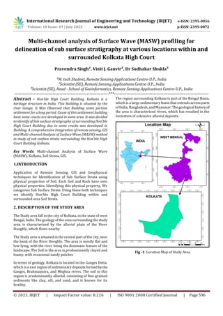
  • 1. International Research Journal of Engineering and Technology (IRJET) e-ISSN: 2395-0056 Volume: 10 Issue: 07 | July 2023 www.irjet.net p-ISSN: 2395-0072 © 2023, IRJET | Impact Factor value: 8.226 | ISO 9001:2008 Certified Journal | Page 596 Multi-channel analysis of Surface Wave (MASW) profiling for delineation of sub surface stratigraphy at various locations within and surrounded Kolkata High Court Pravendra Singh¹, Vinit J. Ganvir², Dr Sudhakar Shukla³ ¹M. tech Student, Remote Sensing Applications Centre-U.P., India ²Scientist (SE), Remote Sensing Applications Centre-U.P., India ³Scientist (SE), Head - School of Geoinformatics, Remote Sensing Applications Centre-U.P., India ---------------------------------------------------------------------***--------------------------------------------------------------------- Abstract - Hon’ble High Court Building, Kolkata is a heritage structure in India. This Building is situated by the river Ganga. It Was Observed that Building some portion settlement for a long period. Cause of this settlement building have some cracks are developed in some area. It was decided to identify of Sub surface stratigraphy of surrounding Hon’ble High Court Building due to some cracks was developed in Building. A comprehensive Integration of remote sensing, GIS and Multi-channel Analysis of Surface Wave (MASW) method in study of sub surface strata surrounding the Hon’ble High Court Building Kolkata. Key Words: Multi-channel Analysis of Surface Wave (MASW), Kolkata, Soil Strata, GIS. 1.INTRODUCTION Application of Remote Sensing, GIS and Geophysical techniques for Identification of Sub Surface Strata using physical properties of Soil. Each Soil and Rock have own physical properties. Identifying this physical property, We categories Sub Surface Strata. Using these both techniques we identify Hon’ble High Court Building within and surrounded area Soil Strata. 2. DESCRIPTION OF THE STUDY AREA The Study area fall in the city of Kolkata, in the state of west Bengal, India. The geology of the area surrounding the study area is characterized by the alluvial plain of the River Hooghly, which flows nearby. The Study area is situated in the central part of the city, near the bank of the River Hooghly. The area is mostly flat and low-lying, with the river being the dominant feature of the landscape. The Soil in the area is predominantly clayed and loamy, with occasional sandy patches In terms of geology, Kolkata is located in the Ganges Delta, which is a vast region of sedimentary depositsformedby the Ganges, Brahmaputra, and Meghna rivers. The soil in this region is predominantly alluvial, consisting of fine-grained sediments like clay, silt, and sand, and is known for its fertility. The region surrounding Kolkata is part of the Bengal Basin, which is a large sedimentary basin that extends across parts of India, Bangladesh, and Myanmar.Thegeological historyof the area is characterized rivers, which has resulted in the formation of extensive alluvial deposits. Fig -1: Location Map of Study Area
  • 2. International Research Journal of Engineering and Technology (IRJET) e-ISSN: 2395-0056 Volume: 10 Issue: 07 | July 2023 www.irjet.net p-ISSN: 2395-0072 © 2023, IRJET | Impact Factor value: 8.226 | ISO 9001:2008 Certified Journal | Page 597 3. DATA USED AND METHODOLOGY 3.1 GEOREFERENCING Fig -2: Google image of Study Area Red Mark in profile Table 1-MASW Profile Coordinate MASW Profile Coordinate Profile Coordinate Length(M) Start End Profile-1 2496370 2496339 92 638032 638121 Profile-2 2496350 2496317 92 638082 638172 Profile-3 2496322 2496411 92 638172 638209 Profile-4 2496409 2496374 92 638076 638168 Profile-5 2496423 2496408 46 638149 638200 Profile-6 2496380 2496426 46 638053 638075 3.2 SOIL MAP & GEOMORPHOLOGICAL MAP OF STUDY AREA Fig -3: Soil Map of Study Area Remote Sensing and GIS Geophysical Studies MASW Data Analysis Interpretation of Subsurface strataSubsurface Georeferencing Soil Map Geomorphological Map Result & Conclusion Methods
  • 3. International Research Journal of Engineering and Technology (IRJET) e-ISSN: 2395-0056 Volume: 10 Issue: 07 | July 2023 www.irjet.net p-ISSN: 2395-0072 © 2023, IRJET | Impact Factor value: 8.226 | ISO 9001:2008 Certified Journal | Page 598 Fig -4: Geomorphological Map of Study Area 3.3 MULTICHANNELANALYSISOFSURFACEWAVES (MASW) The multichannel analysis of surface wave (MASW)method, a powerful geophysical exploration techniquehasbeenused increasingly since 1980 inapplicationsshallowerthan30-50 m depth. The MASW method provides the velocity of S- waves in subsurface materials. The S-wave velocityisa good indicator of the shear property of soil or rock for evaluating the elastic condition (stiffness) of the ground for geotechnical engineering purposes. Fig -5: Evaluation of Average S-Velocity 3.3.1 EQUIPMENT DEPLOYED 3.3.1.1 SEISMIC SOURCE Seismic Source means generate a wave in surface. Lot of source available according to our need like sledgehammers, impact plates, Vibratory. Using this source, we create a S- waves for measurements. 3.3.1.2 GEOPHONES Geophones is performing a receiver work for MASE Survey. That collect a s-wave arrival timing from source. Geophones convert the ground vibration into electrical signal. These electrical signals is recorded and process in Seismography. In this survey we used PASI 24 Geophone Seismography. Mostly MASW survey use a 24 or 48 Geophones used. Geophone arrange Vertically in equally space this 4.5 frequency geophone. Geophones detect the ground motion caused by the seismic waves. 3.3.1.3 RECORDING UNIT Recording unit is the central component for MASW Survey. All Signal received fromthegeophonesandconvertanalogto digital converts and data storage the recording unit also called Seismograph. 3.3.1.4 TRIGGER DEVICE In Multichannel Analysis Surface Waves (MASW), a trigger device is used to initiate the seismic wave Source. The purpose of the trigger device to generate a controlled and synchronized seismic waves that propagates through the ground and is detected by the geophones for subsequently analysis. The Trigger device used in in MASW can vary depending upon the seismic source. 3.3.2 SURVEY GEOMETRY A typical MASE Survey is carried outusingreceiverspread of 24 or 48 Geophones 1 meter to 10-meter interval making a spread length 20 to 470 meter. We can also make this spread length according to our need in field. This spread length depends upon our need and field condition which type of survey field and what’s our purpose and need in Survey. We also take five shot point along the spread length, this short point position are following
  • 4. International Research Journal of Engineering and Technology (IRJET) e-ISSN: 2395-0056 Volume: 10 Issue: 07 | July 2023 www.irjet.net p-ISSN: 2395-0072 © 2023, IRJET | Impact Factor value: 8.226 | ISO 9001:2008 Certified Journal | Page 599 Table 2-Shot Point 3.3.3 APPLICABLE STANDARDS The following standards and guidelines were applied in equipment, field procedures, andinterpretation methodsfor the assessment of subsurface conditions while conducting the MASW Survey: 1. ASTM Standard Designation D5777-00: Standard Guide for Using the MASW Method for Subsurface Investigation 2. IS 15681: 2006 – Geological Exploration by Geophysical Method (MASW) – Code of Practice 3.4 DATA ANALYSIS Field Data in Seg Format after process all five shot. Create a dispersion curve refers to a plot that show relationship between the s- wave velocity and frequency waves propagation through the surface. It provides valuable information about share wave velocity profile of the soil or rock layers. The 1D dispersion curve is obtained by assuming a horizontally layered subsurface model, where the shear wave velocity is assumed to vary only with depth. It represents the relationshipbetweenthephasevelocityofthe surface waves and the corresponding frequency. The 1D dispersion curve provides a simplified representation ofthe subsurface, assuming a uniform shear wave velocity profile within each layer. It is commonly used for preliminary site investigations or when a relatively simple subsurface structure is anticipated. The 2D dispersion curve is derived by considering a more realistic and complex subsurface model. It considers lateral variations in the shear wave velocity, allowing for a more accurate representation of the subsurface structure. The 2D dispersion curve represents the relationship between the phase velocity of the surface waves, frequency,andthe wave propagation direction (usually azimuth). It provides a more detailed and spatially varying picture of the subsurface, which is particularly useful when investigating complex geological conditions or near-surface heterogeneities. Obtaining 1D and 2D dispersion curves in MASW involves similar data acquisition and processing steps. The primary difference lies in the interpretation and inversion methods used to extract the shear wave velocity profile. In the case of 1D dispersion curves, simpler inversion algorithms assuming layered structures are typically employed. For 2D dispersion curves, more sophisticated inversion techniques considering lateral variations in the shear wave velocity are applied. Fig -6: Share Wave Velocity (vs) Distribution along Profile P-1(vs in m/sec) Shot Point 24 Geophones Receiver 48 Geophones Receiver First Offset double distance between two geophones Offset double distance between two geophones Second Between 6-7 Geophones Between 12-13 Geophones Third Between 12-13 Geophones Between 24-25 Geophones Fourth Between 18-19 Geophones Between 36-37 Geophones Fifth Offset double distance between two geophones Offset double distance between two geophones
  • 5. International Research Journal of Engineering and Technology (IRJET) e-ISSN: 2395-0056 Volume: 10 Issue: 07 | July 2023 www.irjet.net p-ISSN: 2395-0072 © 2023, IRJET | Impact Factor value: 8.226 | ISO 9001:2008 Certified Journal | Page 600 Fig -7: Share Wave Velocity (vs) Distribution along Profile P-2(vs in m/sec) Fig -8: Share Wave Velocity (vs) Distribution along Profile P-3(vs in m/sec) Fig -9: Share Wave Velocity (vs) Distribution along Profile P-4(vs in m/sec) Fig -10: Share Wave Velocity (vs) Distribution along Profile P-5(vs in m/sec) Fig -11: Share Wave Velocity (vs) Distribution along Profile P-6(vs in m/sec)
  • 6. International Research Journal of Engineering and Technology (IRJET) e-ISSN: 2395-0056 Volume: 10 Issue: 07 | July 2023 www.irjet.net p-ISSN: 2395-0072 © 2023, IRJET | Impact Factor value: 8.226 | ISO 9001:2008 Certified Journal | Page 601 3.5 SITE CLASSIFICATION Shear wave velocity (VS) hasbeenan essential parameterfor evaluation of dynamic properties of soils. The average shear wave velocity in the top 30 m, based on travel time from surface to a depth of 30 m, is known as VS30. Traditionally, VS30 is determined by seismic measurements in boreholes, using downhole, cross-hole or suspension logging method. However, MASW technique, based on the inversion of surface wave dispersion data, offers advantages of (a) not requiring boreholes and (b) sampling of a larger volume of soil. Vs30 is used in the NEHRP Provisions (BSSC, 1994) and 1997 Uniform Building Code (UBC) to classify sites for engineering design with the expectation that sites in the same class will respond similarly to a given earthquake. The 2000 International Building Code (IBC) permits a similar approach for site classification for the upper 100 ft of soil. The surveyed site is interpreted in this report in accordance with the above Vs based NEHRP site classification Table 3- NEHRP seismic site classification-based share- wave velocity(vs)ranges 3.6 SOIL LIQUEFACTION SUSCEPTIBILITY Soil liquefaction susceptibility refers to thepotential ofa soil deposit to undergo liquefaction when subjected to cyclic loading, typically induced by seismic events. Liquefaction occurs when saturated or partially saturated soils lose their shear strength and stiffness due to the buildup of excess pore water pressure, resulting in a loss of bearing capacity and potential ground failure Standard Penetration Test (SPT), Cone Penetration Test (CPT), Share Wave Velocity Measurement, Laboratory Testing, Empirical Correlations, Liquefaction Hazard Analysis is method for Soil Liquefaction Susceptibility. 3.6 DISCUSSION OF RESULTS Table 4-Six Profile of MASW Result Profile No Result Classification P-1 Vs Value (140-190) m/sec in Depth Ground Level to 10 m Site Class F Vs Value (190-390) m/sec in 10m to 30m Site Class E P-2 Vs Value (180-170) m/sec in Depth Ground Level to 8.5 m Site Class F Vs Value (240-500) m/sec in 8.5m to 25m Site Class E P-3 Vs Value (180-230) m/sec in Depth Ground Level to 14 m Site Class F Vs Value (230-500) m/sec in 14m to 25m Site Class E P-4 Vs Value (140-170) m/sec in Depth Ground Level to 13 m Site Class F Vs Value (240-500) m/sec in 13m to 25m Site Class E P-5 Vs Value (110-180) m/sec in Depth Ground Level to 12 m Site Class F Vs Value (180-270) m/sec in 13m to 18m Site Class E P-6 Vs Value (140-210) m/sec in Depth Ground Level to 5 m Site Class F Vs Value (290-340) m/sec in 5m to 18m Site Class E 3.7 CONCLUSION After getting MASW result Hon’ble High Court Building, Kolkata Area Ground level to mostly 15m depth their S- Velocity is very low <200. So, then we can say that is one of problem of settlement of Building. ACKNOWLEDGEMENT Thanks for Dr S.N. Shukla Managing Director of Gaveshana Geosciences Private Limited New Delhi. who provide me valuable suggestion and chance to performing a Field Work and Data Interpretation work of Kolkata Site. Thanks for Valuable Suggestion Dr. Shashank Tripathi and Anil Kumar Chaurasiya, Project Scientist Remote Sensing Application Centers, Lucknow, India
  • 7. International Research Journal of Engineering and Technology (IRJET) e-ISSN: 2395-0056 Volume: 10 Issue: 07 | July 2023 www.irjet.net p-ISSN: 2395-0072 © 2023, IRJET | Impact Factor value: 8.226 | ISO 9001:2008 Certified Journal | Page 602 REFERENCES [1] Building Seismic Safety Council (BSSC), 1994, NEHRP Recommended Provisions for the Development of Seismic Regulations for New Buildings, Part I: Provisions. [2] C P Lin et al, The Use of MASW Method in the Assessment of Soil Liquefactio Potential. Soil Dynamics and Earthquake Engg, 24(2004) [3] An Introduction to Using Surface Geophysical to characterize Sand and Gravel Deposits, Jefferey E. Lucius, William H.Langer, andkariJ.Ellefsen,USGS,2006 [4] www.masw.com [5] Ground water Information Booklet Kolkata Municipal Corporation, West Bengal