Learning about Springs & Groundwater_ Dr.Jared Buono and Dr. Himanshu Kulkarni_2014
•Download as PPTX, PDF•
2 likes•1,789 views

This is the presentation by Dr.Jared Buono and Dr. Himanshu Kulkarni on Springs, Aquifers and Ground Water. It talks about how springs are related to Ground water management and vice-versa.

Recommended
Recommended
More Related Content
What's hot
What's hot (20)
Viewers also liked
Viewers also liked (20)
Similar to Learning about Springs & Groundwater_ Dr.Jared Buono and Dr. Himanshu Kulkarni_2014
Similar to Learning about Springs & Groundwater_ Dr.Jared Buono and Dr. Himanshu Kulkarni_2014 (20)
More from India Water Portal
More from India Water Portal (20)
Recently uploaded
Recently uploaded (20)
Learning about Springs & Groundwater_ Dr.Jared Buono and Dr. Himanshu Kulkarni_2014
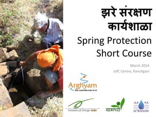
- 1. झरे संरक्षण कार्यशाळा Spring Protection Short Course March 2014 IofC Centre, Panchgani
- 2. • Welcome • Introductions • Organizational Overview
- 3. - In 53 countries - In India since 1968 by Rajmohan Gandhi - Conducts training in ethical leadership, values, personal development & trust building ABOUT IofC India
- 4. MISSION: - Empower rural India through thoughtful, community-led programs CORE AREAS: - Livelihoods - Governance - Health & Environment
- 5. Time Session 10:15-10:40 Welcome, intros, & overview 10:40-11:00 Spring definitions, general characteristics, & geography 11:00-12:15 Hydrogeology , groundwater, local examples & discussion 12:15-1:00 Best practices, water quality, spring ecology 1:00-2:00 Lunch 2:00-3:30 Case Studies – springshed mapping, ecological status, recommendations (Godavalli, Kirunde, etc) 3:30-4:00 Campus tour, sustainable demos & organic garden visit 4:00-4:30 Tea 4:30-6:30 Forest & geology trek 7:00 Dinner & wildfire movie Overview of day 1, March 20th
- 6. Time Session 7:00-8:00 Nature walk & meditation 8:00-9:00 Breakfast 9:00-1:30 Field visit & workday, Umbari village BRING A WATER BOTTLE! 1:30-2:30 Lunch Overview of day 2, March 21st
- 7. Why Springs? • Water biggest issue in local villages • Lots of opportunity for springs as solution • Grampari started spring protection programme 3 years ago
- 8. Map Credit: wikimedia.org/wikipedia/commons • Now part of larger initiative funded by Arghyam to make springs national priority • Other partners in corners of India • We are partners for Western Ghats
- 9. विहिरी वि स्प्रंग्ज • पंवपंग खर्य • शुद्ध पाणी • िर्यभर पुरिठा
- 12. Arghyam- Grampari कार्यक्रम विहंगािलोकन पूर्य प्रकलपांची विचाराधीन प्रकलप च्र्ा पलीकडे जार्े Outreach conducted
- 13. सोलर्ुशन्स
- 14. Extent and Characteristics of Western Ghat Springs • Definition & Characteristics • Geography • Examples • Benefits • Eco-status
- 15. Basalt: • Fine grained • Groundwater flow limited to cracks, vesicles
- 16. Deccan traps • 66M year old lava • 500K km2 area • ~2000m thick Present day Iceland
- 17. Laterite Cap Basalt Layers Potential Spring Locations Villages Accessing Spring Water Typical setting
- 18. Spring Formation Laterite Cap Typical Groundwater Flow Paths - At contacts - Occasional fractures - Laterite plateaus
- 19. Typical spring
- 20. Includes shallow ground water sites
- 21. Spring recharge zone Spring discharge zone Well recharge zone Springs Springshed vs. watershed
- 22. Typical Characteristics Discharge = up to 1,00,000 liters per day Elevation = 50 to 1400 m above sea level Geology: basalt, laterite or talus Spring type: contact or fracture
- 23. Typical Characteristics Uses: drinking, irrigation, temples, animals Safe, sustainable source of drinking water • Gravity-fed = no pumping cost • Year round supply • Water quality very high
- 24. Cultural value
- 25. Credit: Rohit Gowaikar, Wikipedia/Flickr Historic value
- 26. Sole drinking water source for many
- 27. Ecohydrologic Status • Generally, declining discharge due to: – groundwater exploitation – ecological degradation • Poor maintenance, mismanagement common
- 28. Current state of many springs
- 29. • Construction in recharge areas • Loss to bore and well pumping
- 30. • Springs being damaged or lost • Many blasting or digging wells on spring locations
- 31. • Destroys spring ecosystem • Does not yield more water
- 32. • How many springs are there? • How many people affected?
- 33. DON’T KNOW YET!
- 34. What we do know • Springs found throughout Western Ghats
- 35. Karjat Area: Elevation – 50 m Flow – ~7 l/m Use – irrigation Status – disuse, loss to bore wells Pune Area: Elevation – 700 m Flow – ~10 l/m Use – drinking Status – loss to bores, wells Koyna Area: Elev – 800 m Flow – ~30 l/m Use – drinking Status – healthy in unpopulated area Panchgani Area: Elev – 1200 m Flow – ~9 l/m Use – drinking Status – loss to bores, wells
- 36. Satara District
- 37. Maharashtra Location Map SATARA DISTRICT SPRINGS Legend District Boundary Taluka Boundary Spring Locations (Subsample) Laterite Tableland Formations • Our growing map of springs • For every point there are probably 100 more
- 38. Detailed survey: • >20 spring systems • 10 dependent villages • ~9000 people • All springs threatened
- 39. Maharashtra Location Map SATARA DISTRICT SPRINGS Legend District Boundary Taluka Boundary Spring Locations (Subsample) Laterite Tableland Formations Conclusion: Lakhs and lakhs of people in District dependent on springs
- 40. National Importance of the Western Ghats
- 41. Western Ghats Modified from Molur et al. 2011 • Considered one of eight top biodiversity hotspots in the world • Only 6% of the primary vegetation remains intact *Myers et al. 2000
- 42. Western Ghats Watersheds - Cover 9 states - Direct water supply for 120 million people - Indirect, >400 million *Molur et al. 2011 Modified from Molur et al. 2011 Western Ghats
- 43. Hydrogeology • Springs in Himalaya vs Western Ghats • Groundwater & springs • Local investigation of Akehgani – Springs, aquifers & recommendations for recharge & protection
- 44. BaUjala vyavasqaapnava Jaro saMvaQa-na ACWADAM & Grampari Supported by Arghyam, Bengaluru Modified after Tolman, 1937
- 45. Mcao mah%va
- 46. BaUgaiBa-ya P`akairta: BaUjalaaivaYayaI ivaivaQata samajaNyaacaM pihlaM pa}la
- 47. maharaYT/acao KDk After GSI, GSDA N SCALE-1:1000000 GEOLOGICAL MAP OF MAHARASHTRA LATERITES DECCAN TRAP LAVA FLOWS (HARD ROCKS) SEDIMENTARY ROCKS (SOFT ROCKS) METAMORPHICS (HARD ROCKS) GEOLOGICAL FORMATION SHALLOW ALLUVIUM DEEP ALLUVIUM MUMBAI CHANDRAPUR BHANDARA GONDIA NAGPUR AMRAVATI YAVATMAL WASHIM GADCHIROLI WARDHA NANDURBAR DHULE NASIK JALGAON BULDHANA AURANGABAD AKOLA NANDED PARBHANI HINGOLI BEED JALNA LATUR NAGAR OSMANABAD PUNE SOLAPUR SATARA RATNAGIRI RAIGAD KOLHAPUR SANGLI SINDHUDURG THANE INDEX
- 48. doSa BaUjalaavar AvalaMbaUna . . . –3 kaoTI ivaihrI va ik%yaok kaoTI Jaro –ipNyaasaazI –g`aamaINa BaagaaMt 85T@@yaahUna AiQak –SaotIsaazI – 60 to 65 T@ko –SahraMt vaapr – javaL javaL 50
- 49. ihmaalayatIla BaUjala P`avaah va Jaro
- 52. Jaro:BaUjalaacaaca ekBaaga jamaInaItIla“BaUjala” ijaqaM jamaInaIvar baahor pDtM %yaa izkaNaI “Jara” saapDtao BaUjala “BaUjalaQaarkat” (aquifer) AaZLtM. BaUjalaQaarkatIla naOsaiga- kir%yaa baahor pDNaaro PaaNaI Jara mhNaUnaAapNa pahtao. Points of Groundwater Discharge
- 53. Jaro:ivaivaQa P`akar Ja-yaa-Mcao P`akar samajaUnaGaoNa AavaSyak… -Depression spring -Contact spring - Fracture spring - Fault spring - Karst spring Modified after Tolman, 1937
- 54. Modified after Tolman, 1937
- 55. Modified after Tolman, 1937
- 56. Modified after Tolman, 1937
- 57. Modified after Tolman, 1937
- 58. Jara va ivaihr yaat kaya samaanata Aaho? AQUIFER ikMvaa BaUjalaQaark
- 59. What normally comes to mind when we refer to “groundwater”..... Aquifer looking beyond sources... ...understanding the resource
- 60. Mountain sources – water in two villages: beyond topography, watersheds and admin boundaries…
- 61. Aquifers: revisiting sources vs the resource
- 65. AaKogaNaI gaavaatIla Jara va BaUgaBaa-tIla vyavasqaa
- 66. Groundwater: partly visible but practically undivisible…
- 67. AaKogaNaItIla BaUjalaQaarktIlaP`avaah:ivaihrI va Jara yaaMnaapaNaI doNaara
- 69. Advanced Center for Water Resources Development and Management Email: acwadam@vsnl.net Website: www.acwadam.org
- 70. Best Practices Build awareness & empower community to: • Find & fix leaks • Identify springshed • Protect from fire, grazing, tree cutting • Limit nearby pumping (bores, wells) • Build/maintain spring box, prevent contamination
- 71. Empowerment
- 72. Field Survey
- 73. • Leaks a major problem • Up to 25% of supply lost
- 74. Shramdhan
- 75. Springshed Restoration & Recharge
- 76. Spring Box
- 80. Sub-surface Box
- 84. Nalla-box (sand dam) With livestock or wildlife guzzler
- 85. Water quality of springs • Contamination generally due to poor design in harvest and storage • Conversion to surface water sources (i.e. blasting) • Surface water runoff • Storage tank hygiene
- 86. Water Quality of Springs • Water quality very good; min & max values – Temp: 17 – 22 °C (winter) – Ph: 7.3 – 8.3 – TDS: 35 – 160 mg/l – EC: 70 – 320 mmho/cm – Hardness (CaCO3): 30 – 140 mg/l – Na: 2 – 25 mg/l – K: 0 – 2 mg/l – Ca2: 10 – 36 mg/l – Mg2: 1 – 12 mg/l – HCO3: 31 – 177 mg/l – Cl: 7 – 14 mg/l – Fe2: 0.4 – 0.7 mg/l ***** From Naik et al. 2000 • Only iron shows marginal excess • Pathogens are rare at source (e.g. no fecals)
- 87. Typical spring box • Installed in 1970s as drought response • Poor design & maintenance = leaks, contamination • Declining flow due to adjacent pumping, ecological degradation
- 89. HUMAN FECES ON A SPRING BOX
- 90. Water quality of springs
- 91. • Conversion to surface water sources (i.e. blasting to make a spring cum well) • Results in contamination
- 92. Spring Restoration & Ecology • Springshed degradation • Restoration best practices • Ecological reference conditions • Importance to biodiversity
- 93. Spring Recharge
- 94. Misplaced wells can destroy springs Spring Recharge
- 95. Best case, healthy native vegetation Spring Recharge
- 96. Spring Recharge Loss of trees = less monsoon captured
- 97. Annual burning & overgrazing = more runoff Spring Recharge
- 98. Spring Recharge Continued pressure = soil loss & no recharge
- 99. Ecological Degradation • Anthropogenic fire • Over grazing • Fuel wood collection
- 100. CCT – Continuos Contour Trenches
- 101. Staggered Trenches
- 102. Farm Ponds
- 103. Loose rock dams
- 104. Tree planting • Survival rate is 10% • Protection from grazing & fire • Watering
- 105. NORTH ASPECT SOUTH ASPECT Is this ecosystem healthy???
- 109. • Freshwater biodiversity dependent on springs (plants, insects, fish and other vertebrates) • Many of the most threatened species (large mammals, fish & amphibians) depend on springs • And these are some of the most heavily used ecosystems
- 110. Nalla-box (sand dam) With livestock or wildlife guzzler
- 111. LUNCH! REFERENCES: Molur, S., Smith, K.G., Daniel, B.A. and Darwall, W.R.T. (Compilers). 2011. The Status and Distribution of Freshwater Biodiversity in the Western Ghats, India. Cambridge, UK and Gland, Switzerland, IUCN, and Coimbatore, India: Zoo Outreach Organisation. Myers, N., R.A. Mittermeier, C.G. Mittermeier, G.A.B. da Fonseca, J. Kent. 2000. Biodiversity Hotspots for Conservation Priorities. Nature 403, 853-858(24 February 2000). Naik, P.K., · A.K. Awasthi, P.C. Mohan. 2002. Springs in a Headwater Basin in the Deccan Trap Country of the Western Ghats, India. Hydrogeology Journal (2002) 10:553–565.
- 114. Godavalli Village Panchgani Tableland Main Spring at Temple N Godavalli Village Mapping & Recommendations Feb 2014
- 115. Lineament/Fracture Zone along Nala Sub-Watershed Spring Laterite - Basalt Contact Contour N Watershed & Spring Feb 2014
- 118. Massive Basalt Vesicular Basalt Talus & Soils Complex 1315 m 1220 m 1187 m 1125 m 1090 m Massive Basalt Vesicular Basalt Laterite Rocky Plateau Geologic Section Feb 2014
- 119. Massive Basalt Vesicular Basalt Talus & Soils Complex 1315 m 1220 m 1187 m 1125 m 1090 m Massive Basalt Vesicular Basalt Laterite Rocky Plateau RECHARGE ZONE SPRING – DISCHARGE ZONE Recharge & Discharge Zones Feb 2014
- 120. Massive Basalt Vesicular Basalt Talus & Soils Complex 1315 m 1220 m 1187 m 1125 m 1090 m Massive Basalt Vesicular Basalt Laterite Rocky Plateau Orthographic Section Feb 2014
- 121. Massive Basalt Vesicular Basalt Talus & Soils Complex 1315 m 1220 m 1187 m 1125 m 1090 m Massive Basalt Vesicular Basalt Laterite Rocky Plateau Recharge Zone Feb 2014
- 122. Lineament/Fracture Zone along Nala Springshed Recharge Zone Springshed Discharge Zone Laterite - Basalt Contact Contour N Recharge & Discharge Zones Feb 2014
- 123. Lineament/Fracture Zone along Nala Management – Reforestation Management – Roof Water Harvest & Limited Pumping Laterite - Basalt Contact Contour N Management Recommendations Feb 2014
- 124. Tomorrow’s Field Visit Umbari Village
- 126. * * • Approximate spring locations • What do you notice about the landscape?
- 127. * *
- 128. • Notice anything else? Recent fire scars
- 129. Spring Quiz!
- 130. LEGEND - - - - Basalt – laterite contact ------ Other contacts * Likely spring locations -.-.-.- Springshed ……. Sub-watershed (picture 2 only) x Management recommendations
- 131. LEGEND - - - - Basalt – laterite contact ------ Other contacts * Likely spring locations -.-.-.- Springshed ……. Sub-watershed (picture 2 only) x Management recommendations ** * * *
- 132. LEGEND - - - - Basalt – laterite contact ------ Other contacts * Likely spring locations -.-.-.- Springshed ……. Sub-watershed (picture 2 only) x Management recommendations ** * * * X X Protect from fire, reduce grazing, ban wood collection, limit pumping
- 133. LEGEND - - - - Basalt – laterite contact ------ Other contacts * Likely spring locations -.-.-.- Springshed ……. Sub-watershed (picture 2 only) x Management recommendations * * * *