
Recommended
Recommended
More Related Content
What's hot
What's hot (20)
Similar to Petroleum explorationoverview part1-lectures
Similar to Petroleum explorationoverview part1-lectures (20)
Recently uploaded
Recently uploaded (20)
Petroleum explorationoverview part1-lectures
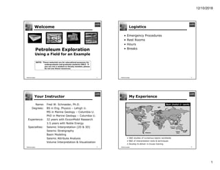
- 1. 12/10/2018 1 FWSchroeder Welcome 1 Petroleum Exploration Using a Field for an Example Block 2 Block 1 Block 5 Block 6 Block 8 Block 7 Block 4 Block 3 OWC NOTE: These materials are for educational purposes for undergraduate and graduate students ONLY. If you are not a student or faculty member, please do not use these resources. FWSchroeder Logistics • Emergency Procedures • Rest Rooms • Hours • Breaks 2 FWSchroeder Your Instructor Name: Fred W. Schroeder, Ph.D. Degrees: BS in Eng. Physics – Lehigh U. MS in Marine Geology – Columbia U. PhD in Marine Geology – Columbia U. Experience: 32 years with ExxonMobil Research 3.5 years with Noble Energy Specialties: Seismic Interpretation (2D & 3D) Seismic Stratigraphy Basin Modeling Seismic Attribute Analysis Volume Interpretation & Visualization 3 FWSchroeder My Experience 4 • G&G studies of numerous basins worldwide • R&D of interpretation tools & techniques • Develop & deliver in-house training Baltimore Canyon US Gulf Coast Exmouth Plateau Nigeria Angola Columbia Chucki Sea Beaufort Sea Haltenbanken Goban Spur Ceduna Basin Viking Graben Mergui Basin Gippsland Basin Pearl River Mouth Yellow Sea Venezuela Central Graben Malay Basin Midland Basin Eq. Guinea Chad Basin Studied 6+ months Falkland's East Med
- 2. 12/10/2018 2 FWSchroeder Course Objective 5 • This course takes a quick look at what we do in the early stages of exploration • We will follow an fictitious field, although I have used more modern data and methods than were available when the field was discovered • We start prior to the first offshore licensing round • We will progress to the stage of a management review of a wildcat well FWSchroeder Course Design 6 • There are three sessions of about 90 minutes • There is homework between sessions Session I Session III Session II Homework • Exercise 3 • Exercise 5 Homework • Exercise 6 • Exercise 7 FWSchroeder Field Location • Our fictitious field is supposedly in the Ross Basin, offshore Antarctica 7 FWSchroeder IBA Preparation 8 Should you be preparing for an IBA competition, please note: • I will guide you through a few typical analysis steps, not a complete analysis • Each IBA data set is different with different amounts of well and seismic data, so the analysis of each would be different • Don’t force your data set and objectives into my example • You want to use creativity in all that you do • Do NOT expect to mimic Fred’s example and win a prize!
- 3. 12/10/2018 1 FWSchroeder Lecture 1 1 Play Elements with an Example NOTE: These materials are for educational purposes for undergraduate and graduate students ONLY. If you are not a student or faculty member, please do not use these resources. FWSchroeder 2 Geoscience Work in Industry The Geoscience Work Process can be subdivided into four (4) main stages that are related to the business cycle of an asset Deplete HC Fields Stage 4 Initiate Production from Discoveries Stage 3 Discover HC Reserves Stage 2 Capture Areas of Highest Potential Stage 1 Early in the Business Cycle Late in the Business Cycle FWSchroeder 3 Exploration Geoscience • Exploration is charged with finding and confirming new oil and gas fields • Their goal is to replace the volumes of HC that the company produces so reserves stay flat or increase Identify High-Potential Regions Early in the Exploration Cycle Late in the Exploration Cycle Locate Quality Leads Capture Exploration Licenses Mature Leads to Prospects Drill Wildcats – Find HCs Confirm Discovery Is Economic FWSchroeder Some Terminology • What is a Lead? – A lead is something that geoscientists find that might be a trap holding an economic volume of recoverable oil and/or gas – It is worthy of further study, but not ready to propose as a drilling target • What is a Prospect? – A prospect is something that has been scientifically matured to the state that we are ready to present it to management as ready to be drilled – We have an estimate of what we will recover and a chance of success 4
- 4. 12/10/2018 2 FWSchroeder Stage 1: Capture Opportunities 1. Of the 700+ sedimentary basins on the planet, which offer the highest potential for undiscovered HCs? 2. Which high potential areas can we hope to operate within, in the near future? 3. Is the land holder (e.g., government) for these accessible areas likely to offer up some exploration licenses? 4. What can we do to get ready to enter this area? Key Questions 5 FWSchroeder Play Elements • What are Play Elements? – A play is a combination of the conditions that make a HC field possible – A play element is one of these necessary conditions – Different companies use slightly different terminology 6 • List of Play Elements (my terminology) 1. Source 2. Reservoir 3. Trap 4. Seal 5. HC Migration FWSchroeder What We Need for Success A Rube Goldberg View of a Hydrocarbon System A “Kitchen” Where Organic Material Is Cooked A “Container” From Which Oil & Gas Can Be Produced “Plumbing” To Connect the Container to the Kitchen Correctly Placed Wells CONVENTIONAL FIELDS 7 FWSchroeder Elements and Processes Essential Elements • Source rocks • Reservoir rocks • Seal rocks • Overburden rocks Major Processes • Trap formation • Hydrocarbon – Generation – Migration – Accumulation 8
- 5. 12/10/2018 3 FWSchroeder The Kitchen • Source – Organic-Rich Rocks, usually shales, best if deposited under anoxic conditions – Temperature & Pressure Conditions such that the geochemical transform of organic matter into molecules of oil & gas has occurred A “Kitchen” Where Organic Material Is Cooked 9 FWSchroeder The Container • Reservoir – Porous & Permeable rock that are suitable for producing HCs – Most commonly sandstones & some types of carbonates • Trap – 3-D configuration in the subsurface where significant amounts of oil & gas is pooled – Structural and/or Stratigraphic Traps • Seal – Rocks that prevent the leakage of HCs from the trap – Most commonly shales and evaporites – We need both top seals & lateral seals A “Container” From Which Oil & Gas Can Be Produced 10 FWSchroeder The Plumbing • HC Migration – From source (shales) to porous reservoirs – Primary mechanism is buoyance – Strata-Parallel Component (sand & silt layers) – Cross-Strata Component (faults, fractures) “Plumbing” To Connect the Container to the Kitchen 11 FWSchroeder Other Important Components • Timing – Did the Trap form before HC Migration began? • Fill & Spill – Has HC Generation Exceeded Trap Volume? – Has there been Spillage from Trap to Trap? – Where is the Oil? • Preservation – Has Oil been Degraded in the Reservoir - Thermal Cracking or Biodegradation? 12
- 6. 12/10/2018 4 FWSchroeder Hydrocarbon Fill & Spill Trap A Trap B Synclinal Spill Point Fault Leak Spill Point 1. Early Charge: Some Oil, Minor Gas 2. Peak Charge: Significant Oil, Some Gas Gas Cap Displaces Oil Oil Spilled from Trap A to Trap B Oil Spills Up Fault 3. Late Charge: No Oil, Significant Gas 13 FWSchroeder Using Play Elements If we can: • Map where source rocks exist and have/are generating hydrocarbons • Determine where reservoir-quality rocks were deposited • Locate potential traps • Deduce that migration paths, timing, fill & spill and preservation all look favorable Then we can: • Decide on which basins to focus on • Determine which blocks hold the greatest promise • Position wells to best evaluate prospects, plan the development of a discovery, or effectively deplete a field 14 FWSchroeder 15 Play Adequacy Maps • To evaluate these eight (8) blocks, we would make maps of the key play elements: Source, Reservoir, Trap, Seal, and Migration • We’d look for locations where all elements were favorable Block 1 Block 5 Block 2 Block 6 Block 8 Block 7 Block 4 Block 3 } FWSchroeder Stage 1: Workflow Regional Studies -> Focus Areas Our company places bids on Blocks 7 & 8 Lease Sale in a Focus Area Play Elements e.g. Reservoir Adequacy Block 2 Block 1 Block 5 Block 6 Block 8 Block 7 Block 4 Block 3 Interesting Leads Block 8 Block 7 Lead A Lead B Lead C Blocks Up for Bid Block 1 Block 5 Block 4 Block 3 Block 2 Block 8 Block 7 Block 6 Profit Analysis 16
- 7. 12/10/2018 5 FWSchroeder 17 Example Exercise 2 Play Elements – Using Play Adequacy Maps FWSchroeder Objective Use a series of seismic interpretation maps to evaluate the HC potential of eight blocks that are open to bidding. 18 Exercise 2 Final Product 1. List of blocks to drop from further analysis. 2. List of blocks to do more work on. FWSchroeder 19 Introduction Our regional geology team has developed a list of high-potential basins and the Bonanza Basin is high on that list. Now eight blocks are up for bid in this basin. A team of 5 people have been tasked with evaluating these eight blocks. There is a well just outside the open blocks that encountered a good reservoir and a good source rock. Unfortunately the well was dry. At the well location the source interval is immature (no HC generation). FWSchroeder 20 Introduction A series of maps have been generated based on the well data and a grid of 2D seismic data. Some modeling of source maturation and reservoir porosity as a function of burial depth has also been done. You will use these maps to decide: • Which blocks merit further work leading to a bid - Good • Which blocks show little HC potential - Bad • Which blocks are in between - Possible
- 8. 12/10/2018 6 FWSchroeder 21 Index Map Index map showing the location of the A-1 well, the 2D seismic grid, and the eight open blocks FWSchroeder 22 Interpreted EODs Interpreted depositional environments and inferred lithologies for the primary reservoir interval FWSchroeder 23 Structural Traps Map of potential structural traps in the Bonanza Basin. Note the salt ridge and anticlines in the northern tier of blocks FWSchroeder 24 HC Generation Map A map showing where oil and gas are currently being generated, based on burial, heat flow, and HC kinetics
- 9. 12/10/2018 7 FWSchroeder 25 HC Migration Map A map showing possible buoyancy-driven flow paths based on the structure (shape) of the top reservoir horizon FWSchroeder 26 Your Task Based on your analysis, categorize each block into “Good,” “Bad,” or “Possible.” You can circle the appropriate word below. Block 1 Good Bad Possible Block 2 Good Bad Possible Block 3 Good Bad Possible Block 4 Good Bad Possible Block 5 Good Bad Possible Block 6 Good Bad Possible Block 7 Good Bad Possible Block 8 Good Bad Possible FWSchroeder 27 HC Migration Map A map showing possible buoyancy-driven flow paths based on the structure (shape) of the top reservoir horizon FWSchroeder 28 Structural Traps Map of potential structural traps in the Bonanza Basin. Note the salt ridge and anticlines in the northern tier of blocks X X
- 10. 12/10/2018 8 FWSchroeder Interpreted depositional environments and inferred lithologies for the primary reservoir interval 29 Interpreted EODs X X FWSchroeder 30 HC Generation Map X X Overmature Gas Oil Immature Gas Oil FWSchroeder 31 Synthesis Block 1 Good Bad Possible Block 2 Good Bad Possible Block 3 Good Bad Possible Block 4 Good Bad Possible Block 5 Good Bad Possible Block 6 Good Bad Possible Block 7 Good Bad Possible Block 8 Good Bad Possible X X Overmature Gas Gas Oil Oil Oil Immature Immature Immature Immature
- 11. 12/10/2018 1 FWSchroeder Introduction to the Ross Basin 1 The Ross Basin NOTE: These materials are for educational purposes for undergraduate and graduate students ONLY. If you are not a student or faculty member, please do not use these resources. NOTE: The Ross Basin is real, but the geology and field used as an example is from a different part of the world FWSchroeder Ross Basin, Offshore Australia 2 • A third of the Ross Basin extends onshore • There are many outcrops of Cretaceous and Paleogene rocks • There are a number of onshore wells; one gas field • There are NO offshore wells 2 Onshore Well Locations Outcrop Belts Gas Field Basin Limits Penguin Field Basin Limits FWSchroeder Tectonic Setting • Plate Tectonic Setting • Basin Evolution • Stratigraphy 3 Mid Cretaceous Upper Cretaceous Present Day 3 FWSchroeder Early Rift Sag Phase Late Rift Late Jurassic East Antarctica West Antarctica Extension Transform Inactive Type of Plate Boundary • Prior to the onset of rifting between East Antarctica and West Antarctica • Mostly continental sedimentation with minor marine incursions Hillary Formation 4
- 12. 12/10/2018 2 FWSchroeder Early Rift Sag Phase Late Rift Early Cretaceous East Antarctica West Antarctica Extension Transform Inactive Type of Plate Boundary Amundsen Formation • Rifting commenced in the Ross Sea separating East and West Antarctica • Early syn-rift sediments including volcano- clastics and major coal seams • First significant marine incursions 5 FWSchroeder Early Rift Sag Phase Late Rift Upper Cretaceous East Antarctica West Antarctica Extension Transform Inactive Type of Plate Boundary Scott Formation • Late syn-rift phase clastic sediments • Declining clastic sediment input • As rifting ceased in the Ross Basin (~65 MY), the region collapsed rapidly and fault blocks rotated • A major transgression occurred 6 FWSchroeder Early Rift Sag Phase Late Rift East Antarctica West Antarctica Paleocene Extension Transform Inactive Type of Plate Boundary Shackleton Member • Time of a world-class transgression • Deep marine shales were deposited in the rapidly subsiding basin 7 FWSchroeder Early Rift Sag Phase Late Rift Present Day Extension Transform Inactive Type of Plate Boundary Larson Formation • The major transgression ceased at the end of the Eocene • A regression occurred during the Oligocene as sedimentation caught up with decreasing subsidence • Very little deposition from the Miocene to the present 8
- 13. 12/10/2018 3 FWSchroeder Basin Evolution • Plate Tectonic Setting • Basin Evolution • Stratigraphy 9 9 FWSchroeder Basin Formation Mantle Continental Crust 35 km Pre-Rifting L. Jurassic Mantle Continental Crust 35 km Early Rifting E. Cretaceous 35 km Mantle Continental Crust End of Rifting L. Cretaceous 35 km Continental Crust Continental Crust Mantle Drift/Sag L. Cenozoic 10 10 FWSchroeder Basin Stratigraphy • Plate Tectonic Setting • Basin Evolution • Stratigraphy 11 11 FWSchroeder Stratigraphy Amundsen Fm Scott Fm Nansen Fm Shackleton Member 12 12 Stratigraphy Inland Coastal Early Rift Sag Phase Late Rift Shackleton Shale Nansen Fm Amundsen Fm Ross Fm Nansen Fm Coals Coals Geologic Ages
- 14. 12/10/2018 4 FWSchroeder Onshore Stratigraphic Summary • The Neogene has thin, fluvial deposits • The Oligocene has fluvial to nearshore • The Eocene is mid slope to shelfal • The Paleocene has deep water shales • The Upper K is fluvial to nearshore-offshore Tectonic Summary • The basin is an extensional, pull-apart basin • Rifting started in the Early Cretaceous • Extension ceased near the end of the Cret. Geologic History Summary • During the Upper K there was a regression followed by a minor marine transgression • A major unconformity occurred at the end of the Cretaceous • The area subsided rapidly, which resulted in a major marine transgression • As subsidence slowed, a new regression occurred • During the Eocene the basin slowly filled (slope to shelfal) • The regression continued to the present Ross Basin, Summary 13 Stratigraphy Inland Coastal Early Rift Sag Phase Late Rift Shackleton Shale Nansen Fm Amundsen Fm Scott Fm Nansen Fm Coals Coals Geologic Ages FWSchroeder The TOR Unconformity • The Ross Basin started as a segment of an extensional triple junction • Active rifting caused basin subsidence from during the Late Cretaceous • Around K-T boundary, extension ceased in the Ross Basin (a failed rift segment) • Once extension ceased, the area rapidly subsided and was flooded • The tectonic readjustments resulted in a major unconformity with erosion of highs on tilted fault blocks and an abrupt change from shallow to deep water facies • The Upper K Scott Formation has fluvial to nearshore (beach) deposits near the current shoreline – these are potential reservoir rocks • The Paleocene Shackleton Member consists of deep water shales deposited as the basin rapidly subsided during a major marine transgression – these are potential sealing rocks A Major Unconformity 14 Inland Coastal TOR FWSchroeder Trap, Reservoir & Seal • Rotated, extensional fault blocks form large potential structural traps • The Scott Formation has fluvial and nearshore sands that can have reservoir quality porosity & permeability • The Shackleton Member can be a very effective seal 15 15 Inland Coastal TOR FWSchroeder Ross Basin Licensing Round • The government of Antarctica is offering up 15 offshore blocks in the Ross Basin • Your company assigned a team of five (5) geoscientists to evaluate the 15 blocks • The team has compiled data from onshore wells and outcrops and deduced a regional geologic story • The team will attempt to generate a series of play element maps and identify interesting leads • For key leads, the team will make some rough estimates of potential HC volumes and risks • These analyses will lead to a bidding strategy 16
- 15. 12/10/2018 5 FWSchroeder Ross Licensing Round The 15 blocks southeast of West Antarctica are open for bids 17 FWSchroeder Ross Licensing Round A coarse grid of 2D seismic lines cover the 15 blocks 18
- 16. 12/10/2018 1 FWSchroeder Lecture 3 1 Regional Evaluation NOTE: These materials are for educational purposes for undergraduate and graduate students ONLY. If you are not a student or faculty member, please do not use these resources. FWSchroeder Mega-Regional Data • Cen. to Maastrictian • Maast. to Present Open marine • Albian to Cenomanian • Aptian • Late Jurassic to Aptian G U L F M A R I N E C A R B O N A T E M A R I N E A N O X I C R I F T • Geologic Maps • Plate Tectonics • Gravity & Magnetics • Regional Seismic Lines • Tectonic Evolution • Stratigraphic Charts • Paleogeographic Maps • Etc. Mitchum et al., 1977b AAPG©1977 reprinted with permission of the AAPG whose permission is required for further use. Images Courtesy of ExxonMobil 2 FWSchroeder Mega-Regional Analysis Usually mega-regional analyses are performed to: • Decide which basins hold the highest potential for discovering & producing oil or gas • Provide the regional context of a basin or sub- basin so that we can understand the important characteristics of the region • Provide geologic constraints and the likelihood of HC presence at the beginning of a lease sale evaluation • To guide step-out wells, i.e., those that extend beyond a known field in search of similar HC accumulations 3 FWSchroeder Questions to Address • Are there any known HC occurrences in or near the study area? • What is the availability of outcrop, well, and geophysical data? • What is the plate tectonic history, including the timing and intensity of structural events? • What does the local stratigraphic chart look like? • Do we have possible mature source rocks? • Are there reservoir quality clastics or carbonates? • How likely are regional seals? • What is the weakest play element for this area? 4
- 17. 12/10/2018 2 FWSchroeder Local Data - Surface Measured Sections 20 ft Surface Observations / Measurements – Topographic/Bathymetric maps – Surface geology (structure & stratigraphy) – Nearby outcrops (or analogs) – Heat flow measurements – HC seeps – Etc. Outcrop Studies Images Courtesy of ExxonMobil 5 FWSchroeder Local Data - Subsurface Subsurface Measurements/Observations – Data from Wells • cores, cuttings, logs • lithology, ages, geochem, etc. – Geophysical Data • Seismic (2D, 3D, 4D) • Gravity & Magnetics Vibrators – Seismic Sources Logging a Well Images Courtesy of ExxonMobil 6