
Recommended
More Related Content
What's hot
What's hot (20)
Similar to Gandhinagar city case study
Similar to Gandhinagar city case study (20)
Recently uploaded
Recently uploaded (20)
Gandhinagar city case study
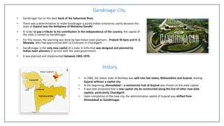
- 1. Gandinagar City. • Gandinagar lies on the west bank of the Sabarmati River. • There was a determination to make Gandinagar a purely Indian enterprise, partly because the state of Gujarat was the birthplace of Mahatma Gandhi. • In order to pay a tribute to his contribution in the independence of the country, the capital of the state is named as Gandhinagar. • For this reason, the planning was done by two Indian town planners : Prakash M Apte and H. K. Mewada, who had apprenticed with Le Corbusier in Chandigarh. • Gandhinagar is the only new capital of a state in India that was designed and planned by Indian town planners in service with the state government. • It was planned and implemented between 1965-1970. History. • In 1960, the Indian state of Bombay was split into two states, Maharashtra and Gujarat; leaving Gujarat without a capital city. • In the beginning, Ahmedabad – a commercial hub of Gujarat was chosen as the state capital. • It was later proposed that a new capital city be constructed along the line of other new state capitals, particularly Chandigarh. • Upon completion of the new city, the administrative capital of Gujarat was shifted from Ahmedabad to Gandhinagar.
- 2. The Sector. • Gandhinagar is planned on the principle of sectors, each measuring about 1 km×0.75 km in length and width. • The sectors are numbered from one to thirty and they are formed by seven roads running in each directions and cutting each other perpendicularly. • Out of 30 sectors, 27 sectors are residential and the remaining 3 sectors are non-residential. • Each sector has a primary school, a secondary school, a higher secondary school, a medical dispensary, a shopping center and a maintenance office. • Gandhinagar is developed on the neighborhood concept. • The total area of the site is about 5,738 Hectares.
- 3. Network of Roads. • Gandhinagar’s streets are numbered (e. g. road no. 1, road no. 2 up to road no. 7). • Cross streets named for letters of the Gujarati alphabet (e. g. k, kh, g, gh, ch, chh, ja). • The letter roads run parallel across the city perpendicular to the number roads and both the roads types intersect each other to form a grid, with each block or square in the grid given a sector number. • Each intersection is marked by signal names such as CH1, CH2, CH3 or JA1, JA2. This provides a high degree of organization and evenness to the various parts of the city. • All streets are aligned at 30 deg. N-W and 60 deg. N-E to avoid direct glare of morning and evening sun while driving. • All streets are in the grid iron patterns. • The campus has been designed to be largely free of cars and other motorized transport. • Pedestrians and cyclist have special scenic routes separate from vehicular roads, through the campus. • While vehicular access has been provided to all housing blocks, parking at the academic blocks has been restricted mainly to cycles. • For internal mobility, the campus provides environment friendly electrical vehicles for universal access and as a means of public transport. • The Gujarat assembly building is in the center of the city to make it close to all the residents.
- 4. Salient Features of Gandhinagar. • Afforestation : The undulated possessed rich soil and so are indigenous species like Neem, Babool, Mango and barriers wear planted under the afforestation scheme. • Drainage : The complete sewage treatment plant consists of grit chambers, clarifiers, sludge digestors, drying beds etc. is located at a distance of about 18 km towards South-West. • Electric Supply : All the electric lines within the town are laid with underground cables. • Parks and Playgrounds : The average standard adopted for the open spaces is about 1.50 to 2.0 hectares per 1000 populations. • Population : The town is designed to accommodate about 4,00,000 persons with possible physical expansion on west side if found necessary in future. • Railways : The railway station in Gandhinagar is situated far away from the township. • Water Supply : The water is supplied from the river Sabarmati and collected in a reservoir of capacity of 27 lakh liters. The plan ensures zero discharge of waste water. Onsite harvesting of rainwater. Waste water is used for growing food and fodder plants. • Zonal Centre : For every four to five sectors, a Zonal Centre is provided and it includes cinema, dispensary, bank, post office, police station, shop of selective nature, etc. Sakshi Gadakh. 4th Year B.Arch.