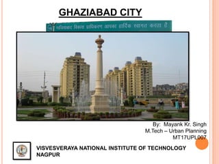
2. LOCATION
•Ghaziabad City is
an important City in
Uttar Pradesh
State.
•Ghaziabad is
located in the
northeastern part of
National Capital
Region, about 20
km east of Central
Delhi.
•Nearest Airport:-
IGI, Delhi – 42Km
•Nearest Railway
Station, Ghazibad
•NDLS – 22Km
•Nearest Metro
Station – Vaisali MS
•Nagpur – 1055 Km
Source : NCR Report
3. INTRODUCING THE CITY
• Founded in 1740. Excavations carried out at the mound of Kaseri, at the banks of
river Hindon, have shown that civilisation existed there as early as 2500 BC.
• Draws its name from its founder Ghazi-ud-din, who named it Ghaziuddin Nagar.
•Later named as "Ghaziabad" with the opening of the Railways in 1864.
• City is developed on
both the sides of River
Hindon, an important
tributary of River Yamuna
•One of the oldest major
centers for trade and
business in state
• Satellite city to Delhi –
the national capital
5. DEMOGRAPHIC PROFILE
DESCRIPTION 2011 2001
ACTUAL POPULATION 1,648,643 968256
MALE 874,607 521026
FEMALE 774,036 447230
AREA(SQ.KM) 133.33 120
POPULATION
DENSITY(PPKM)
12365 8068
SEX RATIO 885 860
AVERAGE LITERACY 75% 71%
1991 2001 2011
Population 454,156 968,256 1648643
0
200,000
400,000
600,000
800,000
1,000,000
1,200,000
1,400,000
1,600,000
1,800,000
No.ofPersons
Population Trend Base
6. DEMOGRAPHIC PROFILE
TOTAL GEN. SC/ST ST CHILD
TOTAL 1,648,643 1,420,190 225,498 2,955 208,853
MALE 874,607 752,828 120,225 1,554 113,827
FEMALE 774,036 667,362 105,273 1,401 95,026
7. CLIMATE
•City lies in COMPOSITE climate
• Three seasons - summer, winter and rainy, prevail here
•Monsoon arrives during the end of the June or the first week of July and
normally it rains until October
•Average rainfall of
the city is 547 mm
•Max. temp. reaches
up to 48°C
•Min. temp. goes
down to 3°C.
9. DENSITY WISE WARD MAP
•The Ghaziabad city is divided into 80 wards
• Ward No.49 has the most population of about 1.2 lakh
•Ward No.62 has the least population of 8536
0
4km2
10. TRANSPORTATION
•NH58 links Ghaziabad in UP with Badrinath and Mana
Pass in Uttarakhand near Indo-Tibet border
•NH24 links Ghaziabad to main cities of UP Lucknow,
Moadabad
0
4km2
11. CITY ECONOMY
•Ghaziabad is one of the largest industrial cities, next to Kanpur, in Uttar
Pradesh
•Centre for trade and commerce in western UP & UK
•Major industries like Bharat Electronics Limited (a public sector unit of Central
Government), UPTRON (a public sector unit of Uttar Pradesh Government),
Dabur, Mohan Meakins
Real Estate Hub
•Proposal has been made to widen National Highway 24 (NH-24) from four to
sixteen lanes on the stretch between the Ghaziabad-Delhi border. Leads to
estabilishment of new Townships and Commercial centres
•Major developers are GAURS, Mahagun, Antriksh, Crossings Republik, Ansal,
Wave
12. CITY DEVELOPMENT
•City is growing at a very high pace and the population base has increased from
0.5 to 1.0 million during 1991-2001
•City is growing spatially.
•Private developers promoted by Public – Private Partnership policy (PPP) are
now supporting the urban development.
•Quality and quantity of housing is improving and reflecting the contribution of
the private sector
13. METRO RAIL DEVELOPMENT
•City has Metro – Rail services within its outer skirts
•Currently, City has two station i.e Vaishali MS & Kausambi MS
•Extented part of Metro line is almost completed till Ghaziabad bus stand
•Extented part involves extension of RED line of metro
14. EASTERN PERIPHERAL E-WAY
•Eastern Peripheral Expressway is an under-construction expressway in
the NCR which will bypass Delhi on the eastern side
•Expressway will provide connectivity between Delhi and the towns
of Ghaziabad, Faridabad, Greater Noida, Baghpat and Sonipat
•Project involves construction of a six-lane expressway with access control
from Faridabad to Sonipat
•Expressway will be 135 km long and will have two sections, the 56 km-long
Palwal-Ghaziabad section and the 79 km-long Ghaziabad-Sonipat section
•Completed expressway will help relieve traffic congestion in the Faridabad-
Ghaziabad stretch AND pollution within Delhi
16. Delhi-Ghz.-Meerut Regional Rapid Transit System
• NCRTC approved
92.05 Kms Delhi-
Ghaziabad-Merrut
high speed rail project
• With maximum speed
of 160 km/h
• Distance between
Delhi and Meerut will
be covered in around
62 min, usually takes
3hr now.
• Various potential TOD
sites were identified in
vicinity of station
areas where vacant
land exists
17. PROBLEMS IN CITY
•Traffic is the biggest problem faced by
commuters and residents
•Pathetic road condition and becames
small pools that leads to huge traffic
accidents
•No proper place for solid waste.
•Always under construction. i.e New
townships, housing and commercials
centres
18. PROBLEMS IN CITY..
GHAZIPUR LANDFILL
Fumes from waste burning
by garbage pickersrelease
toxic gases i.e methane
causing air respiratory
problems
METRO RED LINE PH.2
Because of ongoing
construction of metro leads
to traffic congestion and air
pollution.
NH24
Widening of
NH24 leads to
dust pollution
ELEVATED ROAD TO
RAJNAGAR
Construction of Hindon
elevated road leads to
mounds of dust and
debris on road below
SAHIBABAD FACTORIES
Sahibabad is prominent
industrial belt in ghaziabad and
its emission leads to pollution
ANAND VIHAR ISBT
This is most polluted spot in the city and
situated right on delhi border. As, result
areas near by like Kausambi bear the burnt
WHY YOU CAN’T BREATHE IN CITY
19. PROPOSAL FOR SOLID WASTE DISPOSAL
•At present, there is no
processing plant and
properly designed sanitary
land fill site at
Ghaziabad.
•Waste is disposed off at
an existing site located
near Sai Upvan Nallah by
cured open dumping
method.
•Three landfill site propsed
for solid waste disposal.
•One is situated near NH24
towards Aligarh
•Second is situated near
NH24 towards Hapur, last
is proposed on NH58
towards Meerut
20. SWOT ANALYSIS
STRENGHT
•The city has a strong and diverse economic base which has been flourishing
for long time which is indeed the core strength of the city
•Proximity to Delhi and being an important part of NCR, it has developed strong linkages
with country and attracts a lot of activities
•The City is also a major regional center located as hub of urban activities in the middle of
agriculturally prosperous belt of western Uttar Pradesh
The city is served by an efficient regional road and rail network which provides
connectivity to other major cities
•The city is a district head-quarter, which is served by various local bodies for providing
basic urban services and there are various Central/ state government projects and schemes
WEAKNESS
•Deteriorating pollution levels in water bodies, Rivers, ground water and Air are causing
serious health hazards and making the quality of life really worse for the local population
•Poor Basic Services for the poor in the slums makes life in these areas really pathetic. The
city is considered to be communally very sensitive and has a long history of communal
turbulence
21. SWOT ANALYSIS
OPPORTUNITY
• The up coming sectors such as IT, ITES, and new opportunities in various
manufacturing sectors
•There are numerous Education & Research institutes in the city which supports various
high end industries and economic activities to be located in city
•There is ample unexplored land and opportunity for expansion and the city is located in one
of the richest region of western Uttar Pradesh in terms of natural resources and fertile land
are concerned
THREAT
Dominance of various upcoming cities in the NCR in the proximity to Delhi namely Gurgaon,
Noida, Greater Noida, Jhajjar, Sonipath etc. where large number of mega developmental
projects and SEZs, townships are already in place
•The city may loose other prominent urban centers in the state such as
Lucknow, Kanpur, or other places in the eastern UP