Mysore Town Planning By Akash Thottarath
•Download as PPTX, PDF•
7 likes•6,440 views

Mysore Town Planning

Recommended
More Related Content
What's hot
What's hot (20)
Similar to Mysore Town Planning By Akash Thottarath
Similar to Mysore Town Planning By Akash Thottarath (20)
Recently uploaded
Recently uploaded (20)
Mysore Town Planning By Akash Thottarath
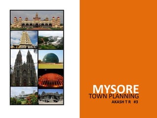
- 1. MYSORETOWN PLANNING AKASH T R #3
- 2. LOCATION & INFO • Mysore officially renamed as Mysuru, is the third most populous and the third largest city in the state of Karnataka, India. • Located in the foothills of the CHAUMUNDI HILLS about 146 km (91 mi) southwest of the state capital Bangalore, • It is spread across an area of 128.42 km2 (50 sq mi). • The population is 887,446. KARNATAKA MYSORE
- 4. HISTORY • Mysore was the centre of administration. It became the capital of the Kingdom of Mysore after the death of Tippu Sultan in 1799. • The administrative centre was shifted to Bangalore in 1831, as the British moved their garrison from Srirangapatnam to Bangalore, thereby establishing the Bangalore Cantonment. • Mysore once again became the capital of the kingdom in 1881 with the rendition of power by the British to the Wodeyars. Most present day historical landmarks, and organisation of the city of Mysore were inspirations of the Wodeyar kings and their Dewans. • Plans for organised development of the city exist as far back as 1904. Several structures were built around late 1800's and early 1900's.
- 5. CONNECTIVITY Mysore is the second biggest city in the state of Karnataka covering an area of 128 sq. kms. It is situated at 140 kms from Bangalore and is well connected by rail and road to all parts of the country. Highways The existing two-lane road linking Mysore to the state capital Bangalore is being upgraded to a four-lane highway and is nearing completion. This would assist in reducing time taken to travel significantly. National Highway 212, and State Highways 17, 33, 88 pass through Mysore connecting it to nearby cities. Rail Mysore is the railway junction for the district, and rail lines connect Mysore city to Bangalore to the northeast via Mandya, and to the rail junction at Hassan to the northwest, to Chamarajanagar via Nanjangud to the southeast. Air The lack of air connectivity could be a key reason for the difference in the development of Mysore, vis-à-vis Bangalore, which has one of the busiest airports in the country. The nearest accessible airport for Mysore is at Bangalore. The Mandkalli Airport, approximately 4 miles from the city
- 6. ARCHITECTURE Based on their architectural features, the heritage buildings of Mysore can be classified as Indo – Sarcenic, traditional Hindu, Greco-Roman, Gothic and the European classical styles. Indo – Sarcenic Buildings Intricately executed multiple mouldings with a superb abundance of deeply sharpened fine carvings of scrolls, foliage, birds, animals and statuettes are the chief characteristics of the Hoysala/ Indo sarcenic style of architecture. Traditional Hindu Style All temples in Mysore exhibit the traditional Hindu style of architecture. Each temple has a Garbhagruha, Sukanasi, Navaranga and Mukhamantapa. The agrahara houses are another example of traditional style with a simple but functional structure placed shoulder to shoulder with shared masonry walls.
- 7. SWOT ANALYSIS Strengths •The heritage city continues to attract increased number of visitors every year. •The slow and measured way of life adds to the charm of this royal city. Brindavan Gardens, Rangana Thittu Bird Sanctuary, Srirangapattana, Melkote, Somanathapura, Talakadu etc, located nearby are added tourist attractions. •The traditional products of Mysore viz., Mysore Silk, Sandal oil, Handicrafts, Mysore Mallige (Jasmine) etc. are of great commercial importance. Weaknesses •Land developments on all sides have encroached upon the lung space. •Huge commercial constructions are coming up pulling down the heritage structures. • IT and BT Sectors are demanding huge extent of open space.
- 8. SWOT ANALYSIS Opportunities •City Development Plan (CDP) is expected to give a face-lift to the entire city of Mysore. •Improved tourist infrastructure would provide tremendous commercial opportunities. •IT and BT sectors would attract visitors from all over the globe. •There would be more market for the traditional products of Mysore. Threats •Large scale speculative land purchase will add to the existing suffocation. •The existing facilities and civic amenities may not be sufficient for the increasing tourist inflow.
- 9. LAND USE PATTERN •The total area for Mysore city as per MUDA has shown an increase to 9221 hectares in 2001 from 7569 hectares in 1995, representing a growth of 22%. As per MUDA, the total area is further expected to increase to 15669 hectares by 2011, representing a significant increase of around 70 % over the total area in 2001.
- 10. LAND USE PATTERN The city’s growth in the recent years has been skewed towards southern Mysore i.e the industrial areas located in Nanjangud. INDUSTRIAL AREA
- 11. LAND USE PATTERN MUDA/ private developers have developed new layouts in the area like, Vijayanagar and J.P. Nagar. Besides, the residential layouts the private developers have lined up an array of proposals to develop malls, convention centres and golf course. RESIDENTIAL AREAS & PRIVATE SECTORS
- 12. LAND USE PATTERN 2001
- 13. LAND USE PATTERN 2011
- 14. PLANNING Planning •The Mysore Urban Development Authority is designated as the Planning Authority under the Karnataka Town and Country Planning Act, 1961. •The Planning City Development Plan for Mysore 47 functions in brief involve the following: •Preparation of development plan for Mysore; •Preparation of Scheme Plans; •Approval of Development Plans for Group Housing and Layouts; •Approval of Building Plans; •Other statutory functions under KTCP Act.
- 15. PLANNING Development In addition to the planning functions, the MUDA Act envisages the following development functions: •Residential sites • Commercial sites •Industrial sites •Civic Amenity sites, •Parks and Playgrounds Planning and implementation of schemes to provide for Residential sites Commercial sites Industrial sites Civic Amenity sites, and Parks and Playgrounds Construction of Commercial Complexes Construction of houses for Economically Weaker Sections, Low Income Group, Middle Income Group, High Income Group Development of major infrastructure facilities
- 16. WATER SUPPLY The history of water supply to Mysore dates back to the time of Deewan Poornaiah. He had planned for a contour canal from Krishnarajasagar to Mysore through gravity to convey the Kaveri water to fulfil the water supply to Mysore. However, the scheme did not achieve the objective as the people during that period were dependent on tanks and wells. Later an arrangement was made to supply water from the Karanji tank. Subsequently, Kukkarahalli tank was constructed from which water was supplied through iron mains. •85% of the households are covered (and metered) by piped water supply system •Quantum of water supplied by the Corporation is about 135 lpcd •Water quality checks are made regularly to ascertain potability & suitable measures are being taken whenever occurrences of water borne diseases have been reported. •Water is supplied daily but the duration of supply is inadequate in a few localities. •New residential localities necessitate provision of additional sources.
- 17. SEWAGE •Mysore was one of the earliest cities in India to have underground drainage. In old parts of the city, underground drainage was completed in 1904. • At present a major part of the city is provided with the underground drainage system. Since the old sewerage lines were incapable of taking the increased load and some parts of the old city were not provided with underground drainage, a comprehensive scheme was undertaken in 1955. • Under this scheme some of the important areas of the old city were provided with underground drainage •. After this another duplicate line was laid behind King Convent from the Krishnamurthy Puram Road. The topography of the city is such that the entire city drains into three valleys viz., northern outfall into Kesare Valley, and other outfalls to the south one into Dalvai tank feeder valley and another to Malalavadi tank valley. The northern outfall drains the area of Narasimharaja Mohalla, Jalapuri, Eeranagere and part of Mandi Mohalla, Medar’s block and Yadavagiri Railway colony, art of Vanivilasa Puram and Kumbarakoppal.
- 18. CITY DEVELOPMENT PLAN Water Supply & Drainage • Improvement of water distribution system • Conservation of ground water sources • Identification of different sources of water from the sustainability point of view – like Kabini • Re-designing of water supply system • Rainwater harvesting • Waste water re-cycling • Improvement of UGD • Protection of natural valleys • Flood Management I Roads & Transport • Focus on local public transport •
- 19. CITY DEVELOPMENT PLAN Road & Transport Improvement of roads – tarring • Outer ring road connection • Improvement of Mysore-Malavalli Junction (can be declared as national highway). • Development of national airport for connectivity. • Underground parking spaces near Town Hall, Makkaji Chowk • Completion of existing ring road, Dasappa to Bommahalli to be improved • Railway to be integrated in public transport system. • Pedestrian facilities to be provided. • North south railway corridor • Introduction of footpaths, cycle tracks, flyovers • Multistoried buildings to be shifted to the outskirts of the city II
- 20. CITY DEVELOPMENT PLAN Beautification • Development of Parks • 277 Parks to be conserved • Plans for development of individual areas - Ashok Nagar, Padavanahalli • Conservation of water bodies III Slums • Improvement of Slums • Relocation / rehabilitation of Slums • NR Muhalla to be developed IV Tourism & Heritage • Declare Mysore as Heritage City • Restoration of Heritage Buildings • Preparation of a Tourism plan • Local artisans to be promoted • Provision of information kiosks
- 21. THANK YOU