
Recommended
Recommended
More Related Content
What's hot
What's hot (20)
Similar to Spatial data sources and applications
Similar to Spatial data sources and applications (20)
More from Md. Yousuf Gazi
More from Md. Yousuf Gazi (20)
Recently uploaded
Recently uploaded (20)
Spatial data sources and applications
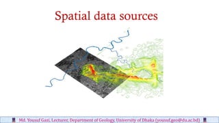
- 1. Spatial data sources Md. Yousuf Gazi, Lecturer, Department of Geology, University of Dhaka (yousuf.geo@du.ac.bd)
- 2. • Scanning • Other point measurements (in text files) • Census data • GPS collections • Aerial photographs • Remote sensing data Primary Data Capture (first-hand collection) Md. Yousuf Gazi, Lecturer, Department of Geology, University of Dhaka (yousuf.geo@du.ac.bd)
- 3. Secondary Data Capture (from others) • Published or released data (originally primary data) • All primary data from others are secondary data for you and me Md. Yousuf Gazi, Lecturer, Department of Geology, University of Dhaka (yousuf.geo@du.ac.bd)
- 4. Secondary Data • Large amount of data is now available • Always check for existing data before creating it • Several groups of data exist • Free data from the government • Government data available for a fee • Internet map servers • Commercial data • Data from other GIS users GIS Md. Yousuf Gazi, Lecturer, Department of Geology, University of Dhaka (yousuf.geo@du.ac.bd)
- 5. Free Government Data Large amounts of data are available from • USGS • Census • NOAA GIS Md. Yousuf Gazi, Lecturer, Department of Geology, University of Dhaka (yousuf.geo@du.ac.bd)
- 6. USGS Data • DEM = Digital Elevation Model • NED = National Elevation Dataset • NHD = National Hydrography Dataset • DRG = Digital Raster Graphic • DLG = Digital Line Graph • DOQQ = Digital Ortho Quarter Quad • GNIS = Geographic Names Information System • LULC = Land Use Land Cover • NLCD = National Land Cover Data GIS Md. Yousuf Gazi, Lecturer, Department of Geology, University of Dhaka (yousuf.geo@du.ac.bd)
- 7. • DEM = Digital Elevation Model • NED = National Elevation Dataset Md. Yousuf Gazi, Lecturer, Department of Geology, University of Dhaka (yousuf.geo@du.ac.bd)
- 8. 3d Analysis
- 9. 30m Dem 1m Dem10m Dem DEM and surfacing
- 10. • NHD = National Hydrography Dataset • DRG = Digital Raster Graphic Md. Yousuf Gazi, Lecturer, Department of Geology, University of Dhaka (yousuf.geo@du.ac.bd)
- 11. • DOQQ = Digital Ortho Quarter Quad • DLG = Digital Line Graph Md. Yousuf Gazi, Lecturer, Department of Geology, University of Dhaka (yousuf.geo@du.ac.bd)
- 12. • LULC = Land Use Land Cover • NLCD = National Land Cover Data Md. Yousuf Gazi, Lecturer, Department of Geology, University of Dhaka (yousuf.geo@du.ac.bd)
- 13. NOAA • Shoreline Data http://www.csc.noaa.gov/shoreline/data.html • Estuarine Bathymetry http://sposerver.nos.noaa.gov/bathy/ • NCDC = National Climatic Data Center NCDC is the world's largest active archive of weather data http://www.ncdc.noaa.gov/oa/ncdc.html GIS Md. Yousuf Gazi, Lecturer, Department of Geology, University of Dhaka (yousuf.geo@du.ac.bd)
- 14. • NASA (USGS) EOS datagate way • http://edcimswww.cr.usgs.gov/pub/imswelcome/ • NASA lunar and planetary science data • http://nssdc.gsfc.nasa.gov/planetary/planets/marspage.html • ESA (European Space Agency) Planetary Science Archive • http://www.rssd.esa.int/index.php?project=PSA Remote sensing data GIS Md. Yousuf Gazi, Lecturer, Department of Geology, University of Dhaka (yousuf.geo@du.ac.bd)
- 15. • http://seamless.usgs.gov/viewer.htm • http://gisdata.usgs.gov • http://edcsns17.cr.usgs.gov/EarthExplorer/ • http://data.geocomm.com/ • http://www.texasview.org/ • http://www.tnris.state.tx.us/ Other Important GIS Data Websites GIS Md. Yousuf Gazi, Lecturer, Department of Geology, University of Dhaka (yousuf.geo@du.ac.bd)
- 16. • Urban Planning, Management & Policy • Zoning, subdivision planning • Land acquisition • Economic development • Code enforcement • Housing renovation programs • Emergency response • Crime analysis • Tax assessment • Environmental Sciences • Monitoring environmental risk • Modeling storm water runoff • Management of watersheds, floodplains, wetlands, forests, aquifers • Environmental Impact Analysis • Hazardous or toxic facility siting • Groundwater modeling and contamination tracking • Political Science • Redistricting • Analysis of election results • Predictive modeling Civil Engineering/Utility • Locating underground facilities • Designing alignment for freeways, transit • Coordination of infrastructure maintenance Business • Demographic Analysis • Market Penetration/ Share Analysis • Site Selection Education Administration • Attendance Area Maintenance • Enrollment Projections • School Bus Routing Real Estate • Neighborhood land prices • Traffic Impact Analysis • Determination of Highest and Best Use Health Care • Epidemiology • Needs Analysis • Service Inventory ApplicationsofGIS GIS Md. Yousuf Gazi, Lecturer, Department of Geology, University of Dhaka (yousuf.geo@du.ac.bd)
- 17. • Zoning, subdivision planning • Land acquisition GIS Md. Yousuf Gazi, Lecturer, Department of Geology, University of Dhaka (yousuf.geo@du.ac.bd)
- 18. • Economic development • Housing renovation programs GIS Md. Yousuf Gazi, Lecturer, Department of Geology, University of Dhaka (yousuf.geo@du.ac.bd)
- 19. • Code enforcement • Emergency response GIS Md. Yousuf Gazi, Lecturer, Department of Geology, University of Dhaka (yousuf.geo@du.ac.bd)
- 20. • Crime analysis • Tax assessment GIS Md. Yousuf Gazi, Lecturer, Department of Geology, University of Dhaka (yousuf.geo@du.ac.bd)
- 21. • Monitoring environmental risk • Modeling storm water runoff GIS Md. Yousuf Gazi, Lecturer, Department of Geology, University of Dhaka (yousuf.geo@du.ac.bd)
- 22. • Management of watersheds, floodplains, wetlands, forests, aquifers • Environmental Impact Analysis GIS Md. Yousuf Gazi, Lecturer, Department of Geology, University of Dhaka (yousuf.geo@du.ac.bd)
- 23. • Hazardous or toxic facility siting • Groundwater modeling and contamination tracking GIS Md. Yousuf Gazi, Lecturer, Department of Geology, University of Dhaka (yousuf.geo@du.ac.bd)
- 24. • Analysis of election results • Redistricting GIS Md. Yousuf Gazi, Lecturer, Department of Geology, University of Dhaka (yousuf.geo@du.ac.bd)
- 25. • Predictive modeling • Locating underground facilitiesGIS Md. Yousuf Gazi, Lecturer, Department of Geology, University of Dhaka (yousuf.geo@du.ac.bd)
- 26. • Designing alignment for freeways, transit • Coordination of infrastructure maintenance GIS Md. Yousuf Gazi, Lecturer, Department of Geology, University of Dhaka (yousuf.geo@du.ac.bd)
- 27. • Demographic Analysis • Market Penetration/ Share Analysis GIS Md. Yousuf Gazi, Lecturer, Department of Geology, University of Dhaka (yousuf.geo@du.ac.bd)
- 28. • Site Selection • Attendance Area Maintenance GIS Md. Yousuf Gazi, Lecturer, Department of Geology, University of Dhaka (yousuf.geo@du.ac.bd)
- 29. • School Bus Routing • Neighborhood land prices GIS Md. Yousuf Gazi, Lecturer, Department of Geology, University of Dhaka (yousuf.geo@du.ac.bd)
- 30. • Traffic Impact Analysis • Epidemiology GIS Md. Yousuf Gazi, Lecturer, Department of Geology, University of Dhaka (yousuf.geo@du.ac.bd)
- 31. GIS Md. Yousuf Gazi, Lecturer, Department of Geology, University of Dhaka (yousuf.geo@du.ac.bd)
- 32. a. Geomorphology b. Coastal slope c. Shoreline change rate d. Rate of sea level change e. Mean tide range f. Bathymetry Coastal Vulnerability Index (CVI) Spatial analysis and modeling Md. Yousuf Gazi, Lecturer, Department of Geology, University of Dhaka (yousuf.geo@du.ac.bd)
- 33. Md. Yousuf Gazi, Lecturer, Department of Geology, University of Dhaka (yousuf.geo@du.ac.bd) Coral Reefs Degradation using Geospatial techniques around Saint Martin’s Island (Gazi et al. 2019)