SlideShare a Scribd company logo
1 of 22
Download to read offline
Md. Yousuf Gazi, Lecturer, Department of Geology, University of Dhaka (yousuf.geo@du.ac.bd)
Image Classification
▪ The process of sorting pixels into a finite
number of individual classes, or categories
of data, based on their spectral response
(the measured brightness of a pixel across
the image bands, as reflected by the pixel’s
spectral signature).
Md. Yousuf Gazi, Lecturer, Department of Geology, University of Dhaka (yousuf.geo@du.ac.bd)
The underlying assumption of image classification is that spectral response of a
particular feature (i.e., land-cover class) will be relatively consistent throughout the
image.
Image Classification
General Approaches to Image Classification
1. Unsupervised
2. Supervised
Md. Yousuf Gazi, Lecturer, Department of Geology, University of Dhaka (yousuf.geo@du.ac.bd)
Unsupervised Classification
• Unsupervised classification (a.k.a., “clustering”) identifies groups of pixels that exhibit a
similar spectral response
• These spectral classes are then assigned “meaning” by the analyst (e.g., assigned to land-cover
categories)
Md. Yousuf Gazi, Lecturer, Department of Geology, University of Dhaka (yousuf.geo@du.ac.bd)
Supervised Classification
Supervised classification uses image pixels representing regions of known, homogenous surface
composition -- training areas -- to classify unknown pixels.
Md. Yousuf Gazi, Lecturer, Department of Geology, University of Dhaka (yousuf.geo@du.ac.bd)
Unsupervised: bulk of analyst’s work comes after
the classification process
Supervised: bulk of analyst’s work comes before the
classification process
Md. Yousuf Gazi, Lecturer, Department of Geology, University of Dhaka (yousuf.geo@du.ac.bd)
Advantages
▪ No prior knowledge of the image area is required
▪ Human error is minimized
▪ Unique spectral classes are produced
▪ Relatively fast and easy to perform
Advantages and Disadvantages of Unsupervised Classification
Md. Yousuf Gazi, Lecturer, Department of Geology, University of Dhaka (yousuf.geo@du.ac.bd)
Disadvantages of Unsupervised Classification
▪ Spectral classes do not represent features on the ground
▪ Does not consider spatial relationships in the data
▪ Can be very time consuming to interpret spectral classes
▪ Spectral properties vary over time, across images
Md. Yousuf Gazi, Lecturer, Department of Geology, University of Dhaka (yousuf.geo@du.ac.bd)
Process of Unsupervised Classification
1. Determine a general classification scheme
2. Assign pixels to spectral classes (ISODATA)
3. Assign spectral classes to informational classes
Md. Yousuf Gazi, Lecturer, Department of Geology, University of Dhaka (yousuf.geo@du.ac.bd)
Process of Unsupervised Classification
1. Determine a general classification scheme
• Depends upon the purpose of the classification
• With unsupervised classification, the scheme does not need to be very specific
Md. Yousuf Gazi, Lecturer, Department of Geology, University of Dhaka (yousuf.geo@du.ac.bd)
Process of Unsupervised Classification
1. Determine a general classification scheme
2. Assign pixels to spectral classes (ISODATA)
• Group pixels into groups of similar values based on pixel value relationships in multi-
dimensional feature space (clustering)
• Iterative ISODATA technique is the most common
3. Assign spectral classes to informational classes
Md. Yousuf Gazi, Lecturer, Department of Geology, University of Dhaka (yousuf.geo@du.ac.bd)
Process of Unsupervised Classification
1. Determine a general classification scheme
2. Assign pixels to spectral classes (ISODATA)
3. Assign spectral classes to informational classes
▪ Once the spectral clusters in the image are identified, the analyst must assign them to the
“informational” classes of the classification scheme (i.e., land cover)
Md. Yousuf Gazi, Lecturer, Department of Geology, University of Dhaka (yousuf.geo@du.ac.bd)
Example: Image to be Classified Example: Image to be Classified
▪ Multiple clusters likely
represent a single type of
“feature” on the ground.
▪ Someone needs to assign a
landcover class to all of these
clusters; can be difficult and
time consuming.
Md. Yousuf Gazi, Lecturer, Department of Geology, University of Dhaka (yousuf.geo@du.ac.bd)
Supervised Classification
Supervised classification uses image pixels
representing regions of known, homogenous surface
composition -- training areas -- to classify unknown
pixels.
Md. Yousuf Gazi, Lecturer, Department of Geology, University of Dhaka (yousuf.geo@du.ac.bd)
Supervised Classification
The underlying assumption is that spectral
response of a particular feature (i.e., land-cover
class) will be relatively consistent throughout
the image.
Md. Yousuf Gazi, Lecturer, Department of Geology, University of Dhaka (yousuf.geo@du.ac.bd)
Advantages
▪ Generates informational classes representing features on the ground
▪ Training areas are reusable (assuming they do not change; e.g. roads)
Md. Yousuf Gazi, Lecturer, Department of Geology, University of Dhaka (yousuf.geo@du.ac.bd)
Disadvantages
▪ Information classes may not match spectral classes
(e.g., a supervised classification of “forest” may mask the
unique spectral properties of pine and oak stands that
comprise that forest)
▪ Homogeneity of information classes varies
▪ Difficulty and cost of selecting training sites
▪ Training areas may not encompass unique spectral
classes
Md. Yousuf Gazi, Lecturer, Department of Geology, University of Dhaka (yousuf.geo@du.ac.bd)
Process of Supervised Classification
1. Determine a classification scheme
2. Create training areas
3. Generate training area signatures
4. Evaluate and refine signatures
5. Assign pixels to classes using a classifier (a.k.a., “decision rule”)
1 | Determine Classification Scheme
• Depends upon the purpose of the classification
• Make the scheme as specific as resources and available reference data allow
You can always generalize your classification scheme to make it less specific; making
it more specific involves starting over
Md. Yousuf Gazi, Lecturer, Department of Geology, University of Dhaka (yousuf.geo@du.ac.bd)
2 | Create Training Areas
▪ Digitizing: drawing polygons around areas in the image
▪ Seeding: “grows” areas based on spectral similarity to seed pixel
▪ Using existing data: existing maps, field data (GPS, etc.), high-resolution imagery
▪ Feature space image training areas
Md. Yousuf Gazi, Lecturer, Department of Geology, University of Dhaka (yousuf.geo@du.ac.bd)

More Related Content

What's hot

Change detection process and techniques
Change detection process and techniquesChange detection process and techniques
Change detection process and techniquesAlexander Decker
 
Remote Sensing and GIS for Coastal Management
Remote Sensing and GIS for Coastal ManagementRemote Sensing and GIS for Coastal Management
Remote Sensing and GIS for Coastal ManagementAnujSharma815
 
The Nippon foundation -GEBCO seabed 2030
The Nippon foundation -GEBCO seabed 2030The Nippon foundation -GEBCO seabed 2030
The Nippon foundation -GEBCO seabed 2030Abdul Saleem K
 
Field Education 2009 Stewart
Field Education 2009 StewartField Education 2009 Stewart
Field Education 2009 StewartRobert Stewart
 
2019-10-29 Recent progress of volcano deformation studies
2019-10-29 Recent progress of volcano deformation studies 2019-10-29 Recent progress of volcano deformation studies
2019-10-29 Recent progress of volcano deformation studies Yosuke Aoki
 
Structural Trends from Airborne Gravity Data of Delta State, Nigeria
Structural Trends from Airborne Gravity Data of Delta State, NigeriaStructural Trends from Airborne Gravity Data of Delta State, Nigeria
Structural Trends from Airborne Gravity Data of Delta State, NigeriaAssociate Professor in VSB Coimbatore
 
Application of GIS and Remote Sensing in the analysis of Landuse/Landcover ch...
Application of GIS and Remote Sensing in the analysis of Landuse/Landcover ch...Application of GIS and Remote Sensing in the analysis of Landuse/Landcover ch...
Application of GIS and Remote Sensing in the analysis of Landuse/Landcover ch...ADITYA SHRESHTKAR
 
Geomorphological Mapping Using Remote Sensing and GIS A Tool for Land Use Pla...
Geomorphological Mapping Using Remote Sensing and GIS A Tool for Land Use Pla...Geomorphological Mapping Using Remote Sensing and GIS A Tool for Land Use Pla...
Geomorphological Mapping Using Remote Sensing and GIS A Tool for Land Use Pla...IOSR Journals
 
Class 11 Cbse Geography Syllabus 2013-14
Class 11 Cbse Geography Syllabus 2013-14Class 11 Cbse Geography Syllabus 2013-14
Class 11 Cbse Geography Syllabus 2013-14Sunaina Rawat
 
Change detection analysis in land use / land cover of Pune city using remotel...
Change detection analysis in land use / land cover of Pune city using remotel...Change detection analysis in land use / land cover of Pune city using remotel...
Change detection analysis in land use / land cover of Pune city using remotel...Nitin Mundhe
 
From global to regional scale: Remote sensing-based concepts and methods for ...
From global to regional scale: Remote sensing-based concepts and methods for ...From global to regional scale: Remote sensing-based concepts and methods for ...
From global to regional scale: Remote sensing-based concepts and methods for ...Repository Ipb
 
Mangrove conservation planning using remote sensing
Mangrove conservation planning using remote sensingMangrove conservation planning using remote sensing
Mangrove conservation planning using remote sensingEmmanuel Olatunji
 
Subsurface Mapping
Subsurface MappingSubsurface Mapping
Subsurface MappingMaliha Mehr
 
Seagrass Mapping and Monitoring Along the Coasts of Crete, Greece
Seagrass Mapping and Monitoring Along the Coasts of Crete, GreeceSeagrass Mapping and Monitoring Along the Coasts of Crete, Greece
Seagrass Mapping and Monitoring Along the Coasts of Crete, GreeceUniversität Salzburg
 
Geological fieldwork report
Geological fieldwork reportGeological fieldwork report
Geological fieldwork reportBhadra Thakuri
 
Geophysics for Geotechnical Engineers
Geophysics for Geotechnical EngineersGeophysics for Geotechnical Engineers
Geophysics for Geotechnical EngineersRamanuja Chari Kannan
 
Structural geology
Structural geologyStructural geology
Structural geologyKhchao Tel
 

What's hot (20)

Change detection process and techniques
Change detection process and techniquesChange detection process and techniques
Change detection process and techniques
 
Remote Sensing and GIS for Coastal Management
Remote Sensing and GIS for Coastal ManagementRemote Sensing and GIS for Coastal Management
Remote Sensing and GIS for Coastal Management
 
The Nippon foundation -GEBCO seabed 2030
The Nippon foundation -GEBCO seabed 2030The Nippon foundation -GEBCO seabed 2030
The Nippon foundation -GEBCO seabed 2030
 
Field Education 2009 Stewart
Field Education 2009 StewartField Education 2009 Stewart
Field Education 2009 Stewart
 
2019-10-29 Recent progress of volcano deformation studies
2019-10-29 Recent progress of volcano deformation studies 2019-10-29 Recent progress of volcano deformation studies
2019-10-29 Recent progress of volcano deformation studies
 
Structural Trends from Airborne Gravity Data of Delta State, Nigeria
Structural Trends from Airborne Gravity Data of Delta State, NigeriaStructural Trends from Airborne Gravity Data of Delta State, Nigeria
Structural Trends from Airborne Gravity Data of Delta State, Nigeria
 
Application of GIS and Remote Sensing in the analysis of Landuse/Landcover ch...
Application of GIS and Remote Sensing in the analysis of Landuse/Landcover ch...Application of GIS and Remote Sensing in the analysis of Landuse/Landcover ch...
Application of GIS and Remote Sensing in the analysis of Landuse/Landcover ch...
 
Geomorphological Mapping Using Remote Sensing and GIS A Tool for Land Use Pla...
Geomorphological Mapping Using Remote Sensing and GIS A Tool for Land Use Pla...Geomorphological Mapping Using Remote Sensing and GIS A Tool for Land Use Pla...
Geomorphological Mapping Using Remote Sensing and GIS A Tool for Land Use Pla...
 
Class 11 Cbse Geography Syllabus 2013-14
Class 11 Cbse Geography Syllabus 2013-14Class 11 Cbse Geography Syllabus 2013-14
Class 11 Cbse Geography Syllabus 2013-14
 
Change detection analysis in land use / land cover of Pune city using remotel...
Change detection analysis in land use / land cover of Pune city using remotel...Change detection analysis in land use / land cover of Pune city using remotel...
Change detection analysis in land use / land cover of Pune city using remotel...
 
From global to regional scale: Remote sensing-based concepts and methods for ...
From global to regional scale: Remote sensing-based concepts and methods for ...From global to regional scale: Remote sensing-based concepts and methods for ...
From global to regional scale: Remote sensing-based concepts and methods for ...
 
Geological mapping
Geological mappingGeological mapping
Geological mapping
 
Mangrove conservation planning using remote sensing
Mangrove conservation planning using remote sensingMangrove conservation planning using remote sensing
Mangrove conservation planning using remote sensing
 
Subsurface Mapping
Subsurface MappingSubsurface Mapping
Subsurface Mapping
 
Seagrass Mapping and Monitoring Along the Coasts of Crete, Greece
Seagrass Mapping and Monitoring Along the Coasts of Crete, GreeceSeagrass Mapping and Monitoring Along the Coasts of Crete, Greece
Seagrass Mapping and Monitoring Along the Coasts of Crete, Greece
 
Geological fieldwork report
Geological fieldwork reportGeological fieldwork report
Geological fieldwork report
 
Fundementals of MASW
Fundementals of MASWFundementals of MASW
Fundementals of MASW
 
MASW_Love_Waves
MASW_Love_WavesMASW_Love_Waves
MASW_Love_Waves
 
Geophysics for Geotechnical Engineers
Geophysics for Geotechnical EngineersGeophysics for Geotechnical Engineers
Geophysics for Geotechnical Engineers
 
Structural geology
Structural geologyStructural geology
Structural geology
 

Similar to Image classification md. yousuf gazi

Introduction to geology md. yousuf gazi
Introduction to geology md. yousuf gaziIntroduction to geology md. yousuf gazi
Introduction to geology md. yousuf gaziMd. Yousuf Gazi
 
Presentation: Introduction to the GETSI-InTeGrate Development Model & Gui...
Presentation: Introduction to the GETSI-InTeGrate Development Model & Gui...Presentation: Introduction to the GETSI-InTeGrate Development Model & Gui...
Presentation: Introduction to the GETSI-InTeGrate Development Model & Gui...SERC at Carleton College
 
Structure of geographic data
Structure of geographic dataStructure of geographic data
Structure of geographic dataMd. Yousuf Gazi
 
Geographic information system
Geographic information systemGeographic information system
Geographic information systemMd. Yousuf Gazi
 
Coastal vulnerability md. yousuf gazi
Coastal vulnerability md. yousuf gaziCoastal vulnerability md. yousuf gazi
Coastal vulnerability md. yousuf gaziMd. Yousuf Gazi
 
Earth internal structure md. yousuf gazi
Earth internal structure md. yousuf gaziEarth internal structure md. yousuf gazi
Earth internal structure md. yousuf gaziMd. Yousuf Gazi
 

Similar to Image classification md. yousuf gazi (9)

Introductory GIS
Introductory GISIntroductory GIS
Introductory GIS
 
Introduction to geology md. yousuf gazi
Introduction to geology md. yousuf gaziIntroduction to geology md. yousuf gazi
Introduction to geology md. yousuf gazi
 
Presentation: Introduction to the GETSI-InTeGrate Development Model & Gui...
Presentation: Introduction to the GETSI-InTeGrate Development Model & Gui...Presentation: Introduction to the GETSI-InTeGrate Development Model & Gui...
Presentation: Introduction to the GETSI-InTeGrate Development Model & Gui...
 
Structure of geographic data
Structure of geographic dataStructure of geographic data
Structure of geographic data
 
Introduction to GETSI-UNAVCO SFTG 2018
Introduction to GETSI-UNAVCO SFTG 2018Introduction to GETSI-UNAVCO SFTG 2018
Introduction to GETSI-UNAVCO SFTG 2018
 
Guiding Principles for Module Design
Guiding Principles for Module DesignGuiding Principles for Module Design
Guiding Principles for Module Design
 
Geographic information system
Geographic information systemGeographic information system
Geographic information system
 
Coastal vulnerability md. yousuf gazi
Coastal vulnerability md. yousuf gaziCoastal vulnerability md. yousuf gazi
Coastal vulnerability md. yousuf gazi
 
Earth internal structure md. yousuf gazi
Earth internal structure md. yousuf gaziEarth internal structure md. yousuf gazi
Earth internal structure md. yousuf gazi
 

More from Md. Yousuf Gazi

Coastal biodiversity md. yousuf gazi
Coastal biodiversity md. yousuf gaziCoastal biodiversity md. yousuf gazi
Coastal biodiversity md. yousuf gaziMd. Yousuf Gazi
 
Coastal engineering md. yousuf gazi
Coastal engineering md. yousuf gaziCoastal engineering md. yousuf gazi
Coastal engineering md. yousuf gaziMd. Yousuf Gazi
 
Coastal economic resource md. yousuf gazi
Coastal economic resource md. yousuf gaziCoastal economic resource md. yousuf gazi
Coastal economic resource md. yousuf gaziMd. Yousuf Gazi
 
Coastal physical processes md. yousuf gazi
Coastal physical processes md. yousuf gaziCoastal physical processes md. yousuf gazi
Coastal physical processes md. yousuf gaziMd. Yousuf Gazi
 
Coastal env. impact assessment md. yousuf gazi
Coastal env. impact assessment md. yousuf gaziCoastal env. impact assessment md. yousuf gazi
Coastal env. impact assessment md. yousuf gaziMd. Yousuf Gazi
 
Coastal hazards md. yousuf gazi
Coastal hazards md. yousuf gaziCoastal hazards md. yousuf gazi
Coastal hazards md. yousuf gaziMd. Yousuf Gazi
 
Integrated coastal zone management md. yousuf gazi
Integrated coastal zone management md. yousuf gaziIntegrated coastal zone management md. yousuf gazi
Integrated coastal zone management md. yousuf gaziMd. Yousuf Gazi
 
Thermal infrared remote sensing md. yousuf gazi
Thermal infrared remote sensing md. yousuf gaziThermal infrared remote sensing md. yousuf gazi
Thermal infrared remote sensing md. yousuf gaziMd. Yousuf Gazi
 
Map projection md. yousuf gazi
Map projection md. yousuf gaziMap projection md. yousuf gazi
Map projection md. yousuf gaziMd. Yousuf Gazi
 
Seismology & earthquake md. yousuf gazi
Seismology & earthquake md. yousuf gaziSeismology & earthquake md. yousuf gazi
Seismology & earthquake md. yousuf gaziMd. Yousuf Gazi
 
Plate tectonics md. yousuf gazi
Plate tectonics md. yousuf gaziPlate tectonics md. yousuf gazi
Plate tectonics md. yousuf gaziMd. Yousuf Gazi
 
Mountain building & volcanism md. yousuf gazi
Mountain building & volcanism md. yousuf gaziMountain building & volcanism md. yousuf gazi
Mountain building & volcanism md. yousuf gaziMd. Yousuf Gazi
 
Geological time scale md. yousuf gazi
Geological time scale md. yousuf gaziGeological time scale md. yousuf gazi
Geological time scale md. yousuf gaziMd. Yousuf Gazi
 
Earth surface processes md. yousuf gazi
Earth surface processes md. yousuf gaziEarth surface processes md. yousuf gazi
Earth surface processes md. yousuf gaziMd. Yousuf Gazi
 
Basic pricipals of geology md. yousuf gazi
Basic pricipals of geology md. yousuf gaziBasic pricipals of geology md. yousuf gazi
Basic pricipals of geology md. yousuf gaziMd. Yousuf Gazi
 
GEOLOGICAL AND GEOPHYSICAL OBSERVATIONS TO DETERMINE THE GAS SEEPAGE SOURCE O...
GEOLOGICAL AND GEOPHYSICAL OBSERVATIONS TO DETERMINE THE GAS SEEPAGE SOURCE O...GEOLOGICAL AND GEOPHYSICAL OBSERVATIONS TO DETERMINE THE GAS SEEPAGE SOURCE O...
GEOLOGICAL AND GEOPHYSICAL OBSERVATIONS TO DETERMINE THE GAS SEEPAGE SOURCE O...Md. Yousuf Gazi
 
SILT CONTENT APPROXIMATION OF NEOGENE SURMA GROUP MUDROCKS, SITAKUND ANTICLIN...
SILT CONTENT APPROXIMATION OF NEOGENE SURMA GROUP MUDROCKS, SITAKUND ANTICLIN...SILT CONTENT APPROXIMATION OF NEOGENE SURMA GROUP MUDROCKS, SITAKUND ANTICLIN...
SILT CONTENT APPROXIMATION OF NEOGENE SURMA GROUP MUDROCKS, SITAKUND ANTICLIN...Md. Yousuf Gazi
 

More from Md. Yousuf Gazi (18)

Coastal biodiversity md. yousuf gazi
Coastal biodiversity md. yousuf gaziCoastal biodiversity md. yousuf gazi
Coastal biodiversity md. yousuf gazi
 
Coastal engineering md. yousuf gazi
Coastal engineering md. yousuf gaziCoastal engineering md. yousuf gazi
Coastal engineering md. yousuf gazi
 
Coastal economic resource md. yousuf gazi
Coastal economic resource md. yousuf gaziCoastal economic resource md. yousuf gazi
Coastal economic resource md. yousuf gazi
 
Coastal physical processes md. yousuf gazi
Coastal physical processes md. yousuf gaziCoastal physical processes md. yousuf gazi
Coastal physical processes md. yousuf gazi
 
Coastal env. impact assessment md. yousuf gazi
Coastal env. impact assessment md. yousuf gaziCoastal env. impact assessment md. yousuf gazi
Coastal env. impact assessment md. yousuf gazi
 
Coastal hazards md. yousuf gazi
Coastal hazards md. yousuf gaziCoastal hazards md. yousuf gazi
Coastal hazards md. yousuf gazi
 
Integrated coastal zone management md. yousuf gazi
Integrated coastal zone management md. yousuf gaziIntegrated coastal zone management md. yousuf gazi
Integrated coastal zone management md. yousuf gazi
 
Thermal infrared remote sensing md. yousuf gazi
Thermal infrared remote sensing md. yousuf gaziThermal infrared remote sensing md. yousuf gazi
Thermal infrared remote sensing md. yousuf gazi
 
Map projection md. yousuf gazi
Map projection md. yousuf gaziMap projection md. yousuf gazi
Map projection md. yousuf gazi
 
Seismology & earthquake md. yousuf gazi
Seismology & earthquake md. yousuf gaziSeismology & earthquake md. yousuf gazi
Seismology & earthquake md. yousuf gazi
 
Plate tectonics md. yousuf gazi
Plate tectonics md. yousuf gaziPlate tectonics md. yousuf gazi
Plate tectonics md. yousuf gazi
 
Mountain building & volcanism md. yousuf gazi
Mountain building & volcanism md. yousuf gaziMountain building & volcanism md. yousuf gazi
Mountain building & volcanism md. yousuf gazi
 
Geological time scale md. yousuf gazi
Geological time scale md. yousuf gaziGeological time scale md. yousuf gazi
Geological time scale md. yousuf gazi
 
Earth surface processes md. yousuf gazi
Earth surface processes md. yousuf gaziEarth surface processes md. yousuf gazi
Earth surface processes md. yousuf gazi
 
Basic pricipals of geology md. yousuf gazi
Basic pricipals of geology md. yousuf gaziBasic pricipals of geology md. yousuf gazi
Basic pricipals of geology md. yousuf gazi
 
GEOLOGICAL AND GEOPHYSICAL OBSERVATIONS TO DETERMINE THE GAS SEEPAGE SOURCE O...
GEOLOGICAL AND GEOPHYSICAL OBSERVATIONS TO DETERMINE THE GAS SEEPAGE SOURCE O...GEOLOGICAL AND GEOPHYSICAL OBSERVATIONS TO DETERMINE THE GAS SEEPAGE SOURCE O...
GEOLOGICAL AND GEOPHYSICAL OBSERVATIONS TO DETERMINE THE GAS SEEPAGE SOURCE O...
 
Basics of geodesy
Basics of geodesyBasics of geodesy
Basics of geodesy
 
SILT CONTENT APPROXIMATION OF NEOGENE SURMA GROUP MUDROCKS, SITAKUND ANTICLIN...
SILT CONTENT APPROXIMATION OF NEOGENE SURMA GROUP MUDROCKS, SITAKUND ANTICLIN...SILT CONTENT APPROXIMATION OF NEOGENE SURMA GROUP MUDROCKS, SITAKUND ANTICLIN...
SILT CONTENT APPROXIMATION OF NEOGENE SURMA GROUP MUDROCKS, SITAKUND ANTICLIN...
 

Recently uploaded

Concept of Vouching. B.Com(Hons) /B.Compdf
Concept of Vouching. B.Com(Hons) /B.CompdfConcept of Vouching. B.Com(Hons) /B.Compdf
Concept of Vouching. B.Com(Hons) /B.CompdfUmakantAnnand
 
The Most Excellent Way | 1 Corinthians 13
The Most Excellent Way | 1 Corinthians 13The Most Excellent Way | 1 Corinthians 13
The Most Excellent Way | 1 Corinthians 13Steve Thomason
 
ECONOMIC CONTEXT - LONG FORM TV DRAMA - PPT
ECONOMIC CONTEXT - LONG FORM TV DRAMA - PPTECONOMIC CONTEXT - LONG FORM TV DRAMA - PPT
ECONOMIC CONTEXT - LONG FORM TV DRAMA - PPTiammrhaywood
 
Science 7 - LAND and SEA BREEZE and its Characteristics
Science 7 - LAND and SEA BREEZE and its CharacteristicsScience 7 - LAND and SEA BREEZE and its Characteristics
Science 7 - LAND and SEA BREEZE and its CharacteristicsKarinaGenton
 
MENTAL STATUS EXAMINATION format.docx
MENTAL     STATUS EXAMINATION format.docxMENTAL     STATUS EXAMINATION format.docx
MENTAL STATUS EXAMINATION format.docxPoojaSen20
 
Enzyme, Pharmaceutical Aids, Miscellaneous Last Part of Chapter no 5th.pdf
Enzyme, Pharmaceutical Aids, Miscellaneous Last Part of Chapter no 5th.pdfEnzyme, Pharmaceutical Aids, Miscellaneous Last Part of Chapter no 5th.pdf
Enzyme, Pharmaceutical Aids, Miscellaneous Last Part of Chapter no 5th.pdfSumit Tiwari
 
CARE OF CHILD IN INCUBATOR..........pptx
CARE OF CHILD IN INCUBATOR..........pptxCARE OF CHILD IN INCUBATOR..........pptx
CARE OF CHILD IN INCUBATOR..........pptxGaneshChakor2
 
The basics of sentences session 2pptx copy.pptx
The basics of sentences session 2pptx copy.pptxThe basics of sentences session 2pptx copy.pptx
The basics of sentences session 2pptx copy.pptxheathfieldcps1
 
SOCIAL AND HISTORICAL CONTEXT - LFTVD.pptx
SOCIAL AND HISTORICAL CONTEXT - LFTVD.pptxSOCIAL AND HISTORICAL CONTEXT - LFTVD.pptx
SOCIAL AND HISTORICAL CONTEXT - LFTVD.pptxiammrhaywood
 
Call Girls in Dwarka Mor Delhi Contact Us 9654467111
Call Girls in Dwarka Mor Delhi Contact Us 9654467111Call Girls in Dwarka Mor Delhi Contact Us 9654467111
Call Girls in Dwarka Mor Delhi Contact Us 9654467111Sapana Sha
 
Paris 2024 Olympic Geographies - an activity
Paris 2024 Olympic Geographies - an activityParis 2024 Olympic Geographies - an activity
Paris 2024 Olympic Geographies - an activityGeoBlogs
 
mini mental status format.docx
mini    mental       status     format.docxmini    mental       status     format.docx
mini mental status format.docxPoojaSen20
 
18-04-UA_REPORT_MEDIALITERAСY_INDEX-DM_23-1-final-eng.pdf
18-04-UA_REPORT_MEDIALITERAСY_INDEX-DM_23-1-final-eng.pdf18-04-UA_REPORT_MEDIALITERAСY_INDEX-DM_23-1-final-eng.pdf
18-04-UA_REPORT_MEDIALITERAСY_INDEX-DM_23-1-final-eng.pdfssuser54595a
 
Interactive Powerpoint_How to Master effective communication
Interactive Powerpoint_How to Master effective communicationInteractive Powerpoint_How to Master effective communication
Interactive Powerpoint_How to Master effective communicationnomboosow
 
BASLIQ CURRENT LOOKBOOK LOOKBOOK(1) (1).pdf
BASLIQ CURRENT LOOKBOOK  LOOKBOOK(1) (1).pdfBASLIQ CURRENT LOOKBOOK  LOOKBOOK(1) (1).pdf
BASLIQ CURRENT LOOKBOOK LOOKBOOK(1) (1).pdfSoniaTolstoy
 
Class 11 Legal Studies Ch-1 Concept of State .pdf
Class 11 Legal Studies Ch-1 Concept of State .pdfClass 11 Legal Studies Ch-1 Concept of State .pdf
Class 11 Legal Studies Ch-1 Concept of State .pdfakmcokerachita
 
Introduction to ArtificiaI Intelligence in Higher Education
Introduction to ArtificiaI Intelligence in Higher EducationIntroduction to ArtificiaI Intelligence in Higher Education
Introduction to ArtificiaI Intelligence in Higher Educationpboyjonauth
 

Recently uploaded (20)

Concept of Vouching. B.Com(Hons) /B.Compdf
Concept of Vouching. B.Com(Hons) /B.CompdfConcept of Vouching. B.Com(Hons) /B.Compdf
Concept of Vouching. B.Com(Hons) /B.Compdf
 
The Most Excellent Way | 1 Corinthians 13
The Most Excellent Way | 1 Corinthians 13The Most Excellent Way | 1 Corinthians 13
The Most Excellent Way | 1 Corinthians 13
 
ECONOMIC CONTEXT - LONG FORM TV DRAMA - PPT
ECONOMIC CONTEXT - LONG FORM TV DRAMA - PPTECONOMIC CONTEXT - LONG FORM TV DRAMA - PPT
ECONOMIC CONTEXT - LONG FORM TV DRAMA - PPT
 
Science 7 - LAND and SEA BREEZE and its Characteristics
Science 7 - LAND and SEA BREEZE and its CharacteristicsScience 7 - LAND and SEA BREEZE and its Characteristics
Science 7 - LAND and SEA BREEZE and its Characteristics
 
MENTAL STATUS EXAMINATION format.docx
MENTAL     STATUS EXAMINATION format.docxMENTAL     STATUS EXAMINATION format.docx
MENTAL STATUS EXAMINATION format.docx
 
Enzyme, Pharmaceutical Aids, Miscellaneous Last Part of Chapter no 5th.pdf
Enzyme, Pharmaceutical Aids, Miscellaneous Last Part of Chapter no 5th.pdfEnzyme, Pharmaceutical Aids, Miscellaneous Last Part of Chapter no 5th.pdf
Enzyme, Pharmaceutical Aids, Miscellaneous Last Part of Chapter no 5th.pdf
 
CARE OF CHILD IN INCUBATOR..........pptx
CARE OF CHILD IN INCUBATOR..........pptxCARE OF CHILD IN INCUBATOR..........pptx
CARE OF CHILD IN INCUBATOR..........pptx
 
9953330565 Low Rate Call Girls In Rohini Delhi NCR
9953330565 Low Rate Call Girls In Rohini  Delhi NCR9953330565 Low Rate Call Girls In Rohini  Delhi NCR
9953330565 Low Rate Call Girls In Rohini Delhi NCR
 
The basics of sentences session 2pptx copy.pptx
The basics of sentences session 2pptx copy.pptxThe basics of sentences session 2pptx copy.pptx
The basics of sentences session 2pptx copy.pptx
 
SOCIAL AND HISTORICAL CONTEXT - LFTVD.pptx
SOCIAL AND HISTORICAL CONTEXT - LFTVD.pptxSOCIAL AND HISTORICAL CONTEXT - LFTVD.pptx
SOCIAL AND HISTORICAL CONTEXT - LFTVD.pptx
 
Call Girls in Dwarka Mor Delhi Contact Us 9654467111
Call Girls in Dwarka Mor Delhi Contact Us 9654467111Call Girls in Dwarka Mor Delhi Contact Us 9654467111
Call Girls in Dwarka Mor Delhi Contact Us 9654467111
 
Paris 2024 Olympic Geographies - an activity
Paris 2024 Olympic Geographies - an activityParis 2024 Olympic Geographies - an activity
Paris 2024 Olympic Geographies - an activity
 
mini mental status format.docx
mini    mental       status     format.docxmini    mental       status     format.docx
mini mental status format.docx
 
18-04-UA_REPORT_MEDIALITERAСY_INDEX-DM_23-1-final-eng.pdf
18-04-UA_REPORT_MEDIALITERAСY_INDEX-DM_23-1-final-eng.pdf18-04-UA_REPORT_MEDIALITERAСY_INDEX-DM_23-1-final-eng.pdf
18-04-UA_REPORT_MEDIALITERAСY_INDEX-DM_23-1-final-eng.pdf
 
TataKelola dan KamSiber Kecerdasan Buatan v022.pdf
TataKelola dan KamSiber Kecerdasan Buatan v022.pdfTataKelola dan KamSiber Kecerdasan Buatan v022.pdf
TataKelola dan KamSiber Kecerdasan Buatan v022.pdf
 
Interactive Powerpoint_How to Master effective communication
Interactive Powerpoint_How to Master effective communicationInteractive Powerpoint_How to Master effective communication
Interactive Powerpoint_How to Master effective communication
 
Model Call Girl in Tilak Nagar Delhi reach out to us at 🔝9953056974🔝
Model Call Girl in Tilak Nagar Delhi reach out to us at 🔝9953056974🔝Model Call Girl in Tilak Nagar Delhi reach out to us at 🔝9953056974🔝
Model Call Girl in Tilak Nagar Delhi reach out to us at 🔝9953056974🔝
 
BASLIQ CURRENT LOOKBOOK LOOKBOOK(1) (1).pdf
BASLIQ CURRENT LOOKBOOK  LOOKBOOK(1) (1).pdfBASLIQ CURRENT LOOKBOOK  LOOKBOOK(1) (1).pdf
BASLIQ CURRENT LOOKBOOK LOOKBOOK(1) (1).pdf
 
Class 11 Legal Studies Ch-1 Concept of State .pdf
Class 11 Legal Studies Ch-1 Concept of State .pdfClass 11 Legal Studies Ch-1 Concept of State .pdf
Class 11 Legal Studies Ch-1 Concept of State .pdf
 
Introduction to ArtificiaI Intelligence in Higher Education
Introduction to ArtificiaI Intelligence in Higher EducationIntroduction to ArtificiaI Intelligence in Higher Education
Introduction to ArtificiaI Intelligence in Higher Education
 

Image classification md. yousuf gazi

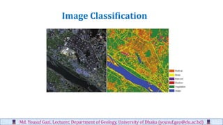
  • 1. Md. Yousuf Gazi, Lecturer, Department of Geology, University of Dhaka (yousuf.geo@du.ac.bd) Image Classification
  • 2. Image Classification ▪ The process of sorting pixels into a finite number of individual classes, or categories of data, based on their spectral response (the measured brightness of a pixel across the image bands, as reflected by the pixel’s spectral signature). Md. Yousuf Gazi, Lecturer, Department of Geology, University of Dhaka (yousuf.geo@du.ac.bd)
  • 3. Md. Yousuf Gazi, Lecturer, Department of Geology, University of Dhaka (yousuf.geo@du.ac.bd)
  • 4. Md. Yousuf Gazi, Lecturer, Department of Geology, University of Dhaka (yousuf.geo@du.ac.bd) The underlying assumption of image classification is that spectral response of a particular feature (i.e., land-cover class) will be relatively consistent throughout the image. Image Classification General Approaches to Image Classification 1. Unsupervised 2. Supervised
  • 5. Md. Yousuf Gazi, Lecturer, Department of Geology, University of Dhaka (yousuf.geo@du.ac.bd) Unsupervised Classification • Unsupervised classification (a.k.a., “clustering”) identifies groups of pixels that exhibit a similar spectral response • These spectral classes are then assigned “meaning” by the analyst (e.g., assigned to land-cover categories)
  • 6. Md. Yousuf Gazi, Lecturer, Department of Geology, University of Dhaka (yousuf.geo@du.ac.bd) Supervised Classification Supervised classification uses image pixels representing regions of known, homogenous surface composition -- training areas -- to classify unknown pixels.
  • 7. Md. Yousuf Gazi, Lecturer, Department of Geology, University of Dhaka (yousuf.geo@du.ac.bd) Unsupervised: bulk of analyst’s work comes after the classification process Supervised: bulk of analyst’s work comes before the classification process
  • 8. Md. Yousuf Gazi, Lecturer, Department of Geology, University of Dhaka (yousuf.geo@du.ac.bd) Advantages ▪ No prior knowledge of the image area is required ▪ Human error is minimized ▪ Unique spectral classes are produced ▪ Relatively fast and easy to perform Advantages and Disadvantages of Unsupervised Classification
  • 9. Md. Yousuf Gazi, Lecturer, Department of Geology, University of Dhaka (yousuf.geo@du.ac.bd) Disadvantages of Unsupervised Classification ▪ Spectral classes do not represent features on the ground ▪ Does not consider spatial relationships in the data ▪ Can be very time consuming to interpret spectral classes ▪ Spectral properties vary over time, across images
  • 10. Md. Yousuf Gazi, Lecturer, Department of Geology, University of Dhaka (yousuf.geo@du.ac.bd) Process of Unsupervised Classification 1. Determine a general classification scheme 2. Assign pixels to spectral classes (ISODATA) 3. Assign spectral classes to informational classes
  • 11. Md. Yousuf Gazi, Lecturer, Department of Geology, University of Dhaka (yousuf.geo@du.ac.bd) Process of Unsupervised Classification 1. Determine a general classification scheme • Depends upon the purpose of the classification • With unsupervised classification, the scheme does not need to be very specific
  • 12. Md. Yousuf Gazi, Lecturer, Department of Geology, University of Dhaka (yousuf.geo@du.ac.bd) Process of Unsupervised Classification 1. Determine a general classification scheme 2. Assign pixels to spectral classes (ISODATA) • Group pixels into groups of similar values based on pixel value relationships in multi- dimensional feature space (clustering) • Iterative ISODATA technique is the most common 3. Assign spectral classes to informational classes
  • 13. Md. Yousuf Gazi, Lecturer, Department of Geology, University of Dhaka (yousuf.geo@du.ac.bd) Process of Unsupervised Classification 1. Determine a general classification scheme 2. Assign pixels to spectral classes (ISODATA) 3. Assign spectral classes to informational classes ▪ Once the spectral clusters in the image are identified, the analyst must assign them to the “informational” classes of the classification scheme (i.e., land cover)
  • 14. Md. Yousuf Gazi, Lecturer, Department of Geology, University of Dhaka (yousuf.geo@du.ac.bd) Example: Image to be Classified Example: Image to be Classified ▪ Multiple clusters likely represent a single type of “feature” on the ground. ▪ Someone needs to assign a landcover class to all of these clusters; can be difficult and time consuming.
  • 15. Md. Yousuf Gazi, Lecturer, Department of Geology, University of Dhaka (yousuf.geo@du.ac.bd) Supervised Classification Supervised classification uses image pixels representing regions of known, homogenous surface composition -- training areas -- to classify unknown pixels.
  • 16. Md. Yousuf Gazi, Lecturer, Department of Geology, University of Dhaka (yousuf.geo@du.ac.bd) Supervised Classification The underlying assumption is that spectral response of a particular feature (i.e., land-cover class) will be relatively consistent throughout the image.
  • 17. Md. Yousuf Gazi, Lecturer, Department of Geology, University of Dhaka (yousuf.geo@du.ac.bd) Advantages ▪ Generates informational classes representing features on the ground ▪ Training areas are reusable (assuming they do not change; e.g. roads)
  • 18. Md. Yousuf Gazi, Lecturer, Department of Geology, University of Dhaka (yousuf.geo@du.ac.bd) Disadvantages ▪ Information classes may not match spectral classes (e.g., a supervised classification of “forest” may mask the unique spectral properties of pine and oak stands that comprise that forest) ▪ Homogeneity of information classes varies ▪ Difficulty and cost of selecting training sites ▪ Training areas may not encompass unique spectral classes
  • 19. Md. Yousuf Gazi, Lecturer, Department of Geology, University of Dhaka (yousuf.geo@du.ac.bd) Process of Supervised Classification 1. Determine a classification scheme 2. Create training areas 3. Generate training area signatures 4. Evaluate and refine signatures 5. Assign pixels to classes using a classifier (a.k.a., “decision rule”)
  • 20. 1 | Determine Classification Scheme • Depends upon the purpose of the classification • Make the scheme as specific as resources and available reference data allow You can always generalize your classification scheme to make it less specific; making it more specific involves starting over Md. Yousuf Gazi, Lecturer, Department of Geology, University of Dhaka (yousuf.geo@du.ac.bd)
  • 21. 2 | Create Training Areas ▪ Digitizing: drawing polygons around areas in the image ▪ Seeding: “grows” areas based on spectral similarity to seed pixel ▪ Using existing data: existing maps, field data (GPS, etc.), high-resolution imagery ▪ Feature space image training areas Md. Yousuf Gazi, Lecturer, Department of Geology, University of Dhaka (yousuf.geo@du.ac.bd)
  • 22. Md. Yousuf Gazi, Lecturer, Department of Geology, University of Dhaka (yousuf.geo@du.ac.bd)