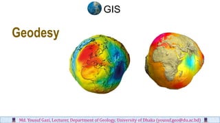
SlideShare a Scribd company logo
1 of 21
Download to read offline
Geodesy
Md. Yousuf Gazi, Lecturer, Department of Geology, University of Dhaka (yousuf.geo@du.ac.bd)
GIS
❖ Geodesy is the division of science associated
with the measurement and portrayal of the
Earth.
❖ Geodesy, known also as geodetics, is intimately
concerned with the determination of the size
and shape of the Earth, as well as its elements.
❖ These Earth-based elements include its
terrestrial gravity, magnetic field, tides,
geologic and crustal movement, and polar
motion.
❖ GIS employs these forms of terrestrial
measurement through various data sources,
such as satellite, GPS, and field measurements.
Ocean
Geoid
Earth surface
Gravity Anomaly
Basics of Geodesy
GIS
Md. Yousuf Gazi, Lecturer, Department of Geology, University of Dhaka (yousuf.geo@du.ac.bd)
❖ To adequately represent the shape of the Earth in scientific and
real-life applications, a calculable, formula-driven figure of the
Earth is needed.
❖ In its most basic sense, an Earth ellipsoid is a flattened sphere that
bulges in the middle and has two imaginary lines traversing its
core: one from north to south and one from east to west. Each
imaginary line is called an axis.
❖ The ellipsoid’s flattening causes two unequal axes: a longer axis
and a shorter axis
❖ The north-to-south axis through the Earth’s core is the shorter axis
and, as such, is called the minor axis or polar axis.
❖ The east-to-west axis through the Earth’s core is longer and is
called the major axis or equatorial axis
Mathematical Model of the Earth GIS
Md. Yousuf Gazi, Lecturer, Department of Geology, University of Dhaka (yousuf.geo@du.ac.bd)
❖ The Earth’s ellipsoid is an ellipse rotated upon its
minor axis, which is functionally called the axis of
rotation or axis of revolution. The purpose of a
mathematical model is to simplify calculations.
❖ Due to the Earth’s symmetry and to minimize
complexity, the mathematical model targets one
quadrant in the ellipse and imparts six key
parameters for calculation.
GIS
Md. Yousuf Gazi, Lecturer, Department of Geology, University of Dhaka (yousuf.geo@du.ac.bd)
❖ The six parameters are the
• Semi major axis
• Semi minor axis
• Flattening
• Inverse flattening
• Eccentricity,
• and second eccentricity.
❖ In brief, the flattening of the ellipse is directly related to
the differences in both the semi major and semi minor
axes. It is represented by the formula
Flattening f= (a-b)/a
GIS
Md. Yousuf Gazi, Lecturer, Department of Geology, University of Dhaka (yousuf.geo@du.ac.bd)
❖ Earth’s flattening is sometimes displayed as a reciprocal
called the inverse flattening.
❖ For instance, a flattening of 0.003389831 (or 1/295) can
be portrayed as an inverse flattening of 295.
❖ Eccentricity e is the first eccentricity, whereby the
descriptor first is typically implied. It measures the degree
of flattening as the relationship between the focal radius,
or radius from the center point to the foci (i.e., F1, F2),
and the semimajor axis.
GIS
Md. Yousuf Gazi, Lecturer, Department of Geology, University of Dhaka (yousuf.geo@du.ac.bd)
❖ Second eccentricity e ′ measures the degree of flattening
as a relationship between the focal radius and the
semiminor axis.
❖ Eccentricity (first and second) is constant throughout the
entire ellipse and ranges from 0 to 1, or more simply from
an ellipsoid with no flattening (circle) to one totally flat
(line). Since a circle has no flattening, its eccentricity
equals zero (e = 0). As e becomes larger and approaches
1, the ellipse becomes flatter until it is a straight line (e =
1).
GIS
Md. Yousuf Gazi, Lecturer, Department of Geology, University of Dhaka (yousuf.geo@du.ac.bd)
GIS
Md. Yousuf Gazi, Lecturer, Department of Geology, University of Dhaka (yousuf.geo@du.ac.bd)
GIS
Md. Yousuf Gazi, Lecturer, Department of Geology, University of Dhaka (yousuf.geo@du.ac.bd)
❖ Basically, every GIS and geographic information product is based upon
a reference ellipsoid, which is defined as a standard ellipsoid with
proven and measured parameters.
❖ The reference ellipsoid enables GIS to define point locations with
regional accuracy.
❖ Throughout the years, numerous reference ellipsoids have been
developed by various geodesists with measurements taken at different
source points on Earth.
❖ These reference ellipsoids are only slightly dissimilar. Because of this
differentiation in source data locations, certain reference ellipsoids
work better than others for certain applications and for certain regions.
❖ Unlike Bessel 1841 and other major area-specific ellipsoids, WGS84 is
much more universal and, as a result, is one of the most widely used
reference ellipsoids available.
Reference Ellipsoids
GIS
Md. Yousuf Gazi, Lecturer, Department of Geology, University of Dhaka (yousuf.geo@du.ac.bd)
Primary Types of Geodetic Datums
▪ Geodetic datum's empower the user
with a referenced-based geographic
coordinate system within which
accurate point positions can be
determined.
▪ In a two-dimensional space, point
positions are defined by a coordinate pair
(x, y) on a uniform plane.
▪ In the real three-dimensional world,
height (z) is as important a distinguisher as
the x and y coordinates.
Md. Yousuf Gazi, Lecturer, Department of Geology, University of Dhaka (yousuf.geo@du.ac.bd)
GIS
• Geodetic datum's, both local and geocentric,
offer the opportunity to manage these
horizontal and vertical levels for greater
positional accuracy.
• This leads us into the two primary types of
geodetic datum's:
- horizontal control datum's
- and vertical control datum's.
Md. Yousuf Gazi, Lecturer, Department of Geology, University of Dhaka (yousuf.geo@du.ac.bd)
GIS
▪ A horizontal control datum (or horizontal datum) is used to manipulate and set a position in the x and y
directions. Horizontal datum's are often defined by a reference ellipsoid and a coordinate origin.
▪ Alternately, a vertical control datum (or vertical datum) is used to manipulate and set a positional height in the z
direction.
▪ Vertical datum's provide a level from which positional heights can be determined. Both primary types of
geodetic datum's provide a favorable degree of positional control.
Md. Yousuf Gazi, Lecturer, Department of Geology, University of Dhaka (yousuf.geo@du.ac.bd)
GIS
World Geodetic System 1984
• The World Geodetic System 1984 (WGS84) is considered a
global datum that defines an Earth-fixed global reference frame
for the Earth.
• WGS84 is based upon the ellipsoidal parameters of the
Geodetic Reference System of 1980.
• WGS84 is used for GPS satellites and is defined by a gravity
model of the Earth.
• WGS is a geocentric datum that made its first appearance in
1960.
• A product of the U.S. Defense Mapping Agency (DMA) for
mapping and charting, the WGS has evolved from the
primitive satellite measurements of 1960 (WGS60) to the
sensitive Doppler satellite data and satellite data altimetry used
in the latest and highly accurate WGS84.
• With its satellite-driven precision, WGS84 has proved to be a
satisfactory reference datum for nearly every Earth location.
Md. Yousuf Gazi, Lecturer, Department of Geology, University of Dhaka (yousuf.geo@du.ac.bd)
GIS
• Given its Earth-fixed nature, WGS84 offers a
standard reference ellipsoid with base
parameters being:
Semimajor axis a =6 378 137 meters
Semiminor axis b=6 356752 .314 meters
Flattening f= 0.003352811
Inverse flattening 1/f = 298.2572236
• Due to its general accuracy worldwide,
WGS84 is a highly used, worldwide datum
(and reference ellipsoid). In fact, due to its
global appeal, many applications require local
datums to be converted to WGS84.
Md. Yousuf Gazi, Lecturer, Department of Geology, University of Dhaka (yousuf.geo@du.ac.bd)
World Geodetic System 1984
GIS
The Vertical Datum
• Today, vertical datums provide just such a
reference from which positional heights on
the Earth’s topographical surface can be
determined with reasonable accuracy.
• There are two primary reference surfaces
used by leading vertical datums: sea levels
(tidal) and standard ellipsoids (geodetic).
• References for sea level–based datums vary
from high and low tide levels to an average
sea level.
• Ellipsoid-based datums generally reference
the same ellipsoid model used for
calculating horizontal datums.
• By function, GIS utilizes these same
reference surfaces when defining general and
specific point heights.
Md. Yousuf Gazi, Lecturer, Department of Geology, University of Dhaka (yousuf.geo@du.ac.bd)
GIS
Md. Yousuf Gazi, Lecturer, Department of Geology, University of Dhaka (yousuf.geo@du.ac.bd)
The orthometric height of a point is the distance H along a plumb line from the point to a reference height.
When the reference height is a geoid model, orthometric height is for practical purposes "height above sea
level".
Orthometric Height:
GIS
Standard Vertical Datums
• The heights or depths of terrestrial points are
determined through referencing the defined
elevation surface of a vertical datum.
• Like the horizontal datum, the need for
positional accuracy has prompted the
development of standardized vertical datums.
• Once again, each major province or country
has its own national standard datum of choice
or design. They are used throughout the world
for elevation-related reference and precision
along the z axis.
• Four commonly used vertical control datums
for the Earth model, namely the Earth
Gravitational Model of 1996, the GEOID03
reference family, the National Geodetic
Vertical Datum of 1929, and the North
American Vertical Datum of 1988.
Md. Yousuf Gazi, Lecturer, Department of Geology, University of Dhaka (yousuf.geo@du.ac.bd)
GIS
Earth Gravitational Model of 1996
• The Earth Gravitational Model of 1996 (EGM96) is the accurate collaborative product of the National
Imagery and Mapping Agency (NIMA), the NASA Goddard Space Flight Center, and the Ohio State
University.
• EGM96 is a geopotential model of the Earth, which means that orthometric height (height above
MSL) is adjusted using the differential of gravity with latitude and elevation.
• Therefore, EGM96 offers heights that are influenced and adjusted by the Earth’s gravity.
• As a well-defined global vertical datum, EGM96 is used as a modern reference for numerous
applications worldwide, such as bathymetrical and geophysical studies.
Md. Yousuf Gazi, Lecturer, Department of Geology, University of Dhaka (yousuf.geo@du.ac.bd)
GIS
Md. Yousuf Gazi, Lecturer, Department of Geology, University of Dhaka (yousuf.geo@du.ac.bd)
GIS

More Related Content

What's hot

Numerical from-photogrammetry-and-relief-displacement-derivation
Numerical from-photogrammetry-and-relief-displacement-derivationNumerical from-photogrammetry-and-relief-displacement-derivation
Numerical from-photogrammetry-and-relief-displacement-derivation
Gokul Saud
 
Global Positioning System
Global Positioning System Global Positioning System
Global Positioning System
Varun B P
 
The Integration of Geospatial Technologies: GIS and GPS
The Integration of Geospatial Technologies: GIS and GPS	The Integration of Geospatial Technologies: GIS and GPS
The Integration of Geospatial Technologies: GIS and GPS
Lindsey Landolfi
 

What's hot (20)

Numerical from-photogrammetry-and-relief-displacement-derivation
Numerical from-photogrammetry-and-relief-displacement-derivationNumerical from-photogrammetry-and-relief-displacement-derivation
Numerical from-photogrammetry-and-relief-displacement-derivation
 
Lecture01: Introduction to Photogrammetry
Lecture01: Introduction to PhotogrammetryLecture01: Introduction to Photogrammetry
Lecture01: Introduction to Photogrammetry
 
inroduction to geodesy
inroduction to geodesyinroduction to geodesy
inroduction to geodesy
 
Overview of Satellite Radar Altimetry
Overview of Satellite Radar AltimetryOverview of Satellite Radar Altimetry
Overview of Satellite Radar Altimetry
 
Introduction to GNSS (1)
Introduction to GNSS (1)Introduction to GNSS (1)
Introduction to GNSS (1)
 
Projections and coordinate system
Projections and coordinate systemProjections and coordinate system
Projections and coordinate system
 
Lecture 08 tilted photograph
Lecture 08  tilted photographLecture 08  tilted photograph
Lecture 08 tilted photograph
 
Microwave remote sensing
Microwave remote sensingMicrowave remote sensing
Microwave remote sensing
 
Global Positioning System
Global Positioning System Global Positioning System
Global Positioning System
 
Geospatial reference-systems
Geospatial reference-systemsGeospatial reference-systems
Geospatial reference-systems
 
GIS Map Projection
GIS Map ProjectionGIS Map Projection
GIS Map Projection
 
The Integration of Geospatial Technologies: GIS and GPS
The Integration of Geospatial Technologies: GIS and GPS	The Integration of Geospatial Technologies: GIS and GPS
The Integration of Geospatial Technologies: GIS and GPS
 
Techniques of Land Surveying
Techniques of Land SurveyingTechniques of Land Surveying
Techniques of Land Surveying
 
Photogrammetry
PhotogrammetryPhotogrammetry
Photogrammetry
 
Historical Development of Photogrammetry
Historical Development of PhotogrammetryHistorical Development of Photogrammetry
Historical Development of Photogrammetry
 
Digital photogrammetry
Digital photogrammetryDigital photogrammetry
Digital photogrammetry
 
Map Projections ―concepts, classes and usage
Map Projections ―concepts, classes and usage Map Projections ―concepts, classes and usage
Map Projections ―concepts, classes and usage
 
Errors and biasis
Errors and biasisErrors and biasis
Errors and biasis
 
GNSS application in Nepal
GNSS application in NepalGNSS application in Nepal
GNSS application in Nepal
 
Datum
DatumDatum
Datum
 

Similar to Geodesy md. yousuf gazi

Sudan Geodetic and Geospatial Reference System
Sudan Geodetic and Geospatial Reference SystemSudan Geodetic and Geospatial Reference System
Sudan Geodetic and Geospatial Reference System
ijtsrd
 
Understandingprojectionsforarcgis 12794889760059-phpapp01
Understandingprojectionsforarcgis 12794889760059-phpapp01Understandingprojectionsforarcgis 12794889760059-phpapp01
Understandingprojectionsforarcgis 12794889760059-phpapp01
Manisha Tomar
 

Similar to Geodesy md. yousuf gazi (20)

Basics of geodesy
Basics of geodesyBasics of geodesy
Basics of geodesy
 
Map projection md. yousuf gazi
Map projection md. yousuf gaziMap projection md. yousuf gazi
Map projection md. yousuf gazi
 
Introductory GIS
Introductory GISIntroductory GIS
Introductory GIS
 
geodesy-1 (1).pptx
geodesy-1 (1).pptxgeodesy-1 (1).pptx
geodesy-1 (1).pptx
 
Differentiation between Global and Local Datum from Different aspect
Differentiation between Global and Local Datum from Different aspect Differentiation between Global and Local Datum from Different aspect
Differentiation between Global and Local Datum from Different aspect
 
Lec_4_Key Propertires of Spatial Data
Lec_4_Key Propertires of Spatial DataLec_4_Key Propertires of Spatial Data
Lec_4_Key Propertires of Spatial Data
 
G0343052058
G0343052058G0343052058
G0343052058
 
Image information extraction techniques gazi
Image information extraction techniques gaziImage information extraction techniques gazi
Image information extraction techniques gazi
 
coordinate systems map projections and graphical and atoms ppt group (B).pptx
coordinate systems map projections and graphical and atoms ppt group (B).pptxcoordinate systems map projections and graphical and atoms ppt group (B).pptx
coordinate systems map projections and graphical and atoms ppt group (B).pptx
 
Chapter2 is344(gis db map-projections,structures, and scale))(amended)
Chapter2 is344(gis db map-projections,structures, and scale))(amended)Chapter2 is344(gis db map-projections,structures, and scale))(amended)
Chapter2 is344(gis db map-projections,structures, and scale))(amended)
 
Sudan Geodetic and Geospatial Reference System
Sudan Geodetic and Geospatial Reference SystemSudan Geodetic and Geospatial Reference System
Sudan Geodetic and Geospatial Reference System
 
Geodetic systems (earth, ellipsoid)
Geodetic systems (earth, ellipsoid)Geodetic systems (earth, ellipsoid)
Geodetic systems (earth, ellipsoid)
 
Understandingprojectionsforarcgis 12794889760059-phpapp01
Understandingprojectionsforarcgis 12794889760059-phpapp01Understandingprojectionsforarcgis 12794889760059-phpapp01
Understandingprojectionsforarcgis 12794889760059-phpapp01
 
Gis data source (geo spatial data) md. yousuf gazi
Gis data source (geo spatial data) md. yousuf gaziGis data source (geo spatial data) md. yousuf gazi
Gis data source (geo spatial data) md. yousuf gazi
 
Coordinate system used in Satellite Navigation.pptx
Coordinate system used in Satellite Navigation.pptxCoordinate system used in Satellite Navigation.pptx
Coordinate system used in Satellite Navigation.pptx
 
2017 PLSC Track: Fundamentals of Coordinate Systems
2017 PLSC Track: Fundamentals of Coordinate Systems2017 PLSC Track: Fundamentals of Coordinate Systems
2017 PLSC Track: Fundamentals of Coordinate Systems
 
TYBSC IT PGIS Unit III Chapter I Spatial Referencing and Positioning
TYBSC IT PGIS Unit III Chapter I Spatial Referencing and PositioningTYBSC IT PGIS Unit III Chapter I Spatial Referencing and Positioning
TYBSC IT PGIS Unit III Chapter I Spatial Referencing and Positioning
 
CARTOGRAPHY – yesterday, today and tomorrow
CARTOGRAPHY – yesterday, today and tomorrowCARTOGRAPHY – yesterday, today and tomorrow
CARTOGRAPHY – yesterday, today and tomorrow
 
Basic Geodesy.pdf
Basic Geodesy.pdfBasic Geodesy.pdf
Basic Geodesy.pdf
 
datum
datumdatum
datum
 

More from Md. Yousuf Gazi

More from Md. Yousuf Gazi (20)

Coastal biodiversity md. yousuf gazi
Coastal biodiversity md. yousuf gaziCoastal biodiversity md. yousuf gazi
Coastal biodiversity md. yousuf gazi
 
Coastal engineering md. yousuf gazi
Coastal engineering md. yousuf gaziCoastal engineering md. yousuf gazi
Coastal engineering md. yousuf gazi
 
Coastal economic resource md. yousuf gazi
Coastal economic resource md. yousuf gaziCoastal economic resource md. yousuf gazi
Coastal economic resource md. yousuf gazi
 
Coastal vulnerability md. yousuf gazi
Coastal vulnerability md. yousuf gaziCoastal vulnerability md. yousuf gazi
Coastal vulnerability md. yousuf gazi
 
Coastal physical processes md. yousuf gazi
Coastal physical processes md. yousuf gaziCoastal physical processes md. yousuf gazi
Coastal physical processes md. yousuf gazi
 
Coastal env. impact assessment md. yousuf gazi
Coastal env. impact assessment md. yousuf gaziCoastal env. impact assessment md. yousuf gazi
Coastal env. impact assessment md. yousuf gazi
 
Coastal hazards md. yousuf gazi
Coastal hazards md. yousuf gaziCoastal hazards md. yousuf gazi
Coastal hazards md. yousuf gazi
 
Integrated coastal zone management md. yousuf gazi
Integrated coastal zone management md. yousuf gaziIntegrated coastal zone management md. yousuf gazi
Integrated coastal zone management md. yousuf gazi
 
Thermal infrared remote sensing md. yousuf gazi
Thermal infrared remote sensing md. yousuf gaziThermal infrared remote sensing md. yousuf gazi
Thermal infrared remote sensing md. yousuf gazi
 
Lidar remote sensing md. yousuf gazi
Lidar remote sensing md. yousuf gaziLidar remote sensing md. yousuf gazi
Lidar remote sensing md. yousuf gazi
 
Introduction to remote sensing md. yousuf gazi
Introduction to remote sensing md. yousuf gaziIntroduction to remote sensing md. yousuf gazi
Introduction to remote sensing md. yousuf gazi
 
Image classification md. yousuf gazi
Image classification md. yousuf gaziImage classification md. yousuf gazi
Image classification md. yousuf gazi
 
Application of gis Md. Yousuf Gazi
Application of gis Md. Yousuf GaziApplication of gis Md. Yousuf Gazi
Application of gis Md. Yousuf Gazi
 
Seismology & earthquake md. yousuf gazi
Seismology & earthquake md. yousuf gaziSeismology & earthquake md. yousuf gazi
Seismology & earthquake md. yousuf gazi
 
Plate tectonics md. yousuf gazi
Plate tectonics md. yousuf gaziPlate tectonics md. yousuf gazi
Plate tectonics md. yousuf gazi
 
Mountain building & volcanism md. yousuf gazi
Mountain building & volcanism md. yousuf gaziMountain building & volcanism md. yousuf gazi
Mountain building & volcanism md. yousuf gazi
 
Introduction to geology md. yousuf gazi
Introduction to geology md. yousuf gaziIntroduction to geology md. yousuf gazi
Introduction to geology md. yousuf gazi
 
Geological time scale md. yousuf gazi
Geological time scale md. yousuf gaziGeological time scale md. yousuf gazi
Geological time scale md. yousuf gazi
 
Earth surface processes md. yousuf gazi
Earth surface processes md. yousuf gaziEarth surface processes md. yousuf gazi
Earth surface processes md. yousuf gazi
 
Earth internal structure md. yousuf gazi
Earth internal structure md. yousuf gaziEarth internal structure md. yousuf gazi
Earth internal structure md. yousuf gazi
 

Recently uploaded

The basics of sentences session 3pptx.pptx
The basics of sentences session 3pptx.pptxThe basics of sentences session 3pptx.pptx
The basics of sentences session 3pptx.pptx
heathfieldcps1
 

Recently uploaded (20)

Basic Civil Engineering first year Notes- Chapter 4 Building.pptx
Basic Civil Engineering first year Notes- Chapter 4 Building.pptxBasic Civil Engineering first year Notes- Chapter 4 Building.pptx
Basic Civil Engineering first year Notes- Chapter 4 Building.pptx
 
Understanding Accommodations and Modifications
Understanding  Accommodations and ModificationsUnderstanding  Accommodations and Modifications
Understanding Accommodations and Modifications
 
Kodo Millet PPT made by Ghanshyam bairwa college of Agriculture kumher bhara...
Kodo Millet  PPT made by Ghanshyam bairwa college of Agriculture kumher bhara...Kodo Millet  PPT made by Ghanshyam bairwa college of Agriculture kumher bhara...
Kodo Millet PPT made by Ghanshyam bairwa college of Agriculture kumher bhara...
 
FSB Advising Checklist - Orientation 2024
FSB Advising Checklist - Orientation 2024FSB Advising Checklist - Orientation 2024
FSB Advising Checklist - Orientation 2024
 
Jamworks pilot and AI at Jisc (20/03/2024)
Jamworks pilot and AI at Jisc (20/03/2024)Jamworks pilot and AI at Jisc (20/03/2024)
Jamworks pilot and AI at Jisc (20/03/2024)
 
Wellbeing inclusion and digital dystopias.pptx
Wellbeing inclusion and digital dystopias.pptxWellbeing inclusion and digital dystopias.pptx
Wellbeing inclusion and digital dystopias.pptx
 
Towards a code of practice for AI in AT.pptx
Towards a code of practice for AI in AT.pptxTowards a code of practice for AI in AT.pptx
Towards a code of practice for AI in AT.pptx
 
SKILL OF INTRODUCING THE LESSON MICRO SKILLS.pptx
SKILL OF INTRODUCING THE LESSON MICRO SKILLS.pptxSKILL OF INTRODUCING THE LESSON MICRO SKILLS.pptx
SKILL OF INTRODUCING THE LESSON MICRO SKILLS.pptx
 
Sensory_Experience_and_Emotional_Resonance_in_Gabriel_Okaras_The_Piano_and_Th...
Sensory_Experience_and_Emotional_Resonance_in_Gabriel_Okaras_The_Piano_and_Th...Sensory_Experience_and_Emotional_Resonance_in_Gabriel_Okaras_The_Piano_and_Th...
Sensory_Experience_and_Emotional_Resonance_in_Gabriel_Okaras_The_Piano_and_Th...
 
REMIFENTANIL: An Ultra short acting opioid.pptx
REMIFENTANIL: An Ultra short acting opioid.pptxREMIFENTANIL: An Ultra short acting opioid.pptx
REMIFENTANIL: An Ultra short acting opioid.pptx
 
Introduction to Nonprofit Accounting: The Basics
Introduction to Nonprofit Accounting: The BasicsIntroduction to Nonprofit Accounting: The Basics
Introduction to Nonprofit Accounting: The Basics
 
UGC NET Paper 1 Mathematical Reasoning & Aptitude.pdf
UGC NET Paper 1 Mathematical Reasoning & Aptitude.pdfUGC NET Paper 1 Mathematical Reasoning & Aptitude.pdf
UGC NET Paper 1 Mathematical Reasoning & Aptitude.pdf
 
ICT Role in 21st Century Education & its Challenges.pptx
ICT Role in 21st Century Education & its Challenges.pptxICT Role in 21st Century Education & its Challenges.pptx
ICT Role in 21st Century Education & its Challenges.pptx
 
Accessible Digital Futures project (20/03/2024)
Accessible Digital Futures project (20/03/2024)Accessible Digital Futures project (20/03/2024)
Accessible Digital Futures project (20/03/2024)
 
How to Give a Domain for a Field in Odoo 17
How to Give a Domain for a Field in Odoo 17How to Give a Domain for a Field in Odoo 17
How to Give a Domain for a Field in Odoo 17
 
This PowerPoint helps students to consider the concept of infinity.
This PowerPoint helps students to consider the concept of infinity.This PowerPoint helps students to consider the concept of infinity.
This PowerPoint helps students to consider the concept of infinity.
 
TỔNG ÔN TẬP THI VÀO LỚP 10 MÔN TIẾNG ANH NĂM HỌC 2023 - 2024 CÓ ĐÁP ÁN (NGỮ Â...
TỔNG ÔN TẬP THI VÀO LỚP 10 MÔN TIẾNG ANH NĂM HỌC 2023 - 2024 CÓ ĐÁP ÁN (NGỮ Â...TỔNG ÔN TẬP THI VÀO LỚP 10 MÔN TIẾNG ANH NĂM HỌC 2023 - 2024 CÓ ĐÁP ÁN (NGỮ Â...
TỔNG ÔN TẬP THI VÀO LỚP 10 MÔN TIẾNG ANH NĂM HỌC 2023 - 2024 CÓ ĐÁP ÁN (NGỮ Â...
 
80 ĐỀ THI THỬ TUYỂN SINH TIẾNG ANH VÀO 10 SỞ GD – ĐT THÀNH PHỐ HỒ CHÍ MINH NĂ...
80 ĐỀ THI THỬ TUYỂN SINH TIẾNG ANH VÀO 10 SỞ GD – ĐT THÀNH PHỐ HỒ CHÍ MINH NĂ...80 ĐỀ THI THỬ TUYỂN SINH TIẾNG ANH VÀO 10 SỞ GD – ĐT THÀNH PHỐ HỒ CHÍ MINH NĂ...
80 ĐỀ THI THỬ TUYỂN SINH TIẾNG ANH VÀO 10 SỞ GD – ĐT THÀNH PHỐ HỒ CHÍ MINH NĂ...
 
Google Gemini An AI Revolution in Education.pptx
Google Gemini An AI Revolution in Education.pptxGoogle Gemini An AI Revolution in Education.pptx
Google Gemini An AI Revolution in Education.pptx
 
The basics of sentences session 3pptx.pptx
The basics of sentences session 3pptx.pptxThe basics of sentences session 3pptx.pptx
The basics of sentences session 3pptx.pptx
 

Geodesy md. yousuf gazi

  • 1. Geodesy Md. Yousuf Gazi, Lecturer, Department of Geology, University of Dhaka (yousuf.geo@du.ac.bd) GIS
  • 2. ❖ Geodesy is the division of science associated with the measurement and portrayal of the Earth. ❖ Geodesy, known also as geodetics, is intimately concerned with the determination of the size and shape of the Earth, as well as its elements. ❖ These Earth-based elements include its terrestrial gravity, magnetic field, tides, geologic and crustal movement, and polar motion. ❖ GIS employs these forms of terrestrial measurement through various data sources, such as satellite, GPS, and field measurements. Ocean Geoid Earth surface Gravity Anomaly Basics of Geodesy GIS Md. Yousuf Gazi, Lecturer, Department of Geology, University of Dhaka (yousuf.geo@du.ac.bd)
  • 3. Md. Yousuf Gazi, Lecturer, Department of Geology, University of Dhaka (yousuf.geo@du.ac.bd)
  • 4. ❖ To adequately represent the shape of the Earth in scientific and real-life applications, a calculable, formula-driven figure of the Earth is needed. ❖ In its most basic sense, an Earth ellipsoid is a flattened sphere that bulges in the middle and has two imaginary lines traversing its core: one from north to south and one from east to west. Each imaginary line is called an axis. ❖ The ellipsoid’s flattening causes two unequal axes: a longer axis and a shorter axis ❖ The north-to-south axis through the Earth’s core is the shorter axis and, as such, is called the minor axis or polar axis. ❖ The east-to-west axis through the Earth’s core is longer and is called the major axis or equatorial axis Mathematical Model of the Earth GIS Md. Yousuf Gazi, Lecturer, Department of Geology, University of Dhaka (yousuf.geo@du.ac.bd)
  • 5. ❖ The Earth’s ellipsoid is an ellipse rotated upon its minor axis, which is functionally called the axis of rotation or axis of revolution. The purpose of a mathematical model is to simplify calculations. ❖ Due to the Earth’s symmetry and to minimize complexity, the mathematical model targets one quadrant in the ellipse and imparts six key parameters for calculation. GIS Md. Yousuf Gazi, Lecturer, Department of Geology, University of Dhaka (yousuf.geo@du.ac.bd)
  • 6. ❖ The six parameters are the • Semi major axis • Semi minor axis • Flattening • Inverse flattening • Eccentricity, • and second eccentricity. ❖ In brief, the flattening of the ellipse is directly related to the differences in both the semi major and semi minor axes. It is represented by the formula Flattening f= (a-b)/a GIS Md. Yousuf Gazi, Lecturer, Department of Geology, University of Dhaka (yousuf.geo@du.ac.bd)
  • 7. ❖ Earth’s flattening is sometimes displayed as a reciprocal called the inverse flattening. ❖ For instance, a flattening of 0.003389831 (or 1/295) can be portrayed as an inverse flattening of 295. ❖ Eccentricity e is the first eccentricity, whereby the descriptor first is typically implied. It measures the degree of flattening as the relationship between the focal radius, or radius from the center point to the foci (i.e., F1, F2), and the semimajor axis. GIS Md. Yousuf Gazi, Lecturer, Department of Geology, University of Dhaka (yousuf.geo@du.ac.bd)
  • 8. ❖ Second eccentricity e ′ measures the degree of flattening as a relationship between the focal radius and the semiminor axis. ❖ Eccentricity (first and second) is constant throughout the entire ellipse and ranges from 0 to 1, or more simply from an ellipsoid with no flattening (circle) to one totally flat (line). Since a circle has no flattening, its eccentricity equals zero (e = 0). As e becomes larger and approaches 1, the ellipse becomes flatter until it is a straight line (e = 1). GIS Md. Yousuf Gazi, Lecturer, Department of Geology, University of Dhaka (yousuf.geo@du.ac.bd)
  • 9. GIS Md. Yousuf Gazi, Lecturer, Department of Geology, University of Dhaka (yousuf.geo@du.ac.bd)
  • 10. GIS Md. Yousuf Gazi, Lecturer, Department of Geology, University of Dhaka (yousuf.geo@du.ac.bd)
  • 11. ❖ Basically, every GIS and geographic information product is based upon a reference ellipsoid, which is defined as a standard ellipsoid with proven and measured parameters. ❖ The reference ellipsoid enables GIS to define point locations with regional accuracy. ❖ Throughout the years, numerous reference ellipsoids have been developed by various geodesists with measurements taken at different source points on Earth. ❖ These reference ellipsoids are only slightly dissimilar. Because of this differentiation in source data locations, certain reference ellipsoids work better than others for certain applications and for certain regions. ❖ Unlike Bessel 1841 and other major area-specific ellipsoids, WGS84 is much more universal and, as a result, is one of the most widely used reference ellipsoids available. Reference Ellipsoids GIS Md. Yousuf Gazi, Lecturer, Department of Geology, University of Dhaka (yousuf.geo@du.ac.bd)
  • 12. Primary Types of Geodetic Datums ▪ Geodetic datum's empower the user with a referenced-based geographic coordinate system within which accurate point positions can be determined. ▪ In a two-dimensional space, point positions are defined by a coordinate pair (x, y) on a uniform plane. ▪ In the real three-dimensional world, height (z) is as important a distinguisher as the x and y coordinates. Md. Yousuf Gazi, Lecturer, Department of Geology, University of Dhaka (yousuf.geo@du.ac.bd) GIS
  • 13. • Geodetic datum's, both local and geocentric, offer the opportunity to manage these horizontal and vertical levels for greater positional accuracy. • This leads us into the two primary types of geodetic datum's: - horizontal control datum's - and vertical control datum's. Md. Yousuf Gazi, Lecturer, Department of Geology, University of Dhaka (yousuf.geo@du.ac.bd) GIS
  • 14. ▪ A horizontal control datum (or horizontal datum) is used to manipulate and set a position in the x and y directions. Horizontal datum's are often defined by a reference ellipsoid and a coordinate origin. ▪ Alternately, a vertical control datum (or vertical datum) is used to manipulate and set a positional height in the z direction. ▪ Vertical datum's provide a level from which positional heights can be determined. Both primary types of geodetic datum's provide a favorable degree of positional control. Md. Yousuf Gazi, Lecturer, Department of Geology, University of Dhaka (yousuf.geo@du.ac.bd) GIS
  • 15. World Geodetic System 1984 • The World Geodetic System 1984 (WGS84) is considered a global datum that defines an Earth-fixed global reference frame for the Earth. • WGS84 is based upon the ellipsoidal parameters of the Geodetic Reference System of 1980. • WGS84 is used for GPS satellites and is defined by a gravity model of the Earth. • WGS is a geocentric datum that made its first appearance in 1960. • A product of the U.S. Defense Mapping Agency (DMA) for mapping and charting, the WGS has evolved from the primitive satellite measurements of 1960 (WGS60) to the sensitive Doppler satellite data and satellite data altimetry used in the latest and highly accurate WGS84. • With its satellite-driven precision, WGS84 has proved to be a satisfactory reference datum for nearly every Earth location. Md. Yousuf Gazi, Lecturer, Department of Geology, University of Dhaka (yousuf.geo@du.ac.bd) GIS
  • 16. • Given its Earth-fixed nature, WGS84 offers a standard reference ellipsoid with base parameters being: Semimajor axis a =6 378 137 meters Semiminor axis b=6 356752 .314 meters Flattening f= 0.003352811 Inverse flattening 1/f = 298.2572236 • Due to its general accuracy worldwide, WGS84 is a highly used, worldwide datum (and reference ellipsoid). In fact, due to its global appeal, many applications require local datums to be converted to WGS84. Md. Yousuf Gazi, Lecturer, Department of Geology, University of Dhaka (yousuf.geo@du.ac.bd) World Geodetic System 1984 GIS
  • 17. The Vertical Datum • Today, vertical datums provide just such a reference from which positional heights on the Earth’s topographical surface can be determined with reasonable accuracy. • There are two primary reference surfaces used by leading vertical datums: sea levels (tidal) and standard ellipsoids (geodetic). • References for sea level–based datums vary from high and low tide levels to an average sea level. • Ellipsoid-based datums generally reference the same ellipsoid model used for calculating horizontal datums. • By function, GIS utilizes these same reference surfaces when defining general and specific point heights. Md. Yousuf Gazi, Lecturer, Department of Geology, University of Dhaka (yousuf.geo@du.ac.bd) GIS
  • 18. Md. Yousuf Gazi, Lecturer, Department of Geology, University of Dhaka (yousuf.geo@du.ac.bd) The orthometric height of a point is the distance H along a plumb line from the point to a reference height. When the reference height is a geoid model, orthometric height is for practical purposes "height above sea level". Orthometric Height: GIS
  • 19. Standard Vertical Datums • The heights or depths of terrestrial points are determined through referencing the defined elevation surface of a vertical datum. • Like the horizontal datum, the need for positional accuracy has prompted the development of standardized vertical datums. • Once again, each major province or country has its own national standard datum of choice or design. They are used throughout the world for elevation-related reference and precision along the z axis. • Four commonly used vertical control datums for the Earth model, namely the Earth Gravitational Model of 1996, the GEOID03 reference family, the National Geodetic Vertical Datum of 1929, and the North American Vertical Datum of 1988. Md. Yousuf Gazi, Lecturer, Department of Geology, University of Dhaka (yousuf.geo@du.ac.bd) GIS
  • 20. Earth Gravitational Model of 1996 • The Earth Gravitational Model of 1996 (EGM96) is the accurate collaborative product of the National Imagery and Mapping Agency (NIMA), the NASA Goddard Space Flight Center, and the Ohio State University. • EGM96 is a geopotential model of the Earth, which means that orthometric height (height above MSL) is adjusted using the differential of gravity with latitude and elevation. • Therefore, EGM96 offers heights that are influenced and adjusted by the Earth’s gravity. • As a well-defined global vertical datum, EGM96 is used as a modern reference for numerous applications worldwide, such as bathymetrical and geophysical studies. Md. Yousuf Gazi, Lecturer, Department of Geology, University of Dhaka (yousuf.geo@du.ac.bd) GIS
  • 21. Md. Yousuf Gazi, Lecturer, Department of Geology, University of Dhaka (yousuf.geo@du.ac.bd) GIS