UNEP Eco DRR project
•
3 likes•798 views

5th International Disaster and Risk Conference IDRC 2014 Integrative Risk Management - The role of science, technology & practice 24-28 August 2014 in Davos, Switzerland

Recommended
Recommended
More Related Content
What's hot
What's hot (19)
Similar to UNEP Eco DRR project
Similar to UNEP Eco DRR project (20)
More from Global Risk Forum GRFDavos
More from Global Risk Forum GRFDavos (20)
UNEP Eco DRR project
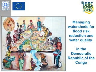
- 1. Managing watersheds for flood risk reduction and water quality in the Democratic Republic of the Congo
- 2. Outline • Project overview • Reflection on key entry points and challenges to Eco- DRR and CCA integration
- 4. Lukaya river basin • Area: 350 Km², high rainfall savanna with gallery forests • ± 20,000 inhabitants • peri-urban watershed • Sub-catchment of the N’Djili River basin that flows into the Congo River • Supplies drinking water to capital city of Kinshasa
- 5. Drivers of risk • Poverty • Unplanned & anarchic urbanization • Deforestation • Lack of drainage systems • Poor waste management and sanitation
- 6. Main hazards in focus • Floods • Soil / gully erosion – Poor water quality • Strong winds
- 7. Hazard impacts • Drinking water • Fishing yields • Farming production • Damage to houses and people’s economic goods • Damage to infrastructure – bridges, roads • Health risks REGIDESO water treatment plant
- 8. Integrated Water Resource Management (IWRM) as an Eco-DRR approach • Integrated river basin management plan for sustainable land and water use • Connect upstream, mid-stream and downstream communities • Improve water quality and reduce disaster risk (floods/ soil erosion) • Building local and national capacities on IWRM • Mainstreaming into national policies Lukaya River Users Association
- 9. Field interventions 3 main field demonstration sites REGIDESO NTAMPA KIMWENZA KASANGULU
- 10. Ntampa – upstream field interventions • Reforestation and protection •Agroforestry •Erosion control with vetiver grass and bamboo •Alternative incomes – bee keeping, fruit trees
- 11. Kasangulu and Kimwenza – downstream field interventions • Vetiver planted on river banks around water treatment plant • Reforestation • Early warning systems – river water quality monitoring, rainfall and flood monitoring
- 12. 3D map of the Lukaya basin - to develop the river basin management plan • Livelihoods/economic activities that affect land and water use in Lukaya • Location of human settlements and social / economic assets • Hazards and hazard prone areas • Understand links between upstream and downstream communities
- 13. Climate change considerations • Changes in rainfall variability patterns – more unpredictable, heavy rainfall events alternating with dry seasons • Affect soil structure, fertility and quality • Greater vulnerability of rainfed small-scale agriculture • National Adaptation Plan of Action identified two priority interventions: (i) energy (electrification) and (ii) enhancing agricultural production capacity
- 14. Entry points and challenges to Eco- DRR/CCA integration 1. Entry points – Address climate / water related hazards – Baseline assessments carried out • Considered DRR, CC, and environmental national policies & strategies • Community baseline assessments - trends / changes in hazards, hazard impacts, natural resource use, livelihood activities, disaster preparedness – Partners • National Working Group on Eco-DRR • Lukaya River Users Association and local leaders 2. Challenges – Lack of data to assess disaster risks and climate change impacts – factoring in uncertainty in project design – Government agencies have difficulty working together – First experience applying IWRM in DRC - creating multiple incentives
Editor's Notes
- Located in the provinces of Kinshasa and Bas-Congo, the Lukaya watershed is a small basin of approximately 355 square kilometres on the southern edge of Kinshasa. The Lukaya basin is a sub-catchment of the N’Djili River basin, which flows at Pool Malebo into the Congo River. From its source in Ntampa in Bas-Congo Province, the Lukaya River traverses a distance of nearly 55 kilometres to its confluence with the N’Djili River. A water treatment plant located in Kimuenza in the lower watershed area of the basin is one of the four sources of drinking water to Kinshasa
- Located in the provinces of Kinshasa and Bas-Congo, the Lukaya watershed is a small basin of approximately 355 square kilometres on the southern edge of Kinshasa. The Lukaya basin is a sub-catchment of the N’Djili River basin, which flows at Pool Malebo into the Congo River. From its source in Ntampa in Bas-Congo Province, the Lukaya River traverses a distance of nearly 55 kilometres to its confluence with the N’Djili River. A water treatment plant located in Kimuenza in the lower watershed area of the basin is one of the four sources of drinking water to Kinshasa The lower catchment of the Lukaya river basin is situated in the Province of Kinshasa, while the upper catchment is situated in the Bas Congo Province.
- Hilly terrain , steep slopes Characterized by sandy soils that are prone to erosion Heavy rains - average annual rainfall is 1.5 m – with peaks of 2 to 3 m in March and November charcoal making, slash and burn agriculture, quarrying, human settlements Bricks in terra-cotta, sand extraction from the river, artisanal mining
- Other hazards linked to poor land and water use management : epidemics Steep slopes wth sparse vegetation Sandy soils - further contribute to soil erosion
- Secondary impact of flooding - Health impact with increase of diarrhea and risk of cholera- Loss of truck farmings situated on the river banks- Reduction of soil fertility because of the sand carried by the floods on the river banks- No acces to the touristic area so it's a loss for the owners of these sites located along the river
- Other benefits - improve livelihoods of households
- 7000 Acacias auriculiformis, 800 Maesopsis sp., 300 Terminalia superba, 2000 Milletia laurentii - Acacia auriculiformis (fast growing tree) Milletia laurentii (local specie, valuable tree) Terminalia superba (local specie, valuable tree) Mesopsis (local specie, fast growing tree)
- Reforestation to stabilize river banks, reduce sedimentation, and provide additional incomes
- majority of population relies on small scale agriculture for subsistence
- Understanding current and future change - in climate, development, multiple hazards - taken into account in more integrated Eco-DRR/CCA practice Partnerships – National working group - focal points from the Ministry of Environment, Disaster Management and Civil Defense agencies, and Climate Change division (within MoE) partnerships will help avoid duplications, foster greater coherence and effectiveness due to combined expertise and resources ,