
Recommended
More Related Content
What's hot
What's hot (20)
Similar to Hydrology of urban areas and agricultural lands.pptx
Similar to Hydrology of urban areas and agricultural lands.pptx (20)
Recently uploaded
Recently uploaded (20)
Hydrology of urban areas and agricultural lands.pptx
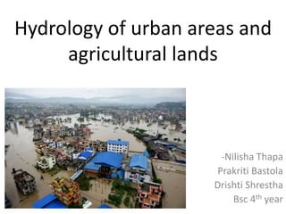
- 1. Hydrology of urban areas and agricultural lands -Nilisha Thapa Prakriti Bastola Drishti Shrestha Bsc 4th year
- 4. Hydrology • Movement, distribution and management of water on Earth and other planets, including the water cycle, water resources and environmental watershed sustainability.
- 5. Urban Hydrology • Urban hydrology is an applied science that will have an increasing role to play in the sustainability of human societies. • Part of land hydrology investigating the hydrological cycle, water regime and quality in urbanized territory. • Also, link in a number of sciences dealing with the problems of ecology, environmental protection, conservation and rational use of the Earth’s water resources
- 7. Urbanized Landscape • Presents a territory transformed by human activities, occupied by a city with suburbs, industrial, economic facilities and communication lines • Formation and evolution result from a natural historical process of development of the human society with its larger portion concentrating in cities.
- 8. • Urban population growth = poverty ( of clean drinking water) ?? • Growth of urban areas brings significant changes in physical properties of land surface increasing integrated vulnerability of inhabitants, agricultural land and rural ecological life supporting systems.
- 9. Growth of Urban Population and Urbanized Territories In 1880,only 3% of the Earth’s population lived in cities with 5 thousand inhabitant 30%population lived in cities in 1950
- 10. •
- 11. Current and emerging challenges recycling of wastewater nutrients, water for sanitation versus sanitation without water, delivery of drinking water supply for growing cities, water to feed depleted aquifers, urban agriculture wastewater irrigation,
- 12. The main changes of the physical pathways of the water cycles due to urbanization include: • Removal of natural vegetation drainage patterns; • Loss of natural depressions which temporarily store surface water; • Loss of rainfall absorbing capacity of soil; • Creation of impervious areas (e.g., rooftops, roads, parking lots, sidewalks, driveways) • Provision of man-made drainage systems (e.g., storm sewers, channels, detention ponds).
- 13. Hydrological cycle of urbanized landscapes • Use of large water volumes(basins and other non renewable ground water) to cover the domestic, industrial and economic needs of the population.
- 15. Source: Nepal Water Supply Corporation (NWSC)
- 16. Contd. • Water withdrawal is comprised of the water losses due to evaporation at leaks from the water pipeline or sewer networks, watering of green plantations, streets, recreation zones, farmlands, etc. The greatest portion of the water intake in the urban water supply with the efficient sewer system is returned after the use (after treatment or without it) to the hydrographic network as sewage water
- 17. Transmission of surface and water bodies • There are drastic transformations in the soil-ground layer. • City planning, Roofs of buildings, asphalted streets and roads create large areas of water impermeable or little impermeable surfaces occupying half and more of urban territories • With the formation and development of urbanized landscapes, hydrographic network is transformed. • this transformation results in a large-scale transition from a water-penetrable (pervious) surface to water-impenetrable (impervous) cover. • In the process of urban construction, drastic relief changes occur, namely, the depressions and runoff bands are covered up.
- 19. Reclamation of the build-on territory, channeling, filling up or creation of new water bodies and water courses and bog reclamation is undertaken resulting in the disturbance of the natural relation between surface and underground waters.
- 20. • Therefore, although the hydrological cycle consists of the same elements, their proportions in urban area are significantly different: • Interception of rainfall is reduced due to removal of trees; • Precipitation is usually higher than in rural areas; • evapotranspiration is much lower; • Surface run-off is much larger; • ground-water run-off, infiltration and recharge is small; • Water storage is much lower; • runoff volumes and peak flows in rivers are higher; • Frequency of surface runoff is increased.
- 21. Ways for Sustainable hydrology in urban areas • Urban development significantly increases the amount of storm water and the frequency of extreme hydrological events experienced by the City's catchments. The increased runoff causes more intense local flooding, while droughts during dry weather are deeper and longer. • Runoff amount from the average annual rainfall. Rural areas Urban areas 10-20% 60-70%
- 22. • Development of green areas in cities mitigate the negative impact on the hydrological cycle improve the quality of the environment and quality of life in cities • Increased water retentiveness of catchments improves flood protection, quality of water, environment and aquatic ecosystems. • Open water spaces and green areas improves microclimate providing better environment for people, increasing population health, providing recreational spaces.
- 23. Contd.. • Construction of permeable pavement for improved water infiltration • Stream restoration, stream bank erosion control • Retrofitting previous development, • Dredging and rehabilitation of lakes • Construction and routine maintenance of city sewer system and stormwater infrastructure
- 26. Hydrology of Agricultural lands
- 27. • Agricultural hydrology is the study of water balance components intervening in agricultural water management, especially in irrigation and drainage. •
- 28. • Agro hydrology can be regarded as the study of hydrological processes and the collection of hydrological data, aimed at increasing the efficiency of crop production, largely by providing beneficial soil moisture conditions. • Rainfall amount and its spatial and temporal distributions determine quantity of water that reaches Land’s surface. • Vegetation, soil conditions and topography determine how much water infiltrates into the soil and how much run offs the land’s surface and where it goes. • Land uses that impact water resources include agriculture, forestry, urbanization, recreation, and industrialization.
- 29. • Agriculture, the clearing of forests, and draining of wetlands have caused significant modifications to the surface of the earth. • Tillage of the land and clear cutting of forests change infiltration and runoff characteristics which affect groundwater recharge, sediment and water yield, and evapotranspiration. • Irrigation of land changes the use and distribution of water. The removal of surface water and groundwater for irrigation changes the water’s natural disrtibution and impacts the ecosystem that depend upon it.
- 30. • Demand for water to irrigate crops usually occurs when there is insufficient precipitation during the growing season, potentially causing streams and groundwater levels to be reduced. • Irrigation water that return to the either groundwater or surface water can contain salts, pesticides or have elevated levels of nutrients such as nitrates and phosphorous. • These contaminants in turn can cause harm to plant and animal life that depend on returned water.
- 31. Source; Wikipedia Fig; Hydrology of agricultural land
Editor's Notes
- 'Relief' is the term used for the differences in height from place to place on the land's surface
- Dredging is the removal of sediments and debris from the bottom of lakes, rivers, harbors, and other water bodies.