
Recommended
More Related Content
What's hot
What's hot (20)
Viewers also liked
Viewers also liked (13)
Similar to BK 7210 Urban plan typology Rotterdam Zuid – ir. Evelien Brandes
Similar to BK 7210 Urban plan typology Rotterdam Zuid – ir. Evelien Brandes (20)
Recently uploaded
Recently uploaded (20)
BK 7210 Urban plan typology Rotterdam Zuid – ir. Evelien Brandes
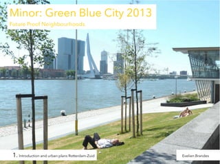
- 1. Bk7210 Urban analysis & design Minor: Green Blue City 2013 Lecture 1 Introduction Rotterdam Zuid Urban plan typology BK 7210 urban plan typology Rotterdam Zuid – ir. Evelien Brandes Evelien Brandes
- 2. Contents of this lecture 1. Introduction to the course Bk 7210 and the assignment slide 3-7 2. Meet Rotterdam Zuid slide 8-16 3. Historical maps slide 17-24 4. Jump to Zuid slide 25-33 5. New developments in surrounding neigbourhoods slide 34-47 6. Urban typology slide 48-67 7. Literature and creative commons slide 68-69 BK 7210 urban plan typology Rotterdam Zuid – ir. Evelien Brandes
- 3. 1. Introduction course - Lectures of the course BK 7210: - Subject: urbanism, urban design and the sustainable neighbourhood - Learning goals - Special skills of an urban designer - Assignment of this course BK 7210 urban plan typology Rotterdam Zuid – ir. Evelien Brandes
- 4. Urban Analysis and Design Lecture 1: Introduction and urban plans Rotterdam Zuid (by Evelien Brandes, coordinator) Lecture 2: Urban analysis and design principles (by Evelien Brandes, coordinator) Lecture 3: Urbanism Rotterdam and the Delta (by Han Meijer, professor Urban Compositions) Lecture 4: Design principles urbanism, Kop van Zuid (by John Westrik, associate professor) Lecture 5: Scenario’s for the Rotterdam Delta (by Anne Loes Nillesen, urban designer) Lecture 6: Examples and imagination in Rotterdam Zuid (by Els Bet, urban designer) Lecture 7: Seminar urban plans students BK 7210 urban plan typology Rotterdam Zuid – ir. Evelien Brandes
- 5. Learning objectives Becoming a good urban designer is a process of years, in attitude and practicing. Good urbanism is contributing to a sustainability city. A. Observing and studying the existing urban fabric creates the right base for: designing a new neighbourhood or; intervening in existing urban fabric B. Drawing an urban plan by selectively redrawing and imagining C. Designing of neighbourhood or urban border BK 7210 urban plan typology Rotterdam Zuid – ir. Evelien Brandes
- 6. Urbanism now Urban designers work next to other disciplines. Specific accents, to compare: - Architects / designers: higher scale, not only buildings, but public environment ; more social economic aspects - Landscape architects: not only the green public space, but the integration of building, traffic-infrastructure, public space, amenities and facilities; higher scale - Urban planners: not the program of functions by demand, but more by spatial possibilities -Real estate / Social housing managers: not only the process, but the spatial result So the urbanist does the integration of different disciplines. Large parts of The Netherlands are in good state now. The experience is useful for other countries. BK 7210 urban plan typology Rotterdam Zuid – ir. Evelien Brandes
- 7. Assignment urban analysis of a self-chosen neighbourhood week 1: Chose one of the residential milieu types in Rotterdam Zuid. Motivate the choise, Search for the best urban map and print it on the right part and scale. District and neighbourhood with environment Visit your site, make pictures, study the map and the urban form on the real site. Use the maps and satellite images of google earth, heightmaps, historical maps, local and national statistical data. week 2-7 Make a booklet “Analysis Urban Fabric of your neighbourhood” with: - main statistics of the district; amount of residents, age-groups, income-groups, household types; compare with Rotterdam or national data. - historical analysis: structure of the former landscape (dikes, old villages, pattern of ditches), plan history, typology of the city ground plan (which typology? dense landscape street patterns, Interbellum design, postwar modernism, functional grid, labyrinthian cluster, post-modern forms), characteristics and underlying goals of the specific city type. - district 1:5000 plan with main streets, water system, public facilities and green. Include explanatory texts ,relevant aspect drawings, traffic systems and parking, housing types and numbers, green and water. - density in FSI and dwelling/ha. - the original structure and the intervention by urban renewal. - chosen neighbourhood 1:1000 plan with building blocks, building heights and indication for the typology, entrees and front facades, road structure (car roads, bike lanes, sidewalks, including parking outside and inside), public space (public or private green, trees, waterstructure, pavement, play-, sport-, and meeting places,) public facilities (shops, schools, offices, waste containers; significant elements). Drawn by hand and/or digital; with legend, scale and north arrow indicator. - sections 1 : 500 of relevant points and a water and street profile 1:200 - images and choice: of photos, perspective drawings, model etc - own or residents valuation of the living, created in the neighbourhood BK 7210 urban plan typology Rotterdam Zuid – ir. Evelien Brandes
- 8. 2. Meet Rotterdam Zuid - The image of Rotterdam Zuid, SWOT-elements - Position and functions on regional scale - Zuid in the region of the island IJsselmonde - Names of neighbourhoods and harbours in Rotterdam Zuid - Typical elements: outer-dike areas, dikes, riverbanks, bridges, water safety aspects BK 7210 urban plan typology Rotterdam Zuid – ir. Evelien Brandes
- 9. Rotterdam Zuid Treats: So-called “problem area” Grim districts / high criminality Concentration of people without a job and education and immigrants Opportunities: Very strategic position Long riverbank, nice views to north bank Diverse + colorful, building + inhabitants 250.000 inhabitants, a lot of young people Redevelopment by Kop van Zuid and environment Western part of Rotterdam Zuid, study area, topographic map BK 7210 urban plan typology Rotterdam Zuid – ir. Evelien Brandes
- 10. Strategic position of Rotterdam Zuid BK 7210 urban plan typology Rotterdam Zuid – ir. Evelien Brandes Poster Minor - groupwork 2008
- 11. Rotterdam Zuid on the island of IJsselmonde BK 7210 urban plan typology Rotterdam Zuid – ir. Evelien Brandes
- 12. Kop van Zuid Katendrecht Maashaven Heijplaat Waalhaven Charlois Tarwewijk Hillesluis Afrikaanderwijk Plan Parkstad Bloemhof Carnisse Vreewijk Wielewaal Zuiderpark Pendrecht Zuidwijk Carnisselande BK 7210 urban plan typology Rotterdam Zuid – ir. Evelien Brandes Barendrecht Districts in Rotterdam Zuid
- 13. Outer dike areas From isolated harbour area to renewed waterfront BK 7210 urban plan typology Rotterdam Zuid – ir. Evelien Brandes
- 14. Dikes BK 7210 urban plan typology Rotterdam Zuid – ir. Evelien Brandes
- 15. Quays and banks BK 7210 urban plan typology Rotterdam Zuid – ir. Evelien Brandes
- 16. BK 7210 urban plan typology Rotterdam Zuid – ir. Evelien Brandes Flood on Noordereiland, 5th of December 2013
- 17. 3. History and historical maps - Landscape before urbanization - Maps from 1850 until 1980 - Different plans for Rotterdam Zuid before and after World War II - Plan Witteveen 1927 - Current situation BK 7210 urban plan typology Rotterdam Zuid – ir. Evelien Brandes
- 18. Underlaying landscape Rotterdam 1850 BK 7210 urban plan typology Rotterdam Zuid – ir. Evelien Brandes Reconstructed from map 1850 by F. Palmboom
- 19. Landscape of the Southern Maas around Katendrecht The landscape of Zuid before digging the Maashaven Zuid after digging the Maashaven Military topographic map ca.1800 Bonne map 1915 BK 7210 urban plan typology Rotterdam Zuid – ir. Evelien Brandes
- 20. BK 7210 urban plan typology Rotterdam Zuid – ir. Evelien Brandes Topographic map 1938
- 21. BK 7210 urban plan typology Rotterdam Zuid – ir. Evelien Brandes Plan Granpré Molière Verhagen 1920
- 22. BK 7210 urban plan typology Rotterdam Zuid – ir. Evelien Brandes Urban development plan of Witteveen 1926
- 23. Postwar plans for new neighbourhoods Pendrecht and Zuidwijk as independent residential areas below the new Zuiderpark BK 7210 urban plan typology Rotterdam Zuid – ir. Evelien Brandes Plan Linker Maasoever 1949
- 24. BK 7210 urban plan typology Rotterdam Zuid – ir. Evelien Brandes Topographic map of Western Rotterdam Zuid 1980
- 25. 4. Recent developments Rotterdam Zuid - Connecting city centre with Zuid: city axes and Erasmusbrug 1992 - New activities in former harbours and new public spaces and profiles in the surrounding area - Kop van Zuid: a new centre with offices, hotel and catering, culture and housing at the waterfront - The river is no longer a barrier between two totally different worlds - Connections along the southern bank, by public spaces and a new bridge Wilheminapier-Katendrecht BK 7210 urban plan typology Rotterdam Zuid – ir. Evelien Brandes
- 26. City axis Rotterdam and opposite side BK 7210 urban plan typology Rotterdam Zuid – ir. Evelien Brandes
- 27. Renewed Entrepothaven BK 7210 urban plan typology Rotterdam Zuid – ir. Evelien Brandes Touristic use and housing in formar warehouses
- 28. BK 7210 urban plan typology Rotterdam Zuid – ir. Evelien Brandes Developments on Kop van Zuid, situation 2000
- 29. The waterfront of Noordereiland seen from the Northern bank, behind it Kop van Zuid BK 7210 urban plan typology Rotterdam Zuid – ir. Evelien Brandes
- 30. BK 7210 urban plan typology Rotterdam Zuid – ir. Evelien Brandes The northern bank with newly designed greenery
- 31. New buildings around the Rijnhaven. What should be planned on the water now? BK 7210 urban plan typology Rotterdam Zuid – ir. Evelien Brandes
- 32. The view from the southern bank, Hotel New York towards the Veerhaven in the North BK 7210 urban plan typology Rotterdam Zuid – ir. Evelien Brandes
- 33. BK 7210 urban plan typology Rotterdam Zuid – ir. Evelien Brandes New pedestrian bridge between Wilhelminapier and Katendrecht
- 34. 5. Developments in surrounding neighbourhoods - Views on the Rijn- and Maashaven - Renewed old shopping streets Beijerlandse Laan - Multifunctional connections from Kop van Zuid to surrounding neighbourhoods - Recent developments on Katendrecht - Growing social activity in Rotterdam Zuid BK 7210 urban plan typology Rotterdam Zuid – ir. Evelien Brandes
- 35. Viewlines on Rijnhaven Metroline is elevated New buildings are freestanding Creating an open and diverse view BK 7210 urban plan typology Rotterdam Zuid – ir. Evelien Brandes
- 36. Social housing build in 1984 integrated in the new environment BK 7210 urban plan typology Rotterdam Zuid – ir. Evelien Brandes Paperclip by Carel Weeber, recent photo
- 37. New east-west axis in Kop van Zuid BK 7210 urban plan typology Rotterdam Zuid – ir. Evelien Brandes New axis between Kop van Zuid and Hillesluis
- 38. BK 7210 urban plan typology Rotterdam Zuid – ir. Evelien Brandes Laan op Zuid, a new wide urban street
- 39. BK 7210 urban plan typology Rotterdam Zuid – ir. Evelien Brandes Laan op Zuid, streetviews
- 40. BK 7210 urban plan typology Rotterdam Zuid – ir. Evelien Brandes New building in old neighbourhoods Rotterdam Zuid
- 41. Katendrecht: new individual housing with in the back the ss Rotterdam ship BK 7210 urban plan typology Rotterdam Zuid – ir. Evelien Brandes
- 42. BK 7210 urban plan typology Rotterdam Zuid – ir. Evelien Brandes Individual housing project was main impuls for Nieuw-Katendrecht
- 43. BK 7210 urban plan typology Rotterdam Zuid – ir. Evelien Brandes Katendrecht: new building and public green at the waterfront
- 44. Katendrecht: inhabitants maintain their own green, improving the public space BK 7210 urban plan typology Rotterdam Zuid – ir. Evelien Brandes
- 45. New activities in Katendrecht, story telling in theatre-restaurant Bellevue BK 7210 urban plan typology Rotterdam Zuid – ir. Evelien Brandes
- 46. BK 7210 urban plan typology Rotterdam Zuid – ir. Evelien Brandes Renewed shopping street on Beijerlandse Laan
- 47. BK 7210 urban plan typology Rotterdam Zuid – ir. Evelien Brandes Social liveliness in old neighbourhoods Rotterdam Zuid
- 48. 6. Typology of city plans A catalogue of city plan types - Medieval or historic building - Dense housing areas following street plans around 1900 - Interbellum plans 1920 - 1940 - Postwar modernism: the open building block - Cauliflower period 1970-1980 - New geometrical trends 1980-2000 - Vinex typology: eclectic urban design of the attractive BK 7210 urban plan typology Rotterdam Zuid – ir. Evelien Brandes
- 49. Typology Architype/example Monumental Urban plan typology Characteristics - symmetry with building in the middle - axes, long sightlines - star geometry - Haussmannian streets, Paris - Plan Zuid, Amsterdam - Oud West, Amsterdam - Spangen, Rotterdam - Garden towns, Oostzaan - open building block - orthogonal - repetition, stamping - “in ranks”, strict - Corbusian plans - Western Garden towns, Amsterdam - Pendrecht, Rotterdam - Zuidwijk, Rotterdam - hexa- and octagonal - bayonet - dead-end streets - capricicous forms - y-crossings - a lot of green - Bijlmermeer, Amsterdam - Buytenwegh de Leyens, Zoetermeer - Capelle Schollevaar - Waldeck, The Hegae - Geometry - Circular building - Grid with curved line(s) - Kattenbroek, Amersfoort - Emerald, Delfgauw - A lot of water and green - Originated from existing landscape - Segments with diverse patterns - Prinsenland, Rotterdam - Ypenburg, Nootdorp - Leidsche Rijn, Utrecht On this scale level the urban pattern is able to recognize and design. Various contextual, coincidental or medieval plan. These urban plan typologies often Typology Characteristics Architype/example Medieval - enclosed squares - crisscross patern - sponteneous composition of different buildings - coincidental measures - Italian historic centres - village centres Image 1200-1500 Contextual - cultral/geographic lines - for example rivercourse or agrerian parcelling - random dimentions - curved or lightly kniked walls - closed building blocks - old city districts - De Pijp, Amsterdam - Oude Westen, Rotterdam - Oude Noorden, Rotterdam - Romerstad, Frankfurt - Zijlweg area Haarlem Labyrinthian 1970-1980 - grid - closed building blocks - Cerda-grid, Barcalona - Manhatten, New York - Quatieri Spagnoli, Napels - various France bastids 19th century Romantic Functional 1950-1975 1880-1920 Rational 1920-1940 Experimental/ Postmodern 1980-1990 - routes - serendipities - a lot of green - free-standing houses - The Cresant, Bath - v.Stolkkwartier, The Hague - Haarlemmer Hout - Professorenbuurt, Zeist 19th century BK 7210 urban plan typology Rotterdam Zuid – ir. Evelien Brandes Urbanised Landscape/ Composed 1900-now Image
- 50. Medival position of - Italian historic centres - village centres and 17th century inner city patterns 1500-1880 ures Characteristics: Public open space is formed by the buildings Curved or natural street lines High density, closed building blocks, private inner courts Water and dikes form the basic structure Often restored in last century Often pedestrian (or boating) areas, low moterised traffic Many monuments, touristic and cultural function c lines ourse or ns niked walls ocks - old city districts - De Pijp, Amsterdam - Oude Westen, Rotterdam - Oude Noorden, Rotterdam - Romerstad, Frankfurt - Zijlweg area Haarlem BK 7210 urban plan typology Rotterdam Zuid – ir. Evelien Brandes Historic parts of inner city Amsterdam and Delft
- 51. BK 7210 urban plan typology Rotterdam Zuid – ir. Evelien Brandes Historic part of inner city Delft
- 52. Few historic neighbourhoods in Rotterdam BK 7210 urban plan typology Rotterdam Zuid – ir. Evelien Brandes Witte Huis and reconstructed houses, Northern bank Historic village centre and dike in Rotterdam Zuid
- 53. ourse or - De Pijp, Amsterdam - Oude Westen, Rotterdam nsBuilding- closed blocks on the Oude Noorden, Rotterdam niked walls - Romerstad, Frankfurt former landscape Haarlem 1880-1920 locks - Zijlweg area Characteristics: Narrow streets, long rows of 3-4 storey houses High densities Closed building blocks, private innercourts Former ditch pattern forms the basis Often renovated in period 1970-1990 locks - Cerda-grid, Barcalona - Manhatten, New York - Quatieri Spagnoli, Napels - various France bastids BK 7210 urban plan typology Rotterdam Zuid – ir. Evelien Brandes Narrow streets mostly containing family housing
- 54. Alligned houses in long rows with retail functions in the plinth BK 7210 urban plan typology Rotterdam Zuid – ir. Evelien Brandes Long dense residential streets in different class of quality
- 55. More exclusive neighbourhoods 1880-1920 Fusion between Contextual and Romantic typology BK 7210 urban plan typology Rotterdam Zuid – ir. Evelien Brandes Statenkwatier, The Hague
- 56. Urban plan garden town 1920-1940 Characteristics: Vreewijk Symmetrical streets and buildings Axes with marker, hierarchy Front- and corner gardens Green collective courtyards Low-rise with traditional housing Public green: girth with banks Enclosed squares Collectivity, organized peaceful setting Social control Kiefhoek Heijplaat BK 7210 urban plan typology Rotterdam Zuid – ir. Evelien Brandes Bloemhof
- 57. Garden village Bloemhof 1920-1940 Recently renewed by means of restoring and new buildings BK 7210 urban plan typology Rotterdam Zuid – ir. Evelien Brandes
- 58. Urban form of 1920-1940 typology BK 7210 urban plan typology Rotterdam Zuid – ir. Evelien Brandes City plan of Berlage and Amsterdam Zuid
- 59. Post-war “stamp” construction rise and fall 1985 1968 1950 1995 BK 7210 urban plan typology Rotterdam Zuid – ir. Evelien Brandes
- 60. Postwar open strip parceling Characteristics: Short sides towards the access road Introduced in Charlois and Carnisse Basic principle in post-war neighbourhoods: Pendrecht, Zuidwijk, etc. In reconstruction sometimes abandoned oriented behind each other BK 7210 urban plan typology Rotterdam Zuid – ir. Evelien Brandes oriented towards each other
- 61. Cauliflower quarters 1970-1980 Characteristics: traffic system: cul de sac priority for pedestrians green contra-mold safe green strips, adventurous small-scale, inwardly faced neighbourhoods BK 7210 urban plan typology Rotterdam Zuid – ir. Evelien Brandes Barendrecht, Zoetemeer, Houten and Hengelo
- 62. Metaphor urbanism 1980-2000 BK 7210 urban plan typology Rotterdam Zuid – ir. Evelien Brandes Kattenbroek, Amerfoort
- 63. Urbanized landscape 1990 BK 7210 urban plan typology Rotterdam Zuid – ir. Evelien Brandes
- 64. Vinex district 1995- 2010 BK 7210 urban plan typology Rotterdam Zuid – ir. Evelien Brandes Carnisselande, Barendrecht, Google satellite image 2003
- 65. Vinex diversity: waterfront dwelling and diverse parcelling since 2000 onwards BK 7210 urban plan typology Rotterdam Zuid – ir. Evelien Brandes Carnisselande and Ypenburg, Java-eiland, Amsterdam
- 66. Urban typologies in Amsterdam Historic inner city Canal belt First extentions Belt '20-'40 Postwar stamp construction Experimental Harbour and industry BK 7210 urban plan typology Rotterdam Zuid – ir. Evelien Brandes Evelien Brandes
- 67. Urban typologies in Rotterdam Zuid centre city districts garden towns garden cities offices large greencores locale facilities main access route rail infrastructures BK 7210 urban plan typology Rotterdam Zuid – ir. Evelien Brandes
- 68. Four essential books to study urbanism BK 7210 urban plan typology Rotterdam Zuid – ir. Evelien Brandes
- 69. BK 7210 urban plan typology Rotterdam Zuid – ir. Evelien Brandes
- 70. Creative commons You are free: - to copy, distribute, display, and perform the work - to make derivative works Under the following conditions: - Attribution. You must give the original author credit - Non-Commercial. You may not use this work for commercial purposes - Share Alike. If you alter, transform, or build upon this work, you may distribute the resulting work only under a licence identical to this one BK 7210 urban analysis and design principles – ir. Evelien Brandes