Download as PDF, PPTX
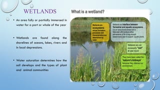
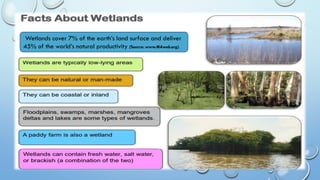
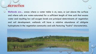
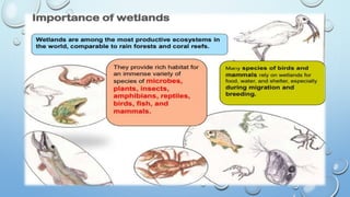
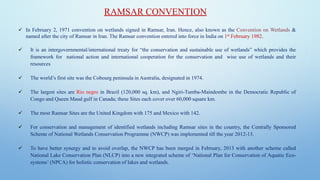
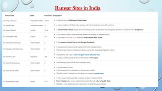
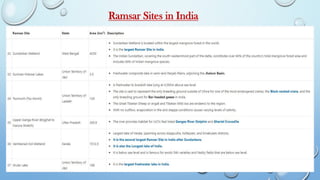


The document provides a comprehensive overview of wetlands, defining them as water-saturated areas crucial for ecological systems, societal needs, and biodiversity. It highlights their importance in flood control, water filtration, and as habitats for various species, as well as detailing the types and classifications of wetlands, especially in India. Additionally, it discusses the Ramsar Convention, which aims at conserving global wetlands, including India's significant wetland resources.


