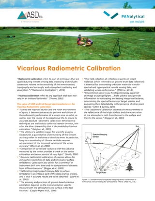
Vicarious radiometric calibration refers to techniques used to calibrate remote sensing data without relying on onboard calibrators. Field spectroradiometers can be used to collect ground reflectance spectra and atmospheric parameters needed for vicarious calibration. Accurate vicarious calibration allows correction of instrument drift over time and comparison of datasets from different sensors, enabling monitoring of climate variables. Portable spectroradiometers like ASD's FieldSpec models are well-suited for rapid collection of calibration target and atmospheric data in the field.
Evaluating effectiveness of radiometric correction for optical satellite imag...Dang Le
One of our published researches in ACRS 31st in Hanoi.
It has been used for our project in processing optical satellite imagery to detect environmental pollution.
MMEA (The Measurement, Monitoring and Environmental Efficiency Assessment) research program final seminar presentation by Dr. Eija Honkavaara, Finnish Geospatial Research Institute
Summary of current radiometric calibration coefficients for Landsat MSS, TM, ETM+,
and EO-1 ALI sensors
Gyanesh Chander a,⁎, Brian L. Markham b, Dennis L. Helder c
a SGT, Inc. 1 contractor to the U.S. Geological Survey (USGS) Earth Resources Observation and Science (EROS) Center, Sioux Falls, SD 57198-0001, USA
b National Aeronautics and Space Administration (NASA) Goddard Space Flight Center (GSFC), Greenbelt, MD 20771, USA
c South Dakota State University (SDSU), Brookings, SD 57007, USA
This presentation cover description of microwave remote sensing, Active and Passive Microwave remote sensing, RADAR, Slant range distortion like Foreshortening and Layover, Sar image and some Recent works in where microwave remote sensing has used to detect natural calamities
Chronological Calibration Methods for Landsat Satellite Images iosrjce
IOSR Journal of Applied Physics (IOSR-JAP) is a double blind peer reviewed International Journal that provides rapid publication (within a month) of articles in all areas of physics and its applications. The journal welcomes publications of high quality papers on theoretical developments and practical applications in applied physics. Original research papers, state-of-the-art reviews, and high quality technical notes are invited for publications.
The presentation looks into the principle and uses of multi-spectral imaging (MSI) systems. Hyperspectral imaging, an extention of MSI was also covered herein. Moreover, the components of the system were highlighted with special attention paid to the detector (or image sensor). Finally, a few application in the Bioresource Engineering domain was covered
hyperspectral remote sensing and its geological applicationsabhijeet_banerjee
this is an introductory presentation on hyperspectral remote sensing, which essential deals with the distinguishing features, imaging spectrometers and its types, and some of the geological applications of hyperspectral remote sensing.
Data Collection via Synthetic Aperture Radiometry towards Global SystemIJERA Editor
Nowadays it is widely accepted that remote sensing is an efficient way of large data management philosophy. In
this paper, we present a future view of the big data collection by synthetic aperture radiometry as a passive
microwave remote sensing towards building a global monitoring system. Since the collected data may not have
any value, it is mandatory to analyses these data in order to get valuable and beneficial information with respect
to their base data. The collected data by synthetic aperture radiometry is one of the high resolution earth
observation, these data will be an intensive problems, Meanwhile, Synthetic Aperture Radar able to work in
several bands, X, C, S, L and P-band. The important role of synthetic aperture radiometry is how to collect data
from areas with inadequate network infrastructures where the ground network facilities were destroyed. The
future concern is to establish a new global data management system, which is supported by the groups of
international teams working to develop technology based on international regulations. There is no doubt that the
existing techniques are so limited to solve big data problems totally. There is a lot of work towards improving 2-
D and 3-D SAR to get better resolution.
International Journal of Engineering Research and Applications (IJERA) is an open access online peer reviewed international journal that publishes research and review articles in the fields of Computer Science, Neural Networks, Electrical Engineering, Software Engineering, Information Technology, Mechanical Engineering, Chemical Engineering, Plastic Engineering, Food Technology, Textile Engineering, Nano Technology & science, Power Electronics, Electronics & Communication Engineering, Computational mathematics, Image processing, Civil Engineering, Structural Engineering, Environmental Engineering, VLSI Testing & Low Power VLSI Design etc.
This content presents for basic of Synthetic Aperture Radar (SAR) including its geometry, how the image is created, essential parameters, interpretation, SAR sensor specification, and advantages and disadvantages.
RADAR (RAdio Detection and Ranging) use modulated waveforms and directive antennas to transmit electromagnetic energy into a specific volume in space to search for targets. The targets within the volume reflect echoes back to the radar which are further processed to extract target information. A better SNR (Signal to Noise Ratio) to for radar surveillance is achieved. The results are provided by Matlab simulation.
In the modern age, High-resolution radar images can be achieved by employing SAR technique. It is well
known that SAR can provide several times better image resolution than conventional radars. The exploration for efficient
image denoising methods still remains a valid challenge for researchers. Despite the difficulty of the recently proposed
methods, mostly of the algorithms have not yet attained a pleasing level of applicability; each algorithm has its
assumptions, advantages, and limitations. This paper presents a review of synthetic aperture radar. Behind a brief
introduction in our work we are especially targeting the noise called backscattered noise in SAR terminology which
causes the appearance of speckle Potential future work in the area of air flight navigation, mapping Weather Monitoring
& during natural disaster like earth quake. The SAR having the capability, to make human visibility beyond optical
vision, is also discussed.
LIDAR is an acronym for light detection and ranging. It is an optical remote sensing technology used to examine the surface of the earth, often using pulses from a laser.
The presentation explains the basics of LiDAR Technology with its applications and case studies. This is presented by the Second Year Instrumentation and Control Engineering students of Vishwakarma Institute of Technology, Pune.
Essentials of Automations: Optimizing FME Workflows with ParametersSafe Software
Are you looking to streamline your workflows and boost your projects’ efficiency? Do you find yourself searching for ways to add flexibility and control over your FME workflows? If so, you’re in the right place.
Join us for an insightful dive into the world of FME parameters, a critical element in optimizing workflow efficiency. This webinar marks the beginning of our three-part “Essentials of Automation” series. This first webinar is designed to equip you with the knowledge and skills to utilize parameters effectively: enhancing the flexibility, maintainability, and user control of your FME projects.
Here’s what you’ll gain:
- Essentials of FME Parameters: Understand the pivotal role of parameters, including Reader/Writer, Transformer, User, and FME Flow categories. Discover how they are the key to unlocking automation and optimization within your workflows.
- Practical Applications in FME Form: Delve into key user parameter types including choice, connections, and file URLs. Allow users to control how a workflow runs, making your workflows more reusable. Learn to import values and deliver the best user experience for your workflows while enhancing accuracy.
- Optimization Strategies in FME Flow: Explore the creation and strategic deployment of parameters in FME Flow, including the use of deployment and geometry parameters, to maximize workflow efficiency.
- Pro Tips for Success: Gain insights on parameterizing connections and leveraging new features like Conditional Visibility for clarity and simplicity.
We’ll wrap up with a glimpse into future webinars, followed by a Q&A session to address your specific questions surrounding this topic.
Don’t miss this opportunity to elevate your FME expertise and drive your projects to new heights of efficiency.
JMeter webinar - integration with InfluxDB and GrafanaRTTS
Watch this recorded webinar about real-time monitoring of application performance. See how to integrate Apache JMeter, the open-source leader in performance testing, with InfluxDB, the open-source time-series database, and Grafana, the open-source analytics and visualization application.
In this webinar, we will review the benefits of leveraging InfluxDB and Grafana when executing load tests and demonstrate how these tools are used to visualize performance metrics.
Length: 30 minutes
Session Overview
-------------------------------------------
During this webinar, we will cover the following topics while demonstrating the integrations of JMeter, InfluxDB and Grafana:
- What out-of-the-box solutions are available for real-time monitoring JMeter tests?
- What are the benefits of integrating InfluxDB and Grafana into the load testing stack?
- Which features are provided by Grafana?
- Demonstration of InfluxDB and Grafana using a practice web application
To view the webinar recording, go to:
https://www.rttsweb.com/jmeter-integration-webinar
Builder.ai Founder Sachin Dev Duggal's Strategic Approach to Create an Innova...Ramesh Iyer
In today's fast-changing business world, Companies that adapt and embrace new ideas often need help to keep up with the competition. However, fostering a culture of innovation takes much work. It takes vision, leadership and willingness to take risks in the right proportion. Sachin Dev Duggal, co-founder of Builder.ai, has perfected the art of this balance, creating a company culture where creativity and growth are nurtured at each stage.
Accelerate your Kubernetes clusters with Varnish CachingThijs Feryn
A presentation about the usage and availability of Varnish on Kubernetes. This talk explores the capabilities of Varnish caching and shows how to use the Varnish Helm chart to deploy it to Kubernetes.
This presentation was delivered at K8SUG Singapore. See https://feryn.eu/presentations/accelerate-your-kubernetes-clusters-with-varnish-caching-k8sug-singapore-28-2024 for more details.
Epistemic Interaction - tuning interfaces to provide information for AI supportAlan Dix
Paper presented at SYNERGY workshop at AVI 2024, Genoa, Italy. 3rd June 2024
https://alandix.com/academic/papers/synergy2024-epistemic/
As machine learning integrates deeper into human-computer interactions, the concept of epistemic interaction emerges, aiming to refine these interactions to enhance system adaptability. This approach encourages minor, intentional adjustments in user behaviour to enrich the data available for system learning. This paper introduces epistemic interaction within the context of human-system communication, illustrating how deliberate interaction design can improve system understanding and adaptation. Through concrete examples, we demonstrate the potential of epistemic interaction to significantly advance human-computer interaction by leveraging intuitive human communication strategies to inform system design and functionality, offering a novel pathway for enriching user-system engagements.
Dev Dives: Train smarter, not harder – active learning and UiPath LLMs for do...UiPathCommunity
💥 Speed, accuracy, and scaling – discover the superpowers of GenAI in action with UiPath Document Understanding and Communications Mining™:
See how to accelerate model training and optimize model performance with active learning
Learn about the latest enhancements to out-of-the-box document processing – with little to no training required
Get an exclusive demo of the new family of UiPath LLMs – GenAI models specialized for processing different types of documents and messages
This is a hands-on session specifically designed for automation developers and AI enthusiasts seeking to enhance their knowledge in leveraging the latest intelligent document processing capabilities offered by UiPath.
Speakers:
👨🏫 Andras Palfi, Senior Product Manager, UiPath
👩🏫 Lenka Dulovicova, Product Program Manager, UiPath
Transcript: Selling digital books in 2024: Insights from industry leaders - T...BookNet Canada
The publishing industry has been selling digital audiobooks and ebooks for over a decade and has found its groove. What’s changed? What has stayed the same? Where do we go from here? Join a group of leading sales peers from across the industry for a conversation about the lessons learned since the popularization of digital books, best practices, digital book supply chain management, and more.
Link to video recording: https://bnctechforum.ca/sessions/selling-digital-books-in-2024-insights-from-industry-leaders/
Presented by BookNet Canada on May 28, 2024, with support from the Department of Canadian Heritage.
GraphRAG is All You need? LLM & Knowledge GraphGuy Korland
Guy Korland, CEO and Co-founder of FalkorDB, will review two articles on the integration of language models with knowledge graphs.
1. Unifying Large Language Models and Knowledge Graphs: A Roadmap.
https://arxiv.org/abs/2306.08302
2. Microsoft Research's GraphRAG paper and a review paper on various uses of knowledge graphs:
https://www.microsoft.com/en-us/research/blog/graphrag-unlocking-llm-discovery-on-narrative-private-data/
Encryption in Microsoft 365 - ExpertsLive Netherlands 2024Albert Hoitingh
In this session I delve into the encryption technology used in Microsoft 365 and Microsoft Purview. Including the concepts of Customer Key and Double Key Encryption.
Software Delivery At the Speed of AI: Inflectra Invests In AI-Powered QualityInflectra
In this insightful webinar, Inflectra explores how artificial intelligence (AI) is transforming software development and testing. Discover how AI-powered tools are revolutionizing every stage of the software development lifecycle (SDLC), from design and prototyping to testing, deployment, and monitoring.
Learn about:
• The Future of Testing: How AI is shifting testing towards verification, analysis, and higher-level skills, while reducing repetitive tasks.
• Test Automation: How AI-powered test case generation, optimization, and self-healing tests are making testing more efficient and effective.
• Visual Testing: Explore the emerging capabilities of AI in visual testing and how it's set to revolutionize UI verification.
• Inflectra's AI Solutions: See demonstrations of Inflectra's cutting-edge AI tools like the ChatGPT plugin and Azure Open AI platform, designed to streamline your testing process.
Whether you're a developer, tester, or QA professional, this webinar will give you valuable insights into how AI is shaping the future of software delivery.
UiPath Test Automation using UiPath Test Suite series, part 3DianaGray10
Welcome to UiPath Test Automation using UiPath Test Suite series part 3. In this session, we will cover desktop automation along with UI automation.
Topics covered:
UI automation Introduction,
UI automation Sample
Desktop automation flow
Pradeep Chinnala, Senior Consultant Automation Developer @WonderBotz and UiPath MVP
Deepak Rai, Automation Practice Lead, Boundaryless Group and UiPath MVP
Slack (or Teams) Automation for Bonterra Impact Management (fka Social Soluti...Jeffrey Haguewood
Sidekick Solutions uses Bonterra Impact Management (fka Social Solutions Apricot) and automation solutions to integrate data for business workflows.
We believe integration and automation are essential to user experience and the promise of efficient work through technology. Automation is the critical ingredient to realizing that full vision. We develop integration products and services for Bonterra Case Management software to support the deployment of automations for a variety of use cases.
This video focuses on the notifications, alerts, and approval requests using Slack for Bonterra Impact Management. The solutions covered in this webinar can also be deployed for Microsoft Teams.
Interested in deploying notification automations for Bonterra Impact Management? Contact us at sales@sidekicksolutionsllc.com to discuss next steps.
1. Vicarious Radiometric Calibration
“Radiometric calibration refers to a set of techniques that are
applied during remote sensing data processing and includes
corrections related to the sensitivity of the remote sensor,
topography and sun angle, and atmospheric scattering and
absorption.” (“Radiometric Calibration”, 2016)
“Vicarious calibration refers to any approach that does not
rely on an onboard calibrator.” (Thome, 2002)
The value of VNIR and Full-Range Spectroradiometers for
Vicarious Radiometric Calibration:
• “Due to the rigors of launch and the harsh environment
of space, it becomes necessary to perform evaluations of
the radiometric performance of a sensor once on orbit, as
well as over the course of its operational life, to insure its
accurate absolute radiometric calibration. While several
techniques are available to calibrate a sensor on orbit, few
offer the direct traceability that is obtainable by vicarious
calibration.” (Leigh et al., 2013)
• “The utility of a satellite imager for scientific analysis
necessitates a quantitative understanding of the sensor’s
accuracy either in a relative or absolute sense. In particular,
long-term monitoring of climate variables requires
an assessment of the temporal variation of the sensor
accuracy.” (Minnis et al., 2002)
• “Comparison of ‘predicted’ radiance with the radiance
measured by the sensor provides a check on the sensor
calibration and sensor control of stray light.” (Smith, 2002)
• “Accurate radiometric calibration of a sensor allows for
atmospheric correction of data and retrieval of surface
reflectance. Calibration also allows for a correction of
instrument drift over time and for comparison of datasets
from different sensors.” (Biggar et al., 2003)
• “Calibrating imaging spectroscopy data to surface
reflectance is an integral part of the data analysis process,
and is vital if accurate results are to be obtained.” (Clark et
al., 2002)
• “The accuracy and precision of ground-based vicarious
calibration depends on the instrumentation used to
measure both the atmosphere and surface at the test
location.” (Czapla-Myers et al., 2008)
Figure 1. Considerations for spectral imaging sensor calibration to
reflectance and correcting for atmospheric effects. (ASD Inc., n.d.)
• “The field collection of reflectance spectra of intact
materials (often referred to as ground truth data collection)
is essential for interpreting unknown materials in multi-
spectral and hyperspectral remote sensing data, and
validating sensor performance.” (ASD Inc., 2014)
• “It is common place to use field spectroscopy as part of
an image analysis program. …Field spectral data provide
information for calibrating and testing imagery reflectance,
determining the spectral features of target species, and
evaluating their detectability in the presence of other plant
species.” (Ustin & Santos, 2010)
• “The radiometric calibration depends on measurements of
the reflectance of the bright surface and characterization
of the atmospheric path from the sun to the surface and
then to the sensor.” (Biggar et al., 2003)
2. The Solution:
ASD field portable spectroradiometers have optimal signal-to-noise design for faster measurements, and wide spectral
coverage of 350-2500 nm that is ideal for the vicarious radiometric calibration of a wide range of aircraft and satellite remote
sensing systems.
Used in conjunction with 8 to 10° field-of-view fore optics and a calibrated Spectralon panel, ASD’s FieldSpec® 4
spectroradiometer enables rapid collection of the grid of surface reflectance spectra necessary to characterized calibration
targets used for vicarious radiometric calibration of imaging sensors. ASD’s direct irradiance receptor coupled to a solar
tracking stage turns the ASD FieldSpec 4 spectroradiometer into a hyperspectral sun photometer enabling the calculation of
the atmospheric scattering parameters necessary for accurate vicarious calibrations.
ASD offers different instrument configurations and additional accessory options for a variety of set-up and sampling
approaches for a versatile, wide range of measurement scenarios.
ASD instruments offer a practical solution to analyze Vicarious Radiometric Calibration data measurements.
Full-range spectroradiometers designed specifically
around the challenges researchers face when
performing spectral measurements in the field.
FieldSpec 4 Features:
SWIR Detector Packages:
• Two stage thermo electric cooling to reduce dark current
and noise.
• Shunt resistance optimized to reduce dark current and
noise.
• SWIR 2 responsive out to 2.55 microns at -20Deg C for
optimal S/N at our instrument performance specification
limit of 2.5 microns.
SWIR Dispersion Elements:
• Concave holographic reflective diffraction gratings are
master gratings, not replicates.
• Optimized aberration reduction.
• Optimized response and resolution.
Built-in Fiber Optic Cables:
• Low OH fibers for optimal signal transmission.
• Hard mounted, continuous (not jumpered), direct to
dispersion elements for optimal signal transmission.
• Constructed with steel coil jacket and Kevlar fiber to
protect fiber optics.
NIST Traceable Calibration Facilities:
• Wavelength calibrations from various NIST traceable
sources including many emission lines from Neon, Mercury,
Argon, Krypton, and Xenon.
• Wavelength verifications on various reflectance standards
including NIST traceable pucks.
• NIST traceable FEL lamps.
• Radiometric calibration facilities that have been compared
to NASA-Ames Research Center and Los Alamos National
Laboratory and have been found to be within 1% of both
facilities.
• Main calibration source cross checked against second source
for every instrument.
ASD’s RS3™ Software:
• Highly developed spectral curve generation functions to
optimize spectral performance and to reduce noise to the
lowest possible level.
Figure 2. Compare
ground endmember
spectra to overflight
spectra. (ASD Inc., n.d.).
3. FieldSpec HandHeld 2 a versatile and durable hand-
held spectroradiometer that utilizes the FieldSpec 4 VNIR
spectrometer for accurate analysis in the 325 – 1075 nm
spectral range.
Optional fore optics for wide and small field-of-views, for
use with the FieldSpec and HandHeld 2 spectroradiometer, to
meet a variety of applications:
• Lenses which limit the field-of-view from 1 to 25 degrees
• A radiometric calibration for radiance (W/m2/steradian/nm)
measurements
• Diffuse transmission and reflective type cosine receptors
and radiometric calibrations for measuring full sky
irradiance (W/m2/nm)
ASD pioneered the science of field spectroscopy over 25
years ago and continues to lead the industry with the
world’s most trusted field-portable spectroradiometers.
Ideal for Vicarious Radiometric Calibration
applications
• Portable solution
• Simple, rapid and cost effective real-time
measurement (data and analysis in the
field)
• Use to ground truth hyperspectral and
multispectral imaging data
References
ASD Inc. (2014). Ground Truthing. Retrieved from the ASD, Inc. website
http://www.asdi.com/applications/remote-sensing/ground-truthing.
Biggar, S. F., Thome, K. J., & Wisniewski, W. (2003). Vicarious radiometric
calibration of EO-1 sensors by reference to high-reflectance ground targets.
Geoscience and Remote Sensing, IEEE Transactions on, 41(6), 1174-1179.
Clark, R.N., Swayze, G.A., Livo, K.E., Kokaly, R.F., King, T.V.V., Dalton, J.B.,
Vance, J.S., Rockwell, B.W., Hoefen, T., and McDougal, R.R. (2002). “Surface
Reflectance Calibration of Terrestrial Imaging Spectroscopy Data: a Tutorial
Using AVIRIS”, 10th Airborne Earth Science Workshop Proceedings. (http://
speclab.cr.usgs.gov/PAPERS.calibration.tutorial/)
Czapla-Myers, J. S., Thome, K. J., Cocilovo, B. R., McCorkel, J. T., &
Buchanan, J. H. (2008, August). Temporal, spectral, and spatial study of
the automated vicarious calibration test site at Railroad Valley, Nevada.
In Optical Engineering+ Applications (pp. 70810I-70810I). International
Society for Optics and Photonics.
Leigh, L.; Aaron, D. (2013), Absolute radiometric vicarious calibration of on
orbit imaging satellites. Retrieved from http://a-a-r-s.org/acrs/index.php/
acrs/acrs-overview/proceedings-1?view=publication&task=show&id=1163.
Minnis, P., Nguyen, L., Doelling, D., Young, D., Miller, W. Kratz, D. (2002),
Rapid Calibration of Operational and Research Meteorological Satellite
Imagers. Part I: Evaluation of Research Satellite Visible Channels as
References, Journal of Atmospheric and Oceanic Technology(19), 1233-
1249.
Radiometric Calibration. (n.d.). In Wikipedia. Retrieved March 11, 2016,
from https://en.wikipedia.org/wiki/Radiometric_calibration.
Smith, J.R. (2002), “Radiometric Ground Truthing for Airborne and Satellite
Sensor Tests”, Pecora 15/Land Satellite Information IV/ISPRS Commission I/
FIEOS 2002 Conference Proceedings. (http://www.isprs.org/proceedings/
XXXIV/part1/paper/00078.pdf)
Thome, K.J. (2002), Ground looking radiometric calibration approaches for
remote sensing imagers in the solar reflective, in Proceedings of the Pecora
15/Land Satellite Information IV/ISPRS Commission I/FIEOS 2002 Conference,
10-14 November 2002, Denver, Colorado.
Ustin, S.L., & Santos, M.J. (2010, February). Spectral identification of
native and non-native plant species. Paper presented at ASD and IEEE GRS
Proceedings; Art, Science and Applications of Reflectance Spectroscopy
Symposium, Boulder, CO, USA (pp. 1-17).