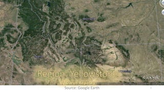
SlideShare a Scribd company logo
Source: Google Earth 1
Source: http://www.nrmsc.usgs.gov/files/swans/images/tricore.jpg 
2
Source: media.away.com/gifs/states/wy/m_gryell.gif 3
Source: http://www.nps.gov/yell/planyourvisit/images/yell_loc ation_map.gif 4
The Yellowstone Region receives roughly 
between 4 to 6.03* insolation in the spring 
(April through June) and starts to decline, from 
6 to 4* in the summer (July through Mid- 
September). These numbers continue to taper 
off in the fall, (late-September through 
November) down to rates ≤ 4* and then into 
winter (November through the end of May) 
with rates of insolation from ~1.5* through 
January, increasing to rates ≤ 3* in February 
only to increase lightly up through May. Fall 
and early winter experience the lowest and 
most indirect amount of insolation, while 
spring and fall have the highest levels of direct 
insolation. The presence of Yellowstone Lake 
effects these temperatures the most, followed 
by the dense vegetation near the lake. The 
Yellowstone area receives the most direct 
insolation in June, July, and August with an 
averages of 6.03*, 6.24*, and 5.37*, 
respectively. The angle of insolation is oblate 
during the fall and winter seasons, restricting 
the amount of insolation during those 
seasons. 
*(kWh/m^2/day) – Kilowatt hours per square 
meters per day 
Souce: http://www.wrcc.dri.edu/cgi-bin/cliMAIN.pl?wyyell http://www.gaisma.com/en/location/yellowstone-national-park-wyoming.html 5
Source: http://www.wrcc.dri.edu/cgi-bin/cliMAIN.pl?wyyell 6 
Amounts of precipitation increase 
during seasons of lower insolation 
rates. November-March show ≤ 
1in. of precipitation, before 
increasing to 1in. in April, 1.45in. 
in May, 1.75in. in June, and sliding 
back down to ~1.15in both July 
and August.
The visiting area’s elevation ranges between 6,500 to 8,000 feet surrounded by 
mountain ranges. High elevations increase the amount of direct sunlight and cause 
alpine weather patterns to become more dynamic and faster-changing. Due to the 
varying elevations and temperatures of the Yellowstone region, thunderstorms are 
common during the summer months. Thunderstorms are brought on by the rapid 
temperature changes from the day (mid-70’s) dropping to 40’s-30’s and occasionally, 
20’s. As the temperatures start to decline and the season transitions into Autumn/fall, 
the likelihood of snowstorms increases, brought on by cool temperatures and high 
precipitation, and the lack of direct insolation. Bouts of warm Chinook winds, which 
are rain shadow winds brought on by the adiabatic warming of air that has dropped a 
majority of its moisture on windward slopes, warms up winter temperatures to the 
40s and 50s, generally. Average snowfall rates in the area are approximately 150in., 
depending on elevation. Higher elevated areas may see as much as 400in. The 
presence of moderate precipitation and low temperatures throughout most months 
in the Yellowstone area promotes the likelihood of snow through spring, fall, and 
winter. Wind in this area is common through all months due to the geographical 
layout of the park (dynamic elevations). Wind rates are likely to increase in the event 
of winter and rain storms. The park is subjected to seismic activity all year round. 
Source: http://www.yellowstonenationalparklodges.com/things-to-do/plan-your-trip/weather/ 
http://www.ultimateyellowstonepark.com/Yellowstone/weatherandclimate.html 
http://en.wikipedia.org/wiki/Chinook_wind http://www.rvingyellowstone.com/YellowstonePics/YellowstoneWeather_4393.jpg 7
Source: http://www.yellowstone.climatemps.com/ 
http://www.nps.gov/features/yell/climateexplorer/index.html 
8 
I hypothesize that the Yellowstone National 
Park is generally in a state of deficit due to the 
parks many hydrothermal elements. Any 
surplus would be gathered in the cooler 
months such as January, February, November, 
and December. Utilization would most likely 
start as early as May and extend to mid- 
August before recharging late-August through 
the end of October.
Source: http://www.yellowstone.climatemps.com/ https://weatherspark.com/averages/31209/Yellowstone-National-Park-Wyoming-United-States ELEMENTAL 
GEOSYSTEMS PG. 165 
9 
The Yellowstone Park region is 
classified differently, depending 
on where you are in the region. 
This area shows signs of: Dfc, a 
humid, subarctic continental 
climate with cool summers and 
no dry seasons; BSk, cold, semi-arid 
climate; Dfb, humid 
continental climate. The 
Yellowstone area can also be 
considered a midlatitude cold 
steppe due to location, 
elevation, and an average 
annual rainfall of ~13in. Winter 
temperatures fall drastically 
during the season and 
temperatures can be described 
as frigid. 
Wind Average annual temperature for the Directions Over the Entire Year 
park May-October are ≥ 40°, while 
November-April are ≤ 38°. The 
temperatures transition at a reasonable 
pace for the park to experience all four 
seasons. Annual precipitation is 
generally low, however constant, 
ranging from 1 to 2in. monthly. 
The Yellowstone park experiences various climatic elements due to it’s unique volcanic 
construction as well as general elevation. Wind speeds for the area are ≤ 10mph do to high 
elevation of the region and are most commonly blowing west, from over the Yellowstone Lake. 
The park experiences anywhere from 40-59 days of thunderstorms, low-speed winds, and light 
rainfall, yearly(pg.165). Cold wind temperatures are due to the parks nearby location to the 
polar jet stream.
Source: http://www.geologycafe.com/images/vulcan3.jpg https://gsa.confex.com/gsa/2011RM/finalprogram/abstract_187754.htm 
http://serc.carleton.edu/research_education/yellowstone_reu/index.html “Metamorphism” http://www.cr.nps.gov/history/online_books/geology/publications/bul/1347/images/fig5.jpg 
10 
Table 1: Basic rocks and types found in the 
Yellowstone National Park by Daryn Repasky 
Granite is an intrusive, igneous rock 
that is created by magma. Granite is 
coarse-grained meaning it takes 
longer to cool and crystalize from it’s 
liquid from due to magma exposure. 
The Yellowstone park is home to many 
different types of rock due to it’s ancient 
history of volcanism, then later, glaciation. 
Basalt is formed by the rapid cooling 
of basaltic lava and is an extrusive 
igneous rock made of a mixture of 
minerals. Rhyolite is also formed by 
lava; however, rapid cooling may 
result in obsidian. 
A combination of sand-like minerals and rock 
undergoing lithification creates sandstone. The 
compression and lithification of chemical contain 
sediments produce limestone, namely calcium 
carbonate. 
Quartzite is the result of sandstone having 
undergone the metamorphic process, usually 
caused by continental plates crumbling and being 
forced upwards (orogenic belts). Limestone or 
dolomite that experiences the metamorphic 
process creates marble.
Source: http://volcano.oregonstate.edu/hotspotparks http://www.geology.sdsu.edu/how_volcanoes_work/Thumblinks/yellowstone_page.html 
11 
The Yellowstone Park itself was created by various tectonic, 
glacial and volcanic processes. I hypothesize that the 
Yellowstone region’s crust was formed from stable platforms 
of rocks. Due to the historic presence of the Yellowstone 
“super volcano” and the park location over a continental hot 
spot, it’s safe to say the region is largely volcanic. The park is 
situated on a high plateau supported by a thermally 
expanded, buoyant mantle, called a mantle plume. The 
mantle itself expands and contracts The deformed crustal 
formation would have been brought on by bouts of faulting, 
folding, and crustal movement caused by various volcanic 
eruptions over the course of millions of years. In the wake of 
these ancient eruptions, U-shaped valleys were formed, as 
well as a few calderas, some of which have been long since 
covered by basaltic lava flows and surficial elements.
I hypothesize that weathering and mass wasting affect this 
region greatly, to a point of the area being entirely different 
without it. The Yellowstone National Park is subjected to both 
physical and chemical wasting, which play primary roles in the 
creation of unique sights and structures in the area. The parks 
location over a hotspot enables various geothermic events to 
transpire that cause chemical wasting. Notable chemical 
wasting processes are salt erosion of the rocks and oxidization 
brought on by the hydrothermal elements of the park (hot 
springs, geysers, fumaroles) due to the elemental compounds, 
like iron oxide, found in the heated water. Physical elements 
include landslides, avalanches, creep, transitional slides, rock 
fall, pressure release, water erosion, and the creation of joints 
by basalt columns. The seismic activity of the region may play 
a part in triggering physical weathering effects experienced 
throughout the park. 
Source: http://surveyofyellowstone.tumblr.com/ http://volcanoes.usgs.gov/vsc/images/image_mngr/0-99/img12_800w_500h.jpg http://geo1202.blogspot.com/2011/03/normal-0-false-false-false- 
en-us-x-none.html 12
Source: http://www.secretyellowstone.com/wp-content/uploads/2010/01/yellowstonerivers.jpg http://www.secretyellowstone.com/historical-cultural-scientific/rivers-streams-lakes 
http://www.scienceclarified.com/landforms/Ocean-Basins-to-Volcanoes/Stream-and-River.html 
13 
There are various rivers, lakes, streams, and creeks that run from and 
through the Yellowstone park. The Yellowstone river spreads across 
the continental divide, reaching from the Rocky Mountains within the 
park out to the Great Plains where the water flow slows and creates a 
floodplain. The Yellowstone River is tributary to the Missouri River and 
is a meandering channel with alluvial deposits, waterfalls, and eroding 
bedrock. The Yellowstone River Basin flows out into the Great Plains to 
be later emptied in the Mississippi River and then the Gulf of Mexico. 
At the confluence of the Firehole and Gibbon River’s, the Maddison 
River, another tributary to the Missouri River, is formed. The Grand 
Canyon of Yellowstone is both a caldera and a remnant of glaciation. 
Water erosion overtime helped design the landform of the canyon and 
continues to do so via the waterfall that feeds into the canyon today. 
The streams in this region are likely ungraded due to the general old-age 
of the other near by water systems. It is likely that the park 
inhabits both graded and ungraded streams, graded being the more 
prominent type. The Snake River is the largest river in Yellowstone 
park and is a large tributary of the Colombia river.
Mudpots are portions of the earth’s surface that have a limited water supply and are highly acidic. They 
form in high-temperature areas and form in areas rich with volcanic ash. Microorganisms that use 
hydrogen sulfide, brought to the surface from deep in the earth by a water source, help convert the gas 
into sulfuric acid which breaks down rocks into clay and mud. 
Source: http://traveltips.usatoday.com/types-landforms-yellowstone-63188.html http://commons.wikimedia.org/wiki/File:Origin_of_volcanic_caldera_via_analogue_model.gif 
Christopherson, ELEMENTAL GEOSYSTEMS (G.15” Volcanoes”) http://3.bp.blogspot.com/-2XYaCslOQRo/T6W139QNu9I/AAAAAAAAANw/_E7lGhqwIA4/s1600/domes5.jpeg 
14 
The Yellowstone National Park is home of various landform types and is known as a “super volcano,” as 
most of the park resides inside of an ancient caldera. The unique hydrothermal activity of this hot spot 
deserves credit for the extreme and diverse landforms of the region. Calderas, geysers, hot springs, 
mudpots, fumaroles, waterfalls, mountains, volcanos, and canyons inhabit the Yellowstone(1). 
The force of a 
volcanic eruption 
cracks and breaks the 
upper cone-like walls 
around the mouth of 
the volcano. Once 
emptied, the 
volcano’s broken 
outer walls collapse 
in a circular form, 
creating a caldera. 
Lakes are sometimes 
found in calderas. 
Volcanoes are landmasses at the end of a pipe-like structure that comes from within the earth’s crust and ventilate to the 
surface. Deep inside a chamber at the base of this structure pools magma, that gets trapped in the pipe and pushed out, causing 
a volcanic eruption. (BOOK) 
A location on the surface of the earth 
that experiences volcanic activity for 
great periods of time is called a 
hotspot. Upwelling material, like 
magma, from the asthenosphere 
remains fixed, relative to migrating 
plates(2).
Geysers are hot springs that erupt periodically. The chambers of magma trapped underground 
release heat that is transferred into the surrounding rock. Water that has traveled down into the 
earth is then heated by these rocks creating steam that bubbles up. 
The bubbles then expand, blocking the path out and creating a pressure that lifts water from the 
column until it bursts out from the surface(1). 
Hot springs or thermal springs are water 
springs with water temperatures greatly 
exceeding the regions air temperature. They 
release groundwater heated by intrusive bits 
of magma. Hot springs are not always 
produced by volcanic activity, they can also be 
formed by convective circulation(4). 
Black Growler 
Source: http://yellowpark.weebly.com/geysers.html http://www.britannica.com/EBchecked/topic/272775/hot-spring http://www.nps.gov/yell/photosmultimedia/norris-tour-black-growler.htm 
http://www.nps.gov/features/yell/slidefile/history/postcards/fjhaynes/Images/11516.jpg 15 
fumaroles are cracks in the 
earth that release extremely 
hot steam. These steam vents 
are created by very small 
amounts of water under 
intense pressure. Water is 
forced out and becomes 
steam before it reaches the 
surface, where it unleashes 
busts of steam from the 
ground. The Black Growler 
steam vent in Yellowstone 
reaches temperatures up to 
280°F(3). 
The Grand Canyon of Yellowstone is a result 
landmass erosion caused by a caldera eruption 
600 thousand years ago. The area was faulted by 
the doming action of the caldera before it’s 
eruption. The caldera was covered by glaciation by 
have long since eroded away(2). 
Mammoth Hot Springs 
Grand Canyon of Yellowstone
The northwestern Wyoming mountains, known as the Absoroka Absaroka Mountains 
Mountains, spans over ~9,000 square miles and is made up of 
andesitic volcanoes. This volcanic field contains 5,000ft of Eocene 
andesitic, basaltic, and dacitic volcanoclastic rocks, air-fall tuffs and 
intrusive rock(1). Before volcanic activity took roots in the Yellowstone 
region, 4,000ft of glaciated ice covered everything. The Absoroka 
Mountains creates an eastern boarder for the park and crosses paths 
with both the Beartooth Mountain Range and the Gallatin Mountain 
Range, located in the northeast and northwest, respectively. The 
Washburn Mountain Range and the Red Mountain Range are the only 
ranges completely inside the parks boundaries. 
Source: http://www.montana.edu/business/images/absaroka-mountains.jpg http://www.wsgs.wyo.gov/research/stratigraphy/AbsarokaRange/Default.aspx 
http://www.pbs.org/program/yellowstone/ 16
Mollisols, Inceptisols, Entisols, and Alfisols are the soil types most likely to be found in the Yellowstone region, given the 
climate of the location. There is potential that Aridisols and Andisols are also found in Yellowstone, however in small amounts, 
if any. The region is relatively humid, with cool summers and frigid winters. Mollisols are likely the most dominant type of soil 
found in this region, followed by inceptisols, entisols and finally, alfisols. It would seem that certain areas of the Yellowstone 
region are likely to be lush, like the alpine mountains, with vegetation that retains moisture well, while other portions are arid 
or semiarid, with vegetation similar to those found in highland plains, or semiarid deserts. While Mollisols are rich in organic 
material and humus, I believe the local vegetation would spend a great deal of time outside of ideal precipitation levels to 
grow fully. Some months out of the year there would be adequate resources while the remainder would be spent in deficit. 
The agriculture of the Yellowstone region is likely to have pockets of surplus, and of deficits, depending on their geographic 
locations to other processes within the area. 
Source: https://soilseries.sc.egov.usda.gov/OSD_Docs/Y/YELLOWSTONE.html http://www.wyomingextension.org/agpubs/pubs/b1069.pdf 
http://www.fs.fed.us/rm/pubs_other/rmrs_2013_sikkink_p001.pdf http://4.bp.blogspot.com/-ufG_jeBj3s4/T5TsjrmwiZI/AAAAAAAAALA/RHcEHbSTNo4/s1600/Bolg+2+soil+profile+of+K's.jpg 
ELEMENTAL GEOSYSTEMS PG. 455 “Soil Taxonomy” 
17
Over 1,200 species of flowering plants have 
been identified in this region. Lupine, Phlox, 
and Larkspurs are a few common types of 
flowering plants in the area. The blooming 
season can be as early as April or as late as 
September. Approximately 4/5ths of the park 
is forested, Lodgepole Pines being the most 
abundant species. Lower elevations consist 
greatly of Douglas Fir; Willow and Cottonwood 
often growing near streams. Higher elevations 
are home to Whitebark Pine and various other 
species of Conifer[1]. 
Whitebark Pine 
Source: http://pubs.usgs.gov/wri/wri984269/fig10.gif 
Lupine 
Larkspur 
http://www.britannica.com/EBchecked/topic/652774/Yellowstone-National-Park/306480/Plant-and-animal-life 
http://www.yellowstone.co/wildflowers/wildflowerspage3.htmhttp://fedgycc.org/images/clip_image002_009.jpg 18
The Yellowstone region is known for it’s hooved inhabitants, 
ranging from Bison to Pronghorn. Various ungulates roam 
throughout the park. Both Brown and Black Bear are also 
quite common, along with Wolves, Mule Deer, Coyotes, Elk, 
Foxes, Weasel, Beaver, Moose, some large cats (Lynx, 
Cougar), various species of Bats, Mice, Squirrel, and 
Chipmunk. There are six known specie of Hare in the park, 
along with predators such as Osprey, Harrier, hawks of many 
kind, and many more wild creatures. Because Yellowstone 
contains a great deal of biodiversity in such a confined area, 
it is able to provide different types of ecosystems with 
suitable food and shelter sources for all sorts of wildlife. 
Amphibians and reptiles also live in this region, however are 
less abundant due to the cold temperatures. The 
hydrothermal features attract thermopiles (and other 
extremophiles alike), or creatures that can withstand 
extreme temperatures, specifically hot in this case. 
Thermophilic archaea and Tardigrades (my personal favorite 
micro-animal) are likely to be wriggling around the hotter 
areas of the park. 
Source: http://www.yellowstone.co/animals.htm http://www.britannica.com/EBchecked/topic/652774/Yellowstone-National-Park/306480/Plant-and-animal-life 19
20 
Task 10d: http://traveltips.usatoday.com/types-landforms-yellowstone-63188.html 
http://commons.wikimedia.org/wiki/File:Origin_of_volcanic_caldera_via_analogue_model.gif 
Christopherson, ELEMENTAL GEOSYSTEMS (G.15” Volcanoes”) 
http://3.bp.blogspot.com/- 
2XYaCslOQRo/T6W139QNu9I/AAAAAAAAANw/_E7lGhqwIA4/s1600/domes5.jpeg 
10 cont: http://yellowpark.weebly.com/geysers.html 
http://www.britannica.com/EBchecked/topic/272775/hot-spring 
http://www.nps.gov/yell/photosmultimedia/norris-tour-black-growler.htm 
http://www.nps.gov/features/yell/slidefile/history/postcards/fjhaynes/Images/11516.jpg 
10 cont: http://www.montana.edu/business/images/absaroka-mountains.jpg 
http://www.wsgs.wyo.gov/research/stratigraphy/AbsarokaRange/Default.aspx 
http://www.pbs.org/program/yellowstone/ 
Task 1: Google Earth 
Location Map: http://www.nrmsc.usgs.gov/files/swans/images/tricore.jpg 
Map 2: media.away.com/gifs/states/wy/m_gryell.gif 
Map 3: http://www.nps.gov/yell/planyourvisit/images/yell_loc ation_map.gif 
Task 2: http://www.wrcc.dri.edu/cgi-bin/cliMAIN.pl?wyyell 
http://www.gaisma.com/en/location/yellowstone-national-park-wyoming.html 
Task 3: http://www.yellowstonenationalparklodges.com/things-to-do/plan-your-trip/ 
weather/ 
http://www.ultimateyellowstonepark.com/Yellowstone/weatherandclimate.html 
http://en.wikipedia.org/wiki/Chinook_wind 
http://www.rvingyellowstone.com/YellowstonePics/YellowstoneWeather_4393.jpg 
Task 4: Source: http://www.yellowstone.climatemps.com/ 
http://www.nps.gov/features/yell/climateexplorer/index.html 
Task 5: http://www.yellowstone.climatemps.com/ 
https://weatherspark.com/averages/31209/Yellowstone-National-Park-Wyoming-United- 
States 
ELEMENTAL GEOSYSTEMS PG. 165 
Task 6: Source: http://www.geologycafe.com/images/vulcan3.jpg 
https://gsa.confex.com/gsa/2011RM/finalprogram/abstract_187754.htm 
http://serc.carleton.edu/research_education/yellowstone_reu/index.html 
“Metamorphism” 
http://www.cr.nps.gov/history/online_books/geology/publications/bul/1347/images/fig5 
.jpg 
Task 7: http://volcano.oregonstate.edu/hotspotparks 
http://www.geology.sdsu.edu/how_volcanoes_work/Thumblinks/yellowstone_page.html 
Task 8: http://surveyofyellowstone.tumblr.com/ 
http://volcanoes.usgs.gov/vsc/images/image_mngr/0-99/img12_800w_500h.jpg 
http://geo1202.blogspot.com/2011/03/normal-0-false-false-false-en-us-x-none.html 
Task 9: : http://www.secretyellowstone.com/wp-content/uploads/2010/01/yellowstonerivers.jpg 
http://www.secretyellowstone.com/historical-cultural-scientific/rivers-streams-lakes 
http://www.scienceclarified.com/landforms/Ocean-Basins-to-Volcanoes/Stream-and-River.html 
Task 11: https://soilseries.sc.egov.usda.gov/OSD_Docs/Y/YELLOWSTONE.html 
http://www.wyomingextension.org/agpubs/pubs/b1069.pdf 
http://www.fs.fed.us/rm/pubs_other/rmrs_2013_sikkink_p001.pdf 
http://4.bp.blogspot.com/- 
ufG_jeBj3s4/T5TsjrmwiZI/AAAAAAAAALA/RHcEHbSTNo4/s1600/Bolg+2+soil+profile+of+K's.jpg 
ELEMENTAL GEOSYSTEMS PG. 455 “Soil Taxonomy” 
Task 12: : http://pubs.usgs.gov/wri/wri984269/fig10.gif 
http://www.britannica.com/EBchecked/topic/652774/Yellowstone-National-Park/306480/Plant-and-animal- 
life 
http://www.yellowstone.co/wildflowers/wildflowerspage3.htm 
http://fedgycc.org/images/clip_image002_009.jpg 
12 cont: http://www.yellowstone.co/animals.htm 
http://www.britannica.com/EBchecked/topic/652774/Yellowstone-National-Park/306480/Plant-and-animal- 
life

More Related Content

What's hot

Exogenous disasters
Exogenous disastersExogenous disasters
Exogenous disasters
MALLIKARJUNA REDDY KASIREDDY
 
Weather and climate by Daniel Portelli 3.02
Weather and climate by Daniel Portelli 3.02Weather and climate by Daniel Portelli 3.02
Weather and climate by Daniel Portelli 3.02geographystudents
 
Avalanches and landslides
Avalanches and landslidesAvalanches and landslides
Avalanches and landslides
Nuhi Shaikh
 
Peatland & Permafrost: a cool relationship
Peatland & Permafrost: a cool relationshipPeatland & Permafrost: a cool relationship
Peatland & Permafrost: a cool relationship
Global Landscapes Forum (GLF)
 
Unit ii landslide
Unit ii  landslideUnit ii  landslide
Unit ii landslide
jagadish108
 
Mt St Helens Into Powerpoint
Mt St Helens Into PowerpointMt St Helens Into Powerpoint
Mt St Helens Into Powerpointgeographypods
 
Environmental Hazards
Environmental HazardsEnvironmental Hazards
Environmental HazardsMalia Damit
 
стихийные бедствия Natural disasters
стихийные бедствия  Natural disastersстихийные бедствия  Natural disasters
стихийные бедствия Natural disastersvlodi
 
Ecuador Biome
Ecuador BiomeEcuador Biome
Hazardous environments
Hazardous environmentsHazardous environments
Hazardous environments
Brittany Farrant
 
Pertemuan 03 front
Pertemuan 03 frontPertemuan 03 front
Pertemuan 03 front
Eko Efendi
 
Endogenous disasters landslides
Endogenous disasters   landslidesEndogenous disasters   landslides
Endogenous disasters landslides
MALLIKARJUNA REDDY KASIREDDY
 
Landslides with case studies Presentation by Anand Swaroop Jaichandran
Landslides with case studies Presentation by Anand Swaroop JaichandranLandslides with case studies Presentation by Anand Swaroop Jaichandran
Landslides with case studies Presentation by Anand Swaroop Jaichandran
Anand Swaroop Jaichandran
 
Global Warming
Global WarmingGlobal Warming
Global Warming
Sally Laurente
 
Landslides
Landslides Landslides
Landslides
Saurabh Singh
 

What's hot (20)

Exogenous disasters
Exogenous disastersExogenous disasters
Exogenous disasters
 
Geohazards gmap yes camp
Geohazards gmap yes campGeohazards gmap yes camp
Geohazards gmap yes camp
 
Weather and climate by Daniel Portelli 3.02
Weather and climate by Daniel Portelli 3.02Weather and climate by Daniel Portelli 3.02
Weather and climate by Daniel Portelli 3.02
 
Avalanches and landslides
Avalanches and landslidesAvalanches and landslides
Avalanches and landslides
 
Peatland & Permafrost: a cool relationship
Peatland & Permafrost: a cool relationshipPeatland & Permafrost: a cool relationship
Peatland & Permafrost: a cool relationship
 
Unit ii landslide
Unit ii  landslideUnit ii  landslide
Unit ii landslide
 
Mt St Helens Into Powerpoint
Mt St Helens Into PowerpointMt St Helens Into Powerpoint
Mt St Helens Into Powerpoint
 
Environmental Hazards
Environmental HazardsEnvironmental Hazards
Environmental Hazards
 
стихийные бедствия Natural disasters
стихийные бедствия  Natural disastersстихийные бедствия  Natural disasters
стихийные бедствия Natural disasters
 
Ecuador Biome
Ecuador BiomeEcuador Biome
Ecuador Biome
 
Hazardous environments
Hazardous environmentsHazardous environments
Hazardous environments
 
Pertemuan 03 front
Pertemuan 03 frontPertemuan 03 front
Pertemuan 03 front
 
Endogenous disasters landslides
Endogenous disasters   landslidesEndogenous disasters   landslides
Endogenous disasters landslides
 
Landslides with case studies Presentation by Anand Swaroop Jaichandran
Landslides with case studies Presentation by Anand Swaroop JaichandranLandslides with case studies Presentation by Anand Swaroop Jaichandran
Landslides with case studies Presentation by Anand Swaroop Jaichandran
 
3
33
3
 
Ch07
Ch07Ch07
Ch07
 
Chapter seven
Chapter sevenChapter seven
Chapter seven
 
Natural disasters Group4
Natural disasters Group4Natural disasters Group4
Natural disasters Group4
 
Global Warming
Global WarmingGlobal Warming
Global Warming
 
Landslides
Landslides Landslides
Landslides
 

Similar to UAA GEOG111: Yellowstone Region

Enceladus Research Paper
Enceladus Research PaperEnceladus Research Paper
Enceladus Research Paper
Alexis Naranjo
 
Yellowstone - A Geothermal Wonderland
Yellowstone - A Geothermal WonderlandYellowstone - A Geothermal Wonderland
Yellowstone - A Geothermal Wonderland
Geothermal Resources Council
 
Yellowstone pppppppppp ppppppppppp
Yellowstone pppppppppp pppppppppppYellowstone pppppppppp ppppppppppp
Yellowstone pppppppppp pppppppppppcarolzinhaveloso
 
The yellowstone hotspot
The yellowstone hotspotThe yellowstone hotspot
The yellowstone hotspot
Geo T Tico
 
ΠΕΡΙΒΑΛΛΟΝΤΙΚΗ ΜΟΛΥΝΣΗ
ΠΕΡΙΒΑΛΛΟΝΤΙΚΗ ΜΟΛΥΝΣΗΠΕΡΙΒΑΛΛΟΝΤΙΚΗ ΜΟΛΥΝΣΗ
ΠΕΡΙΒΑΛΛΟΝΤΙΚΗ ΜΟΛΥΝΣΗ
Aristoteles Greek Credit School
 
Yellowstone National Park Geography
Yellowstone National Park GeographyYellowstone National Park Geography
Yellowstone National Park Geography
Adele Lassiter
 
Ocean notes: a comprehensive study on different ocean zones including intert...
Ocean notes:  a comprehensive study on different ocean zones including intert...Ocean notes:  a comprehensive study on different ocean zones including intert...
Ocean notes: a comprehensive study on different ocean zones including intert...
Robin Seamon
 
Final yellowstone national park
Final yellowstone national parkFinal yellowstone national park
Final yellowstone national parkscherms1
 
Yellowstone National Park
Yellowstone National ParkYellowstone National Park
Yellowstone National Park
scherms1
 
Volcanoes
VolcanoesVolcanoes
Volcanoes
guest1a09e4
 
Tectonic terror
Tectonic terrorTectonic terror
Tectonic terror
Kristy Smith
 
Natural disasters
Natural disastersNatural disasters
Natural disasters
Kella Randolph
 
Diouf
DioufDiouf
weather disasters and natural disasters
weather disasters and natural disastersweather disasters and natural disasters
weather disasters and natural disasters
mukundapriya
 
Impact of Climate Change on Mountain Ecosystems.pptx
Impact of Climate Change on Mountain Ecosystems.pptxImpact of Climate Change on Mountain Ecosystems.pptx
Impact of Climate Change on Mountain Ecosystems.pptx
LalitaChoudhary39
 
Field Report 1-Ancient Wetlands of the Rocky Mountains
Field Report 1-Ancient Wetlands of the Rocky MountainsField Report 1-Ancient Wetlands of the Rocky Mountains
Field Report 1-Ancient Wetlands of the Rocky MountainsJason E Evitt
 
The Greater Yellowstone Ecosystem
The Greater Yellowstone EcosystemThe Greater Yellowstone Ecosystem
The Greater Yellowstone Ecosystem
Diana Grace Dumaoang-Dumo
 
Mnt St Helens Interactive Yogi
Mnt St Helens Interactive YogiMnt St Helens Interactive Yogi
Mnt St Helens Interactive Yogijstrachan
 

Similar to UAA GEOG111: Yellowstone Region (20)

Enceladus Research Paper
Enceladus Research PaperEnceladus Research Paper
Enceladus Research Paper
 
Yellowstone - A Geothermal Wonderland
Yellowstone - A Geothermal WonderlandYellowstone - A Geothermal Wonderland
Yellowstone - A Geothermal Wonderland
 
Yellowstone pppppppppp ppppppppppp
Yellowstone pppppppppp pppppppppppYellowstone pppppppppp ppppppppppp
Yellowstone pppppppppp ppppppppppp
 
The yellowstone hotspot
The yellowstone hotspotThe yellowstone hotspot
The yellowstone hotspot
 
ΠΕΡΙΒΑΛΛΟΝΤΙΚΗ ΜΟΛΥΝΣΗ
ΠΕΡΙΒΑΛΛΟΝΤΙΚΗ ΜΟΛΥΝΣΗΠΕΡΙΒΑΛΛΟΝΤΙΚΗ ΜΟΛΥΝΣΗ
ΠΕΡΙΒΑΛΛΟΝΤΙΚΗ ΜΟΛΥΝΣΗ
 
Yellowstone National Park Geography
Yellowstone National Park GeographyYellowstone National Park Geography
Yellowstone National Park Geography
 
Ocean notes: a comprehensive study on different ocean zones including intert...
Ocean notes:  a comprehensive study on different ocean zones including intert...Ocean notes:  a comprehensive study on different ocean zones including intert...
Ocean notes: a comprehensive study on different ocean zones including intert...
 
Final yellowstone national park
Final yellowstone national parkFinal yellowstone national park
Final yellowstone national park
 
Yellowstone National Park
Yellowstone National ParkYellowstone National Park
Yellowstone National Park
 
Volcanoes
VolcanoesVolcanoes
Volcanoes
 
Tectonic terror
Tectonic terrorTectonic terror
Tectonic terror
 
Natural disasters
Natural disastersNatural disasters
Natural disasters
 
Diouf
DioufDiouf
Diouf
 
weather disasters and natural disasters
weather disasters and natural disastersweather disasters and natural disasters
weather disasters and natural disasters
 
Impact of Climate Change on Mountain Ecosystems.pptx
Impact of Climate Change on Mountain Ecosystems.pptxImpact of Climate Change on Mountain Ecosystems.pptx
Impact of Climate Change on Mountain Ecosystems.pptx
 
Field Report 1-Ancient Wetlands of the Rocky Mountains
Field Report 1-Ancient Wetlands of the Rocky MountainsField Report 1-Ancient Wetlands of the Rocky Mountains
Field Report 1-Ancient Wetlands of the Rocky Mountains
 
Yellowstone
YellowstoneYellowstone
Yellowstone
 
The Greater Yellowstone Ecosystem
The Greater Yellowstone EcosystemThe Greater Yellowstone Ecosystem
The Greater Yellowstone Ecosystem
 
Natural Disasters
Natural DisastersNatural Disasters
Natural Disasters
 
Mnt St Helens Interactive Yogi
Mnt St Helens Interactive YogiMnt St Helens Interactive Yogi
Mnt St Helens Interactive Yogi
 

Recently uploaded

Fish and Chips - have they had their chips
Fish and Chips - have they had their chipsFish and Chips - have they had their chips
Fish and Chips - have they had their chips
GeoBlogs
 
How to Create Map Views in the Odoo 17 ERP
How to Create Map Views in the Odoo 17 ERPHow to Create Map Views in the Odoo 17 ERP
How to Create Map Views in the Odoo 17 ERP
Celine George
 
How libraries can support authors with open access requirements for UKRI fund...
How libraries can support authors with open access requirements for UKRI fund...How libraries can support authors with open access requirements for UKRI fund...
How libraries can support authors with open access requirements for UKRI fund...
Jisc
 
Polish students' mobility in the Czech Republic
Polish students' mobility in the Czech RepublicPolish students' mobility in the Czech Republic
Polish students' mobility in the Czech Republic
Anna Sz.
 
1.4 modern child centered education - mahatma gandhi-2.pptx
1.4 modern child centered education - mahatma gandhi-2.pptx1.4 modern child centered education - mahatma gandhi-2.pptx
1.4 modern child centered education - mahatma gandhi-2.pptx
JosvitaDsouza2
 
Palestine last event orientationfvgnh .pptx
Palestine last event orientationfvgnh .pptxPalestine last event orientationfvgnh .pptx
Palestine last event orientationfvgnh .pptx
RaedMohamed3
 
Welcome to TechSoup New Member Orientation and Q&A (May 2024).pdf
Welcome to TechSoup   New Member Orientation and Q&A (May 2024).pdfWelcome to TechSoup   New Member Orientation and Q&A (May 2024).pdf
Welcome to TechSoup New Member Orientation and Q&A (May 2024).pdf
TechSoup
 
How to Break the cycle of negative Thoughts
How to Break the cycle of negative ThoughtsHow to Break the cycle of negative Thoughts
How to Break the cycle of negative Thoughts
Col Mukteshwar Prasad
 
Operation Blue Star - Saka Neela Tara
Operation Blue Star   -  Saka Neela TaraOperation Blue Star   -  Saka Neela Tara
Operation Blue Star - Saka Neela Tara
Balvir Singh
 
Overview on Edible Vaccine: Pros & Cons with Mechanism
Overview on Edible Vaccine: Pros & Cons with MechanismOverview on Edible Vaccine: Pros & Cons with Mechanism
Overview on Edible Vaccine: Pros & Cons with Mechanism
DeeptiGupta154
 
How to Make a Field invisible in Odoo 17
How to Make a Field invisible in Odoo 17How to Make a Field invisible in Odoo 17
How to Make a Field invisible in Odoo 17
Celine George
 
The French Revolution Class 9 Study Material pdf free download
The French Revolution Class 9 Study Material pdf free downloadThe French Revolution Class 9 Study Material pdf free download
The French Revolution Class 9 Study Material pdf free download
Vivekanand Anglo Vedic Academy
 
Students, digital devices and success - Andreas Schleicher - 27 May 2024..pptx
Students, digital devices and success - Andreas Schleicher - 27 May 2024..pptxStudents, digital devices and success - Andreas Schleicher - 27 May 2024..pptx
Students, digital devices and success - Andreas Schleicher - 27 May 2024..pptx
EduSkills OECD
 
The geography of Taylor Swift - some ideas
The geography of Taylor Swift - some ideasThe geography of Taylor Swift - some ideas
The geography of Taylor Swift - some ideas
GeoBlogs
 
2024.06.01 Introducing a competency framework for languag learning materials ...
2024.06.01 Introducing a competency framework for languag learning materials ...2024.06.01 Introducing a competency framework for languag learning materials ...
2024.06.01 Introducing a competency framework for languag learning materials ...
Sandy Millin
 
aaaaaaaaaaaaaaaaaaaaaaaaaaaaaaaaaaaaaaaaa
aaaaaaaaaaaaaaaaaaaaaaaaaaaaaaaaaaaaaaaaaaaaaaaaaaaaaaaaaaaaaaaaaaaaaaaaaaaaaaaaaa
aaaaaaaaaaaaaaaaaaaaaaaaaaaaaaaaaaaaaaaaa
siemaillard
 
Unit 8 - Information and Communication Technology (Paper I).pdf
Unit 8 - Information and Communication Technology (Paper I).pdfUnit 8 - Information and Communication Technology (Paper I).pdf
Unit 8 - Information and Communication Technology (Paper I).pdf
Thiyagu K
 
Mule 4.6 & Java 17 Upgrade | MuleSoft Mysore Meetup #46
Mule 4.6 & Java 17 Upgrade | MuleSoft Mysore Meetup #46Mule 4.6 & Java 17 Upgrade | MuleSoft Mysore Meetup #46
Mule 4.6 & Java 17 Upgrade | MuleSoft Mysore Meetup #46
MysoreMuleSoftMeetup
 
Thesis Statement for students diagnonsed withADHD.ppt
Thesis Statement for students diagnonsed withADHD.pptThesis Statement for students diagnonsed withADHD.ppt
Thesis Statement for students diagnonsed withADHD.ppt
EverAndrsGuerraGuerr
 
Cambridge International AS A Level Biology Coursebook - EBook (MaryFosbery J...
Cambridge International AS  A Level Biology Coursebook - EBook (MaryFosbery J...Cambridge International AS  A Level Biology Coursebook - EBook (MaryFosbery J...
Cambridge International AS A Level Biology Coursebook - EBook (MaryFosbery J...
AzmatAli747758
 

Recently uploaded (20)

Fish and Chips - have they had their chips
Fish and Chips - have they had their chipsFish and Chips - have they had their chips
Fish and Chips - have they had their chips
 
How to Create Map Views in the Odoo 17 ERP
How to Create Map Views in the Odoo 17 ERPHow to Create Map Views in the Odoo 17 ERP
How to Create Map Views in the Odoo 17 ERP
 
How libraries can support authors with open access requirements for UKRI fund...
How libraries can support authors with open access requirements for UKRI fund...How libraries can support authors with open access requirements for UKRI fund...
How libraries can support authors with open access requirements for UKRI fund...
 
Polish students' mobility in the Czech Republic
Polish students' mobility in the Czech RepublicPolish students' mobility in the Czech Republic
Polish students' mobility in the Czech Republic
 
1.4 modern child centered education - mahatma gandhi-2.pptx
1.4 modern child centered education - mahatma gandhi-2.pptx1.4 modern child centered education - mahatma gandhi-2.pptx
1.4 modern child centered education - mahatma gandhi-2.pptx
 
Palestine last event orientationfvgnh .pptx
Palestine last event orientationfvgnh .pptxPalestine last event orientationfvgnh .pptx
Palestine last event orientationfvgnh .pptx
 
Welcome to TechSoup New Member Orientation and Q&A (May 2024).pdf
Welcome to TechSoup   New Member Orientation and Q&A (May 2024).pdfWelcome to TechSoup   New Member Orientation and Q&A (May 2024).pdf
Welcome to TechSoup New Member Orientation and Q&A (May 2024).pdf
 
How to Break the cycle of negative Thoughts
How to Break the cycle of negative ThoughtsHow to Break the cycle of negative Thoughts
How to Break the cycle of negative Thoughts
 
Operation Blue Star - Saka Neela Tara
Operation Blue Star   -  Saka Neela TaraOperation Blue Star   -  Saka Neela Tara
Operation Blue Star - Saka Neela Tara
 
Overview on Edible Vaccine: Pros & Cons with Mechanism
Overview on Edible Vaccine: Pros & Cons with MechanismOverview on Edible Vaccine: Pros & Cons with Mechanism
Overview on Edible Vaccine: Pros & Cons with Mechanism
 
How to Make a Field invisible in Odoo 17
How to Make a Field invisible in Odoo 17How to Make a Field invisible in Odoo 17
How to Make a Field invisible in Odoo 17
 
The French Revolution Class 9 Study Material pdf free download
The French Revolution Class 9 Study Material pdf free downloadThe French Revolution Class 9 Study Material pdf free download
The French Revolution Class 9 Study Material pdf free download
 
Students, digital devices and success - Andreas Schleicher - 27 May 2024..pptx
Students, digital devices and success - Andreas Schleicher - 27 May 2024..pptxStudents, digital devices and success - Andreas Schleicher - 27 May 2024..pptx
Students, digital devices and success - Andreas Schleicher - 27 May 2024..pptx
 
The geography of Taylor Swift - some ideas
The geography of Taylor Swift - some ideasThe geography of Taylor Swift - some ideas
The geography of Taylor Swift - some ideas
 
2024.06.01 Introducing a competency framework for languag learning materials ...
2024.06.01 Introducing a competency framework for languag learning materials ...2024.06.01 Introducing a competency framework for languag learning materials ...
2024.06.01 Introducing a competency framework for languag learning materials ...
 
aaaaaaaaaaaaaaaaaaaaaaaaaaaaaaaaaaaaaaaaa
aaaaaaaaaaaaaaaaaaaaaaaaaaaaaaaaaaaaaaaaaaaaaaaaaaaaaaaaaaaaaaaaaaaaaaaaaaaaaaaaaa
aaaaaaaaaaaaaaaaaaaaaaaaaaaaaaaaaaaaaaaaa
 
Unit 8 - Information and Communication Technology (Paper I).pdf
Unit 8 - Information and Communication Technology (Paper I).pdfUnit 8 - Information and Communication Technology (Paper I).pdf
Unit 8 - Information and Communication Technology (Paper I).pdf
 
Mule 4.6 & Java 17 Upgrade | MuleSoft Mysore Meetup #46
Mule 4.6 & Java 17 Upgrade | MuleSoft Mysore Meetup #46Mule 4.6 & Java 17 Upgrade | MuleSoft Mysore Meetup #46
Mule 4.6 & Java 17 Upgrade | MuleSoft Mysore Meetup #46
 
Thesis Statement for students diagnonsed withADHD.ppt
Thesis Statement for students diagnonsed withADHD.pptThesis Statement for students diagnonsed withADHD.ppt
Thesis Statement for students diagnonsed withADHD.ppt
 
Cambridge International AS A Level Biology Coursebook - EBook (MaryFosbery J...
Cambridge International AS  A Level Biology Coursebook - EBook (MaryFosbery J...Cambridge International AS  A Level Biology Coursebook - EBook (MaryFosbery J...
Cambridge International AS A Level Biology Coursebook - EBook (MaryFosbery J...
 

UAA GEOG111: Yellowstone Region

  • 5. The Yellowstone Region receives roughly between 4 to 6.03* insolation in the spring (April through June) and starts to decline, from 6 to 4* in the summer (July through Mid- September). These numbers continue to taper off in the fall, (late-September through November) down to rates ≤ 4* and then into winter (November through the end of May) with rates of insolation from ~1.5* through January, increasing to rates ≤ 3* in February only to increase lightly up through May. Fall and early winter experience the lowest and most indirect amount of insolation, while spring and fall have the highest levels of direct insolation. The presence of Yellowstone Lake effects these temperatures the most, followed by the dense vegetation near the lake. The Yellowstone area receives the most direct insolation in June, July, and August with an averages of 6.03*, 6.24*, and 5.37*, respectively. The angle of insolation is oblate during the fall and winter seasons, restricting the amount of insolation during those seasons. *(kWh/m^2/day) – Kilowatt hours per square meters per day Souce: http://www.wrcc.dri.edu/cgi-bin/cliMAIN.pl?wyyell http://www.gaisma.com/en/location/yellowstone-national-park-wyoming.html 5
  • 6. Source: http://www.wrcc.dri.edu/cgi-bin/cliMAIN.pl?wyyell 6 Amounts of precipitation increase during seasons of lower insolation rates. November-March show ≤ 1in. of precipitation, before increasing to 1in. in April, 1.45in. in May, 1.75in. in June, and sliding back down to ~1.15in both July and August.
  • 7. The visiting area’s elevation ranges between 6,500 to 8,000 feet surrounded by mountain ranges. High elevations increase the amount of direct sunlight and cause alpine weather patterns to become more dynamic and faster-changing. Due to the varying elevations and temperatures of the Yellowstone region, thunderstorms are common during the summer months. Thunderstorms are brought on by the rapid temperature changes from the day (mid-70’s) dropping to 40’s-30’s and occasionally, 20’s. As the temperatures start to decline and the season transitions into Autumn/fall, the likelihood of snowstorms increases, brought on by cool temperatures and high precipitation, and the lack of direct insolation. Bouts of warm Chinook winds, which are rain shadow winds brought on by the adiabatic warming of air that has dropped a majority of its moisture on windward slopes, warms up winter temperatures to the 40s and 50s, generally. Average snowfall rates in the area are approximately 150in., depending on elevation. Higher elevated areas may see as much as 400in. The presence of moderate precipitation and low temperatures throughout most months in the Yellowstone area promotes the likelihood of snow through spring, fall, and winter. Wind in this area is common through all months due to the geographical layout of the park (dynamic elevations). Wind rates are likely to increase in the event of winter and rain storms. The park is subjected to seismic activity all year round. Source: http://www.yellowstonenationalparklodges.com/things-to-do/plan-your-trip/weather/ http://www.ultimateyellowstonepark.com/Yellowstone/weatherandclimate.html http://en.wikipedia.org/wiki/Chinook_wind http://www.rvingyellowstone.com/YellowstonePics/YellowstoneWeather_4393.jpg 7
  • 8. Source: http://www.yellowstone.climatemps.com/ http://www.nps.gov/features/yell/climateexplorer/index.html 8 I hypothesize that the Yellowstone National Park is generally in a state of deficit due to the parks many hydrothermal elements. Any surplus would be gathered in the cooler months such as January, February, November, and December. Utilization would most likely start as early as May and extend to mid- August before recharging late-August through the end of October.
  • 9. Source: http://www.yellowstone.climatemps.com/ https://weatherspark.com/averages/31209/Yellowstone-National-Park-Wyoming-United-States ELEMENTAL GEOSYSTEMS PG. 165 9 The Yellowstone Park region is classified differently, depending on where you are in the region. This area shows signs of: Dfc, a humid, subarctic continental climate with cool summers and no dry seasons; BSk, cold, semi-arid climate; Dfb, humid continental climate. The Yellowstone area can also be considered a midlatitude cold steppe due to location, elevation, and an average annual rainfall of ~13in. Winter temperatures fall drastically during the season and temperatures can be described as frigid. Wind Average annual temperature for the Directions Over the Entire Year park May-October are ≥ 40°, while November-April are ≤ 38°. The temperatures transition at a reasonable pace for the park to experience all four seasons. Annual precipitation is generally low, however constant, ranging from 1 to 2in. monthly. The Yellowstone park experiences various climatic elements due to it’s unique volcanic construction as well as general elevation. Wind speeds for the area are ≤ 10mph do to high elevation of the region and are most commonly blowing west, from over the Yellowstone Lake. The park experiences anywhere from 40-59 days of thunderstorms, low-speed winds, and light rainfall, yearly(pg.165). Cold wind temperatures are due to the parks nearby location to the polar jet stream.
  • 10. Source: http://www.geologycafe.com/images/vulcan3.jpg https://gsa.confex.com/gsa/2011RM/finalprogram/abstract_187754.htm http://serc.carleton.edu/research_education/yellowstone_reu/index.html “Metamorphism” http://www.cr.nps.gov/history/online_books/geology/publications/bul/1347/images/fig5.jpg 10 Table 1: Basic rocks and types found in the Yellowstone National Park by Daryn Repasky Granite is an intrusive, igneous rock that is created by magma. Granite is coarse-grained meaning it takes longer to cool and crystalize from it’s liquid from due to magma exposure. The Yellowstone park is home to many different types of rock due to it’s ancient history of volcanism, then later, glaciation. Basalt is formed by the rapid cooling of basaltic lava and is an extrusive igneous rock made of a mixture of minerals. Rhyolite is also formed by lava; however, rapid cooling may result in obsidian. A combination of sand-like minerals and rock undergoing lithification creates sandstone. The compression and lithification of chemical contain sediments produce limestone, namely calcium carbonate. Quartzite is the result of sandstone having undergone the metamorphic process, usually caused by continental plates crumbling and being forced upwards (orogenic belts). Limestone or dolomite that experiences the metamorphic process creates marble.
  • 11. Source: http://volcano.oregonstate.edu/hotspotparks http://www.geology.sdsu.edu/how_volcanoes_work/Thumblinks/yellowstone_page.html 11 The Yellowstone Park itself was created by various tectonic, glacial and volcanic processes. I hypothesize that the Yellowstone region’s crust was formed from stable platforms of rocks. Due to the historic presence of the Yellowstone “super volcano” and the park location over a continental hot spot, it’s safe to say the region is largely volcanic. The park is situated on a high plateau supported by a thermally expanded, buoyant mantle, called a mantle plume. The mantle itself expands and contracts The deformed crustal formation would have been brought on by bouts of faulting, folding, and crustal movement caused by various volcanic eruptions over the course of millions of years. In the wake of these ancient eruptions, U-shaped valleys were formed, as well as a few calderas, some of which have been long since covered by basaltic lava flows and surficial elements.
  • 12. I hypothesize that weathering and mass wasting affect this region greatly, to a point of the area being entirely different without it. The Yellowstone National Park is subjected to both physical and chemical wasting, which play primary roles in the creation of unique sights and structures in the area. The parks location over a hotspot enables various geothermic events to transpire that cause chemical wasting. Notable chemical wasting processes are salt erosion of the rocks and oxidization brought on by the hydrothermal elements of the park (hot springs, geysers, fumaroles) due to the elemental compounds, like iron oxide, found in the heated water. Physical elements include landslides, avalanches, creep, transitional slides, rock fall, pressure release, water erosion, and the creation of joints by basalt columns. The seismic activity of the region may play a part in triggering physical weathering effects experienced throughout the park. Source: http://surveyofyellowstone.tumblr.com/ http://volcanoes.usgs.gov/vsc/images/image_mngr/0-99/img12_800w_500h.jpg http://geo1202.blogspot.com/2011/03/normal-0-false-false-false- en-us-x-none.html 12
  • 13. Source: http://www.secretyellowstone.com/wp-content/uploads/2010/01/yellowstonerivers.jpg http://www.secretyellowstone.com/historical-cultural-scientific/rivers-streams-lakes http://www.scienceclarified.com/landforms/Ocean-Basins-to-Volcanoes/Stream-and-River.html 13 There are various rivers, lakes, streams, and creeks that run from and through the Yellowstone park. The Yellowstone river spreads across the continental divide, reaching from the Rocky Mountains within the park out to the Great Plains where the water flow slows and creates a floodplain. The Yellowstone River is tributary to the Missouri River and is a meandering channel with alluvial deposits, waterfalls, and eroding bedrock. The Yellowstone River Basin flows out into the Great Plains to be later emptied in the Mississippi River and then the Gulf of Mexico. At the confluence of the Firehole and Gibbon River’s, the Maddison River, another tributary to the Missouri River, is formed. The Grand Canyon of Yellowstone is both a caldera and a remnant of glaciation. Water erosion overtime helped design the landform of the canyon and continues to do so via the waterfall that feeds into the canyon today. The streams in this region are likely ungraded due to the general old-age of the other near by water systems. It is likely that the park inhabits both graded and ungraded streams, graded being the more prominent type. The Snake River is the largest river in Yellowstone park and is a large tributary of the Colombia river.
  • 14. Mudpots are portions of the earth’s surface that have a limited water supply and are highly acidic. They form in high-temperature areas and form in areas rich with volcanic ash. Microorganisms that use hydrogen sulfide, brought to the surface from deep in the earth by a water source, help convert the gas into sulfuric acid which breaks down rocks into clay and mud. Source: http://traveltips.usatoday.com/types-landforms-yellowstone-63188.html http://commons.wikimedia.org/wiki/File:Origin_of_volcanic_caldera_via_analogue_model.gif Christopherson, ELEMENTAL GEOSYSTEMS (G.15” Volcanoes”) http://3.bp.blogspot.com/-2XYaCslOQRo/T6W139QNu9I/AAAAAAAAANw/_E7lGhqwIA4/s1600/domes5.jpeg 14 The Yellowstone National Park is home of various landform types and is known as a “super volcano,” as most of the park resides inside of an ancient caldera. The unique hydrothermal activity of this hot spot deserves credit for the extreme and diverse landforms of the region. Calderas, geysers, hot springs, mudpots, fumaroles, waterfalls, mountains, volcanos, and canyons inhabit the Yellowstone(1). The force of a volcanic eruption cracks and breaks the upper cone-like walls around the mouth of the volcano. Once emptied, the volcano’s broken outer walls collapse in a circular form, creating a caldera. Lakes are sometimes found in calderas. Volcanoes are landmasses at the end of a pipe-like structure that comes from within the earth’s crust and ventilate to the surface. Deep inside a chamber at the base of this structure pools magma, that gets trapped in the pipe and pushed out, causing a volcanic eruption. (BOOK) A location on the surface of the earth that experiences volcanic activity for great periods of time is called a hotspot. Upwelling material, like magma, from the asthenosphere remains fixed, relative to migrating plates(2).
  • 15. Geysers are hot springs that erupt periodically. The chambers of magma trapped underground release heat that is transferred into the surrounding rock. Water that has traveled down into the earth is then heated by these rocks creating steam that bubbles up. The bubbles then expand, blocking the path out and creating a pressure that lifts water from the column until it bursts out from the surface(1). Hot springs or thermal springs are water springs with water temperatures greatly exceeding the regions air temperature. They release groundwater heated by intrusive bits of magma. Hot springs are not always produced by volcanic activity, they can also be formed by convective circulation(4). Black Growler Source: http://yellowpark.weebly.com/geysers.html http://www.britannica.com/EBchecked/topic/272775/hot-spring http://www.nps.gov/yell/photosmultimedia/norris-tour-black-growler.htm http://www.nps.gov/features/yell/slidefile/history/postcards/fjhaynes/Images/11516.jpg 15 fumaroles are cracks in the earth that release extremely hot steam. These steam vents are created by very small amounts of water under intense pressure. Water is forced out and becomes steam before it reaches the surface, where it unleashes busts of steam from the ground. The Black Growler steam vent in Yellowstone reaches temperatures up to 280°F(3). The Grand Canyon of Yellowstone is a result landmass erosion caused by a caldera eruption 600 thousand years ago. The area was faulted by the doming action of the caldera before it’s eruption. The caldera was covered by glaciation by have long since eroded away(2). Mammoth Hot Springs Grand Canyon of Yellowstone
  • 16. The northwestern Wyoming mountains, known as the Absoroka Absaroka Mountains Mountains, spans over ~9,000 square miles and is made up of andesitic volcanoes. This volcanic field contains 5,000ft of Eocene andesitic, basaltic, and dacitic volcanoclastic rocks, air-fall tuffs and intrusive rock(1). Before volcanic activity took roots in the Yellowstone region, 4,000ft of glaciated ice covered everything. The Absoroka Mountains creates an eastern boarder for the park and crosses paths with both the Beartooth Mountain Range and the Gallatin Mountain Range, located in the northeast and northwest, respectively. The Washburn Mountain Range and the Red Mountain Range are the only ranges completely inside the parks boundaries. Source: http://www.montana.edu/business/images/absaroka-mountains.jpg http://www.wsgs.wyo.gov/research/stratigraphy/AbsarokaRange/Default.aspx http://www.pbs.org/program/yellowstone/ 16
  • 17. Mollisols, Inceptisols, Entisols, and Alfisols are the soil types most likely to be found in the Yellowstone region, given the climate of the location. There is potential that Aridisols and Andisols are also found in Yellowstone, however in small amounts, if any. The region is relatively humid, with cool summers and frigid winters. Mollisols are likely the most dominant type of soil found in this region, followed by inceptisols, entisols and finally, alfisols. It would seem that certain areas of the Yellowstone region are likely to be lush, like the alpine mountains, with vegetation that retains moisture well, while other portions are arid or semiarid, with vegetation similar to those found in highland plains, or semiarid deserts. While Mollisols are rich in organic material and humus, I believe the local vegetation would spend a great deal of time outside of ideal precipitation levels to grow fully. Some months out of the year there would be adequate resources while the remainder would be spent in deficit. The agriculture of the Yellowstone region is likely to have pockets of surplus, and of deficits, depending on their geographic locations to other processes within the area. Source: https://soilseries.sc.egov.usda.gov/OSD_Docs/Y/YELLOWSTONE.html http://www.wyomingextension.org/agpubs/pubs/b1069.pdf http://www.fs.fed.us/rm/pubs_other/rmrs_2013_sikkink_p001.pdf http://4.bp.blogspot.com/-ufG_jeBj3s4/T5TsjrmwiZI/AAAAAAAAALA/RHcEHbSTNo4/s1600/Bolg+2+soil+profile+of+K's.jpg ELEMENTAL GEOSYSTEMS PG. 455 “Soil Taxonomy” 17
  • 18. Over 1,200 species of flowering plants have been identified in this region. Lupine, Phlox, and Larkspurs are a few common types of flowering plants in the area. The blooming season can be as early as April or as late as September. Approximately 4/5ths of the park is forested, Lodgepole Pines being the most abundant species. Lower elevations consist greatly of Douglas Fir; Willow and Cottonwood often growing near streams. Higher elevations are home to Whitebark Pine and various other species of Conifer[1]. Whitebark Pine Source: http://pubs.usgs.gov/wri/wri984269/fig10.gif Lupine Larkspur http://www.britannica.com/EBchecked/topic/652774/Yellowstone-National-Park/306480/Plant-and-animal-life http://www.yellowstone.co/wildflowers/wildflowerspage3.htmhttp://fedgycc.org/images/clip_image002_009.jpg 18
  • 19. The Yellowstone region is known for it’s hooved inhabitants, ranging from Bison to Pronghorn. Various ungulates roam throughout the park. Both Brown and Black Bear are also quite common, along with Wolves, Mule Deer, Coyotes, Elk, Foxes, Weasel, Beaver, Moose, some large cats (Lynx, Cougar), various species of Bats, Mice, Squirrel, and Chipmunk. There are six known specie of Hare in the park, along with predators such as Osprey, Harrier, hawks of many kind, and many more wild creatures. Because Yellowstone contains a great deal of biodiversity in such a confined area, it is able to provide different types of ecosystems with suitable food and shelter sources for all sorts of wildlife. Amphibians and reptiles also live in this region, however are less abundant due to the cold temperatures. The hydrothermal features attract thermopiles (and other extremophiles alike), or creatures that can withstand extreme temperatures, specifically hot in this case. Thermophilic archaea and Tardigrades (my personal favorite micro-animal) are likely to be wriggling around the hotter areas of the park. Source: http://www.yellowstone.co/animals.htm http://www.britannica.com/EBchecked/topic/652774/Yellowstone-National-Park/306480/Plant-and-animal-life 19
  • 20. 20 Task 10d: http://traveltips.usatoday.com/types-landforms-yellowstone-63188.html http://commons.wikimedia.org/wiki/File:Origin_of_volcanic_caldera_via_analogue_model.gif Christopherson, ELEMENTAL GEOSYSTEMS (G.15” Volcanoes”) http://3.bp.blogspot.com/- 2XYaCslOQRo/T6W139QNu9I/AAAAAAAAANw/_E7lGhqwIA4/s1600/domes5.jpeg 10 cont: http://yellowpark.weebly.com/geysers.html http://www.britannica.com/EBchecked/topic/272775/hot-spring http://www.nps.gov/yell/photosmultimedia/norris-tour-black-growler.htm http://www.nps.gov/features/yell/slidefile/history/postcards/fjhaynes/Images/11516.jpg 10 cont: http://www.montana.edu/business/images/absaroka-mountains.jpg http://www.wsgs.wyo.gov/research/stratigraphy/AbsarokaRange/Default.aspx http://www.pbs.org/program/yellowstone/ Task 1: Google Earth Location Map: http://www.nrmsc.usgs.gov/files/swans/images/tricore.jpg Map 2: media.away.com/gifs/states/wy/m_gryell.gif Map 3: http://www.nps.gov/yell/planyourvisit/images/yell_loc ation_map.gif Task 2: http://www.wrcc.dri.edu/cgi-bin/cliMAIN.pl?wyyell http://www.gaisma.com/en/location/yellowstone-national-park-wyoming.html Task 3: http://www.yellowstonenationalparklodges.com/things-to-do/plan-your-trip/ weather/ http://www.ultimateyellowstonepark.com/Yellowstone/weatherandclimate.html http://en.wikipedia.org/wiki/Chinook_wind http://www.rvingyellowstone.com/YellowstonePics/YellowstoneWeather_4393.jpg Task 4: Source: http://www.yellowstone.climatemps.com/ http://www.nps.gov/features/yell/climateexplorer/index.html Task 5: http://www.yellowstone.climatemps.com/ https://weatherspark.com/averages/31209/Yellowstone-National-Park-Wyoming-United- States ELEMENTAL GEOSYSTEMS PG. 165 Task 6: Source: http://www.geologycafe.com/images/vulcan3.jpg https://gsa.confex.com/gsa/2011RM/finalprogram/abstract_187754.htm http://serc.carleton.edu/research_education/yellowstone_reu/index.html “Metamorphism” http://www.cr.nps.gov/history/online_books/geology/publications/bul/1347/images/fig5 .jpg Task 7: http://volcano.oregonstate.edu/hotspotparks http://www.geology.sdsu.edu/how_volcanoes_work/Thumblinks/yellowstone_page.html Task 8: http://surveyofyellowstone.tumblr.com/ http://volcanoes.usgs.gov/vsc/images/image_mngr/0-99/img12_800w_500h.jpg http://geo1202.blogspot.com/2011/03/normal-0-false-false-false-en-us-x-none.html Task 9: : http://www.secretyellowstone.com/wp-content/uploads/2010/01/yellowstonerivers.jpg http://www.secretyellowstone.com/historical-cultural-scientific/rivers-streams-lakes http://www.scienceclarified.com/landforms/Ocean-Basins-to-Volcanoes/Stream-and-River.html Task 11: https://soilseries.sc.egov.usda.gov/OSD_Docs/Y/YELLOWSTONE.html http://www.wyomingextension.org/agpubs/pubs/b1069.pdf http://www.fs.fed.us/rm/pubs_other/rmrs_2013_sikkink_p001.pdf http://4.bp.blogspot.com/- ufG_jeBj3s4/T5TsjrmwiZI/AAAAAAAAALA/RHcEHbSTNo4/s1600/Bolg+2+soil+profile+of+K's.jpg ELEMENTAL GEOSYSTEMS PG. 455 “Soil Taxonomy” Task 12: : http://pubs.usgs.gov/wri/wri984269/fig10.gif http://www.britannica.com/EBchecked/topic/652774/Yellowstone-National-Park/306480/Plant-and-animal- life http://www.yellowstone.co/wildflowers/wildflowerspage3.htm http://fedgycc.org/images/clip_image002_009.jpg 12 cont: http://www.yellowstone.co/animals.htm http://www.britannica.com/EBchecked/topic/652774/Yellowstone-National-Park/306480/Plant-and-animal- life