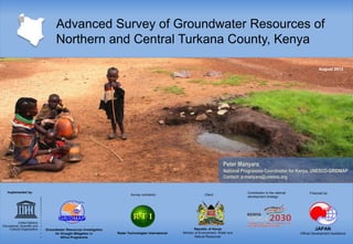
The document summarizes an advanced survey of groundwater resources conducted in northern and central Turkana County, Kenya from July 2012 to June 2013. The survey was implemented by UNESCO's Groundwater Resources Investigation for Drought Mitigation in Africa Programme (GRIDMAP) and conducted by Radar Technologies International. The objectives were to assess groundwater potential and identify new resources. Methodologies included remote sensing, geophysical surveys, and modeling. Results identified over 3 billion cubic meters of annual recharge and 250 billion cubic meters of storage. Priority areas like Lodwar were found to have significant groundwater endowments. Recommendations included further research, drilling capacity building, short-term projects, and aquifer management.
The first phase of the Northern Collector Water Tunnel project is located along the eastern fringes of the Aberdare Conservation area approximately 60 kilometer north of Nairobi county.
The works are located in Kangema and Kigumo sub counties of Murang'a county
Phase 1 of the Development Plan of International Navigation on the Lancang-Mekong River (LMDP) aims to improve navigation in the Mekong mainstream from the Golden Triangle to Luang Prabang. Projects include the development of three cargo ports at Xiengkok, Pak Beng and Luang Prabang in Laos; the improvement and maintenance of 146 rapids and shoals; and the construction of four emergency response and rescue ships and 1199 aids to navigation.
ICEM has received grant funding from the Critical Ecosystems Partnership Fund (CEPF) to conduct the Environmental Study of the LMDP from the Golden Triangle to Luang Prabang. This study aims to engage riparian communities, MRC member countries and local government in an exploration of the potential environmental impacts of the LMDP, and to support Mekong countries in ensuring that potential impacts of the LMDP are managed through appropriate enhancement and mitigation measures.
Implementation of the study includes key issues for biodiversity and navigation development; trends in the key issues without the LMDP; impacts of the LMDP on each of these trends; and risks to be avoided or mitigated and benefits to be enhanced.
This presentation was delivered by ICEM Director General, Dr Jeremy Carew-Reid, at the Lancang - Mekong Environmental Study Workshop that took place at the 2016 Greater Mekong Forum on Water, Food and Energy.
This presentation was delivered on the 10th of December 2018 in Vientiane by Jeremy-Carew-Reid at the MRC final stakeholder workshop as part of the Environmental Study of the Lancang-Mekong Development Plan (LMDP) project.
The Third Workshop for the LCWA's Conceptual Restoration Plan was held at the Seal Beach Senior Center on May 10th 2012. These slides are from the presentation of that evening.
Phase 1 of the Development Plan of International Navigation on the Lancang-Mekong River (LMDP) aims to improve navigation in the Mekong mainstream from the Golden Triangle to Luang Prabang.
Projects include the development of three cargo ports at Xiengkok, Pak Beng and Luang Prabang in Laos; the improvement and maintenance of 146 rapids and shoals; and the construction of four emergency response and rescue ships and 1199 aids to navigation.
The environmental study aims to engage riparian communities, MRC member countries and local government in an exploration of the potential environmental impacts of the LMDP, and to support Mekong countries in ensuring that potential impacts of the LMDP are managed through appropriate enhancement and mitigation measures.
Implementation of the study includes:
- Key issues for biodiversity and navigation development
- Trends in the key issues without the LMDP
- Impacts of the LMDP on each of these trends
- Risks to be avoided or mitigated and benefits to be enhanced
This presentation was delivered on the 10th of December 2018 in Vientiane by Peter-John Meynell at the MRC final stakeholder workshop as part of the Environmental Study of the Lancang-Mekong Development Plan (LMDP) project.
The Second Public Workshop for the LCWA's Conceptual Restoration Plan was held at the Aquarium of the Pacific in Long Beach on March 8th, 2012. These are the slides from the presentation at the Aquarium's Honda Theatre.
This is a presentation that was given by Eric Zahn and Taylor Parker of Tidal Influence for the Moffatt & Nichol consulting team in charge of the Conceptual Restoration Design for the Los Cerritos Wetlands Authority. If you have questions or concerns, please email info@tidalinfluence.com
This presentation was delivered on the 10th of December 2018 in Vientiane by Jeremy Carew-Reid at the MRC final stakeholder workshop as part of the Environmental Study of the Lancang-Mekong Development Plan (LMDP) project.
DSD-INT 2017 Bangladesh Delta Plan 2100 - Prediction of Morphological Evoluti...Deltares
Presentation by Zahirul Haque Khan, Division Director Institute of Water Modelling, Bangladesh, at the Symposium Knowledge and Innovation for Decision Making, during Delft Software Days - Edition 2017. Friday, 27 October 2017, Delft.
This a presentation that was given by Eric Zahn and Taylor Parker of Tidal Influence for the Moffatt & Nichol consulting team in charge of the Conceptual Restoration Design for the Los Cerritos Wetlands Authority. If you have questions or concerns, please email info@tidalinfluence.com
By Zahir-ul Haque Khan, Sarafat Hossain Khan, Dr. M. Shah Alam Khan, Farhana Akter Kamal, Nasim Al Azad Khan
Revitalizing the Ganges Coastal Zone Conference
21-23 October 2014, Dhaka, Bangladesh
http://waterandfood.org/ganges-conference/
Integration of the MODFLOW Lak7 package in the FREEWAT GIS modelling environmentMassimiliano Cannata
The MODFLOW Lake Package is integrated into the FREEWAT GIS environment in order to simulate surface water - groundwater interaction using state of the art techniques for numerical simulations, thus allowing the improved consideration of surface water bodies for water resources management. Surface water bodies, both stationary and flowing, can strongly affect groundwater elevations and flow patterns which in turn may affect the qualitative and quantitative state of groundwater resources. With the advancement of numerical simulation techniques and increased model complexity, FREEWAT facilitates the usage of the lake package through existing QGIS tools to edit model layer geometry as well as an intuitive and simple user interface for the specification of constant and time variable lake properties as defined through MODFLOW.
This presentation was given as part of the EPA-funded Catchment Science and Management Course focusing on Integrated Catchment Management, held in June 2015. This course was delivered by RPS Consultants. If you have any queries or comments, or wish to use the material in this presentation, please contact catchments@epa.ie
It is increasingly being recognised internationally that integrated catchment management (ICM) is a useful organising framework for tackling the ongoing challenge of balancing sustainable use and development of our natural resource, against achieving environmental goals. The basic principles of ICM (Williams, 2012) are to:
• Take a holistic and integrated approach to the management of land, biodiversity, water and community resources at the water catchment scale;
• Involve communities in planning and managing their landscapes; and
• Find a balance between resource use and resource conservation
ICM is now well established in Australia, New Zealand, and the United States. In Europe the ICM approach has been proposed as being required to achieve effective water and catchment management, and is the approach being promoted by DEFRA for the UK, where it is called the “Catchment Based Approach” (CaBA). The principles and methodologies behind ICM sit well within the context of the Water Framework Directive with its aims and objectives for good water quality, sustainable development and public participation in water resource management. In Ireland it is proposed that the ICM approach will underlie the work and philosophy in developing and implementing future River Basin Management Plans.
This presentation was delivered by Dr. Jeremy Carew-Reid, Director General of ICEM at the 5th Greater Mekong Subregion Environment Minister's Meeting in Chiang Mai, Thailand from 30 January to 1 February 2018. The presentation demonstrates how green infrastructure can enhance resilience and sustainability in urban areas and across rural landscapes.
This presentation was delivered on the 10th of December 2018 in Vientiane by Peter-John Meynell at the MRC final stakeholder workshop as part of the Environmental Study of the Lancang-Mekong Development Plan (LMDP) project.
Watershed management along the Colorado River - Michael GabaldonYourAlberta
Michael is an Associate Vice-President with AECOM and a presenter at Alberta’s Watershed Management Symposium: Flood and Drought Mitigation. Using the Colorado River and recent flood events in the State of Colorado as backdrops, Michael talked about bringing diverse stakeholders together to create an effective total watershed management plan.
Modeling the Effects of Land Use Change on FloodingAdam Nayak
Due to population growth, urban areas in Oregon have been expanding, leading to increases in impervious surfaces and net losses in wetlands, riparian vegetation, and forestation in the Northwest. Utilizing ArcGIS and NOAA’s C-CAP imagery, this study classifies and analyzes urban land use changes between 1996 and 2010. These findings shed light on the importance of land use management in urban settings and are being used by local watershed councils to advocate for changes within their stream basins.
"Sujalam Consultants" established in year 1998, as proprietary consultants in the field of groundwater exploration, has now grown in terms of expertise and experience as a multidisciplinary in the field of Environment, Engineering, Geology and Mining etc.
We have successfully completed the Reaccreditation of QCI NABET in Categoery A to carry out Geological and Hydro-geological Studies for various developemental activities like Mining, Thermal Power Plants, Township etc,
[Expert Discussion] Advanced Planning Survey by BARC Jedox
The “Advanced Planning Survey 2015”, a recent study by BARC Institute, shows that planning processes that are supported with Excel stand-alone or a combination of different tools are more likely to have problems and take significantly longer. Nonetheless, 90% of all businesses still use Excel for their year-end planning.
Watch our on-demand expert webinar with BARC senior analyst Dr. Christian Fuchs to gain valuable insight from independent market analysts and see the results of the BARC Advanced Planning survey first hand. And see how Jedox’s powerful planning capabilities stack up against the competition.
Klingbeil, R., 2013. Regional Experiences in Managed Aquifer Recharge and Aquifer Storage and Recovery: An Opportunity also for Oman? Presentation at the 3rd Oman Power and Water Summit 2013, Muscat, Oman, 06 May 2013.
https://waterpartnership.org.au/hydrogeology-of-the-dry-zone-central-myanmar-published/
https://waterpartnership.org.au/publications/
https://waterpartnership.org.au/wp-content/uploads/2017/10/Hydrogeology-of-the-Dry-Zone-Central-Myanmar-Summary.pdf
Hydrogeology of the Dry Zone, Central Myanmar
Hydrogeology of the Dry Zone – Central Myanmar, is a major study by Dr Leonard Drury, prepared with assistance from the Ministry of Agriculture, Livestock and Irrigation (MOALI). The study revises and updates hydrogeological surveys and a drilling program begun in the late 1970s to mid-1980s. It represents an understanding of the groundwater resources of the Dry Zone based on decades of experience from hydrogeologists from Myanmar and Dr Drury’s extensive international experience (read full summary).
Download Book: Hydrogeology of the Dry Zone, Central Myanmar 118mb
Acknowledgements
This report has been prepared by Dr Len Drury, Aqua Rock Konsultants, with assistance from the Groundwater Division, Irrigation
and Water Utilization Management Department (IWUMD) of the Ministry of Agriculture, Livestock and Irrigation (MOALI).
The figures and maps were digitised by International Centre Environmental Management (ICEM). The text was peer reviewed by
the International Water Management Institute (IWMI).
The author is grateful to colleagues (active and retired) from the Rural Water Supply Division (RWSD) of the Agricultural
Mechanisation Department (AMD) and IWUMD, other government departments, universities, city and township development
committees, Non-Government Organisations, and consulting companies who readily provided their hydrogeological reports
and databases. Special thanks to Deputy Director General U Tin Maung Aye Htoo, Director U Htay Lwin, and Assistant Director
U Than Zaw (IWUMD) whose professionalism and enthusiasm was outstanding; and U Myint Thein, Hydrogeological Advisor
to the National Water Resources Committee (NWRC) – Advisory Group, who facilitated meetings and gave valuable input.
Research Interests: Hydrogeology, Myanmar, Dry Zone, and central myanmar
8. E&S Hydro Advisory Program: Advancing sustainability in the hydropower sectorEthical Sector
On 19/20 March, two biodiversity, business and human rights events were organised by MCRB in Yangon: a multistakeholder consultation on the draft Briefing Paper, and a training session conducted by a number of international experts on biodiversity and environmental impact assessment (EIA) for around 70 representatives from companies, particularly EIA consultancies.
Read more: http://www.myanmar-responsiblebusiness.org/news/reinforcing-connections.html
Presented by IWMI's Luna Bharati, Senior Researcher-Hydrology Water Resources, at a high level policy dialog held in Kathmandu, Nepal, on April 27, 2016.
Villholth, K., Klingbeil, R., Ruz Vargas, C., et al., 2020. Assessing Groundwater Quality: A Global Perspective. Importance, methods and potential data sources. Presentation at the SADC 3rd Groundwater Conference, 24-26 Nov 2020.
Contribution to the Paleontology, Stratigraphy and Paleogeography of Ninety-seven Southern Tethyan Agglutinated Foraminiferal Species
Integrated Geophysical and Geospatial Approaches for Delineating Groundwater Potential Zones in Karachi, Pakistan
Evaluation of Wellbore Stability by Analytical and Numerical Methods: A Case Study in a Carbonate Oil Field
Assessment of Pollution and Identification of Sources of Heavy Metals, and Radionuclides Contamination in Sand along the Southern Part of the Cameroonian Coast (South-West, Africa)
International Journal of Computational Engineering Research(IJCER) is an intentional online Journal in English monthly publishing journal. This Journal publish original research work that contributes significantly to further the scientific knowledge in engineering and Technology.
II WORKSHOP INTERNACIONAL: GESTÃO SUSTENTÁVEL DE RECURSOS HÍDRICOS NA AGRICULTURA IRRIGADA:
Pesquisa, Políticas Públicas, Extensão Rural e Participação dos Agricultores do Nebraska, USA e do Oeste da Bahia, Brasil
AUDITÓRIO AIBA - BARREIRAS, BA
Similar to Advanced Survey of Groundwater Resources of Northern and Central Turkana County, Kenya (20)
Knowledge management has recently attracted much attention as a platform to achieving sustainable water resource management. Knowledge Management comprises a range of practices used by organizations to identify, create, represent, and distribute knowledge for productive gain. Knowledge management is the capabilities by which organization and players within defined localities capture the knowledge that is critical to them, constantly improve it and make it available in the most effective manner to those who need it, so that they can exploit it creatively to add value as a normal part of their routine work.
Key Trends Shaping the Future of Infrastructure.pdfCheryl Hung
Keynote at DIGIT West Expo, Glasgow on 29 May 2024.
Cheryl Hung, ochery.com
Sr Director, Infrastructure Ecosystem, Arm.
The key trends across hardware, cloud and open-source; exploring how these areas are likely to mature and develop over the short and long-term, and then considering how organisations can position themselves to adapt and thrive.
UiPath Test Automation using UiPath Test Suite series, part 4DianaGray10
Welcome to UiPath Test Automation using UiPath Test Suite series part 4. In this session, we will cover Test Manager overview along with SAP heatmap.
The UiPath Test Manager overview with SAP heatmap webinar offers a concise yet comprehensive exploration of the role of a Test Manager within SAP environments, coupled with the utilization of heatmaps for effective testing strategies.
Participants will gain insights into the responsibilities, challenges, and best practices associated with test management in SAP projects. Additionally, the webinar delves into the significance of heatmaps as a visual aid for identifying testing priorities, areas of risk, and resource allocation within SAP landscapes. Through this session, attendees can expect to enhance their understanding of test management principles while learning practical approaches to optimize testing processes in SAP environments using heatmap visualization techniques
What will you get from this session?
1. Insights into SAP testing best practices
2. Heatmap utilization for testing
3. Optimization of testing processes
4. Demo
Topics covered:
Execution from the test manager
Orchestrator execution result
Defect reporting
SAP heatmap example with demo
Speaker:
Deepak Rai, Automation Practice Lead, Boundaryless Group and UiPath MVP
JMeter webinar - integration with InfluxDB and GrafanaRTTS
Watch this recorded webinar about real-time monitoring of application performance. See how to integrate Apache JMeter, the open-source leader in performance testing, with InfluxDB, the open-source time-series database, and Grafana, the open-source analytics and visualization application.
In this webinar, we will review the benefits of leveraging InfluxDB and Grafana when executing load tests and demonstrate how these tools are used to visualize performance metrics.
Length: 30 minutes
Session Overview
-------------------------------------------
During this webinar, we will cover the following topics while demonstrating the integrations of JMeter, InfluxDB and Grafana:
- What out-of-the-box solutions are available for real-time monitoring JMeter tests?
- What are the benefits of integrating InfluxDB and Grafana into the load testing stack?
- Which features are provided by Grafana?
- Demonstration of InfluxDB and Grafana using a practice web application
To view the webinar recording, go to:
https://www.rttsweb.com/jmeter-integration-webinar
Epistemic Interaction - tuning interfaces to provide information for AI supportAlan Dix
Paper presented at SYNERGY workshop at AVI 2024, Genoa, Italy. 3rd June 2024
https://alandix.com/academic/papers/synergy2024-epistemic/
As machine learning integrates deeper into human-computer interactions, the concept of epistemic interaction emerges, aiming to refine these interactions to enhance system adaptability. This approach encourages minor, intentional adjustments in user behaviour to enrich the data available for system learning. This paper introduces epistemic interaction within the context of human-system communication, illustrating how deliberate interaction design can improve system understanding and adaptation. Through concrete examples, we demonstrate the potential of epistemic interaction to significantly advance human-computer interaction by leveraging intuitive human communication strategies to inform system design and functionality, offering a novel pathway for enriching user-system engagements.
Elevating Tactical DDD Patterns Through Object CalisthenicsDorra BARTAGUIZ
After immersing yourself in the blue book and its red counterpart, attending DDD-focused conferences, and applying tactical patterns, you're left with a crucial question: How do I ensure my design is effective? Tactical patterns within Domain-Driven Design (DDD) serve as guiding principles for creating clear and manageable domain models. However, achieving success with these patterns requires additional guidance. Interestingly, we've observed that a set of constraints initially designed for training purposes remarkably aligns with effective pattern implementation, offering a more ‘mechanical’ approach. Let's explore together how Object Calisthenics can elevate the design of your tactical DDD patterns, offering concrete help for those venturing into DDD for the first time!
DevOps and Testing slides at DASA ConnectKari Kakkonen
My and Rik Marselis slides at 30.5.2024 DASA Connect conference. We discuss about what is testing, then what is agile testing and finally what is Testing in DevOps. Finally we had lovely workshop with the participants trying to find out different ways to think about quality and testing in different parts of the DevOps infinity loop.
Builder.ai Founder Sachin Dev Duggal's Strategic Approach to Create an Innova...Ramesh Iyer
In today's fast-changing business world, Companies that adapt and embrace new ideas often need help to keep up with the competition. However, fostering a culture of innovation takes much work. It takes vision, leadership and willingness to take risks in the right proportion. Sachin Dev Duggal, co-founder of Builder.ai, has perfected the art of this balance, creating a company culture where creativity and growth are nurtured at each stage.
UiPath Test Automation using UiPath Test Suite series, part 3DianaGray10
Welcome to UiPath Test Automation using UiPath Test Suite series part 3. In this session, we will cover desktop automation along with UI automation.
Topics covered:
UI automation Introduction,
UI automation Sample
Desktop automation flow
Pradeep Chinnala, Senior Consultant Automation Developer @WonderBotz and UiPath MVP
Deepak Rai, Automation Practice Lead, Boundaryless Group and UiPath MVP
Transcript: Selling digital books in 2024: Insights from industry leaders - T...BookNet Canada
The publishing industry has been selling digital audiobooks and ebooks for over a decade and has found its groove. What’s changed? What has stayed the same? Where do we go from here? Join a group of leading sales peers from across the industry for a conversation about the lessons learned since the popularization of digital books, best practices, digital book supply chain management, and more.
Link to video recording: https://bnctechforum.ca/sessions/selling-digital-books-in-2024-insights-from-industry-leaders/
Presented by BookNet Canada on May 28, 2024, with support from the Department of Canadian Heritage.
GraphRAG is All You need? LLM & Knowledge GraphGuy Korland
Guy Korland, CEO and Co-founder of FalkorDB, will review two articles on the integration of language models with knowledge graphs.
1. Unifying Large Language Models and Knowledge Graphs: A Roadmap.
https://arxiv.org/abs/2306.08302
2. Microsoft Research's GraphRAG paper and a review paper on various uses of knowledge graphs:
https://www.microsoft.com/en-us/research/blog/graphrag-unlocking-llm-discovery-on-narrative-private-data/
Connector Corner: Automate dynamic content and events by pushing a buttonDianaGray10
Here is something new! In our next Connector Corner webinar, we will demonstrate how you can use a single workflow to:
Create a campaign using Mailchimp with merge tags/fields
Send an interactive Slack channel message (using buttons)
Have the message received by managers and peers along with a test email for review
But there’s more:
In a second workflow supporting the same use case, you’ll see:
Your campaign sent to target colleagues for approval
If the “Approve” button is clicked, a Jira/Zendesk ticket is created for the marketing design team
But—if the “Reject” button is pushed, colleagues will be alerted via Slack message
Join us to learn more about this new, human-in-the-loop capability, brought to you by Integration Service connectors.
And...
Speakers:
Akshay Agnihotri, Product Manager
Charlie Greenberg, Host
Dev Dives: Train smarter, not harder – active learning and UiPath LLMs for do...UiPathCommunity
💥 Speed, accuracy, and scaling – discover the superpowers of GenAI in action with UiPath Document Understanding and Communications Mining™:
See how to accelerate model training and optimize model performance with active learning
Learn about the latest enhancements to out-of-the-box document processing – with little to no training required
Get an exclusive demo of the new family of UiPath LLMs – GenAI models specialized for processing different types of documents and messages
This is a hands-on session specifically designed for automation developers and AI enthusiasts seeking to enhance their knowledge in leveraging the latest intelligent document processing capabilities offered by UiPath.
Speakers:
👨🏫 Andras Palfi, Senior Product Manager, UiPath
👩🏫 Lenka Dulovicova, Product Program Manager, UiPath
Encryption in Microsoft 365 - ExpertsLive Netherlands 2024Albert Hoitingh
In this session I delve into the encryption technology used in Microsoft 365 and Microsoft Purview. Including the concepts of Customer Key and Double Key Encryption.
Accelerate your Kubernetes clusters with Varnish CachingThijs Feryn
A presentation about the usage and availability of Varnish on Kubernetes. This talk explores the capabilities of Varnish caching and shows how to use the Varnish Helm chart to deploy it to Kubernetes.
This presentation was delivered at K8SUG Singapore. See https://feryn.eu/presentations/accelerate-your-kubernetes-clusters-with-varnish-caching-k8sug-singapore-28-2024 for more details.
2. Table of Contents
• About UNESCO & IHP
• The Turkana Groundwater Survey and Mapping
–
–
–
–
–
–
–
Overview
Objectives
Methodology
Validation
Results and findings
Recommendations
Survey outputs
• UN IYWC 2013
3. ABOUT UNESCO
•
Established in 1945, the United Nations Educational, Scientific and Cultural Organization
(UNESCO) contributes to peace and security by promoting international collaboration through
education, science, and culture.
UNESCO strives to build networks among nations that enable this kind of solidarity, by:
•
Mobilizing for education: access; quality; rights; development.
•
Building intercultural understanding: cultural diversity; World Heritage
•
Pursuing scientific cooperation: early warning systems; trans-boundary waters; relations
•
Protecting freedom of expression: condition for democracy, development and human dignity.
4. UNESCO-IHP
The International Hydrological Programme (IHP)
•
•
The only intergovernmental programme of the UN system devoted to water research, water
resources management, and education and capacity building; Tailored to States’ needs
it is implemented in six-year phases – allowing it to adapt to a rapidly changing world.
IHP-VII: Water Dependencies: Systems under Stress and Societal Responses (2008-2013)
•
This phase continued to lead international hydrological research, facilitate education and capacity
development and enhance governance in water management towards meeting the UN MDGs on
environmental sustainability, water supply, sanitation, food security and poverty alleviation.
IHP-VIII: Water Security: Responses to Local, Regional, and Global Challenges (2014-2021)
•
The new phase follows the Millennium Development Goals (MDGs) era and envisions new
challenges to be set in the SDGs. During its eighth phase, IHP aims to improve water security in
response to local, regional, and global challenges.
5. IHP-VIII, 2014–2021
In response to the priorities and needs of Member States, IHP-VIII focuses on six knowledge
areas, translated into themes:
6. IHP-VIII, 2014–2021
THEME 2: GROUNDWATER IN A CHANGING ENVIRONMENT
•
Focal Area 2.1 - Enhancing sustainable groundwater resources management
•
Focal Area 2.2 - Addressing strategies for management of aquifers recharge
•
Focal Area 2.3 - Adapting to the impacts of climate change on aquifer systems
•
Focal Area 2.4 - Promoting groundwater quality protection
•
Focal Area 2.5 - Promoting management of transboundary aquifers
7. IHP PROGRAMMES
CROSS-CUTTING PROGRAMMES AND INITIATIVES
•
•
•
•
•
•
•
•
•
•
•
•
•
HELP: Hydrology for the Environment, Life, and Policy
FRIEND: Flow Regimes from International Experimental and Network Data
GRAPHIC: Groundwater Resources Assessment under the Pressures of Humanity and Climate Change
G-WADI: Global Network on Water and Development Information in Arid Lands
IDI: International Drought Initiative
IFI: International Flood Initiative
ISARM: Internationally Shared Aquifer Resources Management
ISI: International Sediment Initiative
JIIHP: UNESCO-IAEA Joint International Isotope Hydrology Programme
PC-CP: Water for Peace: From Potential Conflicts to Cooperation Potential
UWMP: Urban Water Management Programme
International Knowledge, Research, and Policy Initiative on Water Quality
WHYMAP: World Hydrogeological Map
8. Advanced Survey of Groundwater
Resources of Northern and Central
Turkana County, Kenya
9. OVERVIEW
Target area
Beneficiary
Executioner
Budget
Donor
Duration
Contractor
National framework
Regional frameworks
Parent Project
Scientific review
Northern and central Turkana County
Ministry of Environment, Water and Natural Resources
UNESCO
$700,000 ($150,000 for exploratory drilling)
Japan (Official Development Assistance)
July 2012 – June 2013
Radar Technologies International (RTI)
Kenya Vision 2030
GRIDMAP, IGAD
Strengthening capacity to combat drought and famine in the
Horn of Africa (Ethiopia, Kenya, Somalia), $1.5 million
Technical Scientific Committee (Kenya)
10. OBJECTIVES
1. To survey and assess the groundwater potential of North-central Turkana County
2. To identify and assess a maximum quantity of new clean groundwater resources
for populations, with particular focus on Lodwar, Lokichogio, and Kakuma
3. To assess the potential of groundwater for development, with a focus on both
shallow and deep structures
Lokichogio
36,000 km2
Kakuma
Lodwar
14. METHODOLOGY
WATEX Shallow Aquifer Groundwater Occurrence Model (SAGOM):
Classifying shallow groundwater (0-80 m)
Light blue
30% probability of aquifer presence if
combined with a conductive fracture.
Green
25% probability of groundwater
occurrence, located over hills and
mountains. Wells in these pixels should
only be drilled with the presence of a
conductive fracture
Black / dark
0-5%, minimal occurrence potential, likely
to be dry or have little potential for
groundwater occurrence.
6.25 m
75% probability of aquifer presence if
combined with a conductive fracture.
Negative
Negative
Negative
Positive
6.25 m
Red
Minimum of 90%. These pixels represent
fracture discharges in alluvial sediments,
or pure alluvial aquifers.
Negative
Negative
Negative
Negative
Positive
Positive
6.25 m
Yellow
Occurrence potential at location
Negative
Negative
Positive
Positive
Positive
6.25 m
Pixel Color
Pixel resolution (39 m2)
Negative
Negative
Positive
Positive
Positive
6.25 m
Groundwater potential color coding
Positive
Positive
Positive
Positive
Positive
6.25 m
6.25 m
6.25 m
6.25 m
6.25 m
15. Mapping shallow groundwater (0-80 m)
METHODOLOGY
WATEX fracture mapping and classification
WATEX Landsat and SRTM
processing for fractures
WATEX Fracture classification,
Conductive (yellow), non-conductive (blue)
16. Mapping shallow groundwater (0-80 m)
METHODOLOGY
WATEX Deep Aquifer Model (DAM):
Inferring deep-seated aquifers (100 - 3000 m)
Interpretation of gravimetric data
Interpretation of seismic data
17. Mapping shallow groundwater (0-80 m)
METHODOLOGY
WATEX Deep Aquifer Model (DAM):
Inferring deep-seated aquifers (100 - 3000 m)
Regional deep aquifers
Lotikipi Aquifer (330m)
Lodwar Aquifer (126m)
18. MODEL VALIDATION
WATEX accuracy level in Turkana: > 94% for shallow alluvial groundwater occurrence
UNESCO Validation Results
19. RESULTS & FINDINGS
Total Groundwater Resources in Northern-central Turkana County
Aquifer regime
Est. Recharge
(MCM / yr)
Est. Storage
Capacity (MCM)
Shallow alluvial systems (0-100 m)
2,085
2,085*
Deep-seated systems (100-800 m)
1,362
248,250
3,447
250,335
* In absence of localized data at the regional scale, a conservative estimate for the cumulative storage capacity
of shallow alluvial assumes the same amount of annual recharge
20. RESULTS & FINDINGS
Deep-seated Aquifer Systems in Northern-central Turkana County
Aquifer system
Recharge
Storage
(MCM/yr)
capacity
(MCM)
(1) Lotikipi Basin
1,200
207,500
(2) Lodwar Basin
-*
10,000
(3) Gatome Half-graben
61
17,250
(4) Nakalale Half-graben
59
7,000
(5) Kachoda Half-graben
21
6,500
1,362
248,250
Total
* Estimate for recharge of Lodwar Aquifer is not given due to insufficient data on Turkwel River recharge dynamics.
21. RESULTS & FINDINGS
Groundwater Potentials for Priority Areas in Northern-central Turkana County
Lodwar
Kakuma
Lokichogio
•
•
•
Groundwater
potential (1,292
MCM per year)
•
•
•
No seasonal
groundwater level
variation in the
boreholes below
alluvial deposits
•
Endowed with the
deep Lodwar Basin
Aquifer (10 BCM)
•
Groundwater potential,
within 10km2, (51 million
m3/year
Current water withdrawals
only 2.5% of available
groundwater
Best options for shallow
boreholes (<100 meters) is
to drill within the fracture
corridor of the Tarash River
identified by the study
Located 25 km south of the
southern portion of Lotikipi
Basin Aquifer
•
•
•
Groundwater potential,
(107 million m3/year)
Few viable options
available within 10 km
of town
Located 25 km west of
the western portion of
Lotikipi Basin Aquifer
22. RECOMMENDATIONS
Survey tools and maps
•
•
Research
•
•
•
•
Drilling capacities
•
•
•
The Government of Kenya should take measures to ensure the dissemination
of information and tools to stakeholders.
GOK, UNESCO and other partners should expand and build the cadre of
skilled professionals who can utilize the survey tools.
Kenyan government and its affiliated research institutions should conduct
additional studies in order to achieve a more comprehensive understanding
of these resources and their full potential and vulnerabilities.
Expand the WATEX study approach to the rest of Turkana and Kenya in
order to benefit other regions. Turkana can be a model for other counties.
Study socio-economic potential of groundwater, particularly deep aquifers
Continue hydrogeological research and modeling of deep structures,
including the exploration of the un-confirmed structures, and more boreholes
on the confirmed aquifers.
The skills/capacity of the drilling industry is inadequate for carrying out
reliable and sound exploratory drilling.
A major campaign should be launched to build the capacity of the industry as
a whole, and reduce the inefficiencies in the market.
It is important if the Government can acquire specialized drilling equipment
for exploratory drilling of scientific boreholes.
23. RECOMMENDATIONS
Short term projects
•
•
Aquifer management
•
•
•
Develop exploratory boreholes (Lotikipi and Lodwar) to be able to provide
immediate water supply to local communities.
Drill up to 200-500 shallow alluvial boreholes in high-potential areas identified
by this survey.
Kenyan authorities should establish a limit on abstraction rates for both the
Lotikipi and Lodwar Aquifers. WRMA can establish the rates for abstraction
for both normal and emergency situations.
Kenyan authorities are recommended to undertake aquifer zoning and
gazette adjacent land to protect the aquifers from harmful activities.
Establish a modern aquifer monitoring system to monitor the Lotikipi and
Lodwar aquifers.
24. SURVEY OUTPUTS
Full Technical Report
(August 2013)
High Potential Groundwater Target Map;
Groundwater Recharge Map;
Soil and Vegetation Map (1:200,000)
GIS Database of
groundwater resources
RADAR TECHNOLOGIES
INTERNATIONAL
!
Technical Field Manual for
Groundwater Targeting
NORTHERN-CENTRAL TURKANA COUNTY
Groundwater Exploration
Navigation System (GENS)
Technical field manual for
groundwater targeting
Practical field training
25. UN IYWC 2013
UN International Year of Water Cooperation 2013
•
Aims at raising awareness about opportunities in water cooperation.
•
UNESCO was officially designated by UN-Water to lead the preparations for this IY in 2013.
•
Water cooperation: has multiple dimensions including cultural, educational, scientific, religious,
ethical, social, political, legal, institutional and economic aspects.
•
A multidisciplinary approach is essential to grasp the many facets implied in the concept and
to blend such parts into a holistic vision.
•
A common understanding of what the needs and challenges are around water is required in order
for water cooperation to be successful and long-lasting: building a shared consensus
•
Participation from a wide range of parties including NGOs, IOs, UN Agencies, National and
Regional Institutions, and Academia among others is expected and encouraged.