The document summarizes the Tysons Metrorail Station Access Management Study (TMSAMS) which was initiated in 2009 to identify and prioritize improvements to access the four metro stations in Tysons Corner via bus, bicycle, and pedestrian infrastructure. Through an advisory group and extensive public outreach, the study identified top priority locations for sidewalk, crosswalk, trail, and bicycle facility improvements to better connect the surrounding areas to the metro stations.
Innovation North-Side Neighborhood Access Feasibility StudyFairfax County
This document summarizes a feasibility study for a shared-use path connecting two neighborhoods to a future Metro station in Fairfax County, Virginia. It evaluates three alternatives for the path, with estimated costs ranging from $1.6 million to $6.6 million. It also discusses establishing a residential parking permit district to address potential parking impacts once the path and station open. The path would be 10 feet wide and made of concrete to accommodate pedestrians and bicyclists between the station and two neighborhoods.
Guideline and Recommended Standard for Geofoam ApplicationsJulio Mejia Alcocer
This document provides a summary of a guideline and recommended standard for using geofoam (expanded polystyrene foam) in highway embankments. The guideline was developed through a cooperative research project between the American Association of State Highway and Transportation Officials and the Transportation Research Board. The guideline contains recommendations for the design, construction, and quality assurance of geofoam applications in highway embankments. It is intended to help highway engineers and owners properly and safely implement geofoam technologies.
Transportation Funding Discussion: Board Retreat 2012Fairfax County
The document summarizes discussions from a Department of Transportation board retreat regarding transportation funding needs and plans. It finds a $5.3 billion funding deficit for needed projects over 10 years. It outlines 3 tiers of prioritized projects and examples from each tier. It proposes a framework for the next 4-year transportation plan and discusses options to help address funding shortfalls.
Ray freeman aus mtn bike tourism conference presentation - critical success...Ray Freeman
Mountain Bike Tourism and Community Development in British Columbia, Canada:Critical Success Factorsfor the Future. A presentation for the 5th Australian Cycle Tourism Conference, Canberra, February 2nd, 2012.
Transportation Alternatives Public Meeting: Sept. 14, 2017Fairfax County
This document summarizes a public meeting held by the Fairfax County Department of Transportation regarding Transportation Alternatives funding. It provides an overview of the Transportation Alternatives Set-Aside program and eligible project activities like sidewalks, bike lanes, and trails. It also outlines Fairfax County's proposed projects for funding in fiscal years 2019-2020, and provides contact information for public input on project recommendations or comments.
Fairfax Center Area Study Kickoff Open HouseFairfax County
This document summarizes an open house for a study of land use and development in the Fairfax Center area. It outlines the study's process and timeline. The study will examine "transition areas" of existing low-density neighborhoods over the next year, and then focus on the "Suburban Center" core and broader guidance over 18-24 months. The goal is to understand current conditions and opportunities to guide the area's development over the next 20 years.
The Fairfax County Department of Planning and Zoning conducted an evaluation of its 2011 Area Plans Review process and received feedback that it should maintain a systematic approach while expanding community involvement and promoting a more logical and flexible review. This led to the development of the 2012 Fairfax Forward initiative to find alternative means to manage comprehensive planning through increased public outreach and engagement as well as an updated land use classification system and concept map.
A Special Working Group was tasked with developing land use recommendations for Opportunity Area C in Seven Corners, as the previous Land Use Task Force did not reach consensus. The SWG created three initial draft concepts for review by the public from December 9, 2014 to January 4, 2015. The concepts - Aerie, The Hollows, and Village at Craftsman Heights - provide different master plan approaches for redeveloping the 6 parcels that make up Opportunity Area C near Baileys Upper Elementary School. Public feedback will help the SWG refine their recommendations for the county.
This document discusses various prized fish species found in the Chesapeake Bay, festivals and events celebrating the Bay's culture and ecology, and conservation efforts to protect the Bay and its wildlife. Key fish highlighted include striped bass, blue crab, and sturgeon. Festivals in Maryland and Virginia celebrate the Bay's heritage through food, music, and arts. Groups work to reduce pollution from animal waste that contributes to dead zones in the Bay.
Comprehensive Plan Amendment Work Program Process (March 22, 2017)Fairfax County
The current and the proposed changes to the Comprehensive Plan Amendment Work Program process are explained. This presentation describes:
• Why the county amends the plan
• What is the current process
• What was learned from the evaluation of the process
• What was the outcome of that evaluation?
The Comprehensive Plan is Fairfax County’s policy guide for making land use decisions and is amended on a regular basis to ensure that its goals and objectives support sound land used decision making.
The document summarizes a project to evaluate the sanitary and storm sewer systems in the Bennett Area of Toledo, Ohio. The project aims to eliminate sanitary sewer overflows, reduce basement backups, and maintain sewer infrastructure. It will involve flow monitoring, inspecting sewer structures, smoke and dye testing, sump pump monitoring, CCTV of sewers, hydraulic modeling, and recommendations for improvements. Public meetings are being held to inform residents and get feedback through questionnaires. Work may occur on public and private property.
Great Passage Storm Sewer Improvement ProjectFairfax County
This project improved drainage and reduced flood potential in a Fairfax County community. It installed a headwall, yard inlet, and pedestrian bridge with handrails to increase water flow into the storm sewer system. The project cleared land, excavated, installed structures, widened a swale, added landscaping and restored the site with native plants. It was completed in May 2014 by a project team from the county's Maintenance and Stormwater Management and Utilities Design and Construction divisions.
Storm drain markers were installed in downtown Monroe, NC by students to educate the public that drains empty into local waterways and not treatment plants. Students learned about protecting water quality while helping beautify their community through this project. The city of Monroe thanks the participating students and supervising parents for their work in storm drain marking.
Este documento presenta el Plan Parcial de Desarrollo Urbano del Distrito Urbano 10 en Puerto Vallarta, Jalisco. El plan evalúa las condiciones actuales del área de estudio, incluyendo factores físicos, socioeconómicos y legales. Propone una estrategia de desarrollo urbano que incluye la clasificación de áreas, zonificación secundaria, y acciones de conservación, mejoramiento y crecimiento. El objetivo general es regular el desarrollo urbano del distrito de acuerdo a la normativ
This document provides an overview of storm sewer and culvert solutions presented in a webinar by Armtec Infrastructure Inc. It discusses flexible pipe materials like corrugated HDPE and steel-reinforced HDPE pipes. HDPE pipes are lightweight with uniform pressure distribution and lower bearing pressure than rigid pipes. Corrugated steel pipes discussed include helical-locked Hel-Cor pipes and spiral-ribbed Ultra-Flo pipes available in various diameters, thicknesses, and coatings. The document also outlines Armtec as a provider of drainage engineering support and design-build services for infrastructure projects.
Clogged storm drains are contributing to street flooding in Miami BeachVolunteerCleanup.Org
Weekly trash cleanups in the canal led to a significant discovery - Clogged Storm Drains are contributing to street flooding in Miami Beach. Trash comes from the street level into storm drains. Trash that makes it past ‘traps’ discharge to the waterway and clog the outlet.
4 Simple Solutions :
1) Reduce litter with proper placement of trash cans - “can on every corner”
2) Street level gratings that keep material from going into the drains, while allowing full flow of storm water. Watch in action : http://youtu.be/ezdqgPX8AWw
3) Better cleaning schedule of existing storm drain traps/interceptors (which catch debris)
4) ‘Catch bin’ at the water output (flexible net style)
The document discusses various structural and non-structural stormwater best management practices (BMPs). It describes structural BMPs like biofilters, detention basins, infiltration trenches, media filters, porous pavement, retention ponds, wetland basins, and hydrodynamic devices. It also discusses non-structural BMPs that focus on public education, illicit discharge detection and elimination, construction site runoff control, and pollution prevention through activities like proper waste disposal and landscape management.
In 2014 Todd Wacome delivered this presentation at the Portland Oregon StormCon. The talk focused around stormwater treatment issues and the unveiling of novel approach to stormwater filtration at the catch basin level.
Marketing Public Health Through Social MediaAngela Connor
The document discusses using social media to promote public health. It notes that over 65% of adult internet users use social media, as do 80% of teens. Social media can help public health organizations achieve goals like behavior change, raising awareness, and educating on unknown topics. The document provides tips for social media success, including listening to audiences, finding the right audiences, engaging audiences through education and real dialogue, and using visual content and advertising. Examples are given of organizations successfully using social media for public health purposes.
San Elijo Hills Drainage Diversion storm drain line ‘n’ 1talerco
A fire hydrant was knocked over, spilling over 90,000 gallons of water into a storm drain line over 21 minutes. This caused erosion and transported sediment and rocks downstream. Photos show the progression of erosion over time from the initial incident and subsequent rains, including a boulder being toppled over. The temporary fix of adding rocks to an eroded area was deemed insufficient and exposed more land to erosion.
Lecture notes of Environmental Engineering-II as per Solapur university syllabus of TE CIVIL.
Prepared by
Prof S S Jahagirdar,
Associate Professor,
N K Orchid college of Engg and Technology,
Solapur
The document summarizes a case study of the SMART Tunnel in Kuala Lumpur, Malaysia. The 9.7km stormwater and motorway tunnel project was a joint venture that cost RM1887 million. The tunnel diverts large volumes of flood water via holding ponds and a bypass tunnel to reduce flooding in the city center and traffic congestion. It has advanced features like automated flood gates, air quality monitoring, emergency vehicles, and operates in different modes depending on rainfall levels to control stormwater flow and manage traffic.
Reston Network Analysis: Mid-Buildout Results and Roadway Classifications- Ap...Fairfax County
This document summarizes a county transportation study for Reston, Virginia. It outlines the study purpose and process, presents mid-buildout and full-buildout transportation network scenarios for 2030 and 2050, and identifies resulting traffic issues and prioritized improvement projects. Analysis of the mid-buildout scenario in 2030 found 6 intersections expected to operate at the lowest service level, while the full mitigation plan is projected to significantly reduce traffic delays and issues by 2050.
Reston Network Analysis: Community Meeting Tier 1 & Tier 2Fairfax County
The document summarizes a county transportation meeting regarding a network analysis study for Reston, Virginia. It outlines the study purpose and process, which included analyzing the existing street grid, forecasting 2030 and 2050 traffic, and developing multi-tier mitigation recommendations. The first tier involved optimizations like new traffic signals. The second tier included some right-of-way impacts like turn lanes. Seven intersections remained over capacity after second tier mitigation. Next steps include third tier solutions for those intersections and developing a funding plan to implement recommendations over 40 years through public-private partnerships.
Reston Network Analysis: Stakeholder Kick-off Meeting Fairfax County
This document provides an overview of the Reston Network Analysis study being conducted by the Fairfax County Department of Transportation. The study aims to analyze and optimize the conceptual grid of streets planned for the Reston Transit Station Areas to determine road design and accommodate different transportation modes. It will involve collecting data, modeling existing and future traffic conditions, engaging stakeholders, and selecting improvements. The analysis will be conducted over 12 months to refine the street grid and integrate it into the comprehensive plan.
Edge City to Real City. The Transformation of Tysons Corner VA and White Flin...Virtual ULI
The document summarizes plans to transform two suburban areas, Tysons Corner, Virginia and White Flint, Maryland, into more urban, transit-oriented places. For Tysons Corner, the plans include developing a grid of streets, increasing densities around future Metro stations, reducing parking requirements, and adding new housing, offices and retail. For White Flint, the plans envision a denser street grid, mixed-use neighborhoods organized around walking, and active ground-floor retail along new streetscapes. Both aim to create vibrant, sustainable communities centered around new transit connections.
The City of Manitou Springs is planning a creek walk along Fountain Creek, an aspirational goal for over two decades. The question is: how to unite a diverse set of stakeholders with competing interests to agree on a preferred route, that incorporates their values and priorities? The answer was to use geodesign.
Geodesign is a powerful participatory planning method that uses stakeholder input and geospatial analytics to show the possible impact of design scenarios. It gets its strength in two ways: 1) from the diversity of participants—proving the adage that two heads are indeed better than one—and 2) from the power of spatial analytics, which allow the visualization of the world both as it is, and as it could be.
The presentation will focus on how geodesign methods where used to define stakeholder groups, clarify values, and prioritize criteria to help decision makers evaluate planning scenarios. Esri ArcGIS Pro was utilized to develop models—such as bikeability, walkability, ADA compliance, and more—that were used to both visualize and evaluate the impacts of each route segment. The spatial analysis resulted in an innovative solution that addressed both the concerns of both government and public stakeholders.
Attendees of this session will learn how to use geodesign as a systems approach for informed decision-making. More importantly, they will learn how to use spatial technology to guide conversations among diverse stakeholders to come up with plans that people understand and are happy with.
The agenda/presentation slide deck shown during the November 3, 2021 Citizens' Transportation Advisory Committee (CTAC) virtual workshop. The workshop video can be viewed at https://youtu.be/dcT7vz80fhE
Reston Network Analysis: 2030 Results and Roadway ClassificationsFairfax County
This document summarizes the results of a network analysis study for the Reston area of Fairfax County, Virginia conducted to plan for transportation needs through 2030 and 2050. Key findings from the 2050 analysis include 5 intersections still experiencing poor levels of service after mitigation. The top priority projects to address this are identified. The 2030 mid-buildout scenario finds 7 intersections with issues, but these would be addressed by 2050 improvements. Roadway classifications were also determined for different areas based on transportation guidelines. Next steps include additional community meetings and finalizing the report.
The document summarizes Community Meeting #3 for the Cuyahoga Greenways project. It discusses the agenda, introduces the project background and partners. A proposed greenway network for Cuyahoga County is presented, including 120 miles of existing trails and 175 miles of proposed new trails and on-street bike facilities. An evaluation process involving 8 core factors was used to analyze over 300 proposed greenway projects based on criteria like access to parks, habitat, socioeconomics, and transit.
The proposed Morris Williams Trail would connect four schools, four green spaces, Mueller, and three swimming pools in the East MLK area. It would provide a safer alternative route for over 9,000 people compared to the current dangerous streets. The trail would have two segments totaling 1.1 miles and pass through the Mueller, Marlo Heights East, Creekwood, and Springdale Hills neighborhoods. There is 95-97% community support but some opposition from the nearby golf community over security concerns. The Parks Department has provided conditions for the trail including using a firm surface, ADA compliance, fencing, and signage. The total estimated cost is $2.3 million with the City of Austin responsible for construction, contingencies,
The document summarizes a study of sidewalk conditions in the East Kensington neighborhood of Philadelphia. A team of interns surveyed sidewalks and measured damage like cracks, missing sections, and vegetation overgrowth. They prioritized repairs based on proximity to schools, parks, transit stations, and businesses. The goal was to assess sidewalk needs and provide a repair plan to improve safety and accessibility for residents of all ages and abilities.
On March 2015, the City of Summit initiated a Feasibility Study on the vision of converting the abandoned Rahway Valley Railroad into a rail trail more commonly referred to as the Summit Parkline. The Study develops feasible and economical concepts for a 1.2-mile trail and linear park on the existing railroad right-of-way. The Summit Parkline is a unique opportunity for the City to create a recreational amenity that has potential to be a major local and regional attraction and character-giving symbol for the community.
Do not include any personal information as all posted material on this site is considered to be part of a public record as defined by section 27 of the Municipal Freedom of Information and Protection of Privacy Act.
We reserve the right to remove inappropriate comments. Please see Terms of Use for City of Toronto Social Media Sites at http://www.toronto.ca/e-updates/termsofuse.htm.
This document summarizes a community meeting for the Northfield-Warrensville Multi-Modal Connectivity Plan. It introduces the project and study area, discusses existing transportation and land use conditions, and identifies key stakeholders. Community input was sought through an online survey. The project aims to improve multi-modal access and connectivity to spur economic development through public agencies, consultants, and input from communities, organizations, and businesses in the area.
Reston Network Analysis: Existing ConditionsFairfax County
This document summarizes an existing conditions analysis and next steps for a transportation network study in Reston, Virginia. It finds that under current conditions, some intersections are already at poor levels of service during peak hours. It also outlines the data collection process, analyzes pedestrian, bicycle, and transit networks, and models future 2030 and 2050 traffic based on planned land development. Next steps include testing a 2050 buildout, evaluating mitigation measures with stakeholders, and conducting more detailed studies of specific locations. The goal is to create a balanced multimodal transportation network that supports planned growth.
In early 2019 Habitat for Humanity in Paterson, NJ contacted the APA-NJ chapter to talk about their need for a team of volunteer planners. They wanted to create a concept for a green space along the Passaic River in the Northside Neighborhood of Paterson, NJ. They wanted two types of green space; a walkway along the river, called Riverwalk, and a sports fields in an area along the river dominated by abandoned and marginal industrial and residential properties. The Northside Neighborhood is across the Passaic River from Downtown Paterson.
This public event presented design concepts for the preferred trail alignment of the East Don Trail project. Attendees could view panels and presentations about the design concepts and provide feedback. The design concepts were developed by dividing the preferred alignment into segments and considering constraints like topography, trees, and infrastructure. Options were evaluated based on criteria such as environmental impacts, safety, accessibility, and costs. Feedback from the event will be used to select a preliminary preferred design concept.
Reston Network Analysis: Transportation Advisory Commission: July 19, 2016 Fairfax County
This document summarizes a study conducted by the Fairfax County Department of Transportation on the transportation network in Reston, Virginia. The study analyzed the existing transportation conditions and forecasted future conditions in 2030 and 2050. It evaluated a proposed grid of streets and recommended mitigation measures to improve traffic flow. The analysis found that without mitigation, 24 intersections would operate at unacceptable levels of service in 2050. The recommended 1st tier mitigation measures like signal timing optimization and additional turn lanes reduced this to 13 intersections. The 2nd tier measures such as adding through lanes and turn lanes further reduced problems to 10 intersections. The study recommends further analysis of specific intersections and developing a phasing plan for improvements.
Tysons Status Report: Board of Supervisors Community Revitalization and Reinv...Fairfax County
This document provides a status report on the redevelopment of Tysons, Virginia following the adoption of the Tysons Corner Comprehensive Plan Amendment in June 2010. It summarizes 12 rezoning cases submitted for redevelopment within 1/4 mile of new Metro stations. It also describes the establishment of the Tysons Partnership and provides updates on the 20 follow-on motions made by the Board of Supervisors related to transportation infrastructure funding, workforce housing, district names, design guidelines, and staff resources to implement the redevelopment vision for Tysons.
Similar to TMSAMS-Final Public Meeting Presentation: 10-4-2011 (20)
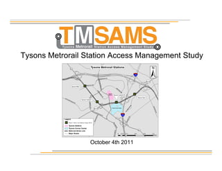
Merrifield Nursery Emergency Gravity Sewer ReplacementFairfax County
During a routine Closed-Circuit Television (CCTV) Camera inspection by Wastewater Collection Division (WCD), it was found that 45 linear feet of 8-inch asbestos reinforced concrete pipe (RCP) between MH-292 to MH-291 was within imminent danger of failing. The bottom of the RCP was missing within the 45 linear feet of repair and the pipe was on the verge of surcharging. After an immediate pre-construction meeting with Merrifield Nursery, it was agreed to work from 6pm-10am everyday of the week to avoid disruption and potentially placing patrons at risk during the biggest time of the year for Merrifield Garden Center. The contractor mobilized to the site and began the 20-foot excavation to replace 45 linear feet of broken gravity sewer. The project started on March 14th, 2022 and was substantially complete on March 23, 2022.
The Sully Basins Stormwater Pond Retrofits project was substantially completed on April 19, 2022. The project is located within the Cub Run watershed. The project consisted of repair and enhancement of multiple stormwater basins, 0326DP, 0964DP and 1484DP. The project also included construction of new stone cascades, stone weir basin structures and the construction of wetlands with high and low marsh areas. The project will facilitate improved sediment removal and improve downstream water quality using forebays and micro pools. Aquatic and natural habitat were also added within the three basins.
Clarks Crossing Road Improvements 05-13-22Fairfax County
This document summarizes a pedestrian access improvement project along Clarks Crossing Road in Fairfax County, Virginia. The project improved pedestrian and bicycle access by constructing a missing link of sidewalk between Brookside Lane and an existing sidewalk further along Clarks Crossing Road. Work included installing sidewalk, curb ramps, drainage improvements, and milling and overlaying asphalt. The project was substantially completed in March 2022 and provides approximately 200 feet of new pedestrian access along Clarks Crossing Road.
Tysons West Wastewater Conveyance Systems Modifications Project 05-22.pptxFairfax County
Future wastewater flows in northern Fairfax County exceed existing system capacity
Treatment capacity is available in Noman M. Cole Jr. Pollution Control Plant in Lorton, VA
New pipes and pumps are needed to move future flows to treatment plant
NEXT STEPS
Field investigations / surveys
Finalize alignments and pump station layout
Use of open cut excavation
Use of trenchless methods
Easement acquisition needed
Develop traffic control plans
Description:
The project consists of a new, 23,000 square feet, two-story, four-bay fire station facility and associated improvements to the 3.3-acre site including storm water detention, landscaping and parking. The scope also included the demolition of the existing fire station, and a temporary fire station to house the Fire and Rescue Department during construction of the new facility. The key elements of the overall project include:
Scotts Run at Old Meadow Road Park Phase I and Phase II Stream RestorationFairfax County
Scotts Run @ Old Meadow Road Stream Restoration was substantially completed on March 30, 2022. The Scotts Run project consisted of restoring, enhancement, and stabilizing of approximately 2,930 linear feet of eroding stream using Natural Channel Design criteria. This project included two phases: Phase I was funded by proffers from a private development and Phase II was County funded. Also included was the removal of invasive non-native plants and the installation of new plantings to stabilize the stream and floodplain.
Sully Community Center Construction ProgressFairfax County
This document provides construction progress photos of the Sully Community Center in Fairfax County, Virginia. The photos show the ongoing construction of the building's exterior, interior spaces like the lobby, corridors, multi-purpose rooms, game room, gym, exercise room, and healthcare suite. The document was published by the Fairfax County Department of Public Works and Environmental Services to share updates on the construction of the new community center, which is scheduled to open in summer 2022.
Riverwood Community Meeting - 04-14-2022- Presentation.pptxFairfax County
The new 4-inch ductile iron force main will serve the surrounding community for the foreseeable future. Replacement of the force main will:
Reduce the level and frequency of maintenance required to keep the force main operating.
Prevent costly emergency repairs.
Provide residents with safe, reliable utility infrastructure.
Enhance the quality of life for residents.
Reduce risks to public health and the environment.
Burke Centre VRE Connector Phase IV project was substantially completed on March 7, 2022. This project enhanced the access to mass transit by creating a more direct connection from the VRE Station to the residential areas west of Premier Court. This project also connects the Oak Bluff community to the Virginia Rail Express (VRE) Burke Station and provides a multi-use shared pedestrian and bicycle trail for outdoor recreation.
Long Branch Public Meeting - FINAL - 04-11-2022Fairfax County
Overarching Project Goals:
-Achieve Long Branch Central TMDL waste load reduction requirements.
-Provide long-term stability and have low maintenance.
-Improve water quality within the Long Branch Central Watershed.
-Improve habitat and environmental health (ecological lift).
Objectives: Share our project understanding with the council and seek input on the unique opportunities and housing goals for this site that could help guide
our master planning process.
Rabbit Branch at Collingham Drive Stream Restoration - March 28, 2022.pptxFairfax County
4,800 linear feet of stream will be restored using Natural Channel Design methodologies
Pollutant reduction
1,439 lbs/total phosphorus
3,400 lbs/total nitrogen
462.1 tons of total suspended sediment
Protection of private property and public infrastructure
Increased ecological diversity with native vegetation
DEQ has awarded a SLAF grant to this project for these environmental benefits
LAKE BARTON DREDGING, RESTORATION AND RISER MODIFICATION PROJECT Fairfax County
The Lake Barton Dredging, Restoration, and Riser Modification project was substantially completed on December 29, 2021. The project is located within the Pohick Creek watershed. The project consisted of dredging and removal of approximately 19,100 cubic yards of sediment to restore the sediment trapping capacity and improve water quality. The project also included construction of new sediment forebays, in-lake haul roads, and riser modifications (new mid-level sluice gate and cold-water intake) to facilitate future maintenance, stabilize the shoreline, and improve downstream water quality. Fish habitat was also added within the lake.
Reston Arts Community Center Feasibility - Wrap UpFairfax County
This document summarizes a meeting about a proposed arts center in Reston, Virginia that would result from a proffer from Boston Properties for development of an area known as Block J. The meeting covered the background and objectives of community outreach efforts to understand needs for the arts venue. Feedback was shared from previous focus group meetings on performing arts, visual arts, and other topics. Key spaces discussed included a 500-seat theater, art studios, galleries, and support spaces. Next steps include further programming, cost estimating, and community input before potential design and construction.
Stormwater Wastewater Facility Virtual Community Meeting, March 29, 2022Fairfax County
Benefits of Consolidated Facility
Building and Site Efficiencies
Operational Efficiencies
Addresses Space Deficiencies
Addresses Renovations and Capital Renewal Requirements
for WCD
Provides for a Centrally Located Site that Accommodates Program
Consolidates Integrated Services on One Centrally Located Site
Reston Arts Center Feasibility Study Focus Group - March 28, 2022Fairfax County
This is the 4th of 5 engagement meetings. We are excited to hear from you – your preferences, priorities, questions, hopes, concerns. The information we receive today will be used to inform the space allocations and cost estimating for discussion of the proffer by Fairfax County.
Oak Marr Pump Station Rehabilitation – Construction ProjectFairfax County
Neighborhood was built in the 1980s, and the sewer infrastructure has been in operation since.
Aged pump station equipment – pumps, valves, fans, concrete, etc.
This aging equipment has the potential of causing:
Sanitary Sewer Overflows (SSO)
Sewer back-ups into homes
Environmental damages
Maintenance problems
Tucker Avenue Neighborhood Community Meeting, 03-15-2022Fairfax County
Identify and evaluate house flooding and public safety concerns
Improve drainage conditions to convey 100-year storm if feasible
Reduce and treat stormwater runoff at the source
Improve water quality and stream protection
Use resilient & functional designs
Make improvements compatible with characteristics of neighborhood
Partner with community to develop sound, cost effective solutions that can be collaboratively implemented and maintained
Build on lessons learned to help improve site development process for infill development
Reston Arts Center Feasibility - Focus Group Visual ArtsFairfax County
This document summarizes a focus group meeting to discuss needs and ideas for a proposed new arts center in Reston, Virginia. The meeting covered background on the proposed project, which would result from a development proffer. Attendees provided input through polls and discussion on desired visual arts programming, spaces, and amenities. Key priorities identified included studio space, galleries, classrooms, digital media facilities, and ensuring the center is diverse, equitable and accessible. The project team will take this community feedback into account as they continue planning.
Here is Gabe Whitley's response to my defamation lawsuit for him calling me a rapist and perjurer in court documents.
You have to read it to believe it, but after you read it, you won't believe it. And I included eight examples of defamatory statements/
Essential Tools for Modern PR Business .pptxPragencyuk
Discover the essential tools and strategies for modern PR business success. Learn how to craft compelling news releases, leverage press release sites and news wires, stay updated with PR news, and integrate effective PR practices to enhance your brand's visibility and credibility. Elevate your PR efforts with our comprehensive guide.
13062024_First India Newspaper Jaipur.pdfFIRST INDIA
Find Latest India News and Breaking News these days from India on Politics, Business, Entertainment, Technology, Sports, Lifestyle and Coronavirus News in India and the world over that you can't miss. For real time update Visit our social media handle. Read First India NewsPaper in your morning replace. Visit First India.
CLICK:- https://firstindia.co.in/
#First_India_NewsPaper
Youngest c m in India- Pema Khandu BiographyVoterMood
Pema Khandu, born on August 21, 1979, is an Indian politician and the Chief Minister of Arunachal Pradesh. He is the son of former Chief Minister of Arunachal Pradesh, Dorjee Khandu. Pema Khandu assumed office as the Chief Minister in July 2016, making him one of the youngest Chief Ministers in India at that time.
2. Background and Goals
• Board of Supervisors approved funding for TMSAMS in
summer of 2009
1. Educate the public on alternative mode transportation improvement
recommendations that have been made to improve access to the four
Metrorail Stations in Tysons.
2. Identify how the public would like these improvement recommendations
to be prioritized.
3. Identify areas or topics, pertaining to improving bus, bicycle and
pedestrian access to the rail stations in Tysons, that need additional
analysis or study.
3. Background and Goals
Ultimately
TMSAMS will be used as a tool for the Board to make funding
decisions on multi-modal transportation improvement projects, to
access the Metrorail stations in Tysons Corner, as funding becomes
available.
4. Advisory Group
19 Members Formed March 2010
• Micah Himmel: Providence District Supervisor Staff
• Sally Liff: Providence District Resident
• Hillary Zahm: Tysons Corner Center/Macerich
• Merrily Pierce: Hunter Mill District Supervisor Staff
• Paul Davis: Hunter Mill District Supervisor Staff
• Diane O’Grady: Hunter Mill District Supervisor Staff
• Jenifer Joy Madden: Hunter Mill District Resident
• Scott Konnath: Hunter Mill District Resident/Bicycle Advocate
• Julie Ide: Dranesville District Supervisor Staff
• Carol A. Martz: Dranesville District Resident
• Dorothy McAuliffe: Dranesville District Resident
• Sandy Stallman: FFC Parks Authority Staff
• Kris Morley-Nikfar: FFC DOT Staff
• Jason Tipton: Chairman Bulova’s Office Staff
• Brian Worthy: FFC Office of Public Affairs Staff
• Keith Turner: Business Community Rep
• Aaron Georgelas: Business Community Rep
• Mayor Jane Seeman: Mayor,Town of Vienna
• Barry Biggar: Visit Fairfax Staff
5. Focused On
• Bus Service Improvements
• Pedestrian Improvements
• Bicycle Facility Improvements
6. No Permanent Daily or Long Term Parking
at Tysons Metrorail Stations
The Goal Not The Goal
Single Purpose Rail Stations
Vibrant, Mixed-use Urban Center
Tysons Corner Interim Parking Study ongoing to address short-term parking needs
7. Studies/Plans Included in
• Fairfax County Transit Development Plan (TDP)
• Tysons Corner Sidewalk Analysis
• Comprehensive Plan for Tysons Corner Urban Center (planned trail
facilities)
• Tysons Bicycle Master Plan
9. Public Outreach with The Perspectives Group
• Created a thoroughly informative TMSAMS website including a web-
based survey www.fairfaxcounty.gov/fcdot/tmsams/
• Conducted 1 evening public meeting in each of the following three
Fairfax County Supervisor Districts: Dranesville, Hunter Mill, and
Providence, plus 1 daytime meeting in Central Tysons in March of
2011
• Held approximately 20 stakeholder meetings throughout Spring of
2011
10. Public Outreach with The Perspectives Group
Key Stakeholder Meetings With:
• Booze Allen Hamilton • Lerner Enterprises
• Capital One • Lewinsville Coalition
• Citizens for Traffic Calming on Old • Macerich
Courthouse Road (CTCOCR) • McLean Citizens Association
• Coalition for Smarter Growth • Northeast Vienna Citizens Association
• Dulles Corridor Metrorail Project • Pimmit Hills Citizens Association
• Dulles Corridor Rail Association • Rotary Club of Tysons Corner
• Fairfax Advocates for Better Bicycling • VA Mega Projects
(FABB) • Vienna Tysons Regional Chamber of
• Fairfax County Chamber of Commerce Commerce
• Fairfax County Economic Development • Wolf Trap Park for the Performing Arts
Authority (FCEDA) • Fairfax Disability Board
• Gannet
• Great Falls Civic Association
11. Highly Successful Public Outreach Process
Locations of TMSAMS Online Survey Participants
• Over 250 people attended one of the TMSAMS public meetings.
• Over 1,800 people participated in the online survey
13. Sidewalk Analysis (Study Area-Tysons Urban Boundary)
The following top five sidewalk
priorities were identified based
on responses received from the
806 people who answered the
sidewalk question in the
TMSAMS online survey.
• Segment 3 – 35.9%
(Virginia Dominion Power Easement,
between Higdon Dr and Leesburg Pike
(Rt.7))
• Segment 18 – 31.9%
(International Dr, East side, between
Fletcher St and Ring Rd)
• Segments 2 & 1 – 30.6%
(Westwood Center Dr, North and South
sides, between Cul-de-sac and Sheraton
Tysons Dr and Leesburg Pike (Rt.7))
• Segment 12 – 27.2%
(Scotts Run Community Park Trail, between
Colshire Meadow Dr and Magarity Rd)
• Segment 4 – 21.5%
(Tyco Rd, from VA Dominion Power
Easement and Spring Hill Rd)
14. Sidewalk Analysis (Study Area-Tysons Urban Boundary)
The following top five crosswalk
priorities were identified based on
responses received from the 962
people who answered the
crosswalk question in the
TMSAMS online survey.
• Segments 24 & 25 – 20.1%
(Chain Bridge Rd (Rt.123) and International D,
East and North Side)
• Segment 36 – 18.6%
(Chain Bridge Rd (Rt.123)/Old Meadow
Rd/Capital One Dr, West Side)
• Segments 5, 6, 7, & 8 – 15.4%
(Leesburg Pike (Rt.7)/Spring Hill Rd, North,
West, East, and South sides)
• Segment 9 – 14.9%
(Leesburg Pike (Rt.7)/Gosnell Rd/Westpark Dr,
North Side)
• Segments 1, 2, 3, & 4 – 14.7%
(Leesburg Pike (Rt.7)/Tyco Rd/Westwood Center
Dr, North, South, East and West sides)
15. Planned Trails (Study Area-Tysons Urban Boundary)
The following top five trail priorities
were identified based on
responses received from the 856
people who answered the trail
question in the TMSAMS online
survey.
• Segment D – 37.9%
(Virginia Dominion Power Easement, between
Higdon Dr and Leesburg Pike (Rt.7))
• Segment J – 36.7%
(Tysons Central 123 Metrorail Station to
International Dr, parallel and between Tysons
Blvd and Westpark Dr)
• Segment K – 34.6%
(Tysons East Metrorail Station to existing Scotts
Run Community Park Trail)
• Segment L – 33.6%
(Old Meadow Rd to existing Scotts Run
Community Park Trail)
• Segment M – 31.0%
(Magarity Rd to existing Scotts Run Community
Park Trail)
16. Bicycle Master Plan (Study Area-3 Mile Radius of Tysons)
When asked if a planned bicycle
facility will provide better access to the
Tysons Corner Metrorail Stations, the
following answers were provided.
• 56.8% Yes
• 43.2% No
The top locations where survey takers
would like bicycle facilities are along:
• Rt.7
• Rt.123
• Old Courthouse Rd to Beulah Rd
• Magarity Road
• Old Dominion Drive
• Chain Bridge Road
• Lewinsville Road
• Towlston Road
17. Fairfax County Transit Development Plan
(Study Area-Entire County for Regional Bus Service)
The following top five regional bus route
priorities were identified based on
responses received from the 509
people who answered the regional bus
route question in the TMSAMS online
survey.
• Leesburg Pike Shuttle 2 (Rt.7) – 19.6%
(From Colvin Run Rd to Loundoun County Line)
• Leesburg Pike Shuttle 1 (Rt.7) – 15.5%
(From Colvin Run Rd to Tysons West Metrorail station)
• Metrobus 23A – 13%
(Along Old Dominion Dr from Arlington)
• FC 574 – 10%
(From Reston Parkway Metrorail station, along Baron Cameron
Ave and Leesburg Pike, to Tysons West Metrorail station)
• FC 401 – 7.5%
(From Springfield Metrorail Station, along Backlick Rd, Lee Hwy
and Gallows Rd, to Vienna Metrorail station and Tysons Central
123 Metrorail station)
18. Fairfax County Transit Development Plan (Study Area-3 Mile Radius of Tysons)
The following top five neighborhood
bus route priorities were identified
based on responses received from
the 966 people who answered the
neighborhood bus route question in
the TMSAMS online survey.
• FC 732 (Wolf Trap Park and Ride
Shuttle – 20.3%
• Metrobus 2T – 17.6%
• McLean Connector – 14.9%
• Metrobus 3T – 14.1%
• FC 463 – 8.8%
19. Fairfax County Transit Development Plan (Study Area-Tysons Urban Boundary)
The following top five link bus route
priorities were identified based on
responses received from the 594 people
who answered the link bus route question
in the TMSAMS online survey.
• Central Link via Westpark – 27.9%
• West Link – 25.4%
• Beltway Link – 23.7%
• Greensboro Link – 13.3%
• East Link via Jones Branch – 9.6%
20. Advisory Group Recommendations
• To address the 3rd goal of the study which is to “identify areas or topics, pertaining to improving bus, bicycle and
pedestrian access to the rail stations in Tysons, that need additional analysis or study”.
• A total of 33 Recommendations Included.
• Intended to provide guidance to FCDOT Staff.
• Input collected throughout the TMSAMS public outreach process was used.
• Advisory Group recommendations are in addition to the pedestrian, bicycle and bus service improvements that were
presented to the public for prioritization through the TMSAMS public outreach process and are not intended to conflict
with those projects in terms of prioritization.
21. Advisory Group Recommendations
Highlights
• FCDOT should work with VDOT to evaluate the use of median running, pedestrian/bicycle parks to
provide safe pedestrian and bicycle access into Tysons Corner, specifically along Rt. 7 and Rt.123
where they cross I-495 and/or the Dulles Toll Road.
• The Tysons Corner Sidewalk Analysis was incorporated into the TMSAMS effort to identify and
prioritize necessary sidewalk and crosswalk improvements within the Tysons Corner Urban
Boundary. FCDOT Staff should conduct a more extensive study to identify necessary sidewalk and
crosswalk improvements for the area within a 3-mile radius of Tysons Corner.
• In coordination with the Fairfax Connector, WMATA and the Fairfax County Supervisor District
Offices that encompass Tysons Corner, FCDOT should revise planned bus routes shown in the
Transit Development Plan to reflect input obtained through the TMSAMS effort.
22. Advisory Group Recommendations
Highlights
• FCDOT should prioritize and “fast track” roadway projects, located within a 3-mile radius of Tysons
Corner, which enhance multi-modal travel and adhere to the complete streets policy.
• The American’s with Disabilities Act (ADA) requires the bare minimum in terms of facilities required
to accommodate people with disabilities. FCDOT should work with VDOT to ensure all transportation
projects within Fairfax County include standards endorsed by the U.S. Access Board.
• FCDOT should protect property owners in neighborhoods surrounding Tysons Corner from
commuters parking on residential streets to access nearby Metrorail Stations.
• FCDOT should continue its work on the Tysons Interim Parking Study to identify locations to provide
interim commuter parking facilities at the Metrorail Stations in Tysons Corner.
23. Advisory Group Recommendations
Highlights
• FCDOT should take the following steps to ensure timely implementation of the multi-modal priorities
identified in the TMSAMS effort:
– Calculate preliminary engineering and total project costs for each project.
– Label TMSAMS priorities as such in the 2011 Annual Report for the Board’s Four-Year
Transportation Program, the subsequent Board’s Four-Year Program Quarterly
Reports, the Transportation Design Division Monthly Projects Status Report, and
VDOT’s Six-Year Plan.
– Request that VDOT re-evaluate Six-Year Plan Projects to advance allocations to
Tysons Corner priorities for timely implementation before the stations open.
– Include and account for study priorities in the annual report on the County’s Tysons
Corner Area Transportation to the Board, TYTRAN and the Tysons Partnership.
24. Next Steps
• TMSAMS Final report will be complete and posted on the TMSAMS
website by mid-October.
• The TMSAMS Final Report will be presented to the Fairfax County Board
of Supervisors and, with a recommendation that it be, referred back to
FCDOT staff to be used as a tool to develop a FCDOT Staff
Recommended List of multi-modal transportation improvement priorities
designed to access the Metrorail stations in Tysons Corner.
• TMSAMS will ultimately be used as a tool for the Board of Supervisors to
make funding decisions on multi-modal transportation improvement
projects, specifically designed to access the Metrorail Stations in Tysons
Corner, as funding becomes available.
25. Questions?
Kris Morley-Nikfar
Transportation Planner II
Fairfax County Department of Transportation
4050 Legato Road, Suite 400
Fairfax, Virginia 22033-2895
(703) 877-5672
Kris.morley-nikfar@fairfaxcounty.gov
http://www.fairfaxcounty.gov/fcdot/tmsams/