The City of Manitou Springs is planning a creek walk along Fountain Creek, an aspirational goal for over two decades. The question is: how to unite a diverse set of stakeholders with competing interests to agree on a preferred route, that incorporates their values and priorities? The answer was to use geodesign.
Geodesign is a powerful participatory planning method that uses stakeholder input and geospatial analytics to show the possible impact of design scenarios. It gets its strength in two ways: 1) from the diversity of participants—proving the adage that two heads are indeed better than one—and 2) from the power of spatial analytics, which allow the visualization of the world both as it is, and as it could be.
The presentation will focus on how geodesign methods where used to define stakeholder groups, clarify values, and prioritize criteria to help decision makers evaluate planning scenarios. Esri ArcGIS Pro was utilized to develop models—such as bikeability, walkability, ADA compliance, and more—that were used to both visualize and evaluate the impacts of each route segment. The spatial analysis resulted in an innovative solution that addressed both the concerns of both government and public stakeholders.
Attendees of this session will learn how to use geodesign as a systems approach for informed decision-making. More importantly, they will learn how to use spatial technology to guide conversations among diverse stakeholders to come up with plans that people understand and are happy with.
Sarasota's US41 Grand Boulevard from University Parkway down the North Trail and along the Bayfront. As planned for safer livability and economic stimulation, and inviting welcome to the Sarasota's amenities as the cultural heart of the state of Florida.
Metroparks of Toledo Area Final PresentationFermata Inc.
This is a presentation by Ted Lee Eubanks, reporting the recommendations of the report developed by Fermata Inc. for the Metroparks of the Toledo Area.
Case Studies:
- Taman Bukit Jalil, Kuala Lumpur, Malaysia
- Publika, Mont Kiara, Kuala Lumpur, Malaysia
- Gardens by the bay, Marina Bay South, Singapore
- Cheonggyecheon-gil, South Korea
South Suburban Master Plan Public Meeting PresentationGreg Collette
South Suburban Park and Recreation District in south metro Denver, CO, is working with Design Workshop to create its first 10-year master plan.
This presentation covers the preliminary results and themes identified in a series on focus groups and resident surveys.
Brian, from Ecoteer, used his knowledge and degree in Sustainable Tourism to put this beauty together, helping identify the need for sustainable tourism and giving a whole load of ways for you to get involved, reducing the impact your holidays jaunts have on the planet!
The final presentation of the AIA's Design and Resiliency Team (DART) to Provincetown, Massachusetts regarding future housing, the waterfront, resiliency, land use and governance.
Heritage Trail Final community presentationAPA_Planning
The Heritage Trail Community Planning Assistance Team (CPAT) presented their final recommendations on Oct 20, 2012 in Dubuque, IA. More details on the project, including the team's final report are available here: https://www.planning.org/communityassistance/teams/dubuque/
City of San Diego's General Plan and a prototypical Community Plan (San Ysidro) which have strong policies for sustainability and environmental justice
GISCO Fall 2018: Bike Network Equity: A GIS and Qualitative Analysis of Ameri...GIS in the Rockies
The equitable distribution of bike paths ensuring safe cycling are inconsistently planned and evaluated. For residents to fully utilize bikes, it is essential that bike networks equitably serve all urban populations. In the absence of impartial evaluation, the construction of biking infrastructure may continue to perpetuate cycles of disadvantage. By measuring the spatial equity of six urban biking networks using GIS (San Francisco, Chicago, Minneapolis, Madison, Boulder and College Station) and interviewing transportation planners, we demonstrate that equity can play a role in planning. We provide spatial and qualitative analyses revealing varying relationships between urban transport planning and the relative equity of bike networks in major cities.
GISCO Fall 2018: Colorado 811: Changes and Challenges – Brian CollisonGIS in the Rockies
On May 25, Governor Hickenlooper signed Senate Bill 18-167 into law. This bill included the creation of the Underground Damage Prevention Safety Commission, effective August 8, 2018. The ratification of this law has started transitioning tier two members of the Utility Notification Center of Colorado, or Colorado 811, into tier one members. Safety and accuracy are some of the most challenging issues damage prevention professionals face. While the law will improve communication between all parties involved once it’s implemented, damage prevention work will drastically change over the next two years of transition. Join Brian Collison as he gives an overview of the changes, how tier two members can ease their transition to tier one and how this will affect anyone who works within right of ways in the state of Colorado.
GISCO Fall 2018: Senate Bill 18-167 and GIS – Dave MurrayGIS in the Rockies
The recently passed Senate Bill 18-167 has many new provisions that could impact the GIS community and location of in-ground infrastructure. Find out about how this bill might impact your organization.
2018 GIS in the Rockies Vendor Showcase (Th): The Data Driven GovernmentGIS in the Rockies
Today, GIS is not just software. It’s data. It’s people. It’s getting to the answer. Quicker. Data is expanding. More users demand access to information but don’t consume the information in the same way as a GIS professional would. But as curators and managers of geospatial information, GIS professionals are looking to support the entire organizational needs not just those in GIS Departments. The chief information officer is acutely aware of how much geospatial data is being collected; now, how do city and state governments leverage these data for smarter, more effective government services. Here are five pillars of the data-driven government to consider:
1. Extensibility: Whatever the choice, the platform must be customizable for users beyond the GIS department. Knowledge workers need access to geospatial technology too.
2. Usability: GIS is a complex tool. However, today’s desktop platform must be adaptable to many types of workflows.
3. Flexibility: The next generation of geospatial solutions must be ready to support the desktop, cloud, SaaS as well as mobile platforms. GIS must adapt to the user’s preferred IT environment…not the other way around.
4. Compatibility: GIS must work in mixed environments of open source and commercial software and ingest data from myriad sources.
5. Expandability: Can your GIS environment work in the world of big data? Smart cities depend on ingesting sensor data produced at high rates that require geoprocessing on a scale not thought possible until recently.
2018 GIS in the Rockies Vendor Showcase (Th): Solving Real World Issues With ...GIS in the Rockies
With the proliferation of location-aware mobile devices and the emergence of everyday analytics, geospatial technology now spans every market, crosses national boundaries, and affects every trending issue. There is no doubt that cloud-based solutions are increasing in demand, requiring next generation, customizable technology to harness multisource data and transform it into focused solutions to be consumed by users of every level. The M.App Portfolio platform is designed to create smart, lightweight, customized market applications that address unique business and industry problems by combining geospatial analytics with cloud technology, as well as enterprise-level deployment environments. These applications, known as Hexagon Smart M.Apps, link sophisticated analytics and spatial models to geospatially relevant information, conveying data about solutions through intuitive, customizable, interactive and innovative displays. In this presentation, you will see several Smart M.Apps in action to better understand how this platform is changing the way we visualize, interpret, and interact with spatial information. Learn how Hexagon Geospatial has teamed with the World Antiquities Coalition to use Smart M.App technology to track missing and stolen cultural artifacts. See how the Green Space Analyzer provides a new way for decision makers to influence policy. Understand how a Smart M.App helps count endangered species in Africa. See how Smart M.Apps address the problems of refugee camps and can be used in country-wide census. Hexagon Geospatial’s technology provides the ability to address the challenge of linking business information with multisource multi-sensor data, in near real-time to answer questions and make decisions about our dynamically changing Earth.
2018 GIS in the Rockies Vendor Showcase (Th): ERDAS Imagine What's New and Ti...GIS in the Rockies
This presentation will cover the latest release highlights as well as tips and tricks for processing LiDAR data, ERDAS Imagine modeling capabilities and a roadmap for cloud based processing.
The session will highlight exploiting the full spectrum of LiDAR from viewing and measurements to surface and terrain modeling as well as extraction of point clouds from imagery.
In addition we will discuss the migration of our image exploitation capabilities from the desktop to the cloud.
2018 GIS in the Rockies Vendor Showcase (Th): Building High Performance Gover...GIS in the Rockies
With thousands of citizens relying on your city's GIS and related technology, a lot is resting on your shoulders. Your team works day and night to map and maintain millions of dollars in infrastructure assets, plan for the future, and keep your residents safe and informed. But, how do you keep up when budget cuts, disasters, and staff changes are thrown into the mix?
During this session, you’ll learn how to build effective, innovative GIS teams and implement efficient processes. In addition, you’ll uncover the 5 reasons why local government agencies are working to become high performing, plus expert tips to help you get started on your journey today.
As a part of a joint effort between the Town of Silverthorne and the Summit Sky Ranch development, Allpoints GIS and Contour Logic were contracted to provide trail planning services on private and National Forest lands. Several variables presented challenges that required detailed planning work. Lidar data analysis, 3D web scenes, survey data, high resolution web maps, and ArcGIS Collector in the field were all employed in a joint desktop and field GIS effort to create trail plans. I will detail our GIS methods and products from this project from start to finish.
2018 GIS in Recreation: The Latest Trail Technology Crowdsourcing Maps and AppsGIS in the Rockies
Americans are increasingly recognizing the health, quality of life, environmental, and economic benefits that trails and active transportation offer. As a result, now more than ever it’s important to connect people to our trails, improve the planning of new trails, and better understand how visitors use trails.
For this session, we’ll explore what role technology plays in how people engage with trails. How can land managers utilize technology to publish better information to their visitors and also understand who’s engaging with their recreational infrastructure? Learn how to reach and understand new audiences, using everything from apps that get people outdoors to crowdsourced data.
2018 GIS in the Rockies: Riparian Shrub Assessment of the Mancos River Canyon...GIS in the Rockies
The Mancos River is the only perennial stream of Mesa Verde National Park and is a vital water source for flora and fauna. Mapping of the riparian shrubs is an important component to understanding the ecological state of the riparian zone, and will ultimately be used to inform future land management and restoration decisions.
2018 GIS in Development: Partnerships Lead to Additional Recreational Content...GIS in the Rockies
In 2010, the USGS National Geospatial Program (NGP) began producing the new US Topo map series. The first maps were relatively simple, but quality and content have continually improved. Recreational features, especially trails, are among the most often requested features, but have been difficult to add due to lack of national datasets. Some trails in National Forests were added in 2014. In 2015 the USGS partnered with the International Mountain Biking Association (REI-Adventure Projects) to include trails outside of Federal lands. A pilot project with the National Park Service in 2016 added trails, visitor centers, trailheads, and campgrounds to US Topo maps covering the Great Smoky Mountains National Park. 2018 US Topo maps include trails, trailheads, campgrounds, picnic areas, visitor centers, and other recreation information on selected Federal lands, using data provided by the relevant agencies. Continuing into the future, the USGS is working on partnerships with states and other organizations including The National Map Corps to expand recreational features to non-Federal lands. All such data will be in the public domain and published in The National Map geospatial databases.
2018 GIS in Recreation: Adding Value to Colorado the Beautiful Initiative carrGIS in the Rockies
The main point of this abstract is increasing the value of the current Colorado the Beautiful Initiative through additional data points gathered by mapping the trail systems with the use of unmanned aerial systems and 3rd party software to build the additional data points to be included in the current mapped environment.
I have used Unmanned Aerial Systems and 3rd Party Mapping Software Companies (DroneDeploy, Precision Hawk, Pix4D, and DroneMapper) to build sample data to support my work
I have been able to create sample maps, photos, video of certain trail sections to show how additional data sets can be included to increase the value of the initiative for both the public and government sectors
With the data I have collected, I can discuss several points of interest with the conference. I can show how the data can be utilized to benefit the public sector: Safety, knowledge, and planning and the government sector: trail maintenance, anticipating future problems- heavy traffic areas or lost hikers, plant health - fire danger and erosion, and intersection of multiple agency and private land area issues.
2018 GIS in Recreation: Virtually Touring the National TrailsGIS in the Rockies
Terrain360 has been commissioned to create a 360° “streetview” map of the Captain John Smith National Scenic Trail, Huron River Water Trail, Lake Huron, Lake St. Clair, Detroit River and other important waterways in 2018.We will be discussing the technical and mechanical challenges of capturing/managing massive amounts of GIS data and imagery from these projects. We will also discuss dissemination of the data on a forward facing exploration tool.
The Public Land Survey System (PLSS), which is the basis of land surveying in the western United States will be presented and will include how the system was developed, why it is important to the public, surveying and GIS communities and the appropriate use of the system in order to describe parcels of land. The attendees will lean the basics of the system from the founding fathers to requirements of the State of Colorado regarding the PLSS.
2018 GIS in the Rockies PLSC Track: Grid to Ground NATRF2022GIS in the Rockies
Here at altitude, if distances between points matter to you, correctly scaling your coordinates to ground is necessary. This presentation will address the modification of common map projections, how to compute and apply a combined adjusted scale factor, and an introduction to the North American Terrestrial Reference Frame of 2022, replacing NAD83 and NAVD88. Are you ready?
2018 GIS in Development: USGS and Citizen Science Success and Enhancements fo...GIS in the Rockies
The National Map Corps (TNMCorps) is a U.S. Geological Survey (USGS) citizen science project that uses crowdsourcing techniques to update structures data for The National Map and U.S. Topo maps. Using an online mapping application, volunteers confirm or update structures such as hospitals, cemeteries, post offices, schools, law enforcement, and fire stations.
Since its initiation in 2010 and nation-wide expansion in 2013, TNMCorps has evolved to become a stable and productive citizen science project. A new and internally-developed web application was launched in 2016. TNMCorps has also broadened the variety of approaches used to engage with volunteers. As a testimony to its success, TNMCorps recently passed a major milestone, with volunteers having collected more than 300,000 points. This presentation will provide an overview of the TNMCorps project as a whole while briefing audience members on milestones and enhancements.
A semantic web is a relativity modern technology coined by Sir Tim Berners-Lee in 2001. Web 2.0 is readable by humans. We have HTML 5 and CSS and it does a great job of allowing information to be read by humans. Where web 2.0 fails is supporting machine reading. This then brings up web 3.0. Being able to support data is great, but often what we are most interested in is not the data itself, but the relationships between and among data. Think about how hard it is currently to get all water features. Those features are often in different services and provided by different organizations. I want to quickly and easily get all water features nationally. This is where a semantic web would be very useful because one can store the relationships between data to give you all water features. This talk will show you some of the advantages of a semantic web and how it can be used to answer questions that one would struggle to answer without it.
Transcript: Selling digital books in 2024: Insights from industry leaders - T...BookNet Canada
The publishing industry has been selling digital audiobooks and ebooks for over a decade and has found its groove. What’s changed? What has stayed the same? Where do we go from here? Join a group of leading sales peers from across the industry for a conversation about the lessons learned since the popularization of digital books, best practices, digital book supply chain management, and more.
Link to video recording: https://bnctechforum.ca/sessions/selling-digital-books-in-2024-insights-from-industry-leaders/
Presented by BookNet Canada on May 28, 2024, with support from the Department of Canadian Heritage.
Dev Dives: Train smarter, not harder – active learning and UiPath LLMs for do...UiPathCommunity
💥 Speed, accuracy, and scaling – discover the superpowers of GenAI in action with UiPath Document Understanding and Communications Mining™:
See how to accelerate model training and optimize model performance with active learning
Learn about the latest enhancements to out-of-the-box document processing – with little to no training required
Get an exclusive demo of the new family of UiPath LLMs – GenAI models specialized for processing different types of documents and messages
This is a hands-on session specifically designed for automation developers and AI enthusiasts seeking to enhance their knowledge in leveraging the latest intelligent document processing capabilities offered by UiPath.
Speakers:
👨🏫 Andras Palfi, Senior Product Manager, UiPath
👩🏫 Lenka Dulovicova, Product Program Manager, UiPath
UiPath Test Automation using UiPath Test Suite series, part 4DianaGray10
Welcome to UiPath Test Automation using UiPath Test Suite series part 4. In this session, we will cover Test Manager overview along with SAP heatmap.
The UiPath Test Manager overview with SAP heatmap webinar offers a concise yet comprehensive exploration of the role of a Test Manager within SAP environments, coupled with the utilization of heatmaps for effective testing strategies.
Participants will gain insights into the responsibilities, challenges, and best practices associated with test management in SAP projects. Additionally, the webinar delves into the significance of heatmaps as a visual aid for identifying testing priorities, areas of risk, and resource allocation within SAP landscapes. Through this session, attendees can expect to enhance their understanding of test management principles while learning practical approaches to optimize testing processes in SAP environments using heatmap visualization techniques
What will you get from this session?
1. Insights into SAP testing best practices
2. Heatmap utilization for testing
3. Optimization of testing processes
4. Demo
Topics covered:
Execution from the test manager
Orchestrator execution result
Defect reporting
SAP heatmap example with demo
Speaker:
Deepak Rai, Automation Practice Lead, Boundaryless Group and UiPath MVP
Elevating Tactical DDD Patterns Through Object CalisthenicsDorra BARTAGUIZ
After immersing yourself in the blue book and its red counterpart, attending DDD-focused conferences, and applying tactical patterns, you're left with a crucial question: How do I ensure my design is effective? Tactical patterns within Domain-Driven Design (DDD) serve as guiding principles for creating clear and manageable domain models. However, achieving success with these patterns requires additional guidance. Interestingly, we've observed that a set of constraints initially designed for training purposes remarkably aligns with effective pattern implementation, offering a more ‘mechanical’ approach. Let's explore together how Object Calisthenics can elevate the design of your tactical DDD patterns, offering concrete help for those venturing into DDD for the first time!
Kubernetes & AI - Beauty and the Beast !?! @KCD Istanbul 2024Tobias Schneck
As AI technology is pushing into IT I was wondering myself, as an “infrastructure container kubernetes guy”, how get this fancy AI technology get managed from an infrastructure operational view? Is it possible to apply our lovely cloud native principals as well? What benefit’s both technologies could bring to each other?
Let me take this questions and provide you a short journey through existing deployment models and use cases for AI software. On practical examples, we discuss what cloud/on-premise strategy we may need for applying it to our own infrastructure to get it to work from an enterprise perspective. I want to give an overview about infrastructure requirements and technologies, what could be beneficial or limiting your AI use cases in an enterprise environment. An interactive Demo will give you some insides, what approaches I got already working for real.
Essentials of Automations: Optimizing FME Workflows with ParametersSafe Software
Are you looking to streamline your workflows and boost your projects’ efficiency? Do you find yourself searching for ways to add flexibility and control over your FME workflows? If so, you’re in the right place.
Join us for an insightful dive into the world of FME parameters, a critical element in optimizing workflow efficiency. This webinar marks the beginning of our three-part “Essentials of Automation” series. This first webinar is designed to equip you with the knowledge and skills to utilize parameters effectively: enhancing the flexibility, maintainability, and user control of your FME projects.
Here’s what you’ll gain:
- Essentials of FME Parameters: Understand the pivotal role of parameters, including Reader/Writer, Transformer, User, and FME Flow categories. Discover how they are the key to unlocking automation and optimization within your workflows.
- Practical Applications in FME Form: Delve into key user parameter types including choice, connections, and file URLs. Allow users to control how a workflow runs, making your workflows more reusable. Learn to import values and deliver the best user experience for your workflows while enhancing accuracy.
- Optimization Strategies in FME Flow: Explore the creation and strategic deployment of parameters in FME Flow, including the use of deployment and geometry parameters, to maximize workflow efficiency.
- Pro Tips for Success: Gain insights on parameterizing connections and leveraging new features like Conditional Visibility for clarity and simplicity.
We’ll wrap up with a glimpse into future webinars, followed by a Q&A session to address your specific questions surrounding this topic.
Don’t miss this opportunity to elevate your FME expertise and drive your projects to new heights of efficiency.
LF Energy Webinar: Electrical Grid Modelling and Simulation Through PowSyBl -...DanBrown980551
Do you want to learn how to model and simulate an electrical network from scratch in under an hour?
Then welcome to this PowSyBl workshop, hosted by Rte, the French Transmission System Operator (TSO)!
During the webinar, you will discover the PowSyBl ecosystem as well as handle and study an electrical network through an interactive Python notebook.
PowSyBl is an open source project hosted by LF Energy, which offers a comprehensive set of features for electrical grid modelling and simulation. Among other advanced features, PowSyBl provides:
- A fully editable and extendable library for grid component modelling;
- Visualization tools to display your network;
- Grid simulation tools, such as power flows, security analyses (with or without remedial actions) and sensitivity analyses;
The framework is mostly written in Java, with a Python binding so that Python developers can access PowSyBl functionalities as well.
What you will learn during the webinar:
- For beginners: discover PowSyBl's functionalities through a quick general presentation and the notebook, without needing any expert coding skills;
- For advanced developers: master the skills to efficiently apply PowSyBl functionalities to your real-world scenarios.
Slack (or Teams) Automation for Bonterra Impact Management (fka Social Soluti...Jeffrey Haguewood
Sidekick Solutions uses Bonterra Impact Management (fka Social Solutions Apricot) and automation solutions to integrate data for business workflows.
We believe integration and automation are essential to user experience and the promise of efficient work through technology. Automation is the critical ingredient to realizing that full vision. We develop integration products and services for Bonterra Case Management software to support the deployment of automations for a variety of use cases.
This video focuses on the notifications, alerts, and approval requests using Slack for Bonterra Impact Management. The solutions covered in this webinar can also be deployed for Microsoft Teams.
Interested in deploying notification automations for Bonterra Impact Management? Contact us at sales@sidekicksolutionsllc.com to discuss next steps.
Connector Corner: Automate dynamic content and events by pushing a buttonDianaGray10
Here is something new! In our next Connector Corner webinar, we will demonstrate how you can use a single workflow to:
Create a campaign using Mailchimp with merge tags/fields
Send an interactive Slack channel message (using buttons)
Have the message received by managers and peers along with a test email for review
But there’s more:
In a second workflow supporting the same use case, you’ll see:
Your campaign sent to target colleagues for approval
If the “Approve” button is clicked, a Jira/Zendesk ticket is created for the marketing design team
But—if the “Reject” button is pushed, colleagues will be alerted via Slack message
Join us to learn more about this new, human-in-the-loop capability, brought to you by Integration Service connectors.
And...
Speakers:
Akshay Agnihotri, Product Manager
Charlie Greenberg, Host
UiPath Test Automation using UiPath Test Suite series, part 3DianaGray10
Welcome to UiPath Test Automation using UiPath Test Suite series part 3. In this session, we will cover desktop automation along with UI automation.
Topics covered:
UI automation Introduction,
UI automation Sample
Desktop automation flow
Pradeep Chinnala, Senior Consultant Automation Developer @WonderBotz and UiPath MVP
Deepak Rai, Automation Practice Lead, Boundaryless Group and UiPath MVP
Software Delivery At the Speed of AI: Inflectra Invests In AI-Powered QualityInflectra
In this insightful webinar, Inflectra explores how artificial intelligence (AI) is transforming software development and testing. Discover how AI-powered tools are revolutionizing every stage of the software development lifecycle (SDLC), from design and prototyping to testing, deployment, and monitoring.
Learn about:
• The Future of Testing: How AI is shifting testing towards verification, analysis, and higher-level skills, while reducing repetitive tasks.
• Test Automation: How AI-powered test case generation, optimization, and self-healing tests are making testing more efficient and effective.
• Visual Testing: Explore the emerging capabilities of AI in visual testing and how it's set to revolutionize UI verification.
• Inflectra's AI Solutions: See demonstrations of Inflectra's cutting-edge AI tools like the ChatGPT plugin and Azure Open AI platform, designed to streamline your testing process.
Whether you're a developer, tester, or QA professional, this webinar will give you valuable insights into how AI is shaping the future of software delivery.
Securing your Kubernetes cluster_ a step-by-step guide to success !KatiaHIMEUR1
Today, after several years of existence, an extremely active community and an ultra-dynamic ecosystem, Kubernetes has established itself as the de facto standard in container orchestration. Thanks to a wide range of managed services, it has never been so easy to set up a ready-to-use Kubernetes cluster.
However, this ease of use means that the subject of security in Kubernetes is often left for later, or even neglected. This exposes companies to significant risks.
In this talk, I'll show you step-by-step how to secure your Kubernetes cluster for greater peace of mind and reliability.
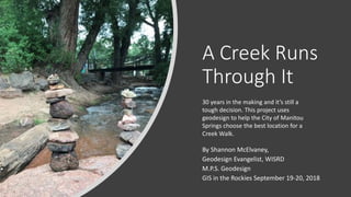
1. A Creek Runs
Through It
By Shannon McElvaney,
Geodesign Evangelist, WISRD
M.P.S. Geodesign
GIS in the Rockies September 19-20, 2018
30 years in the making and it’s still a
tough decision. This project uses
geodesign to help the City of Manitou
Springs choose the best location for a
Creek Walk.
9. The Contrasting Views of Fountain Creek
The early settlers of Manitou Springs built along Fountain Creek to have easy access to water and to experience the
beauty of the creek. The creek and the mineral springs gave Manitou Springs its identity as a place of healing. Over
the years, the creek has been diverted, built over, and neglected. As a result, the creek has not manifest its potential
as a placemaking resource for the city.
The purpose of this geodesign project is to help stakeholders select a preferred route for the Manitou Springs Creek
Walk that incorporates the values and priorities held by diverse stakeholder groups associated with the city.
10. Hypothesis
Engaging community stakeholders in a participatory geodesign process can improve site selection options for the
Manitou Springs Creek Walk while maximizing multiple economic, cultural and environmental outcomes improving
connections to community identity in water resources.
11. Geodesign Framework
• Powerful participatory planning method
• Uses stakeholder input to define criteria and values
• Utilizes a multi-disciplinary geodesign team
• Uses analytics to show the possible impact of design scenarios
• Allows the visualization of the world both as it is, and as it could be
• Supports better, more informed decision-making
13. • Plan Manitou
• Hazard Mitigation Plan
• Fountain Creek restoration
• East Manitou Springs
Redevelopment
• Infrastructure Vulnerability
Assessment
• Storm Water Master Plan
• Mobility Plan
• Soda Springs Park Master Plan
• Creek Walk Master Plan
Research Existing Plans…
Educate yourself. Identify plan
synergies or conflict.
14. Representation Models - Gathering the data
• City Data
• Zoning – parcels – city boundary – businesses
• Parks, open space, easements
• Building foot prints
• Creek
• Roads
• Buildings , bridges, staircases
• Hazards- floodway, floodplain
• Derived Data
• Riparian zone
• Shade – heat map
• Aesthetics – heat map
• Collected Data
• Street art
• Trees
• Amenities – parking, bathrooms, benches
• Erosion
• Large trees
• Low Impact Development (LID) potential
Survey 123
15. Getting Feedback from the “People of the Place”
Seeking input from stakeholders is an essential part of the participatory
change effort.
The immediate questions at this stage were:
1) Who are the stakeholders and what values
and concerns might they have,
2) What criteria should be used to evaluate
alternative routes,
3) What priority should those criteria be given,
4) And are the criterion equal, or should they
be weighted?
16. People of the Place
Workshop attendees consisted of:
• A successful businessman and trails
enthusiast who loves art. He also happens
to be physically challenged.
• A former government official who is still active on other committees.
• A local business owner with a love of the outdoors and a newborn child.
• A resident, land owner, and member of the group that deals with parking.
• A representative of Economic Development and the Arts Council for
Manitou Springs.
Local, knowledgeable opinion leaders
17. Review of Design Constraints and Opportunities
• Competing plans
• New parking
• Flood plain
• Easements
• Multi-modal
• Funding
• Active living
It was important to bring the team up to speed…
…so everyone had a common understanding.
18. Verifying Stakeholder Groups
These were the stakeholders thought to be most affected by a creek walk.
• Visitors
• Residents
• Businesses (owners or managers)
• Property Owners
• Manitou Springs Government
19. Clarifying Stakeholder Values and Concerns
Visitors
• Folks who stay at nearby campgrounds and motels like to walk to
town
• They want interesting things to see (e.g., nature, wildlife, history,
science)
• Shade is important
• Proximity, #’s of campers, #’s of moteliers…potential walkers/bikers
• If the route is beautiful, it increases use
• If the route is safe, it increases the likelihood of use
• Make it interesting, educational, use good signage, include native
American history
• Health benefits of walking, biking, etc.
• Add bike share spots
Note: The bullets in black were compiled
from various meetings, interviews, and
plans. The bullets in red italics were
added by workshop participants.
Strawman start. Asked for help.
Collaborative. Seeking input.
The whole group was asked to put
themselves in the shoes of each
stakeholder. This helped put them in an
open mindset, one less identified with
their own point of view.
20. Residents
• Needs to be accessible, good connectivity
• Need parking at trail heads
• There is a fear that transients will increase use
along the trail
• Fear an increase of trash along the creek
• Desire seating along the trail
• ADA compliant
• Protect nature – love big trees and wildness
• Protect animals/birds/plants
• Should support a modal mix (e.g., bike, walk, run)
• Entertainment (note: goes with interesting)
• Dog friendly - safe
• Social interaction opportunities (a “Third Place”)
• Health benefits
• Some residents do not want the city to grow
• Too many people, costs might go up
• Tie to Midland Trail
• Add kid friendly spots or nodes for different age
groups
• Add meditative, quiet spots to stop
• Safety: Inform folks riding bikes of where they
need to walk or slow down
• Add bike racks, places where it is safe to lock
your bike
Clarifying Stakeholder Values and Concerns
21. Businesses
• It would be a good business attractor – residents
and locals
• Good tourism attractor – people will come, stay
longer
• Will attract those who enjoy walking and biking
• Brand the creek to promote Manitou Springs
• Creek Walk will reduce congestion
• Reduce parking pressure
• Enhance connectivity across town
• Increase customers
Clarifying Stakeholder Values and Concerns
22. Manitou Springs Government
• Attracts new residents
• Increase property value and thus property tax revenue
• Help citizens to live an active lifestyle
• Supports “health” as a city value
• Protect green infrastructure and increase resiliency
• Decrease flood impact
• Safety is paramount
• Add art throughout (involve Arts Council)
• Incorporate events (e.g., duck races, other) to promote
brand
Clarifying Stakeholder Values and Concerns
23. Defining Evaluation Criteria
• ADA capable
• Path already exists
• Easements possible
• Near creek
• Natural setting
• Off-street
This map shows the use of graduated linear symbolization as a technique to show the
value of weighting evaluation criteria.
24. The post-workshop combined list of evaluation criteria includes:
• ADA Capable
• Easement already in place or possible
• Near Creek
• Hear, see, smell the water
• Shade
• Natural Setting
• Trees, shrubs, grass, open space
• Animals, birds
• Off-street
• Away or separate from traffic
• Limiting the experience of traffic noise and pollution
• Path Already Exists
• Lowers potential construction costs and/or easement acquisition
• Aesthetics/Enjoyable (Added to the list by participants)
• Historic buildings and bridges
• Mineral springs
• Art
• Programmed elements for kids of different ranges – playgrounds, recreation, getting in the creek
• Nature
• Shade
25. Prioritization of Evaluation Criteria
Priorities
Visitors Residents Businesses
Property
Owners Gov't
Stakeholder
Agreement
Total
Agreement Level/
Importance Level
ADA Capable 3 5 3 3 1 4 High /High
Near Creek 2 1 1 6 6 3 High /High
Natural Setting 5 3 5 5 5 1 High/Low
Off-street 4 2 2 7 4 2 High/Medium
Path Exists 6 6 6 4 3 1 High/Low
Easement/Access
Possible
7 7 7 1 2 2 High/Low
Aesthetics &
Enjoyment
1 4 4 2 7 2 High/Medium
Agreement of Evaluation Criteria Priorities by Stakeholder Group
Stakeholders
Criteria
Priorities
High 1 - 3
Medium 4
Low 5-7
26. Evaluation Criteria Prioritization Outcome
Given the outcome of the priority setting session, the major guiding
priorities that satisfy the most stakeholders are:
• ADA Capable
• Near the Creek
• Aesthetics and Enjoyable
• Nature
• Culture
Routes with existing easements are preferred, and where possible existing
routes should be leveraged. In addition, routes that are both in Natural
Areas and Off-Street should be given precedence.
This expanded the idea of the
creek walk to include downtown
and business.
27. Evaluation Models
The next step involved
describing what kind of spatial
and attribute data would be
needed to create the
evaluation models in the GIS
that would support each
criterion.
GIS language
• Suitability
• Capability
• Vulnerability
Table 2
Evaluation Criteria and their Spatial Representation
Criteria Category Description Subcategory Description
ADA Capable
Areas either ADA compliant or capable of
compliance
Sidewalks wide enough for a wheelchair to pass
Cross walks
Curbs cut low for wheelchair access
Near Creek Proximity to Creek. Can hear, see, smell the creek
Areas within 20 ft. of the creek
Natural Setting Areas where nature dominates the landscape
Riparian Zone
Creek
Parks or open space
Trees
Off-street Away from the street and street noise
Areas over 15 ft. from the street
Path Exists Areas with existing infrastructure
Sidewalks
Trails with paved or compact surface
Pedestrian bridges or road bridges with sidewalk
Existing roads
Easement/Access
Possible
Locations where legal access exists or is possible
Parcel already owned by the city
City already has an easement
Landowner open to easement / City in discussion
Route is in an open right-of-way
Aesthetics &
Enjoyment
Places that are beautiful, aesthetically pleasing,
and enjoyable
Historic buildings, bridges, staircases, and stone
walls
Mineral springs Location of mineral springs
28. List continued.
Criteria Category Description Subcategory Description
Street Art
Locations of statues,
sculptures, tiling, exhibits,
murals
Interesting views
Directional views of buildings,
mountains, open space, the
creek
Outdoor café seating
Locations of restaurants and
cafes with outdoor seating
Amenities
Numbers and frequency of
amenities
Bathrooms
Parking
Benches and informal seating
areas
Trash receptacles
Bike racks
Playgrounds
Picknick benches
Nature Proximity to nature
Access to creek
Trees
Planters and potted plants
Parks, gardens, and fountains
Near business
Proximity to commercial
business
Retail shops
Restaurants
Bars
Shade
Areas to walk or sit in the
shade
Numbers of trees as indicator
North side of tree as area with
most shade after 1:00 pm
Bikeability Location of paths conducive to safe cycling
Low traffic roads
Evaluation Models
29. Evaluation Models*
• ADA capable
• Path already exists
• Easements possible
• Near creek
• Natural setting
• Off-street
• Near Business
• Bikeability
• Shaded
• Aesthetics and Enjoyment
*Existing conditions
34. Alternative Route Options
The next stage in the geodesign framework addresses
what Steinitz (2012) refers to as change models (design
alternatives). These encompass the simulation,
visualization and communication of future states.
The three design scenarios examined in this project
included:
1) bicycle friendly routes
2) ADA compliant walkable routes
3) a solution that combines these options.
35.
36.
37.
38. Impact Models
• The geodesign impact model stage provided an opportunity to
examine the impact of each change model (design alternative) against
the process and evaluation models built during earlier stages.
• The purpose of this process was to examine the impact of each design
alternative using the evaluation criteria refined after the stakeholder
engagement workshop.
• The following tables provide an in-depth analysis of the impacts of
each of the three Creek Walk route alternatives.
39. Cyclists Rule
• Each design’s impact was evaluated
against the decision criteria
• A green-red scale for criteria
• A green-yellow-orange-red scale
for cost
• And linear feet or miles per
segment
Section Route Narrative Cost
ADA
Compliant
Near
Creek
Aesthetic
Enjoyment Shade
Distance
(feet)
Distance
(miles)
1 Preferred
Build single track
bike path
Low Yes No No No 853 0.1616
2 Preferred Use Existing Road None No No No No 1,486 0.2814
3 Preferred
Path requires design
and construction
High Yes Yes Yes Yes 300 0.0568
4 Preferred Path exists None Yes Yes Yes Yes 449 0.0850
5 Preferred Crosswalk required Very Low Yes Yes Yes No 34 0.0064
6 Preferred
Path surface requires
design and
construction
Medium to
High
Yes Yes Yes Yes 1,128 0.2136
6a Alternate Path exists None Yes Yes Yes Yes 551 0.1044
6b Alternate
Sidewalk over historic
bridge too narrow.
Road too narrow too
expand sidewalk
Very High No Yes Yes Yes 64 0.0121
7 Preferred Crosswalk required Very Low Yes Yes No No 24 0.0045
8 Preferred
Path requires design
and construction
High Yes Yes No Yes 423 0.0801
9 Preferred
Pedestrian & cyclist
bridge requires
design and
construction
Very High Yes Yes No Yes 234 0.0443
10 Access Exists None No No No Yes 177 0.0335
10a Access
Existing pedestrian
bridge
None No Yes Yes Yes 165 0.0313
11 Preferred
Path requires design
and construction
High Yes Yes No Yes 1,425 0.2699
12 Preferred Uses existing road None No Yes No Yes 141 0.0267
13 Preferred Uses existing trail None Yes No No Yes 2,224 0.4212
14 Access Uses existing trail None Yes No No Yes 844 0.1598
7,938 4,323 2,076 7,286 10,522
1.50 0.82 0.39 1.38 1.99
75% 41% 20% 69%
Cyclists Rule Impact Calculations
Preferred Route Distance (feet) Totals
Percentage of Route Covered
Preferred Route Distance (miles) Totals
Table 3
40. Nature Walk to Shop Section Route Narrative Cost
ADA
Compliant
Near
Creek
Aesthetic
Enjoyment Shade
Distance
(feet)
Distance
(miles)
1 Preferred Sidewalk exists None Yes Yes Yes No 676 0.1280
1a Preferred
To be built as part
of Park Master Plan
Medium Yes Yes Yes Yes 660 0.1250
2 Preferred
Uses existing
sidewalk
None Yes No Yes No 2,875 0.5445
2a Preferred Requires crosswalk Low Yes Yes Yes No 34 0.0064
2b Alternate
Uses existing
sidewalk
None Yes No Yes Yes 101 0.0191
3 Preferred
Path requires
design and
construction
High Yes Yes Yes Yes 300 0.0568
4 Preferred
Uses existing
sidewalk
None Yes Yes No No 307 0.0581
4a Alternate Path exists None Yes Yes No Yes 500 0.0947
4b Alternate
Retaining wall
repair & ped bridge
needed
Very High Yes Yes No Yes 210 0.0398
5 Preferred Crosswalk exists None Yes Yes Yes No 34 0.0064
5a Alternate Crosswalk required Very Low Yes Yes Yes No 34 0.0064
6 Preferred
Path surface
requires design
and construction
Medium to
High
Yes Yes Yes Yes 1,128 0.2136
6a Alternate Path exists None Yes Yes Yes Yes 551 0.1044
6b Alternate
Sidewalk over
historic bridge too
narrow. Road too
narrow too expand
sidewalk
Very High No Yes Yes Yes 64 0.0121
7 Preferred Crosswalk required Very Low Yes Yes No No 24 0.0045
8 Preferred
Path requires
design and
construction
High Yes Yes No Yes 423 0.0801
9 Preferred
Pedestrian & cyclist
bridge requires
design and
construction
Very High Yes Yes No Yes 234 0.0443
10 Access Path exists None No No No Yes 177 0.0335
10a Access
Existing pedestrian
bridge
None No Yes Yes Yes 165 0.0313
11 Preferred
Path requires
design and
construction
High Yes Yes No Yes 1,425 0.2699
12 Preferred Use existing road None No Yes No Yes 141 0.0267
13 Preferred Uses existing trail None Yes No No Yes 2,224 0.4212
14 Access Uses existing trail None Yes No No Yes 844 0.1598
11,289 5,386 6,179 7,721 13,131
2.14 1.02 1.17 1.46 2.49
86% 41% 47% 59%
Table 4
Nature Walk to Shop Impact Calculations
Preferred Route Distance (feet) Totals
Percentage of Route Covered
Preferred Route Distance (miles) Totals
• Each design’s impact was evaluated
against the decision criteria
• A green-red scale for criteria
• A green-yellow-orange-red scale
for cost
• And linear feet or miles per
segment
41. Combo Walk and Bike Section Route Type Narrative Cost
ADA
Compliant
Near
Creek
Aesthetic
Enjoyment Shade
Distance
(feet))
Distance
(miles)
1 Preferred Walk Sidewalk exists None Yes Yes Yes No 676 0.1280
1a Preferred Walk
To be built as part of
Park Master Plan
Medium Yes Yes Yes Yes 660 0.1250
1b Preferred Walk
To be built as part of
Park Master Plan
Medium Yes Yes Yes Yes 153 0.0290
1c Preferred Bike
Proposed single cycle
track
Low Yes No No No 853 0.1616
2 Preferred Walk
Uses existing
sidewalk
None Yes No Yes No 2,875 0.5445
2a Preferred Walk Requires crosswalk Low Yes Yes Yes No 34 0.0064
2b Alternate Walk
Uses existing
sidewalk
None Yes No Yes Yes 101 0.0191
2c Preferred Bike Uses existing road None No No No No 1,486 0.2814
3 Preferred Walk-Bike
Path requires design
and construction
High Yes Yes Yes Yes 300 0.0568
4 Preferred Walk
Uses existing
sidewalk
None Yes Yes No No 307 0.0581
4a Preferred Bike Path exists None Yes Yes No Yes 500 0.0947
5 Preferred Walk Crosswalk exists None Yes Yes Yes No 34 0.0064
5a Alternate Walk-Bike Crosswalk required Very Low Yes Yes Yes No 34 0.0064
6 Preferred Walk-Bike
Path surface requires
design and
construction
Medium to
High
Yes Yes Yes Yes 1,128 0.2136
7 Preferred Walk-Bike Crosswalk required Very Low Yes Yes No No 24 0.0045
8 Preferred Walk-Bike
Path requires design
and construction
High Yes Yes No Yes 423 0.0801
9 Preferred Walk-Bike
Pedestrian & cyclist
bridge requires design
and construction
Very High Yes Yes No Yes 234 0.0443
10 Access Walk Path exists None No No No Yes 177 0.0335
10a Access Walk
Existing pedestrian
bridge
None No Yes Yes Yes 165 0.0313
11 Preferred Walk-Bike
Path requires design
and construction
High Yes Yes No Yes 1,425 0.2699
12 Preferred Walk-Bike Crosswalk required Low Yes No No 48 0.0091
12a Preferred Walk-Bike
Move parking, add
sidewalk & trees
Medium Yes No No Yes 121 0.0229
12b Preferred Walk-Bike
Pedestrian bridge
exists,to be made ADA
compliant
Medium Yes Yes Yes Yes 56 0.0106
13 Preferred Walk-Bike Uses existing trail None Yes No No Yes 2,224 0.4212
14 Access Walk-Bike Uses existing trail None Yes No No Yes 844 0.1598
12,919 6,296 6,081 8,458 14,882
2.45 1.19 1.15 1.60 2.82
87% 42% 41% 57%
Preferred Route Distance (miles) Totals
Table 5
Combo Walk and Bike Impact Calculations
Preferred Route Distance (feet) Totals
Percentage of Route Covered
• Each design’s impact was evaluated
against the decision criteria
• A green-red scale for criteria
• A green-yellow-orange-red scale
for cost
• And linear feet or miles per
segment
43. Combo Walk and Bike – best of both worlds
• Serves both cyclists AND those
with disabilities
• Allows cyclists to bike to or go
around town
• Allows walkers to walk to town in
a safe and enjoyable manner
• Adds little extra cost and actually
solves some engineering/design
issues
45. Dot Mapping Exercise
ADA capable 2
Path already exists 13
Easements possible 10
Near creek 18
Natural setting 9
Off-street 15
Aesthetics and Enjoyment 20
Validated the findings of the
smaller group session.
48. Common Themes
• Desire to separate cyclists from walkers
• There can be more than one creek walk
• Connectivity to other trails and downtown
• Desire for loops
• Desire to leave natural areas and turf in the parks alone
50. Lessons Learned
• Involve citizens early – don’t be afraid
• The “people of the place” have knowledge you don’t
• Hard to get people’s time - work asynchronously - short one-on-ones invaluable
• Geodesign provides valuable information on context
• Be prepared for set backs
• Staff turn over, funding delays, conflicting projects
• Go with the flow – incorporate new info as it comes
• Geodesign (and planning for that matter) is not a linear process
• With the geodesign framework, you always know where you are in the process
• Move the ball forward – capture values – those will live on in the next plan
• A multi-disciplinary, systems approach is what the world needs now
51. Benefits of the Geodesign Process
“Due to a number of factors, communities are demanding transparency from their city
leaders. Geodesign enables project managers, administrators and officials to clearly and
succinctly explain the process and build confidence in city-wide projects. This is a
necessary, and often missing, part of so many community efforts.”
“The Creek Walk Project enjoys incredible popularity. That being said, we all have a
different idea of what a finished Creek Walk experience will be. Using the Geodesign
process, we were able to preserve the passion and popularity of the project without
turning it into a divisive issue. Geodesign is a benefit to all communities and community
projects.”
Natalie Johnson, Director of Economic Development
City of Manitou Springs
52. Special thanks to:
• The City of Manitou Springs
• THK Associates, Inc.
• Nancy Fortuin, Natalie Johnson, Barb Cole, Karen Berchtold,
Kevin Shanks, Shanti and Coreen Toll, Danu, Lucas, Lisa
McElvaney, Becky Elder
• Penn State University
Stukeman School of Landscape Architecture, Geodesign Program
Kelleann Foster, Dan Meehan, and many others.
• Capstone Advisor, Eric Bernard, Texas Tech University
For more information on graduate programs in Geodesign check
out https://geodesign.psu.edu/