Download to read offline
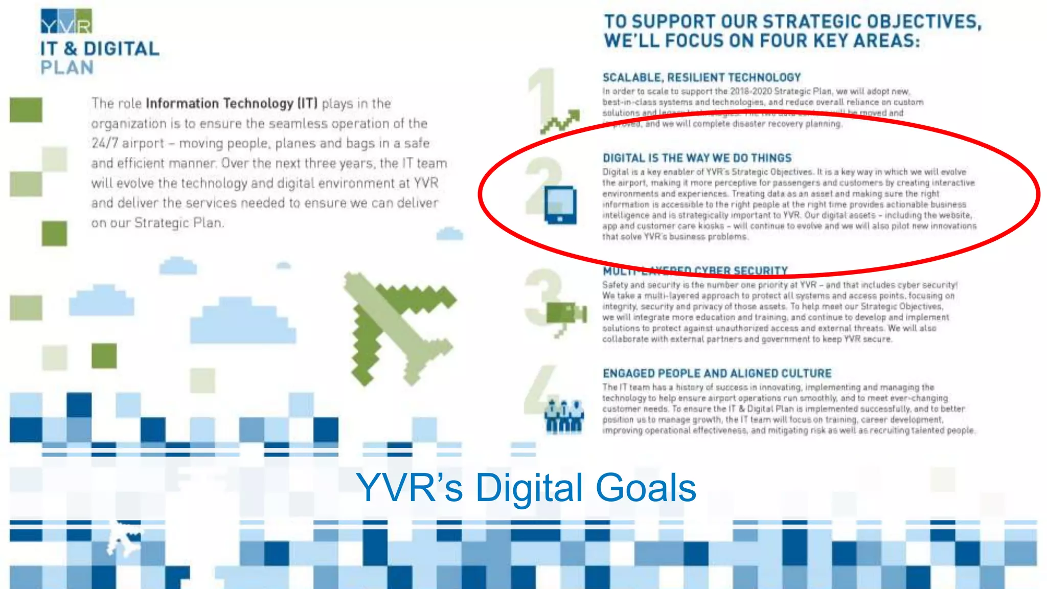
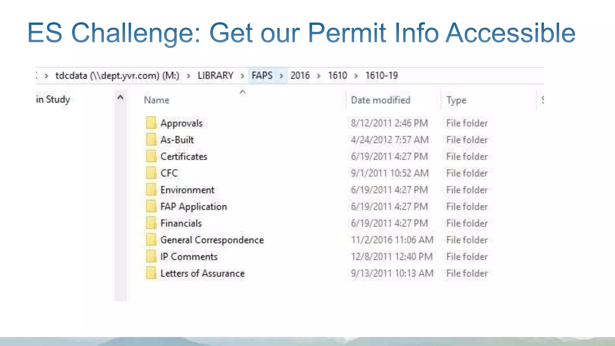
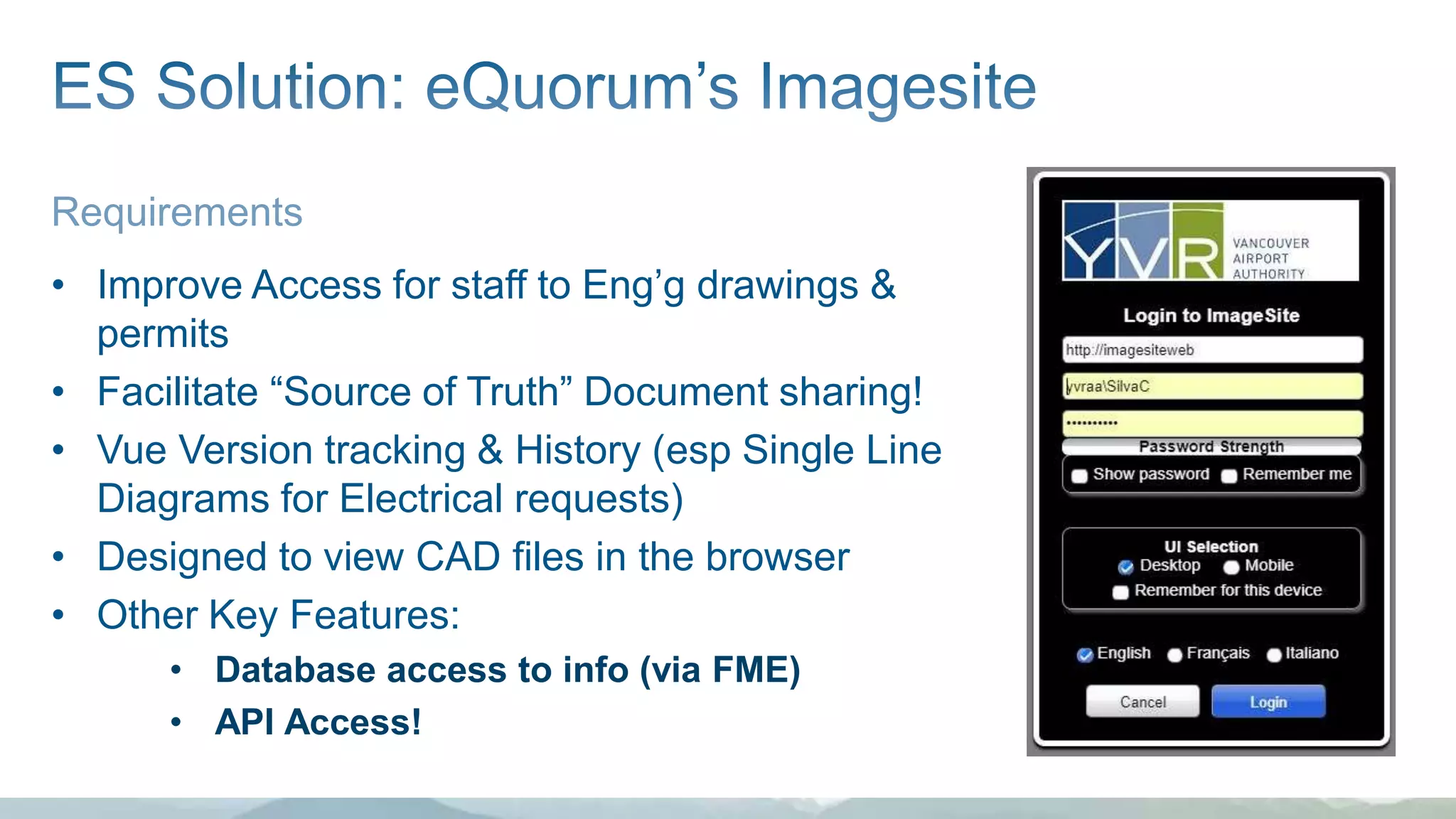

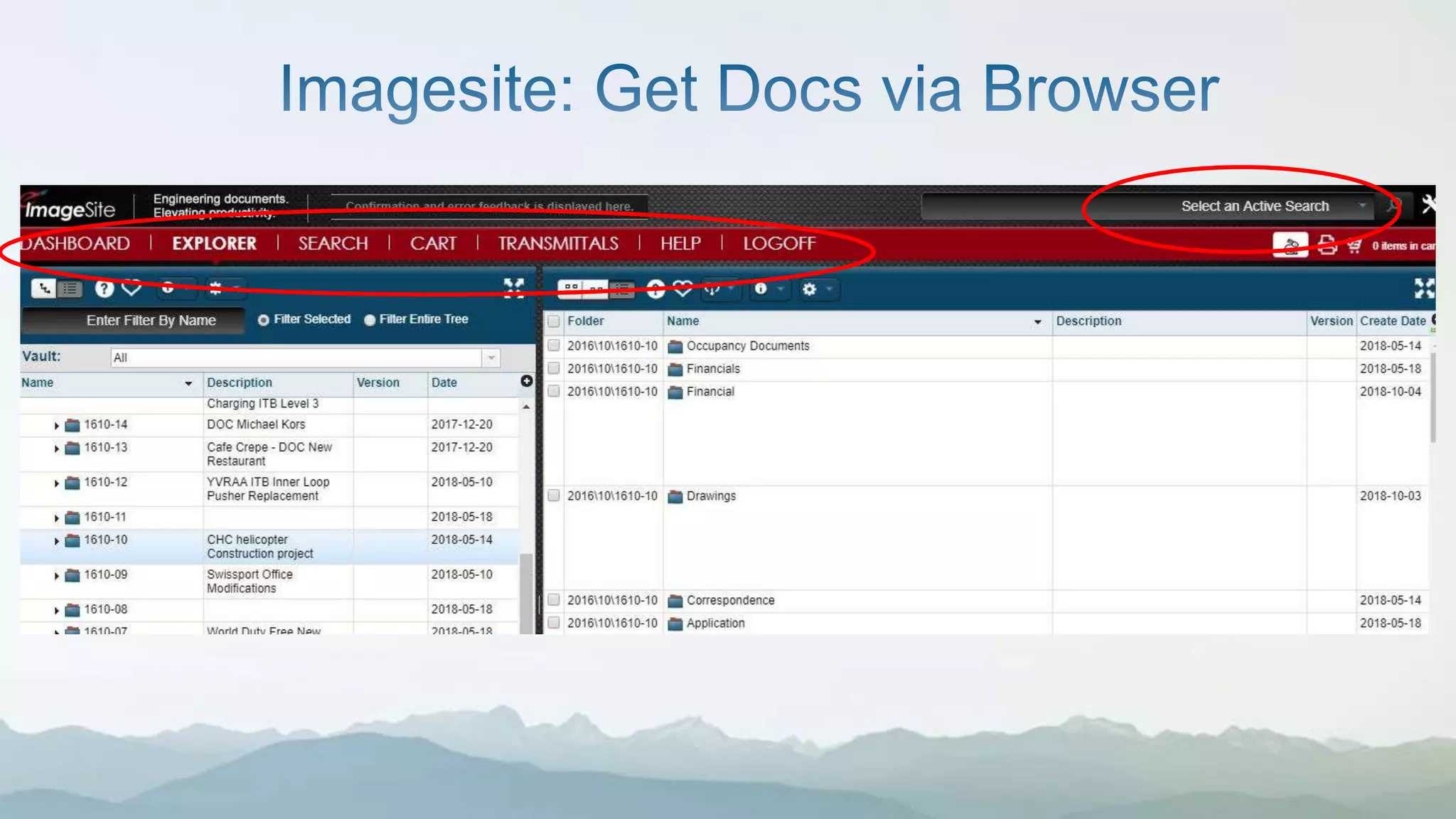
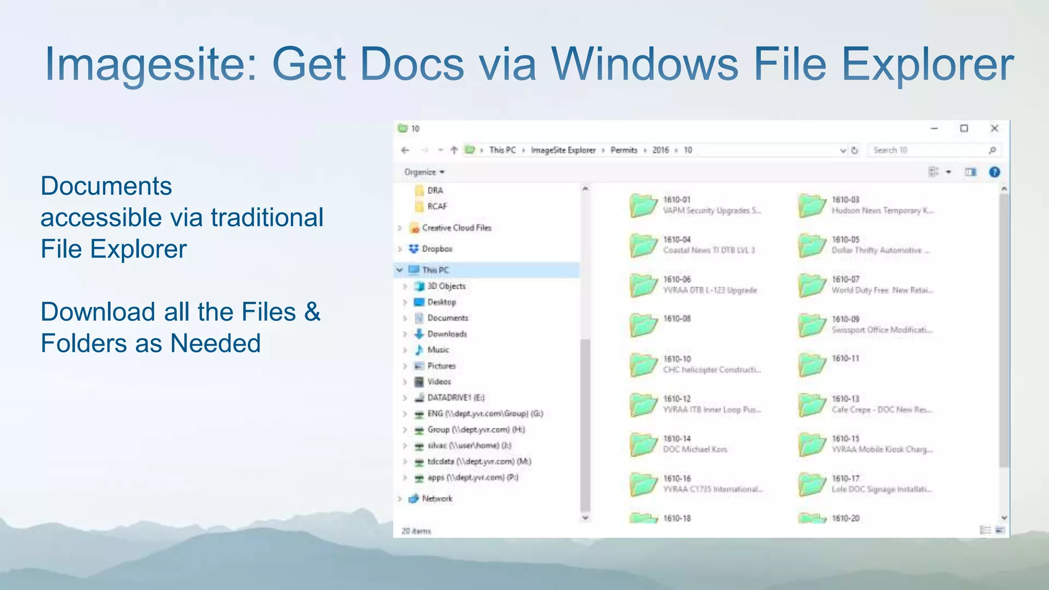
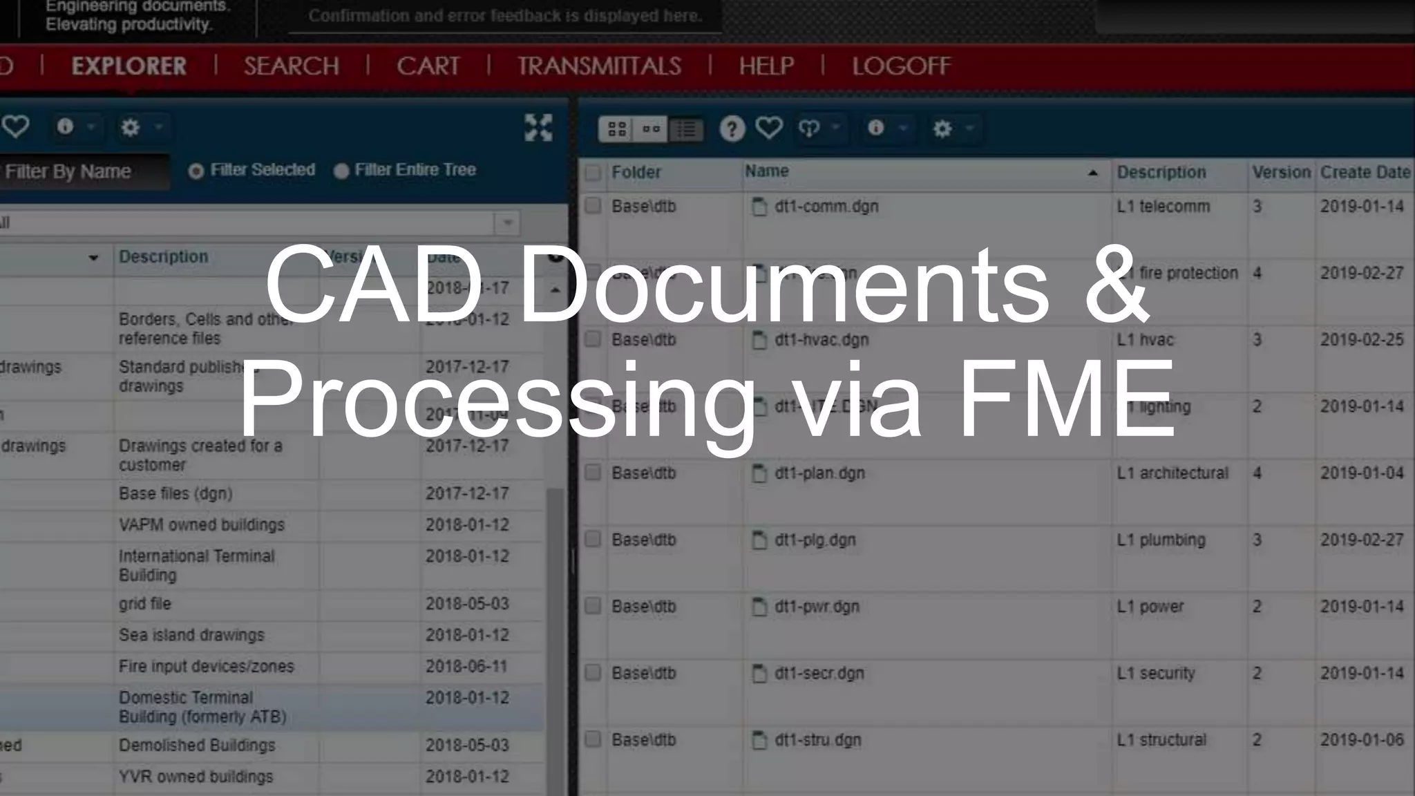
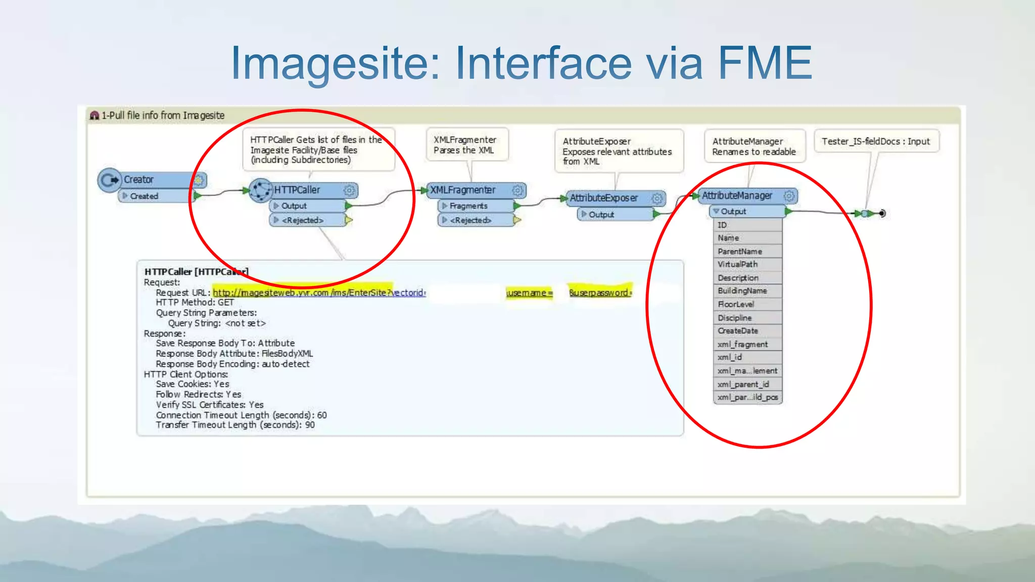
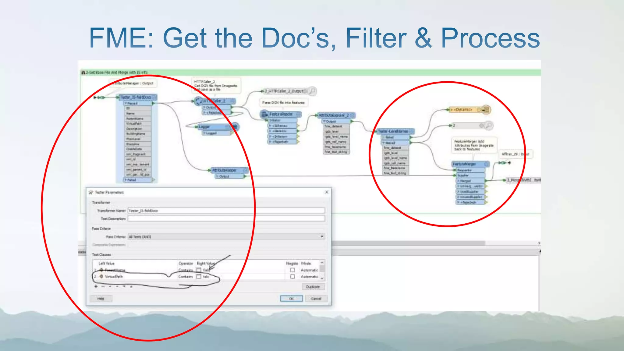
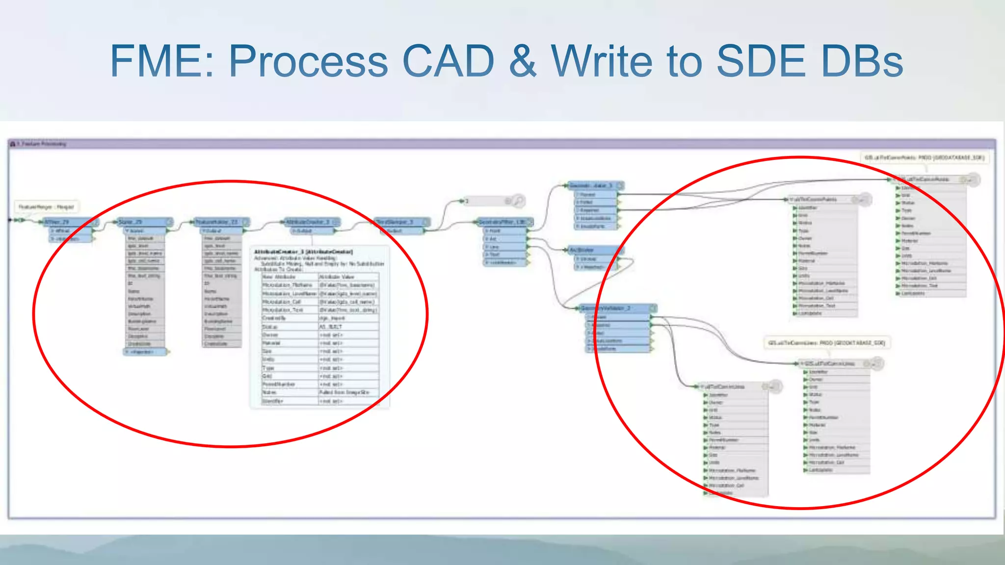
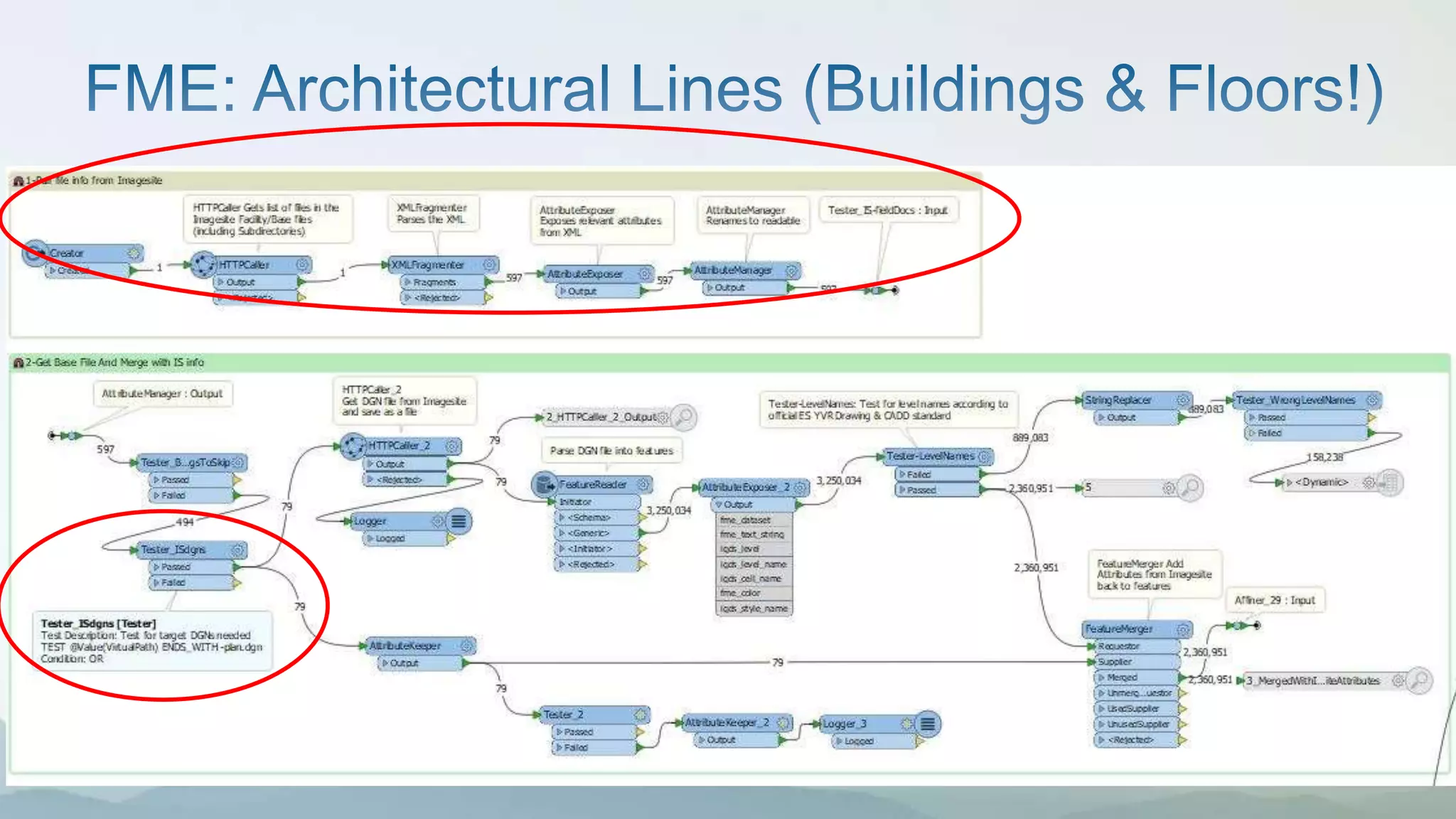
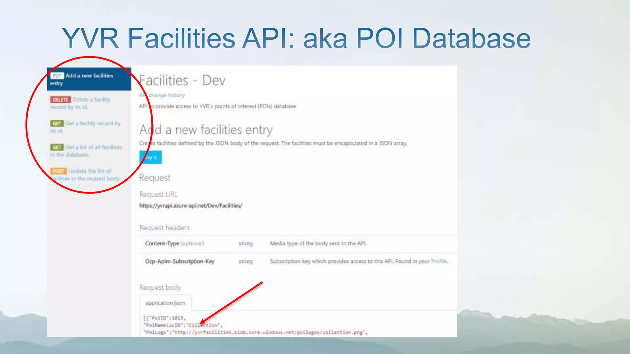


The document outlines the integration of CAD documents into GIS using a document management system at YVR to improve access to engineering drawings and permits. It emphasizes the need for features like version tracking, database access, and API functionality to streamline document sharing and reduce staff requests. Future goals include linking infrastructure information to the web and developing additional FME scripts for uncharted features.


