Downloaded 139 times

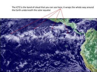
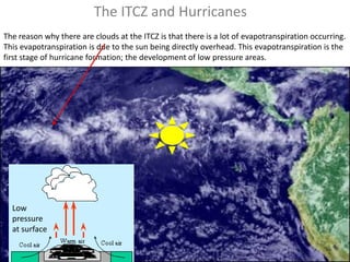
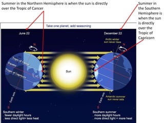
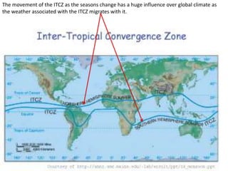
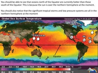
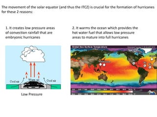
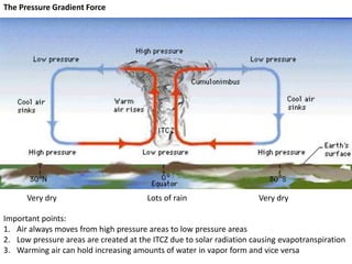
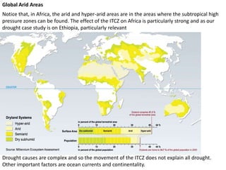

The document discusses the Intertropical Convergence Zone (ITCZ) and its significant role in influencing global climate, droughts, and hurricanes. It explains how evapotranspiration at the ITCZ creates low pressure areas essential for hurricane formation and affects precipitation patterns, particularly in regions like Africa. Additionally, it highlights that while the ITCZ impacts droughts, other factors such as ocean currents also play a role.


![EVS-1-Global climate [Autosaved].pptx](https://cdn.slidesharecdn.com/ss_thumbnails/evs-1-globalclimateautosaved-230211182852-8012fb9b-thumbnail.jpg?width=640&height=640&fit=bounds)


