
Recommended
More Related Content
What's hot
What's hot (17)
Similar to Tales of Three Cities
Similar to Tales of Three Cities (20)
More from Yuan0623
Recently uploaded
Recently uploaded (20)
Tales of Three Cities
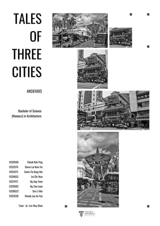
- 1. Cheok Kah Ying Daren Lai Kam Fei Gavin Tio Kang Hui Loi Chi Wun Ng Jing Yuan Ng Zien Loon Sim Li Mei Wendy Lau Jia Yee Tutor : Ar. Lim Wey Shan 0328560 0332570 0333373 0328652 0331472 0328565 0328623 0333538 Bachelor of Science (Honours) in Architecture TALES OF THREE CITIES ARC61003
- 2. ABSTRACT Page 01 1.0 INTRODUCTION Page 02 1.1 Key Plan of Kuala Lumpur 1.2 Location Plan of Pasar Seni - Petaling Street 1.3 Site Plan of Pasar Seni - Petaling Street 2.0 FIGURE GROUND ANALYSIS Page 06 2.1 Solid and Void 2.2 Land Use Distribution 2.3 Vertical Zoning 2.4 Public-private Space 2.5 Building Typology 2.6 Scale 2.7 Usability of Open Space 2.8 Landscape 3.0 SERIAL VISION Page 15 3.1 Jalan Tun Tan Cheng Lock 3.2 Pasar Seni 3.3 Petaling Street 4.0 COLLAGE CITY Page 18 5.0 THE FIVE IMAGES OF CITIES Page 19 5.1 Path 5.2 Edge 5.3 Node 5.4 District 5.5 Landmark CONTENT LIST MAPPING THE TOWNSCAPE 00
- 3. 6.0 URBAN DISTINCTIVE CHARACTER Page 24 6.1 Morphology 6.2 Clustered Organization 6.3 Social Fabric 6.4 Typology In-Between Building 6.5 Triangular Building Typology 6.6 Scale 6.7 Active and Passive Facade 6.8 Green Edge 6.9 Conclusion 7.0 TALES OF WISH Page 34 7.1 Comparison of three cities 7.2 City of Wishes 8.0 CONCLUSION Page 39 9.0 REFERENCE Page 40 CONTENT LIST MAPPING THE TOWNSCAPE 00
- 4. ABSTRACT ABSTRACT MAPPING THE TOWNSCAPE 01 Started from the confluence of Klang River and Gombak River, the Kuala Lumpur town, the streets, and settlements slowly expand into what it is today. Pasar Seni and Petaling Street are located near the confluence of the rivers, hence its urban development is closely tied to the urban planning of Kuala Lumpur, and has rich urban context. This study takes place in Pasar Seni-Petaling Street, a town that holds plethora information and layers of history on site that dates back to 19’s century. The spatial form of the city is documented and analysed to note the key spatial experience that is driven by the urban form and content. The study focuses on the tangible and intangible typologies of ‘in-between’ spaces which are prevalent in the context of the city at street scale. The analysis is speculated from three distinctive aspects; form, activity and movement, based on the Jan Gehl’s study tools of public life. In short, this study illustrates and concludes the relationship between the typologies of ‘in-between’ space and its effect on the usage of path in Pasar Seni-Petaling Street.
- 5. INTRODUCTION 1.1 KEY PLAN OF KUALA LUMPUR 1.2 LOCATION PLAN OF PASAR SENI-PETALING STREET 1.3 SITE PLAN OF PASAR SENI-PETALING STREET 1.0
- 6. Petaling Street or ‘ Chee Cheong Kai’ in Cantonese is Malaysia's Chinatown, a place where early settlers came to Kuala Lumpur in pursuit of wealth from the booming tin mining industry in the 1800s. They were largely Cantonese and Hakkas who came to the city because of the tin trade, working as coolies in the mines. They were governed by a Chinese Kapitan or headman. The most famous Chinese Kapitan is Yap Ah Loy, a Hakka. Chinatown's origins centred on market square ( current Central Market) and along Jalan Tun H.S Lee, formerly known as High Street due to its higher grounds. This strip became a popular place for settlements because it was less prone to floods. In 1870, civil war erupted with the Chinese community being split along partisan lines into the Hokkien-Cantonese Ghee Hin and the Hakka Hai San secret societies over the control of tin and related trade. The fighting was so intense, it halted tin mine production altogether. The British administration was forced to intervene, marking its first such involvement in local politics. The war led to the destruction of many buildings as well as abandonment of several mines. During the Selangor Civil War, the tin mines were abandoned and when the miners returned after the war, they found that the mines were flooded and therefore could not work. Yap Ah Loy persuaded the miners and coolies to remain in KL and the Malays in surrounding districts to grow rice and other garden products to refocus their skills on the agriculture sector instead. He set up a tapioca mill in Petaling Street where the tubers from his farms were brought here to be ground into flour. Petaling Street is therefore fondly called ‘Chee Cheong Kai’ in Cantonese which means starch factory street. 1.0 INTRODUCTION 1.0 INTRODUCTION MAPPING THE TOWNSCAPE 02
- 7. Diagram 1.1 Key plan of Kuala Lumpur Capital of Malaysia, Kuala Lumpur. Over 8 million people live within this area which is clearly noticeable by the huge and vast amounts of traffic. As a vibrant multi-ethnic and multi-cultural society provide the stimulus to guide urban design initiatives to create a distinct and unique city identity. A friendly melting point of nationalities, religions and cultures prompt people to identify more closely with the City and each other, thus fostering a sense of community and social harmony. 1.1 KEY PLAN KUALA LUMPUR 1.0 INTRODUCTION MAPPING THE TOWNSCAPE 03 Pasar Seni
- 8. Pasar Seni and Petaling Street located near to the Klang river where the nucleus of the city began. The development grew near the confluence of Klang river and Gombak river and extend further. Evolved from the Chinese original settlement, the historical Chinese Old Town is still an area full of vibrance. Diagram 1.2 Location plan 1.2 LOCATION PLAN PASAR SENI - PETALING STREET MAPPING THE TOWNSCAPE 04 1.0 INTRODUCTION
- 9. A townscape as cultural heritage strategically located in the heart of Kuala Lumpur, encompassess Petaling Street and Central Market. An essence integration of cityspace which maintain the traditional atmosphere presenting the historical visual treat along the street. Diagram 1.3 Site plan 1.3 SITE PLAN PASAR SENI - PETALING STREET MAPPING THE TOWNSCAPE 05 1.0 INTRODUCTION
- 10. FIGURE GROUND ANALYSIS 2.1 SOLID & VOID 2.2 LAND USE DISTRIBUTION 2.3 VERTICAL ZONING 2.4 PRIVATE-PUBLIC SPACE 2.5 BUILDING TYPOLOGY 2.6 SCALE 2.7 CIRCULATION 2.8 USABILITY OF OPEN SPACE 2.9 LANDSCAPE 2.0
- 11. Urban solid made up of predominant field of blocks with repetition of pre-shaped parcels. Significant urban solid, the public institution is set off by public space. Urban void acts as the primary network of streets and squares, as the city linkage for vehicles and pedestrians and unifying city by serving social function and active city public life. The mixed-used street is preserved and acting as the nodes for the city. Diagram 2.1 Solid and void 2.1 SOLID & VOID COHERENCE 2.0 FIGURE GROUND ANALYSIS MAPPING THE TOWNSCAPE 06
- 12. The land use of the area is brimming with work and tourism purposes. The area encompasses spaces of different functions such as commercial, institutional, religious, educational, etc. Commercialised shoplots, guesthouses and hotels occupy the highest percentage of land use distribution. The open space located adjacent to the Pasar Seni Central Market is used as a car park. Diagram 2.2 Land use distribution 2.2 LAND USE DISTRIBUTION DISPERSE MAPPING THE TOWNSCAPE 07 Educational Undeveloped cleared lands Institutional Commercial 2.0 FIGURE GROUND ANALYSIS Religious
- 13. The zoning of area A and area B shared the same approached where the ground floor of the shops are mainly used for commercial purpose. First floor or upper floor are either semi public or private for residential and institutional purpose. Diagram 2.3 Vertical zoning 2.3 VERTICAL ZONING FRAGMENT MAPPING THE TOWNSCAPE 08 2.0 FIGURE GROUND ANALYSIS A B Area A - Area B - Commercial Residential Abandoned Religious
- 14. The accessibility of buildings to public is determined by the function housed by each. Commercial spaces by nature are public spaces, institutional and educational spaces caters to only certain groups of people, while residentials are exclusive to provide privacy to its user groups. Diagram 2.4 Private-public spaces 2.4 PRIVATE-PUBLIC SPACE BINARY MAPPING THE TOWNSCAPE 09 Semi-public Public Private 2.0 FIGURE GROUND ANALYSIS
- 15. Townscape utilizing the geographical relationship between sense of place and social capacity at the collective and individual level. Spatial dimensions at the individual level and a schema of spatial clustering at the collection level constitute a non-disjoint relationship amid clustered spatial. Diagram 2.5 Building typology 2.5 BUILDING TYPOLOGY DEMEANOR MAPPING THE TOWNSCAPE 10 2.0 FIGURE GROUND ANALYSIS Collective Individual
- 16. Random high scale of building scattered within the low structure create contrast and emphasis. Unorganised scaling in urban planning varying degree whilst prompt an inconsistency along the persistent scale of structure create sense of disparity in urban void. Diagram 2.6 Scale 2.6 SCALE ERRATIC MAPPING THE TOWNSCAPE 11 2.0 FIGURE GROUND ANALYSIS ≤2 storeys >2 storeys
- 17. Circulation connects the urban spaces through movement. Circulation route in the area consists of pedestrian circulation route and vehicular circulation route. Designated path works as a spinal circulation whilst sub-axis circulation branching out from the broad central axis for secondary pedestrian and vehicular flow. Diagram 2.7 Circulation 2.7 CIRCULATION SPINE MAPPING THE TOWNSCAPE 12 Pedestrian Vehicular Zebra crossing 2.0 FIGURE GROUND ANALYSIS
- 18. Public life study categorizes spaces into spaces for movement and spaces for staying. The pedestrian-priority street serving function as a destination, encourage stationary activities to occur. The covered street responds to the local climate and providing shield for people. Pedestrian flow and vehicular circulation occur on transit street. Diagram 2.8 Usability of open spaces 2.8 USABILITY OF OPEN SPACE SENSIBLE MAPPING THE TOWNSCAPE 13 Space for staying Space for movement 2.0 FIGURE GROUND ANALYSIS
- 19. A row of trees is planted along the side of path, keeping passive activities like construction activity away from street frontage. It also establishes privacy to the upper floor of shop lots while attracting an influx of activities and people to the shop on the ground floor. Diagram 2.9 Landscape 2.9 LANDSCAPE VISUAL PERMEABILITY MAPPING THE TOWNSCAPE 14 2.0 FIGURE GROUND ANALYSIS
- 20. SERIAL VISION 3.1 JALAN TUN TAN CHENG LOCK 3.2 JALAN HANG KASTURI 3.3 JALAN PETALING 3.0
- 21. Figure 3.1 View to Jalan Tun Sambanthan Jalan Tun Tan Cheng Lock 3.1 Jalan Tun Tan Cheng Lock 3.0 SERIAL VISION MAPPING THE TOWNSCAPE 15 Jalan Tun Sambanthan and Jalan Hang Kasturi converge into a main road which causes heavy traffic during peak hour. Zebra crossing connects opposite walkway to Kasturi Walk. Absence of five foot walkway along street facade disengages public users with the building. Railing further obstructs the pedestrian flow from the opposite walkway. 1 2 3 654 7 8 9 1 2 3 4 5 6 7 8 9
- 22. Figure 3.1 View to Hang Kasturi 3.0 SERIAL VISION MAPPING THE TOWNSCAPE Jalan Hang Kasturi 3.2 Jalan Hang Kasturi The prominent entrance gate and difference in pavement pattern of the pedestrian walkway and the tar road distinguish the Kasturi Walk from the vehicular path. Activity is prolonged along the path. Vendors draw attention encourage movement into within. Initial unintentional activity is developed into a symbolic path in Pasar Seni. 1 2 3 4 5 6 1 2 3 4 5 6 16
- 23. MAPPING THE TOWNSCAPE Figure 3.1 View to Jalan Petaling Jalan Petaling 3.3 Jalan Petaling Spillage of the business activities out from the shoplots in the form of vendor stalls is a testament to the liveliness of the business district narrow down the pedestrian walkway. The small distance between vendors units resulting high intimacy and intensity of social activities 5 6 3 4 1 2 1 2 3 4 5 6 3.0 SERIAL VISION 17
- 24. COLLAGE CITY 4.0
- 25. MAPPING THE TOWNSCAPE 4.0 COLLAGE CITY 18 CITY AFOOT - RECLAIMING PEDESTRIAN WALKABILITY The paths which are used to be congested with vehicles are now being reclaim back by the pedestrians. Distance in an urban pattern functions to regulate intimacy and intensity of social activities. A city designed to the distance of walking? Or a city designed to the speed of motorised vehicle?
- 26. IMAGES OF THE CITIES 5.1 PATH 5.2 EDGE 5.3 NODE 5.4 DISTRICT 5.5 LANDMARK 5.0
- 27. 5.1 PATH PATH AS STIMULANT 5.0 THE FIVE IMAGES OF THE CITES MAPPING THE TOWNSCAPE 19 Diagram 5.1 Path Designated path works in a comprehensive and continuous network of spinal circulation, connecting the pass-by spaces along the path. Commercialised area has a relatively wider walkway that is able to stimulate commercial opportunities at the path since it is used to accommodate higher pedestrian traffic during peak period. 1 2 3 4 PedestrianVehicular 1 2 3 4
- 28. 5.2 EDGES ENGAGING WITH CITY EDGES 5.0 THE FIVE IMAGES OF THE CITES MAPPING THE TOWNSCAPE 20 edges Diagram 5.2 Edges The main spinal traffic path, acting as a barrier, separates the area into two major parts, Pasar Seni Market Central and Petaling Street. Façades of buildings as an edge, further disengages both regions from the street with some of facades being physically inaccessible from the spinal path. The traffic path further branches perpendicularly into secondary paths that connect the commercial edges. Collectively, the commercial edges activate the zone by drawing in tourists to the site. 1 2 1 2
- 29. 5.3 NODE CITY OF PERMEABILITY 5.0 THE FIVE IMAGES OF THE CITES MAPPING THE TOWNSCAPE 21 Node Diagram 5.3 Node The junctions in front of the two main landmarks act as the primary nodes due to the activity and opportunity it has bring. It is where there is activity and infrastructure to support it, such as tourist hotspots, commercial and retail buildings, that is alongside the public transport. According to Jan Gehl, (Gehl, Kaefer & Reigstad, 2011), the acceptable walking distances for most people in ordinary daily situations has been found to be less than 400 to 500 meters. From Central Market to Petaling Street, the walking distance is 350 meters which has met the requirements, thus, most of the nodes are designed to the distance of walking. 1 2 1 2
- 30. 5.4 DISTRICT DISTRICT BY FUNCTION 5.0 THE FIVE IMAGES OF THE CITES MAPPING THE TOWNSCAPE 22 banking & finance commercial Diagram 5.4 District by function The district at this area is separated by the activity and function. The function can be categorised into banking and finance, commercial and religious. The districts in the area have identifiable and memorable characteristics. Ranging from history, cultural identity and activities held at there, these elements make the district become recognizable from other part. 1 2 2 1 religious 3 3
- 31. 5.5 LANDMARK HERITAGE REALIZATION 5.0 THE FIVE IMAGES OF THE CITES MAPPING THE TOWNSCAPE 23 Petaling Street Pasar Seni Diagram 5.5 Landmarks Pasar Seni Central Market is an art-deco structure and a Malaysian culture market that sets within the area. It transforms from a wet market in 1800s to an amusing stop for tourists, shoppers and art lovers. Petaling street (Chee Cheong Kai) is the original traditional Chinatown. This night market sells a variety of goods and some of the restaurants here have been in business for generations. These landmarks add on heritage values to the surrounding atmosphere, ranging from Malaysian culture, chinese heritage to the most elaborate Hindu design in the country. 1 2 3 4 2 1 4 3
- 32. URBAN DISTINCTIVE CHARACTER 6.1 MORPHOLOGY 6.2 CLUSTERED ORGANIZATION 6.3 SOCIAL FABRIC 6.4 TYPOLOGY IN-BETWEEN BUILDING 6.5 TRIANGULAR BUILDING TYPOLOGY 6.6 SCALE 6.7 ACTIVE & PASSIVE FACADE 6.8 GREEN EDGE 6.0 CITY AFOOT - RECLAIMING PEDESTRIAN WALKABILITY
- 33. 6.1 MORPHOLOGY 6.0 URBAN DISTINCTIVE CHARACTER MAPPING THE TOWNSCAPE 24 1895 1960 THE RIVER CONFLUENCE The confluence of Klang river on the east and Gombak river on the west divided the city into three land parcels, west bank of Klang river for British authorities, Chinese settlement to the east bank of river and Malay settlement at north. The nucleus of the city started at the confluence of the river and as the streets developed, they confined the plots into various sizes. INAUGURATED The development expanded further south to Brickfields for commercial uses. Many squatters built along the waterfront as the city became more congested. Building expansion along and in between the river increases. To accommodate human density and uncontrolled developments of buildings, skyscrapers, new areas opened up for residential outside of city. Diagram 6.1.1 Figure ground of Kuala Lumpur in 1895 Diagram 6.1.2 Figure ground of Kuala Lumpur in 1960
- 34. 6.1 MORPHOLOGY 6.0 URBAN DISTINCTIVE CHARACTER MAPPING THE TOWNSCAPE 25 2000 2019 UNFOLD The construction of the rail tracks are mostly constructed align and along the river. The road network is more developed to disperse traffic from city and growing population from rural areas to city to move to affordable house at new area. The high-rise buildings found near the waterfront is evident resulted from limited land and high priced land. GRANDIOSE Developed transportation network of road and rail infrastructure divided the city into adjacent areas and nodes. Intrusion of new mega development into traditional heritage area creates awkward juxtaposition of new development in relation to earlier development remain. The scattering of new urban development in city caused local identity deteriorates. Diagram 6.1.3 Figure ground of Kuala Lumpur in 2000 Diagram 6.1.4 Figure ground of Kuala Lumpur in 2019
- 35. 6.2 CLUSTERED ORGANIZATION AXIAL 6.0 URBAN DISTINCTIVE CHARACTER MAPPING THE TOWNSCAPE 26 Diagram 6.2 Clustered along main path Clustered organization of site consists of solids that are of dissimilar size, form and function but organized along an axis. The axis is the main path of movement through the site. The portions of clustered organization unify by the axial and strengthen the importance of place within the organization. Flexibility of clustered organization allows growth and changes without affecting its character and sense of place. Clustered along main path-main path is primary circulation branching out into secondary paths. 1 2 1 2
- 36. 6.3 SOCIAL FABRIC SOCIETAL ENTICEMENT 6.0 URBAN DISTINCTIVE CHARACTER MAPPING THE TOWNSCAPE 27 Diagram 6.3 Social Fabric The sociocultural context of Petaling Street and Pasar Seni Central Market began in the 19’s century. The escalation in the number of Chinese immigrants that settled within the area introduced the site with their social activities such as trading, entertainment, Malaysian art and culture, etc. The streets are slowly dominated by the pedestrians and vendors due to the development of commercialised activities. The culturally rich and social-oriented activities lure the city users to come and stay. 1 2 3 Kasturi Walk Petaling Street 1 2 3
- 37. Petaling Street and Kasturi Walk were transformed from space of movement to space of staying. The extension of activity into five foot walkway and beyond the actual limit encourages engagement of pedestrian, slowing their movement and hence turning the street into a space of staying. 6.4 TYPOLOGY IN-BETWEEN BUILDING FROM MOVEMENT TO ENGAGEMENT 6.0 URBAN DISTINCTIVE CHARACTER MAPPING THE TOWNSCAPE 28 Diagram 6.4 Typology In-Between Building 1 2 3 4 Kasturi Walk Petaling Street 1 2 3 4
- 38. 6.5 TRIANGULAR BUILDING TYPOLOGY PERCEPTIBILITY 6.0 URBAN DISTINCTIVE CHARACTER MAPPING THE TOWNSCAPE 29 Diagram 6.5 Triangular Building Typology The main vehicular axis and secondary branchings are not intersecting at a right angle, therefore buildings with triangular typology are formed within the trapezium urban plot. A smooth turning corner is established in complementary with the sharp edge of the trapezium plot in order to provide the pedestrian a continual visual quality from the vehicle path. Due to its limited built area, the buildings are used to run mini market, food stalls, vendors, etc, creating a breathing space for the pedestrians to buy foods and beverages. 1 2 4 3 1 2 4 3
- 39. 6.6 SCALE INTIMATE SCALE 6.0 URBAN DISTINCTIVE CHARACTER MAPPING THE TOWNSCAPE 30 ≤ 2 storeys >2 storeys Diagram 6.6 Scale In contrast with the street across the junction along the same axis, the low and consistent skyline of the terrace shophouses set up a pedestrian-friendly pathway. Five foot walkway is used to display selling goods and some extends it into the pedestrian path. 1 2 2 1
- 40. 6.7 ACTIVE AND PASSIVE FACADE JUXTAPOSITION 6.0 URBAN DISTINCTIVE CHARACTER MAPPING THE TOWNSCAPE 31 Passive facade Active facade Diagram 6.7 Active and passive facade Active and passive facades are both shown along Jalan Tun H.S. Lee. Southern segment of the road clearly demonstrated an active facade with Eclectic style ornamentation details. The facades are vibrantly characterised and lively animated through the opening of windows and doors. Based on our observation on site, passer-by would slow down their movement and turned their heads more often to look into the shops compared to the northern segment of the road. The passive facade with repetitive monotonous details inactivates the northern segment, causing the path to be less pedestrian-friendly. 1 2 3 123
- 41. 6.8 GREEN EDGE TRANQUILITY 6.0 URBAN DISTINCTIVE CHARACTER MAPPING THE TOWNSCAPE 32 Diagram 6.8 Green Edge Greeneries are present along Jalan Lebuh Pudu. A green edge is established with a rows of trees planted along the vehicular path. The presence of landscape softens the boundary to the vehicular path and provides solar shading to the public, hence forming a breathing space within the dense city. 1 2 3 4 1 2 3 4
- 42. Pasar Seni is a city in progress, evolving in a clustered organisation along the main vehicular axis, Jalan Tun Tan Cheng Lock that established axially from the River of Life. Cultural activities slowly engulfed the street, forging a public space (Kasturi Walk and Petaling Street) for pedestrian to stay and social activities to take place. Connectivity between the public domains is designed to the distance of walking. In complementary of scale and facade of the building, commercial activity is stimulated. All in all, social life in Pasar Seni unfolds on the street due to the inviting setting and segregation of undesirable traffic from the local public life. 6.0 URBAN DISTINCTIVE CHARACTER MAPPING THE TOWNSCAPE 33 6.9 CONCLUSION
- 43. TALES OF WISHES 7.0 7.1 COMPARISON BETWEEN 3 CITIES 7.2 CITY OF WISHES
- 44. Steigereiland Amsterdam ChinaTown Singapore Pasar Seni-Petaling Street Kuala Lumpur Steigereiland is a city built to overcome the overpopulation issue in city centre. It was originally an agriculture land with east-west trading routes both over land and water. Low-rise shophouses are being replaced by skyscrapers due to Chinatown transformation into an urban scape. Network of transportation path divided the city into adjacent areas and nodes. Development in the area resulted in juxtaposition of high-rises and traditional heritage buildings. Distinctive form in different zones; block unit in Noodbuurt, floating unit in Waterbuurt and clustered freestanding unit in Zuidbuurt. Mixed scale of building typology as a result of the attempt of preserving the remaining ‘built heritage’ within the locality. Orientation of commercial buildings with vibrant facade towards main streets creates visual interaction with pedestrian Arrangement of building units opens up to the focal points and gathering spaces which promote public engagement. The regional activity focuses mainly on cultural tourism which provides exposure to the heritage, arts, lifestyle of the local dwellings, etc. Spillage of the business activities out from the shoplots in the form of vendor stalls enhance liveliness and pedestrian interactions of the business district Large building volume along main road act as edge that disconnects the primary vehicular path from the residential area, visually and physically The encircling of MRT line along its perimeter and the primary vehicular path that passes through and by Chinatown formulate it to be a city of high permeability. Branches of paths with pedestrian infrastructure from the main road, Jalan Tun Tan Cheng Lock encourages movement by displaying a walkable environment. The bridge is the gateway to city centre while the intersection of main path and axis establishes a node that acts as a meeting point for Ijburg and city centre. Commercial edge is established to draw public into within. The presence of cultural landmarks in the vicinity of opened public domain create breathing space, hence promotes humans engagement. Cultural activities and mixture of architecture styles such as Eclectic and International style creates attention for locals and tourists to gather. 7.1 COMPARISON BETWEEN 3 CITIES 7.0 TALES OF WISHES MAPPING THE TOWNSCAPE 34 MORPHOLOGY CONTEMPORARYBUILDING TYPOLOGY ACTIVITYPERMEABILITYNODES
- 45. 7.2 CITY OF WISHES 7.0 TALES OF WISHES MAPPING THE TOWNSCAPE 35 I wish to live in a city with rich diversity of forms and activities that capable to enrich the vibrancy of the city. Kuala Lumpur as a fast-developing city, it’s a hub for a good quality lifestyle. With its gleaming skyscrapers that has the mix of colonial architecture and the local culture attractions, convenient accessibility to various local and international outlets, developing in modernism while retaining the local traditions which represents the malaysian lifestyle, all these forms and activities has illustrious the vibrant city. CHEOK KAH YING The city that I like the most is a city with large green footprint. This city will be more pedestrian friendly, people will be able to cycling or walking on the road, not stuck in the heavy traffic all the time. All the mass transportation system will be built underground, creating more multipurpose open spaces on the ground for human interaction and serve as a recreational facilities for the urban population. London is one of the city that I like the most, green parks set within walking distance no matter on which part of the city, established some breathe zones for the busy urban populations to reduce their stress and take a short break. Other than green footprint, London is also one of the most diverse city in the world, ranging from the historical cathedrals to the modern skyscrapers to the hundred languages spoken in the city which make London a great city with rich in cultural aspect, high living lifestyle and well planned public transportation. DAREN LAI KAM FEI
- 46. 7.2 CITY OF WISHES 7.0 TALES OF WISHES MAPPING THE TOWNSCAPE 36 The contemporary urban patterns in Malaysia are mostly in grid or clustered organization. Open space that acts as a breathing space are lacking in most of the cities in our country. The city that I wish to live in is a city whereby its urban void is surrounded by the urban solid. The buildings would share a common ground where socializing activities would take place. A city that is able to hold on to its warmth and vibrancy. A place that contains intimacy. The societal activities that transpire organically as the result of public engagement glue the local community together, forming a distinctive social fabric that consists of the individuality of local dwellings. GAVIN TIO KANG HUI Gleeful sense of aspiration coursing through cities today is more than mere "urban renewal." Thoughts and assumptions about what makes a city a city are being challenged. Tales of Wish : I admire the beauty of cultural and traditional assets with urban friendly elements. Beginning of social activities from distinctive gateways, entering through and within unique realms of streets and public spaces with car free walkways together with the presence of pedestrian friendly infrastructures which displays the greener urban living of a city. Moreover, changing in scales of built forms by narrowing down structures of built environment into multiple intimate human scales proportions, paths branching out along the spaces creating linear form of dynamic with elements of surprise which portraying the liveliness of a city. Other than that, preserving multiple elements of cultural and traditional identity through approaching the ideas of urban planning and designs pay respect and honours to the spirit of a city. Therefore, the elements of wishes were abstracted and combined through the studies of the urban planning of the cities of Amsterdam - Steigereiland and Kuala Lumpur - Pasar Seni which considers the intangible essence of a city and social aspects through the quality of public realm and vibrancy of a city. LOI CHI WUN
- 47. 7.2 CITY OF WISHES 7.0 TALES OF WISHES MAPPING THE TOWNSCAPE 37 I wish to live in a city that more community cultural spaces for workshops, sports, different hobbies would be best incorporated in the densely developed business hub , that enrich their lifestyles. Historical heritage shall be preserved and celebrated just like the Petaling Street that remind us of the past culture. Also, I am impressed by the pedestrian priority city planning of Singapore. I wish to live in city that fulfill the needs of mobility of city users, a higher-capacity transit could reduce the emissions from personal vehicles and speed up the commute times, and it entails fewer personal automobiles on the road and means more pedestris space is available. To make Kuala Lumpur more pedestrian friendly, ample greeneries and shade trees should be provided for cooling effects to users walking on foot in this hot and humid country. As Malaysia has high rainfall throughout the year, rainwater cleansing bioswales can be incorporated into the landscaping. All these would contribute more active lifestyles to the city dweller and more sustainable environment. NG JING YUAN I wish to live in a city with high permeability and well-connected like Chinatown, Singapore, that allows me travel anywhere to explore the hidden gems lying within the city; a city where the urban planning involves nature (water) like Steigereiland, Amsterdam, that provides me the flexibility to roam beyond the land and occasionally return to a simpler way of living; and a city with rich mixture of culture much like Pasar Seni - Petaling Street, Kuala Lumpur, that enriches my soul and provides me a sense of belonging. Each city has its own distinctive character. Extracting the essences from different cities will form the ideal city with high walkability, engagement with nature, and distinguished identity, it’s a city that I am proud and wish to live in. NG ZIEN LOON
- 48. 7.2 CITY OF WISHES 7.0 TALES OF WISHES MAPPING THE TOWNSCAPE 38 Urban planning affects social life in terms of shaping people behaviour and decisions. The culture of the society forms by the relationship between the environment and people. The planning of public space brings social cohesion to the people and acts as a catalysts for human interaction to occur in the setting. The social dimensions of the historic city serve as the reference point to their cultural identity. The shared space which promotes passive and active social behaviors, enhances public realm in urban areas and fosters the understanding of people and environment relationship. The city that I would wish for is the city which values preservation of culture and sense of the place. The green public spaces within the city provide people constant engagement with the society. The connection between youth and old is created in accordance with the visual, experiential and the spatial composition which forms the overall environmental setting of the city. SIM LI MEI City meeting with urbanisation, restoring the values of past, encompassess history with an energy and vitality, my ideal one, which abide as a vital, contemporary city. By far the greatest and most admirable form of wisdom is that needed to plan a beautify cities with human social memories coexisting in spaces. Intangible positively astonishing atmosphere derived arise from the engagement within human interaction whilst prompt affiliation with yore. Urbanisation should perpetuate the significant historical context and rich layers of social memories by retaining or augment the historic integrity. By appreciate where we come from and how that history shaped us in ways, define origin and roots from trees. Cities have a soul. A soul made by its essential characteristics, built by its citizens. This soul translates the history of its urban spaces, it should not be erased. As an eternal light, it must prevail. As must its memory, which entangles with its history. A city of vibrant, unfolding the past, with an omnipresent historical memories, transcend the essence from bygone, into my tales of wishes. WENDY LAU JIA YEE
- 49. CONCLUSION 8.0
- 50. 8.0 CONCLUSION MAPPING THE TOWNSCAPE 39 8.0 CONCLUSION The evolution of Petaling Street and Kasturi Walk from the vehicular path into landmarks is the most distinctive urban characteristics in the area. It is stimulated from the local social and cultural activities that take place on the path. The distinctive gateways announce emphasis on both entrances and draws the attention of pedestrians whereas a spatial discontinuity between the landmarks and vehicular path is established by the distinguished pavement patterns. The cultural decorations hanging below the canopies that stretched over the street creates a different realm for the social activities. The area has a convenient accessibility through public transportation and both the landmarks are within walking distance. However, there is a lack of traffic control at the junction in front of Kasturi Walk which results in the conflict between vehicular and pedestrian flow to the landmark. Hence, a clear distinction between both paths is needed. The street planning should take precedent from Steigereiland, whereby the pedestrian path is being separated from the vehicle path by a row of trees, hence their experience along the path is not disturbed. In a nutshell, the existing urban characters vitalize the walkability of the city.
- 51. REFERENCE 9.0
- 52. 9.0 REFERENCE 9.0 REFERENCE MAPPING THE TOWNSCAPE 40 Broadbent G. 1990 Emerging Concepts in Urban Space Design, E. and F. N. Spon. CoEP. (2013, October 13). Image of the city. Retrieved from https://www.slideshare.net/PlanningTheory/image-of-the-city Cullen, Gordon, 1961 Townscape, Architectural Press, London, 1961. Floating Amsterdam. (n.d.). Amsterdam: Stichting Festijn. Gehl, J., 2011, Life between Buildings: Using Public Space. New York: Van Nostrand Reinhold Jan Gehl and Birgitte Svarre, 2013, How to Study Public Life, Island Press, Washington DC. Lynch, K. (1984). Reconsidering the image of the city. In Cities of the Mind (pp. 151-161). Springer, Boston, MA. McGlynn S., Smith G., Alcock A. & Bentley, I., (Ed.), 2013, Responsive Environments: Manual For Designers, Routledge, London Mihi, N., & Mihi, N. (n.d.). How To Study Public Life. Retrieved from https://www.academia.edu/8920784/How_To_Study_Public_Life Rowe, C., & Koetter, F. (1983). Collage city. MIT press. Salamani, I., & Salamani, I. (n.d.). Jan Gehl-Life Between Buildings. Retrieved from https://www.academia.edu/29430383/jan_Gehl-Life_Between_Buildings Tiesdell, S., & Carmona,M. (Ed.), 2006, Urban Design Reader, Routledge Trancik, R. (1986). Finding lost space: theories of urban design. John Wiley & Sons. VORM / BESIX / MN and BIG en BARCODE Architects win quality tender Sluishuis on Steigereiland-Noord (IJburg). (n.d.). Retrieved from https://press.besix.com/vorm--besix--mn-and-big-en-barcode-architects-win-quality-tender -sluishuis-on-steigereiland-noord-ijburg Water Houses/ Floating Houses in Steigereiland IJburg, Amsterdam, Netherlands by Architectenbureau Marlies Rohmer. (2011, March 26). Retrieved from https://www10.aeccafe.com/blogs/arch-showcase/2011/03/26/water-houses-floating-house s-in-steigereiland-ijburg-amsterdam-netherlands-by-architectenbureau-marlies-rohmer/ Yeang, K, 1987, ‘Verandah City - A Plan for Kuala Lumpur as a Tropical Urban Garden’, KL.