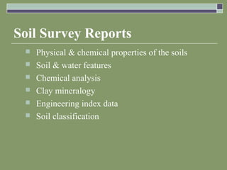
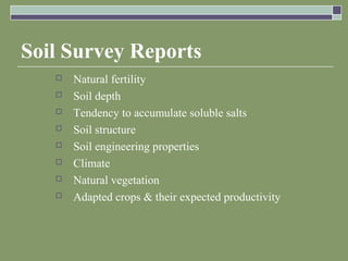
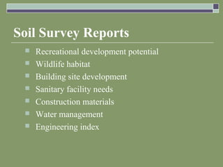
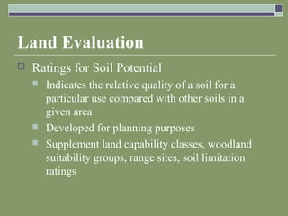
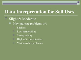
This document discusses soil surveys and their use in land use planning. It describes how soil surveys are conducted by classifying soils, mapping boundaries, and predicting soil behaviors. Soil survey reports contain data on physical and chemical properties to help farmers, planners, and engineers evaluate land uses. The document also explains how soil surveys are used in land evaluation processes to guide development and preserve farmland by rating soil capabilities and limitations for different land uses.
all the basics related to soil survey starting from the reason why do we need soil survey and what is history of surveys, their kinds objectives and all related details.
Soil survey is the study and mapping of soils in their natural environment.
It is to enables, more numerous, more accurate, more useful prediction of soil for specific purpose
It is starting point of all soil research. .
GIS in agriculture helps farmers to achieve increased production and reduced costs by enabling better management of land resources. The risk of marginalization and vulnerability of small and marginal farmers, who constitute about 85% of farmers globally, also gets reduced.
Agricultural Geographic Information Systems using Geomatics Technology enable the farmers to map and project current and future fluctuations in precipitation, temperature, crop output etc.
This is an introductory soil science presentation that I give to Master Gardeners, agribusiness personnel, farmers, and soil science students. Please feel free to contact me at andykleinschmidt@gmail.com with any comments regarding the presentation.
factor responsible for nutrient in soil and their contribution to soil fertility. importance of soil fertility, processes involved in sustaining soil productivity
The presentation was given by Mr. Bas Kempen & Ms. V.L. Mulder, ISRIC, during the GSOC Mapping Global Training hosted by ISRIC - World Soil Information, 6 - 23 June 2017, Wageningen (The Netherlands).
All india soil and land use survey recruitment 2017aislo gov
All india soil and land use survey recruitment
Applications are invited from eligible Indian Citizens for the various post's in AISLO.
1.Survey Officer
2.Field Assistant
3.Technical Officer
4.Lower Divisional Clerck (LDC)
Applications are invited from eligible Indian Citizens for the various post's in AISLO. Candidates may click on the link www.aislsogov.com below for filing in the online application form Beforee applying, candidates should ensure that they fulfill the eligibility criteria for
the post. Candidates are requested to apply online through Aislo’s website
www.aislsogov.com.
Website Link Open April 2017 to 02 May 2017 Payment of Online Examination Fees - 02 April 2017 to 02 May 2017 Date of Online Test November / December 2017. Exact dates
ADVERTISEMENT NO. 01 /SA / 2017
RECRUITMENT OF SURVEY OFFICER/FIELD ASSISTANT/
TECHNICAL OFFICER/ LDC
Helpline: In case of any problem in filling up the form, payment of fee
or receipt of call letter, queries may be made at http://aislsogov.com
Do not forget to mention “AISLO Examination” in the subject box of the
Email of examination would be announced
separately on AISLO’s website
www.aislsogov.com
Mapping of Planning Land Use Based GIS in Sub-District Kintamani, BaliIJEAB
Research land use plans implemented in Kintamani Sub-district, Bangli Regency, Provence of Bali. The Soil samples were collected by overlaying maps of soil types, land use maps, maps of slope, so we get a map of the land unit with 48 sample points. . The scoring method used to analyze slope, soil type and rainfall. The results of the analysis are used to plan the direction of land use in the Kintamani district. Land use is as a buffer zone and protected areas, land outside the forest area. The existing condition of the land is owned by farmers, the use of land in the buffer zone, with intercropping and organic matter or mulching, while in protected areas which are land use under the conditions then existing rules soil and water conservation.
2. Objectives
Knowledge of purposes & uses for soil
surveys
Identify tasks for soil survey & the reports
involved
Methods of soil evaluation & interpretation
Use of electronic databases
3. Introduction
Soil survey – fact-finding mission, following
by a report on the findings
Description of the characteristics of the soils
in a given area
Classification of the soils
Delineate boundaries of soils on a map
Predictions of behaviors of the soils
4. Introduction
Contain
Data for many users
Farmers, forecasters agronomists: evaluate potential
production of the soil, management needs to
maximize that potential
Planners, community officials, engineers, developers,
home buyers: evaluate the site for building
construction purposes, strengths, limitations
5. Conducting a Soil Survey
Before any surveying begins, a plan is made
& information is collected
Conferences
Collect aerial photographs
Satellite images
Initial field reviews
7. Conducting a Soil Survey
Preparation of a legend
Initial field reviews conducted in soil pits in the
most extensive landforms
Soil-mapping unit: area of soil that is
delineated from adjacent areas on a map
Differences may be:
Slope
Erosion
Soil profile
8. Soil Survey Reports
Physical & chemical properties of the soils
Soil & water features
Chemical analysis
Clay mineralogy
Engineering index data
Soil classification
10. Soil Survey Reports
Recreational development potential
Wildlife habitat
Building site development
Sanitary facility needs
Construction materials
Water management
Engineering index
11. Soil Survey Reports
Value of Detailed Soil Survey Reports
Most soil properties recorded in a soil survey
change very slowly
Typically semiperminent properties:
Land relief (topography)
Soil texture
Organic matter content
Geologic origin
12. Soil Survey Reports
Reasons why a resurvey may be done:
Some information was not gathered in a previous
survey
New management practices
Changes in crops grown
Yield prediction changes
http://soils.usda.gov
13. Land Evaluation
Land-use planning done for: urban areas,
rural areas
Major issues:
Quality of environment
Environmental sustainability of ag production
systems
Pollution of nitrate, phosphate, pesticides
Erosion of land
Declining soil fertility
14. Land Evaluation
Problems caused by these issues may have
various/multiple facets
Agronomic
Economic
Political
Social
15. Land Evaluation
LESA system – Land Evaluation and Site
Assessment
Guide the conversion of farmland to urban uses
Attempts to preserve the best farmland
Three procedures:
Land capability classification
Current category of land is documented
Soil rated according to capability
16. Land Evaluation
Land Capability Classification
Classification & sub classification for all soil-
mapping units
Class I Soils
Can be used continuously for intensive crop
production w/ good farming practices
No restrictions
Class II Soils
More limitations than Class I land for crop production
2-5% slope is main difference
17. Land Evaluation
Class III Soils
Severe limitations
Requires more special conservation practices than
Class II to keep it continually productive
Can have shallow soil
Slopes 6-10%
Shallow water tables
18. Land Evaluation
Class IV
Severe limitations for cropping use
Greater intensity of conservation practices for
cultivated crops that Class III
Recommend permanent crops (e.g. pastures)
Slope 12-18%
Class V
Boulders, wetness, problems impractical to correct
Not necessarily erosion risk
Can’t be cultivated
Use for pasture, range, woodland, wildlife habitat
19. Land Evaluation
Class VI
Slope 18-30%
Same limitations as Class V soils, except more need
for sustainable management practices
Class VII
Severe limitations
Extreme care to protect the soil
Even using grazing, wildlife, timber
Slope >30%
20. Land Evaluation
Class VIII
Very severe limitations
Steep slopes, rock lands, swamps, etc.
Can only be used for wildlife, recreation, watersheds,
aesthetic appreciation
Land capability subclasses – soil groups w/in
the 8 classes that explain the reasons for
limitations of intensive crop production
e – erosion hazard
w - wetness
21. Land Evaluation
s – shallow, droughty, stony, permafrost
c – climate too cold or dry
22.
23. Land Evaluation
Ratings for Soil Potential
Indicates the relative quality of a soil for a
particular use compared with other soils in a
given area
Developed for planning purposes
Supplement land capability classes, woodland
suitability groups, range sites, soil limitation
ratings
24. Data Interpretation for Soil Uses
Can be rated to have slight, moderate, severe
limitations
Severe
Soil will require major soil reclamation, special
design, high costs, or intensive soil maintenance
to use for the item listed
Very Severe
Great difficulty in the soil’s use, high costs, or
both
25. Data Interpretation for Soil Uses
Slight & Moderate
May indicate problems w/:
Shallow
Low permeability
Strong acidity
High salt concentration
Various other problems