Global positioning system 1
•Download as PPT, PDF•
0 likes•48 views

BEST FOR TRAINING PURPOSE
![WHAT IS G.P.S
• GPS is a location system based on
satellite orbiting the earth [satellite
sig. tech. ]
• Developed by US dept. of defense
for its application as a military
locating utility
• It is also used in nonmilitary
application such as navigation,
surveying & mapping.](data:image/gif;base64,R0lGODlhAQABAIAAAAAAAP///yH5BAEAAAAALAAAAAABAAEAAAIBRAA7)
Recommended
More Related Content
What's hot
What's hot (20)
Viewers also liked
Viewers also liked (9)
Similar to Global positioning system 1
Similar to Global positioning system 1 (20)
Recently uploaded
Recently uploaded (20)
Global positioning system 1
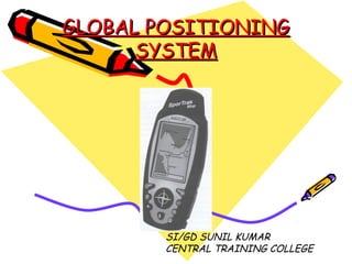
- 1. GLOBAL POSITIONINGGLOBAL POSITIONING SYSTEMSYSTEM SI/GD SUNIL KUMAR CENTRAL TRAINING COLLEGE
- 2. WHAT IS G.P.S • GPS is a location system based on satellite orbiting the earth [satellite sig. tech. ] • Developed by US dept. of defense for its application as a military locating utility • It is also used in nonmilitary application such as navigation, surveying & mapping.
- 3. • Satellite are high enough to avoid the problems associated with land based systems. • GPS can provide accurate position 24 hrs. a day , any where in the world. • When using differential correction tech. it can provide accuracy within 5 meters or less. • Uncorrected posn. determined by GPS satellite sig. produce accuracy up to 50- 100 mtr. range.
- 4. • The technology is beneficiary to the GPS user community in terms of obtaining accurate data up to about100 meters for navigation, meter-level for mapping, and down to millimeter level for geodetic positioning. • The GPS uses satellites and computers to compute positions anywhere on earth. • GPS uses a trigonometric approach to calculate the positions.
- 5. • Introduction, History, Background, &characteristics. • Short form of NAVSTAR GPS. • Navigation, system with time& ranging, global posn. System. • After the Second World War, it became apparent to the U.S. Dept. of Defense to found the solution of accurate, absolute positioning. • Several projects and experiments ran during the next 25 years or so, including Transit, Timation, Loran, and Decca etc. ,these projects were limited in accuracy or functionality
- 6. • At the beginning of the 1970s, a new project was proposed - GPS. This concept promised to fulfill all the requirements of the US government. • It determine ones position accurately, at any point on the earths surface, at any time, in any weather conditions. • GPS is a satellite-based system that uses a constellation of 24 satellites to give a user an accurate position.
- 7. • To a hiker or soldier in the desert, accurate means about 15m. To a ship in coastal waters, accurate means 5m. To a land surveyor, accurate means 1cm or less. • GPS can be used to achieve all of these accuracies in all of these applications. • The difference being the type of GPS receiver used and the technique employed. • GPS was originally designed for military use at any time anywhere on the surface of the earth. •
- 8. • Soon after the original proposals were made, it became clear that civilians could also use GPS. • The first two major civilian applications to emerge were marine navigation and surveying. • Nowadays applications range from in car navigation through truck fleet management to automation of construction machinery.
- 9. WORKING PRINCIPLE OF GPS • Worldwide coverage • 24 hours per day • Low end user cost • Military safe • 10-20 mtr. accurate navigation posn. • It was designed to take over from existing navigation systems . • To be supplied to each man in the field and installed in all military vehicles.
- 10. GPS navigation has three major components • The Space Segment • The Control Segment • The User Segment THE SPACE SEGMENT • The Space Segment is designed to consist of 24 satellites orbiting the earth at approximately 20200km every 12 hours. • At this time there are 26 operational satellites orbiting the earth.
- 11. • The space segment is so designed that there will be a minimum of 4 satellites visible above a 15° cut-off angle at any point of the earth’s surface at any one time. • . Four satellites are the minimum that must be visible for most applications. • there are usually at least 5 satellites visible above 15° for most of the time and quite often there are 6 or 7 satellites visible .
- 12. • Each satellite contains four precise atomic clocks (Rubidium and Cesium standards) and has microprocessor on board for limited self-monitoring and data processing . • The clocks operate at a fundamental frequency of 10.23MHz. & used to generate the signals broadcasted from the satellite. • The satellites are equipped with thrusters which can be used to maintain or modify their orbits.
- 13. THE CONTROL SEGMENT • Control Segment consists of one master control station.[ Colorado Springs serves as the master control station ] • 5 monitor stations [Colorado Springs, Ascension Island, Diego Garcia, Hawaii, and Kwajalein Island] and 4 ground antennas distributed amongst 5 locations roughly on the Earth’s equator . • The Control Segment tracks the GPS satellites, updates their orbiting position and calibrates and synchronizes their clocks.
- 14. THE USER SEGMENT • The User Segment comprises of anyone using a GPS receiver to receive the GPS signal and determine their position and/or time. • Typical applications within the user segment are land navigation for hikers, vehicle location, surveying, marine navigation, aerial navigation, machine control etc. • The GPS receiver decodes the timing signals from the 'visible' satellites (four or more) and, having calculated their distances, computes its own latitude, longitude, elevation, and time.
- 15. • This is a continuous process and the position is updated on a second-by-second basis, output to the receiver display device and, if the receiver display device and, if the receiver provides data capture capabilities, stored by the receiver-logging unit. • the techniques can be broken down into three basic classes: • A] Autonomous Navigation • a single stand-alone receiver, used by hikers, ships that are far out at sea and the military. Position Accuracy is better than 100m for civilian users and about 20m for military users.
- 16. B] Differentially corrected positioning • commonly known as DGPS, this gives an accuracy of between 0.5-5m. Used for inshore marine navigation, GIS data acquisition, precision farming etc. C] Differential Phase position. • Gives an accuracy of 0.5-20mm. Used for many surveying tasks, machine control etc.
- 17. THANKS FOR A PATIENT HEARING