Paper presentation
•Download as PPTX, PDF•
1 like•168 views

Relationship between Mining Industry and GPS Navigation system

Recommended
More Related Content
What's hot
What's hot (20)
Similar to Paper presentation
Similar to Paper presentation (20)
Recently uploaded
Recently uploaded (20)
Paper presentation
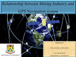
- 1. PREPARED BY NAME: MUHIRE JACOBS LIONEL CIVIL DEPARTMENT ENGINEERING & TECHNOLOGY
- 2. ABSTRACT: • Recently the National Aeronautics and Space Administration (NASA) developed sensor technology that records the global positioning system (GPS) signal reflected from the surface of Earth, which estimates the dielectric properties of soil and can be used to estimate and help faster and safely during completion of huge project. • The overall objective of this study was to determine the feasibility of utilizing GPS-based technology developed by NASA for ground precise measurements and to determine other essential supports.. • The results showed strong positive correlations between the ground and reflected signals. Other factors (soil compaction and soil type), were not significantly related to reflectivity and did not significantly change the relationship between reflectivity and soil contents . Therefore, this system could be used as a real-time and continuous nonintrusive sensor for site-specific mining scheduling.
- 3. SCOPE: GEO-REFERENCED IMAGE BY QGIS FROM GOOGLE EARTH • Image from Google Earth Pro. How this image was made… • Various corners are made by using QGIS and GOOGLE EARTH PRO. . • GPS facilitates to identify latitude and longitude and altitude of the current specific location. • Sensors for navigation support to study area with available monitoring facilities.
- 5. NEXT……
- 6. From Universal Transverse Mercator NEYVELI IS LOCATED IN 44P ZONE FROM UTM COORDINATES Advantages…. • These corners help to identify limits of the given area by using GPS navigation. • Contributing much more realistic and precise informations . • Identify the locations and limits of area of study.
- 7. Methodology: • Number of Satellites There is one problem in using GPS in mine site situations, which has become increasingly obvious over the last 12 months. As explained earlier, four satellites are necessary in order to obtain a fix in three dimensions. For high precision RTK operation five satellites are necessary. With the current constellation of 28 GPS satellites, there are rare occasions when only three are visible and almost daily occurrences of only four visible GPS satellites. This applies to a receiver on a flat plain which has an unobstructed view of the full sky.. In a pit where part of the sky is obscured by the pit walls, satellite availability may prevent 24 hour continuous coverage.
- 8. How It Works
- 9. Important notice…. • The US NAVSTAR system has about 28 GPS satellites in orbit. The number varies slightly as old ones are retired and new ones launched. • Each satellite carries a highly accurate Caesium atomic clock. The satellites put out a coded time and position signal. • A ground receiver with a similar atomic clock can compute the travel time of the signal and hence the range to the satellite.
- 10. Let’s talk about mining scenario… • Surveying • Most mines now use RTK GPS systems for surveying. GPS considerably speeds up the surveying process and reduces the time surveyors are in the field. • often invulnerable locations. For example, because the GPS system gives an absolute position,the tedious process of establishing field control points is entirely eliminated.
- 11. Key findings….
- 12. High Precision Machine Control • Many mines have started to fit high precision guidance systems to their mining equipment. The systems are accurate enough to eliminate the need for survey design pegs in the field. • Besides greatly increasing efficiency, this eliminates the need to have people on the ground outside vehicles, where they are most vulnerable to accidents.
- 13. More adv ’s… • Not only do the surveyors not have to put the pegs in, but the operators do not have to climb out of their cabs to look at them. • Moreover the machines record the positions that they have worked and so build a grid file of the completed job. This can be turned into an “as-built” drawing – all without ever having a surveyor in the field.
- 14. GPS solved an issue of rollover events…
- 15. Solution… • A further safety benefit of the GPS system was recently revealed when a dozer was involved in a rollover accident. The sequence of events leading to the accident could be thoroughly reviewed because the GPS system had recorded the position of the dozer every few seconds.
- 16. …. • On shovels and excavators, GPS systems can be set up to indicate the exact location of the bucket in three dimensions relative to the boundaries of the ore body or coal seam. In situations where the ore is not readily distinguishable from waste’ • Hazard Avoidance • It is also possible to set up the dozer so that it automatically broadcasts an assistance required signal at the operators command or if it is tilted beyond a preset angle. • The signal from the machine can include its position, making it easy to find.
- 17. Collision Avoidance • Another possible use of GPS to enhance safety is in collision avoidance. If all mobile vehicles are fitted with GPS and telemetry systems, they can continuously report their position to a central control base. • Software at the base can then analyze the data and warn when two vehicles are on a collision course, as is done with civilian air flights in crowded air corridors.
- 18. Number of Satellites • four satellites are necessary in order to obtain a fix in three dimensions. For high precision RTK operation five satellites are necessary. There is one problem in using GPS in mine site situations In a pit where part of the sky is obscured by the pit walls, satellite availability may prevent 24 hour continuous coverage.
- 19. There are potential means of overcoming this shortcoming: • Planning. It is quite easy to predict the periods of low satellite availability or when particular areas in the pit will be blocked from sufficient satellites. Using this information, activities can be scheduled around the down times. • Other Satellites. Russians have GPS system too and known as GLONASS, The European Space Agency also has a GPS network – to be known as Galileo. Receivers capable of seeing the 72 satellites from all three systems would be continuously available for high precision • Pseudolite artificial satellites or “ Pseudolite ”, which would be placed on the pit walls. For various technical reasons, including the swamping of the weak satellite signals by the close pseudolite signal
- 21. Conclusion…. • GPS survey and machine guidance applications are finding increasing acceptance in the mining industry. • Widespread adoption of this technology has important safety benefits as a by product. In addition there are a number of applications where GPS systems may be fitted for primary safety purposes. • Lack of satellites is the major problem to be overcome, but there are a number of possible solutions and more will be available in the future.