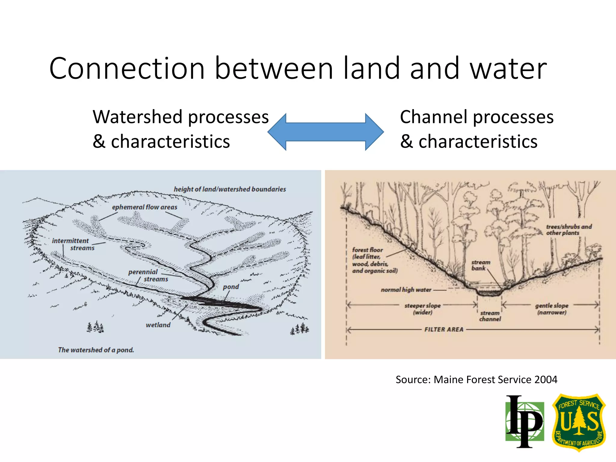
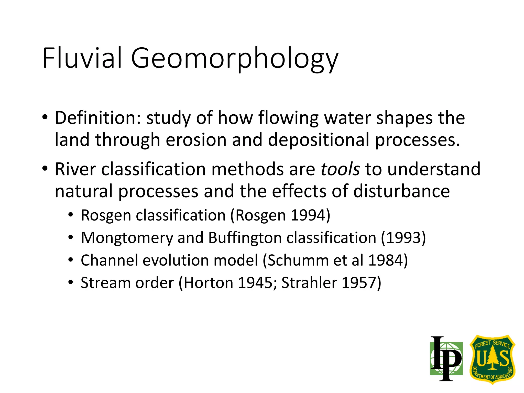
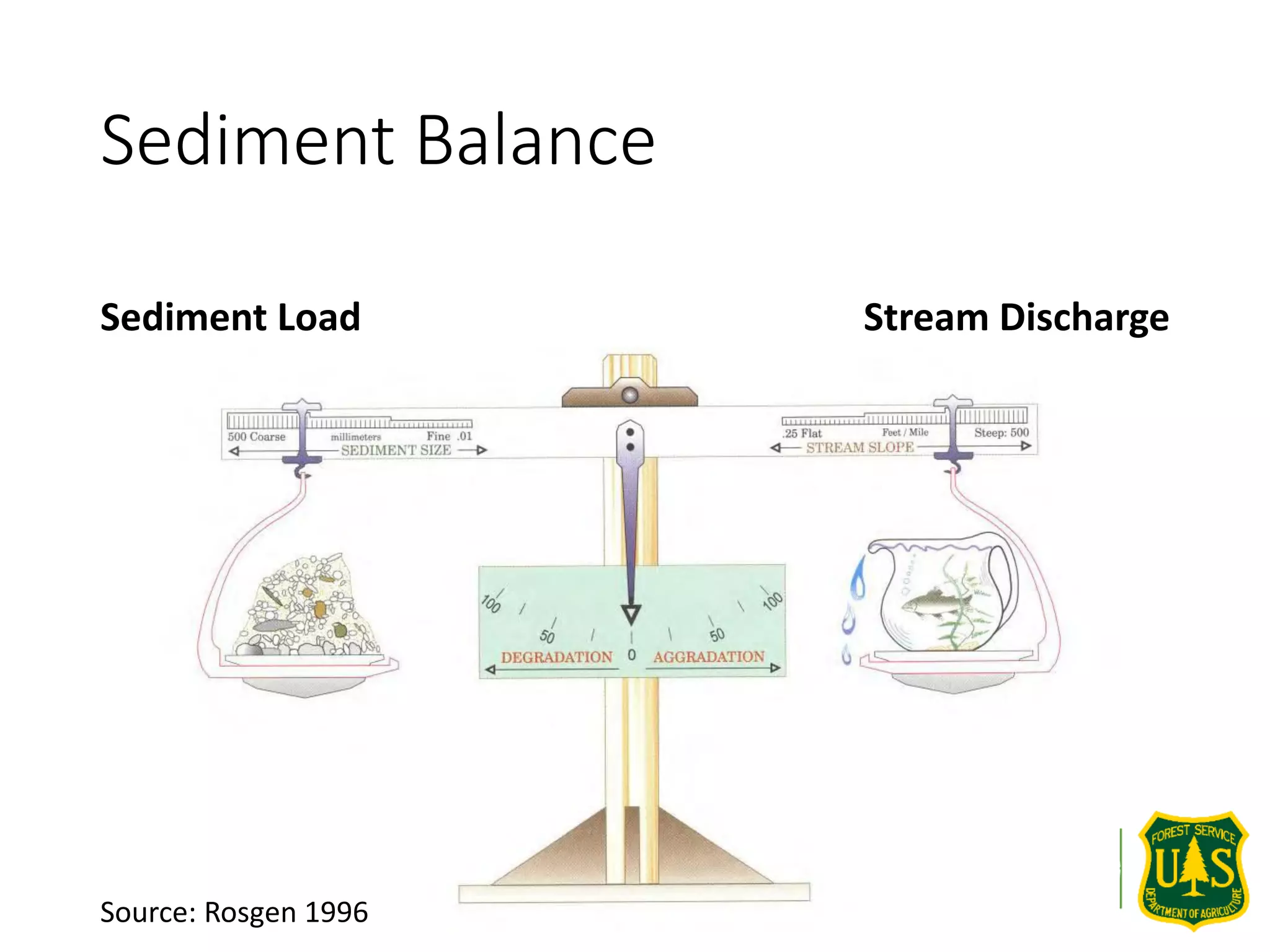
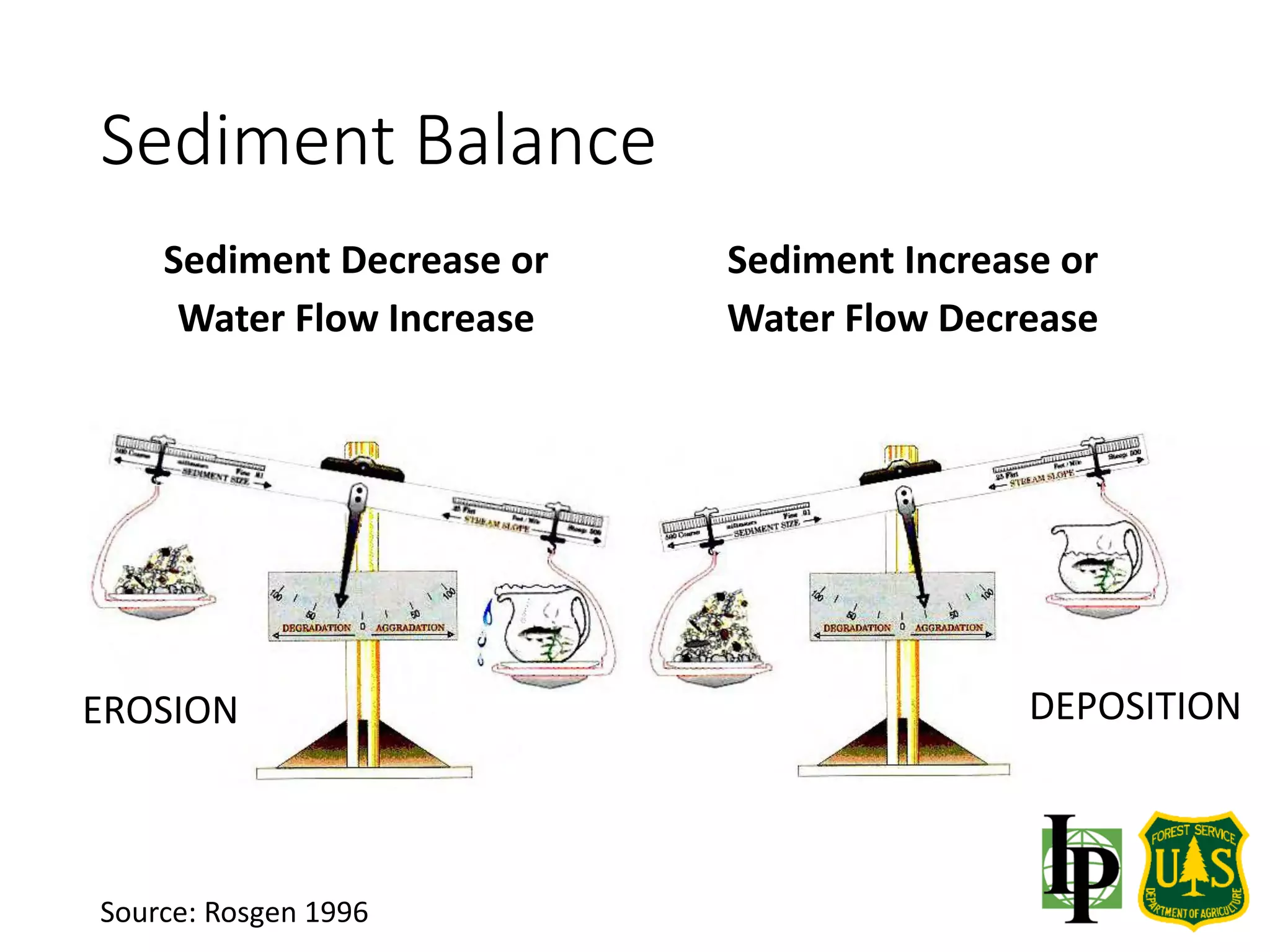
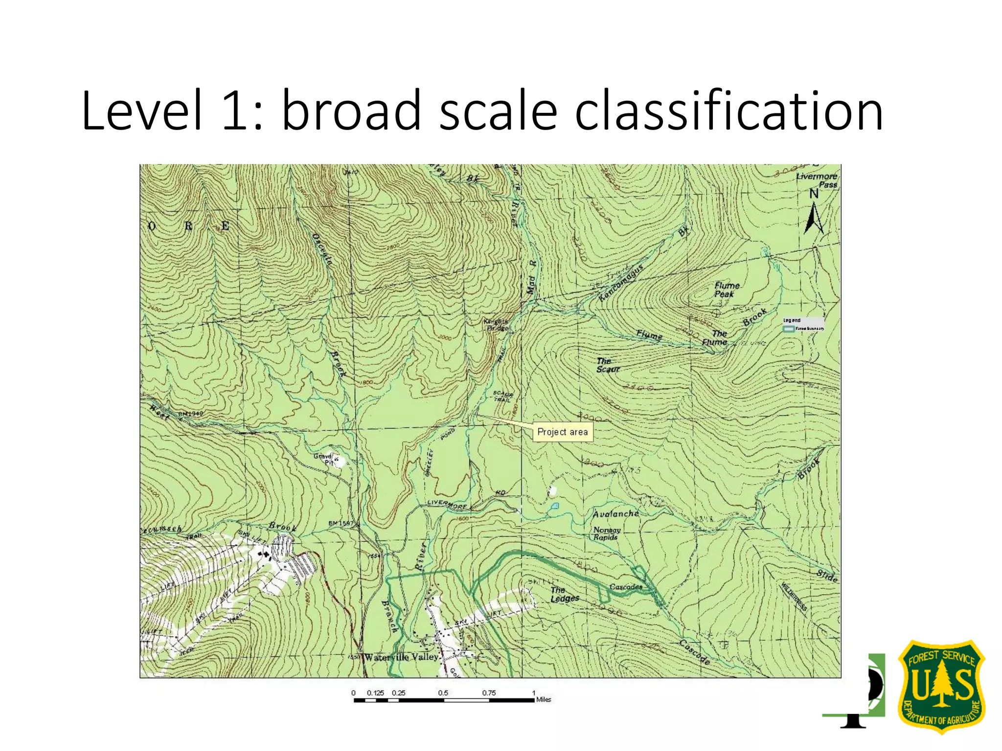
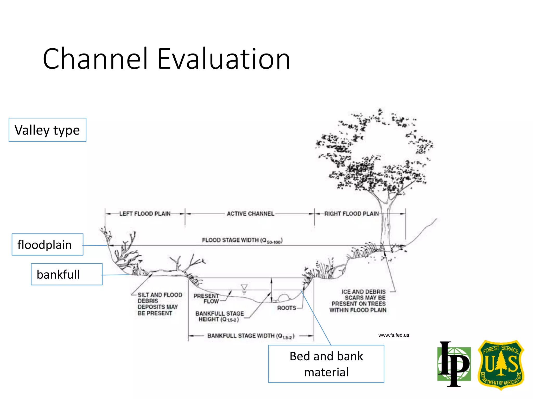
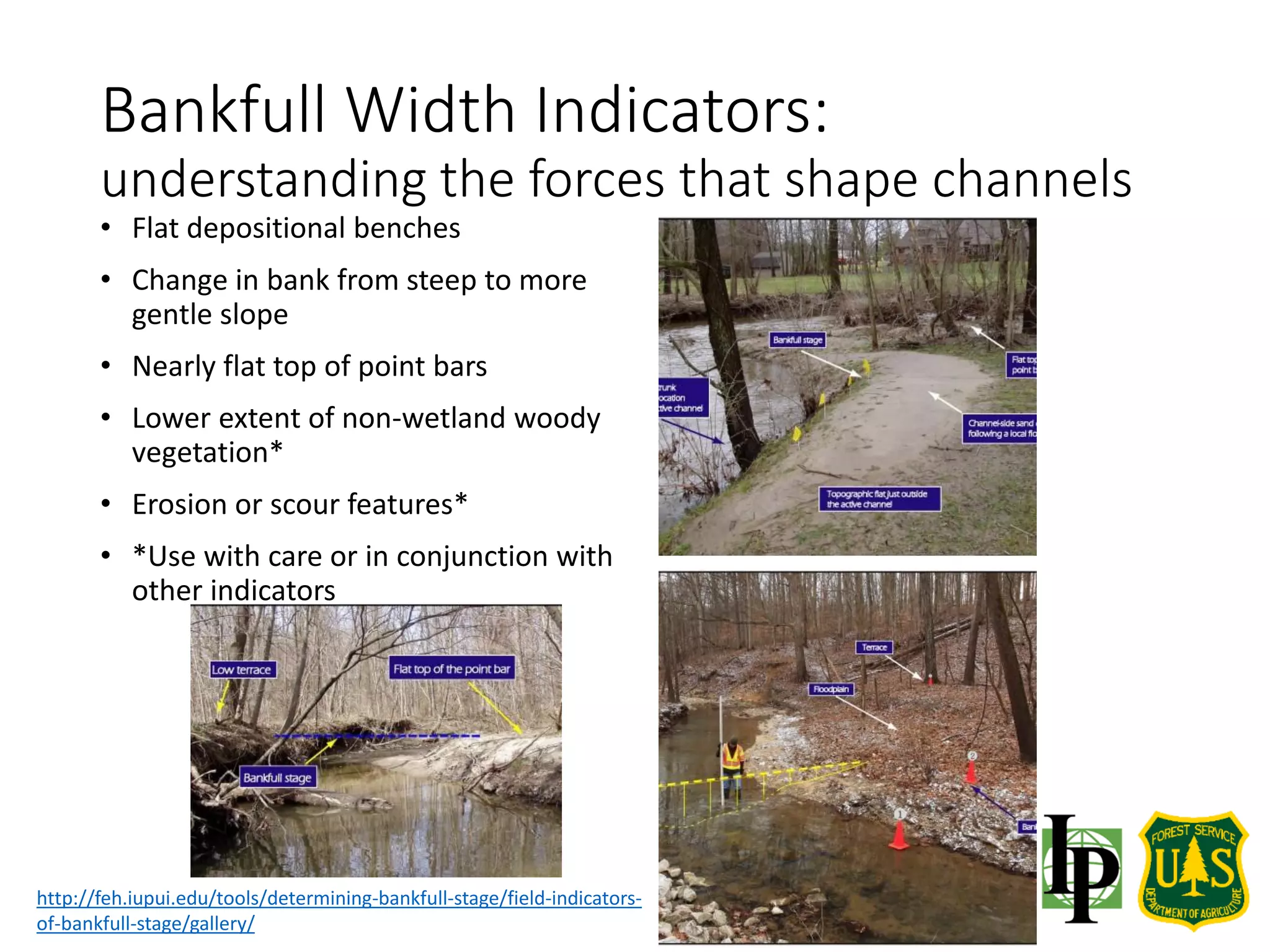
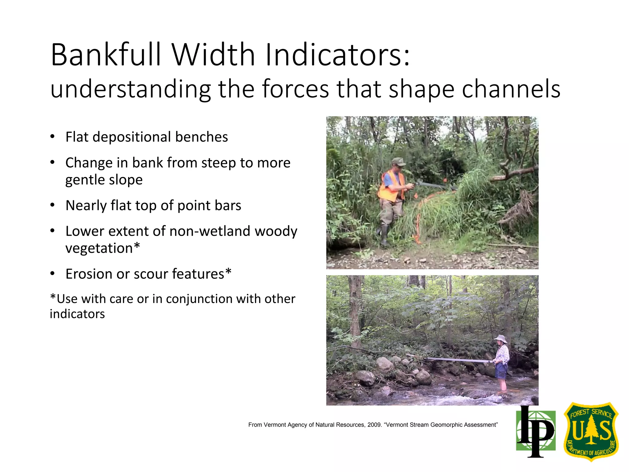
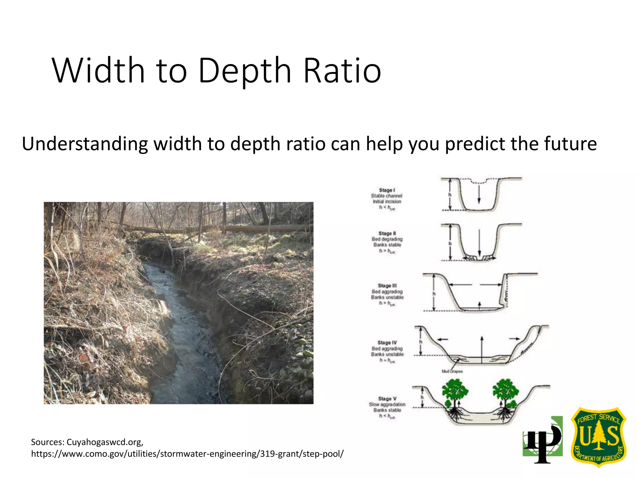
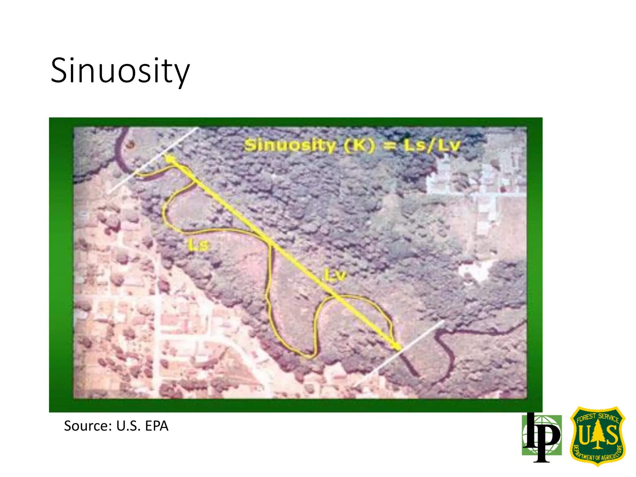
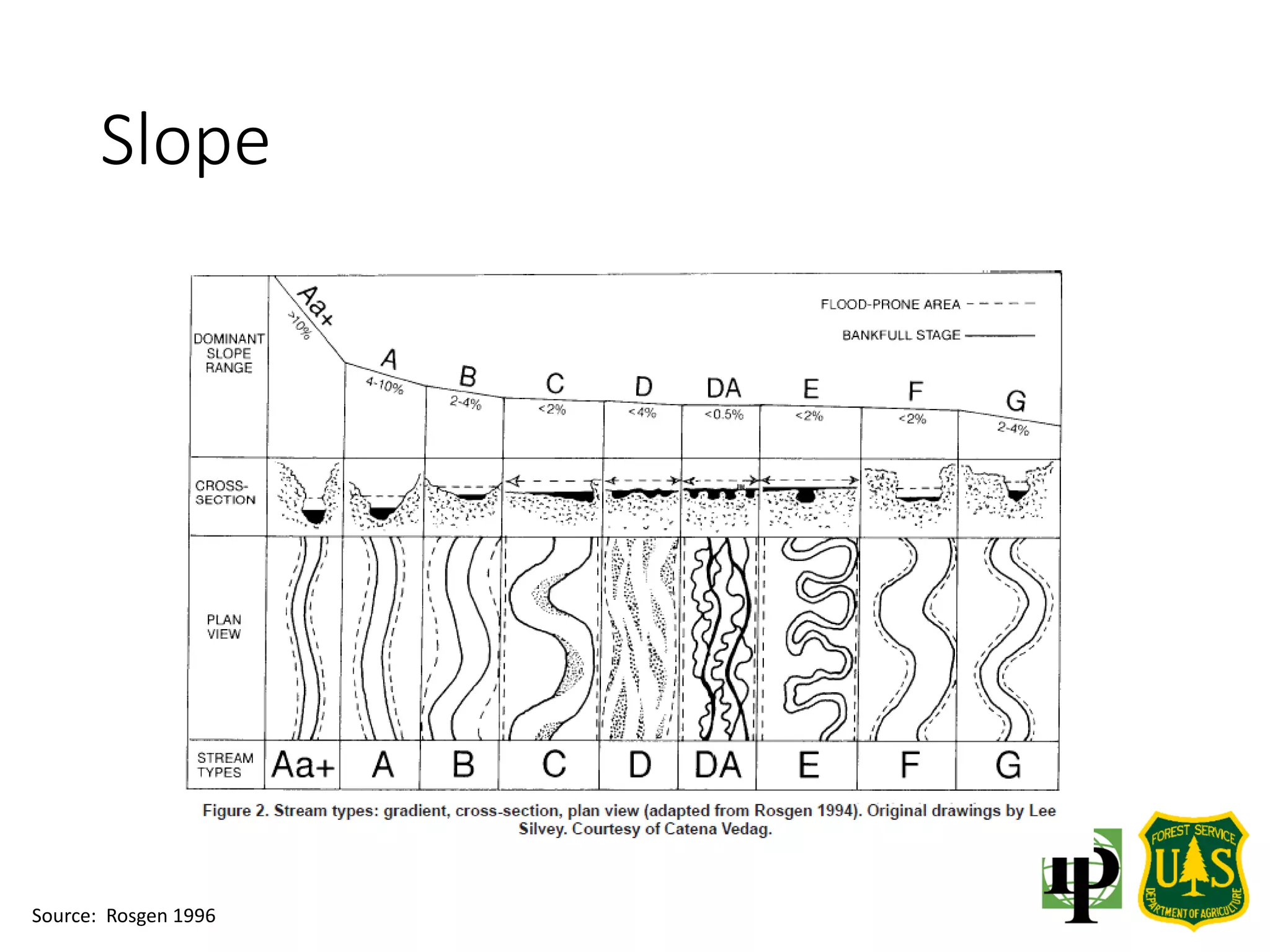
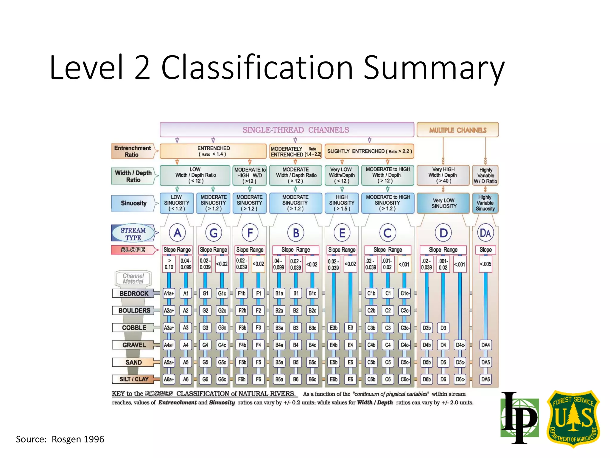
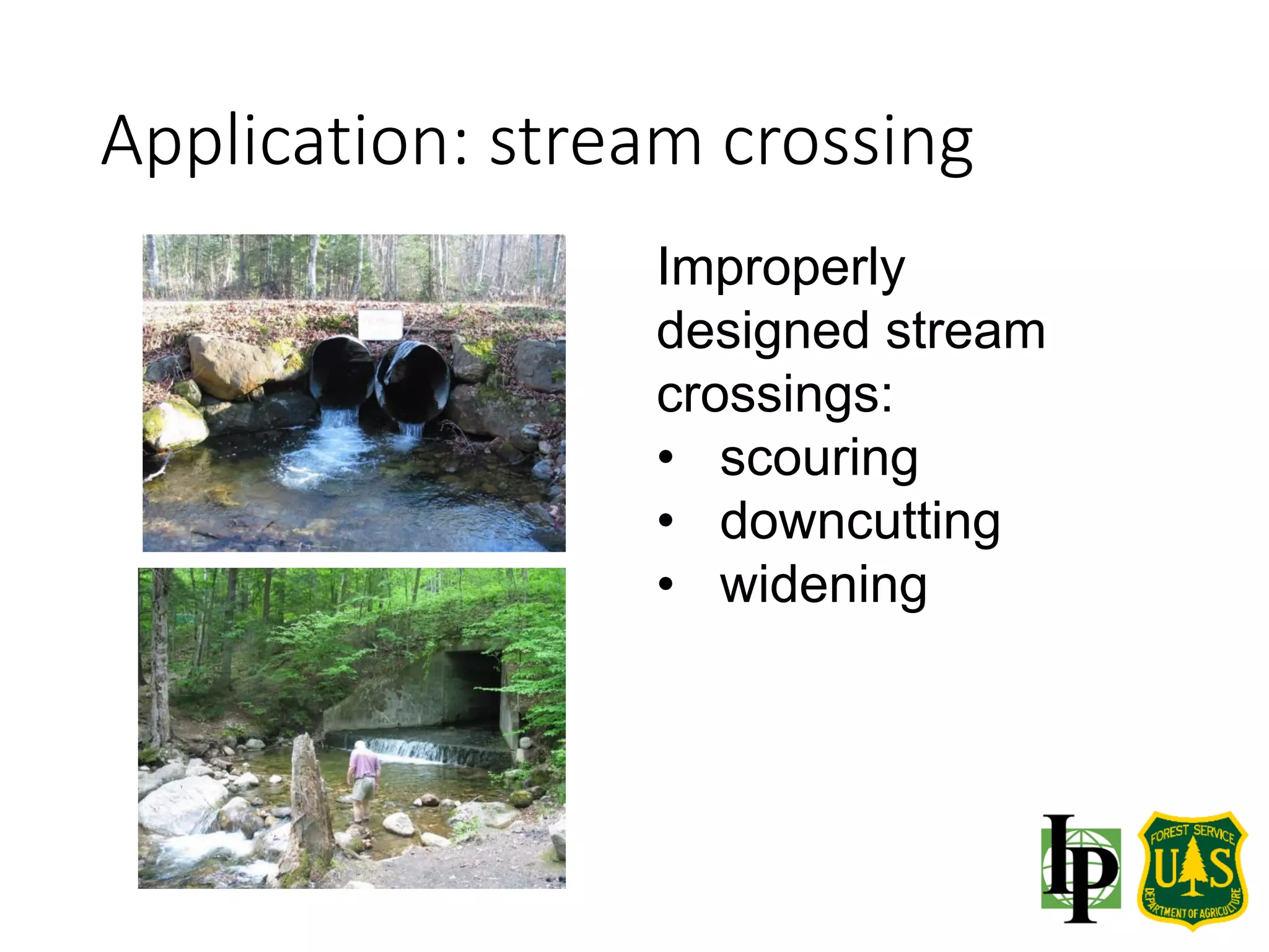
This document provides an overview of fluvial geomorphology and channel classification methods. It discusses the connection between watershed processes, land, and water. Several classification systems are described for classifying stream channels, including the Rosgen and Montgomery-Buffington systems. Level 1 classification involves rapidly identifying stream type, while Level 2 classification uses field measurements of cross-sections, slope, sinuosity and other characteristics to further classify channels. Indicators of bankfull width are also outlined. The classification systems can be used to understand natural channel processes and impacts of disturbance.