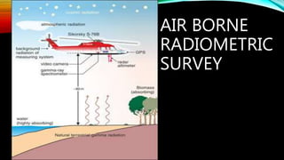
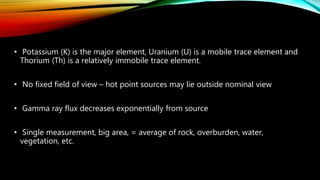
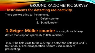
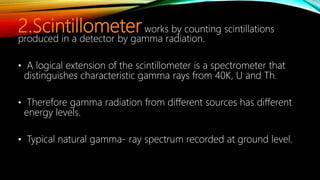
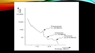
Radiometric surveys measure the natural radiation emitted from the Earth's surface to identify distributions of certain rocks and soils. The survey quantifies levels of potassium, thorium, and uranium by detecting their unique gamma ray signatures. Airborne surveys from aircraft map large areas by averaging radiation readings over terrain, while ground surveys use detectors like Geiger counters and scintillometers placed near outcrops. Applications include mineral exploration, soil mapping, engineering studies, and environmental monitoring.


![W. van schmus natural radioactivity of the crust and mantle [short article]...](https://cdn.slidesharecdn.com/ss_thumbnails/w-201026101905-thumbnail.jpg?width=640&height=640&fit=bounds)


