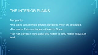
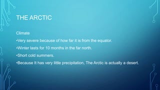
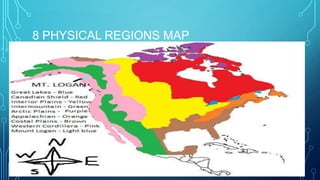
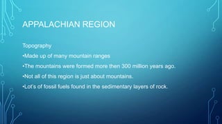
3. APPALACHIAN REGION
Topography
•Made up of many mountain ranges
•The mountains were formed more then 300 million years ago.
•Not all of this region is just about mountains.
•Lot’s of fossil fuels found in the sedimentary layers of rock.
4. APPALACHIAN REGION
Vegetation
•Was originally forested with mixed coniferous and deciduous trees.
•The mixed coniferous and deciduous tress can survive in the poor and
unproductive mountain soil, and flourish on the plateaus and in the
rivers.
5. APPALACHIAN REGION
Climate
•This region is affected by 2 currents, the Labrador current and the Gulf
Stream.
•The Labrador Current brings cold water south of the Arctic.
•The Gulf Stream brings warm currents of water from the Caribbean.
•Has average temperature and lots of rain yearly.
6. WESTERN CORDILLERA
Topography
•It is comprised of new mountains not yet worn down by erosion
•More than 2 times higher than the Appalachian mountains in the east.
•Lots of mountain ranges.
•Rivers drain towards the Pacific ocean.
7. WESTERN CORDILLERA
Climate
•The west coast has a maritime Climate.
• It is very moist because of how close it is to the ocean and very mild
because of same reasons.
•Because of the Pacific oceans, winters are usually above
freezing/below 0°C.
8. WESTERN CORDILLERA
Vegetation
•Some trees grow as high as a 30 story high building.
•The Giant Sequoia, the largest tree in the world, grows near Yosemite.
•At the top of the mountains, the vegetation
becomes very similar to the tundra, or it ceases
entirely.
10. THE CANADIAN SHIELD
Topography
•Glaciers have removed most of the soil.
•Has rocky surfaces in many places.
•Glaciers effected the draining of the shield to a significant degree.
•Average elevation about 100 meters above sea level in the north. In the
south, rising about 500 meters above sea level.
• Center has much lower elevation than the outer portion.
• The are around Hudson Bay and James Bay is COVERED with clay.
11. THE CANADIAN SHIELD
Climate
•In the north, the winters are long and cold. The summers are short and
not much warmer than winter.
• Has high precipitation and mostly cold.
12. THE CANADIAN SHIELD
Vegetation
•Boreal forests cover most of this region, since evergreens, such as
spruce, pine, and fir are more suited to the thin sandy soil.
•The trees are small and weak, more suited to the pulp and paper industry
than lumbering.
•In the north, the growing season is too short, too little precipitation, and has
permafrost. Making it so trees can barely grow there.
13. THE COSTAL PLAINS
Topography
•Mostly flat, or gently rolling.
•Has an average elevation less than 200 meters above sea level.
•Contains many swamps and marshes.
•It is the Mississippi Delta, it empties the gulf of Mexico.
14. THE COSTAL PLAINS
Climate
•Cold, snowy winters.
•Hot, humid summers.
•Hurricane season occurs between late summer and early winter.
15. THE COSTAL PLAINS
Vegetation
•Mainly very sandy.
•Original vegetation was pine forests.
•Natural vegetation adapted to this sandy soil, in some
areas(Mexico)lush jungles have developed.
16. THE GREAT LAKES – ST. LAWRENCE
LOWLAND
Topography
•Rolling landscape.
•Mainly created by Glaciation.
•Flat plains are broken by hills and deep river valleys.
17. THE GREAT LAKES – ST. LAWRENCE
LOWLAND
Climate
•Humid because of the Great Lakes.
•The Great Lakes tend to cool temperature during summer, same goes
with winter. Strong heat warms the areas around the great lakes.
18. THE GREAT LAKES – ST. LAWRENCE
LOWLAND
Vegetation
•Has very fertile soil.
•Was Canada’s largest brood-leafed forests.
•Because of its soil and climate conditions, it allowed
maple, beech, hickory, and black walnut trees to live.
19. [Website]
THE GREAT LAKES – ST. LAWRENCE
LOWLAND
Environmental concerns
•Water pollution is not adequately regulated
www.appalmad.org
20. THE INTERIOR PLAINS
Topography
•The plains contain three different elevations which are separated.
•The Interior Plains continues to the Arctic Ocean.
•Has high elevation rising about 600 meters to 1500 meters above sea
level.
22. THE INTERIOR PLAINS
Vegetation
•Was covered with mixed deciduous trees and scattered evergreen.
•Trees grew only in river valleys.
•Northern portion of the Interior Plains gradually becoming tundra
towards the Arctic Ocean.
23. THE ARCTIC
Topography
•Near the ocean, land is very flat.
•Mountains of far north formed by folding and are presently covered by glaciers.
•Trees normally do not grow there.
•Small shrubs, mosses, and lichens are the only things that CAN grow there.
•Plants cling to the ground soaking up all the warmth and moist it can find.
24. THE ARCTIC
Climate
•Very severe because of how far it is from the equator.
•Winter lasts for 10 months in the far north.
•Short cold summers.
•Because It has very little precipitation, The Arctic is actually a desert.
27. THE INTERMOUNTAIN REGION
Topography
•The mountains and plateaus never reached the sea, instead they flow
into brackish lakes.
•Some rivers may eventually find their way to the ocean.
28. THE INTERMOUNTAIN REGION
Climate
•South winters are short and warm with very little precipitation.
•Northern winters are short and warm and also with very little
precipitation.
•They have hot and dry summers.
29. THE INTERMOUNTAIN REGION
Vegetation
•Higher areas covered in thin pine forests.
•Ranges between sparse grassland to plants that can survive in semidesert conditions or desert conditions.