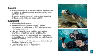
Download to read offline

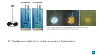
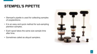
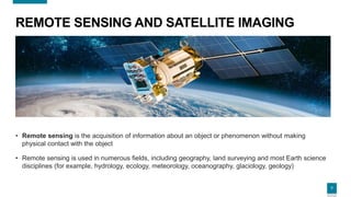
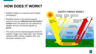

The document presents an overview of oceanographic instruments, detailing their definitions and specific types such as the Secchi disc, Stempel’s pipette, remote sensing technologies, underwater photography, and scuba apparatus. Each instrument is described with its purpose, functionality, and relevant applications in oceanography. Additionally, the document provides references for further information related to the topics discussed.


![An introduction to ocean remote sensing (2nd ed.) [s. martin, 2014]](https://cdn.slidesharecdn.com/ss_thumbnails/anintroductiontooceanremotesensing2nded-160718130035-thumbnail.jpg?width=640&height=640&fit=bounds)


![谷歌留痕技术 [ 𝙩𝙤𝙥 𝟮𝟯𝟯. 𝙘 𝙤𝙢 ]](https://cdn.slidesharecdn.com/ss_thumbnails/top233-260130174328-3833018c-thumbnail.jpg?width=640&height=640&fit=bounds)

