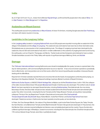
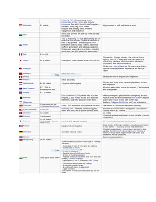
2015
Nepal Earthquake
Ahsan Jadoon
Department of E&ES
Bahria University
Nepal Earthquake
The 2015 Nepal earthquake, also called the Gorkha earthquake and Nepal Greater Earthquake occurred at 11:56
NST on 25 April, killing at least 6,700 people and injuring more than twice as many as of 1 May 2015,with
a moment magnitude of 7.8M or 8.1 and a maximum Mercalli Intensity of IX (Violent). Its epicenter lay in Barpak
village of Gorkha district and its hypocenter was at a depth of approximately 15 km (9.3 mi).
It was the most powerful disaster to strike Nepal since the 1934 Nepal–Bihar earthquake Some casualties have
also been reported in the adjoining areas of India, China, and Bangladesh.
The earthquake triggered an avalanche on Mount Everest, killing at least 19, making it the deadliest day on the
mountain in history.It triggered another huge avalanche in Langtang valley, where 250 are now missing. Centuries-
old buildings were destroyed at UNESCO World Heritage sites in the Kathmandu Valley including some at
the Kathmandu Durbar Square the Patan Durbar Square and the Bhaktapur Durbar Square. Nepal's government
has declared three days of mourning after the quake
Geophysicists and other experts had warned for decades that Nepal was vulnerable to a deadly earthquake,
particularly because of its geology, urbanization, and architecture.
Continued aftershocks occurred throughout Nepal, with one shock reaching a magnitude of 6.7 on 26 April
at 12:54:08 NST.The country is at continued risk of landslides as well.
Geology
Nepal lies towards the southern limitofthe diffuse collision boundarywhere the Indian Plate under thrusts the Eurasian Plate,
occupying the central sector of the Himalayan arc, nearly one-third of the 2,400 km (1,500 mi) long Himalayas.Geologically,the
Nepal Himalayas are sub-divided into five tectonic zones from north to south,eastto westand almostparallel to sub-parallel.
These five distinct morph-geotectonic zones are:
(1) Terrain Plain
(2) Sub Himalaya (Visalia Range),
(3) Lesser Himalaya (Mahabharata Range and mid valleys),
(4) Higher Himalaya,
(5) Inner Himalaya (Tibetan Tethys) Each of these zones is clearly identified by their morphological,geological,and tectonic
features.
The convergence rate between the plates in central Nepal is about45 mm (1.8 in) per year. The location,magnitude,and focal
mechanism ofthe earthquake suggestthatit was caused bya slip along the Main Frontal Thrust
The earthquake's effects were amplified in Kathmandu as itsits on the Kathmandu Basin,which contains up to 600 m (2,000 ft)
of sedimentaryrocks,representing the infilling ofa lake.
Based on a study published in 2014,ofthe Main Frontal Thrust, on average a great earthquake occurs every 750 ± 140 and
870 ± 350 years in the eastNepal region. A study from 2015 found a 700-year delay between earthquakes in the region.The
………….study also suggests thatbecause oftectonic stress buildup,the earthquake from 1934 in Nepal and the 2015 quake
are connected,following a historic earthquake pattern.
Intensity
According to "Did You Feel It?" (DYFI?) responses on the USGS website,the intensityin Kathmandu was IX (Violent).Tremors
were felt in the neighboring Indian states of Bihar,Uttar Pradesh,Assam,WestBengal,Sikkim,Uttarakhand,Odisha,Andhra
Pradesh,Gujaratin the Indian capital region around New Delhi and as far south as Karnataka.Many buildings were brought
down in Bihar.Minor cracks in the walls of houses were reported in Odisha.Minor quakes were registered as far as Kochi in the
southern state of Kerala.The intensity in Patna was V (Moderate). The intensity was IV (Light) in Dhaka, Bangladesh.The
earthquake was also experienced across southwestern China,ranging from the TibetAutonomous Region to Chengdu,which is
1,900 km (1,200 mi) away from the epicenter.Tremors were felt in Pakistan and Bhutan.
Aftershocks
A major aftershock of magnitude 6.7 Mw occurred on 26 April 2015 in the same region at12:55 NST (07:09 UTC), with an
epicenter located about17 km (11 mi) south of Kodari,Nepal.The aftershock caused fresh avalanches on Mount Everest and
was felt in manyplaces in northern India including Kolkata,Siliguri,Jalpaiguri and Assam.The aftershock caused a landslideon
the Koshi Highwaywhich blocked the section ofthe road between Bhedetar and Mulghat.
A model of Geo Gateway, based on a United States Geological Survey mechanism ofa near-horizontal faultas well as location
of aftershocks showed thatthe fault was an 11° dip striking at 295°, 50 km (31 mi) wide, 150 km (93 mi) long,and had a dip slip
of 3 m (9.8 ft). The USGS says the aftershock on Sunday registered ata shallow depth of10 km (6.2 mi).
Assuming thatthis earthquake was the largestevent in this seismic episode,Nepal could expectmore than 30 aftershocks
greater than magnitude 5 over the following month. As of 1 May 2015,120 aftershocks had occured with differentepicenters
and magnitudes above 4 Mw.
Casualties
Nepal
The earthquake killed atleast6,655 and injured more than twice as many, as of 1 May 2015.Nepal's Prime Minister,Sushil
Koirala,has said thatthe number could reach 10,000. The rural death toll may have been lower than expected as villagers were
outdoors working during the time the quake hit. Survivors were found up to 5 days after the earthquake.
On 27 April, The Himalayan Times reported thatas many as 20,000 foreign nationals mayhave been visiting Nepal at the time
of the earthquake,although reports of foreign deaths were relatively low. As reports came in from isolated villages,itwas
possible thattotal deaths would reach or exceed the more than 10,000 killed in the 1934 earthquake. Hundreds ofpeople are
still considered missing and more than 450,000 are displaced.
India
As of 27 April 2015 at 4:14 p.m., Indian Home Minister Rajnath Singh,confirmed that56 people died in the state of Bihar,12
in Uttar Pradesh,3 in West Bengal and 1 in Rajasthan.
Avalanches onMount Everest
This earthquake caused manyavalanches on Mount Everest. At least19 climbers,including Google executive Dan Fredinburg,
are dead,with dozens injured or missing.
Landslides inthe Langtang Valley
In the Langtang valley located in Lang tang National Park around 250 people were reported missing after an avalanche hit the
village of Ghodatabela and the village of Lang tang. The avalanche was estimated to have been two to three kilometers wide.
Ghodatabela was an area popular on the Langtang trekking route. The village of Langtang mayhave been destroyed by the
avalanche.Around 300 were estimated to have died in smaller settlements on the outskirts ofLangtang that were buried during
the earthquake,such as Chyamki,Thangsyap,and Mundu. Twelve locals and two foreigners were believed to have survived.
Smaller landslides occured in the Tritely Valley with reports of significantdamage atMailung,Simle,and Archale
Damage
The Tribhuvan International Airport serving Kathmandu was closed immediatelyafter the quake, but was re-opened later in the
day for reliefoperations,with commercial flights planned to resume on April 26. It has since shutdown operations sporadically
due to aftershocks and manyworkers are not at their posts,either from becoming earthquake casualties or because theyare
dealing with its aftereffects.
Reports from Christian websites reported thatsome churches fell onto the heads ofcongregations while theywere praying, a s
Saturday is the Nepalese Sabbath.The collapsed buildings mayhave affected hundreds ofNepali Christians.
Kathmandu Durbar Square,a UNESCO World Heritage Site, collapsed, as did the Dharahara tower, builtin 1832;the collapse
of the latter structure killed at least180 people.ManakamanaTemple in Gorkha was also destroyed.The northern side of Janaki
Mandir has been reported to be damaged Several temples,including Kasthamandap,Panchtale temple,the nine-storey
Basantapur Durbar,the Dasa Avtar temple and two dewals located behind the Shiva Parvati temple were demolished bythe
quake.Few other monuments,including the Kumari Temple and the Taleju Bhawani Temple,among others,have partially
collapsed. The top of the Jay Bageshwori Temple in Gaushala and some parts ofthe Pashupatinath
Temple,Swyambhunath,Boudhanath Stupa,Ratna Mandir, inside Rani Pokhari,and Durbar High School have been
destroyed.Telephone service in Kathmandu has been sporadic since the quake,as has electricity.
In Patan, the Char Narayan Mandir, the statue of Yog Narendra Malla, a pati inside Patan Durbar Square,the Taleju Temple,
the Hari Shanker, Uma Maheshwor Temple and the Machhindranath Temple in Bungmati were destroyed.In Tripureshwor,the
Kal Mochan Ghat, a temple inspired byMughal architecture,was completelydestroyed and the nearby Tripura Sundari also
suffered significantdamage.In Bhaktapur,several monuments,including the Fasi Deva temple,the Chardham temple and the
17th century Vatsala Durga Temple,were fully or partiallydes troyed.
Outside the Valley, the Manakamana Temple in Gorkha,the Gorkha Durbar,the Palanchowk Bhagwati,in Kavrepalanchowk
District,the Rani Mahal in Palpa District, the Janaki Mandir in Janakpur,the Churiyamai in Makwanpur District,the Dolakha
Bhimsensthan in Dolakha District,and the NuwakotDurbar were partiallydestroyed
Historian Prushottam Lochan Shrestha stated,"We have lostmostof the monuments thathad been designated as World
Heritage Sites in Kathmandu,Bhaktapur and Lalitpur District,Nepal.They cannotbe restored to their original states
Economic Effects
Nepal,with a total Gross Domestic Productof USD$19.921 billion (according to a 2012 estimate), is one of Asia's poorest
countries,and has little ability to fund a major reconstruction efforton its own. Even before the quake,the Asian Development
Bank estimated thatit would need to spend aboutfour times more than it currently does annuallyon infrastructure through 2020
to attract investment. The U.S. Geological Survey initially estimated economic losses from the temblor at9 percent to 50
percentof gross domestic product,with a bestguess of35 percent. "It’s too hard for now to tell the extent of the damage and
the effect on Nepal’s GDP", according to Hun Kim,an Asian DevelopmentBank (ADB) official. The ADB said on the 28th that it
would provide a USD$3 million grantto Nepal for immediate reliefefforts,and up to USD$200 million for the firstphase of
rehabilitation.
"This is a very catastrophic event in a very poor nation. The costof reconstruction over the next few years will be massive.
Rebuilding costs could easily exceed USD$5 billion,which would be about20 percent of Nepal's gross domestic product.
Massive international disaster reliefand rescue efforts will be needed urgently, as well as large-scale international financial and
technical assistance for long-term reconstruction ofthe economy." said RajivBiswas,chiefAsia-Pacific economistatColorado-
based consultancyservices IHS Inc.
Coverage on Social Media
The earthquake received extensive coverage on social networking sites such as Facebook and Twitter.Close to 5 million
tweets relating to Nepal were published during the firstthree days following the disaster. Official Nepal governmentsocial
media profiles were also used bythe Nepal Police, the Office of the Prime Minister of Nepal Prime Minister's Disaster Relief
Fund and the National EmergencyOperation Centre. A group of popular Nepalese accounts on social media were constantly
providing rescue and reliefinformation to the world. The hashtag #NepalEarthquake was in popular use on Twitter, and a
subediton the website Reeditwas also created.
Rescue Effects
About 90 percent of soldiers from the Nepalese Army were sent to the stricken area in the aftermath of the
earthquake underOperation Sankat Mochan, with volunteers mobilized from other parts of the country.[96].
Nepalese Premier Sushil Koirala emphasized the need for quick action and International aid. Rainfall and
aftershocks were factors complicating the rescue efforts, with potential secondary effects like additional landslides
and further building collapses being concerns. Impassable roads and damaged communications infrastructure
posed substantial challenges to rescue efforts.
International Aid
Being Nepal's immediate neighbour,India was the first to respond,with Operation Maitri, which provided rescue and reliefby its
armed forces within hours. It also evacuated its own and other countries'stranded nationals.
On 26 April 2015, international aid agencies and governments mobilized to respond to the earthquake.However, they faced
challenges in getting assistance to the country and distributing itamid the widespread devastation. The global response was
coordinated by the Nepalese governmentthrough its National EmergencyOperation Center Reliefefforts were hampered by
congestion atKathmandu's airport.
As of 1 May 2015,international aid agencies like Medecins Sans Frontieres and the International Federation ofRed Cross and
Red CrescentSocieties had landed emergencymedical teams and aid in Nepal,and struggled to identify the need in areas cut-
off, outlying Kathmandu,[
were able to startmedicallyevacuating the critically wounded by helicopter from there, and treating
others in mobile and makeshiftfacilities.
UNICEF appealed for donations,as close to 1.7 million children had been driven out into the open,and were in desperate need
of drinking water, temporaryshelters,sanitation and protection from disease outbreak due to rotting dead bodies,as well as
psychological counseling as of29 April 2015.It distributed water,tents,hygiene kits,water purification tablets and buckets.
Some Glimpse of Destruction
Summary of International Relief
Nepal earthquake
Nepal earthquake

Nepal earthquake

  • 1.
  • 2.
    Nepal Earthquake The 2015Nepal earthquake, also called the Gorkha earthquake and Nepal Greater Earthquake occurred at 11:56 NST on 25 April, killing at least 6,700 people and injuring more than twice as many as of 1 May 2015,with a moment magnitude of 7.8M or 8.1 and a maximum Mercalli Intensity of IX (Violent). Its epicenter lay in Barpak village of Gorkha district and its hypocenter was at a depth of approximately 15 km (9.3 mi). It was the most powerful disaster to strike Nepal since the 1934 Nepal–Bihar earthquake Some casualties have also been reported in the adjoining areas of India, China, and Bangladesh. The earthquake triggered an avalanche on Mount Everest, killing at least 19, making it the deadliest day on the mountain in history.It triggered another huge avalanche in Langtang valley, where 250 are now missing. Centuries- old buildings were destroyed at UNESCO World Heritage sites in the Kathmandu Valley including some at the Kathmandu Durbar Square the Patan Durbar Square and the Bhaktapur Durbar Square. Nepal's government has declared three days of mourning after the quake Geophysicists and other experts had warned for decades that Nepal was vulnerable to a deadly earthquake, particularly because of its geology, urbanization, and architecture. Continued aftershocks occurred throughout Nepal, with one shock reaching a magnitude of 6.7 on 26 April at 12:54:08 NST.The country is at continued risk of landslides as well. Geology Nepal lies towards the southern limitofthe diffuse collision boundarywhere the Indian Plate under thrusts the Eurasian Plate, occupying the central sector of the Himalayan arc, nearly one-third of the 2,400 km (1,500 mi) long Himalayas.Geologically,the Nepal Himalayas are sub-divided into five tectonic zones from north to south,eastto westand almostparallel to sub-parallel. These five distinct morph-geotectonic zones are: (1) Terrain Plain (2) Sub Himalaya (Visalia Range), (3) Lesser Himalaya (Mahabharata Range and mid valleys), (4) Higher Himalaya, (5) Inner Himalaya (Tibetan Tethys) Each of these zones is clearly identified by their morphological,geological,and tectonic features. The convergence rate between the plates in central Nepal is about45 mm (1.8 in) per year. The location,magnitude,and focal mechanism ofthe earthquake suggestthatit was caused bya slip along the Main Frontal Thrust The earthquake's effects were amplified in Kathmandu as itsits on the Kathmandu Basin,which contains up to 600 m (2,000 ft) of sedimentaryrocks,representing the infilling ofa lake. Based on a study published in 2014,ofthe Main Frontal Thrust, on average a great earthquake occurs every 750 ± 140 and 870 ± 350 years in the eastNepal region. A study from 2015 found a 700-year delay between earthquakes in the region.The
  • 3.
    ………….study also suggeststhatbecause oftectonic stress buildup,the earthquake from 1934 in Nepal and the 2015 quake are connected,following a historic earthquake pattern. Intensity According to "Did You Feel It?" (DYFI?) responses on the USGS website,the intensityin Kathmandu was IX (Violent).Tremors were felt in the neighboring Indian states of Bihar,Uttar Pradesh,Assam,WestBengal,Sikkim,Uttarakhand,Odisha,Andhra Pradesh,Gujaratin the Indian capital region around New Delhi and as far south as Karnataka.Many buildings were brought down in Bihar.Minor cracks in the walls of houses were reported in Odisha.Minor quakes were registered as far as Kochi in the southern state of Kerala.The intensity in Patna was V (Moderate). The intensity was IV (Light) in Dhaka, Bangladesh.The earthquake was also experienced across southwestern China,ranging from the TibetAutonomous Region to Chengdu,which is 1,900 km (1,200 mi) away from the epicenter.Tremors were felt in Pakistan and Bhutan. Aftershocks A major aftershock of magnitude 6.7 Mw occurred on 26 April 2015 in the same region at12:55 NST (07:09 UTC), with an epicenter located about17 km (11 mi) south of Kodari,Nepal.The aftershock caused fresh avalanches on Mount Everest and was felt in manyplaces in northern India including Kolkata,Siliguri,Jalpaiguri and Assam.The aftershock caused a landslideon the Koshi Highwaywhich blocked the section ofthe road between Bhedetar and Mulghat. A model of Geo Gateway, based on a United States Geological Survey mechanism ofa near-horizontal faultas well as location of aftershocks showed thatthe fault was an 11° dip striking at 295°, 50 km (31 mi) wide, 150 km (93 mi) long,and had a dip slip of 3 m (9.8 ft). The USGS says the aftershock on Sunday registered ata shallow depth of10 km (6.2 mi). Assuming thatthis earthquake was the largestevent in this seismic episode,Nepal could expectmore than 30 aftershocks greater than magnitude 5 over the following month. As of 1 May 2015,120 aftershocks had occured with differentepicenters and magnitudes above 4 Mw. Casualties Nepal The earthquake killed atleast6,655 and injured more than twice as many, as of 1 May 2015.Nepal's Prime Minister,Sushil Koirala,has said thatthe number could reach 10,000. The rural death toll may have been lower than expected as villagers were outdoors working during the time the quake hit. Survivors were found up to 5 days after the earthquake. On 27 April, The Himalayan Times reported thatas many as 20,000 foreign nationals mayhave been visiting Nepal at the time of the earthquake,although reports of foreign deaths were relatively low. As reports came in from isolated villages,itwas possible thattotal deaths would reach or exceed the more than 10,000 killed in the 1934 earthquake. Hundreds ofpeople are still considered missing and more than 450,000 are displaced.
  • 4.
    India As of 27April 2015 at 4:14 p.m., Indian Home Minister Rajnath Singh,confirmed that56 people died in the state of Bihar,12 in Uttar Pradesh,3 in West Bengal and 1 in Rajasthan. Avalanches onMount Everest This earthquake caused manyavalanches on Mount Everest. At least19 climbers,including Google executive Dan Fredinburg, are dead,with dozens injured or missing. Landslides inthe Langtang Valley In the Langtang valley located in Lang tang National Park around 250 people were reported missing after an avalanche hit the village of Ghodatabela and the village of Lang tang. The avalanche was estimated to have been two to three kilometers wide. Ghodatabela was an area popular on the Langtang trekking route. The village of Langtang mayhave been destroyed by the avalanche.Around 300 were estimated to have died in smaller settlements on the outskirts ofLangtang that were buried during the earthquake,such as Chyamki,Thangsyap,and Mundu. Twelve locals and two foreigners were believed to have survived. Smaller landslides occured in the Tritely Valley with reports of significantdamage atMailung,Simle,and Archale Damage The Tribhuvan International Airport serving Kathmandu was closed immediatelyafter the quake, but was re-opened later in the day for reliefoperations,with commercial flights planned to resume on April 26. It has since shutdown operations sporadically due to aftershocks and manyworkers are not at their posts,either from becoming earthquake casualties or because theyare dealing with its aftereffects. Reports from Christian websites reported thatsome churches fell onto the heads ofcongregations while theywere praying, a s Saturday is the Nepalese Sabbath.The collapsed buildings mayhave affected hundreds ofNepali Christians. Kathmandu Durbar Square,a UNESCO World Heritage Site, collapsed, as did the Dharahara tower, builtin 1832;the collapse of the latter structure killed at least180 people.ManakamanaTemple in Gorkha was also destroyed.The northern side of Janaki Mandir has been reported to be damaged Several temples,including Kasthamandap,Panchtale temple,the nine-storey Basantapur Durbar,the Dasa Avtar temple and two dewals located behind the Shiva Parvati temple were demolished bythe quake.Few other monuments,including the Kumari Temple and the Taleju Bhawani Temple,among others,have partially collapsed. The top of the Jay Bageshwori Temple in Gaushala and some parts ofthe Pashupatinath Temple,Swyambhunath,Boudhanath Stupa,Ratna Mandir, inside Rani Pokhari,and Durbar High School have been destroyed.Telephone service in Kathmandu has been sporadic since the quake,as has electricity. In Patan, the Char Narayan Mandir, the statue of Yog Narendra Malla, a pati inside Patan Durbar Square,the Taleju Temple, the Hari Shanker, Uma Maheshwor Temple and the Machhindranath Temple in Bungmati were destroyed.In Tripureshwor,the Kal Mochan Ghat, a temple inspired byMughal architecture,was completelydestroyed and the nearby Tripura Sundari also suffered significantdamage.In Bhaktapur,several monuments,including the Fasi Deva temple,the Chardham temple and the 17th century Vatsala Durga Temple,were fully or partiallydes troyed.
  • 5.
    Outside the Valley,the Manakamana Temple in Gorkha,the Gorkha Durbar,the Palanchowk Bhagwati,in Kavrepalanchowk District,the Rani Mahal in Palpa District, the Janaki Mandir in Janakpur,the Churiyamai in Makwanpur District,the Dolakha Bhimsensthan in Dolakha District,and the NuwakotDurbar were partiallydestroyed Historian Prushottam Lochan Shrestha stated,"We have lostmostof the monuments thathad been designated as World Heritage Sites in Kathmandu,Bhaktapur and Lalitpur District,Nepal.They cannotbe restored to their original states Economic Effects Nepal,with a total Gross Domestic Productof USD$19.921 billion (according to a 2012 estimate), is one of Asia's poorest countries,and has little ability to fund a major reconstruction efforton its own. Even before the quake,the Asian Development Bank estimated thatit would need to spend aboutfour times more than it currently does annuallyon infrastructure through 2020 to attract investment. The U.S. Geological Survey initially estimated economic losses from the temblor at9 percent to 50 percentof gross domestic product,with a bestguess of35 percent. "It’s too hard for now to tell the extent of the damage and the effect on Nepal’s GDP", according to Hun Kim,an Asian DevelopmentBank (ADB) official. The ADB said on the 28th that it would provide a USD$3 million grantto Nepal for immediate reliefefforts,and up to USD$200 million for the firstphase of rehabilitation. "This is a very catastrophic event in a very poor nation. The costof reconstruction over the next few years will be massive. Rebuilding costs could easily exceed USD$5 billion,which would be about20 percent of Nepal's gross domestic product. Massive international disaster reliefand rescue efforts will be needed urgently, as well as large-scale international financial and technical assistance for long-term reconstruction ofthe economy." said RajivBiswas,chiefAsia-Pacific economistatColorado- based consultancyservices IHS Inc. Coverage on Social Media The earthquake received extensive coverage on social networking sites such as Facebook and Twitter.Close to 5 million tweets relating to Nepal were published during the firstthree days following the disaster. Official Nepal governmentsocial media profiles were also used bythe Nepal Police, the Office of the Prime Minister of Nepal Prime Minister's Disaster Relief Fund and the National EmergencyOperation Centre. A group of popular Nepalese accounts on social media were constantly providing rescue and reliefinformation to the world. The hashtag #NepalEarthquake was in popular use on Twitter, and a subediton the website Reeditwas also created. Rescue Effects About 90 percent of soldiers from the Nepalese Army were sent to the stricken area in the aftermath of the earthquake underOperation Sankat Mochan, with volunteers mobilized from other parts of the country.[96]. Nepalese Premier Sushil Koirala emphasized the need for quick action and International aid. Rainfall and aftershocks were factors complicating the rescue efforts, with potential secondary effects like additional landslides and further building collapses being concerns. Impassable roads and damaged communications infrastructure posed substantial challenges to rescue efforts.
  • 6.
    International Aid Being Nepal'simmediate neighbour,India was the first to respond,with Operation Maitri, which provided rescue and reliefby its armed forces within hours. It also evacuated its own and other countries'stranded nationals. On 26 April 2015, international aid agencies and governments mobilized to respond to the earthquake.However, they faced challenges in getting assistance to the country and distributing itamid the widespread devastation. The global response was coordinated by the Nepalese governmentthrough its National EmergencyOperation Center Reliefefforts were hampered by congestion atKathmandu's airport. As of 1 May 2015,international aid agencies like Medecins Sans Frontieres and the International Federation ofRed Cross and Red CrescentSocieties had landed emergencymedical teams and aid in Nepal,and struggled to identify the need in areas cut- off, outlying Kathmandu,[ were able to startmedicallyevacuating the critically wounded by helicopter from there, and treating others in mobile and makeshiftfacilities. UNICEF appealed for donations,as close to 1.7 million children had been driven out into the open,and were in desperate need of drinking water, temporaryshelters,sanitation and protection from disease outbreak due to rotting dead bodies,as well as psychological counseling as of29 April 2015.It distributed water,tents,hygiene kits,water purification tablets and buckets.
  • 7.
    Some Glimpse ofDestruction
  • 8.