
Download as PDF, PPTX
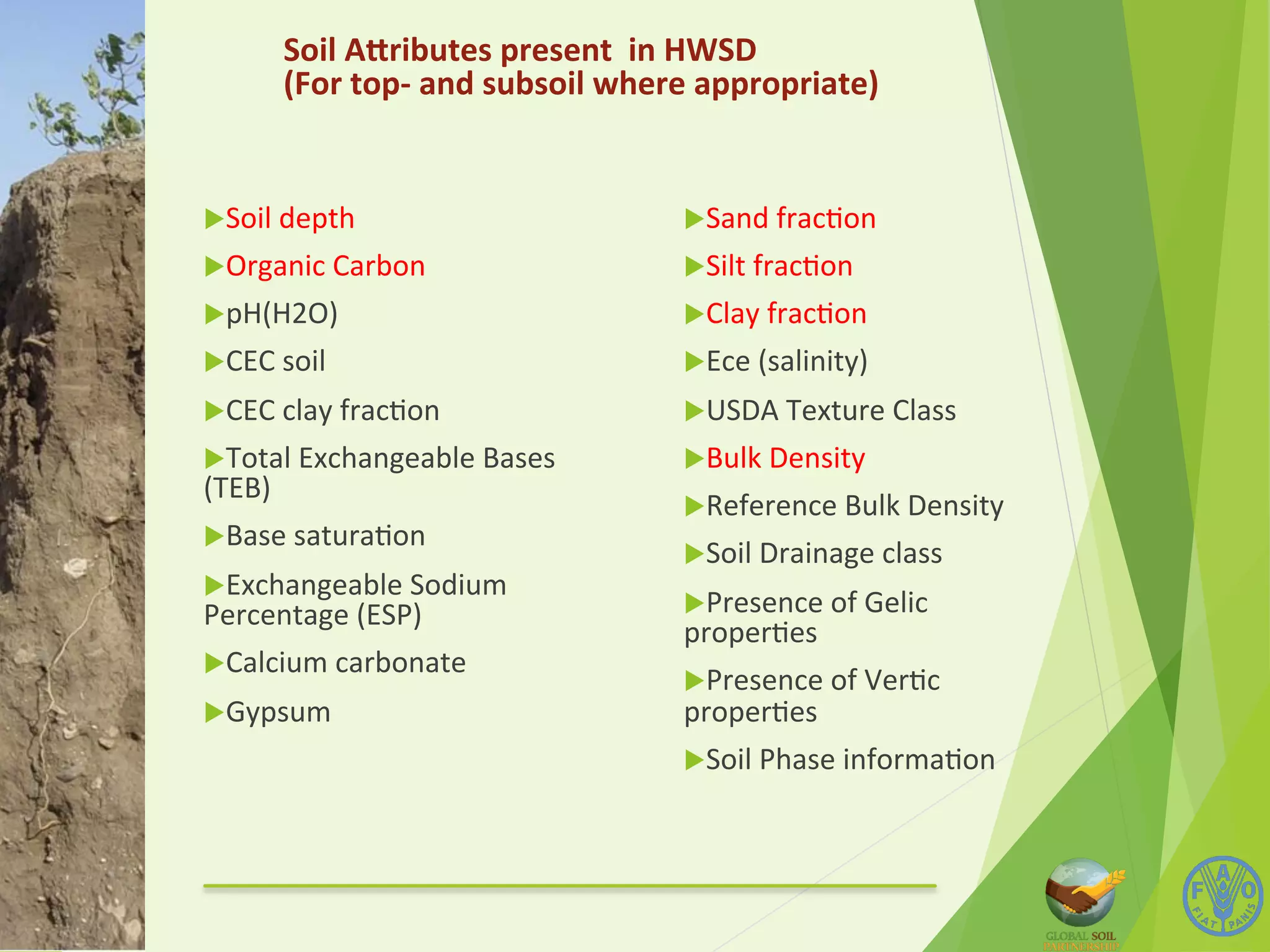
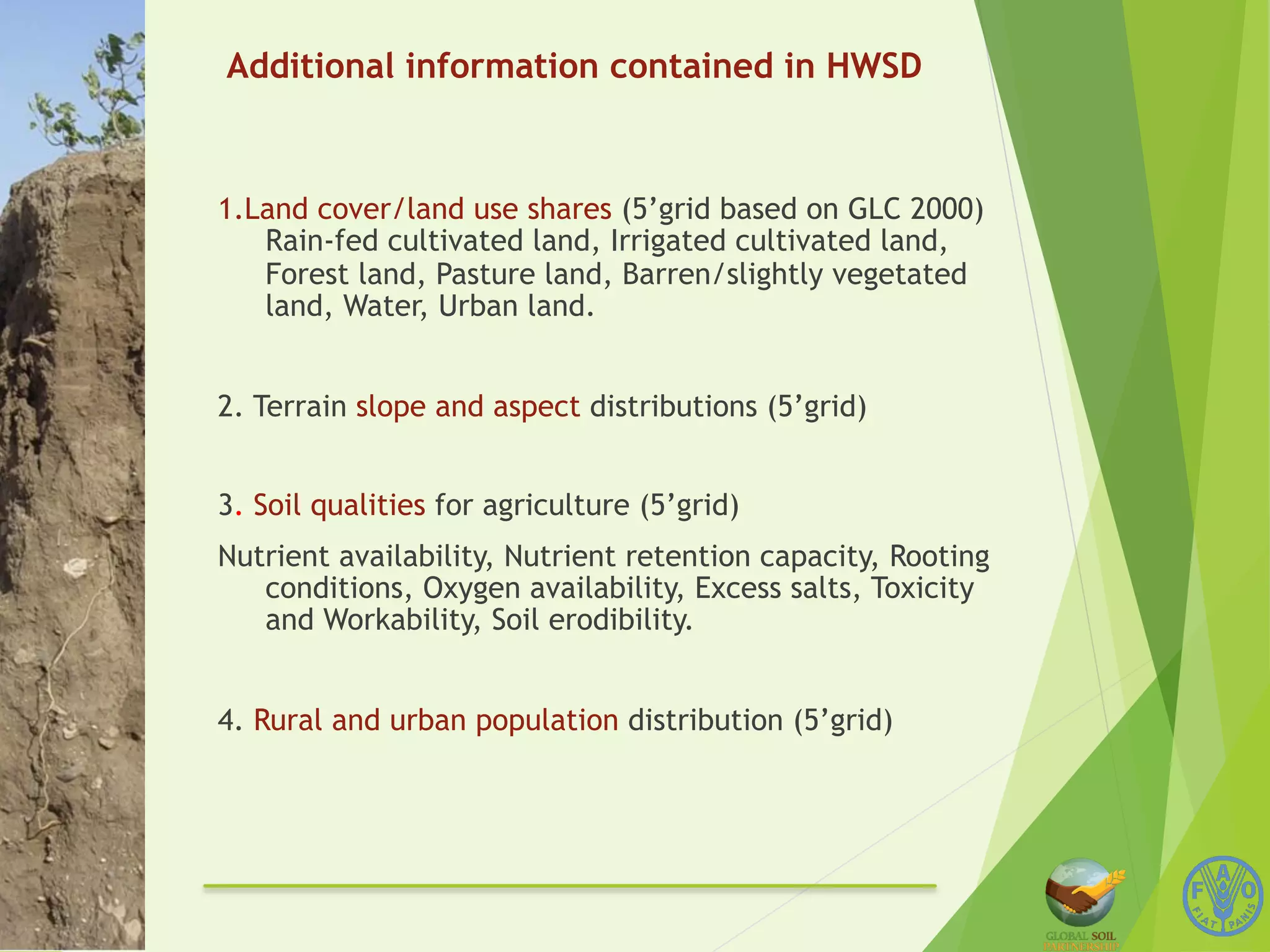
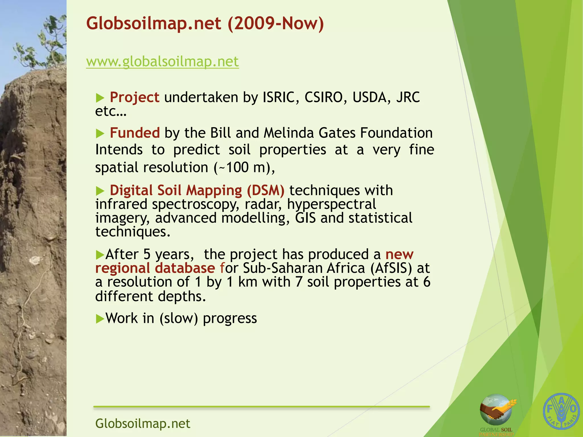
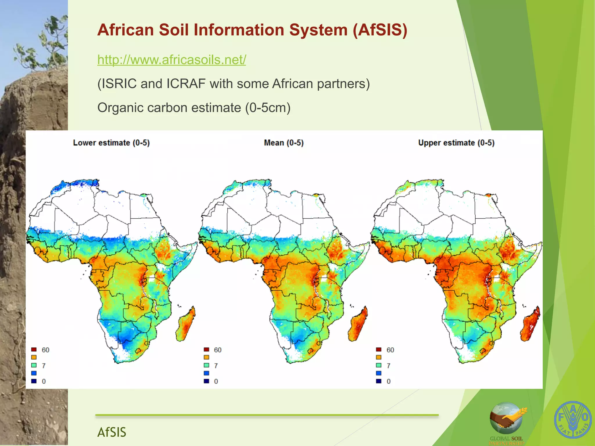
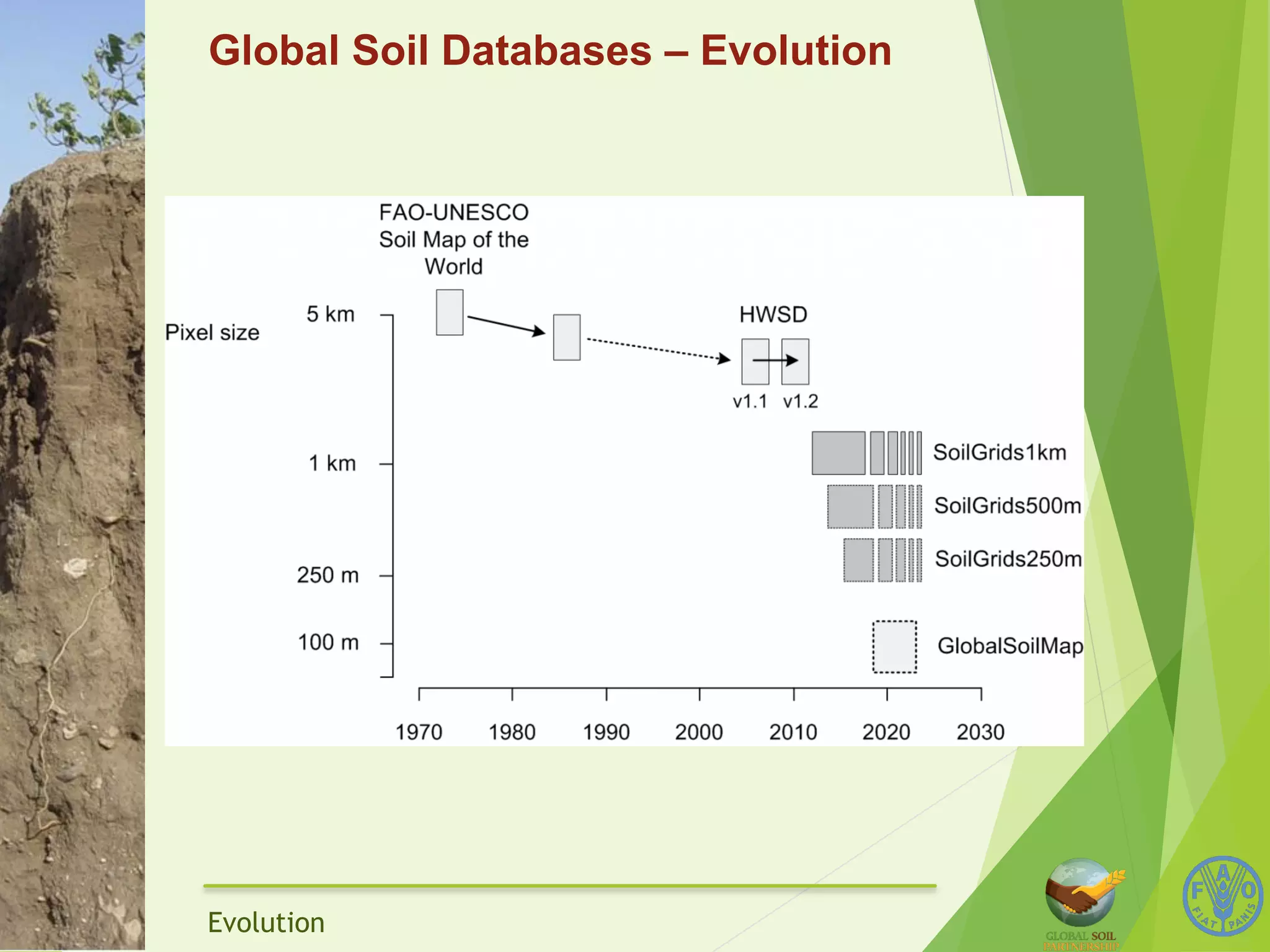
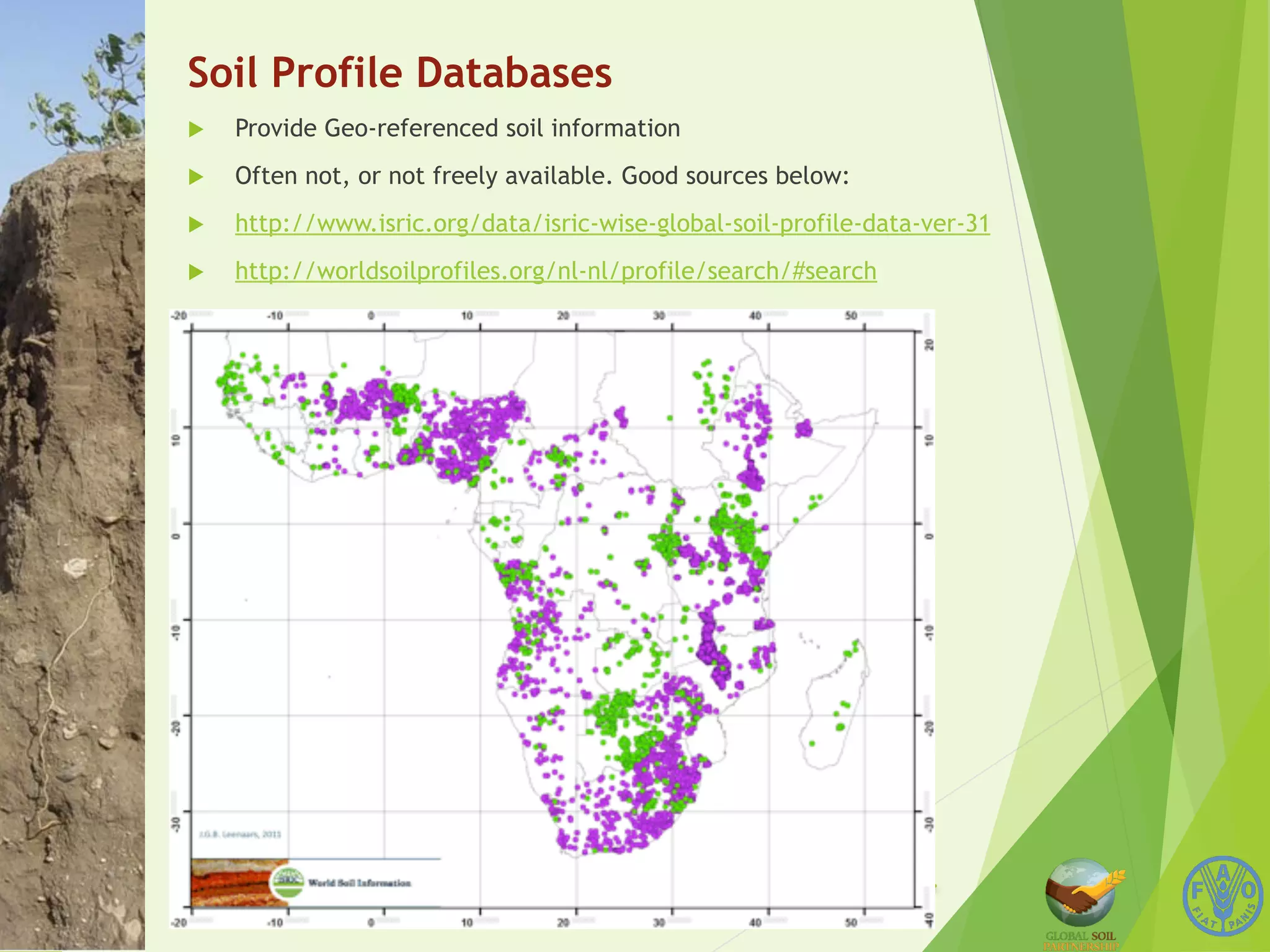
The document discusses several global and regional soil databases. It notes that the Harmonized World Soil Database is currently the most appropriate freely available global soil database, though it is no longer being updated. Efforts like Globsoilmap aim to map soils at higher resolutions but have not achieved global coverage yet. Regional databases like AfSIS for Africa provide more detailed information. National databases also exist but availability varies. New techniques involving spectroscopy, remote sensing, and statistics aim to improve soil mapping.


![[Day 1] Keynote - Opening Remarks and Challenges](https://cdn.slidesharecdn.com/ss_thumbnails/cgiar-csi-day1-31mar2009-opening-agra-090405004217-phpapp01-thumbnail.jpg?width=640&height=640&fit=bounds)


