Downloaded 215 times
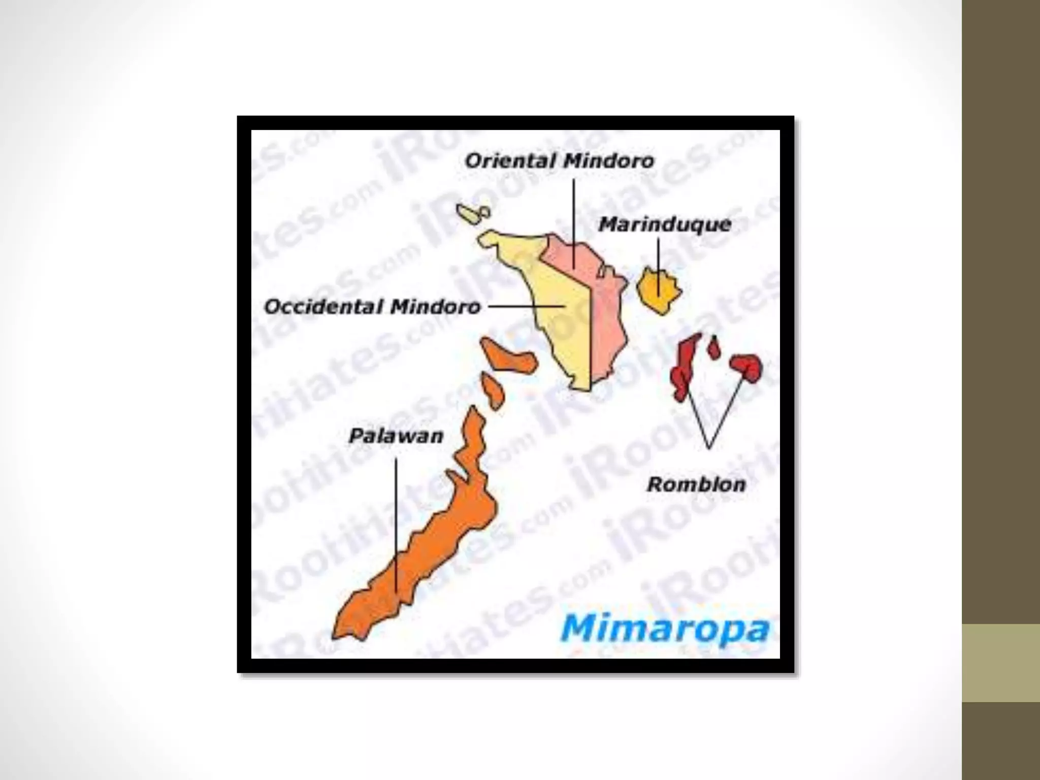


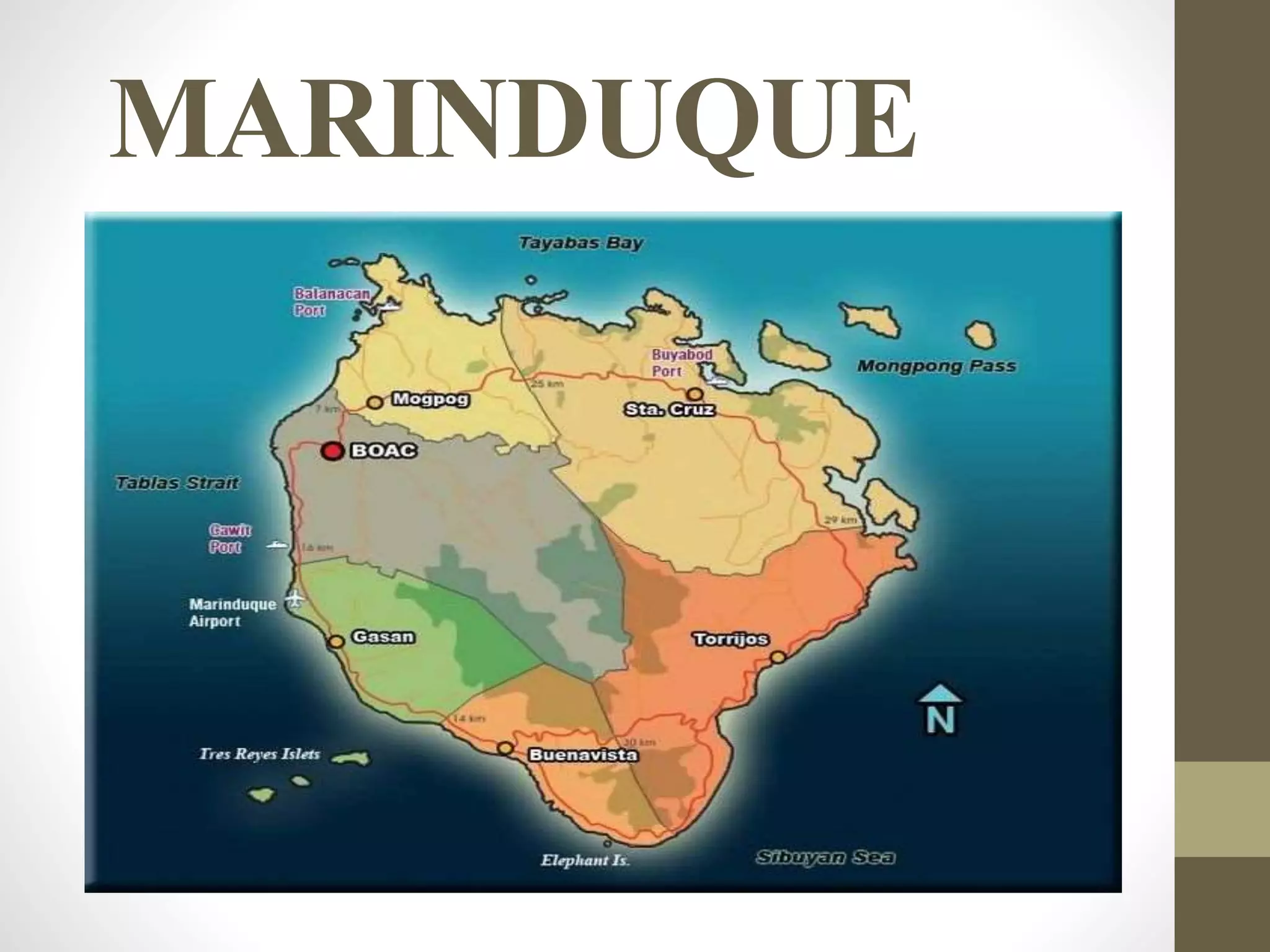


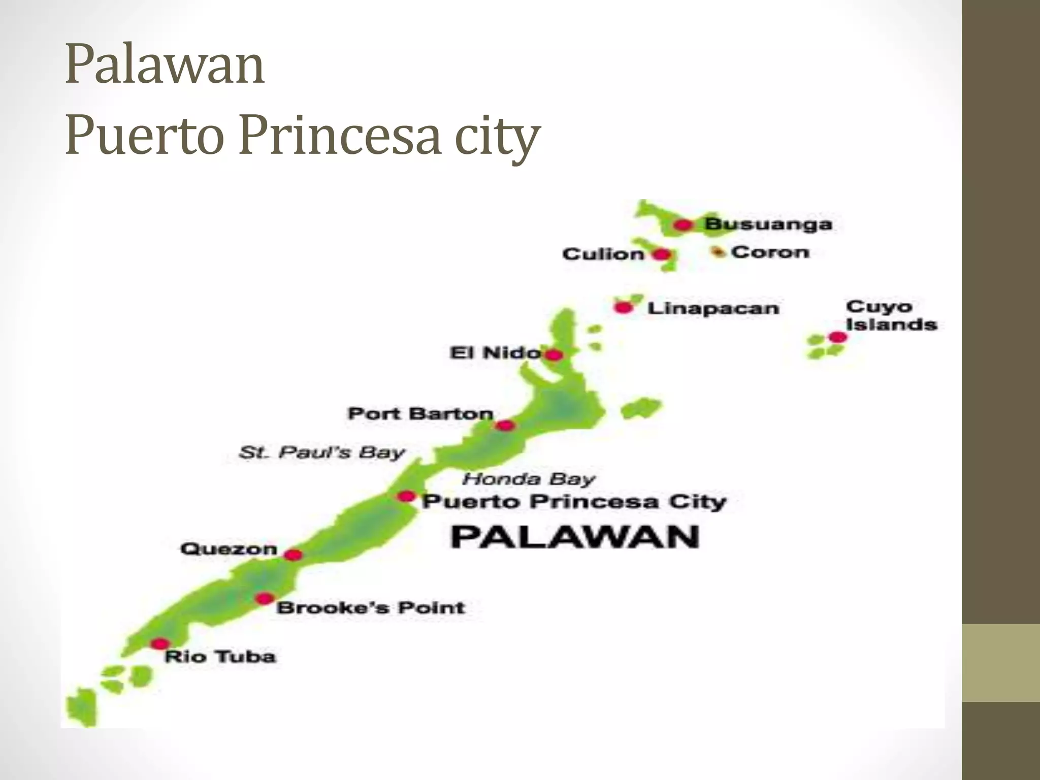


Executive Order 103, issued by President Gloria Macapagal-Arroyo in 2002, reorganized Southern Tagalog into two regions, IV-A (Calabarzon) and IV-B (Mimaropa), with the latter consisting of Mindoro, Marinduque, Romblon, and Palawan. The document highlights the region's linguistic diversity and tourist attractions, including natural parks and beaches, while also detailing the histories and capitals of its provinces. It discusses transportation options to the region and the climate variations, underlining its significance in terms of eco-tourism and cultural richness.


