The document summarizes information about the city of Piacenza, Italy as the location for a proposed summer school project. It provides background on Piacenza's history dating back to Roman times, its population of over 100,000 which includes 17,165 foreign residents, and key infrastructure as an intersection of major highways. The document also includes maps showing Piacenza's urban development over time from its origins as a Roman city to the present day.
Kevyn introduced a concept of planning that was the base for understanding and visualising The Planning Aspects; important for the budding planners.
The presentation initiates the same understanding and invokes a means for better understanding of 'Planning'.
The document discusses types of urban design as presented by Nguyen Dang Phuong Linh at Hanoi Architectural University in 2014. It focuses on Le Corbusier's master plan for Chandigarh, India, which was conceived as a "Garden City" with 30% of land allocated to parks. The plan included overall urban design with sectors and superblocks, all-of-a-piece design to capture unity and variety, infrastructure like roads designed for pedestrians and cyclists, and urban guidelines to accommodate future growth in a human-scaled way.
Urban conservation provides cultural and economic benefits. Culturally, it preserves historic architecture, streetscapes, and sites that give cities a unique identity and sense of place. Economically, conserving urban heritage increases income opportunities from tourism as well as making cities more livable and competitive. Improving conservation and management of historic assets in cities generates civic pride while attracting investment and spending from tourists, thereby boosting local economies.
Urban conservation techniques and strategies mainly followed in the INDIA.This is done for my friends in B.ARCH(VIIth semester) JNAFAU & JNTUK.
University.
Urban morphology approaches human settlements as generally unconscious products that
emerge over long periods, through the accrual of successive generations of building activity.
This leaves traces that serve to structure subsequent building activity and provide
opportunities and constraints for city-building processes, such as land subdivision,
infrastructure development, or building construction. Articulating and analysing the logic of
these traces is the central question of urban morphology. Urban morphology is not generally
object-centered, in that it emphasizes the relationships between components of the city. We
will be discussing in detail about the urban morphology of the Chennai metropolitan.
1. The document discusses and compares the two original master plans for Chandigarh - the first by American architect Albert Mayer and the second by French architect Le Corbusier.
2. The first plan envisioned a more traditional Indian city with curved roads and leaf-shaped layout, while the second created the current grid structure with sectors.
3. Key differences between what would have been under each plan include the city's shape, residential units (superblocks vs. sectors), inclusion of Sukhna Lake, and industrial area placement. The implementation of Le Corbusier's plan resulted in a more modernist design for Chandigarh.
Kochi, also known as Cochin, is a major port city in Kerala, India located on the southwest coast. It developed due to flooding of the Periyar River, with early settlements in Mattanchery facing protected lagoons. Kochi was an important trading center for spices and maintained trade networks with Arab merchants. It was occupied by European powers like the Portuguese, Dutch, and British from the 16th century onwards. Over time, Kochi has expanded from its original settlements through urbanization and industrialization. Major developments include the construction of the Kochi port in 1916 and the expansion of residential and commercial areas.
This document provides an overview of a master plan for Bangalore, India. A master plan is a long-term blueprint that guides development over 10-20 years by setting public policies on land use and infrastructure. The Bangalore plan divides the city into five belts based on development levels and proposes land use zones. It analyzes factors like population, economy, transportation and spatial growth to develop a vision and strategies to manage growth.
World wide examples of urban regenerationAsraHafeez
The document summarizes examples of urban regeneration projects in Singapore and Egypt. It describes the redevelopment of the Golden Shoe Car Park site in Singapore into a 280m mixed-use tower with offices, serviced apartments, retail space, and public amenities. It also discusses the Al-Azhar Park project in Cairo, which involved archaeological work, historic building rehabilitation, and quality of life improvements. The goal of urban regeneration projects is to reverse urban decline through improving physical infrastructure and local economies.
This document summarizes the key aspects of a master plan submitted for a settlement. It discusses:
1. The need for master plans arose due to unplanned growth of cities following industrialization and wars, which led to overcrowding and lack of infrastructure.
2. A master plan is a statutory document that guides the orderly development of a city over a horizon year through land use planning and regulations. It addresses issues like transportation, housing, employment and provision of utilities and services.
3. The key components of the master plan submitted include analyses of the existing conditions, projected population and land requirements, and development proposals to organize land use and infrastructure over the plan period. It provides guidelines for implementation and monitoring of
The linear city model proposes an urban plan consisting of elongated, parallel zones specialized for different functions like industry, housing, and agriculture. As the city expands, additional zones would be added linearly instead of spreading wider. The model was first developed in the 19th century but promoted in the 1920s Soviet Union under Milyutin. It aimed to separate functions like housing from pollution-causing industry through zoning along transportation lines like rivers or railroads. A linear settlement is a similar but smaller concept, usually following a transport route like a road, and may lack a defined center.
- Le Corbusier was an influential 20th century architect and pioneer of modern architecture. He developed principles like pilotis and roof gardens.
- His 1925 plan for the Radiant City proposed vertical housing blocks surrounded by green space, with strict zoning and an emphasis on transportation. It aimed to provide a better urban lifestyle.
- Though never fully realized, the Radiant City influenced modern planning with its high-density approach. Le Corbusier later applied these principles to his master plan for Chandigarh, India in the 1950s.
The document proposes a design to revitalize the riverfront areas of Blocks E and G in the Bandra-Kurla Complex in Mumbai. The underlying concept is to rediscover and bring the Mithi River back into the public realm. It involves developing the neglected riverfront area with esplanades, promenades and green spaces to make it people-friendly. The proposal also aims to strengthen connectivity between the blocks and improve pedestrian movement by introducing pedestrian bridges and ramps. Case studies of successful riverfront developments elsewhere provide inspiration for the concept. The project is planned to be implemented in phases and could seek funding from various government and private sources.
Brasília is the planned capital city of Brazil, located in the central highlands. It was designed in the 1950s by urban planner Lúcio Costa and architect Oscar Niemeyer to decentralize Brazil's population and develop its interior. The city is laid out in a pilot plan resembling an airplane, with distinct sectors for administration, commerce, housing and recreation connected by broad avenues. While Brasília succeeded architecturally and symbolically, its utopian social ideals did not fully translate to reality due to high costs and cultural issues. Today it remains an iconic example of modernist urban planning.
Local policies and strategies designed to deal with urban decline, decay or transformation are termed as urban renewal.
It is a comprehensive and integrated vision and action which leads to the resolution of urban problems and which seeks to bring about a lasting improvement in the economic, physical, social and environmental conditions of an area that has been subject to change’
With the decision and authority of a governing municipality, rearranging land use, function and ownership features of a socially, economically or structurally decayed part of a certain city .
such as slum zones or brown fields, for the purpose of obtaining a desired, well organized neighbourhood.
The document provides information on the City Development Plan for Panaji City, Goa, India. It outlines key details about Goa such as population, population density, and per capita income. It then discusses the demographic characteristics of Panaji City including population projections, gender ratio, and floating population. The document also covers various aspects of infrastructure in Panaji City such as transportation links, land use, heritage areas, water and storm water management, sewerage, roads, tourism, and housing.
This document discusses different types of riverfront development and advantages of riverfront projects. It provides details about a specific project along the Haihe River in Tianjin, China that redeveloped the riverfront for flood control, tourism, recreation, and economic activity. The project included new land uses, transportation improvements, and public open spaces along the river to revitalize the area. It also describes a riverfront redevelopment project in Hamburg, Germany along the Elbe River that protected the area from floods while improving public access and activating the waterfront.
The document provides a review of Kevin Lynch's book "The Image of the City". It summarizes the key points of each chapter, including Lynch's analysis of how people perceive and navigate urban environments through mental maps containing paths, edges, districts, nodes, and landmarks. It also analyzes Lynch's writing style, praising the logical flow of ideas, focus on the central topic of a city's image, effective use of illustrations, and coherence. The review evaluates Lynch's influential work on urban planning and how understanding human perception can influence city design.
This document discusses urban morphology and the determinants of urban form. It begins by defining key terms like form, urban form, and urban morphology. It then describes the two main types of urban form - organic and grid oriented. The main determinants that shape urban form are described as natural (e.g. topography, climate) and man-made (e.g. political, religious, economic). Specific examples of each determinant are provided with images to illustrate how the determinant influenced the urban form. The document also includes a glossary defining terms commonly used in urban design like urban block, public realm, grain, and density.
The document provides a history and overview of the growth of Barcelona, Spain from its founding by the Romans to modern times. Some key points:
- Barcelona was founded as a Roman colony called Barcino in the 1st century BC and grew under Muslim rule and as a center of the Crown of Aragon.
- In the 19th century, Barcelona underwent rapid urban expansion and industrialization during the Industrial Revolution, aided by Ildefonso Cerdà's master plan which envisioned wide streets in a grid pattern.
- While Cerdà's plan accounted for open green spaces, overpopulation led to higher density development that compromised his vision for light and ventilation.
- Currently, Barcelona is
Navi Mumbai was created in 1970 to decongest Mumbai and promote balanced regional development. It was planned by CIDCO according to principles of decentralization, self-sufficient townships, and single use zoning. Navi Mumbai consists of several nodes planned for different income groups with residential neighborhoods, industrial zones, and conservation areas. While growth has been slow, it accelerated in the 1990s with the Nhava Sheva port. Today Navi Mumbai stands as a structured, planned city contrasting with Mumbai's organic development.
The document discusses elements of urban design that shape cities, including buildings, public spaces, streets, landscape, and their interrelationships. It also summarizes Kevin Lynch's book "The Image of the City", which examines how residents mentally map their city based on paths, edges, districts, nodes, and landmarks. Finally, it provides examples of these elements in Mysore, India, highlighting landmarks like the Ambavilas Palace, focal points like Chamaraja Circle, and the city's planned layout with vistas, public squares, and response of buildings to the street network.
This document discusses strategies for riverfront development. It provides examples of the Sabarmati Riverfront development in Ahmedabad, India and the Crescent riverfront development in New Orleans, USA. Some key strategies discussed include creating public open spaces and access to the river, supporting a mix of uses, rehabilitating adjacent communities, and enhancing transportation connectivity to activate the waterfront and improve quality of life. Both projects aimed to reconnect their cities to their rivers through redevelopment that balanced environmental, social and economic objectives.
This document provides guidelines for urban development planning in India. It discusses the need for guidelines given deficiencies in urban planning. It outlines the scope of the study, including formulation of spatial development and resource plans for small, medium, and large urban centers. Case studies were conducted in 3 states. The document also discusses classification of urban centers, the structure of the report, the recommended urban planning system and process, plan approval processes, implementation, people's participation, and resource mobilization measures including various taxes, transfers, financing sources, and effective tax administration.
Urban heritage conservation , India under the subject of urban planning and techniques in town and country planning with international and national level contribution , its need and case of heritage walk of Ahmadabad city.
-Definitions related to Urban Conservation
-Important of Heritage conservation
-Conservation Elements
-Conservation at International Level
-Conservation at National Level
-Constitution Obligation
-Acts for Conservation
-Need of Urban Heritage Conservation
-Heritage walk of Ahmedabad City
The document discusses a thesis project for expanding the campus of the University of Minnesota. It proposes adding new academic buildings and student housing to accommodate enrollment growth. The expansion aims to utilize underdeveloped land and modernize campus facilities while preserving green spaces.
This document summarizes a student project to design and analyze a tow bar for a portable compressor. It will include load analysis for various maneuvers, material selection based on strength and toughness, and tube selection to sustain tensile and compressive loads. The project aims to renew the design of the tow bar for an Atlas Copco portable compressor model to improve results and address defects in the existing design. The students will work with Atlas Copco employees and receive guidance from their project advisor.
Case study of NATIONAL WAR MUSEUM , DELHI .Kureelalok55
DELHI >> INDIA GATE COMPLEX >> PRINCESS PARK >> PROPOSED SITE.
CASE STUDY 1..... SAURYA SMARAK , BHOPAL.
CASE STUDY 2..... NATIONAL MAUSEUM , DELHI.
CASE STUDY 3..... JANG - E - AZADI , KARTARPUR , PUNJAB
This document discusses plans to redevelop Speer Boulevard in downtown Denver through a multimodal corridor approach. It identifies current problems like traffic congestion, lack of pedestrian connectivity and sustainability, and underutilized land. The redevelopment aims to create a safe pedestrian environment, reduce traffic issues, provide diverse and consistent urban spaces, offer transportation choices beyond cars, increase sustainability efforts, encourage infill development and strengthen connectivity. The goals are implemented through streetscape improvements, traffic realignments, and development standards and incentives.
The document provides an overview of the Marina Bay Sands integrated resort project in Singapore. It discusses the key players like Las Vegas Sands Corp, the macroeconomic context, risks, and concludes that while the project faces short term challenges, the Singapore government is committed to ensuring its success in the long run.
case study of chandigarh college of architectureAbhishek Tiwari
1) The Chandigarh College of Architecture (CCA) was established in 1961 in Chandigarh, India by Le Corbusier as part of the Chandigarh Experiment.
2) CCA is located on a 20,000 square meter campus in Sector 12 of Chandigarh and has an enrollment of 200 undergraduate students.
3) The building utilizes north light and ventilation and includes facilities such as studios, workshops, a library and computer lab to support the education of architecture students.
A Framework for campus planning - Case Study - IndiaShubh Cheema
Report on the existing framework of one the upcoming Engineering college in South India . The focus of the report was to give suggestion to the board on how they can improve upon the existing campus .
Yale Art + Architecture Building - Case StudyVikram Bengani
A case study from the perspective of architecture of the Architecture Building at Yale University. Performed as part of the architectural education campus design project in the year three of the B. Architecture course.
The design project involves creating a café and retail space for chocolates within a department store. Key requirements include integrating the café and retail areas without compromising function, incorporating a chocolate display counter, addressing limited space, and appealing to both male and female customers. The proposed design features a central island bar with areas for retail, drinks preparation and chocolate display. Furnishings include wood and glass cabinets, refrigerated storage, and a mix of chairs and upholstered seating.
The document summarizes the existing conditions of the road network, land use patterns, built environment, and public spaces in Hackney central, London. It finds that the area has busy streets with traffic congestions and unclear pedestrian links, making it difficult to get around. It also has strong local landmarks like churches that provide clarity. However, the overhead railway line obstructs views and isolates some spaces. The pedestrian links and public spaces lack signage and have unsafe crossings, while green spaces are underdeveloped and underutilized.
The JT Performing Arts Centre (JTPAC) is located in Tripunithura, Kochi, Kerala. It was established in 2009 with the vision of being a premier arts and performance hub in South India that preserves traditional Indian art forms. JTPAC offers a world-class performance venue and regularly hosts Indian classical music, dance, drama, and folk performances by renowned Indian artists. It also supports upcoming performing artists through scholarships and helps preserve dying art forms in India.
Creative ~ Innovative ~ Career Focused ~ Multi-Skilled
The design process gives me a great deal of satisfaction where I can concentrate on my ultimate goal and still be creative and inspired by my memories of past places, spaces and the widely differing uses of raw materials. A visit to the site is sometimes a glimpse into the past where historical associations or cultural signatures have somehow left their mark on the environment and landscape which may inspire further curiosity into what might or could come next in the constant evolution of the built environment. Design is a process that engages all the senses and the outcome of what we produce or build will ultimately have an effect on everyone who uses or visits that place and the judgment of our work and our creativity may last for generations to come.
2259SessionV - Conservation of Historical Center and Urban Landscape - Ecuado...gowtham928345
This document provides an overview of the cultural and natural heritage conservation efforts in Cuenca, Ecuador. It summarizes the history of Cuenca from its founding in 1557 to the present day city of 600,000 people. It describes the various inventories conducted of the historical center from 1975-1999 that helped designate Cuenca as a Cultural Heritage of Humanity site in 1999. The document also identifies threats to the historical center such as development pressures, abandonment, and loss of identity, and outlines policies and strategies to manage heritage and mobility in the area.
Carlton south heritage & urban character talkBen Mckenna
The document discusses heritage, urban character, and planned expansion of Melbourne's Capital City Zone. It examines how heritage is currently defined, the urban character of the city, and proposed amendments that could impact Carlton. Amendment C196 proposes expanding the Capital City Zone into Carlton, which may change the area's heritage and urban character defined by its historic buildings and streetscapes. More development could lack recognition of heritage and impact the continuity of Carlton's urban character.
The document discusses the historical Mediterranean compact city model as a smart, sustainable, and contemporary urban planning approach. It emphasizes exploiting the heritage and architectural value of historic buildings and public spaces to develop the urban landscape in a way that engages local residents. Cities are encouraged to build on their past traditions and cultural heritage to help shape their future by establishing a forward-looking vision that highlights each city's unique attractiveness and supports broader urban transition and regeneration.
G. Angileri
C O L L A B O R A T I O N A T T H E P R O J E C T “ M O V E S ”
18 19
G i u s e p p e A n g i l e r i
Po r t fo l i o
The project aims to rethink the relationship between the city of
Messina and the sea, through the redevelopment of the coastal
strip between the Torrente Tono and the Torrente Portalegni.
The interventions proposed concern:
- The creation of a continuous pedestrian and cycle path along
the entire coastline, to reconnect the city to the sea and allow
free access to the
- Helped in the design of interior spaces by drawing Concept diagrams, plans, elevations, sections.
- Made 3D models and visualisations of the proposed development using SketchUp and V-Ray.
- Provided assistance during meetings with the local authority and planning consultants.
- Researched case studies of similar projects to inform the design process.
- Assisted with the production of planning documents such as Design and Access Statement.
The project aimed to:
- Introduce high-quality residential accommodation with a mix of tenures including affordable housing.
- Activate the ground floor with retail/commercial uses to enhance the street.
- Improve connections with the surrounding area and insert new public spaces.
The document summarizes the history and current state of Greenpoint, Brooklyn's waterfront and proposes a plan for its redevelopment. It describes how Greenpoint was once a thriving industrial area with shipyards and factories but is now mostly abandoned, though there is renewed interest in developing the waterfront. The plan analyzes precedents like Sunnyside Gardens to develop a strategy that connects the site to Brooklyn through regional transportation links, a residential core, and open spaces. The goal is to activate the waterfront through mixed-use development, affordable housing, parks and community facilities while respecting the historic character.
Alessia pulcini presentation urban design 1 - eu citiesPulcini Alessia
Globalization and the European Union have reshaped urban networks and competition among cities. Urban design is increasingly important for economic development, as it helps attract skilled workers, businesses, and investment through improving urban spaces and cultural amenities. There are generally three classes of European cities: metropolitan cities which focus on prestigious urban landscapes; larger cities which regenerate through events and infrastructure; and smaller cities which thrive on specialized industries and quality of life. Case studies show how avant-garde urban design projects in various cities have created new cultural districts, identities, and economic opportunities.
The social dimension of historic centres regenerationVIVA_EAST
The social dimension of historic centres regeneration
Presented during the VIVA EAST Thematic Seminar on "Methodology for Urban Planning and Design of minor Historic Centres Territorial Cultural Systems, Bari, Italy, Oct. 2012
Presentation Wednesday, June 10, 2009, from OSLO-DENVER INITIATIVE ON URBAN DESIGN AND CLIMATE CHANGE at CNU 17 in Denver.
The “Oslo-Denver-Initiative” (ODI) is aimed at promoting practical measures in urban and regional development to reduce the effects of climate change. Its panel of experts continues the international exchange of ideas generated by the CEU international conference on Urban Design and Climate Change held in Oslo in September of 2008. The panel will identify New Urbanist and European Urbanism tools, techniques, and models in response to the challenges of climate change.
This document outlines a lecture on town planning given by Engr. Ali Raza Khalid. It includes definitions of town planning, the history and objectives of town planning such as health, convenience and beauty. Principles of town planning like zoning, green belts, housing and transportation facilities are discussed. The necessity of town planning to avoid problems towns face without planning like lack of amenities and traffic congestion is also covered.
Best Practices in Heritage-Led RegenerationVIVA_EAST
The role of best practice case studies is to convince localities and stakeholders of the benefits of HERITAGE LED REGENERATION by information on lessons learned in the process of regenerating through investment in heritage and good practice guidance, in terms of processes to be followed by local, department and national authorities.
Presented during the VIVA EAST Local Workshops in Valea Hartibaciului - Romania, Cahul - Republic of Moldova, Dilijan - Armenia, Nov. 2012
European Case Studies on Heritage - Led Territorial DevelopmentVIVA_EAST
This document discusses case studies for heritage-led regeneration. It provides context that small historic towns are an important part of European cultural heritage and have economic and social benefits. Best practice case studies should convince stakeholders of the benefits of investing in heritage regeneration. The document then provides details on specific regeneration projects in Romania that renovated historic buildings and public spaces to revitalize several towns, with the goals of improving quality of life and cultural diversity while attracting further public and private investment. Partnerships between various levels of government and the private sector and community were important for the successful projects.
The document discusses urban diversity and integration in Luanda, Angola. It states that large social housing projects in peri-urban areas risk creating homogenous environments if quantitative measures are prioritized over qualitative ones. There are also large social and economic divisions between urban and peri-urban settlements, enhancing the urban divide. For sustainable development, the city needs inclusive programs that encourage diversity and integration. Improving public transportation like the railway can help decrease spatial isolation of peri-urban residents and enable economic opportunities.
Design Principles of Villa Lante, Bagnaia ItalyAndrea Drabicki
Villa Lante in Bagnaia, Italy follows design principles that distinguish between sacred and profane spaces. [1] Sacred spaces have a clear central axis and focal points, while profane spaces are more disorganized. [2] The villa was designed in the Renaissance era, when elements like town squares and sightlines oriented around landmarks and architecture were common. [3] The villa synthesizes these elements to divide the landscape into the old city, new city, villa gardens, and surrounding forest.
Architectural Design Final Presentation in the Architectural Engineering MSc course in Politecnico di Milano, Polo Regionale di Lecco. The course was under the supervision of Prof. Massimo Tadi. The Team consisted of Amr Alaaeldin Elesawy, Jimeno Fonseca Alvarado, Rohit Perla, Alemayehu Amsalu, and Burcu Durak.
My contribution to the 7th European Conference on Sustainable Cities and Town, Geneva 17 April 2013. Slides do not say much, they are mostly evocative. Unfortunately Slideshare does not have a soundtrack. ;-)
This document provides an introduction to the lecture on urban design. It discusses the role, importance and scope of urban design in relation to architecture and urban planning. Urban design is concerned with shaping and designing public spaces in cities and towns, from the scale of streets and squares down to individual buildings. It aims to create places that are good to live in, attractive to visit, and socially and economically successful.
Bab Al-Bahrain Avenue is one of the liveliest streets and its location is in the intermediate of the historical part that gave the avenue a strong historical dimension in the urban context of Manama city, Kingdom of Bahrain. Moreover, the avenue has economic and cultural significance activities. The socio-economic value of Bab-AL Bahrain and the gold market make them the busiest streets in Manama. The existing users of the avenue are variable between residences, local visitors and tourist. Unfortunately, with the rapid urban developing for the Manama City in general and Bab Al Bahrain area, and the changing for the economic base for most of the original families they moved to other suitable places to them while new non-Bahraini replaced them. As a result, the sense of identity and belonging is not considerable. Consequently, the identity for these areas is in its way to disappear. This research analyzed the street furniture condition and focused on the act of street furniture role in revitalizing Bahraini identity in such an area. Moreover, the research draws the point of revitalizing the sense of belonging for the residences, which will influence positively upon the open spaces’ conditions and the visual quality.
Barcelona Study Tour Abroad Research PaperDaryl Kern
Can Architecture Affect Positive Social Change in Port Cities? The Barcelona Model: A Case Study of Applying Micro-scale Solutions to Waterfront Renewal Projects
Similar to Master thesis presentation 2011.12.21 (20)
International Upcycling Research Network advisory board meeting 4Kyungeun Sung
Slides used for the International Upcycling Research Network advisory board 4 (last one). The project is based at De Montfort University in Leicester, UK, and funded by the Arts and Humanities Research Council.
Best Digital Marketing Strategy Build Your Online Presence 2024.pptxpavankumarpayexelsol
This presentation provides a comprehensive guide to the best digital marketing strategies for 2024, focusing on enhancing your online presence. Key topics include understanding and targeting your audience, building a user-friendly and mobile-responsive website, leveraging the power of social media platforms, optimizing content for search engines, and using email marketing to foster direct engagement. By adopting these strategies, you can increase brand visibility, drive traffic, generate leads, and ultimately boost sales, ensuring your business thrives in the competitive digital landscape.
Explore the essential graphic design tools and software that can elevate your creative projects. Discover industry favorites and innovative solutions for stunning design results.
Architectural and constructions management experience since 2003 including 18 years located in UAE.
Coordinate and oversee all technical activities relating to architectural and construction projects,
including directing the design team, reviewing drafts and computer models, and approving design
changes.
Organize and typically develop, and review building plans, ensuring that a project meets all safety and
environmental standards.
Prepare feasibility studies, construction contracts, and tender documents with specifications and
tender analyses.
Consulting with clients, work on formulating equipment and labor cost estimates, ensuring a project
meets environmental, safety, structural, zoning, and aesthetic standards.
Monitoring the progress of a project to assess whether or not it is in compliance with building plans
and project deadlines.
Attention to detail, exceptional time management, and strong problem-solving and communication
skills are required for this role.
Practical eLearning Makeovers for EveryoneBianca Woods
Welcome to Practical eLearning Makeovers for Everyone. In this presentation, we’ll take a look at a bunch of easy-to-use visual design tips and tricks. And we’ll do this by using them to spruce up some eLearning screens that are in dire need of a new look.
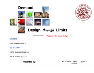
1. Demand
Design through Limits
Piacenza city area design
RELATORE
PROF. MASSIMO TADI
CO-RELATORE
PROF. GABRIELE MASERA
PROF. DANILO PALAZZO
Presented by: ABDUXUKUR . ZAYIT ( Uyghur )
751975
3. Introduction Urban Design Architecture Structure Design Technology Views
| Choosing A Project | Scope |
Site Relevance/Proximity
From landscape to exterior design
An international summer school
The school is open to young final year,
graduate and doctoral students from
Italian and foreign Architecture;
The relationship among three project
sites and urban settlement rules.
Area competition for Summer school
4. Introduction Urban Design Architecture Structure Design Technology Views
| Choosing A Project | Scope |
The area for our
study case is located
on the northern
edge of the Roman
cast rum, area 1 ;
BETWEEN THE CITY
AND THE RIVER
5. Introduction Urban Design Architecture Structure Design Technology Views
| Choosing A Project | Scope |
Landscape design - Rediscover with the Po itself &
Improve the landscape of the
involved area;
Open Space - Requalification of the ‘ex sports field’ area
Public space face to the Palazzo Farnse as new open
space integrated with the different public
functions and collective
Housing
A Housing involves:
- culture -economy
- Society -functionality
- social life -spatial quality
- urban development -aesthetics
- environment
Challenging
- The density of the infrastructure (constraint)
- The risk of flood
- Further development of the methodology is
needed in order to address correctly the
External Losts of visual impact, but that those
impact cannot be neglected especially when
considering local effects.
7. Introduction Urban Design Architecture Structure Design Technology Views
| Location | History | Population | Infrastructure | Site Analysis | Site Visits | S.W.O.T. | Goals and Objectives |
Global
8. Introduction Urban Design Architecture Structure Design Technology Views
| Location | History | Population | Infrastructure | Site Analysis | Site Visits | S.W.O.T. | Goals and Objectives |
National
ITALY
Piacenza
INTRODUCTION
Emilia–Romagna is an administrative region
of Northern Italy comprising the two
historic regions of Emilia and Romagna. The
capital is Bologna; it has an area of 20,124
km² and about 4.3 million inhabitants.
•CITY
The city is situated on the right of the Po,
near its junction with the Trebbia, in an
important strategic position. Agriculture is
the chief industry. The cathedral is of the
ninth century; it was remodeled by Santa da
Sambuceto and others (1122-1223) in
beautiful Lombard style.
9. Introduction Urban Design Architecture Structure Design Technology Views
| Location | History | Population | Infrastructure | Site Analysis | Site Visits | S.W.O.T. | Goals and Objectives |
Regional
ITALY
Emilia–Romagna
Repeated under the bearing location on
the railway line Milan-Bologna and Turin on
the cross-
Brescia, a rail hub of national and
International importance.
10. Introduction Urban Design Architecture Structure Design Technology Views
| Location | History | Population | Infrastructure | Site Analysis | Site Visits | S.W.O.T. | Goals and Objectives |
The earliest urban settlement may be traced back to
the year 218 B.C.
ITALY
The Romans had planned to construct them after the
successful conclusion of the latest war with the Gauls
ending in 219 BC.
In the 13th century, despite unsuccessful wars against
Emperor Federick II, Piacenza managed to gain
strongholds on the Lombardy shore of the Po River.
During the Middle Ages the town was ravaged quite a few times, fell under the
power of the Germanic invaders and suffered the effects of the war between the
Goths and the troops of the Eastern Roman Empire. After being under the rule of
Ostrogoths and Byzantines, Piacenza became the administrative center of a
Longobard dukedom, but its true recovery started in the ninth century, under the
Franks.
Piacenza paid a high toll for its remarkable participation in the two World Wars
The beginning of the post-war period for the town. (28 April 1945)
11. Introduction Urban Design Architecture Structure Design Technology Views
| Location | History | Population | Infrastructure | Site Analysis | Site Visits | S.W.O.T. | Goals and Objectives |
Urban development of Piacenza: Sequence of historical maps
Roman City Medieval City 1500 1435
1600 1821 2010
1908
12. Introduction Urban Design Architecture Structure Design Technology Views
| Location | History | Population | Infrastructure | Site Analysis | Site Visits | S.W.O.T. | Goals and Objectives |
2589 square kilometers and is located in the
north west of Emilia Romagna, south of the river Po.
The average family size is 2.31
102,268 95,594 103,206 23% of the population have a qualification higher
than that of the obligatory school diploma and 3%
2011 have a university degree.
2001
Foreign Population for altitude…
hill mountain
plane
P n ra
ia u :
2 .6 7
5 6
Males- 49,217 life events: born- 870
Females- 53,989 death-1,247
Sum – 103,206 wedding-219
C llin :
o a
Foreign- 17,165 ( childern-3825) 9 8
.5 3
• Employment rate is 49.4% Mn g a
o ta n :
930
• Unemployment rate stands at 5.1%
13. Introduction Urban Design Architecture Structure Design Technology Views
| Location | History | Population | Infrastructure | Site Analysis | Site Visits | S.W.O.T. | Goals and Objectives |
On a street view
Piacenza is the intersection of the
A1 (Milan-Naples) and A21 (Turin-Brescia).
Pan-European Corridors Middle Padania Plain node
14. Introduction Urban Design Architecture Structure Design Technology Views
| Location | History | Population | Infrastructure | Site Analysis | Site Visits | S.W.O.T. | Goals and Objectives |
15. Introduction Urban Design Architecture Structure Design Technology Views
| Location | History | Population | Infrastructure | Site Analysis | Site Visits | S.W.O.T. | Goals and Objectives |
Built up space-density and rarefaction
Open Space System
Strong Areas
Qualitative
16. Introduction Urban Design Architecture Structure Design Technology Views
| Location | History | Population | Infrastructure | Site Analysis | Site Visits | S.W.O.T. | Goals and Objectives |
Public Space
integration and settlement
of the railway system
system of urban green
spaces connected to the
main roads and sliding
Highway system
Inter urban system
Urban Traffic flow
Interquater system
District system
Pedestrian and cycle
Mobility System paths
17. Introduction Urban Design Architecture Structure Design Technology Views
| Location | History | Population | Infrastructure | Site Analysis | Site Visits | S.W.O.T. | Goals and Objectives |
Site Visit
18. Introduction Urban Design Architecture Structure Design Technology Views
| Location | History | Population | Infrastructure | Site Analysis | Site Visits | S.W.O.T. | Goals and Objectives |
Site Visit
19. Introduction Urban Design Architecture Structure Design Technology Views
| Location | History | Population | Infrastructure | Site Analysis | Site Visits | S.W.O.T. | Goals and Objectives |
Strengths: Weaknesses:
Presence of unlimited green area Between the banks of the Po river and road
Different level of land without adequate urban quality.
Presence of historical city area Connection of river with city
Lacking of pedestrians
High density of infrastructure
S W
Opportunities:
O T
Develop Po river bank; Threats:
Po-river can create transformation
Huge potential for the city, exploitable in many In between(Po river and city)
ways (spaces and public places but also new Development
residential areas). Transportation connections with the other
Relationship between city and the river part of the city
Development for the public local events Flood risks
Development of Public Spaces Political risks
20. Introduction Urban Design’’ Architecture Structure Design Technology Views
| Preliminary Thoughts| Analysis and Proposal | Master Plan | Master Plan Analysis |
Ecosystem
Landscape Creation
Habitat creation
Climate Change mitigation and
adaptation Resilience
Physical benefits
OPEN PARK IMPLEMENTATION OF GREEN/BLUE
INFRASTRUCTURES
Landscape Bike Green
Water
1 2 3 4
Sports
Restoration Of on Activiti Nitrogen
Focusing
Water
The Entire
quality
River es Cycle
Morphology
SOCIAL NETWORK
LINKING DIFFERENT AREAS
21. Introduction Urban Design’’ Architecture Structure Design Technology Views
| Preliminary Thoughts| Analysis and Proposal | Master Plan | Master Plan Analysis |
Concept
plan 1
22. Introduction Urban Design’’ Architecture Structure Design Technology Views
| Preliminary Thoughts| Analysis and Proposal | Master Plan | Master Plan Analysis |
Concept
plan 2
23. Introduction Urban Design’’ Architecture Structure Design Technology Views
| Preliminary Thoughts| Analysis and Proposal | Master Plan | Master Plan Analysis |
Using existing slope landscape
Area to create riverfront
recreational spots;
Create small Bars Create water sports
facilities (mainly summer) to connect the
existing sports field…
Bars & restaurants to serve Piacenza night or
Design weekend life...
24. Introduction Urban Design’’ Architecture Structure Design Technology Views
| Preliminary Thoughts| Analysis and Proposal | Master Plan | Master Plan Analysis |
Design
25. Introduction Urban Design’’ Architecture Structure Design Technology Views
| Preliminary Thoughts| Analysis and Proposal | Master Plan | Master Plan Analysis |
Design
26. Introduction Urban Design’’ Architecture Structure Design Technology Views
| Preliminary Thoughts| Analysis and Proposal | Master Plan | Master Plan Analysis | Views & Model |
27. Introduction Urban Design’’ Architecture Structure Design Technology Views
| Preliminary Thoughts| Analysis and Proposal | Master Plan | Master Plan Analysis | Views & Model |
M
A
S
T
E
R
P
L
A
N
28. Introduction Urban Design’’ Architecture Structure Design Technology Views
| Preliminary Thoughts| Analysis and Proposal | Master Plan | Master Plan Analysis | Views & Model |
Open Park
Library
Cultural Center
Palazzo Farnese
Mixed Use
Commercial, Office,
Social House…etc.
Master Plan
29. Introduction Urban Design’’ Architecture Structure Design Technology Views
| Preliminary Thoughts| Analysis and Proposal | Master Plan | Master Plan Analysis | Views & Model |
30. Introduction Urban Design’’ Architecture Structure Design Technology Views
| Preliminary Thoughts| Analysis and Proposal | Master Plan | Master Plan Analysis | Views & Model |
Sight Corridor
Sight Corridor
31. Introduction Urban Design’’ Architecture Structure Design Technology Views
| Preliminary Thoughts| Analysis and Proposal | Master Plan | Master Plan Analysis | Views & Model |
F.
Area Ground T. Architecture Area Architectural
Usage/Character (Sq m) Floor area Area Ratio Underground Height
A Library 4490 3319 19914 4.4 yes 22.50m
B Cultural Center 2438 1951 7804 3.2 yes 18.00m
C Commercial 16147 12468 49872 3.1 no varies
D Residential 4825 3522 21132 4.4 no 15.00m
E Public space 14282
F Mixed use 7972 5709 22836 2.9 yes Varies
Total 50154 26969 121558 3.6
Detailed area allocation for different functions
32. Introduction Urban Design’’ Architecture Structure Design Technology Views
| Preliminary Thoughts| Analysis and Proposal | Master Plan | Master Plan Analysis | Views & Model |
34. Introduction Urban Design’’ Architecture Structure Design Technology Views
| Library Types |Library Examples| Project Requirements |Design Sketches | Drawings | Visuals |
Why Library ? General Libraries
General libraries are centralized facilities
Piacenza needs library
Connections that serve the whole community and its
People of Piacenza population. General libraries are the most
common type of library facilities and
programs. These facilities offer information,
materials, collections, and services similar
Farnese
to general public libraries found in most
communities and schools.
Academic Libraries
Technical Libraries
Dante, Piacenza
Legal Libraries
Medical Libraries
Academic, technical, legal, and medical
libraries feature specialized content
regarding a unique program.
Biblioteca Passerini Landi,Piacenza. Children
35. Introduction Urban Design Architecture Structure Design Technology Views
| Library Types |Library Examples| Project Requirements |Design Sketches | Drawings | Visuals |
Public Library Kelsterbach, Germany Public library in Pontivy, France Surry Hills Library, Australia
36. Introduction Urban Design Architecture Structure Design Technology Views
| Library Types |Library Examples| Project Requirements |Design Sketches | Drawings | Visuals |
Circulation Overall
Meeting place for citizen
Resource center for all ages
Climate adaptive building and
energy adaptive building
Public transportation net system
Opportunity for a better
evaluation growth
Lighting
Urban Context
Skin
Connections
37. Introduction Urban Design Architecture Structure Design Technology Views
| Library Types |Library Examples| Project Requirements |Design Sketches | Drawings | Visuals |
The concept for Piacenza library is to create a learning and information centre of excellence to promote long life
learning, engendering social inclusion and raising inspiration for the whole community.
The connections of the building with two green spaces, one is on east connected to the building through faç and the
ade
other one is strongly connected with the building itself.
49. Introduction Urban Design Architecture Structure Design Technology Views
| Approach | Analysis |Design |
According to the properties of this project, we pursue
the following goals:
EN 1991 Eurocode 1 : Actions on structures
Structural design should be precise, secure, high
EN 1992 Eurocode 2 : Design of concrete structures
technology, economic, ensure quality, environment
EN 1994 Eurocode 3 : Design of composite steel and
friendly;
concrete structures
Structural design should consider local technology
condition and materials availability;
Ensure the quality of project and security, actively use
new structure and technology, material; the material
used should be helpful to save money and high speed
and short time of construction;
For the selection of the structure, primarily consider
lowering weight of the structure; reduce section, and
structural design should be convenient to protect and
maintenance;
Structural design should be consider flexibility of
architecture and usage;
50. Introduction Urban Design Architecture Structure Design Technology Views
| Approach | Analysis |Design |
The building floor height is 4.5 and total height of the building is 22.5m.In building we provided two
shear walls opposite direction to each other and here we provided the structure of the building and
applied load combinations
COMBO1
1.35DL+1.35SDL
COMBO2
1.35DL+1.35SDL+1.5LL
COMBO3
1.35DL+1.35LL+1.35SDL+1.35WLX
COMBO4
1.35DL+1.35LL+1.35SDL+(-1.35)WLX
COMBO5
1.35DL+1.35LL+1.35SDL+1.35WLY
COMBO6
1.35DL+1.35LL+1.35SDL+(-1.35)WLY
51. Introduction Urban Design Architecture Structure Design Technology Views
| Approach | Analysis |Design |
Slab
Flexible
Relatively light, therefore
less foundation costs and
longer spans are
economic
Speed of construction
Fairly slim floor depths
Robustness
Excellent vibration
control
Thermal mass
Good for services Area Reinforcement
integration
Durable finishes
Fire resistance
52. Introduction Urban Design Architecture Structure Design Technology Views
| Approach | Analysis |Design |
Beams
Ultimate Limit State verification Bending
Sections and corresponding bending moment
Serviceability Limit
States check
Pre-dimensioning of longitudinal reinforcement
53. Introduction Urban Design Architecture Structure Design Technology Views
| Approach | Analysis |Design |
Columns and Footing
Dimension of longitudinal reinforcement
Limit States verifications
54. Introduction Urban Design Architecture Structure Design Technology Views
| Approach | Analysis |Design |
The axial load at the
bottom of the column
considered is 1800 KN.
Assuming a rectangular
plinth, whose dimensions
are (a x b x h) = 3.4x3.2x0.8
m the self-weight due to
the foundation is
Gplinth = (3.4· 0.8)3.2·
m3· kN/m3 = 217.6 kN
25
56. Introduction Urban Design Architecture Structure Design Technology Views
| Climate | Concept | Energy needs | Lighting |
Average temperature- 24.7C
Analysis for Climate
Average maximum temperature- 31.2 Weather data
Minimum temperatures average- -1.8 Comfort model
Relative humidity- 55% to 82% Radiation Range
Atmospheric pressure- 1006 to 1013 (Hpa) Monthly Diurnal
Prevailing winds- East Ground Tempt.
Average speed- 4.3 to 8.5%
Relative humidity
Days with fog- Average 32 days per year
Days of rain- Spring and Autumn
Psychometric
Precipitation- 6.4 to 167.4 mm chart
Global radiation- 165 (W/mq ) Climate Consultant
Radiation Range
57. Introduction Urban Design Architecture Structure Design Technology Views
| Climate | Concept | Energy needs | Lighting |
Why do we need to redefine the common concept Examples of definitions for low
of construction industry?
Why do we need to rethink of green Construction?
energy building standards
What are people expectations in the future?
Renewable Energy gross production
Is there a symbiotic relationship between material,
function and aesthetic? trend
Which technologies will move into future? Comparison between total and
renewable energy electricity gross
production
Towards Positive Energy
A Towards Positive
Energy (TPE) is a
Energy Trends building with greatly
reduced energy needs
through efficiency gains
such that the balance of
Different scopes, calculation methods and energy needs can be
norms for low energy and passive houses in supplied with renewable
technologies
selected countries
58. Introduction Urban Design Architecture Structure Design Technology Views
| Climate | Concept | Energy needs | Lighting |
Design Pathways
Thermal envelope
Sustainable site (Facilitate access to
renewable energy)
Architectural design
Exterior
Electric demand
Water consumption
Basic flow chart of towards positive energy
59. Introduction Urban Design Architecture Structure Design Technology Views
| Climate | Concept | Energy needs | Lighting |
U -Values 2500.00
Roof 0.23 W/m2 K 2000.00
Vertical Enclosure 0.09 W/m2K
1500.00
Wall Transparent 0.31 W/m2K Ps
1000.00 Pv
500.00
0.00
Roof 0.00 1.20 6.20 16.20 26.20 30.20 38.20 46.70 46.70
Glazier Diagram of Green roof
2500.0
2000.0
1500.0
P
1000.0 s
500.0
0.0
Vertical Enclosure Wall transparent
Glazier Diagram of wall vertical Enclosure
60. Introduction Urban Design Architecture Structure Design Technology Views
| Climate | Concept | Energy needs | Lighting |
Building data for Winter
Mean U value: 0.32 W/(m² K)
Specific transmission losses: 3532.8 W/K
Specific ventilation losses: 7705.6 W/K
Sum specific losses: 11238.4 W/K
Thermal inertia: 84.0 hours
Maximum heating load: 346.0 kW
Maximum specific heating load: 36.0 W/m²
Maximum cooling load: 469.4 kW
Maximum specific cooling load: 48.9 W/m²
Limit temperature for heating: 17.5°C
Heat energy demand
in kWh/m²
__________________________________ Energy Flow Diagram for heating
January 9.3
February 6.4
March 2.6
April 0.5
October 0.4
November 5.7
December 9.4
__________________________________
Yearly sum 34.3
61. Introduction Urban Design Architecture Structure Design Technology Views
| Climate | Concept | Energy needs | Lighting |
Building data for Summer
Mean U value: 0.32 W/(m² K)
Specific transmission losses: 3532.8 W/K
Specific ventilation losses: 11008.0 W/K
Sum specific losses: 14540.8 W/K
Thermal inertia: 64.9 hours
Maximum heating load: 456.8 kW
Maximum specific heating load: 47.6 W/m²
Maximum cooling load: 458.8 kW
Maximum specific cooling load: 47.8 W/m²
Limit temperature for heating: 18.1°C
Cooling demand in kWh/m²
_____________________________
April 0.1 Energy Flow Diagram for cooling
May 1.1
June 2.2
July 4.9
August 4.2
September 1.8
October 0.3
_____________________________
Yearly sum 14.6
62. Introduction Urban Design Architecture Structure Design Technology Views
| Climate | Concept | Energy needs | Lighting |
Lighting
Sun ray in summer A- A section Sun ray in summer C - C section
ECOTECT ANALYSIS
Sun ray in winter A - A section Sun ray in winter C - C section