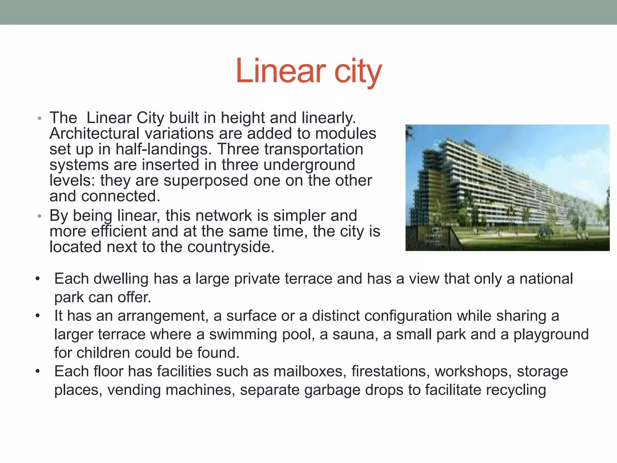
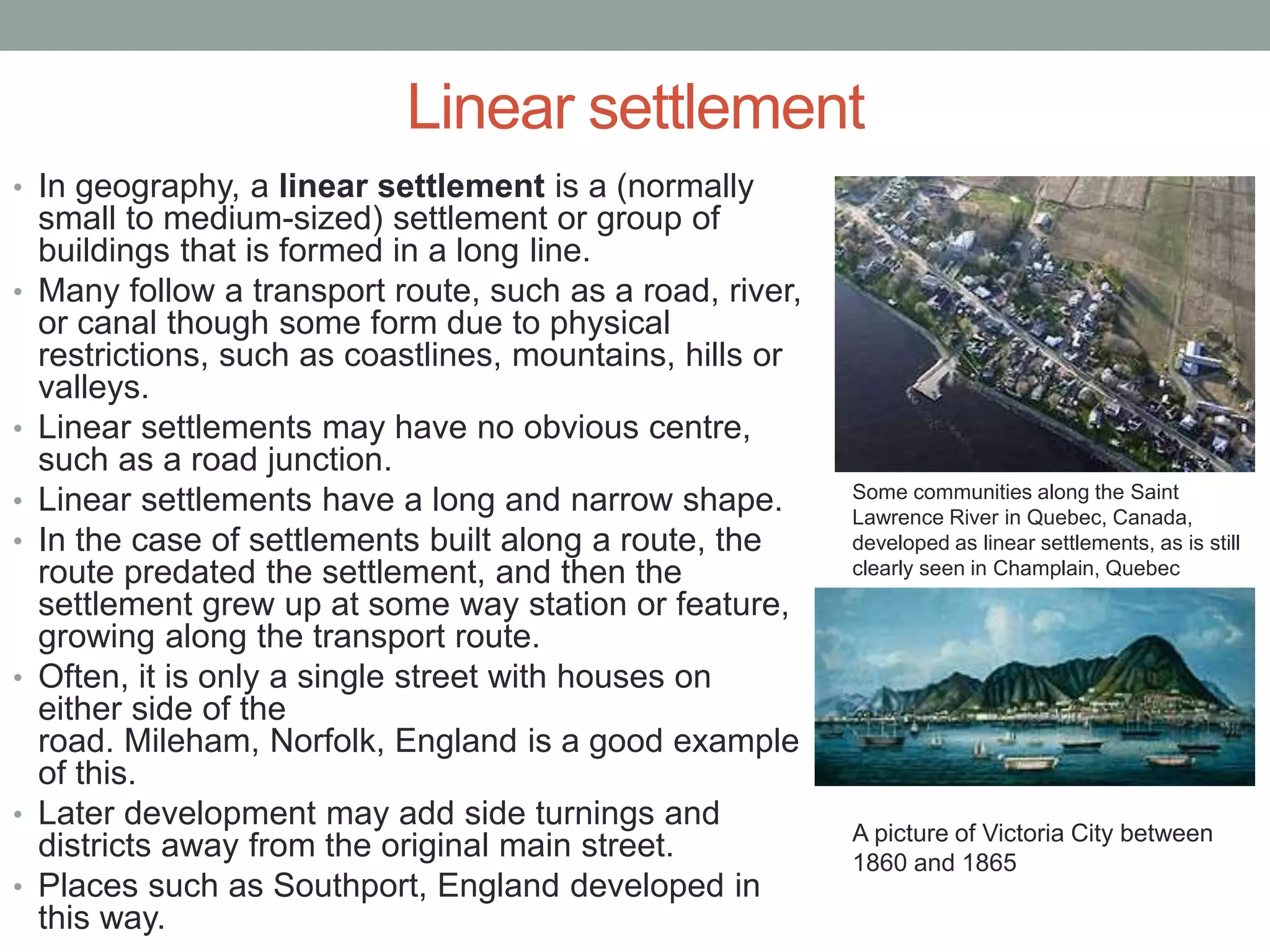
2. Linear city
• The linear city was an urban plan for an elongated urban
formation.
• The city would consist of a series of functionally specialized
parallel sectors.
• Generally, the city would run parallel to a river and be built so
that the dominant wind would blow from the residential areas to
the industrial strip.
The sectors of a linear city would be:
• a purely segregated zone for railway lines,
• a zone of production and communal enterprises, with related
scientific, technical and educational institutions,
• a green belt or buffer zone with major highway,
• a residential zone, including a band of social institutions, a
band of residential buildings and a "children's band",
• a park zone, and
• an agricultural zone with gardens and state-run farms
(the Soviet Union).
3. Linear city
• As the city expanded, additional sectors
would be added to the end of each band, so
that the city would become ever longer,
without growing wider.
• The linear city design was first developed
by Arturo Soria y
Mata in Madrid, Spain during the 19th
century, but was promoted by the Soviet
planner Nikolay Alexandrovich Milyutin in the
late 1920s.
• Ernst May, a famous German functionalist
architect, formulated his initial plan
for Magnitogorsk, a new city in the Soviet
Union, primarily following the model that he
had established with his Frankfurt
settlements:
identical, equidistant five-story communal
apartment buildings and an extensive network
of dining halls and other public services.
Arturo Soria's linear city.
The planning of Ciudad
Lineal(1895-1910) published
by Madrid Urbanization
Company.
4. Linear city
• The Linear City built in height and linearly.
Architectural variations are added to modules
set up in half-landings. Three transportation
systems are inserted in three underground
levels: they are superposed one on the other
and connected.
• By being linear, this network is simpler and
more efficient and at the same time, the city is
located next to the countryside.
• Each dwelling has a large private terrace and has a view that only a national
park can offer.
• It has an arrangement, a surface or a distinct configuration while sharing a
larger terrace where a swimming pool, a sauna, a small park and a playground
for children could be found.
• Each floor has facilities such as mailboxes, firestations, workshops, storage
places, vending machines, separate garbage drops to facilitate recycling
5.
6. Linear settlement
• In geography, a linear settlement is a (normally
small to medium-sized) settlement or group of
buildings that is formed in a long line.
• Many follow a transport route, such as a road, river,
or canal though some form due to physical
restrictions, such as coastlines, mountains, hills or
valleys.
• Linear settlements may have no obvious centre,
such as a road junction.
• Linear settlements have a long and narrow shape.
• In the case of settlements built along a route, the
route predated the settlement, and then the
settlement grew up at some way station or feature,
growing along the transport route.
• Often, it is only a single street with houses on
either side of the
road. Mileham, Norfolk, England is a good example
of this.
• Later development may add side turnings and
districts away from the original main street.
• Places such as Southport, England developed in
this way.
Some communities along the Saint
Lawrence River in Quebec, Canada,
developed as linear settlements, as is still
clearly seen in Champlain, Quebec
A picture of Victoria City between
1860 and 1865