Managing SOC in the black soils of Russia
•Download as PPTX, PDF•
1 like•557 views

This presentation was presented during the 1 Parallel session on Theme 3.1, Managing SOC in: Soils with high SOC – peatlands, permafrost, and black soils, of the Global Symposium on Soil Organic Carbon that took place in Rome 21-23 March 2017. The presentation was made by Mr. Ivan Vasenev, from Timiryazev Academy – Russian Federation, in FAO Hq, Rome

Recommended
Recommended
More Related Content
What's hot
What's hot (20)
Viewers also liked
Viewers also liked (7)
Similar to Managing SOC in the black soils of Russia
Similar to Managing SOC in the black soils of Russia (20)
More from ExternalEvents
More from ExternalEvents (20)
Recently uploaded
Recently uploaded (20)
Managing SOC in the black soils of Russia
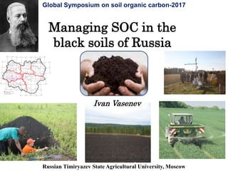
- 1. Managing SOC in the black soils of Russia Russian Timiryazev State Agricultural University, Moscow Global Symposium on soil organic carbon-2017 БЕЛГОРОД ОРЕЛ ЛИПЕЦК ТАМБОВ ВОРОНЕЖ КУРСК Мценск Новосиль Залегошь Хомутово Верховье Покрвское Змиевка Отрадинский Ливны Глазуновка Елец Лебедянь Данков Лев Толстой Болхов Хотынец Нарышкино Шаблыкино Крамы Дмитриевск-Орловский Знаменка Малоорхангельск Колпны Долгое Поныри Железногорск Первоавгустовский Дмитриев-Льговский Фатеж Золотухино Хомутовка Конышевка Щигры Черемисиново Кшенский Рыльск Льгов Курчатов Прямицино Любимовка Бол. Солдатская Суджа Медвенка СолнцевоКоренево Глушково Обоянь Кировский Тим Касторное Олымский Горшечное Губкин Старый Оскол Ивня Прохоровка Ракитное Яковлево Томаровка Борисовка Грайворон Октябрьский Шебекино Короча Чернянка Новый Оскол Волоконовка Валуйки Уразово Вейделевка Красногвардейское Алексеевка Чаплыгин Доброе Первомайский Кочетовка Мичуринск Тербуны Волово Хлебное Усмань Добринка Грязи Рамонь Краснолесный Латная Стрелица Хохольский Нововоронежский Перелешинский Панино Анна Давыдовка Бобров Острогожск Ольховатка Россошь Кантемировка Богучар Петропавловка Таловая Новохоперск Поварино Борисоглебск Терновка Шапкино Мучкапский Уварово Мордово Эртиль Инжавино РжаксаНовопокровка Знаменка Рассказово Котовск Бондари Сосновка Грязи Староюрьево Кирсанов Умет Дмитриевка Моршанск Вернадовка 53°20' 34°00' 52°40' 52°00' 51°20' 50°40' 34°00' 50°00' 35°00' 36°00' 37°00' 38°00' 49°20' 39°00' 40°00' 41°00' 42°00' 49°20' 50°00' 43°00' 50°40' 51°20' 52°00' 52°40' 53°20' 44°00' 54°00' 43°00'42°00'41°00'40°00'39°00'38°00'37°00'36°00' 35°00' 54°00' "Агрофирма Мценская" Учхоз им. Калинина Заболотовский лес Горы Болото Уч."Зоринский" Стенки-Изгорья Уч. "Стрелецкий" Уч. "Казацкий" ОПХ ВНИИЗиЗПЭ Уч. "Букреевы Бары" Уч."Баркаловка" Парсет ООО"Горшечное" Центрально-Черноземный регион Границы областей Центрально-Черноземного региона Объекты исследования Ivan Vasenev
- 2. Why we need to do this especially in case of black soils and Central Chernozemic region of Russia? • Current high variability of farming systems and agroecosystem services levels: with winter wheat yield variability from 2,5 to 7,5 t/ha within one region • High within-field crop yield variability (40-75% of Max) due to complicated soil cover patterns resulted by aggregated soil degradation in frame of the universal land-use zonal systems application within second half of XX century • Relatively young and changeable soil cover in agrolandscapes with n*103 years of modern natural history and n*101-2 years of modern agricultural one • Especial attention by successful agricultural business to the best available agrotechnologies, land agroecological quality evaluation and crop yield prediction due to sharply increased input risks value in case of high inputs in farming • Fast development of applied in RF agrotechnologies and society interest in organic farming and sustainable land-use
- 3. Normative forecasting SOC in the black soils SOC Managing – Normative Forecasting – LQ Evaluating – Search Forecasting – SF&DP – Soil Typifying – STV Analyzing 3 Managing SOC in the black soils Analyzing the black soils and their SOC natural spatial-temporal variability and sustainability Evaluating soil quality dynamics due to SOC man-made changes in the black soils Search forecasting SOC in the black soils in the principal regions of RF Investigating soil forming and degradation processes rates and potentials in the black soils with especial attention to their SOC Typifying the black soils according to their SOC, current land-use and its environmental impact assessment on soil profile, regimes and processes
- 4. SOC Managing – Normative Forecasting – LQ Evaluating – Search Forecasting – SF&DP – Soil Typifying – STV Analyzing 4 Analyzing the black soils and their SOC natural spatial-temporal variability and sustainability (“RF Soil National Atlas”, 2011): 1:2.5 M Scale Soil total area – 1595,4 million ha : Black soils – around 188 million ha Luvic Chernozems + Grey-Luvic Phaeozems – 34,9 million ha Voronic and Vermic Chernozems – 11,3 million ha Vorony-Calcic Chernozems – 22,0 million ha Calcic Chernozems – 17,2 million ha Haplic and Gypsic Kastanozems – 11,3 million ha …
- 5. SOC Managing – Normative Forecasting – LQ Evaluating – Search Forecasting – SF&DP – Soil Typifying – STV Analyzing 5 Analyzing the black soils and their SOC natural spatial-temporal variability and sustainability (“RF Soil National Atlas”, 2011): Soil organic carbon content Soil organic carbon content in A horizon % Level Very high High Average
- 6. SOC Managing – Normative Forecasting – LQ Evaluating – Search Forecasting – SF&DP – Soil Typifying – STV Analyzing 6 Analyzing the black soils and their SOC natural spatial-temporal variability and sustainability (“RF Soil National Atlas”, 2011): Soil organic carbon stocks Soil organic carbon stocks in 1 m: T/ ha Level Extremely high Very high High Above average Average
- 7. SOC Managing – Normative Forecasting – LQ Evaluating – Search Forecasting – SF&DP – Soil Typifying – STV Analyzing 7 Typifying the black soils according to their SOC, current land-use and its environmental impact assessment on soil profile, regimes and processes: Data on humus balance in agricultural area in 1970 – 2001 (“RF Soil National Atlas”, 2011): • Stable tendency of dehumification in arable black soils: • SOC content in arable soils have been decreased by 4.4 – 17.1%. Humus balance in the arable horizon Negative with annual loss of more than 0,5 t/ha Negative with annual loss of less than 0,5 t/ha Positive
- 8. SOC Managing – Normative Forecasting – LQ Evaluating – Search Forecasting – SF&DP – Soil Typifying – STV Analyzing 8 Investigating soil forming and degradation processes rates and potentials in the black soils with especial attention to their SOC: 1. Bioclimatic zonal and province analysis. 2. Geomorphologic regional and local typification. 3. Ecological and agroecological GIS and DB development. 4. Ecological and agroecological monitoring development 5. Field researches in representative plots with local controls (native landscapes or less intensive land-use systems). 6. Soil cover patterns studies within chrono- or agro-secuences. 7. The Soil Cover Patterns investigation by the field catenas, with especial attention to: (a) their position within meso-relief; (b) their micro-relief development; (c) soil profile successions; (d) soil regimes changes; (e) soil matrix transformations; (e) lateral, soil-forming and degradation processes rates within SCP; (f) potentials of soil profiles, functions and services future development.0 20 40 60 80 100 120 140 g kg -1 Principal Methodology:
- 9. Soil Agrogenic Successions at the Central Chernozemic Region of Russia БЛ СЛ ЧОП ЧВ ЧТ ЧТК, Agrogenic succession Agrogenic-erosion succession succession succession Agrogenic-irrigation Agrogenic-amelioration CaCO3 BrLPh S GrLF Ch-C Ch-V Ch-V-C Ch-L
- 10. SOC Evaluation Logistic functions → DSS development
- 11. THE MAIN SOIL NATURAL REFERENCE OBJECTS IN THE CENTRAL CHERNOZEMIC RESERVE Non-Mowed Steppe (NMS) Pasture (PS) 5 year periodically Mowed Steppe (P5MS) Fallow (FL) Forest (FS) 10 year periodically mowed steppe (P10MS)
- 12. 0 20 40 60 80 100 120 140 g kg -1 Humus (SOM) dynamics in Chernozems topsoil with different land-use determines the GHG emission in agrolandscapes old residual arable lands rich cultivated arable lands intensive pastures temporary pasture, old idle lands forest, forest-lines lands with light texture ChM ChP ChOChTChL Root CO2 emission Microbial CO2 emission Control
- 13. Erosion as principal factor of microrelief and soil C dynamics (→Chernozems dehumification and overconsolidation ): 11 7 5 3 1 0 А В 6,2 t/ha 17,7 t/ha 1-st stage 2-nd stage 3-d stage 4-th stage C, % g >33% lands have been eroded at the CChR of Russia
- 14. SOC Managing – Normative Forecasting – LQ Evaluating – Search Forecasting – SF&DP – Soil Typifying – STV Analyzing 1 4 Typifying the black soils according to their SOC, current land-use and its environmental impact assessment on soil profile, regimes and processes IRGA C02 fluxes
- 15. Soil CO2 emission in representative plots of cutted steppe (A), virgin steppe (B), black arable land (C) and pasture (D), g C m-2 d-1 28,72 22,06 18,46 24,62 5,13 17,95 0,000 5,000 10,000 15,000 20,000 25,000 30,000 35,000 12.06.2012 26.06.2012 10.07.2012 24.07.2012 D C B A Agrogenic changes of Soil Cover Patterns as factor of SOC stocks and CO2 emission dynamics
- 16. SOC Managing – Normative Forecasting – LQ Evaluating – Search Forecasting – SF&DP – Soil Typifying – STV Analyzing 1 6 Investigating soil forming and degradation processes rates and potentials in the black soils with especial attention to their SOC: Processes Parameter Processes Rates in Successions: Agrogenic Agrogenic- erosion Agrogenic- irrigation Agrogenic- ameliorat. Erosion А+АВ, sm y-1 0,1-0,3 0,3-3,0 0,3-1,2 0,5-1,0 Dehumification Humus - g kg-1 y-1 0,2-1,0 0,3-1,3 0,3-0,5 0,3-1,0 Humification Humus - g kg-1 y-1 0,1-0,3 - 0,1-0,4 0,1-0,5 Overconsolidation Bulk density -g sm-3 y-1 0,01-0,02 0,01-0,05 0,01-0,06 0,01-0,03 Disaggregation agregates 10-0,25 mm, g kg-1 y-1 1-10 1-18 10-25 8-12 Aggregation 1-10 1-5 1-5 1-5 Season cementation Crust , sm y-1 0,1-1,0 0,1-2,0 Leaching CaCO3 - kg sm m-2 y-1 0,1-0,3 0,3-1 1-150 1-30 Carbonization CaCO3 - g kg-1 y-1 0,3-1 0,3-1,5 0,5-3,0 Acidification рН y-1 0,01-0,1 0,03-0,1 0,05-0,13 0,03-0,1 Alkalization рН y-1 0,01-0,03 0,05-0,07 0,01-0,03 Na-Salinization Na+ mg kg-1 y-1 5-18 Soil Forming and Degradation Processes Rates in Agrogenic Successions of Black Soils (Chernozems and Grey-Luvic Phaeozems)
- 17. SOC Managing – Normative Forecasting – LQ Evaluating – Search Forecasting – SF&DP – Soil Typifying – STV Analyzing 17 Investigating soil forming and degradation processes rates and potentials in the black soils with especial attention to their SOC: • All cumulative functions in Black soils were consistently higher than in Podzoluvisols --- - Moscow field with Podzoluvisols – - Pristen field with Chernozems NEE, Reco, GPP cumulatives
- 18. SOC Managing – Normative Forecasting – LQ Evaluating – Search Forecasting – SF&DP – Soil Typifying – STV Analyzing 18 Investigating soil forming and degradation processes rates and potentials in the black soils with especial attention to their SOC: GPP shifted at the seeds time (0 – point) for EC station in Moscow (green triangles) and station in Kursk (blue diamonds). Solid lines represent 7- day running mean values for station in Moscow (the red line) and for station in Kursk (black line). Vertical lines show the conventional boundaries of the stages of crop development: 0 – seeds, 1- germination, 2 – sprouting, 3- tillering, 4 - leaf tube formation, 5 – milky ripeness, 6- wax ripeness, 7- complete ripeness, 8- harvest. Gross Plant Production, aligned by seeding date (LAMP data)
- 19. Soil cover patterns variability as factor of A+AB horizons depth and SOC stocks: A) In case of Grey-Luvic Phaeozems B) In case of Chernozems Black soil cover patterns and SOC within-field variability due to paleo- microrelief and agrogenic plough erosion Soil Cover Patterns at the Key Plots with Luvic and Voronic Chernozems Field, Key plots Area, ha Slopes* Soils ( 1:10 000 Map) Soil Cover Patterns (1:5000 & 1:2000 - Maps) А+АВ Depth, cm Carbonates Depth, cm Field -1 53 0-8 (0-3) ChТ III ChL ChL III, ChТ II, ChТC III, ChТ IY, ChL II 70 - 130 15 - 100 KP -1.1 4 0-3 (0-1) ChТ III ChТ III, ChТC II, ChL III, ChL II 55 - 100 0 - 105 KP -1.2 4 3-8 (3- 5) ChL ChТ II, ChТC II, ChL , ChТ 42 - 78 0 - 110 Field -2 59 0 -8 (1-5) ChТ II ChТ ChТ ChТ IY, ChL III, ChТC IY, ChТC III, ChТC II 60 - 180 15 - 120 KP -2.1 4 0-8 (3-5) ChТ IY ChТ III, ChL III, ChТC IY, ChL IY, ChТ II 70 - 195 20 - 150
- 20. Crop Yield Variability within key Fields & Plots (Experimental Station, Central Chernozemic Region) # Key Plot (KP) or Field Area, ha Crop Year Weather Yield, dt/ha KP -1.1 4 Barley 1996, 2000, 2004 normal 23-59 KP-1.2 4 Barley 15-64 Field 1 53 Barley 2002, 2005 dry 23-63 Sugar Beat 200-590 KP-2.1 4 Winter Wheat 1998 dry 20-65 Field 2 59 Sugar Beat 1999 normal 242-484 2003 normal 170-546 Barley 2000 normal 21-50 Pea (green food) 2001 normal 100-300 Winter Wheat 2002 dry 38-70 Field 3 53 Barley 1999 normal 25-43 Pea (grain) 22-44
- 21. Roughness of regression regularities and essential uncertainty of normative predictions Current agroecological problem analysis Soil texture Soil texture factor for fertilizing doze N P K N P K Soil erosion factor for fertilizing doze Soil erosion Barley yield, dt/ha
- 22. P2О5>250 Yield - 52.5 P2О5<170 Yield - 45.9 K2О >100 Yield - 48.5 K2О<90 Yield - 43.2 Barley Yield Variability at the slope, dt ha-1 3<Slope<5 Yield - 46.2 1<Slope<3 Yield- 51.0 8<Slope>9 Yield - 32.7 5<Slope<8 Yield - 38.6 Ch Yield - 46.1 Ch Yield - 53.4 ChL Yield - 50.1 ChV Yield - 44.1 ChL Yield - 58.9 ChV Yield - 48.1 W>28% Yield - 49.8 W<23% Yield - 38.4 Crop yield variability as factor of C sequestration potential assessment in case of Luvic and Vermic Chernozems
- 23. SOC Managing – Normative Forecasting – LQ Evaluating – Search Forecasting – SF&DP – Soil Typifying – STV Analyzing 23 Evaluating soil quality dynamics due to SOC man-made changes in black soils: Within-field winter wheat yield variability due to Luvic and Vermic Chernozems agrogenic changes …………… P2О5>250 Yield - 52.5 P2О5<170 Yield - 45.9 K2О >100 Yield - 48.5 K2О<90 Yield - 43.2 Wheat Yield Variability at the slope 3<Slope<5 Yield - 46.2 1<Slope<3 Yield- 51.0 8<Slope>9 Yield - 32.7 5<Slope<8 Yield - 38.6 Ch Yield - 46.1 Ch Yield - 53.4 ChL Yield - 50.1 ChV Yield - 44.1 ChL Yield - 58.9 ChV Yield - 48.1 W>28% Yield - 49.8 W<23% Yield - 38.4
- 24. Inefficient geostatistical analysis of agroecological problems within very heterogeneous soil and landscape areas Soil Cover Patterns at the Experimental Station (4500 ha)
- 25. Deficiency of zone standard data and active information retrieval system Current agroecological problem analysis Winter wheat N N P P K K Available nutrient recoupment by crop yield, dt/ha per mg/kg Soil type NPK usage coefficients Manure in 1-st year Mineral fertilizing in 2-nd year Manure in 2-nd year Mineral fertilizing in 1-st year
- 26. SOC Managing – Normative Forecasting – LQ Evaluating – Search Forecasting – SF&DP – Soil Typifying – STV Analyzing 26 Managing adaptive to landscape land-use and SOC in the black soils: Надежда на будущее – 5Традиции российской научной школыFunctional evaluation of soil cover patterns Evaluation of agro-ecological problems within field scale, including SOC degradation Quantitative assessment of limiting factors of soil fertility, crop yield, ecosystem services, farming profits Annual planning of crop distribution, farming Meso-relief parameters Land agroecological passport of the farm field Soil cover patterns Soil potential fertility principal parameters Potential crop yield prediction mapping SOC and available nutrients content in the soil IT modules for farming technologies agro- ecological optimizing in the concrete field Agroecological assessment of the relief and precursors Agroecological assessment of the soil cover patterns Quantitative assess- ment of the fertility limiting factors Crop yield calculation in concrete PAR and soil-ecological state Crop yield calculation in field with available nutrient limitations
- 27. SOC Managing – Normative Forecasting – LQ Evaluating – Search Forecasting – SF&DP – Soil Typifying – STV Analyzing 27 Managing SOC in the black soils: Agroecological DSS development on best available agrotechnologies including manuring and fertilizing Manuring and Fertilizing programming Economical predictions
- 28. SOC Managing – Normative Forecasting – LQ Evaluating – Search Forecasting – SF&DP – Soil Typifying – STV Analyzing 28 Managing SOC in the black soils: базового агрогеоинфор- мационного обеспечения к условиям конкретного района и хозяйства ЦЧР. principal parameters Potential crop yield prediction mapping SOC and available nutrients content in the soil Quantitative assessment of limiting factors of soil fertility, crop yield, ecosystem services, farming profits Annual planning of crop distribution, farming systems and technology applications Crop yield and SOC calculation in field with available nutrient limitations Crop yield and SOC calculation in concrete PAR and soil-ecological state ment of the fertility limiting factors Annual planning of the within-field varied fertilizing Annual planning of crop rotation and rational distribution in the farm Fertilizing efficiency increasing in 20-25% Farming profitability increasing in 10-15% Sharp decreasing of the environmental risks
- 29. 5-10% Farms 15-20% Farms 30-40% Farms 20-30% Farms In 5 years Crop Y increase in 1,5-2 times : Sugar Beet - 35→70 t/ha, Winter Wheat - 5 → 7 t/ha Dissemination of results (agroecological models, BAAT and DSS)
- 30. Conclusions 1. The carried out long-term researches of representative natural and rural landscapes gave us the regional multi-factorial matrix of soil cover patterns (SCP) with different land-use practices, environmental conditions , SOC dynamics & sequestration potential. 2.The validation and ranging of the limiting factors of SCP dynamics and development helped us to understand better the principal regional-typological forms of SCP, SFP and SOC dynamics & sequestration potential too. 3.The essential amplification of the degradation processes of erosion, dehumification and out-of-balance CO2 emission, disaggregation and overcompaction is result of violation of ecologically sound land-use systems and SOC traditional balances. 4. Due to long-term out-of-balance land-use Russian black soils begin to lose not only their unique natural features (about 1 m of humus horizon, 4-7% of Corg), but traditional soil cover patterns, quality of ecosystem services and level of agroecological functions. 5. Quantitative analysis of land degradation processes in parameters of SOC dynamics help us in developing the different-scale projects of ecologically sound rural land-use, taking into attention not only economical benefits but agroecological functions too .
- 31. We must work in SOC management together!