SlideShare a Scribd company logo
1 of 26
Download to read offline
The status, research progress, and
li ti f il i t inew application of soil inventory in
Japanese agricultural land
Yusuke Takata, Hiroshi Obara, Kazunori Kohyama, and Kazuyuki Yagi
National Institute for Agro‐Environmental Science (NIAES) 
Contents
Hi t f ti l il
Researchers of our institute, as well as other soil
scientists in Japan, have actively contributed to
History of national soil survey program
and status of soil inventories
p , y
the activities of Asian soil science network over a
period of many years. Recently, many of these
activities are based on the East and Southeast
Application of soil inventory 1
- Agro-environmental indicators -
activities are based on the East and Southeast
Asia Federation of Soil Science and Society
(ESAFS) and its soil information WG is a good
example Therefore We hope that GSP Asian RSP
Application of soil inventory 2
- Status of utilization and demands of soil
example. Therefore, We hope that GSP Asian RSP
builds close collaboration with these existing
networks and contribute to the development of
ti t hi f t i bl t fStatus of utilization and demands of soil
information in Japan -
active partnership for sustainable management of
soil resources in Asia.
Agro-geological Maps (1:100,000)
History of National Soil Survey Programs in Japanese Agricultural Land
(1885-1948)
Max Fesca
(1845-1919)
©Tokyo Univ.
Map unit
S il T t /Soil Texture/
Geological Condition
History of National Soil Survey Programs in Japanese Agricultural Land
(1953-1978)
・Soil Survey for Improving Fertilizer application
(1953-1961)
Mainly in paddy field about 200 000 pedons were surveyed
・ Fundamental Soil Survey for Soil Fertility Conservation
(1959-1978)
Mainly in paddy field, about 200,000 pedons were surveyed.
(1959-1978)
Mainly in upland field, the survey density was 500m.
Summaries of Pedon dataset 
(47 prefectures) 
Cultivated soil maps (1:50,000)
Digitalized and updated cultivated soil maps (1: 50,000)
Digitalized soil inventory
Cultivated soil maps (1:50,000)
Benchmarked soil
pedon database
Digital soil map
Benchmarked soil dataset  Updating soil-land map
(about 20,000sites) 
・Soil Survey for Improving
Fertilizer application
F d t l S il S・ Fundamental Soil Survey
for Soil Fertility Conservation
Urban sprawl impacts on fertile soils
History of National Soil Survey Programs in Japanese Agricultural Land
(1979-1999)
Basic Soil - Environment Monitoring
About 20,000 monitoring sites.
5 year interval (Since 1979)
Basic Soil - Environment Monitoring
Site information Soil profile description
5-year-interval (Since 1979)
800
・Site
・Latitude Longitude
・Soil type
・Sampling date
・Depth of horizons
・Color
・Structure
others
O5mg/100g)
600
P
Sampling date
others
Activity data
others
Soil properties
osphate(P2O
400
1979-
1984
Available P
Activity data
・Soil treatment
・Fertilizer application
C t ti
Soil properties
pH, EC, Soil texture, C
and N content, Bulk
density available P CEC
Location of stationary
it i it
ailablePho
200
1984-
1989-
1994-
A
・Crop rotation
・Irrigation/Drainage
others
density, available P, CEC,
Ex-cations, pF, Solid-
liquid-gaseous phase,
Hydraulic conductivity,
monitoring sites.
land use
greenhousepastureorcharduplandpaddy
Ava
0 1998
Paddy Upland Orchard Pasture Greenhouse
others
History of National Soil Survey Programs in Japanese Agricultural Land
(1999-)
1) Soil survey program for monitoring soil function1) Soil survey program for monitoring soil function
(1999 - )
Downsizing of the Basic soil-environment monitoring
(Monitoring sites were decreased from 20 000 to 5 000)
2) A national soil survey program for monitoring soil
carbon content and soil management in Japan
(Monitoring sites were decreased from 20,000 to 5,000)
carbon content and soil management in Japan
(2008 - )
In order to monitor variations in soil carbon content of arable lands and
effects of agricultural management practices (3,500 monitoring sites)effects of agricultural management practices (3,500 monitoring sites)
・Developing the Comprehensive soil classification system
of Japan (seamless between cultivated and forest area)
・Upgrading a seamless digital soil map at scale 1: 250,000
using the Comprehensive soil classification system (also
WRB 2006 will be used)WRB 2006 will be used).
ContentsContents
History of national soil survey program
and status of soil inventoriesand status of soil inventories
Application of soil inventory 1
- Agro-environmental indicators -
Application of soil inventory 2Application of soil inventory 2
- Status of utilization and demands of soil
information in Japan -
Cultivated soil area in Japan
Soil Group Area (x1000 ha)No. of
1973 1992 2001
Gray Lowland
9
Fluvisols,
1275 1157 1072
Soil Group
(WRB)
Area (x1000 ha)
Soil Group
No. of
Soil Series
Group
y
soils
9
,
Gley soils
1275 1157 1072
Gley soils 7 Fluvisols 1027 908 848Gley soils 7 Fluvisols 1027 908 848
Andosols 5 Andosols 1007 944 879
Brown Forest
soils
3 Cambisols 483 426 362
soils
Wet Andosols 5
Gleyic
Andosols
384 419 397
Other soils
31 1498 1347 1231
Total 5675 5202 4790
Application of soil inventory in Japanese agricultural land 1
Agro-environmental indicators
Soil Erodibility Soil Carbon
Radioactive Cs
Concentration mapSoil Erodibility
(K) factor Map
Soil Carbon
Stock Map
Concentration map
(Aug. 2011)
Available Water
Content
Soil Nitrogen
Stock Map
Soil Temperature
Map
S il b t k
Categorical method
Soil carbon stock map
(delineated by categorical method)
In general, categorical method is
Soil carbon content (g/kg)
“Basic Soil-Environmental
Monitoring Project” data
used for delineation of soil carbon
and nitrogen stock at national scale.
Soil carbon content (g/kg)
Bulk density
0 cm
Calculating average value of carbon
and nitrogen stock by soil and/or land
use type
1cm
use type
But,
30 cm
Categorical method has an
i t l bi Low
30 cm
Averaging per soil series
group and land use type
(SSG LU categories) in
environmental bias.
Hi h
(SSG_LU categories) in
each 1cm layer.
High
60 SSG and 4 land use (paddy, upland, orchard, grassland)
240 SSG_LU categories
About 20,000 monitoring sites.
5-year-interval (Since 1979)
Basic Soil - Environment Monitoring Cultivated Soil Map (1:50,0000)
5 year interval (Since 1979)
Andosols
Wet Andosols
Brown Forest soils
Gray Lowland soils
Gley soils
Other Soil Groups
Digital Elevation Model (50m)Soil Temperature Map (1 km)
Environmental bias (Soil temperature)
Residuals (tC/ha)
M d l C t i l l
4
SCS
= Measured values – Categorical values
*Residuals (tC/ha) > 0; Underestimation *Residuals (tC/ha) < 0; Overestimation
siduals
)
0
2
4
SCS a b c c
a b c c
a b c c
a b c bc
a a b ab
C l i U d ti t d
Both SCS and TN
erageRes
(tC/ha
‐4
‐2Cool region; Underestimated
Warm region; Overestimated
Av
‐6
0.1
TN a b b b a b b b a a b b a a b ab ab a b ab
Warm region; Overestimated
Residuals
ha)
‐0 2
‐0.1
0
AverageR
(tN/h
21-30cm
‐0.4
‐0.3
0.2
0-5cm 6-10cm 11-15cm 16-20cm
A
Frigid (0‐8 oC) Mesic (8‐15 oC)
Thermic (15‐22 oC) Hyperthermic (more than 22 oC)
Soil Temperature map
(resolution; 1km)
Environmental bias (Sloping Upland SCS – Landform)
ConvexConvex
Plane Steep Slope
Plane
ConcaveGentle Slope
3 - 8 degree
Concave
Gentle Slope
3 8 degree
0
‐2
Residuals
ha)
C it U d ti t d
Upland SCSUpland SCS2
‐4
AverageR
(tC/h
Concavity area; Underestimated
Convexity area; Overestimated
Categorical method overestimates
SCS in sloping upland field
Steep Slope
> 8 degree
a a a a a a a a a a a a a a a
‐6
A
Convexity area; Overestimated
In Steep slope
SCS in sloping upland field
> 8 degree
0
esiduals
a)
‐5
erageRe
(tC/ha
Digital elevation model
21‐30cm0‐5cm 6‐10cm 11‐15cm 16‐20cm
b ab a b ab a b ab a b ab a a a a‐10
Ave
Digital elevation model
(resolution; 50m)
Hybrid-kriging method
R id l = M d d t P di t d d t E 1Residuals = Measured data – Predicted data Eq.1
Predicted data was provided by Categorical Method
(SCS or TN Point data) (Map data)(Point data)
ResidualsMap = Ordinary kriging (Residuals) Eq.2
(Map data) (Point data)
SCS or TN_Map = Predicted data + ResidualsMap Eq.3
(Categorical) (Eq. 2; Map data)(Map data)
E 3 Eq.3Eq.3
E 1 Eq 2Eq.1 Eq.2
Residuals
SCS or TN map
(Categorical)
SCS or TN_Map
(Hybrid)
ResidualsMap
Comparison accuracy between Categorical method
and Hybrid kriging method.
15.0 1.5
E
E
SOC TN
5.0
10.0
0.5
1.0
RMSE
RMSE
0.0 0.0
R
R
-1 0
0.0 0.0
-3.0
-2.0
1.0
-0.2
-0.1
ME
ME
-4.0 -0.3
Categorical Hybrid-kriging
RMSE; Root mean square error, SQRT{1/N*Σ(mean error)2}
ME; Mean error, 1/N*Σ(Measured values – estimated values)
Categorical Hybrid kriging
SCS and TN Map (1989-1993)
SCS TN
468 Tg 34 Tg
SCS map TN map
Temporal variation of SCS (tC/ha) and
TN (tN/ha) in each land use typeTN (tN/ha) in each land use type
160 
ha)
80
120 
CS(tC/h
0
40 
SC
0 
15.0 
a)
10.0 
N(tN/ha
0.0
5.0 
TN
Paddy fields Upland fields Grassland Orchard
0.0 
ContentsContents
History of national soil survey program
and status of soil inventoriesand status of soil inventories
Application of soil inventory 1
- Agro-environmental indicators -
Application of soil inventory 2Application of soil inventory 2
- Status of utilization and demands of soil
information in Japan -
Application of soil inventory in Japan 2
Soil Information WEB Viewer
http://agrimesh dc affrc go jp/soil db/http://agrimesh.dc.affrc.go.jp/soil_db/
Soil series groups (code)Soil series groups (code)
Explanation of soilp
series groups
Soil surface DB
1979-1983 1984-1988 1989-1993
Who are the users of soil information?
Municipalities (3 6%)
National Federation of Agricultural
Cooperative Association (2.5%)
Hydrologist (0.7%) From Apr. 2010 to Jan. 2012
・Total visits:900,0000
Government
ministries (5.0%)
Municipalities (3.6%)
・Main users have accessed
in their office hours.
Prefectural
officesNational
・Prefectural offices
contains agricultural
Key demands of soil information in
Japanese agricultural landoffices
(30.4%)
National
institutes
(16.1%)
institutes and
consultantsAgronomic consulting
p g
PrivateUniversities
・Private companies
Environmental assessment
Educational materials
companies
(21.8%)
(19.9%) ・Private companies,
(1) IT
(2) Construction
(3) B d ti
Food safety
(3) Broadcasting
(4) Chemicals
(5) Foodstuffs
Development phase for iPhone applications
To link soil knowledge with sustainable soil management
Soil DB
Cloud Computing
C sequestration potential
Climate DB
Models
C sequestration potential
Irrigation timing
Improving fertilization
Etc.
・Location data
A ti it d t
・Effective outputs
・Activity data
・Soil test ID
Agronomic consulting
Environmental assessment
Key demands of soil information
Soil is
Environmental assessment
Food safety
Educational materials
Soil inventory Spatial analyze SCS Map TN map
Thank you very much for your attention.
I have been received a message from the administrative board 
of Japanese Society of Soil Science and Plant Nutritionof Japanese Society of Soil Science and Plant Nutrition
社団
日本土壌肥料学会日本土壌肥料学会
Japanese Society of Soil Science and Plant Nutrition
26‐10‐202, Hongo 6‐chome, Bunkyo‐ku, Tokyo, 113‐0033 Japan
社団
法人日本土壌肥料学会日本土壌肥料学会TEL +81‐3‐3815‐2085 FAX +81‐3‐3815‐6018 sfpoffice@jssspn.jp
February 6th, 2012
Dear Prof. Renfang SHEN and All the Participants to International Conferenceg p
“Advancing the Science and Technology of Soil Information in Asia —
Launch of the Global Soil Partnership’s Asia Soil Science Network and
GlobalSoilMap.net East Asia Node”:GlobalSoilMap.net East Asia Node :
The Japanese Society of Soil Science and Plant Nutrition is willing to join the
Asia Soil Science Network of the Global Soil Partnership CongratulationsAsia Soil Science Network of the Global Soil Partnership. Congratulations
on the successful and fruitful conference !
V b t i hVery best wishes
M. Nanzyo, Chair of the Japanese Society of Soil Science and Plant Nutrition
Cultivated Soil Map (2001 version)
We are using it.
Andosols
Wet Andosols
Brown Forest soils
Gray Lowland soilsGray Lowland soils
Gley soils
Other Soil Groups
Temporal Variation of soil carbon and
Nitrogen content (Tg) in Agricultural landNitrogen content (Tg) in Agricultural land
480240
(Tg)
240
360
160
240
Carbon
0
120
240
0
60
SoilC
00
24 48
n(Tg)
8
16
16
32
Nitrogen
0
8
0
16
SoilN

More Related Content

What's hot

A Survey of Soil Erosion in China of 2011
A Survey of Soil Erosion in China of 2011A Survey of Soil Erosion in China of 2011
A Survey of Soil Erosion in China of 2011ExternalEvents
 
Soil Organic Carbon mapping by geo- and class- matching
Soil Organic Carbon mapping by geo- and class- matchingSoil Organic Carbon mapping by geo- and class- matching
Soil Organic Carbon mapping by geo- and class- matchingExternalEvents
 
Global space-time soil organic carbon assessment
Global space-time soil organic carbon assessmentGlobal space-time soil organic carbon assessment
Global space-time soil organic carbon assessmentExternalEvents
 
Soil mapping goes digital - the GlobalSoilMap experience by Alex. McBratney
Soil mapping goes digital - the GlobalSoilMap experience by Alex. McBratneySoil mapping goes digital - the GlobalSoilMap experience by Alex. McBratney
Soil mapping goes digital - the GlobalSoilMap experience by Alex. McBratneyFAO
 
Soil erosion modelling using RUSLE1 in Shida Kartli Region (Georgia)
Soil erosion modelling using RUSLE1 in Shida Kartli Region (Georgia)Soil erosion modelling using RUSLE1 in Shida Kartli Region (Georgia)
Soil erosion modelling using RUSLE1 in Shida Kartli Region (Georgia)ExternalEvents
 
Data preparation for Digital Soil Mapping
Data preparation for Digital Soil MappingData preparation for Digital Soil Mapping
Data preparation for Digital Soil MappingExternalEvents
 
Introduction to soil property mapping
Introduction to soil property mappingIntroduction to soil property mapping
Introduction to soil property mappingExternalEvents
 
Digital soil mapping
Digital soil mappingDigital soil mapping
Digital soil mappingCIAT
 
Methods & types of soil survey
Methods & types of soil surveyMethods & types of soil survey
Methods & types of soil surveysethupathi siva
 
Soil Carbon Mapping in Australia
Soil Carbon Mapping in AustraliaSoil Carbon Mapping in Australia
Soil Carbon Mapping in AustraliaExternalEvents
 
GSP - GSOC map: Soil Organic Carbon Mapping
GSP - GSOC map: Soil Organic Carbon MappingGSP - GSOC map: Soil Organic Carbon Mapping
GSP - GSOC map: Soil Organic Carbon MappingExternalEvents
 
GSOC17 Introduction, Product specifications, Existing SOC maps and methodologies
GSOC17 Introduction, Product specifications, Existing SOC maps and methodologiesGSOC17 Introduction, Product specifications, Existing SOC maps and methodologies
GSOC17 Introduction, Product specifications, Existing SOC maps and methodologiesFAO
 
Mapping of degraded lands using remote sensing and
Mapping of degraded lands using remote sensing andMapping of degraded lands using remote sensing and
Mapping of degraded lands using remote sensing andsethupathi siva
 
Towards a Tier 3 approach to estimate SOC stocks at sub-regional scale in Sou...
Towards a Tier 3 approach to estimate SOC stocks at sub-regional scale in Sou...Towards a Tier 3 approach to estimate SOC stocks at sub-regional scale in Sou...
Towards a Tier 3 approach to estimate SOC stocks at sub-regional scale in Sou...ExternalEvents
 
Soil Organic Carbon Map of Mexico
Soil Organic Carbon Map of MexicoSoil Organic Carbon Map of Mexico
Soil Organic Carbon Map of MexicoExternalEvents
 
Item 12: Preparation of global maps of soil salinity, soil erosion, and GLOSI...
Item 12: Preparation of global maps of soil salinity, soil erosion, and GLOSI...Item 12: Preparation of global maps of soil salinity, soil erosion, and GLOSI...
Item 12: Preparation of global maps of soil salinity, soil erosion, and GLOSI...FAO
 
Soil erosion assessment using RUSLE and Projection Augmented Landscape Model ...
Soil erosion assessment using RUSLE and Projection Augmented Landscape Model ...Soil erosion assessment using RUSLE and Projection Augmented Landscape Model ...
Soil erosion assessment using RUSLE and Projection Augmented Landscape Model ...ExternalEvents
 
Re-evaluating African arable lands with new tools
Re-evaluating African arable lands with new toolsRe-evaluating African arable lands with new tools
Re-evaluating African arable lands with new toolsFAO
 
3. Technical introduction to the Digital Soil Mapping
3. Technical introduction to the Digital Soil Mapping3. Technical introduction to the Digital Soil Mapping
3. Technical introduction to the Digital Soil MappingFAO
 
Predicting and mapping soil properties using proximal/remote sensing by Zhou ...
Predicting and mapping soil properties using proximal/remote sensing by Zhou ...Predicting and mapping soil properties using proximal/remote sensing by Zhou ...
Predicting and mapping soil properties using proximal/remote sensing by Zhou ...FAO
 

What's hot (20)

A Survey of Soil Erosion in China of 2011
A Survey of Soil Erosion in China of 2011A Survey of Soil Erosion in China of 2011
A Survey of Soil Erosion in China of 2011
 
Soil Organic Carbon mapping by geo- and class- matching
Soil Organic Carbon mapping by geo- and class- matchingSoil Organic Carbon mapping by geo- and class- matching
Soil Organic Carbon mapping by geo- and class- matching
 
Global space-time soil organic carbon assessment
Global space-time soil organic carbon assessmentGlobal space-time soil organic carbon assessment
Global space-time soil organic carbon assessment
 
Soil mapping goes digital - the GlobalSoilMap experience by Alex. McBratney
Soil mapping goes digital - the GlobalSoilMap experience by Alex. McBratneySoil mapping goes digital - the GlobalSoilMap experience by Alex. McBratney
Soil mapping goes digital - the GlobalSoilMap experience by Alex. McBratney
 
Soil erosion modelling using RUSLE1 in Shida Kartli Region (Georgia)
Soil erosion modelling using RUSLE1 in Shida Kartli Region (Georgia)Soil erosion modelling using RUSLE1 in Shida Kartli Region (Georgia)
Soil erosion modelling using RUSLE1 in Shida Kartli Region (Georgia)
 
Data preparation for Digital Soil Mapping
Data preparation for Digital Soil MappingData preparation for Digital Soil Mapping
Data preparation for Digital Soil Mapping
 
Introduction to soil property mapping
Introduction to soil property mappingIntroduction to soil property mapping
Introduction to soil property mapping
 
Digital soil mapping
Digital soil mappingDigital soil mapping
Digital soil mapping
 
Methods & types of soil survey
Methods & types of soil surveyMethods & types of soil survey
Methods & types of soil survey
 
Soil Carbon Mapping in Australia
Soil Carbon Mapping in AustraliaSoil Carbon Mapping in Australia
Soil Carbon Mapping in Australia
 
GSP - GSOC map: Soil Organic Carbon Mapping
GSP - GSOC map: Soil Organic Carbon MappingGSP - GSOC map: Soil Organic Carbon Mapping
GSP - GSOC map: Soil Organic Carbon Mapping
 
GSOC17 Introduction, Product specifications, Existing SOC maps and methodologies
GSOC17 Introduction, Product specifications, Existing SOC maps and methodologiesGSOC17 Introduction, Product specifications, Existing SOC maps and methodologies
GSOC17 Introduction, Product specifications, Existing SOC maps and methodologies
 
Mapping of degraded lands using remote sensing and
Mapping of degraded lands using remote sensing andMapping of degraded lands using remote sensing and
Mapping of degraded lands using remote sensing and
 
Towards a Tier 3 approach to estimate SOC stocks at sub-regional scale in Sou...
Towards a Tier 3 approach to estimate SOC stocks at sub-regional scale in Sou...Towards a Tier 3 approach to estimate SOC stocks at sub-regional scale in Sou...
Towards a Tier 3 approach to estimate SOC stocks at sub-regional scale in Sou...
 
Soil Organic Carbon Map of Mexico
Soil Organic Carbon Map of MexicoSoil Organic Carbon Map of Mexico
Soil Organic Carbon Map of Mexico
 
Item 12: Preparation of global maps of soil salinity, soil erosion, and GLOSI...
Item 12: Preparation of global maps of soil salinity, soil erosion, and GLOSI...Item 12: Preparation of global maps of soil salinity, soil erosion, and GLOSI...
Item 12: Preparation of global maps of soil salinity, soil erosion, and GLOSI...
 
Soil erosion assessment using RUSLE and Projection Augmented Landscape Model ...
Soil erosion assessment using RUSLE and Projection Augmented Landscape Model ...Soil erosion assessment using RUSLE and Projection Augmented Landscape Model ...
Soil erosion assessment using RUSLE and Projection Augmented Landscape Model ...
 
Re-evaluating African arable lands with new tools
Re-evaluating African arable lands with new toolsRe-evaluating African arable lands with new tools
Re-evaluating African arable lands with new tools
 
3. Technical introduction to the Digital Soil Mapping
3. Technical introduction to the Digital Soil Mapping3. Technical introduction to the Digital Soil Mapping
3. Technical introduction to the Digital Soil Mapping
 
Predicting and mapping soil properties using proximal/remote sensing by Zhou ...
Predicting and mapping soil properties using proximal/remote sensing by Zhou ...Predicting and mapping soil properties using proximal/remote sensing by Zhou ...
Predicting and mapping soil properties using proximal/remote sensing by Zhou ...
 

Similar to The status, research progress, and new application of soil inventory in Japanese agricultural land by Yusuke Takata, Hiroshi Obara, Kazunori Kohyama and Kazuyuki Yagi

Remote Sensing Methods for operational ET determinations in the NENA region, ...
Remote Sensing Methods for operational ET determinations in the NENA region, ...Remote Sensing Methods for operational ET determinations in the NENA region, ...
Remote Sensing Methods for operational ET determinations in the NENA region, ...NENAwaterscarcity
 
Land cover and land use change driven change of regional soil organic carbon ...
Land cover and land use change driven change of regional soil organic carbon ...Land cover and land use change driven change of regional soil organic carbon ...
Land cover and land use change driven change of regional soil organic carbon ...ExternalEvents
 
Land resource inventory of India for development of sustainable agricultural ...
Land resource inventory of India for development of sustainable agricultural ...Land resource inventory of India for development of sustainable agricultural ...
Land resource inventory of India for development of sustainable agricultural ...GCARD Conferences
 
A geographic information system based soil loss and sediment estimation in ge...
A geographic information system based soil loss and sediment estimation in ge...A geographic information system based soil loss and sediment estimation in ge...
A geographic information system based soil loss and sediment estimation in ge...Alexander Decker
 
Protection of soil from the loss of organic carbon by taking into account ero...
Protection of soil from the loss of organic carbon by taking into account ero...Protection of soil from the loss of organic carbon by taking into account ero...
Protection of soil from the loss of organic carbon by taking into account ero...ExternalEvents
 
Korean Soil Information System
Korean Soil Information System Korean Soil Information System
Korean Soil Information System ExternalEvents
 
Monitoring Land Use and Land Cover through Remote Sensing and GIS
Monitoring Land Use and Land Cover through Remote Sensing and GISMonitoring Land Use and Land Cover through Remote Sensing and GIS
Monitoring Land Use and Land Cover through Remote Sensing and GISPritam Kumar Barman
 
Global Soil Spectral Library, A global reference, spectral library and conver...
Global Soil Spectral Library, A global reference, spectral library and conver...Global Soil Spectral Library, A global reference, spectral library and conver...
Global Soil Spectral Library, A global reference, spectral library and conver...FAO
 
Diffuse reflectance spectroscopy to estimate soil attributes of Brazilian wet...
Diffuse reflectance spectroscopy to estimate soil attributes of Brazilian wet...Diffuse reflectance spectroscopy to estimate soil attributes of Brazilian wet...
Diffuse reflectance spectroscopy to estimate soil attributes of Brazilian wet...Agriculture Journal IJOEAR
 
GIS-Based Soil Properties Analysis for Sustainable Agriculture in Bani Waleed...
GIS-Based Soil Properties Analysis for Sustainable Agriculture in Bani Waleed...GIS-Based Soil Properties Analysis for Sustainable Agriculture in Bani Waleed...
GIS-Based Soil Properties Analysis for Sustainable Agriculture in Bani Waleed...Agriculture Journal IJOEAR
 
Soil organic carbon in soils of the northern permafrost zones: Information st...
Soil organic carbon in soils of the northern permafrost zones: Information st...Soil organic carbon in soils of the northern permafrost zones: Information st...
Soil organic carbon in soils of the northern permafrost zones: Information st...ExternalEvents
 
Soil Maps and Soil Information of Thailand by Aniruth Potichan
Soil Maps and Soil Information of Thailand by Aniruth PotichanSoil Maps and Soil Information of Thailand by Aniruth Potichan
Soil Maps and Soil Information of Thailand by Aniruth PotichanFAO
 
Soil Atlas of Asia: South Korea
Soil Atlas of Asia: South KoreaSoil Atlas of Asia: South Korea
Soil Atlas of Asia: South KoreaExternalEvents
 
Estimation of Spatial Variability of Land Surface Temperature using Landsat 8...
Estimation of Spatial Variability of Land Surface Temperature using Landsat 8...Estimation of Spatial Variability of Land Surface Temperature using Landsat 8...
Estimation of Spatial Variability of Land Surface Temperature using Landsat 8...theijes
 
The Harmonized World Soil Database (HWSD), A Global Soil Information System, ...
The Harmonized World Soil Database (HWSD), A Global Soil Information System, ...The Harmonized World Soil Database (HWSD), A Global Soil Information System, ...
The Harmonized World Soil Database (HWSD), A Global Soil Information System, ...FAO
 
Soil database of China and carbon dynamics at regional scale by Xue-Zheng Shi
Soil database of China and carbon dynamics at regional scale by Xue-Zheng ShiSoil database of China and carbon dynamics at regional scale by Xue-Zheng Shi
Soil database of China and carbon dynamics at regional scale by Xue-Zheng ShiFAO
 
New Measurement and Mapping of SOC in Australia supports national carbon acco...
New Measurement and Mapping of SOC in Australia supports national carbon acco...New Measurement and Mapping of SOC in Australia supports national carbon acco...
New Measurement and Mapping of SOC in Australia supports national carbon acco...ExternalEvents
 
Introduction to GSOC map
Introduction to GSOC mapIntroduction to GSOC map
Introduction to GSOC mapFAO
 
Turkey’s National Geospatial Soil Organic Carbon Information System
Turkey’s National Geospatial Soil Organic Carbon Information SystemTurkey’s National Geospatial Soil Organic Carbon Information System
Turkey’s National Geospatial Soil Organic Carbon Information SystemExternalEvents
 

Similar to The status, research progress, and new application of soil inventory in Japanese agricultural land by Yusuke Takata, Hiroshi Obara, Kazunori Kohyama and Kazuyuki Yagi (20)

Remote Sensing Methods for operational ET determinations in the NENA region, ...
Remote Sensing Methods for operational ET determinations in the NENA region, ...Remote Sensing Methods for operational ET determinations in the NENA region, ...
Remote Sensing Methods for operational ET determinations in the NENA region, ...
 
Land cover and land use change driven change of regional soil organic carbon ...
Land cover and land use change driven change of regional soil organic carbon ...Land cover and land use change driven change of regional soil organic carbon ...
Land cover and land use change driven change of regional soil organic carbon ...
 
Land resource inventory of India for development of sustainable agricultural ...
Land resource inventory of India for development of sustainable agricultural ...Land resource inventory of India for development of sustainable agricultural ...
Land resource inventory of India for development of sustainable agricultural ...
 
A geographic information system based soil loss and sediment estimation in ge...
A geographic information system based soil loss and sediment estimation in ge...A geographic information system based soil loss and sediment estimation in ge...
A geographic information system based soil loss and sediment estimation in ge...
 
A geographic information system based soil loss and sediment estimation in ge...
A geographic information system based soil loss and sediment estimation in ge...A geographic information system based soil loss and sediment estimation in ge...
A geographic information system based soil loss and sediment estimation in ge...
 
Protection of soil from the loss of organic carbon by taking into account ero...
Protection of soil from the loss of organic carbon by taking into account ero...Protection of soil from the loss of organic carbon by taking into account ero...
Protection of soil from the loss of organic carbon by taking into account ero...
 
Korean Soil Information System
Korean Soil Information System Korean Soil Information System
Korean Soil Information System
 
Monitoring Land Use and Land Cover through Remote Sensing and GIS
Monitoring Land Use and Land Cover through Remote Sensing and GISMonitoring Land Use and Land Cover through Remote Sensing and GIS
Monitoring Land Use and Land Cover through Remote Sensing and GIS
 
Global Soil Spectral Library, A global reference, spectral library and conver...
Global Soil Spectral Library, A global reference, spectral library and conver...Global Soil Spectral Library, A global reference, spectral library and conver...
Global Soil Spectral Library, A global reference, spectral library and conver...
 
Diffuse reflectance spectroscopy to estimate soil attributes of Brazilian wet...
Diffuse reflectance spectroscopy to estimate soil attributes of Brazilian wet...Diffuse reflectance spectroscopy to estimate soil attributes of Brazilian wet...
Diffuse reflectance spectroscopy to estimate soil attributes of Brazilian wet...
 
GIS-Based Soil Properties Analysis for Sustainable Agriculture in Bani Waleed...
GIS-Based Soil Properties Analysis for Sustainable Agriculture in Bani Waleed...GIS-Based Soil Properties Analysis for Sustainable Agriculture in Bani Waleed...
GIS-Based Soil Properties Analysis for Sustainable Agriculture in Bani Waleed...
 
Soil organic carbon in soils of the northern permafrost zones: Information st...
Soil organic carbon in soils of the northern permafrost zones: Information st...Soil organic carbon in soils of the northern permafrost zones: Information st...
Soil organic carbon in soils of the northern permafrost zones: Information st...
 
Soil Maps and Soil Information of Thailand by Aniruth Potichan
Soil Maps and Soil Information of Thailand by Aniruth PotichanSoil Maps and Soil Information of Thailand by Aniruth Potichan
Soil Maps and Soil Information of Thailand by Aniruth Potichan
 
Soil Atlas of Asia: South Korea
Soil Atlas of Asia: South KoreaSoil Atlas of Asia: South Korea
Soil Atlas of Asia: South Korea
 
Estimation of Spatial Variability of Land Surface Temperature using Landsat 8...
Estimation of Spatial Variability of Land Surface Temperature using Landsat 8...Estimation of Spatial Variability of Land Surface Temperature using Landsat 8...
Estimation of Spatial Variability of Land Surface Temperature using Landsat 8...
 
The Harmonized World Soil Database (HWSD), A Global Soil Information System, ...
The Harmonized World Soil Database (HWSD), A Global Soil Information System, ...The Harmonized World Soil Database (HWSD), A Global Soil Information System, ...
The Harmonized World Soil Database (HWSD), A Global Soil Information System, ...
 
Soil database of China and carbon dynamics at regional scale by Xue-Zheng Shi
Soil database of China and carbon dynamics at regional scale by Xue-Zheng ShiSoil database of China and carbon dynamics at regional scale by Xue-Zheng Shi
Soil database of China and carbon dynamics at regional scale by Xue-Zheng Shi
 
New Measurement and Mapping of SOC in Australia supports national carbon acco...
New Measurement and Mapping of SOC in Australia supports national carbon acco...New Measurement and Mapping of SOC in Australia supports national carbon acco...
New Measurement and Mapping of SOC in Australia supports national carbon acco...
 
Introduction to GSOC map
Introduction to GSOC mapIntroduction to GSOC map
Introduction to GSOC map
 
Turkey’s National Geospatial Soil Organic Carbon Information System
Turkey’s National Geospatial Soil Organic Carbon Information SystemTurkey’s National Geospatial Soil Organic Carbon Information System
Turkey’s National Geospatial Soil Organic Carbon Information System
 

More from FAO

Nigeria
NigeriaNigeria
NigeriaFAO
 
Niger
NigerNiger
NigerFAO
 
Namibia
NamibiaNamibia
NamibiaFAO
 
Mozambique
MozambiqueMozambique
MozambiqueFAO
 
Zimbabwe takesure
Zimbabwe takesureZimbabwe takesure
Zimbabwe takesureFAO
 
Zimbabwe
ZimbabweZimbabwe
ZimbabweFAO
 
Zambia
ZambiaZambia
ZambiaFAO
 
Togo
TogoTogo
TogoFAO
 
Tanzania
TanzaniaTanzania
TanzaniaFAO
 
Spal presentation
Spal presentationSpal presentation
Spal presentationFAO
 
Rwanda
RwandaRwanda
RwandaFAO
 
Nigeria uponi
Nigeria uponiNigeria uponi
Nigeria uponiFAO
 
The multi-faced role of soil in the NENA regions (part 2)
The multi-faced role of soil in the NENA regions (part 2)The multi-faced role of soil in the NENA regions (part 2)
The multi-faced role of soil in the NENA regions (part 2)FAO
 
The multi-faced role of soil in the NENA regions (part 1)
The multi-faced role of soil in the NENA regions (part 1)The multi-faced role of soil in the NENA regions (part 1)
The multi-faced role of soil in the NENA regions (part 1)FAO
 
Agenda of the launch of the soil policy brief at the Land&Water Days
Agenda of the launch of the soil policy brief at the Land&Water DaysAgenda of the launch of the soil policy brief at the Land&Water Days
Agenda of the launch of the soil policy brief at the Land&Water DaysFAO
 
Agenda of the 5th NENA Soil Partnership meeting
Agenda of the 5th NENA Soil Partnership meetingAgenda of the 5th NENA Soil Partnership meeting
Agenda of the 5th NENA Soil Partnership meetingFAO
 
The Voluntary Guidelines for Sustainable Soil Management
The Voluntary Guidelines for Sustainable Soil ManagementThe Voluntary Guidelines for Sustainable Soil Management
The Voluntary Guidelines for Sustainable Soil ManagementFAO
 
GLOSOLAN - Mission, status and way forward
GLOSOLAN - Mission, status and way forwardGLOSOLAN - Mission, status and way forward
GLOSOLAN - Mission, status and way forwardFAO
 
Towards a Global Soil Information System (GLOSIS)
Towards a Global Soil Information System (GLOSIS)Towards a Global Soil Information System (GLOSIS)
Towards a Global Soil Information System (GLOSIS)FAO
 
GSP developments of regional interest in 2019
GSP developments of regional interest in 2019GSP developments of regional interest in 2019
GSP developments of regional interest in 2019FAO
 

More from FAO (20)

Nigeria
NigeriaNigeria
Nigeria
 
Niger
NigerNiger
Niger
 
Namibia
NamibiaNamibia
Namibia
 
Mozambique
MozambiqueMozambique
Mozambique
 
Zimbabwe takesure
Zimbabwe takesureZimbabwe takesure
Zimbabwe takesure
 
Zimbabwe
ZimbabweZimbabwe
Zimbabwe
 
Zambia
ZambiaZambia
Zambia
 
Togo
TogoTogo
Togo
 
Tanzania
TanzaniaTanzania
Tanzania
 
Spal presentation
Spal presentationSpal presentation
Spal presentation
 
Rwanda
RwandaRwanda
Rwanda
 
Nigeria uponi
Nigeria uponiNigeria uponi
Nigeria uponi
 
The multi-faced role of soil in the NENA regions (part 2)
The multi-faced role of soil in the NENA regions (part 2)The multi-faced role of soil in the NENA regions (part 2)
The multi-faced role of soil in the NENA regions (part 2)
 
The multi-faced role of soil in the NENA regions (part 1)
The multi-faced role of soil in the NENA regions (part 1)The multi-faced role of soil in the NENA regions (part 1)
The multi-faced role of soil in the NENA regions (part 1)
 
Agenda of the launch of the soil policy brief at the Land&Water Days
Agenda of the launch of the soil policy brief at the Land&Water DaysAgenda of the launch of the soil policy brief at the Land&Water Days
Agenda of the launch of the soil policy brief at the Land&Water Days
 
Agenda of the 5th NENA Soil Partnership meeting
Agenda of the 5th NENA Soil Partnership meetingAgenda of the 5th NENA Soil Partnership meeting
Agenda of the 5th NENA Soil Partnership meeting
 
The Voluntary Guidelines for Sustainable Soil Management
The Voluntary Guidelines for Sustainable Soil ManagementThe Voluntary Guidelines for Sustainable Soil Management
The Voluntary Guidelines for Sustainable Soil Management
 
GLOSOLAN - Mission, status and way forward
GLOSOLAN - Mission, status and way forwardGLOSOLAN - Mission, status and way forward
GLOSOLAN - Mission, status and way forward
 
Towards a Global Soil Information System (GLOSIS)
Towards a Global Soil Information System (GLOSIS)Towards a Global Soil Information System (GLOSIS)
Towards a Global Soil Information System (GLOSIS)
 
GSP developments of regional interest in 2019
GSP developments of regional interest in 2019GSP developments of regional interest in 2019
GSP developments of regional interest in 2019
 

Recently uploaded

Incoming and Outgoing Shipments in 1 STEP Using Odoo 17
Incoming and Outgoing Shipments in 1 STEP Using Odoo 17Incoming and Outgoing Shipments in 1 STEP Using Odoo 17
Incoming and Outgoing Shipments in 1 STEP Using Odoo 17Celine George
 
Employee wellbeing at the workplace.pptx
Employee wellbeing at the workplace.pptxEmployee wellbeing at the workplace.pptx
Employee wellbeing at the workplace.pptxNirmalaLoungPoorunde1
 
18-04-UA_REPORT_MEDIALITERAСY_INDEX-DM_23-1-final-eng.pdf
18-04-UA_REPORT_MEDIALITERAСY_INDEX-DM_23-1-final-eng.pdf18-04-UA_REPORT_MEDIALITERAСY_INDEX-DM_23-1-final-eng.pdf
18-04-UA_REPORT_MEDIALITERAСY_INDEX-DM_23-1-final-eng.pdfssuser54595a
 
Accessible design: Minimum effort, maximum impact
Accessible design: Minimum effort, maximum impactAccessible design: Minimum effort, maximum impact
Accessible design: Minimum effort, maximum impactdawncurless
 
KSHARA STURA .pptx---KSHARA KARMA THERAPY (CAUSTIC THERAPY)————IMP.OF KSHARA ...
KSHARA STURA .pptx---KSHARA KARMA THERAPY (CAUSTIC THERAPY)————IMP.OF KSHARA ...KSHARA STURA .pptx---KSHARA KARMA THERAPY (CAUSTIC THERAPY)————IMP.OF KSHARA ...
KSHARA STURA .pptx---KSHARA KARMA THERAPY (CAUSTIC THERAPY)————IMP.OF KSHARA ...M56BOOKSTORE PRODUCT/SERVICE
 
How to Make a Pirate ship Primary Education.pptx
How to Make a Pirate ship Primary Education.pptxHow to Make a Pirate ship Primary Education.pptx
How to Make a Pirate ship Primary Education.pptxmanuelaromero2013
 
“Oh GOSH! Reflecting on Hackteria's Collaborative Practices in a Global Do-It...
“Oh GOSH! Reflecting on Hackteria's Collaborative Practices in a Global Do-It...“Oh GOSH! Reflecting on Hackteria's Collaborative Practices in a Global Do-It...
“Oh GOSH! Reflecting on Hackteria's Collaborative Practices in a Global Do-It...Marc Dusseiller Dusjagr
 
call girls in Kamla Market (DELHI) 🔝 >༒9953330565🔝 genuine Escort Service 🔝✔️✔️
call girls in Kamla Market (DELHI) 🔝 >༒9953330565🔝 genuine Escort Service 🔝✔️✔️call girls in Kamla Market (DELHI) 🔝 >༒9953330565🔝 genuine Escort Service 🔝✔️✔️
call girls in Kamla Market (DELHI) 🔝 >༒9953330565🔝 genuine Escort Service 🔝✔️✔️9953056974 Low Rate Call Girls In Saket, Delhi NCR
 
BASLIQ CURRENT LOOKBOOK LOOKBOOK(1) (1).pdf
BASLIQ CURRENT LOOKBOOK  LOOKBOOK(1) (1).pdfBASLIQ CURRENT LOOKBOOK  LOOKBOOK(1) (1).pdf
BASLIQ CURRENT LOOKBOOK LOOKBOOK(1) (1).pdfSoniaTolstoy
 
Science 7 - LAND and SEA BREEZE and its Characteristics
Science 7 - LAND and SEA BREEZE and its CharacteristicsScience 7 - LAND and SEA BREEZE and its Characteristics
Science 7 - LAND and SEA BREEZE and its CharacteristicsKarinaGenton
 
Solving Puzzles Benefits Everyone (English).pptx
Solving Puzzles Benefits Everyone (English).pptxSolving Puzzles Benefits Everyone (English).pptx
Solving Puzzles Benefits Everyone (English).pptxOH TEIK BIN
 
Software Engineering Methodologies (overview)
Software Engineering Methodologies (overview)Software Engineering Methodologies (overview)
Software Engineering Methodologies (overview)eniolaolutunde
 
MENTAL STATUS EXAMINATION format.docx
MENTAL     STATUS EXAMINATION format.docxMENTAL     STATUS EXAMINATION format.docx
MENTAL STATUS EXAMINATION format.docxPoojaSen20
 
Presentation by Andreas Schleicher Tackling the School Absenteeism Crisis 30 ...
Presentation by Andreas Schleicher Tackling the School Absenteeism Crisis 30 ...Presentation by Andreas Schleicher Tackling the School Absenteeism Crisis 30 ...
Presentation by Andreas Schleicher Tackling the School Absenteeism Crisis 30 ...EduSkills OECD
 
Enzyme, Pharmaceutical Aids, Miscellaneous Last Part of Chapter no 5th.pdf
Enzyme, Pharmaceutical Aids, Miscellaneous Last Part of Chapter no 5th.pdfEnzyme, Pharmaceutical Aids, Miscellaneous Last Part of Chapter no 5th.pdf
Enzyme, Pharmaceutical Aids, Miscellaneous Last Part of Chapter no 5th.pdfSumit Tiwari
 
Presiding Officer Training module 2024 lok sabha elections
Presiding Officer Training module 2024 lok sabha electionsPresiding Officer Training module 2024 lok sabha elections
Presiding Officer Training module 2024 lok sabha electionsanshu789521
 
The basics of sentences session 2pptx copy.pptx
The basics of sentences session 2pptx copy.pptxThe basics of sentences session 2pptx copy.pptx
The basics of sentences session 2pptx copy.pptxheathfieldcps1
 
SOCIAL AND HISTORICAL CONTEXT - LFTVD.pptx
SOCIAL AND HISTORICAL CONTEXT - LFTVD.pptxSOCIAL AND HISTORICAL CONTEXT - LFTVD.pptx
SOCIAL AND HISTORICAL CONTEXT - LFTVD.pptxiammrhaywood
 

Recently uploaded (20)

Incoming and Outgoing Shipments in 1 STEP Using Odoo 17
Incoming and Outgoing Shipments in 1 STEP Using Odoo 17Incoming and Outgoing Shipments in 1 STEP Using Odoo 17
Incoming and Outgoing Shipments in 1 STEP Using Odoo 17
 
Employee wellbeing at the workplace.pptx
Employee wellbeing at the workplace.pptxEmployee wellbeing at the workplace.pptx
Employee wellbeing at the workplace.pptx
 
18-04-UA_REPORT_MEDIALITERAСY_INDEX-DM_23-1-final-eng.pdf
18-04-UA_REPORT_MEDIALITERAСY_INDEX-DM_23-1-final-eng.pdf18-04-UA_REPORT_MEDIALITERAСY_INDEX-DM_23-1-final-eng.pdf
18-04-UA_REPORT_MEDIALITERAСY_INDEX-DM_23-1-final-eng.pdf
 
Accessible design: Minimum effort, maximum impact
Accessible design: Minimum effort, maximum impactAccessible design: Minimum effort, maximum impact
Accessible design: Minimum effort, maximum impact
 
KSHARA STURA .pptx---KSHARA KARMA THERAPY (CAUSTIC THERAPY)————IMP.OF KSHARA ...
KSHARA STURA .pptx---KSHARA KARMA THERAPY (CAUSTIC THERAPY)————IMP.OF KSHARA ...KSHARA STURA .pptx---KSHARA KARMA THERAPY (CAUSTIC THERAPY)————IMP.OF KSHARA ...
KSHARA STURA .pptx---KSHARA KARMA THERAPY (CAUSTIC THERAPY)————IMP.OF KSHARA ...
 
How to Make a Pirate ship Primary Education.pptx
How to Make a Pirate ship Primary Education.pptxHow to Make a Pirate ship Primary Education.pptx
How to Make a Pirate ship Primary Education.pptx
 
“Oh GOSH! Reflecting on Hackteria's Collaborative Practices in a Global Do-It...
“Oh GOSH! Reflecting on Hackteria's Collaborative Practices in a Global Do-It...“Oh GOSH! Reflecting on Hackteria's Collaborative Practices in a Global Do-It...
“Oh GOSH! Reflecting on Hackteria's Collaborative Practices in a Global Do-It...
 
call girls in Kamla Market (DELHI) 🔝 >༒9953330565🔝 genuine Escort Service 🔝✔️✔️
call girls in Kamla Market (DELHI) 🔝 >༒9953330565🔝 genuine Escort Service 🔝✔️✔️call girls in Kamla Market (DELHI) 🔝 >༒9953330565🔝 genuine Escort Service 🔝✔️✔️
call girls in Kamla Market (DELHI) 🔝 >༒9953330565🔝 genuine Escort Service 🔝✔️✔️
 
BASLIQ CURRENT LOOKBOOK LOOKBOOK(1) (1).pdf
BASLIQ CURRENT LOOKBOOK  LOOKBOOK(1) (1).pdfBASLIQ CURRENT LOOKBOOK  LOOKBOOK(1) (1).pdf
BASLIQ CURRENT LOOKBOOK LOOKBOOK(1) (1).pdf
 
TataKelola dan KamSiber Kecerdasan Buatan v022.pdf
TataKelola dan KamSiber Kecerdasan Buatan v022.pdfTataKelola dan KamSiber Kecerdasan Buatan v022.pdf
TataKelola dan KamSiber Kecerdasan Buatan v022.pdf
 
Science 7 - LAND and SEA BREEZE and its Characteristics
Science 7 - LAND and SEA BREEZE and its CharacteristicsScience 7 - LAND and SEA BREEZE and its Characteristics
Science 7 - LAND and SEA BREEZE and its Characteristics
 
Model Call Girl in Tilak Nagar Delhi reach out to us at 🔝9953056974🔝
Model Call Girl in Tilak Nagar Delhi reach out to us at 🔝9953056974🔝Model Call Girl in Tilak Nagar Delhi reach out to us at 🔝9953056974🔝
Model Call Girl in Tilak Nagar Delhi reach out to us at 🔝9953056974🔝
 
Solving Puzzles Benefits Everyone (English).pptx
Solving Puzzles Benefits Everyone (English).pptxSolving Puzzles Benefits Everyone (English).pptx
Solving Puzzles Benefits Everyone (English).pptx
 
Software Engineering Methodologies (overview)
Software Engineering Methodologies (overview)Software Engineering Methodologies (overview)
Software Engineering Methodologies (overview)
 
MENTAL STATUS EXAMINATION format.docx
MENTAL     STATUS EXAMINATION format.docxMENTAL     STATUS EXAMINATION format.docx
MENTAL STATUS EXAMINATION format.docx
 
Presentation by Andreas Schleicher Tackling the School Absenteeism Crisis 30 ...
Presentation by Andreas Schleicher Tackling the School Absenteeism Crisis 30 ...Presentation by Andreas Schleicher Tackling the School Absenteeism Crisis 30 ...
Presentation by Andreas Schleicher Tackling the School Absenteeism Crisis 30 ...
 
Enzyme, Pharmaceutical Aids, Miscellaneous Last Part of Chapter no 5th.pdf
Enzyme, Pharmaceutical Aids, Miscellaneous Last Part of Chapter no 5th.pdfEnzyme, Pharmaceutical Aids, Miscellaneous Last Part of Chapter no 5th.pdf
Enzyme, Pharmaceutical Aids, Miscellaneous Last Part of Chapter no 5th.pdf
 
Presiding Officer Training module 2024 lok sabha elections
Presiding Officer Training module 2024 lok sabha electionsPresiding Officer Training module 2024 lok sabha elections
Presiding Officer Training module 2024 lok sabha elections
 
The basics of sentences session 2pptx copy.pptx
The basics of sentences session 2pptx copy.pptxThe basics of sentences session 2pptx copy.pptx
The basics of sentences session 2pptx copy.pptx
 
SOCIAL AND HISTORICAL CONTEXT - LFTVD.pptx
SOCIAL AND HISTORICAL CONTEXT - LFTVD.pptxSOCIAL AND HISTORICAL CONTEXT - LFTVD.pptx
SOCIAL AND HISTORICAL CONTEXT - LFTVD.pptx
 

The status, research progress, and new application of soil inventory in Japanese agricultural land by Yusuke Takata, Hiroshi Obara, Kazunori Kohyama and Kazuyuki Yagi

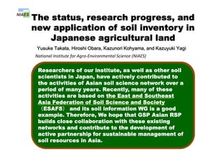
  • 1. The status, research progress, and li ti f il i t inew application of soil inventory in Japanese agricultural land Yusuke Takata, Hiroshi Obara, Kazunori Kohyama, and Kazuyuki Yagi National Institute for Agro‐Environmental Science (NIAES)  Contents Hi t f ti l il Researchers of our institute, as well as other soil scientists in Japan, have actively contributed to History of national soil survey program and status of soil inventories p , y the activities of Asian soil science network over a period of many years. Recently, many of these activities are based on the East and Southeast Application of soil inventory 1 - Agro-environmental indicators - activities are based on the East and Southeast Asia Federation of Soil Science and Society (ESAFS) and its soil information WG is a good example Therefore We hope that GSP Asian RSP Application of soil inventory 2 - Status of utilization and demands of soil example. Therefore, We hope that GSP Asian RSP builds close collaboration with these existing networks and contribute to the development of ti t hi f t i bl t fStatus of utilization and demands of soil information in Japan - active partnership for sustainable management of soil resources in Asia.
  • 2. Agro-geological Maps (1:100,000) History of National Soil Survey Programs in Japanese Agricultural Land (1885-1948) Max Fesca (1845-1919) ©Tokyo Univ. Map unit S il T t /Soil Texture/ Geological Condition
  • 3. History of National Soil Survey Programs in Japanese Agricultural Land (1953-1978) ・Soil Survey for Improving Fertilizer application (1953-1961) Mainly in paddy field about 200 000 pedons were surveyed ・ Fundamental Soil Survey for Soil Fertility Conservation (1959-1978) Mainly in paddy field, about 200,000 pedons were surveyed. (1959-1978) Mainly in upland field, the survey density was 500m. Summaries of Pedon dataset  (47 prefectures)  Cultivated soil maps (1:50,000)
  • 4. Digitalized and updated cultivated soil maps (1: 50,000) Digitalized soil inventory Cultivated soil maps (1:50,000) Benchmarked soil pedon database Digital soil map Benchmarked soil dataset  Updating soil-land map (about 20,000sites)  ・Soil Survey for Improving Fertilizer application F d t l S il S・ Fundamental Soil Survey for Soil Fertility Conservation Urban sprawl impacts on fertile soils
  • 5. History of National Soil Survey Programs in Japanese Agricultural Land (1979-1999) Basic Soil - Environment Monitoring About 20,000 monitoring sites. 5 year interval (Since 1979) Basic Soil - Environment Monitoring Site information Soil profile description 5-year-interval (Since 1979) 800 ・Site ・Latitude Longitude ・Soil type ・Sampling date ・Depth of horizons ・Color ・Structure others O5mg/100g) 600 P Sampling date others Activity data others Soil properties osphate(P2O 400 1979- 1984 Available P Activity data ・Soil treatment ・Fertilizer application C t ti Soil properties pH, EC, Soil texture, C and N content, Bulk density available P CEC Location of stationary it i it ailablePho 200 1984- 1989- 1994- A ・Crop rotation ・Irrigation/Drainage others density, available P, CEC, Ex-cations, pF, Solid- liquid-gaseous phase, Hydraulic conductivity, monitoring sites. land use greenhousepastureorcharduplandpaddy Ava 0 1998 Paddy Upland Orchard Pasture Greenhouse others
  • 6. History of National Soil Survey Programs in Japanese Agricultural Land (1999-) 1) Soil survey program for monitoring soil function1) Soil survey program for monitoring soil function (1999 - ) Downsizing of the Basic soil-environment monitoring (Monitoring sites were decreased from 20 000 to 5 000) 2) A national soil survey program for monitoring soil carbon content and soil management in Japan (Monitoring sites were decreased from 20,000 to 5,000) carbon content and soil management in Japan (2008 - ) In order to monitor variations in soil carbon content of arable lands and effects of agricultural management practices (3,500 monitoring sites)effects of agricultural management practices (3,500 monitoring sites) ・Developing the Comprehensive soil classification system of Japan (seamless between cultivated and forest area) ・Upgrading a seamless digital soil map at scale 1: 250,000 using the Comprehensive soil classification system (also WRB 2006 will be used)WRB 2006 will be used).
  • 7. ContentsContents History of national soil survey program and status of soil inventoriesand status of soil inventories Application of soil inventory 1 - Agro-environmental indicators - Application of soil inventory 2Application of soil inventory 2 - Status of utilization and demands of soil information in Japan -
  • 8. Cultivated soil area in Japan Soil Group Area (x1000 ha)No. of 1973 1992 2001 Gray Lowland 9 Fluvisols, 1275 1157 1072 Soil Group (WRB) Area (x1000 ha) Soil Group No. of Soil Series Group y soils 9 , Gley soils 1275 1157 1072 Gley soils 7 Fluvisols 1027 908 848Gley soils 7 Fluvisols 1027 908 848 Andosols 5 Andosols 1007 944 879 Brown Forest soils 3 Cambisols 483 426 362 soils Wet Andosols 5 Gleyic Andosols 384 419 397 Other soils 31 1498 1347 1231 Total 5675 5202 4790
  • 9. Application of soil inventory in Japanese agricultural land 1 Agro-environmental indicators Soil Erodibility Soil Carbon Radioactive Cs Concentration mapSoil Erodibility (K) factor Map Soil Carbon Stock Map Concentration map (Aug. 2011) Available Water Content Soil Nitrogen Stock Map Soil Temperature Map
  • 10. S il b t k Categorical method Soil carbon stock map (delineated by categorical method) In general, categorical method is Soil carbon content (g/kg) “Basic Soil-Environmental Monitoring Project” data used for delineation of soil carbon and nitrogen stock at national scale. Soil carbon content (g/kg) Bulk density 0 cm Calculating average value of carbon and nitrogen stock by soil and/or land use type 1cm use type But, 30 cm Categorical method has an i t l bi Low 30 cm Averaging per soil series group and land use type (SSG LU categories) in environmental bias. Hi h (SSG_LU categories) in each 1cm layer. High 60 SSG and 4 land use (paddy, upland, orchard, grassland) 240 SSG_LU categories
  • 11. About 20,000 monitoring sites. 5-year-interval (Since 1979) Basic Soil - Environment Monitoring Cultivated Soil Map (1:50,0000) 5 year interval (Since 1979) Andosols Wet Andosols Brown Forest soils Gray Lowland soils Gley soils Other Soil Groups Digital Elevation Model (50m)Soil Temperature Map (1 km)
  • 12. Environmental bias (Soil temperature) Residuals (tC/ha) M d l C t i l l 4 SCS = Measured values – Categorical values *Residuals (tC/ha) > 0; Underestimation *Residuals (tC/ha) < 0; Overestimation siduals ) 0 2 4 SCS a b c c a b c c a b c c a b c bc a a b ab C l i U d ti t d Both SCS and TN erageRes (tC/ha ‐4 ‐2Cool region; Underestimated Warm region; Overestimated Av ‐6 0.1 TN a b b b a b b b a a b b a a b ab ab a b ab Warm region; Overestimated Residuals ha) ‐0 2 ‐0.1 0 AverageR (tN/h 21-30cm ‐0.4 ‐0.3 0.2 0-5cm 6-10cm 11-15cm 16-20cm A Frigid (0‐8 oC) Mesic (8‐15 oC) Thermic (15‐22 oC) Hyperthermic (more than 22 oC) Soil Temperature map (resolution; 1km)
  • 13. Environmental bias (Sloping Upland SCS – Landform) ConvexConvex Plane Steep Slope Plane ConcaveGentle Slope 3 - 8 degree Concave Gentle Slope 3 8 degree 0 ‐2 Residuals ha) C it U d ti t d Upland SCSUpland SCS2 ‐4 AverageR (tC/h Concavity area; Underestimated Convexity area; Overestimated Categorical method overestimates SCS in sloping upland field Steep Slope > 8 degree a a a a a a a a a a a a a a a ‐6 A Convexity area; Overestimated In Steep slope SCS in sloping upland field > 8 degree 0 esiduals a) ‐5 erageRe (tC/ha Digital elevation model 21‐30cm0‐5cm 6‐10cm 11‐15cm 16‐20cm b ab a b ab a b ab a b ab a a a a‐10 Ave Digital elevation model (resolution; 50m)
  • 14. Hybrid-kriging method R id l = M d d t P di t d d t E 1Residuals = Measured data – Predicted data Eq.1 Predicted data was provided by Categorical Method (SCS or TN Point data) (Map data)(Point data) ResidualsMap = Ordinary kriging (Residuals) Eq.2 (Map data) (Point data) SCS or TN_Map = Predicted data + ResidualsMap Eq.3 (Categorical) (Eq. 2; Map data)(Map data) E 3 Eq.3Eq.3 E 1 Eq 2Eq.1 Eq.2 Residuals SCS or TN map (Categorical) SCS or TN_Map (Hybrid) ResidualsMap
  • 15. Comparison accuracy between Categorical method and Hybrid kriging method. 15.0 1.5 E E SOC TN 5.0 10.0 0.5 1.0 RMSE RMSE 0.0 0.0 R R -1 0 0.0 0.0 -3.0 -2.0 1.0 -0.2 -0.1 ME ME -4.0 -0.3 Categorical Hybrid-kriging RMSE; Root mean square error, SQRT{1/N*Σ(mean error)2} ME; Mean error, 1/N*Σ(Measured values – estimated values) Categorical Hybrid kriging
  • 16. SCS and TN Map (1989-1993) SCS TN 468 Tg 34 Tg SCS map TN map
  • 17. Temporal variation of SCS (tC/ha) and TN (tN/ha) in each land use typeTN (tN/ha) in each land use type 160  ha) 80 120  CS(tC/h 0 40  SC 0  15.0  a) 10.0  N(tN/ha 0.0 5.0  TN Paddy fields Upland fields Grassland Orchard 0.0 
  • 18. ContentsContents History of national soil survey program and status of soil inventoriesand status of soil inventories Application of soil inventory 1 - Agro-environmental indicators - Application of soil inventory 2Application of soil inventory 2 - Status of utilization and demands of soil information in Japan -
  • 19. Application of soil inventory in Japan 2 Soil Information WEB Viewer http://agrimesh dc affrc go jp/soil db/http://agrimesh.dc.affrc.go.jp/soil_db/
  • 20. Soil series groups (code)Soil series groups (code) Explanation of soilp series groups Soil surface DB 1979-1983 1984-1988 1989-1993
  • 21. Who are the users of soil information? Municipalities (3 6%) National Federation of Agricultural Cooperative Association (2.5%) Hydrologist (0.7%) From Apr. 2010 to Jan. 2012 ・Total visits:900,0000 Government ministries (5.0%) Municipalities (3.6%) ・Main users have accessed in their office hours. Prefectural officesNational ・Prefectural offices contains agricultural Key demands of soil information in Japanese agricultural landoffices (30.4%) National institutes (16.1%) institutes and consultantsAgronomic consulting p g PrivateUniversities ・Private companies Environmental assessment Educational materials companies (21.8%) (19.9%) ・Private companies, (1) IT (2) Construction (3) B d ti Food safety (3) Broadcasting (4) Chemicals (5) Foodstuffs
  • 22. Development phase for iPhone applications To link soil knowledge with sustainable soil management Soil DB Cloud Computing C sequestration potential Climate DB Models C sequestration potential Irrigation timing Improving fertilization Etc. ・Location data A ti it d t ・Effective outputs ・Activity data ・Soil test ID Agronomic consulting Environmental assessment Key demands of soil information Soil is Environmental assessment Food safety Educational materials
  • 23. Soil inventory Spatial analyze SCS Map TN map Thank you very much for your attention. I have been received a message from the administrative board  of Japanese Society of Soil Science and Plant Nutritionof Japanese Society of Soil Science and Plant Nutrition
  • 24. 社団 日本土壌肥料学会日本土壌肥料学会 Japanese Society of Soil Science and Plant Nutrition 26‐10‐202, Hongo 6‐chome, Bunkyo‐ku, Tokyo, 113‐0033 Japan 社団 法人日本土壌肥料学会日本土壌肥料学会TEL +81‐3‐3815‐2085 FAX +81‐3‐3815‐6018 sfpoffice@jssspn.jp February 6th, 2012 Dear Prof. Renfang SHEN and All the Participants to International Conferenceg p “Advancing the Science and Technology of Soil Information in Asia — Launch of the Global Soil Partnership’s Asia Soil Science Network and GlobalSoilMap.net East Asia Node”:GlobalSoilMap.net East Asia Node : The Japanese Society of Soil Science and Plant Nutrition is willing to join the Asia Soil Science Network of the Global Soil Partnership CongratulationsAsia Soil Science Network of the Global Soil Partnership. Congratulations on the successful and fruitful conference ! V b t i hVery best wishes M. Nanzyo, Chair of the Japanese Society of Soil Science and Plant Nutrition
  • 25. Cultivated Soil Map (2001 version) We are using it. Andosols Wet Andosols Brown Forest soils Gray Lowland soilsGray Lowland soils Gley soils Other Soil Groups
  • 26. Temporal Variation of soil carbon and Nitrogen content (Tg) in Agricultural landNitrogen content (Tg) in Agricultural land 480240 (Tg) 240 360 160 240 Carbon 0 120 240 0 60 SoilC 00 24 48 n(Tg) 8 16 16 32 Nitrogen 0 8 0 16 SoilN