Remote sensing is the collection of information about objects without physical contact using tools like cameras, microscopes, and sensors. It involves sensing and recording reflected or emitted energy and processing, analyzing, and applying that data. Remote sensing allows large area coverage, repetitive monitoring, multi-scale data collection, and efficient data analysis to be used for various applications like mapping and land surveys. The first photograph was taken in 1827 by Joseph Nicéphore Niépce using a camera obscura and the emulsion of bitumen of Judea and oil of lavender.
Now-a-days the field of Remote Sensing and GIS has become exciting and glamorous with rapidly expanding opportunities. Many organizations spend large amounts of money on these fields. Here the question arises why these fields are so important in recent years. Two main reasons are there behind this. 1) Now-a-days scientists, researchers, students, and even common people are showing great interest for better understanding of our environment. By environment we mean the geographic space of their study area and the events that take place there. In other words, we have come to realize that geographic space along with the data describing it, is part of our everyday world; almost every decision we take is influenced or dictated by some fact of geography. 2) Advancement in sophisticated space technology (which can provide large volume of spatial data), along with declining costs of computer hardware and software (which can handle these data) has made Remote Sensing and G.I.S. affordable to not only complex environmental / spatial situation but also affordable to an increasingly wider audience.
Application of Remote Sensing and GIS Technology in Agriculture by SOUMIQUE A...SOUMIQUE AHAMED
Application of Remote Sensing and GIS Technology in Agriculture by SOUMIQUE AHAMED 2024.
Division of Agronomy, Faculty of Agriculture - Wadura, Sher-e-Kashmir University of Agricultural Sciences and Technology of Kashmir.
Remote Sensing and its Applications in AgricultureVikas Kashyap
Here is a presentation prepared by me on Remote sensing and its Applications in agriculture. This presentation created after studying many regarding websites, articles and research papers. Thank You
Introduction -Remote means – far away ; Sensing means – believing or observing or acquiring some information.
Remote sensing means acquiring information of things from a distance with sensors. (without touching the things)
Sensors are like simple cameras except that they not only use visible light but also other bands of the electromagnetic spectrum such as infrared, microwaves and ultraviolet regions.
Distance of Remote Sensing, Definition of remote sensing - Remote Sensing is:
“The art and science of obtaining information about an object without being in direct contact with the object” (Jensen 2000).
India’s National Remote Sensing Agency (NRSA) defined as : “Remote sensing is the technique of deriving information about objects on the surface of the earth without physically coming into contact with them.”
Remote Sensing Process, - (A) Energy Source or Illumination.
(B) Radiation and the Atmosphere.
(C) Interaction with the Target.
(D) Recording of Energy by the Sensor.
(E) Transmission, Reception, & Processing.
(F) Interpretation and Analysis.
(G) Application.
Remote sensing platforms , History of Remote Sensing, Applications of remote sensing - In Agriculture, In Geology, Applications of National Priority.
The Indian economy is classified into different sectors to simplify the analysis and understanding of economic activities. For Class 10, it's essential to grasp the sectors of the Indian economy, understand their characteristics, and recognize their importance. This guide will provide detailed notes on the Sectors of the Indian Economy Class 10, using specific long-tail keywords to enhance comprehension.
For more information, visit-www.vavaclasses.com
Operation “Blue Star” is the only event in the history of Independent India where the state went into war with its own people. Even after about 40 years it is not clear if it was culmination of states anger over people of the region, a political game of power or start of dictatorial chapter in the democratic setup.
The people of Punjab felt alienated from main stream due to denial of their just demands during a long democratic struggle since independence. As it happen all over the word, it led to militant struggle with great loss of lives of military, police and civilian personnel. Killing of Indira Gandhi and massacre of innocent Sikhs in Delhi and other India cities was also associated with this movement.
Model Attribute Check Company Auto PropertyCeline George
In Odoo, the multi-company feature allows you to manage multiple companies within a single Odoo database instance. Each company can have its own configurations while still sharing common resources such as products, customers, and suppliers.
Unit 8 - Information and Communication Technology (Paper I).pdfThiyagu K
This slides describes the basic concepts of ICT, basics of Email, Emerging Technology and Digital Initiatives in Education. This presentations aligns with the UGC Paper I syllabus.
The Art Pastor's Guide to Sabbath | Steve ThomasonSteve Thomason
What is the purpose of the Sabbath Law in the Torah. It is interesting to compare how the context of the law shifts from Exodus to Deuteronomy. Who gets to rest, and why?
How to Create Map Views in the Odoo 17 ERPCeline George
The map views are useful for providing a geographical representation of data. They allow users to visualize and analyze the data in a more intuitive manner.
Students, digital devices and success - Andreas Schleicher - 27 May 2024..pptxEduSkills OECD
Andreas Schleicher presents at the OECD webinar ‘Digital devices in schools: detrimental distraction or secret to success?’ on 27 May 2024. The presentation was based on findings from PISA 2022 results and the webinar helped launch the PISA in Focus ‘Managing screen time: How to protect and equip students against distraction’ https://www.oecd-ilibrary.org/education/managing-screen-time_7c225af4-en and the OECD Education Policy Perspective ‘Students, digital devices and success’ can be found here - https://oe.cd/il/5yV
How to Make a Field invisible in Odoo 17Celine George
It is possible to hide or invisible some fields in odoo. Commonly using “invisible” attribute in the field definition to invisible the fields. This slide will show how to make a field invisible in odoo 17.
The Roman Empire A Historical Colossus.pdfkaushalkr1407
The Roman Empire, a vast and enduring power, stands as one of history's most remarkable civilizations, leaving an indelible imprint on the world. It emerged from the Roman Republic, transitioning into an imperial powerhouse under the leadership of Augustus Caesar in 27 BCE. This transformation marked the beginning of an era defined by unprecedented territorial expansion, architectural marvels, and profound cultural influence.
The empire's roots lie in the city of Rome, founded, according to legend, by Romulus in 753 BCE. Over centuries, Rome evolved from a small settlement to a formidable republic, characterized by a complex political system with elected officials and checks on power. However, internal strife, class conflicts, and military ambitions paved the way for the end of the Republic. Julius Caesar’s dictatorship and subsequent assassination in 44 BCE created a power vacuum, leading to a civil war. Octavian, later Augustus, emerged victorious, heralding the Roman Empire’s birth.
Under Augustus, the empire experienced the Pax Romana, a 200-year period of relative peace and stability. Augustus reformed the military, established efficient administrative systems, and initiated grand construction projects. The empire's borders expanded, encompassing territories from Britain to Egypt and from Spain to the Euphrates. Roman legions, renowned for their discipline and engineering prowess, secured and maintained these vast territories, building roads, fortifications, and cities that facilitated control and integration.
The Roman Empire’s society was hierarchical, with a rigid class system. At the top were the patricians, wealthy elites who held significant political power. Below them were the plebeians, free citizens with limited political influence, and the vast numbers of slaves who formed the backbone of the economy. The family unit was central, governed by the paterfamilias, the male head who held absolute authority.
Culturally, the Romans were eclectic, absorbing and adapting elements from the civilizations they encountered, particularly the Greeks. Roman art, literature, and philosophy reflected this synthesis, creating a rich cultural tapestry. Latin, the Roman language, became the lingua franca of the Western world, influencing numerous modern languages.
Roman architecture and engineering achievements were monumental. They perfected the arch, vault, and dome, constructing enduring structures like the Colosseum, Pantheon, and aqueducts. These engineering marvels not only showcased Roman ingenuity but also served practical purposes, from public entertainment to water supply.
We all have good and bad thoughts from time to time and situation to situation. We are bombarded daily with spiraling thoughts(both negative and positive) creating all-consuming feel , making us difficult to manage with associated suffering. Good thoughts are like our Mob Signal (Positive thought) amidst noise(negative thought) in the atmosphere. Negative thoughts like noise outweigh positive thoughts. These thoughts often create unwanted confusion, trouble, stress and frustration in our mind as well as chaos in our physical world. Negative thoughts are also known as “distorted thinking”.
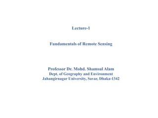
1. Lecture-1
Fundamentals of Remote Sensing
Professor Dr. Mohd. Shamsul Alam
Dept. of Geography and Environment
Jahangirnagar University, Savar, Dhaka-1342
2. What is Remote Sensing?
Remote Sensing is the collection of information relating to
objects without being in physical contact with them. Thus
our eyes and ears are remote sensors, and the same is true
for cameras and microphones and for many instruments
used for all kinds of applications
3. According to Canada Centre for Remote Sensing (CCRS):
"Remote sensing is the science of acquiring information
about the Earth's surface without actually being in contact
with it. This is done by sensing and recording reflected or
emitted energy and processing, analyzing, and applying
that information."
What is Remote Sensing?
4. Different components of the
photograph appear different colors.
i. Hair…………………….………..Black
ii. Face…………………….…….…...Fair
iii. T-Shirt……………………….....Purple
iv. Pant……………stripe _ blue and white
v. Shoe……………………………....Pink
vi. Hair band………………..……......Pink
2. Tree…………………………Light Green
3. Grass………………………. Deep Green
Component…………….…….…….Color
1. Person
5. Spatial relationships between components of a scene may also be
determined from a photograph.
1. Height difference
between objects.
2. Areal extent of the
objects.
3. Relative position,
arrangement of
objects may be
revealed.
6. Significances of Remote Sensing
1. Large area coverage: Remote sensing allows coverage of very
large areas which enables regional surveys on a variety of themes
and identification of extremely large features.
2. Remote sensing allows repetitive coverage which comes in handy
when collecting data on dynamic themes such as water, agricultural
fields and so on.
3. Remote sensing allows for easy collection of data over a variety
of scales and resolutions.
4. A single image captured through remote sensing can be analyzed
and interpreted for use in various applications and purposes.
7. Significances of Remote Sensing
5. Remotely sensed data can easily be processed and analyzed fast
using a computer and the data utilized for various purposes.
6. Data collected through remote sensing is analyzed at the
laboratory which minimizes the work that needs to be done on the
field.
7. Remote sensing allows for map revision at a small to medium
scale which makes it a bit cheaper and faster.
8. Remote sensing is a relatively cheap and constructive method
reconstructing a base map in the absence of detailed land survey
methods.
8. First photograph in the world by Niepce
1827 - Niepce takes first
picture of nature from a
window view of the French
countryside using a camera
obscura and an emulsion
using bitumen of Judea, a
resinous substance, and oil
of lavender (it took 8 hours
in bright sunlight to produce
the image)
9. 1860's - Aerial observations,
and possible photography, for
military purposes were
acquired from balloons in the
Civil War. Balloons were
used to map forest in 1862,
but not used to acquire aerial
photographs as far as scholars
can tell
10. • 1903 - The Bavarian Pigeon
Corps uses pigeons to
transmit messages and take
aerial photos.
11. • 1914 - WWI provided a boost in the use of aerial photography,
but after the war, enthusiasm waned
• 1960 - TIROS-1 launched as first meteorological satellite.
• 1960's - US begins collection of intelligence photography from
Earth orbiting satellites, CORONA.
12. • 1972 - Launch of ERTS-1 (the first Earth Resources
Technology Satellite ,later renamed Landsat 1).
• 1975 - Landsat 2, GOES
• 1977 - Meteosat-1 the first in a long series of European
weather satellites
• 1978 - Landsat 3
• 1981 - Space-Shuttle Imaging Radar (SIR-A), Meteosat-2
• 1982 - Landsat-4
• 1984 - SIR-B
• 1984 - Landsat-5
13. • 1986 - Launch of SPOT-1
• 1990 - SPOT-2
• 1991 - ERS (European Radar Satellite), IRS-1B, Meteosat-5.
• 1992 - JERS-1,Topex/Poseidon.
• 1993 - SPOT-3, Landsat-6 fails to achieve orbit, Meteosat-6
• 1994 - SIR-C/X-SAR flys on the space shuttle.
• 1998 - Launch of SPOT-4, SPIN-2, JERS-1
• 1999 - Launch of Landsat 7, IKONOS, MODIS
• 2000 - SRTM (China),
• 2001- Quickbird
• 2002 - Aqua, SPOT-5,