Impact of Dams on the People of Mali
•
2 likes•2,256 views

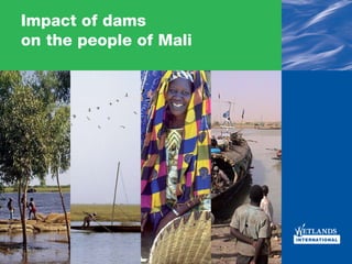
This study shows that individual water management decisions in the Upper Niger have a profound effect on distributional environmental, economic and social benefits to people in different parts of the basin.

Recommended
More Related Content
Viewers also liked
Viewers also liked (20)
Similar to Impact of Dams on the People of Mali
Similar to Impact of Dams on the People of Mali (12)
More from Wetlands International
More from Wetlands International (19)
Recently uploaded
Recently uploaded (20)
Impact of Dams on the People of Mali
- 1. Impact of dams on the people of Mali Impact of dams on the people of Mali 1
- 2. This study shows that individual water management decisions in the Upper Niger have a profound effect on distributional environmental, economic and social benefits to people in different parts of the basin. There has already been significant redistribution between different sectors and communities in different regions and countries. When one or more planned dam developments are considered it is predicted that the effects become more marked and exaggerated. In the Inner Niger Delta area very significant changes in the way of life and in nature values would be experienced. Policy investment and management decisions on water infrastructure should take these facts fully into account, to ensure the best results for the people of Mali, their livelihoods and the environment. 2 Impact of dams on the people of Mali
- 3. Impact of dams on the people of Mali This brochure provides a basis for decisions regarding the This brochure is based on research addressing water management use of water of the Upper Niger. This brochure does not options in the Upper Niger 1. It focuses in particular on the Sélingué prescribe what should or should not be done; it simply and Markala dams in Mali and the proposed Fomi dam in eastern presents facts on the costs and benefits, winners and losers. Guinea. With this brochure, we show the costs and benefits of the three dams and which sectors, regions in both countries In the near future, several decisions have to be taken regarding the and communities lose or win. We do not draw the conclusions use of the river water in the Upper Niger Basin. The major ones regarding the best options for water management in the Upper concern the building of four proposed dams: the Tossaye, Talo, Niger; that is left up to you as the reader. The information is 1. Background information Djenné and Fomi dam (which is discussed in detail here). Other provided to enable better informed decisions to be made with full and facts can be found decisions relate to water management, such as the expansion of awareness of the consequences. at www.wetlands.org/ind. existing irrigation in Office du Niger (Markala dam). The Niger river and Inner Niger Delta Inner Delta Niger river in West Africa Impact of dams on the people of Mali 3
- 4. The net-outcome of the dams All the dams studied provide benefits to specific groups of people Table 1: Annual net-benefits or losses of the and bring costs for others. People downstream only lose as investigated dams (Mali and Guinea) a result of these dams; even in cases where, on average, the Selingué dam € 5 mln country or region benefits. The proposed Fomi dam in Guinea causes however more net costs than benefits. But again, for some Markala dam for Office du Niger € 22 mln groups of people, this dam will just bring benefits. Fomi – € 35 mln Derived from: Zwarts et al (2005) The Niger - a lifeline. Riza, NL A whole range of direct and indirect impacts of the dams were considered. We calculated the costs of building the dams, Table 2: Annual river related benefits per person maintenance costs, electricity production and revenues from Benefits from river without dams € 44 the irrigated areas. We also looked at the more indirect impacts upstream and downstream related to lower water levels. Selingué dam € 48 Selingué and Markala (OND) dam € 68 We expressed all those gains and losses in terms of money Selingué, Markala and Fomi dam € 52 expressed as gross revenues. This provides the following picture Derived from: Zwarts et al (2005) The Niger - a lifeline. Riza, NL for the existing Markala (irrigation of Office du Niger) and Selingué dam and the planned Fomi dam. The table below shows the final Tables 1 and 2 show that the current two dams have a net net outcome when all costs and benefits are taken into account. benefit. This is not the case for the Fomi dam in Guinea. The financial costs are only partly compensated by benefits (mainly The table below provides the final outcomes; table 1 for the region electricity). Moreover, the indirect losses for fisheries, livestock and as a whole; table 2 for individual people. biodiversity downstream dominate these revenues. 4 Impact of dams on the people of Mali
- 5. ‘Winners and losers’ For centuries, people in West Africa have used the Niger River Sectors: winners and losers and the Inner Niger Delta for fisheries, transport, agriculture, and If we look at the different sectors, it is clear that some win and some grazing lands. In the dry area of the Western Sahel, the water of lose as a result of the dams. The figure below shows the impact of this river system was and still is essential for life. the three dams separately for a sector, on a national level. More recently, the river water is also used for hydropower and Different sectors in regions like the Inner Niger Delta also reflect for irrigation of formerly dry land. Many people benefit from these different ethnic groups. The Bozo and Somono people are the infrastructures. Irrigated areas provide stable food production; fishermen; Fulani are the herdsmen and Marka, Bambara and electricity supply is guaranteed. However, others suffer when Sonrai are the farmers. Therefore if one sector is badly affected, water levels drop and the area of annually inundated floodplain a whole community is in trouble. For these people, changing their reduces in size as a result. For instance fisheries, navigation and profession means in fact abandoning their culture. the area of inundation supporting cattle grazing and agriculture in the Inner Niger Delta are impacted. Also the rich nature of these areas is affected when millions of waterbirds lose their important Table 3: Annual costs or benefits of the dams wintering areas. for several sectors within Mali and Guinea Sélingue dam Office du Fomi dam Niger dam Value for : Agriculture € 152,439.02 € 36,280,487.80 € 6,250,000.00 Livestock € 152,439.02 € 0.00 – € 1,981,707.32 Fisheries – € 4,268,292.68 – € 1,219,512.20 – € 9,146,341.46 Biodiversity – € 457,317.07 € 0.00 – € 5,030,487.80 Transport € 304,878.05 – € 152,439.02 – € 152,439.02 Electricity € 10,670,731.71 € 0.00 € 17,987,804.88 Total benefits € 6,707,317.07 € 34,756,097.56 € 7,621,951.22 Total costs € 3,963,414.63 € 22,256,097.56 € 27,743,902.44 Net value € 2,743,902.44 € 12,500,000.00 – € 20,121,951.22 Derived from: Zwarts et al (2005) The Niger - a lifeline. Riza, NL Impact of dams on the people of Mali 5
- 6. Figure 1: Water flows of the Niger River system and the impact of dams. Regions: Winners and losers (Red lines are existing dams, dotted lines are planned dams) All dams take a share of the precious water in this dry environment. This is especially the case for dams used for irrigation, like the Markala dam for Office du Niger. The graph KOUROKELER GBANHALA MILO NIANDAN MAFOU NIGER TINKISSO Derived from: Zwarts et al (2005) The Niger - a lifeline. Riza, NL below shows the water flows and the impact of current dams. Considered on an annual basis, the loss of flow downstream FOMI caused by the existing and proposed dams is quite limited (11,6%). However, the impact of this fixed amount is much greater SANKARANI during the dry season when up to 70% of the total water flow is lost. Water currently taken by the Markala and Selingue dams at low and high discharges of the Niger River during the wet season is respectively 30% (weak flood) and only 6% (high flood). The SÉLENGUÉ (– 0,83 km 3) Banankoro: 24,5 km 3 impact of this fixed amount is of course much greater during the Sélengué: 8,1 km 3 dry season. The reduction at these times is up to 70% of the total BALE SOTUBA (– 0,2 km 3) water flow. FAYA Less water left for the downstream Inner Niger Delta means a BAGOÉ BAOULÉ BANIFING Koulkoro: 32,5 km 3 smaller inundated area of the floodplain. In turn this has a direct impact on cattle raising, rice agriculture and fisheries that depend MARKALA (– 2,69 km 3) on this. The graphs below clearly illustrate this direct link for the Ké-Macina: 28,2 km 3 fisheries as expressed by weight of fish traded. Other sectors in the Inner Niger Delta will show a similar picture. Douna: 7,2 km 3 DJAKA TALO BANI INNER NIGER DELTA Figure 1: Strong relation between water and fish trade Diré: 23,1 km 3 TOSSAYE 6 Impact of dams on the people of Mali Derived from: Zwarts et al (2005) The Niger - a lifeline. Riza, NL
- 7. The table below shows the impact of the current dams on the various regions. Population change is a clear indicator for the regions that win or lose. While the overall Malinese population is rising steeply, the almost stagnant situation in the Inner Niger Delta can be seen. Table 4: Impact of the current dams in Mali Derived from: Zwarts et al (2005) The Niger - a lifeline. Riza, NL Name of area Size People Population Impact of dams change (annually, last decades) Mali (total) 1,240,000 8,810,911 2.43% Additional and stable electricity supply Increased food production Loss of biodiversity, navigation, fish production Inner Niger Delta 30,000 km 2 (inundated) 1,107,791 0.7% Drop in cattle, fish catch, agricultural production and navigation Selingué area 13.5 km 2 irrigated 123,535 2,96% Loss of agricultural and grazing lands (result of the 50km 2 lake); newly irrigated areas and fish production Office due Niger 740 km 2 irrigated 270,289 5-10% Newly irrigated areas Impact of dams on the people of Mali 7
- 8. Impact of dams on different sectors in different regions The overview of sectors gaining and losing is only telling a part of the story. The same applies for the regions that win and lose. The three tables below provide a breakdown of the impact on sectors in each region. This shows exactly who is winning and losing 2. The Selingué dam (1980) has been built to produce electricity, 2. Numbers are for several mainly for Bamako (the capital of Mali). There are also some dates in the last decade; associated irrigation and fisheries activities. On the other hand, dependent on the available 13.500 people living in the valley of the Sankarani lost their data. houses, grazing lands, orchards and other agricultural lands. 8 Impact of dams on the people of Mali
- 9. Office du Niger Office du Niger is an agricultural area. The Markala dam enables gravitational irrigation. At 74,000 ha, it is the largest irrigation scheme in West-Africa and crucial for Mali’s rice production. Expansion of the irrigated area of the Office du Niger is feasible and can be made possible with further improvement of the water eficiency of the system’s. However further increasing the water intake from the Niger River would have a considerable negative impact on the Inner Niger Delta. Due to the Sélingué reservoir and the irrigation by the Office du Niger, the water level in the Inner Niger Delta has been lowered by 20 to 25 cm. As a result of the lower water levels the inundated area of the Inner Niger Delta has been decreased by 900 km 2. Table Table 5: Impact of the existing dams on the investigated areas 5 clearly demonstrates the impact. The lower water level is also expected to reduce the extent of floating “bourgou” fields by 62%. IND without Impact of dams on Impact of dams on Impact of dams on Besides its ecological value, bourgou areas are indispensable as a dams the Inner Niger Delta the Office du Niger the Selingué area nursery habitat for juvenile fish and as grazing for cattle. Rice (tonnes) 99,200 – 13,200 + 333,078 + 6,000 / 7,500 t. The impact of these dams in their own area is predominantly Fish production 54,000 - positive; especially for the Markala dam that had the sole purpose – 4,100 0 + 4,000 t. (tonnes) 133,000 of creating new agricultural land. But also for the Selingué Number of Cattle 1,260,000 – 60,000 + 99,000 – (negative, unknown) dam that had energy supply as a main purpose. Even some Number of Negative impact populations of waterbirds are now dependent on associated newly 3,000,000 - created wetlands. However the Inner Niger Delta and its 1 million wintering (up to 4% less + 595,155 + 20,000 4,000,000 waterbirds reproduction) inhabitants lose out completely. Derived from: Zwarts et al (2005) The Niger - a lifeline. Riza, NL Impact of dams on the people of Mali 9
- 10. The Fomi dam Water levels in the Inner Niger Delta will drop by another 45 cm if The Fomi dam in Guinea is primarily planned for electricity the Fomi dam is built. The inundated area will be further reduced by production. The dam lake will probably also create opportunities for 1400 km 2. With the Fomi dam, the operational season of the Niger some fish production. The areas around the lake may or may not River for larger boats would be reduced due to the shorter period be suitable for some cattle or other livestock and for agriculture and with deep water. Table 6 shows the expected impact of the dam on may provide some opportunities for waterbirds. The negative impact sectors in different regions. on downstream areas (mostly in Mali) is however considerable. If the Fomi dam were built, the impact on people depending on Figure 3: Impact of the Fomi dam on the inundated area of the Inner Niger fisheries, rice production or livestock in the Inner Niger Delta would Delta: (red areas will no longer be inundated) be devastating. The Fomi dam might also lead to significantly lower population levels of both residents and migratory species waterbirds; the last large breeding colonies of cormorants, ibises, herons and egrets in West Africa would be pushed to the edge of existence. Table 6: Additional impact of the Fomi dam on sectors in the investigated areas IND Impact of Fomi Impact of Fomi Impact of Impact of without dam on Inner dam on Office Fomi dam Fomi dam on any dams Niger Delta du Niger on Selingué Fomi-area area Rice (tonnes) 99,200 – 34,000 0 0 - Fish production 54,000 - – 8,500 0 0 + 4000 t. (tonnes) 133,000 – 24,000/ Cattle 1,260,000 0 0 - 48,000 Biodiversity 3,000,000 - Negative 0 0 ? (waterbirds) 4,000,000 impact: Loss of 60% of key habitats (Bourgou); extinction of populations. Derived from: Zwarts et al (2005) The Niger - a lifeline. Riza, NL 10 Impact of dams on the people of Mali
- 11. Colophon Published by: Wetlands International Financial support: Netherlands Ministry of Foreign Affairs Based on the information of: Leo Zwarts (RIZA), Pieter van Beukering (IVN), Bakary Kone (Wetlands International), Eddy Wymenga Printed by: Macula bv, Boskoop Design: Coen Mulder Photo credits: Leo Zwarts Printed on FSC-certified paper Impact of dams on the people of Mali 11
- 12. Mission: Participants To sustain and restore wetlands, their resources and biodiversity for future generations. w For further information please visit our website or contact our office. Website: www.wetlands.org Wetlands International Headquarters Wetlands International Mali office PO Box 471 PO Box 97 6700 AL Wageningen Mopti / Sévaré The Netherlands Mali Tel: +31 318 660910 Tel: +223 21420 122 Fax: +31 318 660950 Fax: +223 21420 242 12 Impact of dams on the peopleE-mail: post@wetlands.org of Mali E-mail: malipin@afribone.net.ml