Characteristics and methods of wetlands utilization in ibiono ibom l.g.a., nigeria
•
1 like•754 views

The International Institute for Science, Technology and Education (IISTE). Science, Technology and Medicine Journals Call for Academic Manuscripts

Recommended
Recommended
More Related Content
What's hot
What's hot (20)
Viewers also liked
Similar to Characteristics and methods of wetlands utilization in ibiono ibom l.g.a., nigeria
Similar to Characteristics and methods of wetlands utilization in ibiono ibom l.g.a., nigeria (20)
More from Alexander Decker
More from Alexander Decker (20)
Recently uploaded
Recently uploaded (20)
Characteristics and methods of wetlands utilization in ibiono ibom l.g.a., nigeria
- 1. Journal of Environment and Earth Science www.iiste.org ISSN 2224-3216 (Paper) ISSN 2225-0948 (Online) Vol.4, No.14, 2014 9 Characteristics and Methods of Wetlands Utilization in Ibiono Ibom L.G.A., Nigeria Faith U. Ekong Dept of Urban and Regional Planning,Faculty of Environmental Studies,University of Uyo, Uyo Email:faithekong@uniuyo.edu.ng; faith_ekong@yahoo.com Itoro U. Akpan AfricaCoast Research Institute,Uyo Abstract Wetlands are valuable resources currently facing severe threats world over due to the drive for economic growth, development and agricultural practices. However, in order not to lose these wetlands, it is imperative that studies be carried out to ensure the sustainable use of wetland resources. This paper therefore examines the various human activities, development strategies and management style of wetlands in Ibiono Ibom Local Government Area. The sample for this study consisted of 339 wetlands users in 8 communities randomly sampled from the 36 identified wetlands communities in Ibiono Ibom L.G.A. Findings from the study reveal that government policies, poverty, societal belief, low technology and other human activities in the area affects wetland development and management. The results strongly show that these factors vary with location and intensities. The study recommends that there should be a wetlands inventory and conservation plan, wetland protection and management guidelines based on proper landuse planning techniques. Also there is a call for environmental impact assessment, community participation, awareness creation and adequate budgetary provision for the planning, development and management of wetlands in the area in line with the current realities of climate change. Keywords: Wetlands, resources, sustainable development, community participation, land use planning. 1. INTRODUCTION One of the most productive ecosystems in the world is wetlands. Although, wetlands vary widely due to regional and local differences in soils, vegetation, topography, climate, water, chemistry and hydrology, they are usually charaterised by specific vegetation, particular soils and the presence of water at least for a period of time in the year. However, some wetlands are constantly wet while others temporarily dry up. Naturally, wetlands exist in every climate and country, except in Antarctica. Wetlands range in size, from thousands of acres to less than one acre. According to Hiscox (2005), wetlands are estimated to cover about 6 percent of the Earth’s land surface, about 570 million hectares (1,408 million acres) or 5.7 million square kilometers (2 million square metres). About 30 percent are peatlands or bogs, 26 percent marshlands or fens, 20 percent swamps, 15 percent floodplains and 2 percent lakes. On the other hand, mangroves cover some 240,000 square kilometers (92,640 square metres) of tropical coast while coral reefs extend over an estimated 600,000 square kilometers (231,600 square metres) worldwide. In the past, the values of wetlands were not fully recognized but recently, they have really appreciated. Hence, the value of wetlands should not be underestimated as they are noted for their ecological value, economic value, recreational value, cultural value as well as aesthetic value. Inspite of the above, the viability of many wetlands has been threatened world over. For instance, their exploration has been so extensive that many areas have been lost. According to Gannaway (1995), the drive for economic growth, agricultural practices and development have posed serious threat to Thailand’s wetlands. Among the major threats are drainage, clearing, filling and reclamation for cash crop production, road building, construction of dams or barrages for water storage, flood protection, irrigation and hydroelectric schemes, construction of water ways and irrigation channels, pollution, especially by pesticide and fertilizer residue, overgrazing by livestock, over fishing and conversion to aquaculture ponds. Similarly, the several upstream dams outside the Hadejia-Nguru wetlands have been a major threat to the natural water balance of the wetland system and as a result of this, large areas of farming and grazing land as well as important fish ponds have either dried up along the block channels now occupied by the invasive typha grass or have been flooded (Wetlands International, 2009). Idris (2008) stated that Nigeria’s most important wetland – the Hadejia-Nguru wetlands have shrunk by as much as two-third of its size in the past 30 – 40 years because of diversions from dams, irrigation developments and drought. Undoubtedly, in many countries of the world especially developing countries, governments have paid less attention to the sustainable development and management of wetlands and this has affected the health and viability of wetlands as well as the ecosystem thereby contributing to regional and global environmental problems. However, sooner or later, the uncontrolled exploitation of wetlands resources without sustainable
- 2. Journal of Environment and Earth Science www.iiste.org ISSN 2224-3216 (Paper) ISSN 2225-0948 (Online) Vol.4, No.14, 2014 10 management will eventually lead to the disappearance of wetlands. This paper, therefore, focuses on the analysis of the characteristics of wetlands, their development and management in Ibiono Ibom LGA with a view to proffering solutions and suggesting strategies for sustainable management. 2. STATEMENT OF PROBLEM Wetlands are richly endowed with natural resources which aid them to play an important role in the maintenance of natural cycle on earth but they are also plagued with challenges that call for urgent attention. Unlike non degraded wetlands, degraded wetlands cannot properly carry out the traditional roles which they play and are valuable to the ecosystem. Although, wetlands are particularly dynamic ecosystem, some of them have been shaped and destroyed by extreme natural events such as floods, storms or drought. On the other hand, human activities such as the construction of dams have radically altered the hydrological functioning of wetlands thereby leading to reduction or loss in their value. According to Idris (2008), Nigeria most important wetlands – the Hadejia-Nguru wetlands have shrunk by as much as two-thirds in the past 30 – 40 years because of diversions from dams, irrigation developments and drought. Also, the floodplain of Hadejia River has been reduced by over 300km2 as a result of dam construction. Furthermore, Essien (2011) stated that Nigeria’s wetland resources are currently being threatened by certain anthropogenic and bio-geographical factors among which are population pressure, rapid rate of urbanization, mining, oil and industrial waste, pollution, uncontrolled tilling for crop production, overgrazing, coastal erosion, droughts, etc. The loss of wetlands have resulted to irreversible damage to communities dependent upon the wetlands for survival and distortion of the natural environment as some wetlands are being drained, diked and filled to make way for buildings, highways, parking lots, etc. Consequently, as wetlands areas have now been reduced, the loss of wetlands now becomes a major cause of concern for sustainable development and management. 3. AIM AND OBJECTIVES OF THE PAPER The aim of this paper is to examine the development and management of wetland in Ibiono Ibom Local Government Area of Nigeria. The objectives are to: (i) identify the wetland areas in Ibiono Ibom L.G.A., (ii) identify the types of wetlands in the area, (iii) examine the different human activities affecting wetlands in the area, (iv) examine the problems affecting wetland development and management, and (v) make appropriate recommendations for sustainable wetlands planning and management 4. THE STUDY AREA Ibiono Ibom is one of the Local Government Areas in Akwa Ibom State, Nigeria; it was created out of Itu Local Government Area. Geographically, Ibiono Ibom lies between Latitude 5°08' and 5°18'N of the Equator and Longitude 7°52'E and 8°04'E of the Greenwich Meridian (Fig.1). It is bounded in the North by Ini Local Government Area of Akwa Ibom State and Arochukwu Local Government Area of Abia State, in the East by Itu Local Government Area, in the West by Ikono Local Government Area and in the South by Uyo Local Government area all in Akwa Ibom State (Akpan, 2012). Ibiono Ibom falls within the tropical rainforest belt of Nigeria. According to Okon (2008), Ibiono Ibom is endowed with natural resources such as hardstones, granites, clay, laterite and there abound forest resources in some areas such as Ibiono North, Ikpanya, Ididep Usuk and Ntan Mbat. The rivers, streams and wetlands are potential resources that support aquatic lives e.g. fishes, crayfish, oysters, shrimps, periwinkles, etc. the major occupation of the people include fishing, farming and trading.
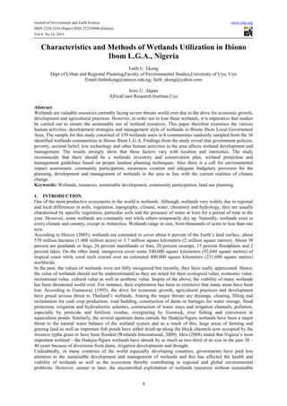
- 3. Journal of Environment and Earth Science www.iiste.org ISSN 2224-3216 (Paper) ISSN 2225-0948 (Online) Vol.4, No.14, 2014 11 Fig 1: Map of Akwa Ibom State showing the Study Area There are two distinct seasons; the wet (rainy) and dry season. The wet (rainy) season begins from March and ends in October while the dry season begins from November and ends in February. Ibiono Ibom has a total landmass of 2,761.76km2 and a population of 189,640 persons (NPC, 2006) and 256 villages. The temperature and humidity favours quick plant growth in the area. Crops such as cassava, cocoyam, plantain, banana, rice are cultivated due to the rich fertile soil. The study area has one of the most extensive freshwater wetlands areas in Akwa Ibom State. 5. LITERATURE REVIEW AND CONCEPTUAL FRAMEWORK 5.1 Types of Wetlands Wetlands are transitional environments where dry land meets water. Basically, wetlands are areas of land covered with water of different depths from water that is several metres deep to water that is merely saturating the soil. The U.S. Army Corps of Engineers (1989) defines wetlands as those areas that are inundated or saturated by surface or ground water at a frequency and duration sufficient to support, and that under normal circumstances do support a prevalence of vegetation typically adapted for life in saturated soil conditions. Wetlands are usually found alongside rivers, lakes and coastal areas and they could be natural or man-made. Natural wetlands include river margins, lakes, coastal lagoons, mangroves, peatlands, bogs, fens, mires and coral reefs. The man-made ones include fish and shrimp ponds, farm ponds, irrigated agricultural land, salt pans, reservoirs, gravel pits, sewage farms and canals. In Nigeria, wetlands fall into two categories; the saline coastal mangrove swamps and the fresh water flood plains. The mangrove swamps cover 900km2 in the eight coastal states of Lagos, Ondo, Edo, Delta, Rivers, Bayelsa, Akwa Ibom and Cross River States. According to Environmental Tobago (2008), there are five wetlands in Trinada and Tobago marine, estuarine, riverine, palustrine and lacustrine. However, the most important features of wetlands include waterlogged soils or soils covered with a shallow layer of water i.e. either permanently or seasonally, unique type of soil and distinctive plants adapted to water-saturated soils.
- 4. Journal of Environment and Earth Science www.iiste.org ISSN 2224-3216 (Paper) ISSN 2225-0948 (Online) Vol.4, No.14, 2014 12 Figure 2: A typical Wetland in Ibiono Ibom Wetlands are shaped and destroyed by extreme natural events such as floods, storms or drought. Climate change also affects wetlands as increase in temperature causes the polar ice to melt and sea levels to rise. This in turn leads to shallow wetlands being swamped and some species of mangrove trees being submerged and drowned. Thus, wetlands respond to changes in global temperature. Hiscox (2005) noted that the change is noticeable in the present extent of Lake Chad which is about 10 percent of the size it was 7,000 years ago. On the other hand, human activities have become a major threat to the survival of wetlands. These activities which range from construction of dams, irrigation, conversion of wetlands for commercial and industrial developments, drainage, extraction of minerals, etc. as a result of these human activities, most wetlands have become vulnerable and degraded. However, degradation alone does not only affect the existence of wetlands but also causes local suffering and affect the ecosystem as a whole; this eventually results to environmental problems. According to Idris (2008), the construction of Tiga and Challawa dams on the Hadejia River and its tributaries greatly altered the river’s natural flow pattern and has brought about changes to the environment and the livelihoods of the communities. Environment Tobago (2008) reported that most of the wetland areas in Tobago have been destroyed and that less than one percent (1%) of the land area is covered by wetlands, this is due to factors like drainage or conversion for development, illegal dumping of solid waste, pollution from domestic sewage, industrial waste, pesticides and fertilizers, siltation due to runoff from cleared areas, over- hunting of wildlife, over fishing and illegal harvesting of mangrove as well as natural threats. Lee (1991) highlighted some problems of wetlands to include: hydrologic alterations e.g. changes in the hydrologic structure and functioning of a wetland by direct surface drainages. Over-exploitation of wetland, sewage runoff from urban and agricultural areas, introduction or change in characteristics of wetlands flora and fauna as a result of change in the adjacent land uses deliberately or naturally changing the water quality, atmospheric deposition of pollutants into these lakes mainly by vehicular and industrial pollution. The loss of wetlands due to commercial and agricultural developments is seriously declining in the U.S.A. though more than half of its original wetland areas have been lost (more than 450,000 acres are lost annually). In Africa, there has been much drainage of wetlands to provide residential and agricultural landuse in areas of Rwanda, Kenya, Malawi (the Nyika Plateau) and Burundi (Hiscox, 2005). The loss and reduction of wetlands have revealed their true value. Shine and De Klamm (1999) acknowledged the value of wetlands by stating that wetlands (periodic inundated) are effective in storing rain water, primary source for recharging ground water supplies, stabilization of shoreline, storm protection and erosion control. Wetlands have good recreational values as they serve as good sites for tourism. Economically, wetlands generate revenue to the local government, provide food and are a source of livelihood to the indigenous people who depend on it for survival. Wetlands also serve as home to plants and animals, without wetlands, plants and animals would lose a safe place to live. Wetlands reduce flooding by acting as sponges and absorbing water during heavy rain storms. Wetlands generate products such as forest, wildlife, fishery, forage and agricultural resources. All these values will be lost once any part of wetland area is cleared temporally or permanently. This is one of the major reasons for this study which we believe will assist in the proper management of this sensitive and precious ecosystem. 5.2 Wetlands Resources in Ibiono Ibom The wetlands in Ibiono Ibom have various natural resources which are usually extracted for use, and they include (1) Forest Resources: There exist a large expanse of freshwater and tropical rainforest in Ibiono Ibom particularly at the Use Ikot Amama/Ikpaya areas; the commonest economic important species is the
- 5. Journal of Environment and Earth Science www.iiste.org ISSN 2224-3216 (Paper) ISSN 2225-0948 (Online) Vol.4, No.14, 2014 13 forest which serves a good source of Timber and fuelwood/charcoal production. Forest trees also abound in the area and they are used for constructing houses. (2) Sand, Gravel and Laterite: Deposits of sand, gravel and laterites are also found in most of the wetlands in Ibiono Ibom especially in the northern section (Fig.1). Use Ikot Amana has a vast mass of sand which is usually exploited for commercial purposes. (3) Sea Foods and domestic water supply: The wetlands in Ibiono Ibom support several varieties of sea foods such as fishes, crabs, lobsters, catfish, mudfish, oyster, periwinkles, shrimps, etc. Figure 3: Freshwater wetlands for domestic water use (4) Recreational Resources: The wetlands of Ibiono Ibom favours recreational activities as people and even researchers often resort to the area in pursuit of fun, sight-seeing and collection of data for research purposes. Recreational activities and tourism is quite an evolving phenomenon in the area and it is anticipated that with the sustainable development and management of wetlands in the area, recreation and tourism will come to stay (Essien, 2011). 5.3 Wetland Development and Management As wetlands the world over are threatened, the loss of wetlands has become a major cause of concern for sustainable development and management. It is in view of this that the convention on wetlands of international importance (an inter-governmental treaty) was adopted in 1971. It is known as the Ramsar convention or the convention on wetlands. According to Hiscox, 2005, the Ramsar convention provides a framework for international co-operation for the conservation and wise use or sustainable use of wetlands. Gannaway (1995) stated that four aspects may be considered as useful in wetland development. i) Productivity: this has to do with the yield or income per unit of resource. ii) Stability: this is the degree to which productivity is constant in the face of small disturbances caused by normal fluctuations of climate. iii) Sustainability: this deal with the system’s ability to maintain productivity in the face of a major disturbance such as soil erosion, an expected drought or a new pest. iv) Equitability: this involves the distributive aspects of the system. For instance how far agricultural products are shared among the community. Furthermore, sustainable wetland development requires strong policy guidelines and framework. According to World Bank (2000), there is need for the adoption maternal wetland polices which should involve a review of existing legislation and institutional arrangements to deal with matters of wetlands. In Zentner (1998) opinion wetland management mechanisms has to be implemented in order to regain and protect the physical, chemical and biological integrity of wetland ecosystems. However, management of wetlands require not only adequate monitoring but increased interaction and co-operation among various agencies such as state departments concerned with the environment, soil, agricultural, forestry, urban planning and development, natural resource management, public interest groups, CBOs, research institutions and policy makers. Moreso, Castelle, Johnson and candly (1994) stated that wetland management need to involve the protection of wetlands by regulating inputs using water quality standard promulgated for wetland and that such inland surface water should promote their normal functioning from the ecosystem perspectives while still deriving economic benefits by sustainable wage. All these depend on the available data on the state of wetlands within a specific region before the question of wise or sustainable use.
- 6. Journal of Environment and Earth Science www.iiste.org ISSN 2224-3216 (Paper) ISSN 2225-0948 (Online) Vol.4, No.14, 2014 14 The sustainable or wise use concept according to World Bank (2000) ensures the sustainability of wetlands and its resources, agricultural productivity and coping with climate change impacts. The concept was first established in 1971 and was later refined in 2005 with the principle that provides benefit to mankind and maintenance of the ecological character (Ramsar, 2005). The wise use concept was developed to promote the conservation of wetlands worldwide. The application of the wise use Concept is very critical in ensuring that wetlands perpetually deliver their vital roles in supporting the maintenance of biological diversity and human well-being. In other words, wetland conservation need not exclude the human element but rather make human use a promoting factor for the sustainable management of wetlands. The concept entails maintaining wetland values and functions, while at the same time delivering services and benefits now and in the future for human well- being. There are three key elements in the wise use concept; ecological character, ecosystem approaches and sustainable development. These three elements are inclusive in the definition of wise use of wetlands. According to Ramsar (2005), the wise use of wetlands is the maintenance of their ecological character, achieved though the implementation of ecosystem approaches, within the context of sustainable development. The ecological character is the combination of the ecosystem, components, processes and benefits/series that characterize the wetland at a given point. The ecosystem approaches considers the complex relationship between every element of an ecosystem and also promotes the integrated management of land, water and living resources (including humans) while the sustainable development is seen as a pattern of resource use that aims to meet human needs while preserving the environment so that needs can be met not only in the present but also for generations to come. 6. METHODOLOGY Data for this study were obtained through questionnaire administration, direct observation and interviews. Questionnaire was administered to 399 wetland users sampled randomly in eight (8) communities. In selecting the sample population, the study area (communities with wetlands over 10 hectares) were stratified into two sectors. In each of the sector, the random sampling technique was adopted to select the communities. A total of 8 communities (Table 1) were selected from the two sectors. Table 1: Villages and Sample Population S/n Village Sector Estimated pop (2012) No. of Households Sampled pop. Male Female 1 Ikot Udom 1 544 90 54 37 17 2 Use Ikot Amama 1 701 116 70 48 22 3 Ikot Asidem 1 364 60 36 23 13 4 Ikot Andem Ididep 1 405 67 40 30 14 5 Afaha Ise 2 433 72 43 28 16 6 Itai Idoro 2 460 76 46 34 15 7 Ikot Inyang 2 491 81 49 38 16 8 Ikot Edom 2 623 103 62 42 18 Total 4021 665 399 280 119 Field survey (2012) In each of the community selected, a list of wetland users (farmers, fishermen, miners, gatherer of Non Timber Forest Products like snail, wrapping leaves, mushroom, etc.) was formed. Each of the households so selected was then interviewed. A total number of 399 households participated in the study. 7. RESULT AND DISCUSSION The spatial distribution of the characteristics of respondents in Table 2 revealed that most of the respondents (household heads) were male 280 (70.18%) while the females were 119 (29.82%).
- 7. Journal of Environment and Earth Science www.iiste.org ISSN 2224-3216 (Paper) ISSN 2225-0948 (Online) Vol.4, No.14, 2014 15 Table 2: Personal Characteristics of Respondents 1 Variable No. of Respondents Percentage (%) Sex Male 280 70.18 Female 119 29.82 Total 399 100 2 Age 20-30 185 46.31 31-40 125 31.33 41-50 65 16.29 51-60 9 2.25 61& above 15 3.76 Total 399 100 3 Marital Status Married 210 52.63 Single 175 43.86 Widowed 9 2.26 Divorced 5 1.25 Total 399 100 4. Educational Level No Formal Education 170 42.61 Primary 109 27.31 Secondary 85 21.30 Tertiary 35 11.28 Total 399 100 Field Survey (2012). The age structure showed that those between the ages of 20-40 were only 9 (2.25%), 41-50 were 65 (16.29%), 51-60 were 125(31.33%), and 61-70 were 185 (46.3%) while those above 70 were 15 (3.76%). This shows that the majority of the households are headed by peoples between the ages of 51 and 70 310(77.63%). In terms of the marital status of the respondents, the married were 210(52.63%), singles were 175(43.86%), widowed were 9(2.26%) and the divorce were only 5(1.25%). This result indicates that majority of the wetland users were married people. From the observations made, it was clear that most of the men married more than two wives in order to assist them in their various activities due to the bulky nature of jobs involved in wetland development. The educational attainment data in table 2 reveals that most of the farmers had no formal education. Thus, the non-formal education group were 170(42.61%), primary consisted of 109(27.31%), those that attained secondary education were 75(18.80%) and those that had tertiary education were 45 (11.28%). Table 3: Income Structure of Respondents Income Level (N) No. of Respondents Percentage (%) Below N10,000 92 32.05 N11,000 – N20,000 151 32.85 N21,000 – N30,000 121 30.33 N31,000 and above 35 8.77 399 100 Field Survey (2012). The income structure of the respondents in Table 3 indicates that 92 (32.05%) were those that earned below N10, 000, 151 (37.85%) earned between N11, 000 – N20, 000, 121(30.33%) earned between N21, 000 – N30, 000 while 35 (8.77%) were those that earned N31, 000 and above per month. This means that majority of the respondents’ earnings falls within the new minimum wage rate of N18, 000 in Nigeria. This assertion also explained why there were many graduates (tertiary) involved in wetlands related occupations. Table 4: Number of Plots No. of Plots No. of Respondents Percentage (%) 1 – 5 98 24.56 6 – 10 112 28.07 11 – 15 164 41.10 16 and above 25 6.27 Total 399 100 Source: Field Survey (2012). Approximate size of a plot is 500m3
- 8. Journal of Environment and Earth Science www.iiste.org ISSN 2224-3216 (Paper) ISSN 2225-0948 (Online) Vol.4, No.14, 2014 16 Table 4 reveals the number of plots cultivated by the respondents. From the Table 98 (24.56%) of the respondents had between 1 – 5 plots of wetland, 112 (28.07%) had 6 – 10 plots, 164 (41.10%) had 11 – 15 plots. While 25 (6.27%) had 16 plots and above (a plot measures about 500m2 ). Thus, the result reveals that the highest plots of wetlands cultivated by the respondents were between 11 – 15 plots i.e. between 5,500-7,500 m2 . The Table also shows that the majority of the respondents were engaged in farming activities. Furthermore, findings from the study revealed that different wetlands activities take place in the study area and Table 5 depicts the different wetland activities. Table 5: Major Human Activities Human Activities No. of Respondents Percentage (%) Farming 126 31.60 Fishing 59 14.79 Timber cutting 63 15.80 Gathering (NFTP) 60 15.00 Mining (Sand/Gravel) 81 20.30 Recreation 10 2.51 Total 399 100 Source: Field Survey 2012 Majority of the respondents were engaged in farming activities i.e. 126 (31.60%), those engaged in fishing were 59 (14.79%), timber cutting i.e. lumbering activities were 63 (15.80%), those in sand/gravel extraction were 81 (20.30%), those in gathering of non-timber forest products (NTFPs) were 63 (15%) while others were in transportation/recreational related activities were 10 (2.51%). Wetlands in the study area perform different types of functions according to the perception of the respondents. Table 6 gives a breakdown of these functions as pointed out by respondents in the study area. Table 6: Values of Wetland Values No. of Respondents Percentage (%) Income Generation 103 25.81 Food Provision 125 31.33 Employment 94 23.56 Research/Recreation 10 2.51 All of the Above 67 16.79 Total 399 100 Field Survey (2012) Majority of the respondents 72 (18.05%) believed that water storage is the best function performed by wetland, this is closely followed by erosion control 60 (15.04%), storm protection 52 (13.03%), irrigation water 45 (11.28%), fish production 41 (10.28%), habitat 40 (10.03%), nutrient retention 37 (8.77%), climate regulation 35 (9.27%), recreation/tourism 9 (2.26%) and others 8 (2.00%). 7.1 Factors affecting Wetlands Utilisation The study further revealed that different human activities affects or impact on the wetlands in the study area as shown in table 7. Table 7: Factors Affecting Wetland Development and Management Factors No. of Respondents Percentage (%) Lack of fund 108 37.07 Government development 65 16.29 Economic constraints 68 17.04 Societal belief 32 8.02 Low level of participation 20 5.01 Waste disposal 54 13.53 Lack of technology 52 13.04 Total 399 100 Field Survey (2012) In Table 7, 97 (24.31%) of the respondents indicated that irrigation especially rice farming affects wetland development and management in the area, 120 (30.08%) indicated that deforestation is one of the major activities that affects and impacts negatively on wetland development and management in the area, other activities were building of dams/road 95 (23.81%), over-fishing 30 (7.57%) and recently overgrazing 57 (14.28%) by the cattle herders who has been attracted to the area because of the steady supply of fodder. The overall utilization of the wetlands resources in the study area which a person engages shows different impacts. The study formulated two hypotheses based on human activities and Chi-Square (X2 ) used to analyse these factors.
- 9. Journal of Environment and Earth Science www.iiste.org ISSN 2224-3216 (Paper) ISSN 2225-0948 (Online) Vol.4, No.14, 2014 17 Hypothesis 1: Ho: Human activities do not affect wetland development and management H1: Human activities affect wetland development and management. Activities Of Ef (Of-Ef)2 Σ Ef Farming 126 66.5 53.24 Fishing 59 66.5 0.85 Timber cutting 63 66.5 0,18 Gathering (NTFP) 60 66.5 0.64 Sand/Gravel Extraction 81 66.5 3.16 Recreation 10 66.5 48.00 Total 399 399 106.07 (Of = Observed Ef = Expected) X2 calculated value = 106.07 X2 Table value (Df: 6-1=5). 5 at 0.05 level of significance = 11.070 Since the calculated value = 106.07 is greater than the table value = 11.070, the Ho is rejected and the Hi is accepted that human activities affect wetland development and management. Hypothesis 2 H0: The factors affecting wetland development and management do not differ significantly. H1: The factors affecting wetland development and management differ significantly Factors Of Ef (Of-Ef)2 Σ Σf Lack of funds 108 57 43.63 Government Development 65 57 1.12 Economic constraints 68 57 21.23 Societal belief 32 57 10.96 Low level of participation 20 57 24.02 Waste disposal 54 57 0.16 Lack of technology 52 57 0.44 Total 399 399 101.56 X2 calculated value = 101.56 X2 table value (Df: 7-1=6). 6 at 0.05 level of significance = 12.592. Therefore, since the calculated value is greater than the table value, the Ho is rejected and the Hi is accepted. This implies that the factors affecting wetland development and management differ significantly. The result shows that many activities exhibits different impacts and the smaller the value the lesser the impacts on wetlands resources. The critical study of the X2 - values (106.07) indicated that farming (53.24) has the greatest value followed by recreation (48.00) and mining (3.16). Other factors like fishing and woodcutting impact on the area, their effects however, are not significant as they have less than one in all cases. The socio-economic value of wetlands reveals that most of the respondents benefitted from the wetlands in many ways. Food/water provision was the highest with 125 (31.33%), income generation was the second highest with 103 (25.81%), this was followed by employment 94 (23.56%), research/recreation 10 (2.51%) while those that benefitted from all of the above were 67 (16.79%). However, despite the value of wetlands in the area, the study also revealed that many factors militated against effective development and management wetlands. The study reveals that lack of funds as a major factor which really hinders wetland development and management with a total of 108 (37.07%) attesting to that, government development was also mentioned accounting for 65 (16.29%), economic constraints was the second highest with 68 (17.04%), societal belief was 32 (8.02%), low level of participation was 20 (5.01%), waste disposal was 54 (13.53%) and lack of technology 52 (13.04%). From the data one can deduce that large family size, poor access to the market arising from poor road network and lack of government interest are among the major problems militating against the rapid and proper development of these wetlands. The critical X2 value indicates that lack of funds (economic constraints) and government policy seems to be the major limiting factors to effective development and management of the wetlands within the area. 8. RECOMMENDATION In order to ensure the wise use of wetlands resources as well as the sustainable development and management of wetlands in the study area, the following recommendations are suggested based on the findings of the study.
- 10. Journal of Environment and Earth Science www.iiste.org ISSN 2224-3216 (Paper) ISSN 2225-0948 (Online) Vol.4, No.14, 2014 18 (i) There should be conservation of wetlands in order to avoid wetlands turning into wastelands. Thus a conservation plan should be developed and there should also be identification of wetlands with high value to be conserved. For instance, the wetland at Use Ikot Amama, Omu Ekene, Ikot Asifa and Ikot Asidem should be conserved for tourism/recreational purpose because of their rich and scenic nature. (ii) Inventory of all wetlands in the area should be undertaken. This can be done through mapping and a detailed field assessment to verify and update the location of the wetlands as well as the conditions and functions/value of such wetlands. The essence of the inventory is to provide data that will aid in the proper planning and management of the wetlands. (iii) A local wetland plan for protection and management should be formulated. The plan will clearly give guidelines that may help in restricting certain activities that threaten the viability of wetlands such as dredging, clearing, filling, dumping of waste, etc. There is need for Environmental Impact Assessment (EIA) of all projects/activities the wetlands. In the EIA process, the wetlands must be delineated and the biodiversities within the wetlands assessed to determine their present values. Also, the impact of human activities such as development, irrigation, dam construction should be assessed. Environmental monitoring system and mitigation measures should be put in place to minimize these impacts on the natural environment. This has become very necessary with the realities of climate change already experience in the area. (iv) Community participation should be undertaken. The wetland development and management should not be done in isolation. Area planning authority should be active in regulating the use of wetlands to allow for the smooth planning, development and management of wetlands. The local populace should be actively involved right from the onset and make to appreciate the wetlands. This call for wetlands education and enlightenment which should be organized to create awareness for the benefits and values of wetlands and the current issues affecting wetlands especially that of climate change predictions. Such education and enrichment should include family planning; disaster/risk management and general sanitation to prevent infections. (v) Wetlands planning and management should be incorporated into landuse planning at all levels of government. Management options like input regulations of the current Fadama project of government should be incorporated in to wetlands planning, development and management. Input regulation which involves the rotation of wetland activities such as change of types of crops during farming, rotation of wetland activities and changing periods or seasons of farming. Here agricultural extension officers should work in collaboration with the Area Planning Authorities to develop a landuse plan for the wetlands in each location. (vi) Adequate budgeting provision should be made and set aside for the development and management of wetlands and all wetlands assess for conservation and/or restoration. 9. CONCLUSION The rapid rate of degradation and destruction of wetlands due to natural and human activities is quite alarming and this calls for special and urgent attention. In order to minimize the perpetual destruction and loss of wetlands, there is need to tackle the problems militating against wetland development and management and landuse planning to regulate and control all activities. However, the recommendations laid down in this work should be adopted in order to ensure that wetlands do not degenerate to wastelands and become a source hazards in the area. REFERENCES Akpan, I. U. (2012). Border Settlement Planning for Ikot Akpan Obong Ididep, Ibiono Ibom Local Government area. Unpublished Technical Report of the Dept of URP, University of Uyo Castelle, A. J., Johnson, A.W. and Conolly, C. (1994). Wetland Stream and Buffer Size Requirements. Journal of Environmental Quality 23(5). Environment Tobago (2008). Wetlands in Tobago Disappearing. Environment Tobago Newsletter Publication. Retrieved on May 3, 2013 from www.scsoft.defet/et2.nst/KAP2view19. Essien, M. J. (2011) Wetland Development and Management in Ibiono Ibom Local Government Area. Unpublished BURP Research Project. University of Uyo, Uyo. Gannaway, N. (1995). Sustainable Wetlands Development. Thailand: Mahidol University Press. Hiscox, J. (2003). Mangrove and Wetland. Retrieved on May 3, 2013 from www.microsoftco-operation.com Idris, M. (2008). Damming Nigeria’s Wetlands People: Communities work together to Restore Lives and Livelihoods. World Rivers Review: Legacy Issue. Retrieved on May 3, 2013 from www.internatonalrivers.org. Lee, Y. (1991). Sustainable Wetland Management Strategies. Department of Land Economics, National Council University, Taipel, Taiwan. Okon, E. (2008). Ibiono Ibom: The History, People and Culture. Artworth Galaxy Publishers, Nigerian.
- 11. Journal of Environment and Earth Science www.iiste.org ISSN 2224-3216 (Paper) ISSN 2225-0948 (Online) Vol.4, No.14, 2014 19 Ramsar (2005). Handbook for the Wise use of Wetlands. The Conceptual Framework. Retrieved on May 2, 2013 at www.ramsar.org/key-guide-framework-wiseuse-e.htm. Paper 7. Schlosberg, D. (1999). Environmental justice and the New Pluralism: The Challenge of Difference for Environmentalism. Oxford university Press. Shine, C. and De Klemn, C. (1999).Wetland waters and the Law using Law to advance Wetland Conservation and Wise Use. IUCN Environmental Policy and Law Paper No. 38. United Nations (1987). Report of the World Commission on Environment and Development. General Assembly Resolution 42/187. Available un-document.net. Wetlands International (2009). Wings over Wetlands Demonstration Project: Hadejia-Nguru Wetlands, Nigeria. Retrieved on May 3, 2013 from www.wetlands.org. World Bank (2000). World Bank Report on Guidelines for Developing and Implementing National Wetland Policies. Zentner, J. (1998). Wetlands Restoration in Urban Areas. Examples from coastal California, New York: Association of Wetland Managers.
- 12. The IISTE is a pioneer in the Open-Access hosting service and academic event management. The aim of the firm is Accelerating Global Knowledge Sharing. More information about the firm can be found on the homepage: http://www.iiste.org CALL FOR JOURNAL PAPERS There are more than 30 peer-reviewed academic journals hosted under the hosting platform. Prospective authors of journals can find the submission instruction on the following page: http://www.iiste.org/journals/ All the journals articles are available online to the readers all over the world without financial, legal, or technical barriers other than those inseparable from gaining access to the internet itself. Paper version of the journals is also available upon request of readers and authors. MORE RESOURCES Book publication information: http://www.iiste.org/book/ IISTE Knowledge Sharing Partners EBSCO, Index Copernicus, Ulrich's Periodicals Directory, JournalTOCS, PKP Open Archives Harvester, Bielefeld Academic Search Engine, Elektronische Zeitschriftenbibliothek EZB, Open J-Gate, OCLC WorldCat, Universe Digtial Library , NewJour, Google Scholar
- 13. Business, Economics, Finance and Management Journals PAPER SUBMISSION EMAIL European Journal of Business and Management EJBM@iiste.org Research Journal of Finance and Accounting RJFA@iiste.org Journal of Economics and Sustainable Development JESD@iiste.org Information and Knowledge Management IKM@iiste.org Journal of Developing Country Studies DCS@iiste.org Industrial Engineering Letters IEL@iiste.org Physical Sciences, Mathematics and Chemistry Journals PAPER SUBMISSION EMAIL Journal of Natural Sciences Research JNSR@iiste.org Journal of Chemistry and Materials Research CMR@iiste.org Journal of Mathematical Theory and Modeling MTM@iiste.org Advances in Physics Theories and Applications APTA@iiste.org Chemical and Process Engineering Research CPER@iiste.org Engineering, Technology and Systems Journals PAPER SUBMISSION EMAIL Computer Engineering and Intelligent Systems CEIS@iiste.org Innovative Systems Design and Engineering ISDE@iiste.org Journal of Energy Technologies and Policy JETP@iiste.org Information and Knowledge Management IKM@iiste.org Journal of Control Theory and Informatics CTI@iiste.org Journal of Information Engineering and Applications JIEA@iiste.org Industrial Engineering Letters IEL@iiste.org Journal of Network and Complex Systems NCS@iiste.org Environment, Civil, Materials Sciences Journals PAPER SUBMISSION EMAIL Journal of Environment and Earth Science JEES@iiste.org Journal of Civil and Environmental Research CER@iiste.org Journal of Natural Sciences Research JNSR@iiste.org Life Science, Food and Medical Sciences PAPER SUBMISSION EMAIL Advances in Life Science and Technology ALST@iiste.org Journal of Natural Sciences Research JNSR@iiste.org Journal of Biology, Agriculture and Healthcare JBAH@iiste.org Journal of Food Science and Quality Management FSQM@iiste.org Journal of Chemistry and Materials Research CMR@iiste.org Education, and other Social Sciences PAPER SUBMISSION EMAIL Journal of Education and Practice JEP@iiste.org Journal of Law, Policy and Globalization JLPG@iiste.org Journal of New Media and Mass Communication NMMC@iiste.org Journal of Energy Technologies and Policy JETP@iiste.org Historical Research Letter HRL@iiste.org Public Policy and Administration Research PPAR@iiste.org International Affairs and Global Strategy IAGS@iiste.org Research on Humanities and Social Sciences RHSS@iiste.org Journal of Developing Country Studies DCS@iiste.org Journal of Arts and Design Studies ADS@iiste.org