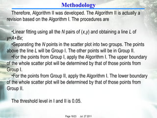
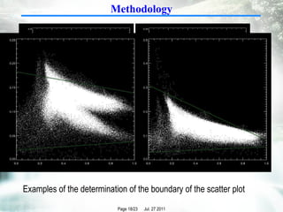
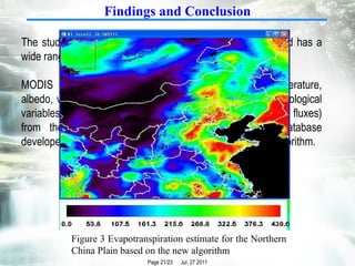
A new study developed three algorithms to automatically determine the boundaries of scatter plots used in the triangle method for estimating evapotranspiration from satellite data. The algorithms were tested on data from northern China and showed improved consistency over manual boundary selection. Algorithm II performed best by separating scatter plots into upper and lower regions before boundary fitting. The new automatic method enables more objective and repeatable evapotranspiration estimates at regional scales from remote sensing data.


![Thanks for your attention! Contact Info: Hongbo Su [email_address] [email_address]](https://image.slidesharecdn.com/igarss11-hongbosu-ver3-110727172248-phpapp02/85/IGARSS11_HongboSu_ver3-ppt-23-320.jpg)


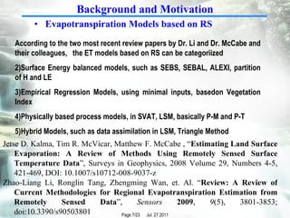
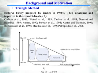
![Heritage hetherington lidar_pdf[1]](https://cdn.slidesharecdn.com/ss_thumbnails/heritagehetheringtonlidarpdf1-100701210824-phpapp02-thumbnail.jpg?width=640&height=640&fit=bounds)


