Download to read offline
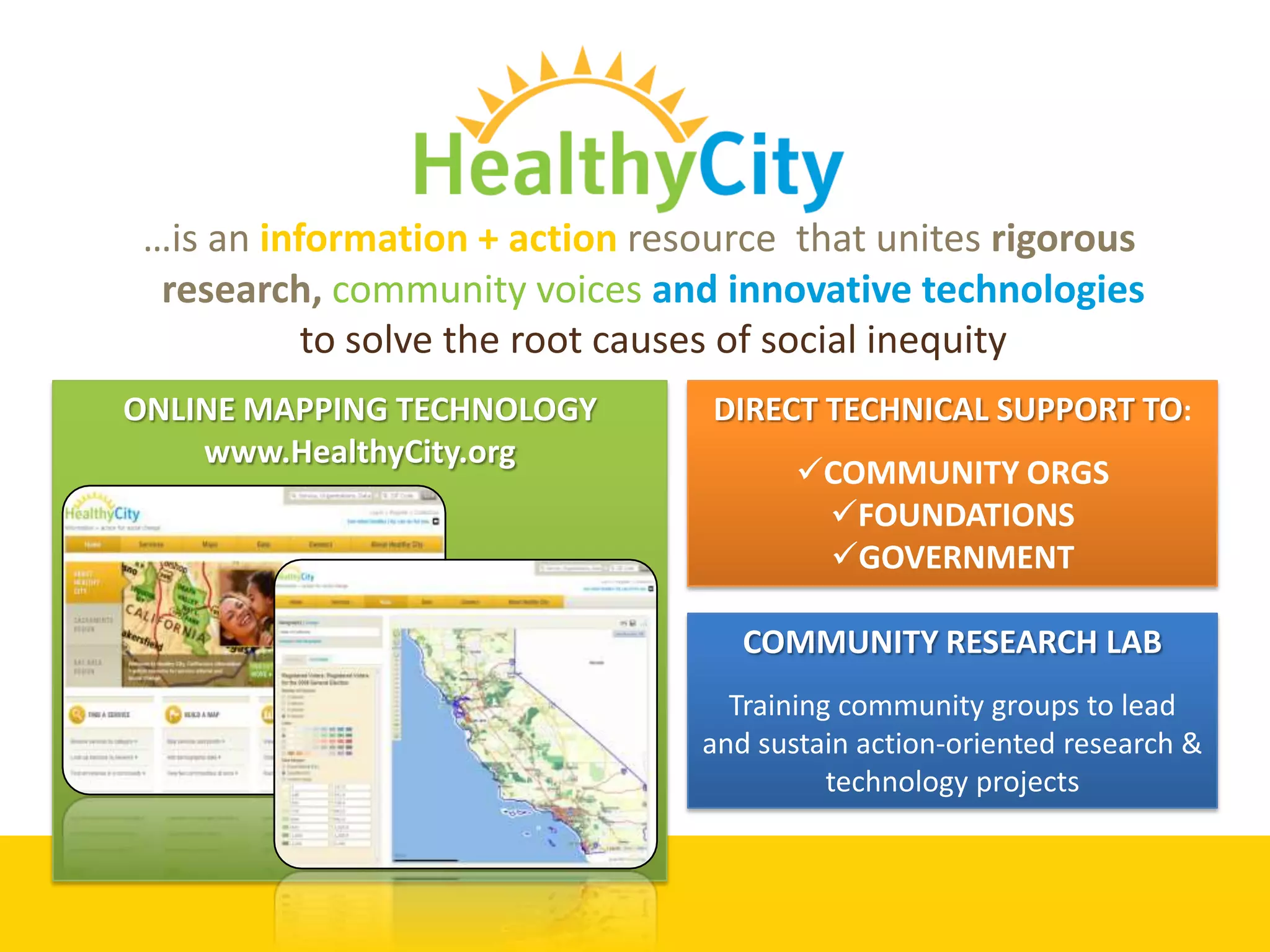
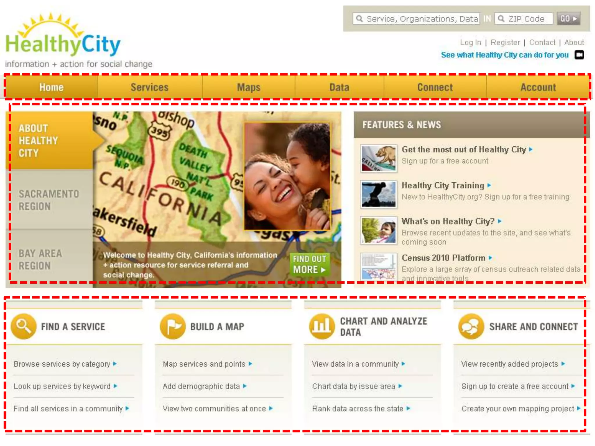
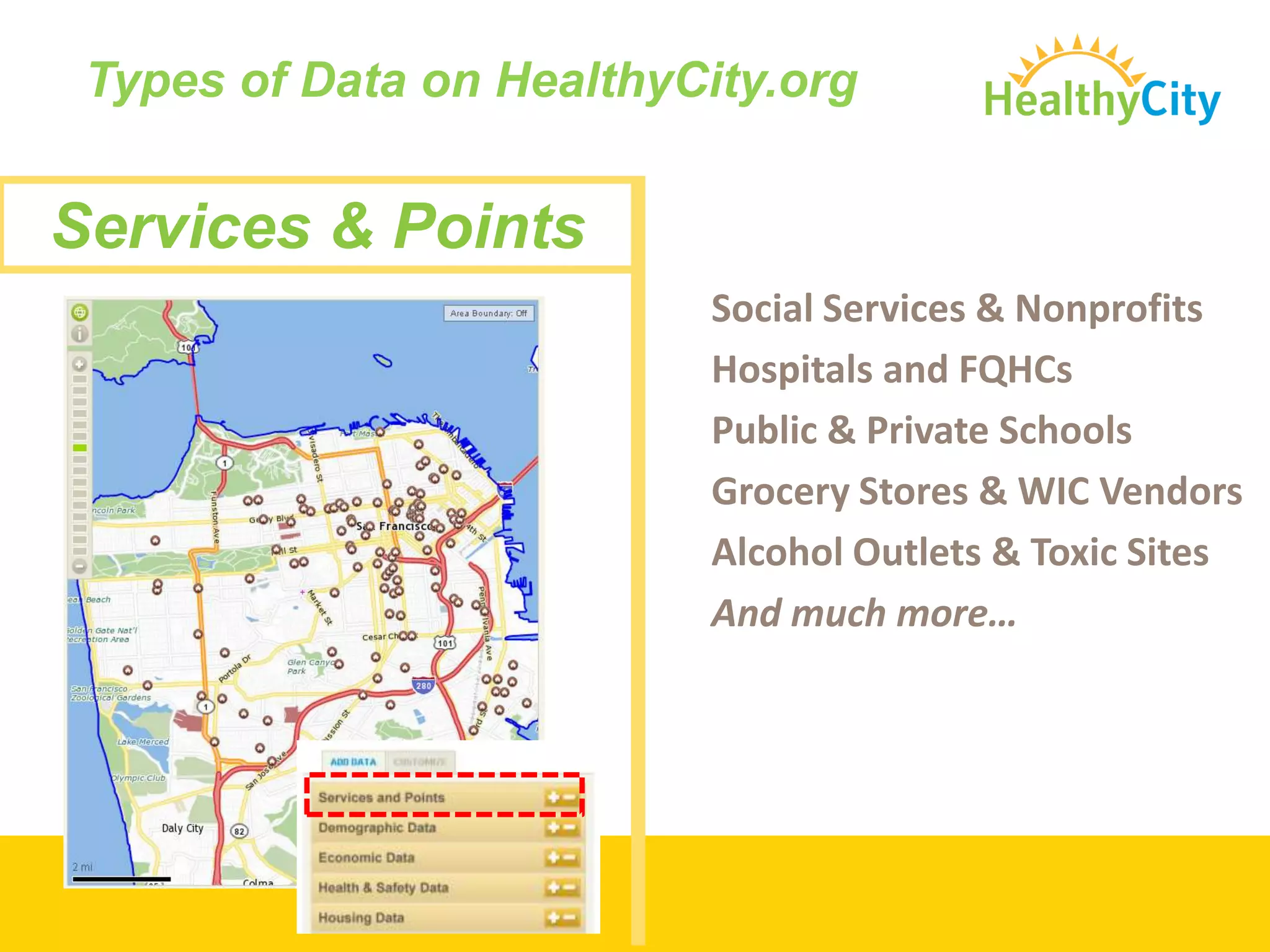
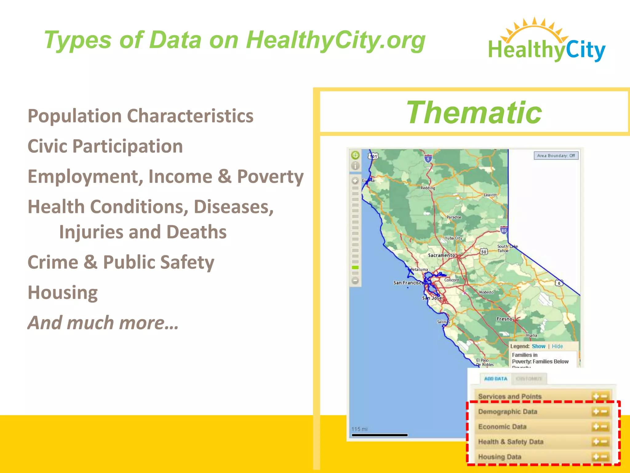
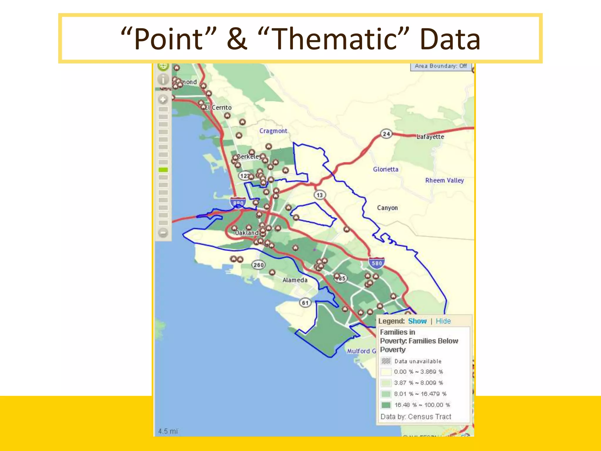
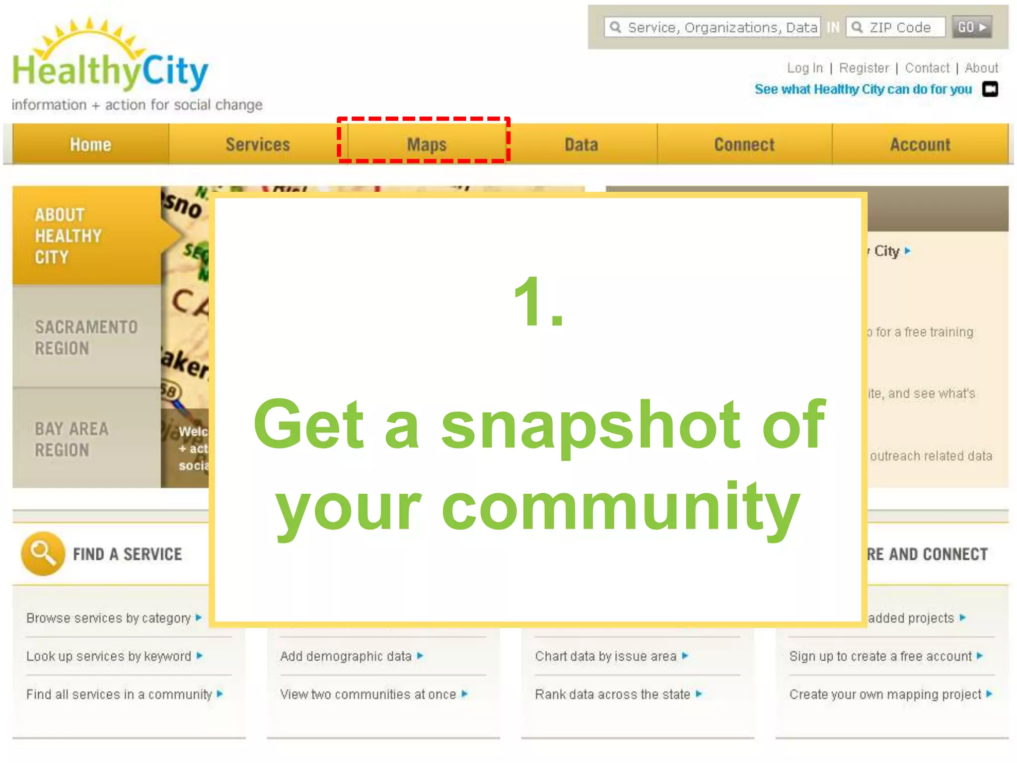
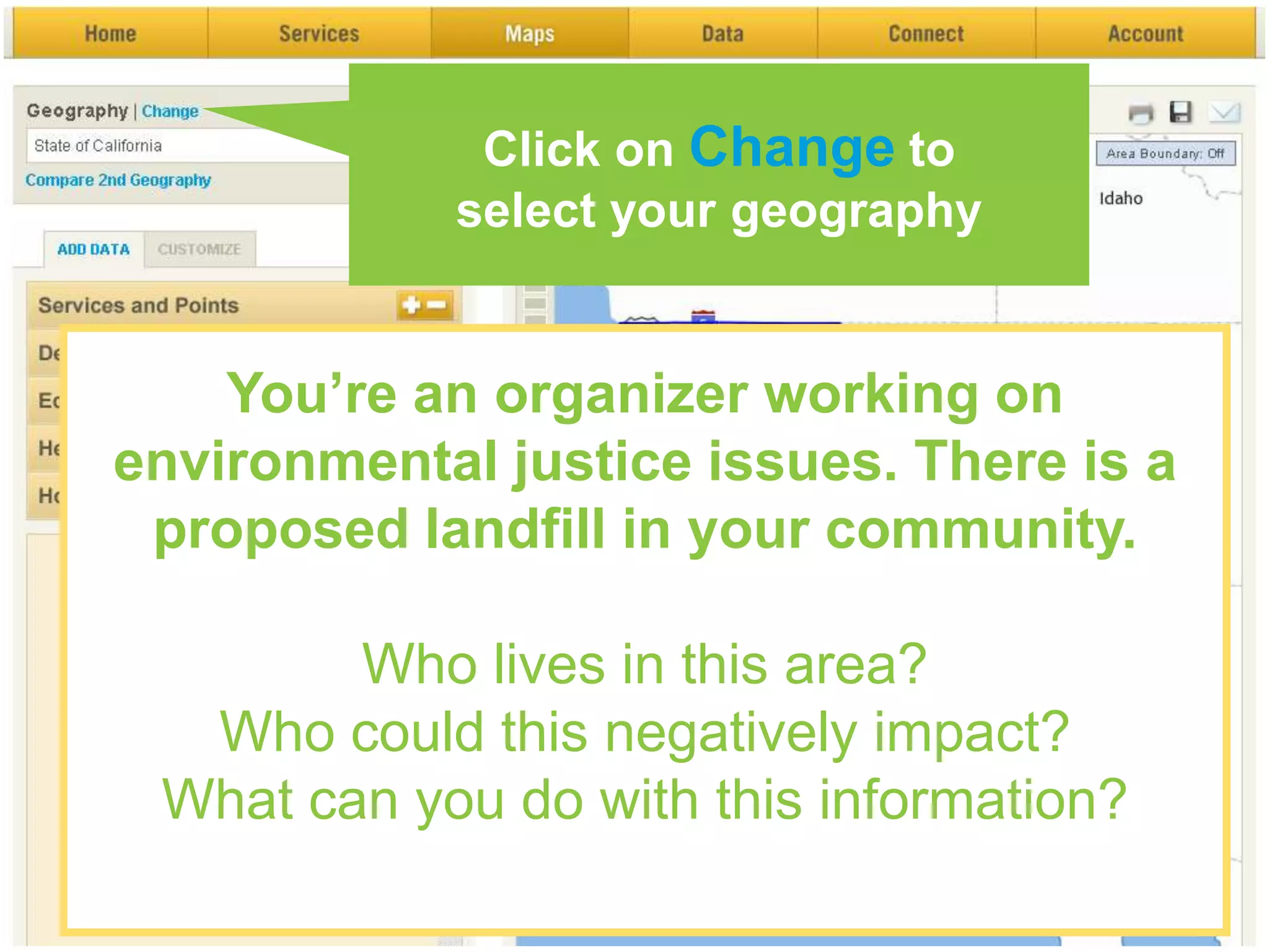
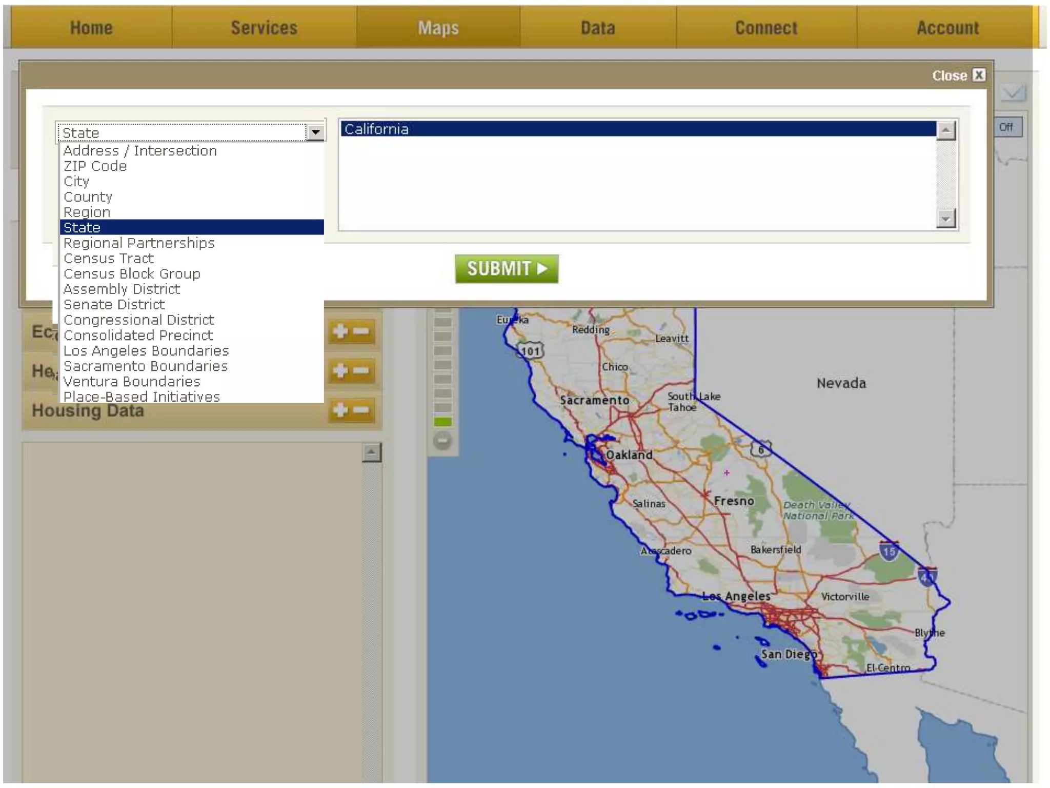
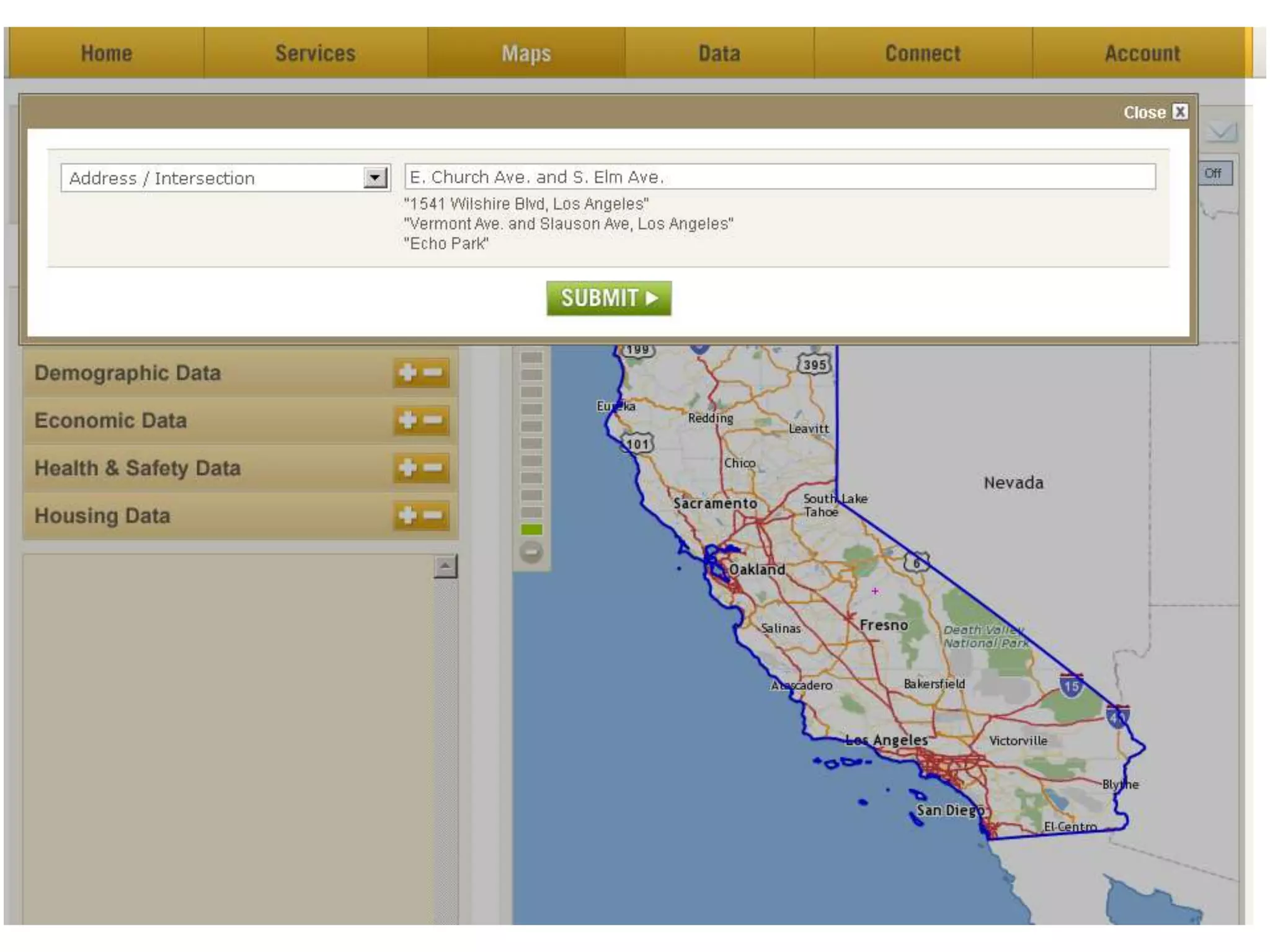
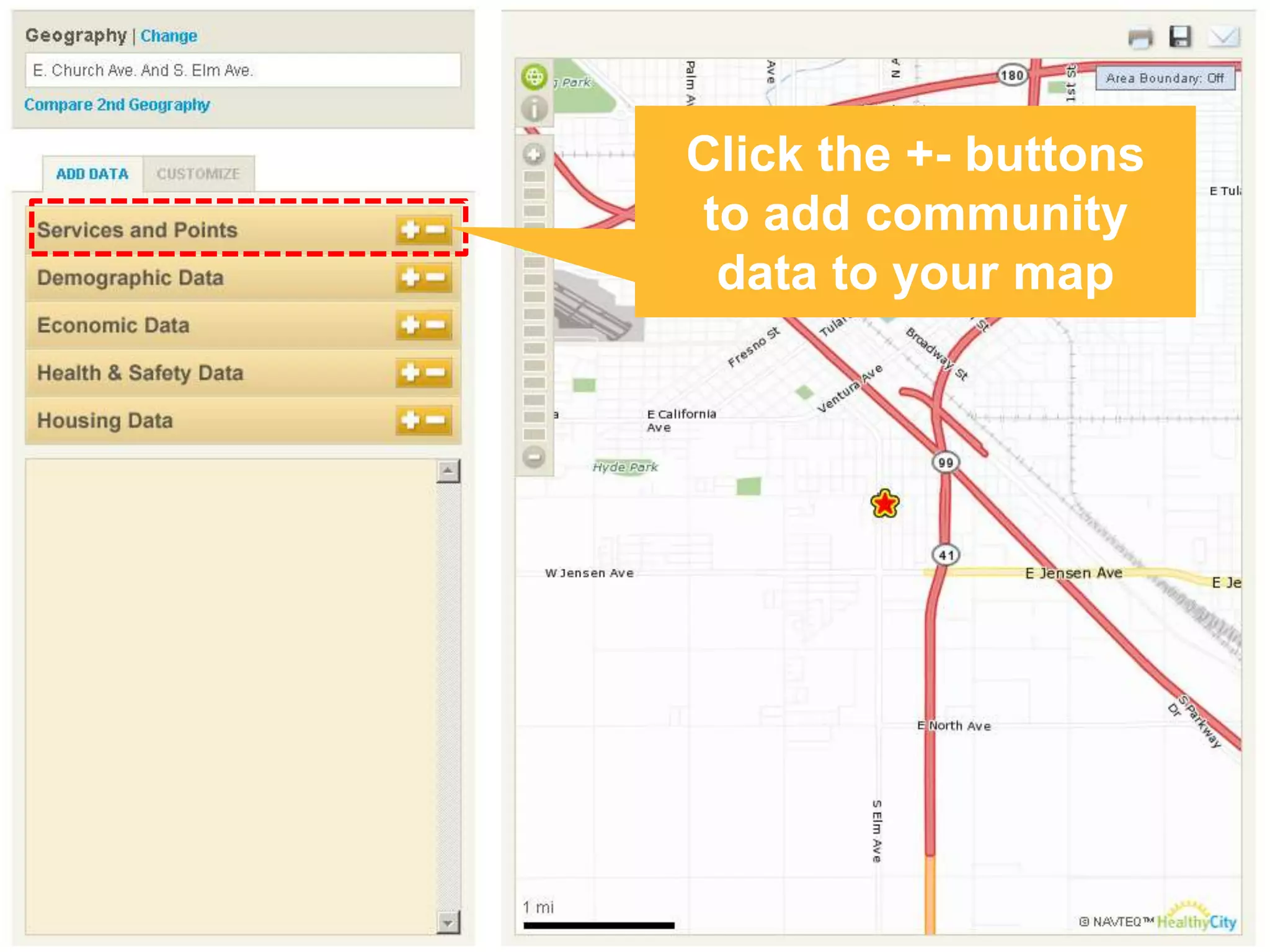
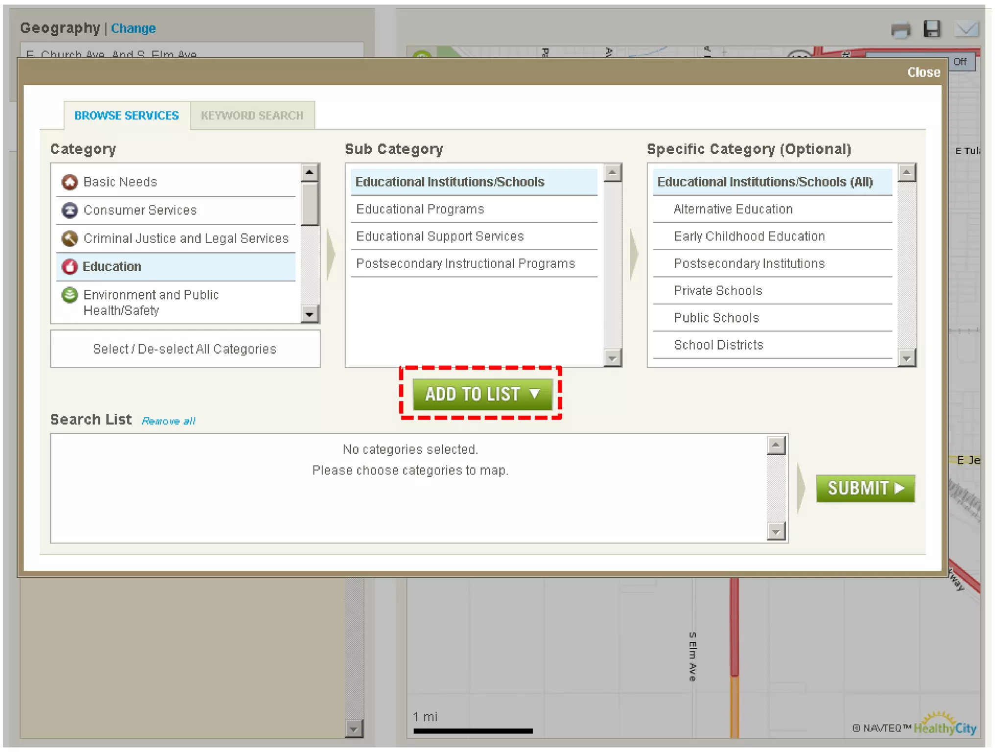
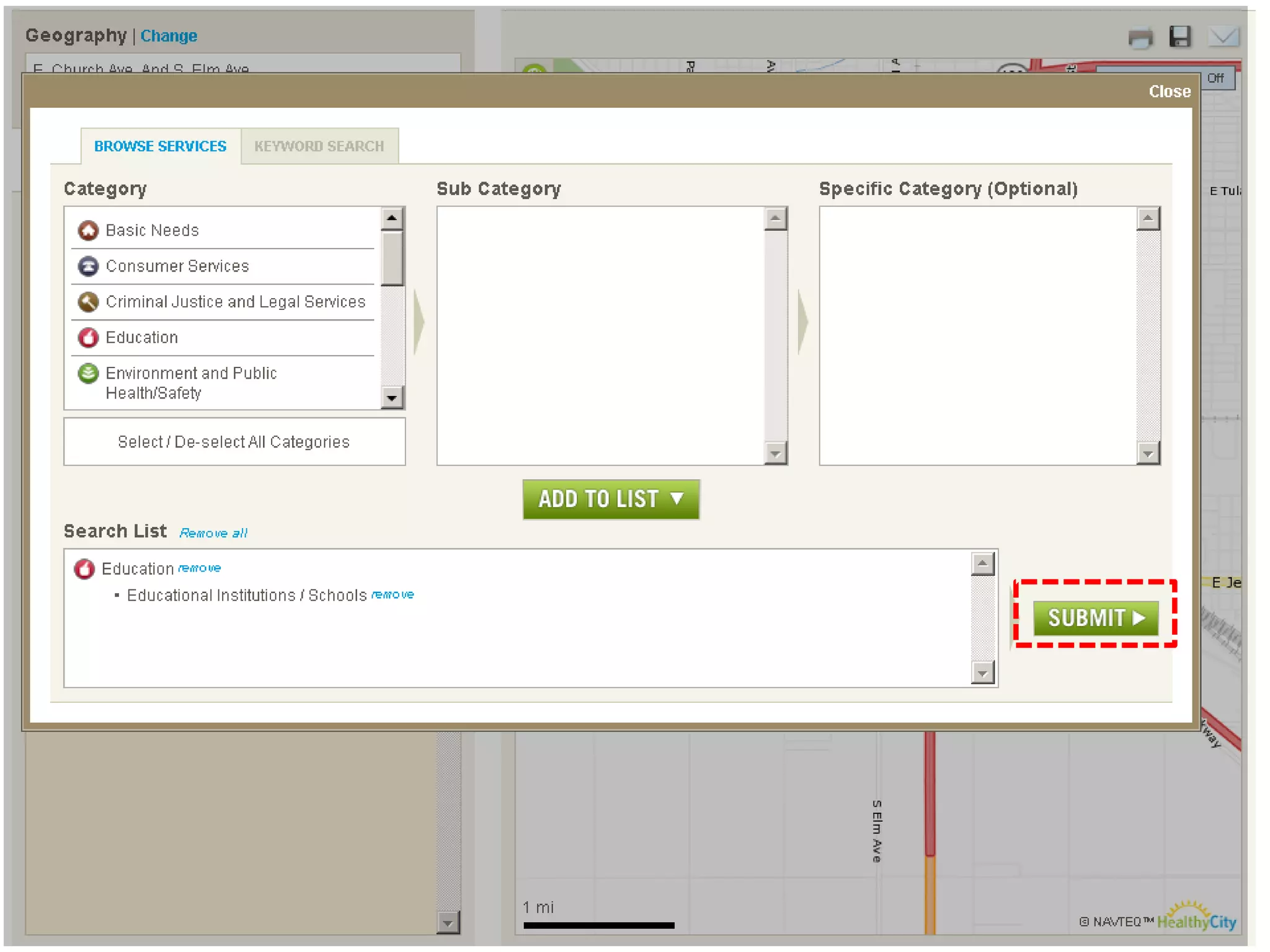
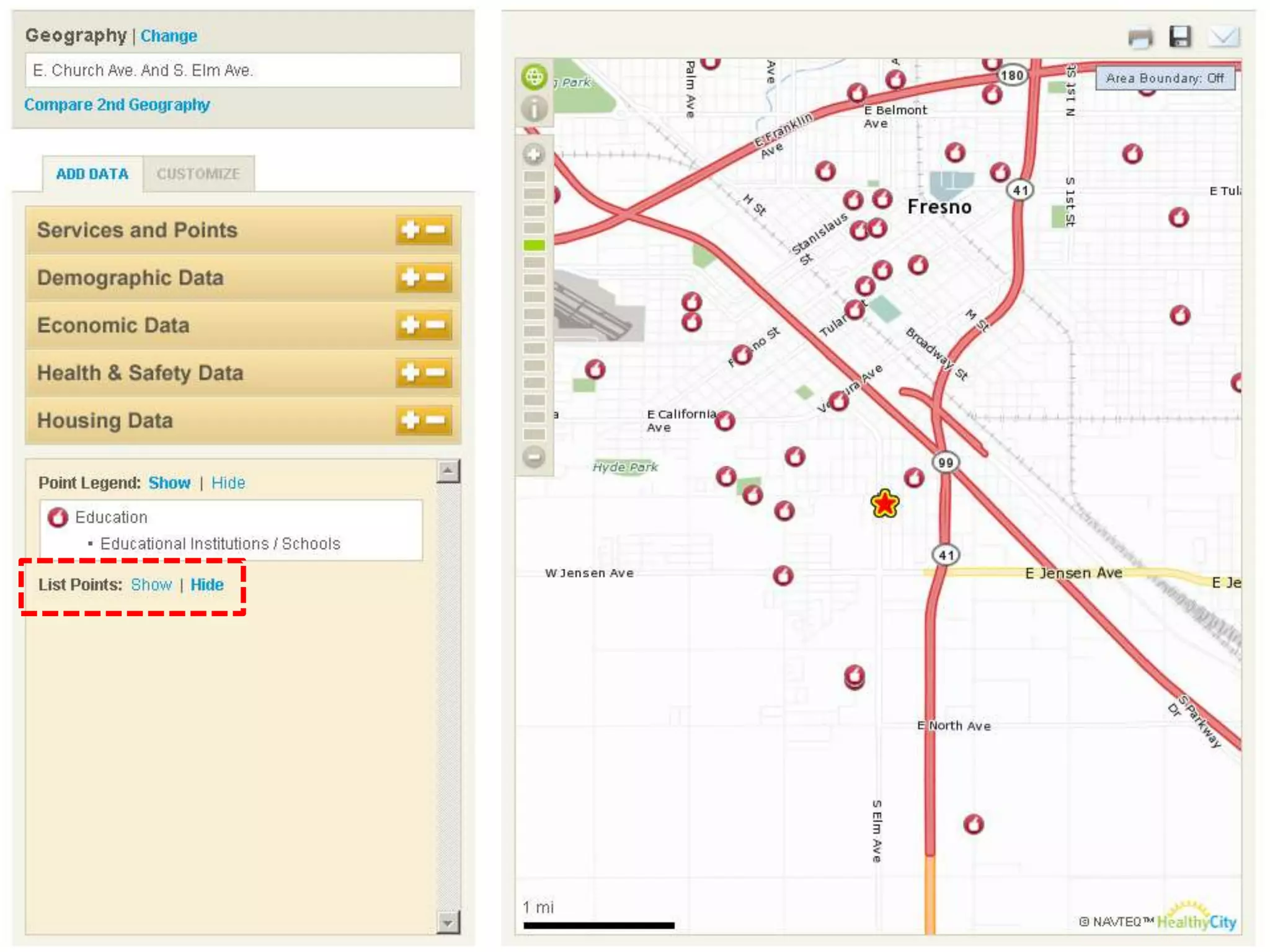
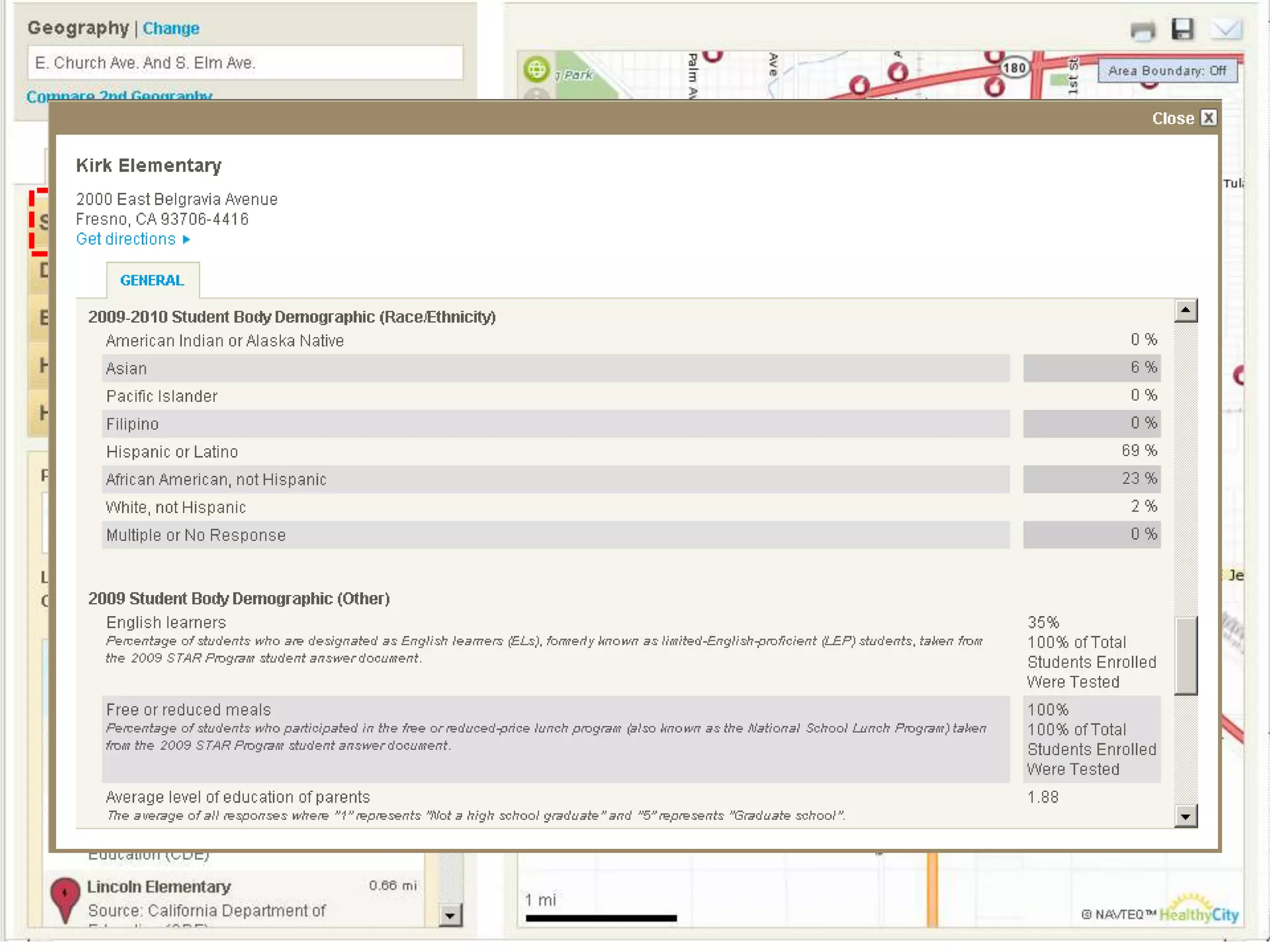
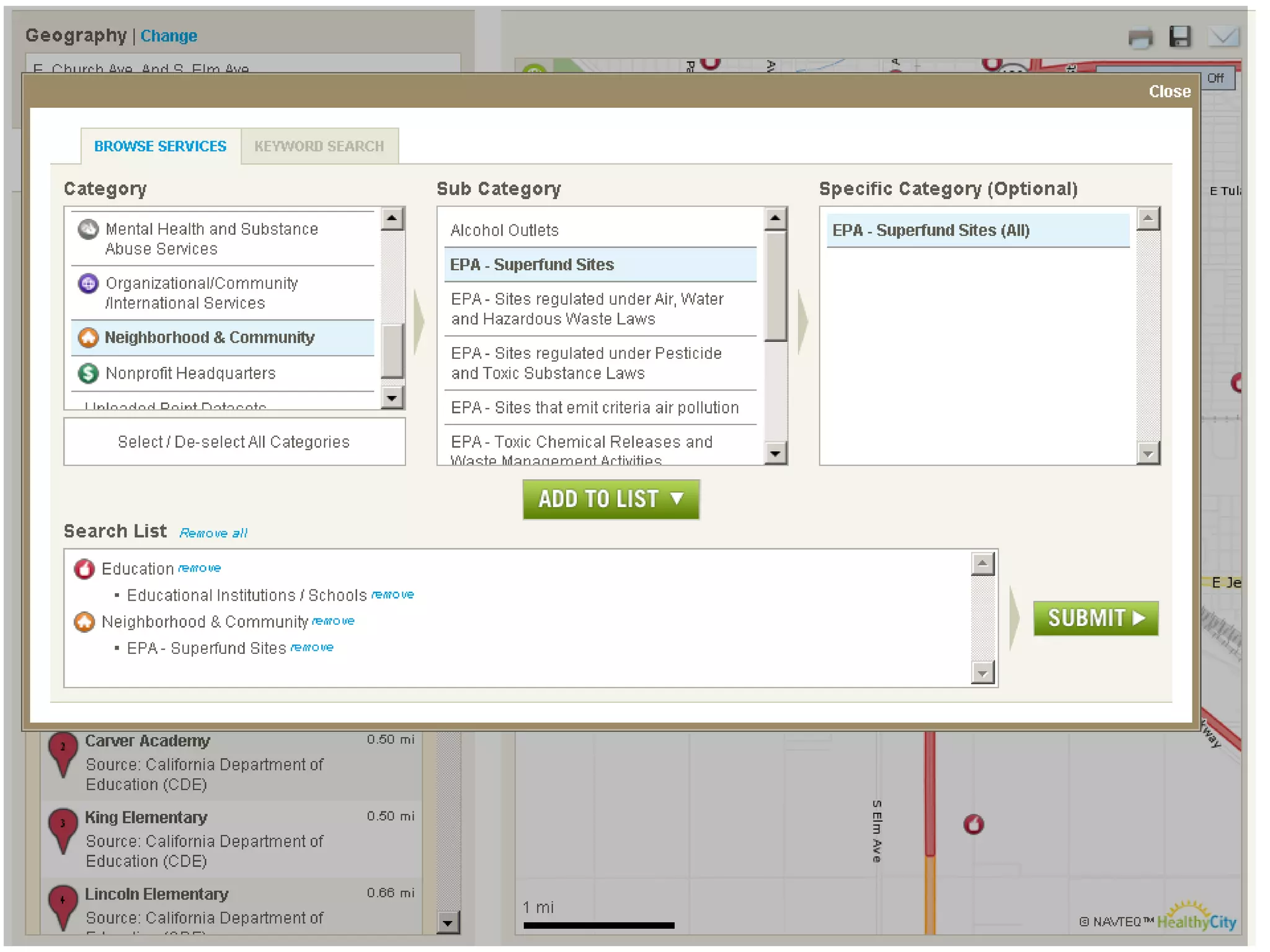
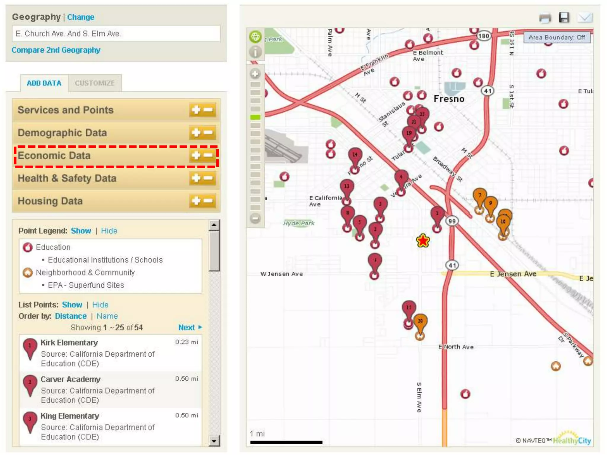
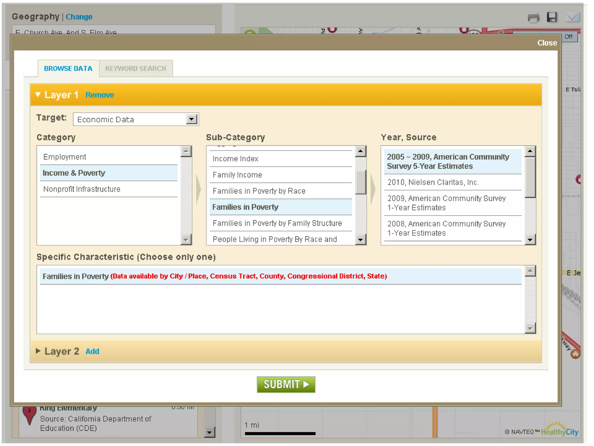
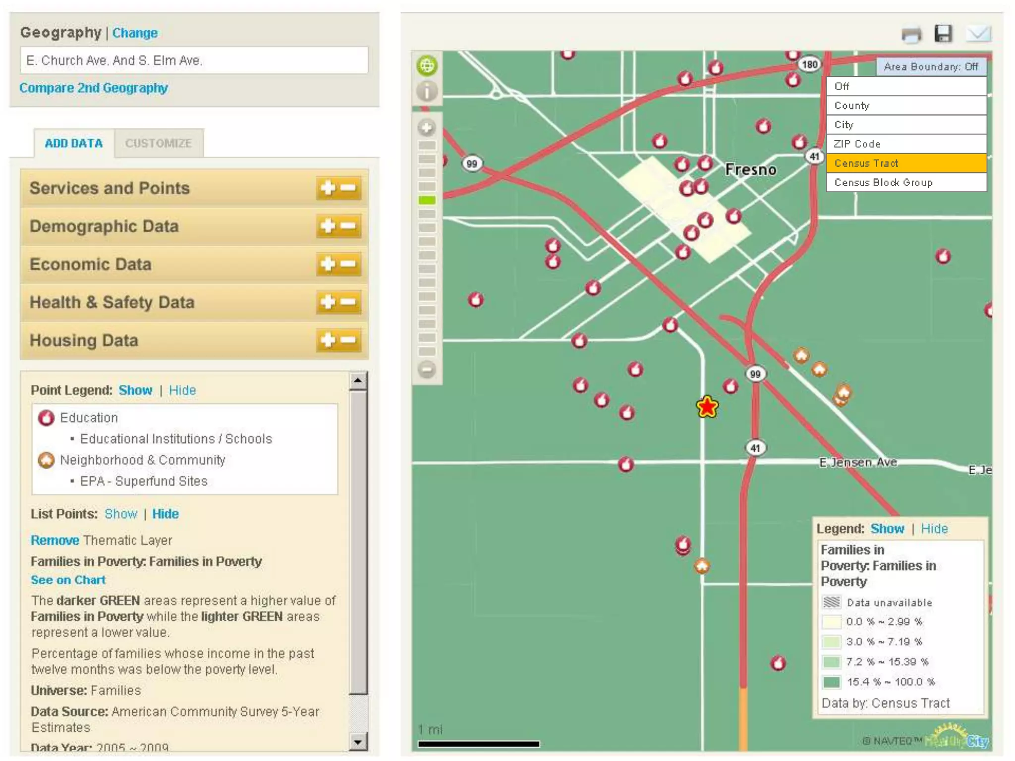
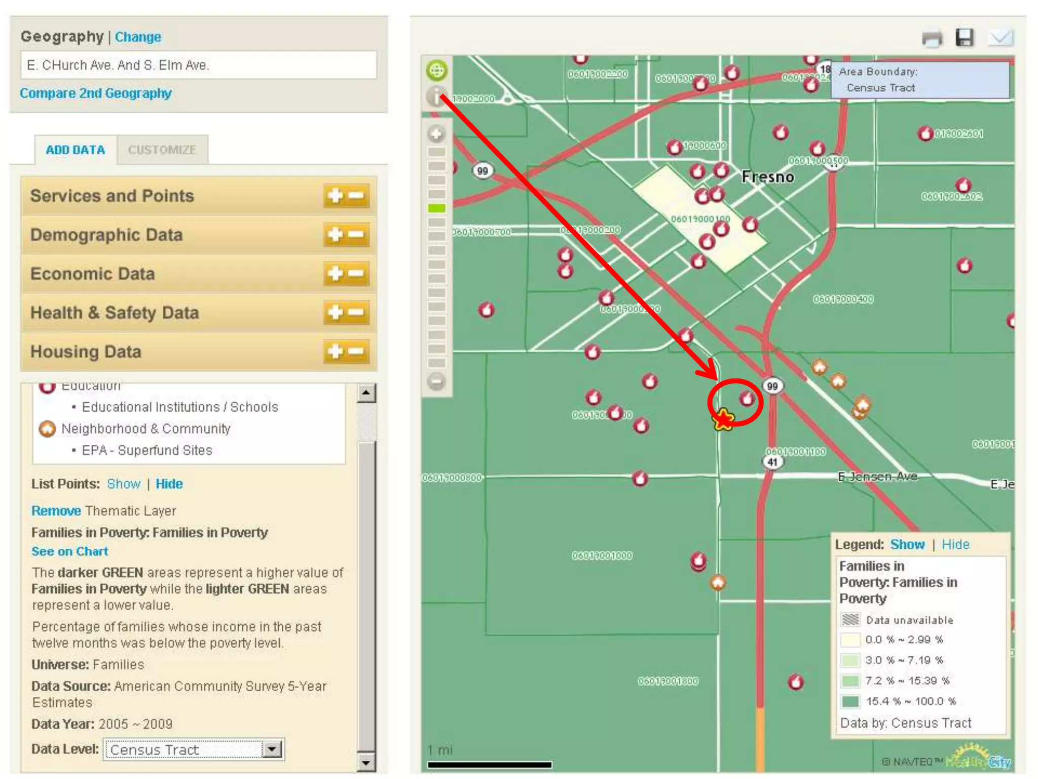
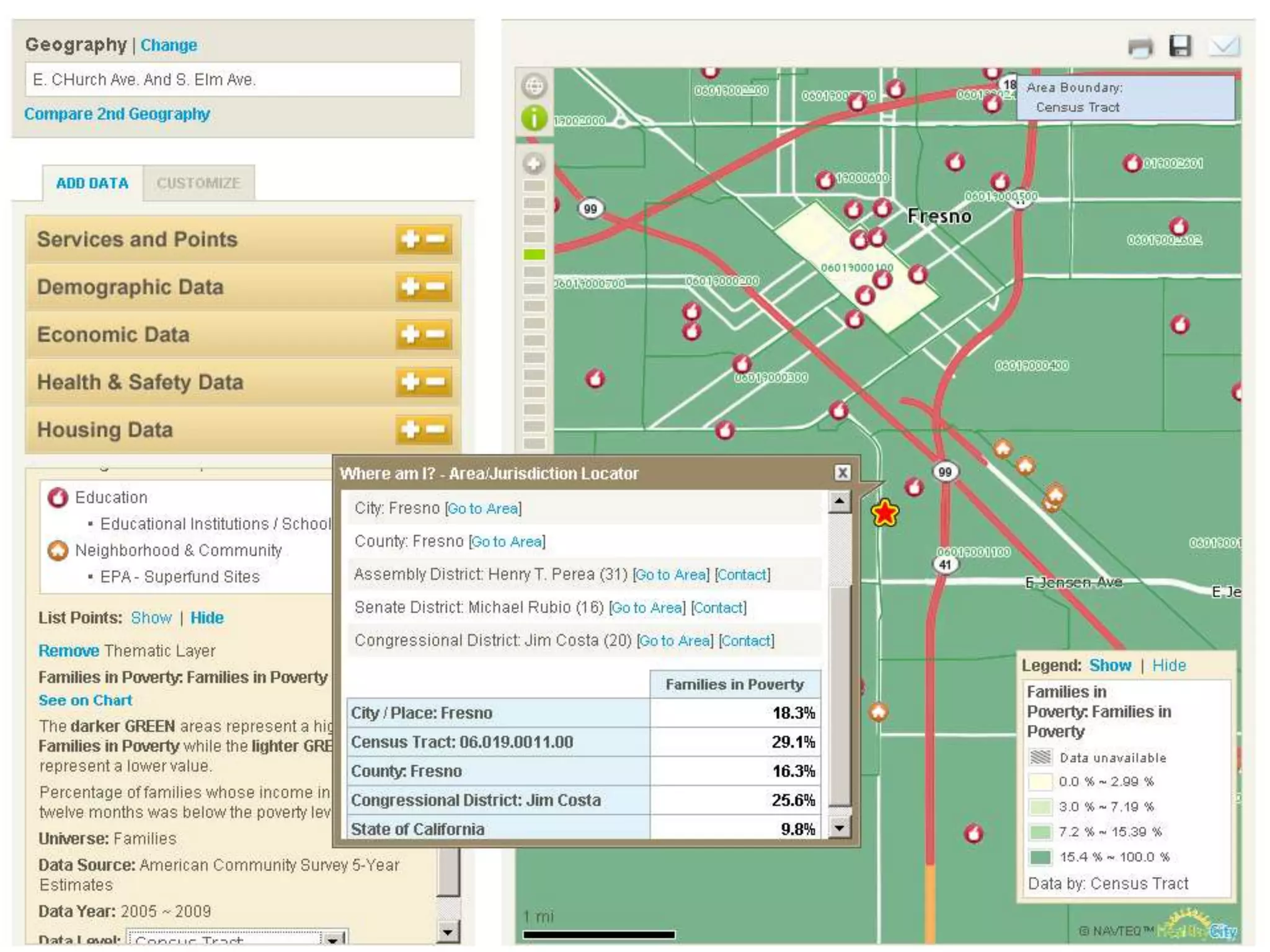
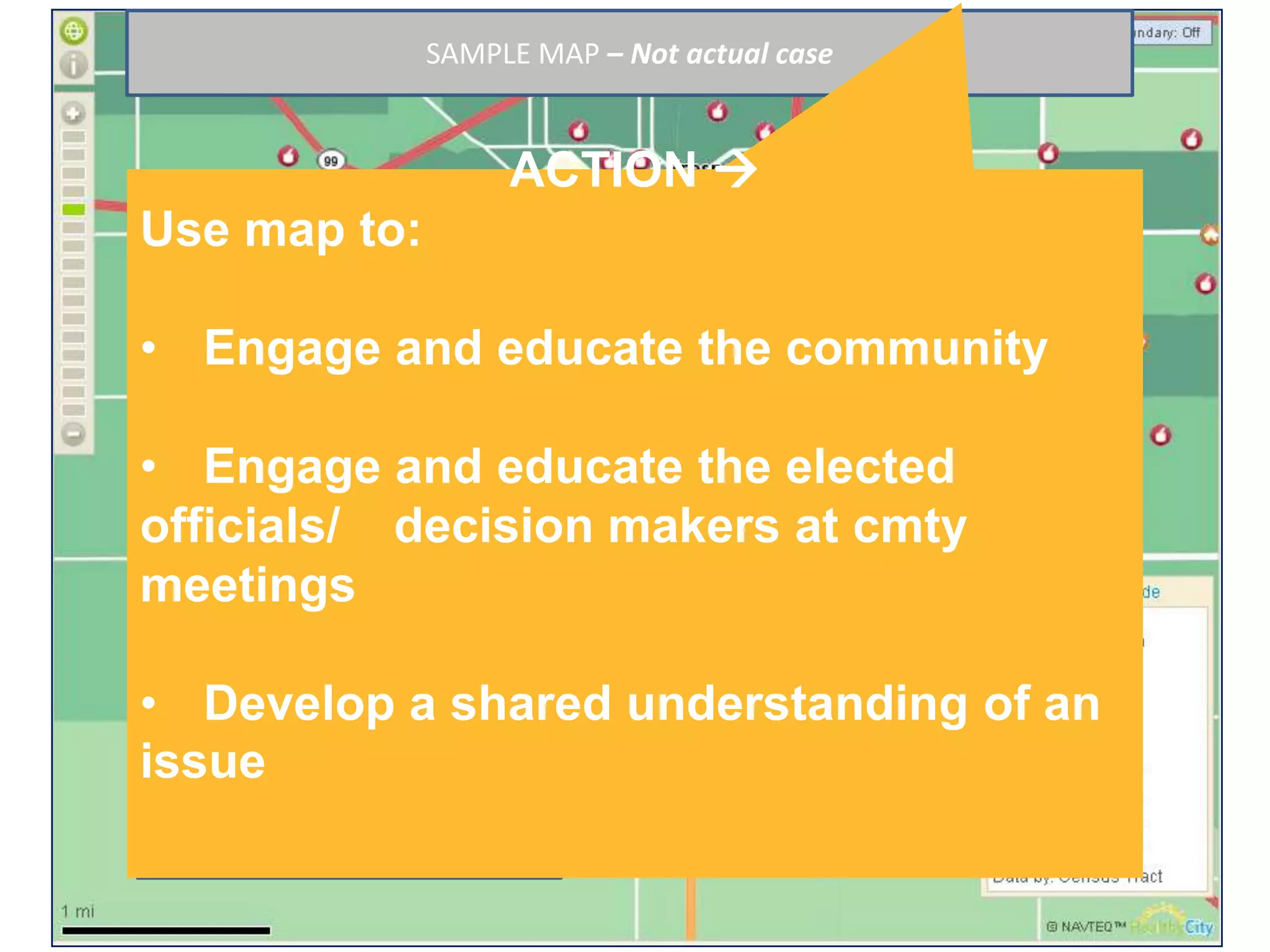
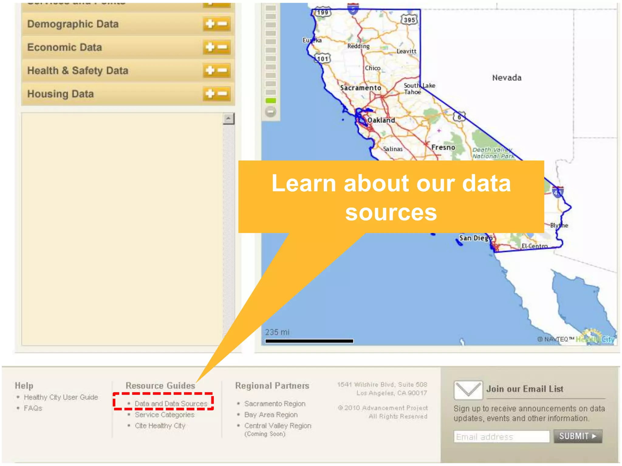


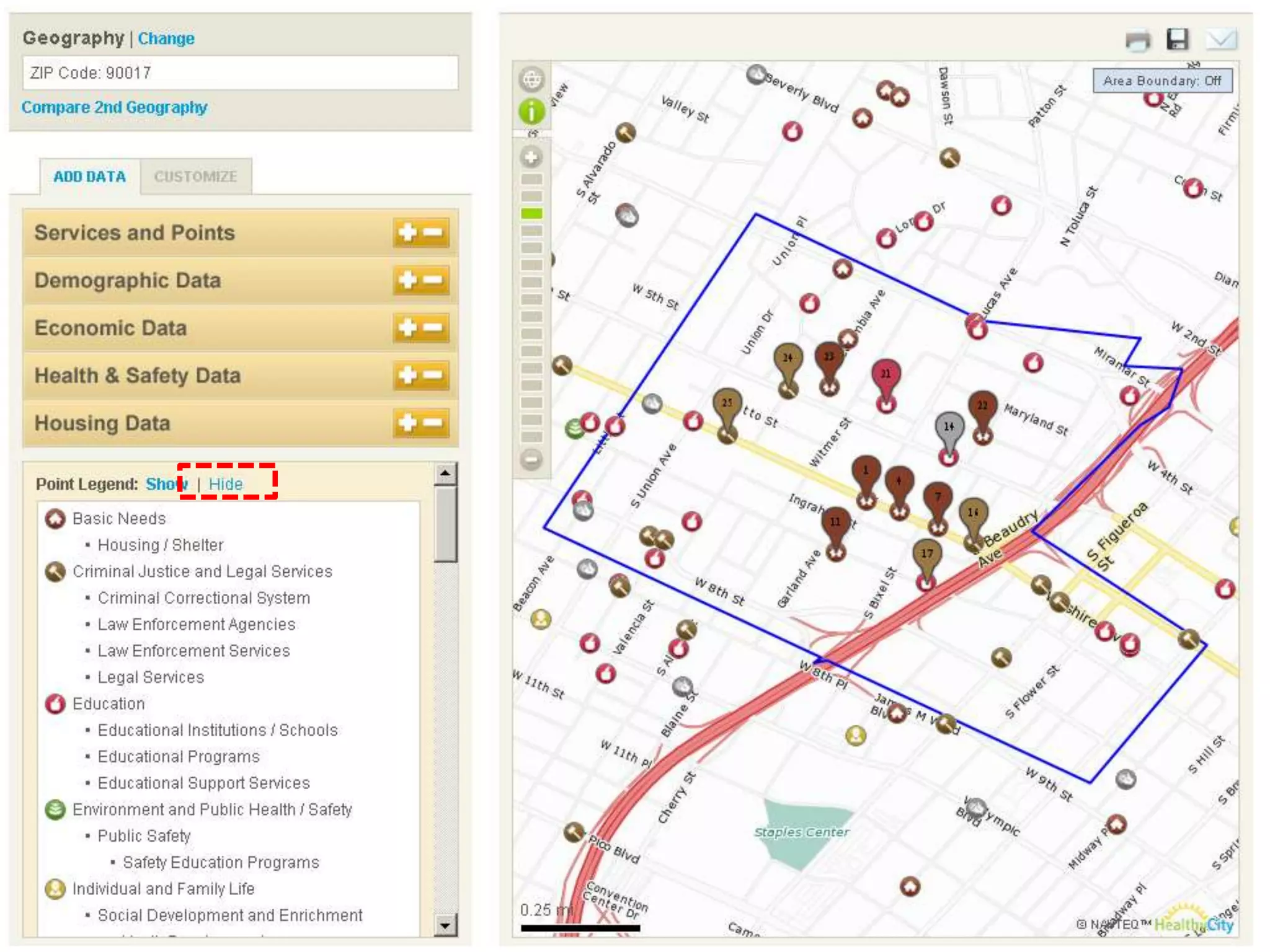
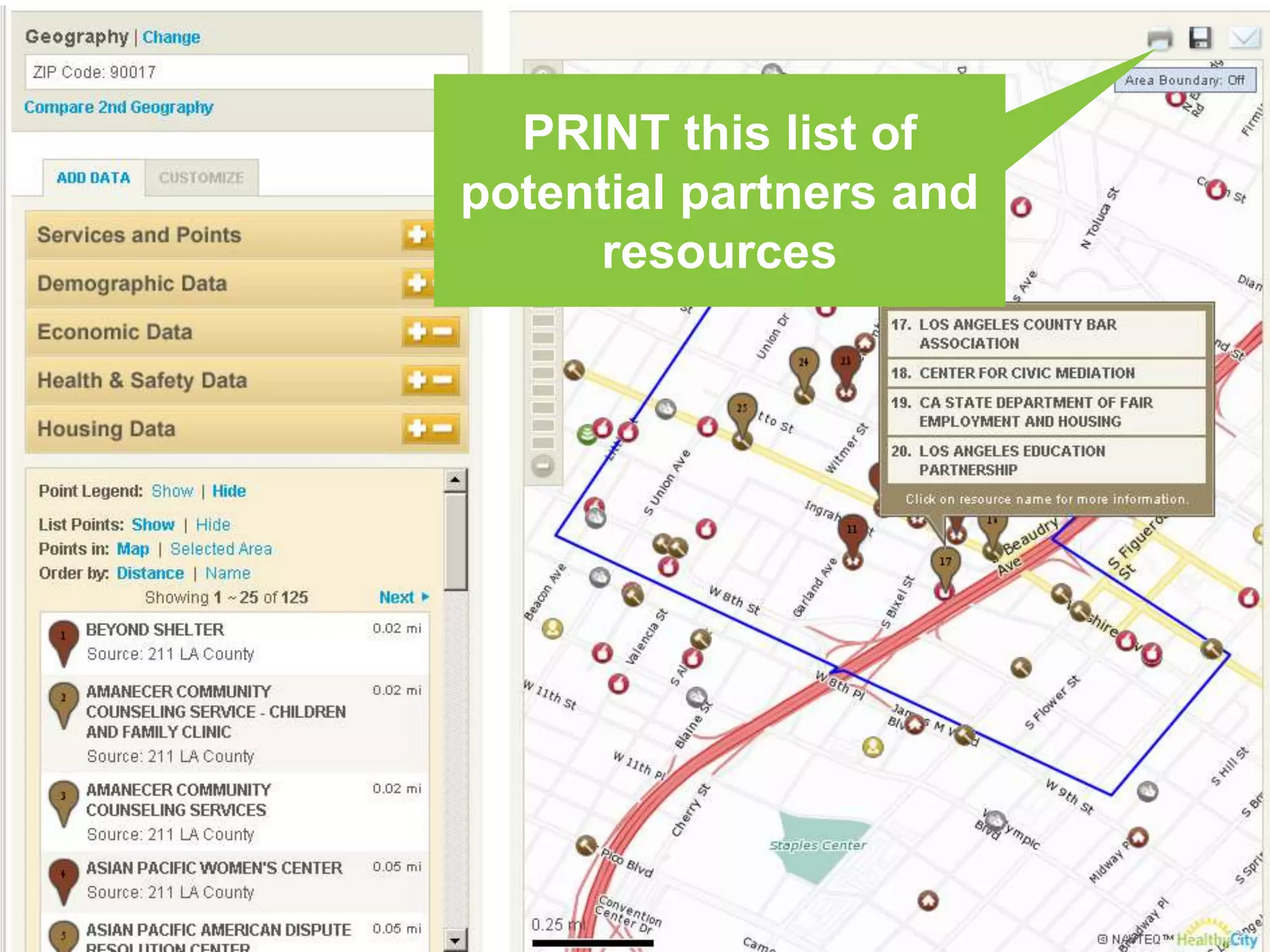
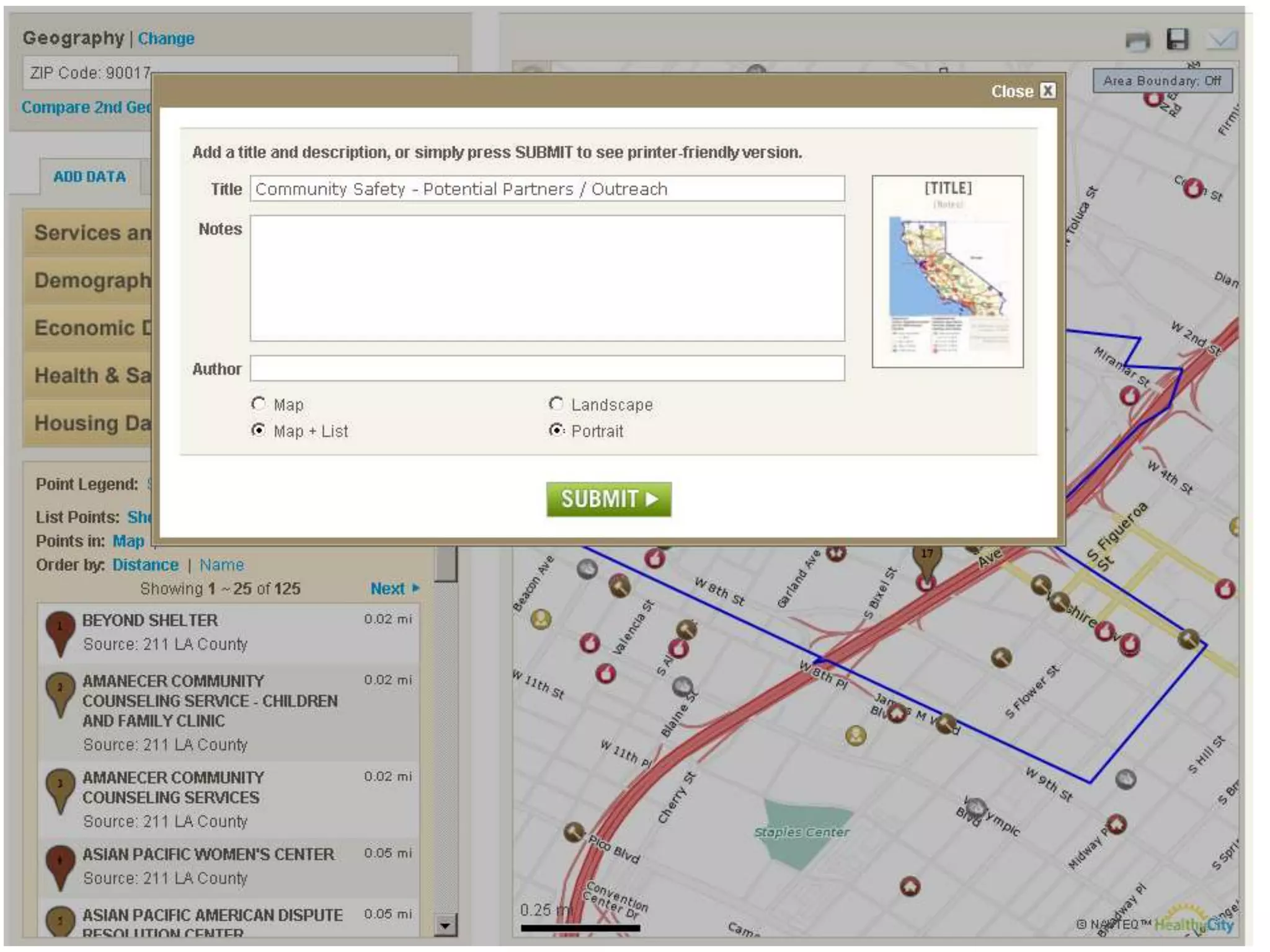
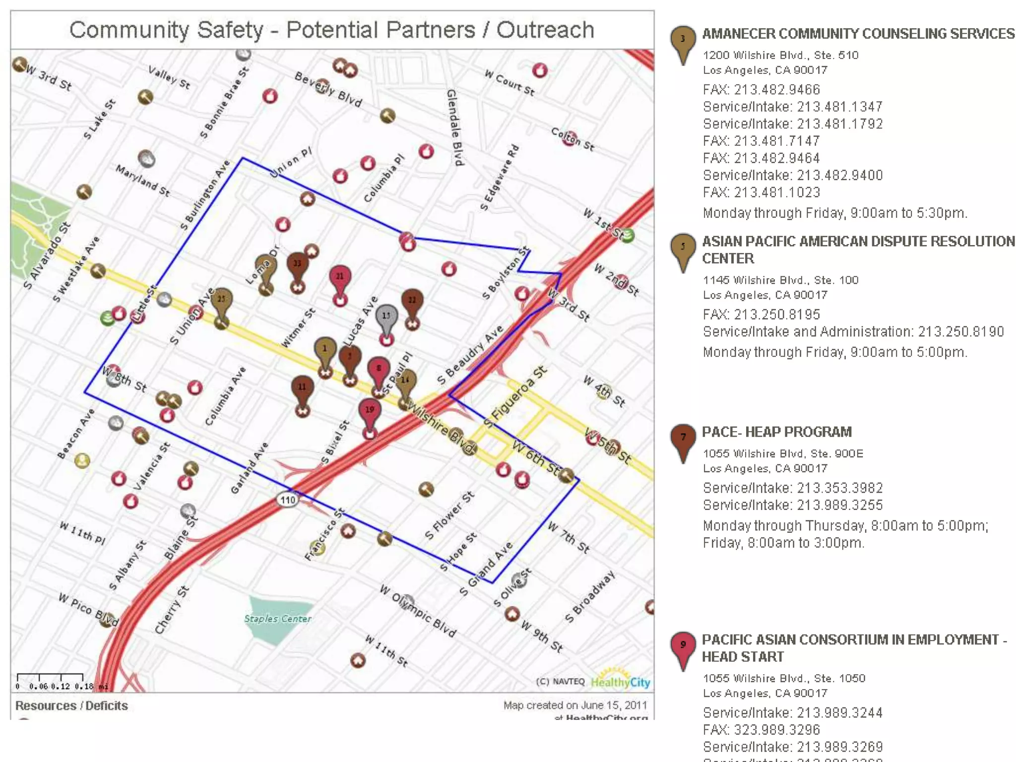
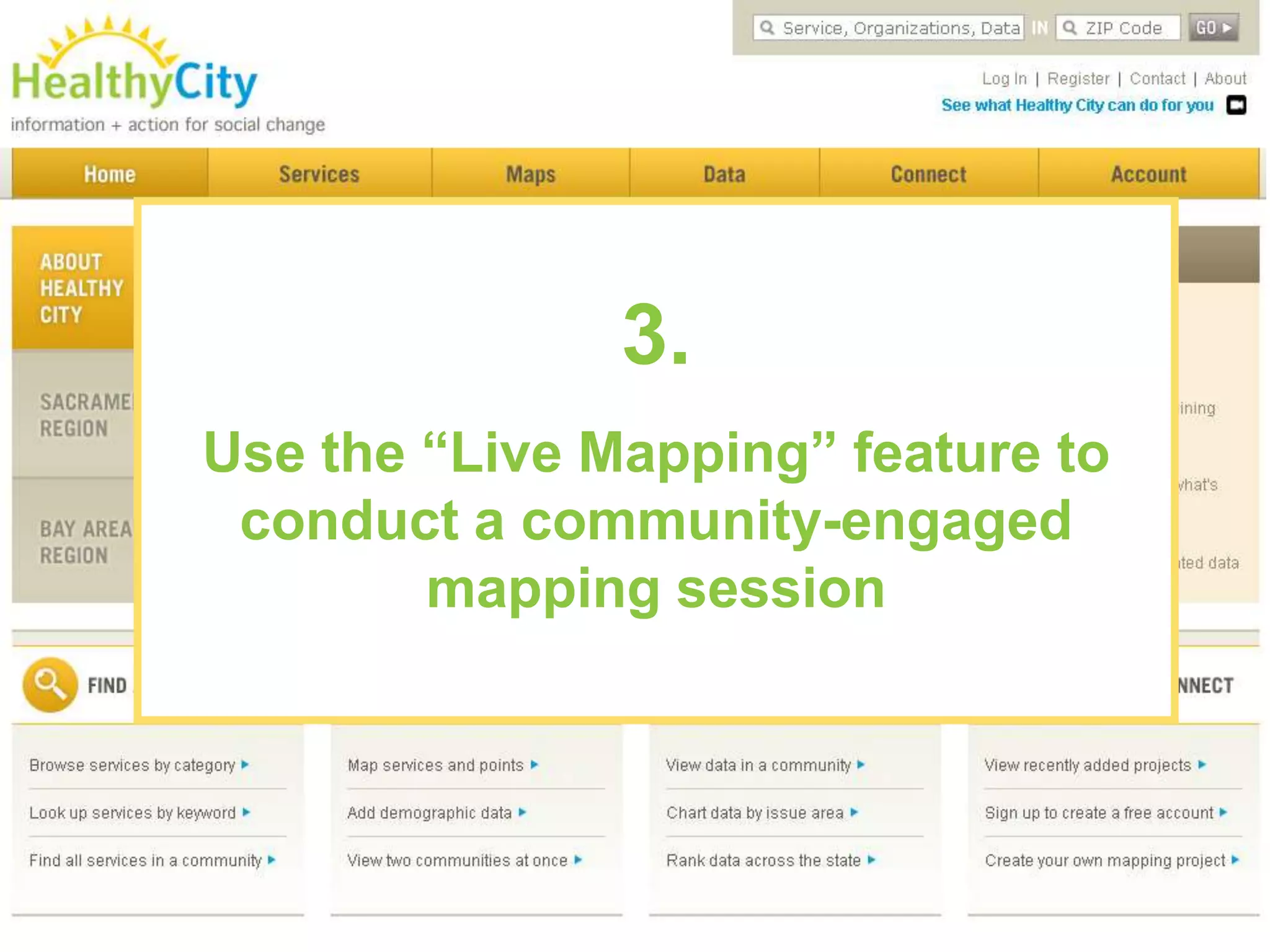
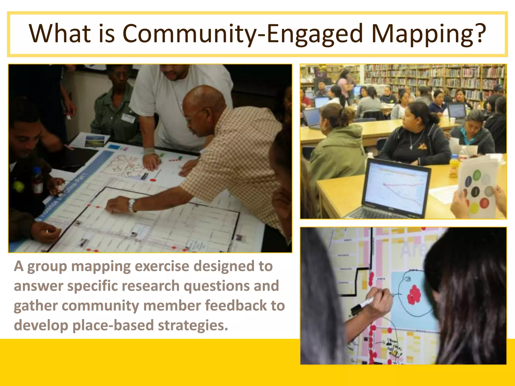
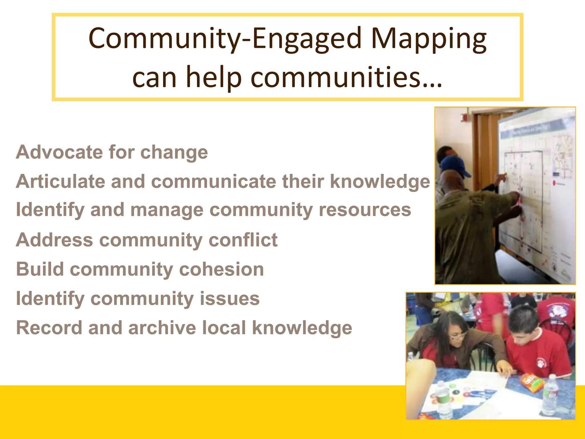
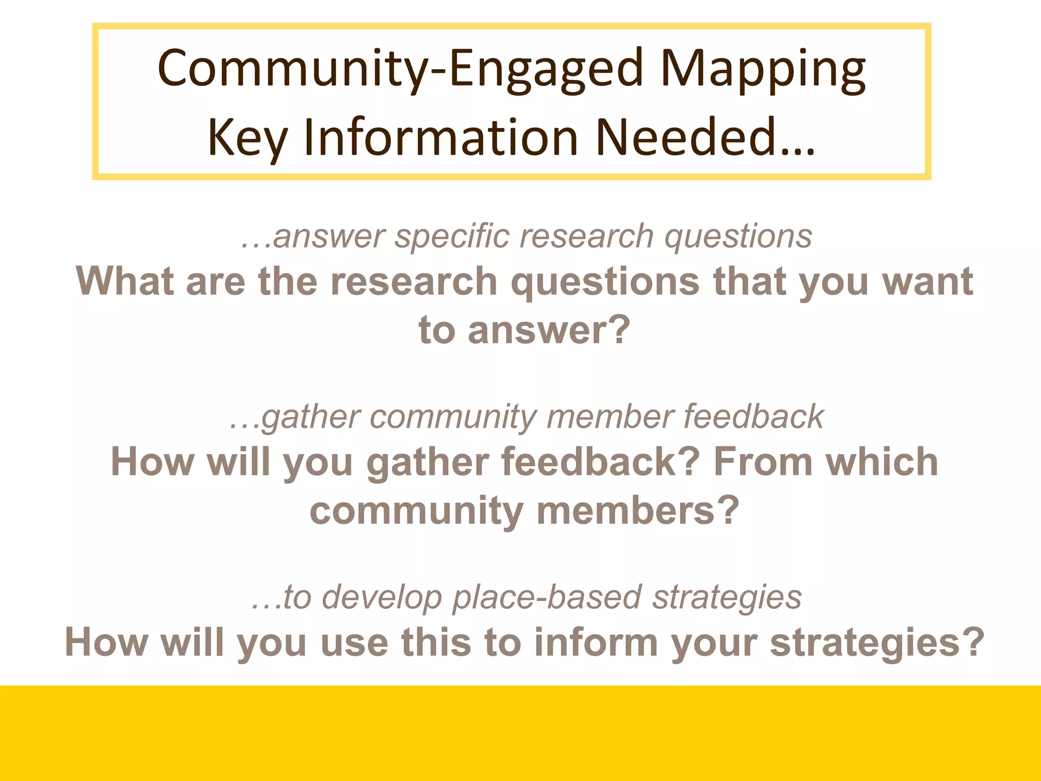
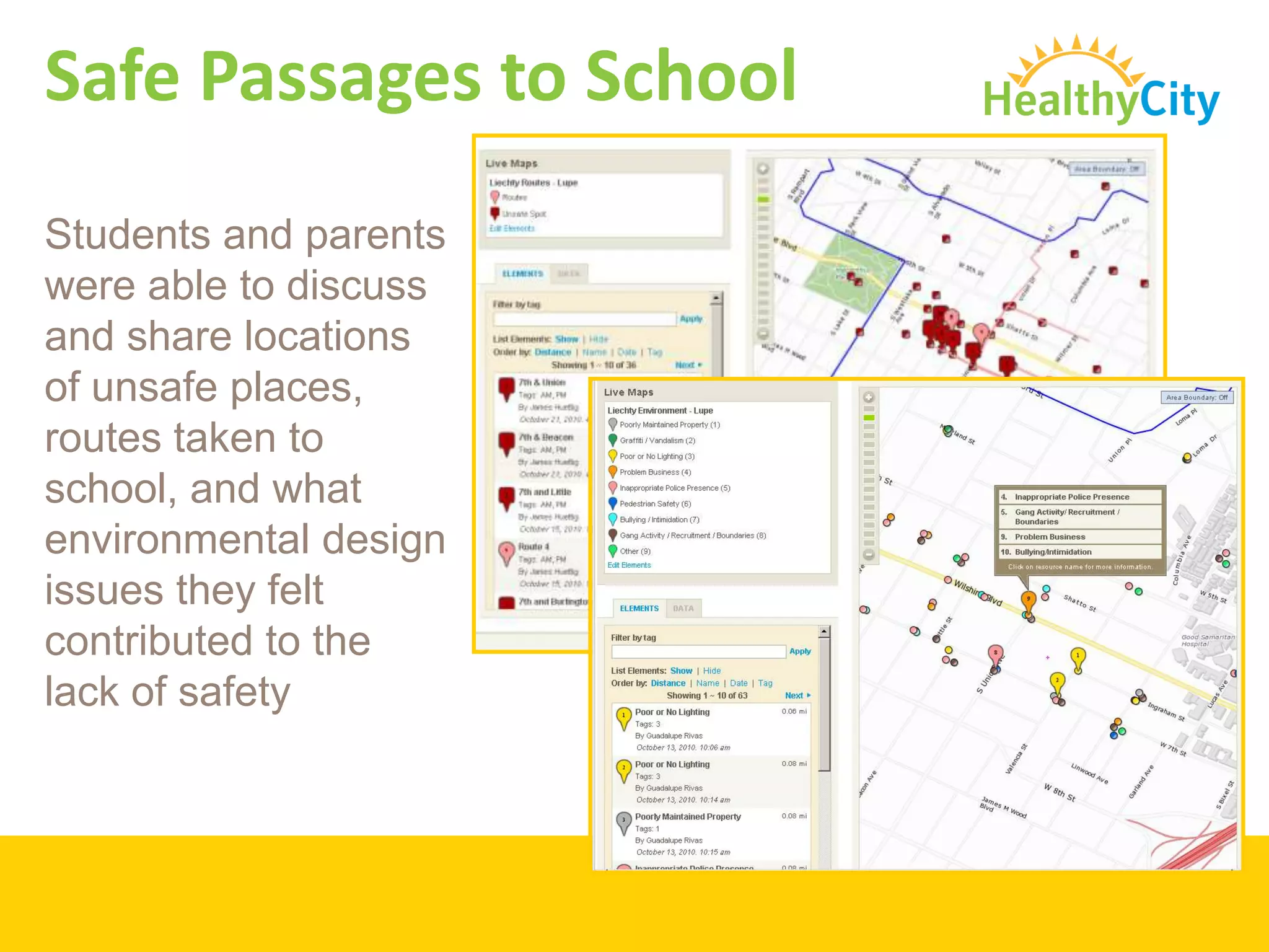
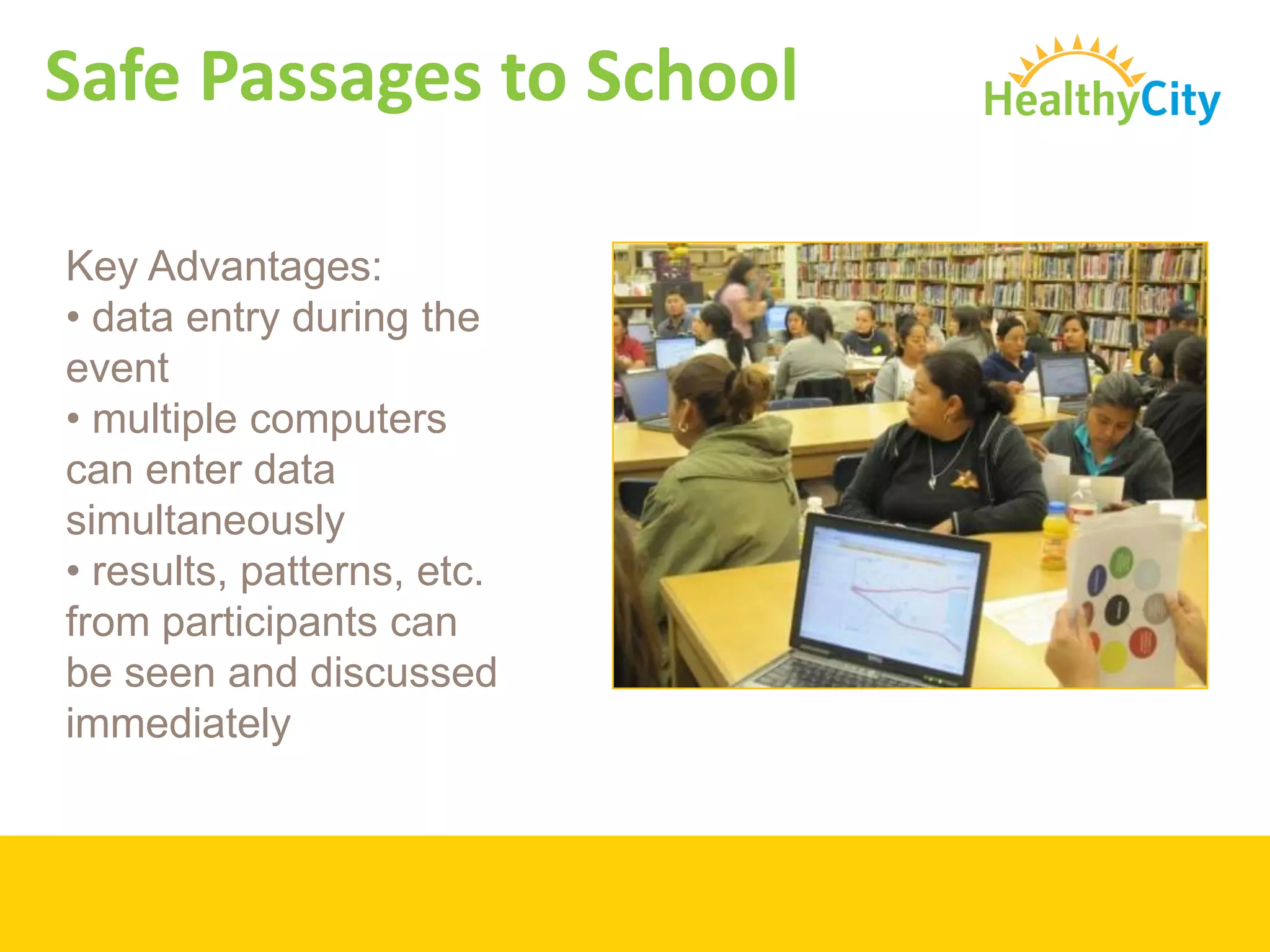
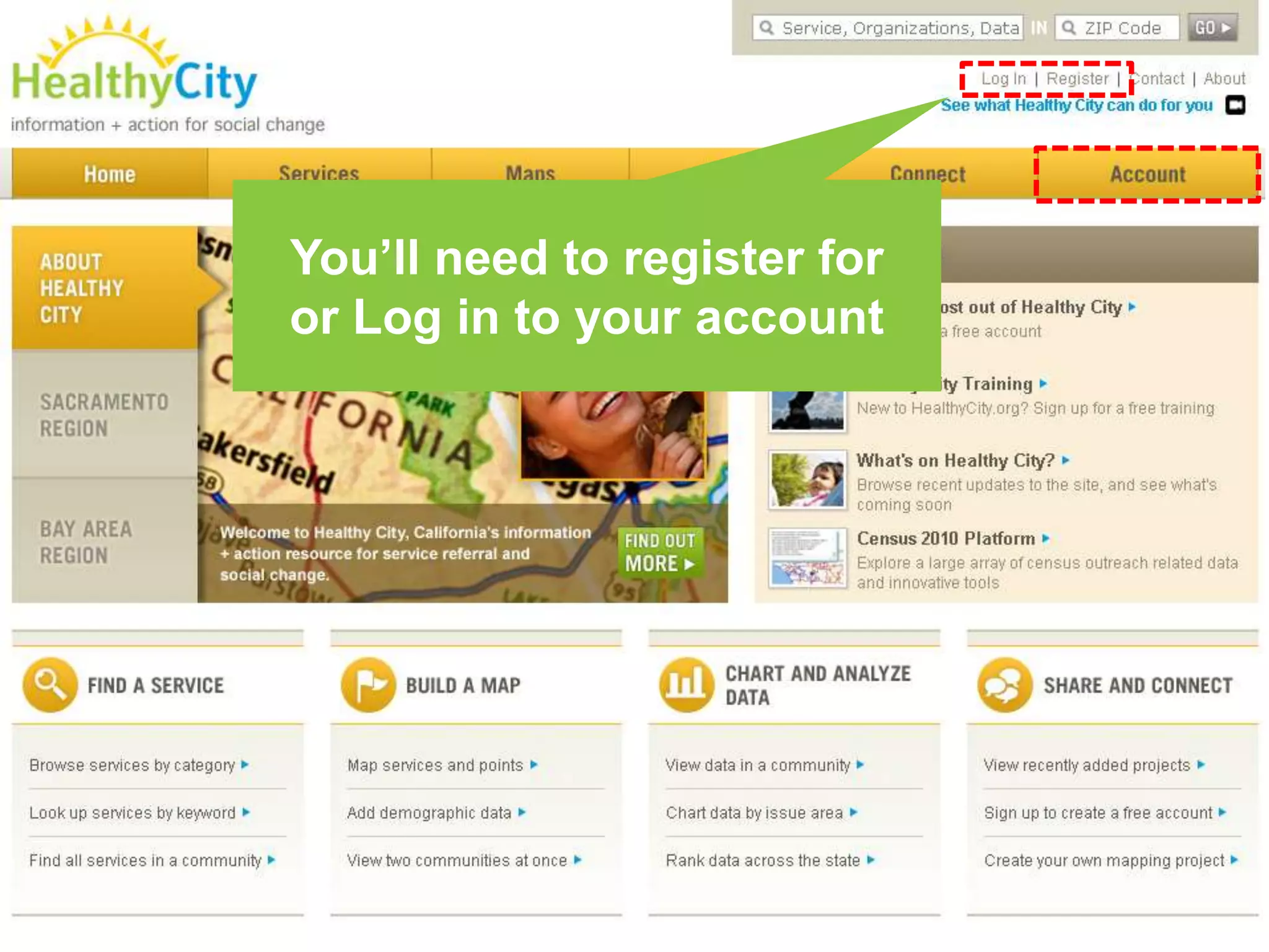
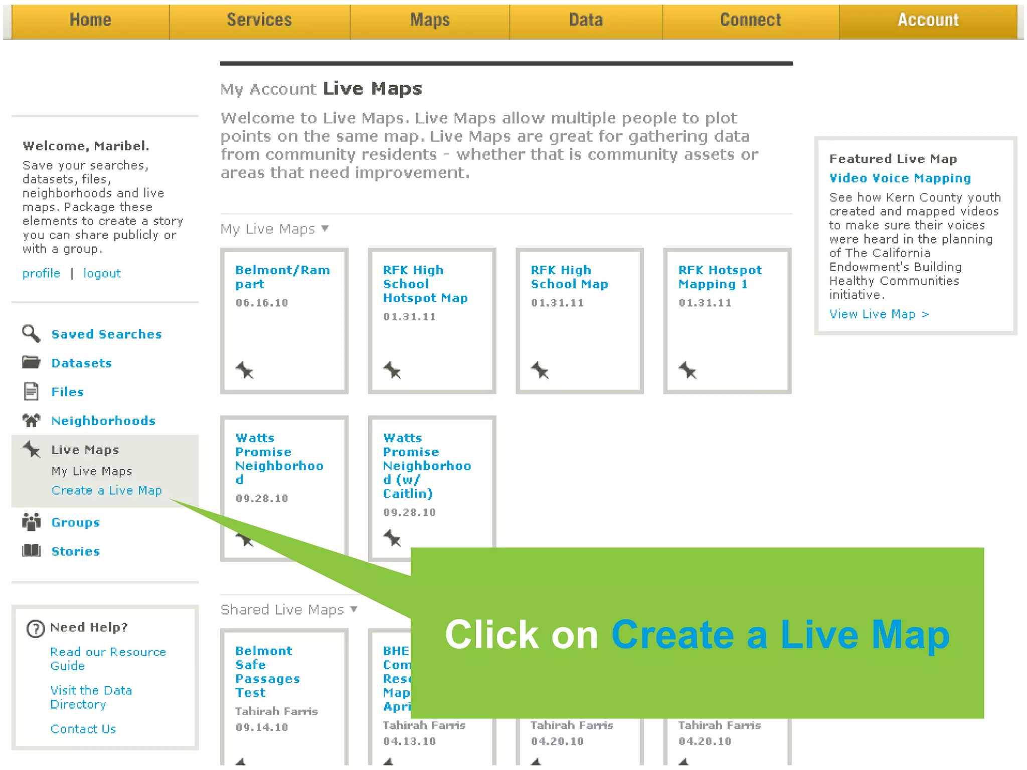
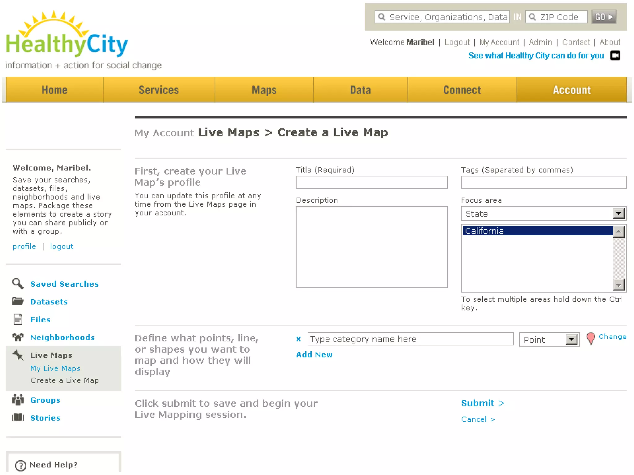
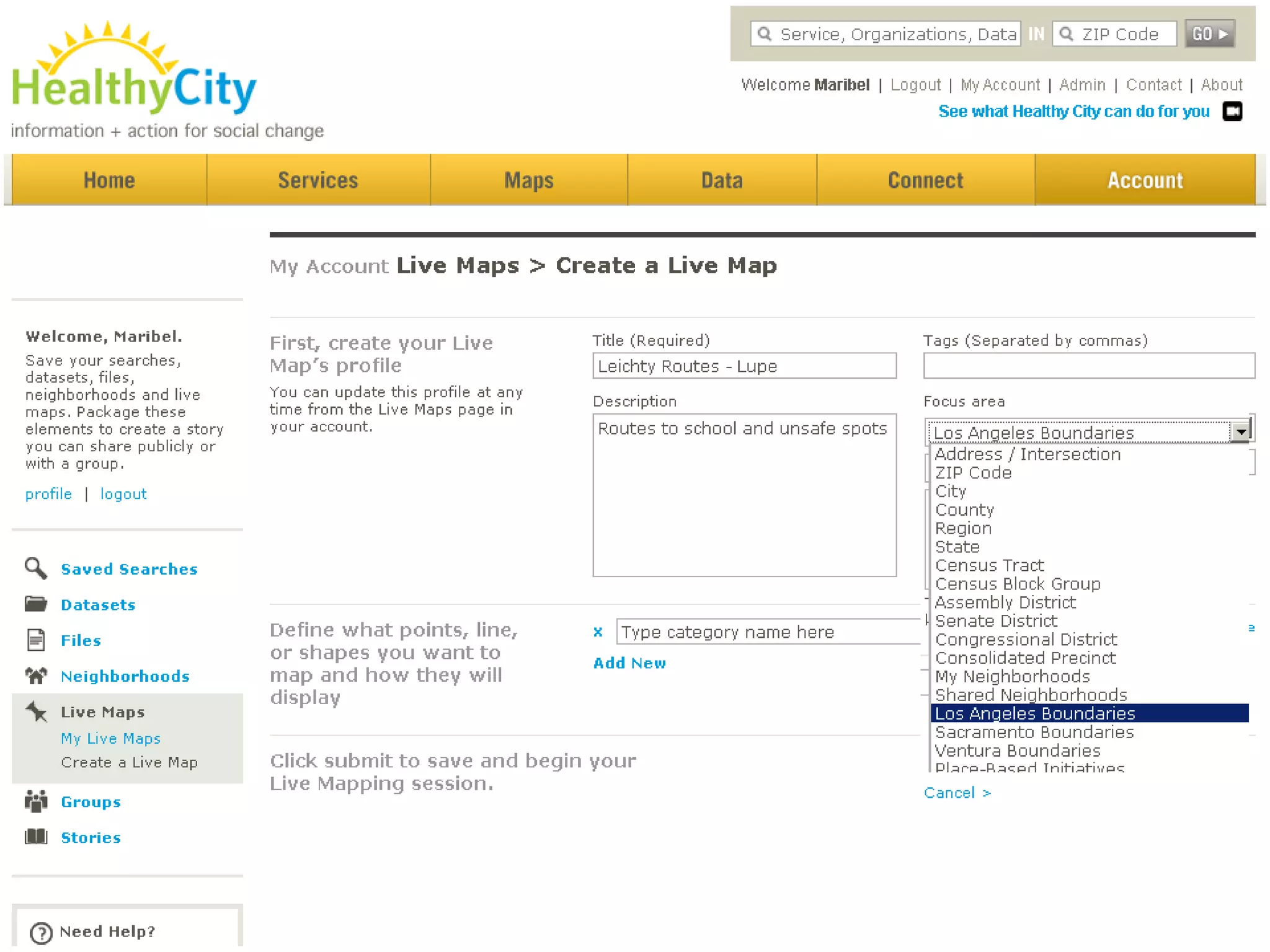
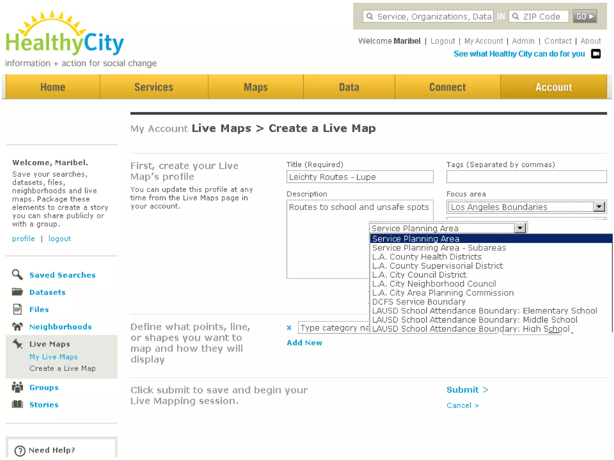
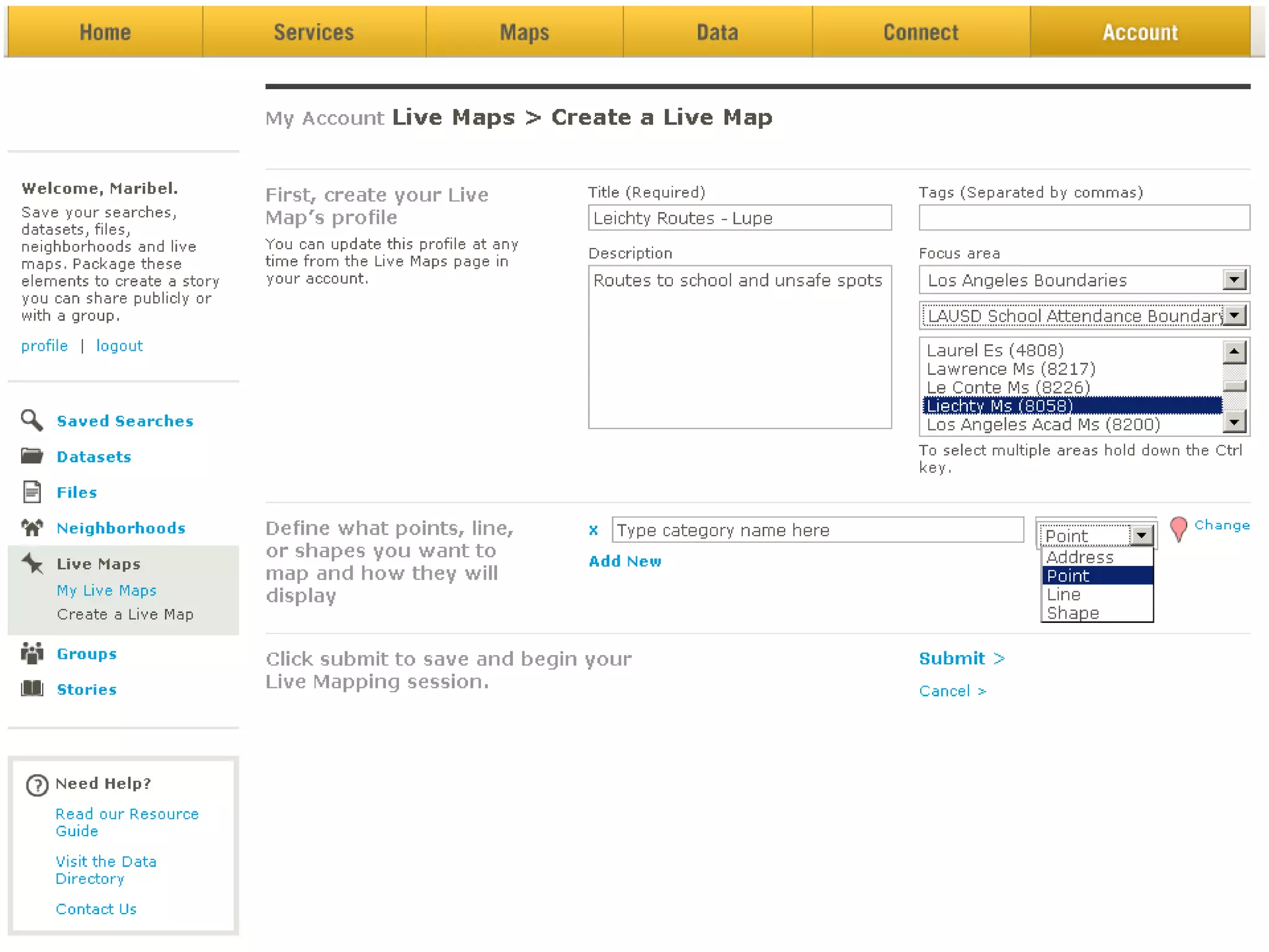
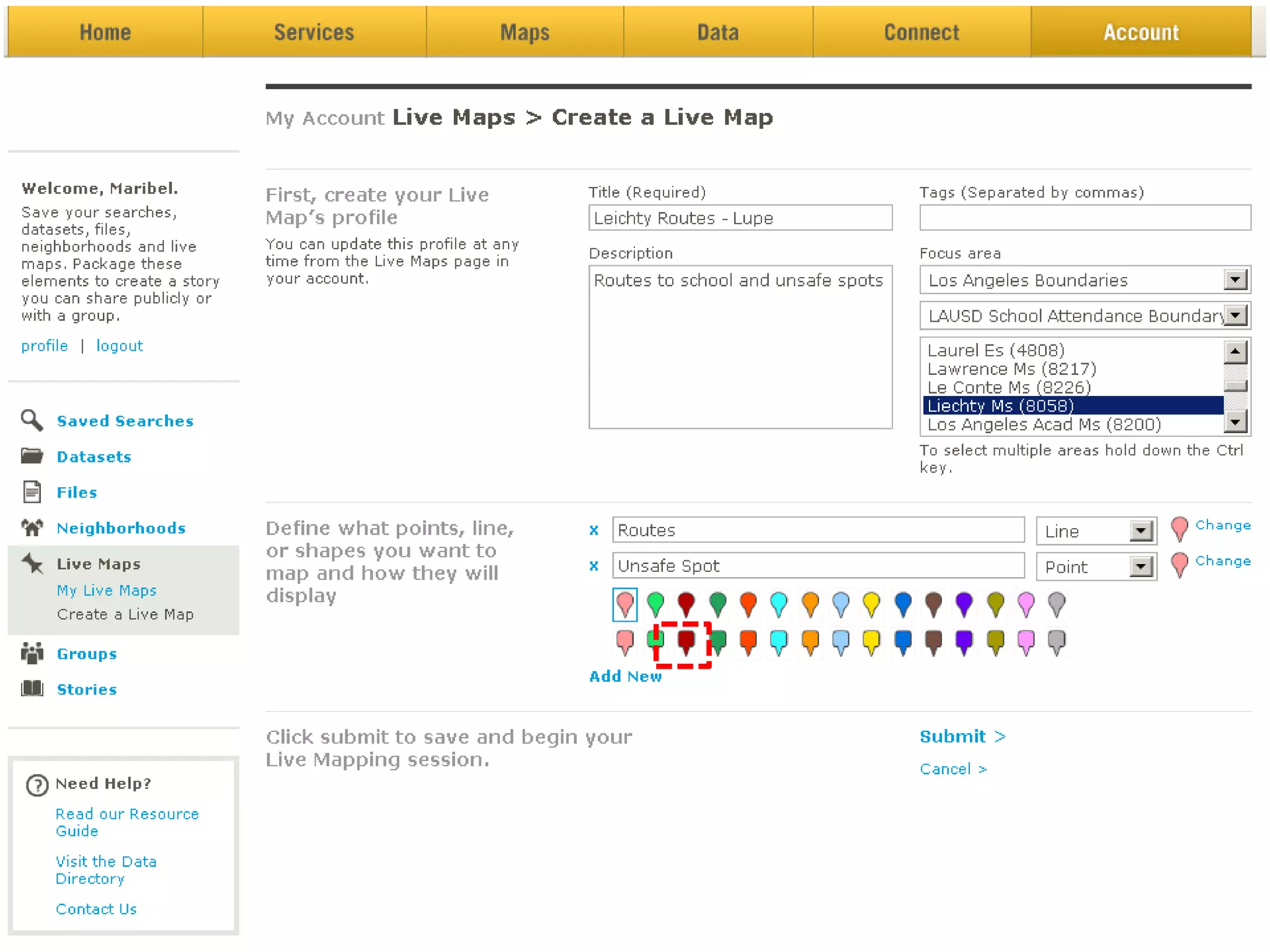
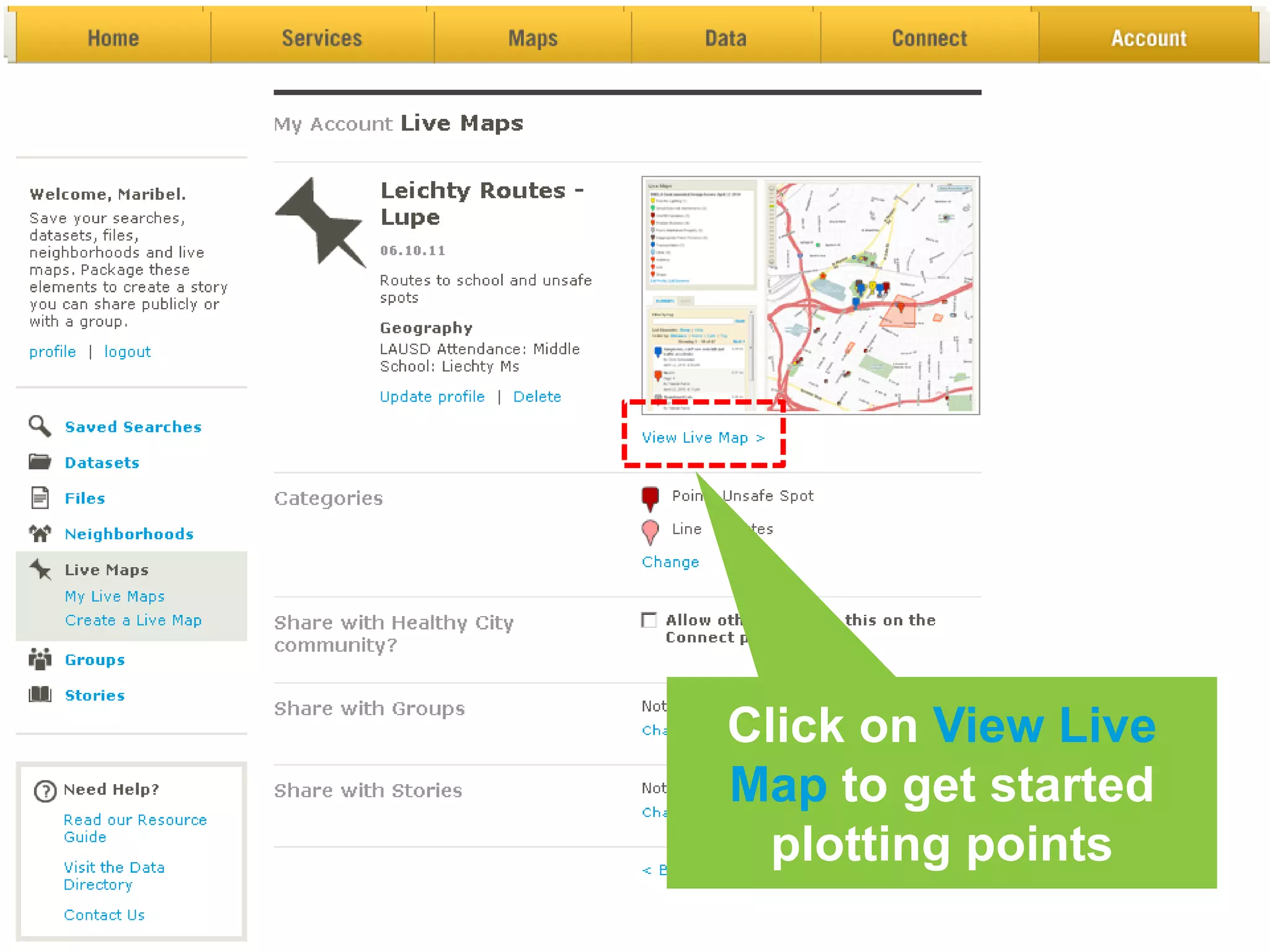
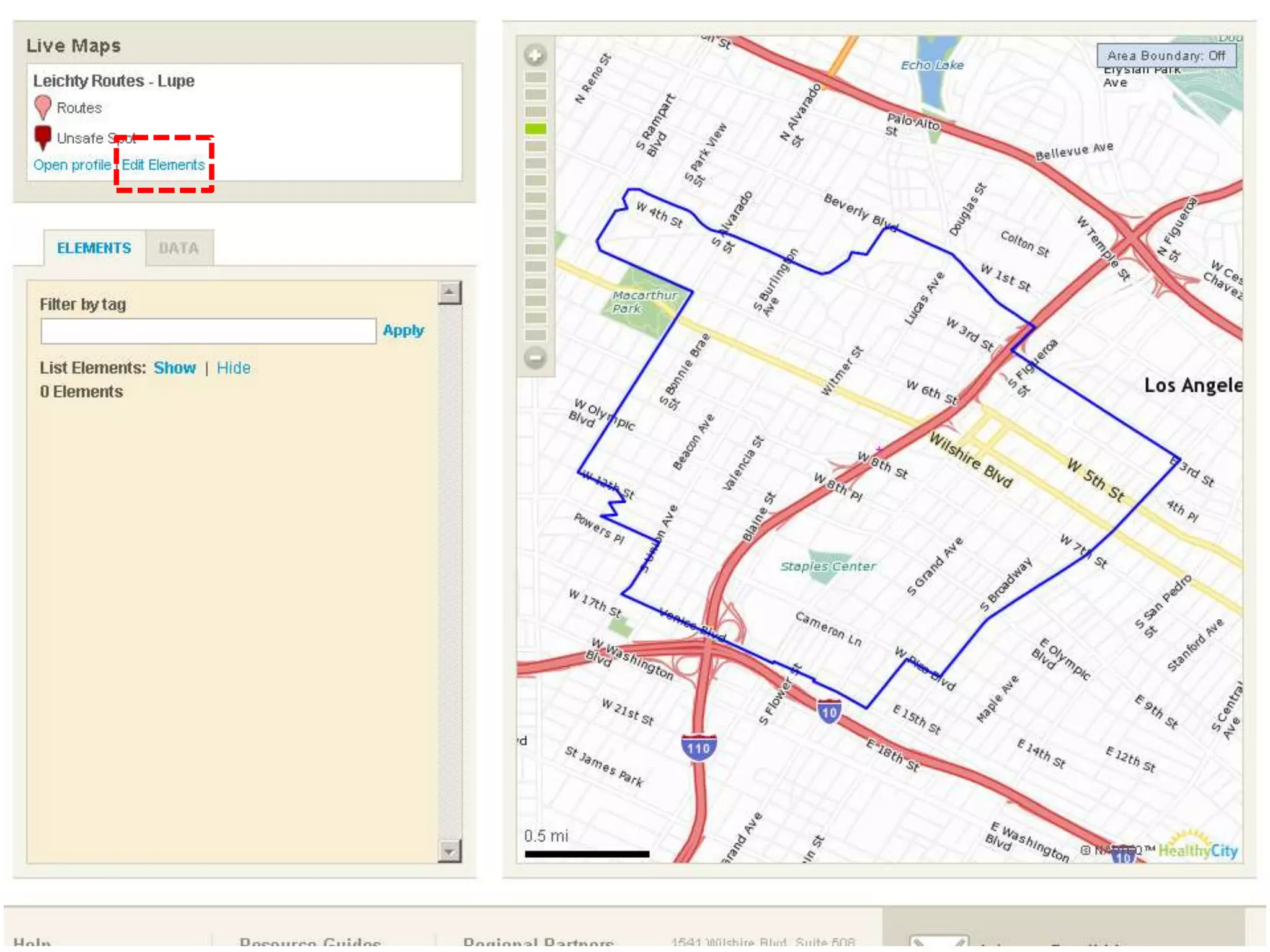
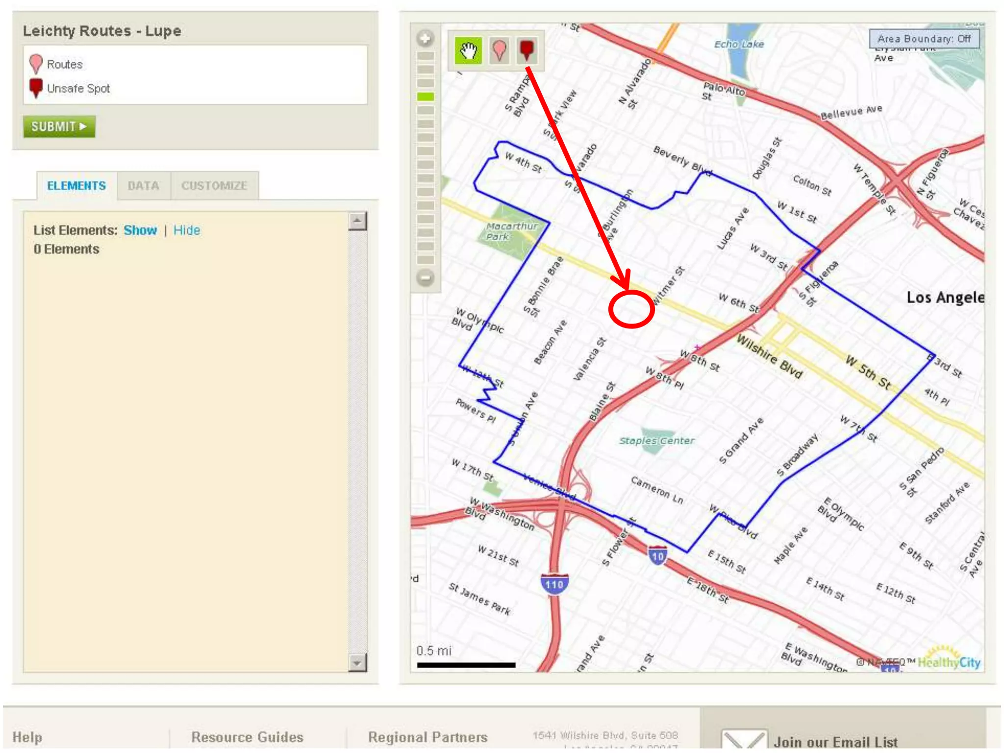

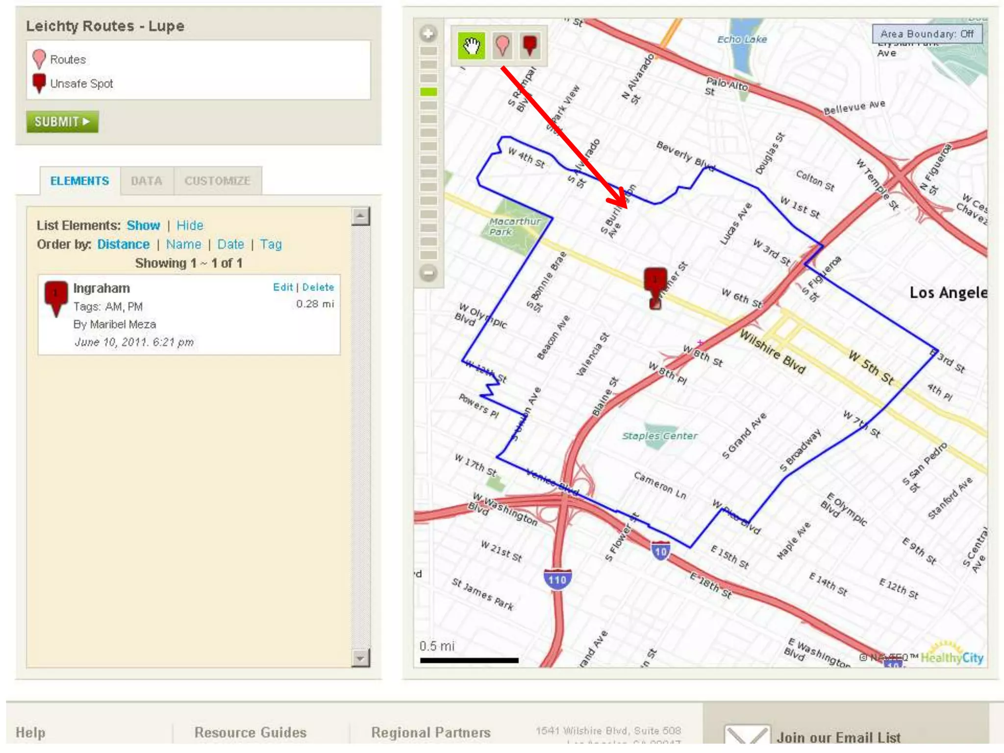
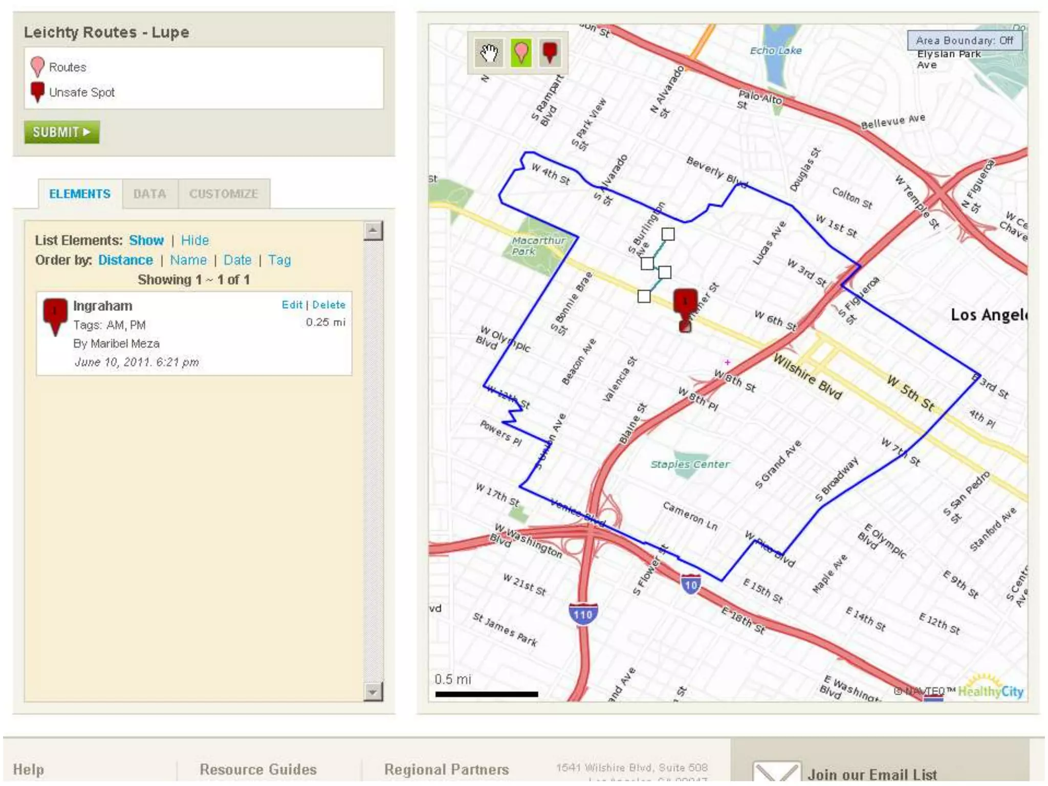
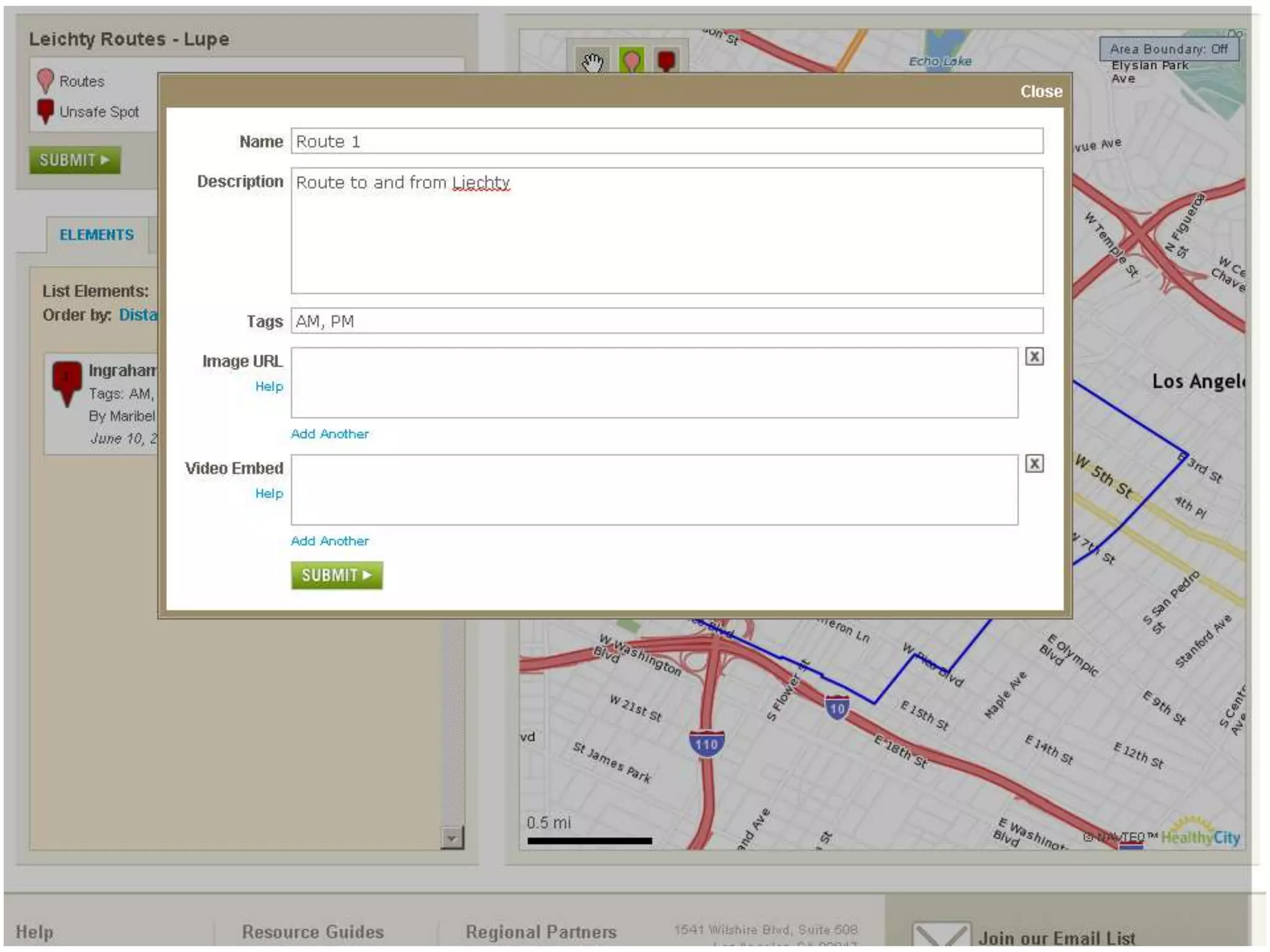
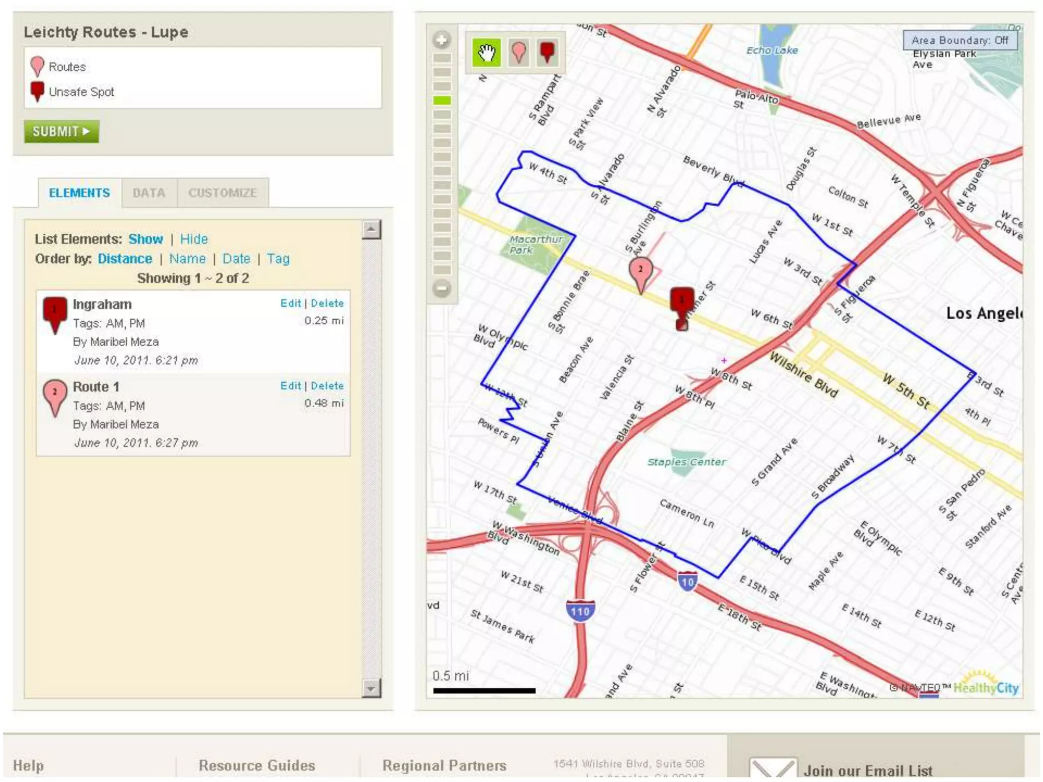
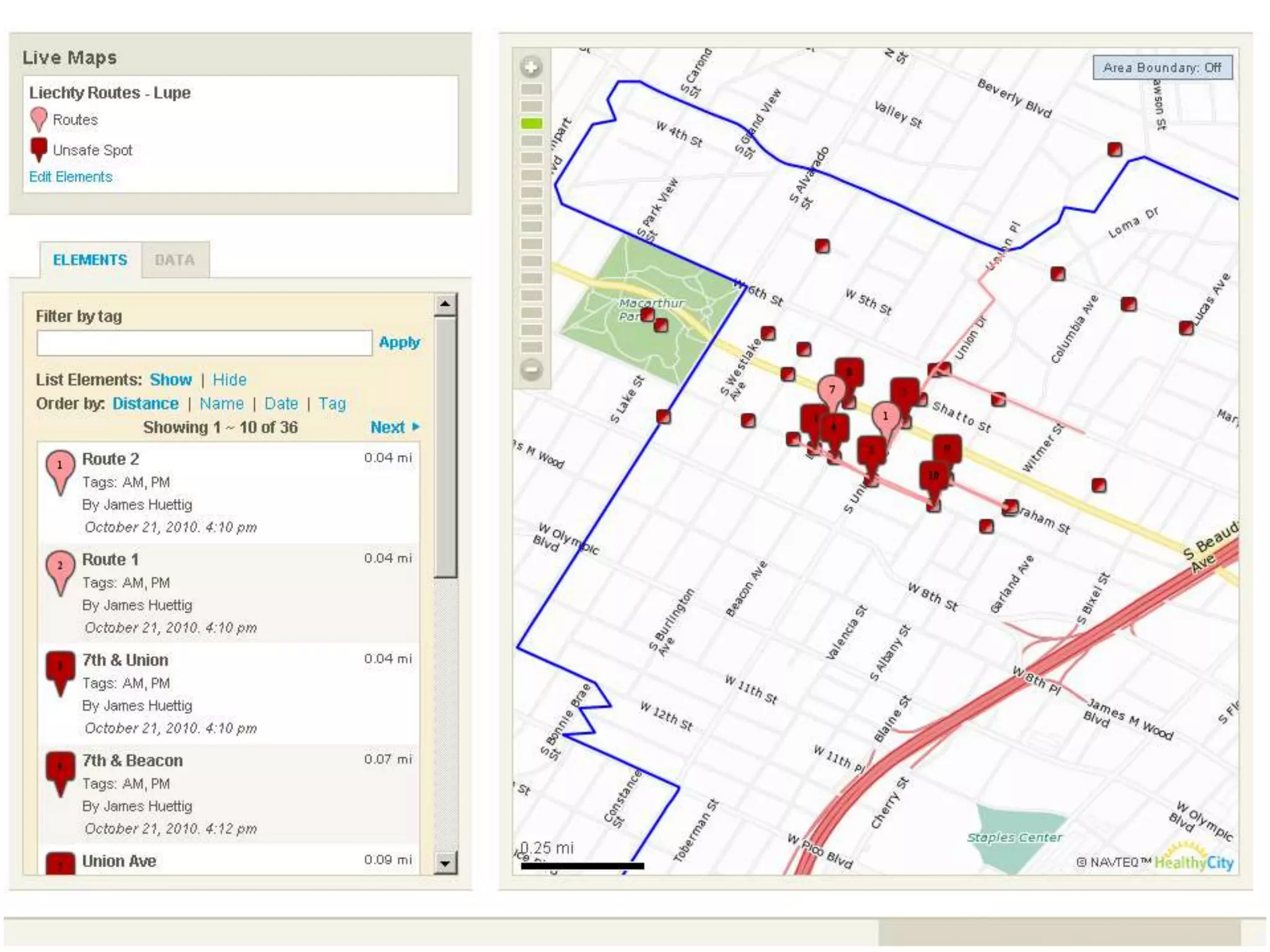
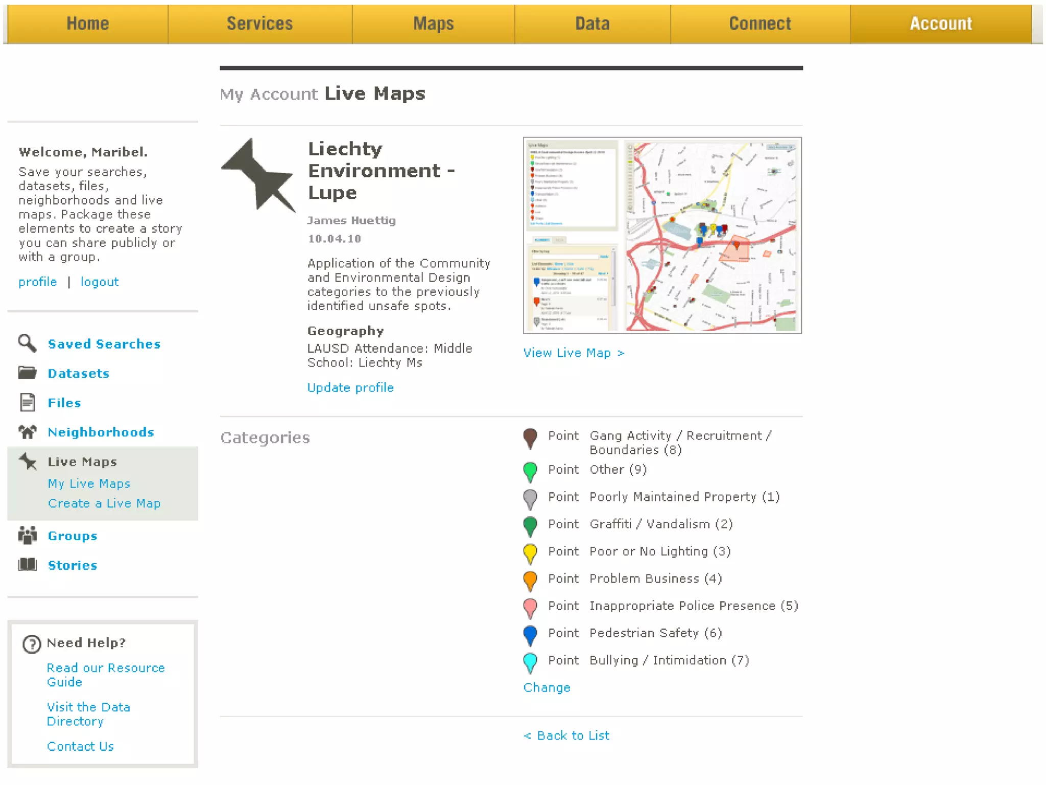
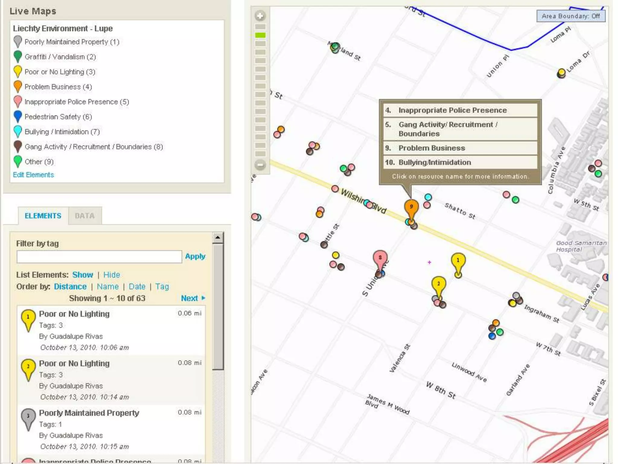
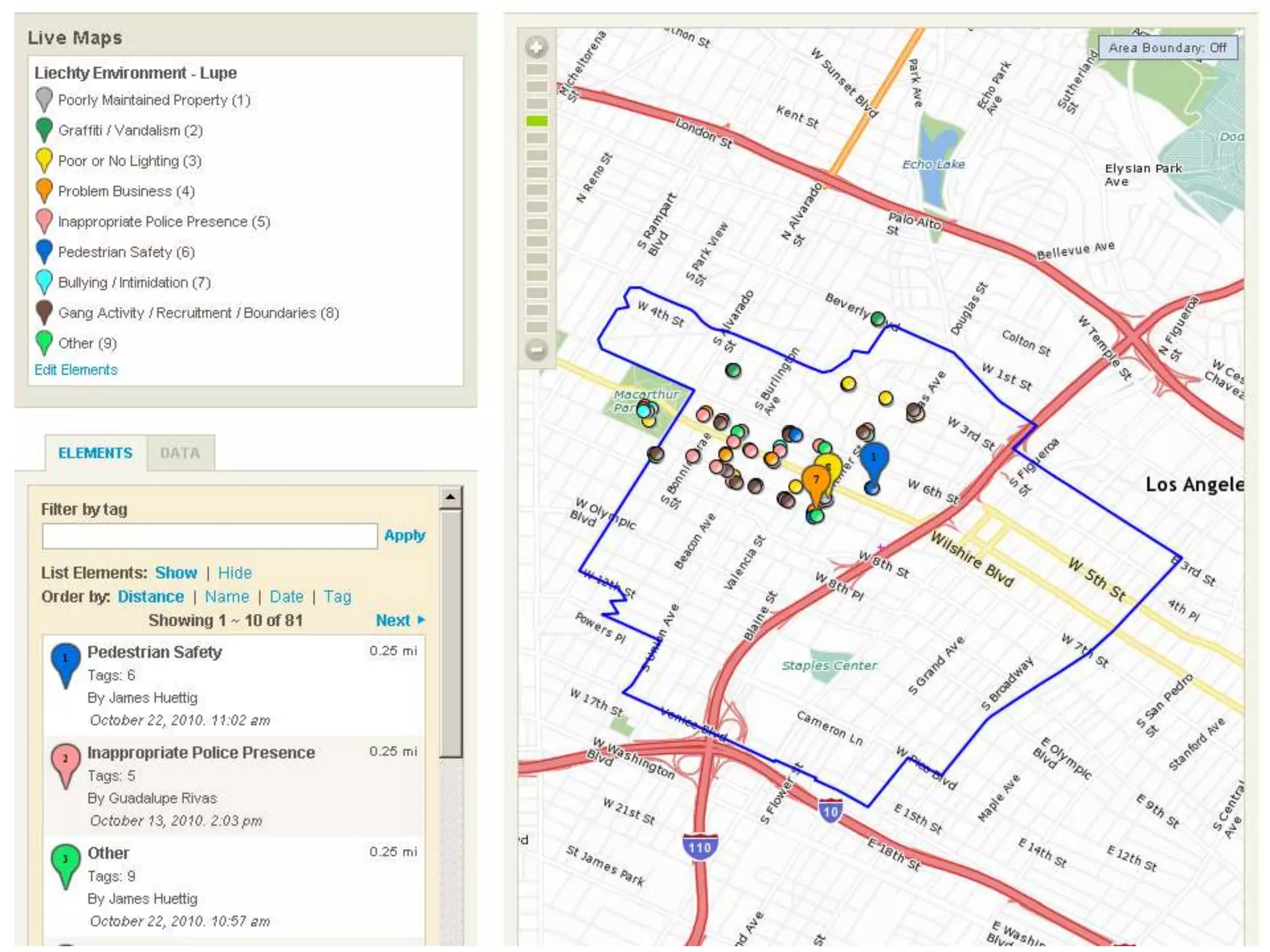
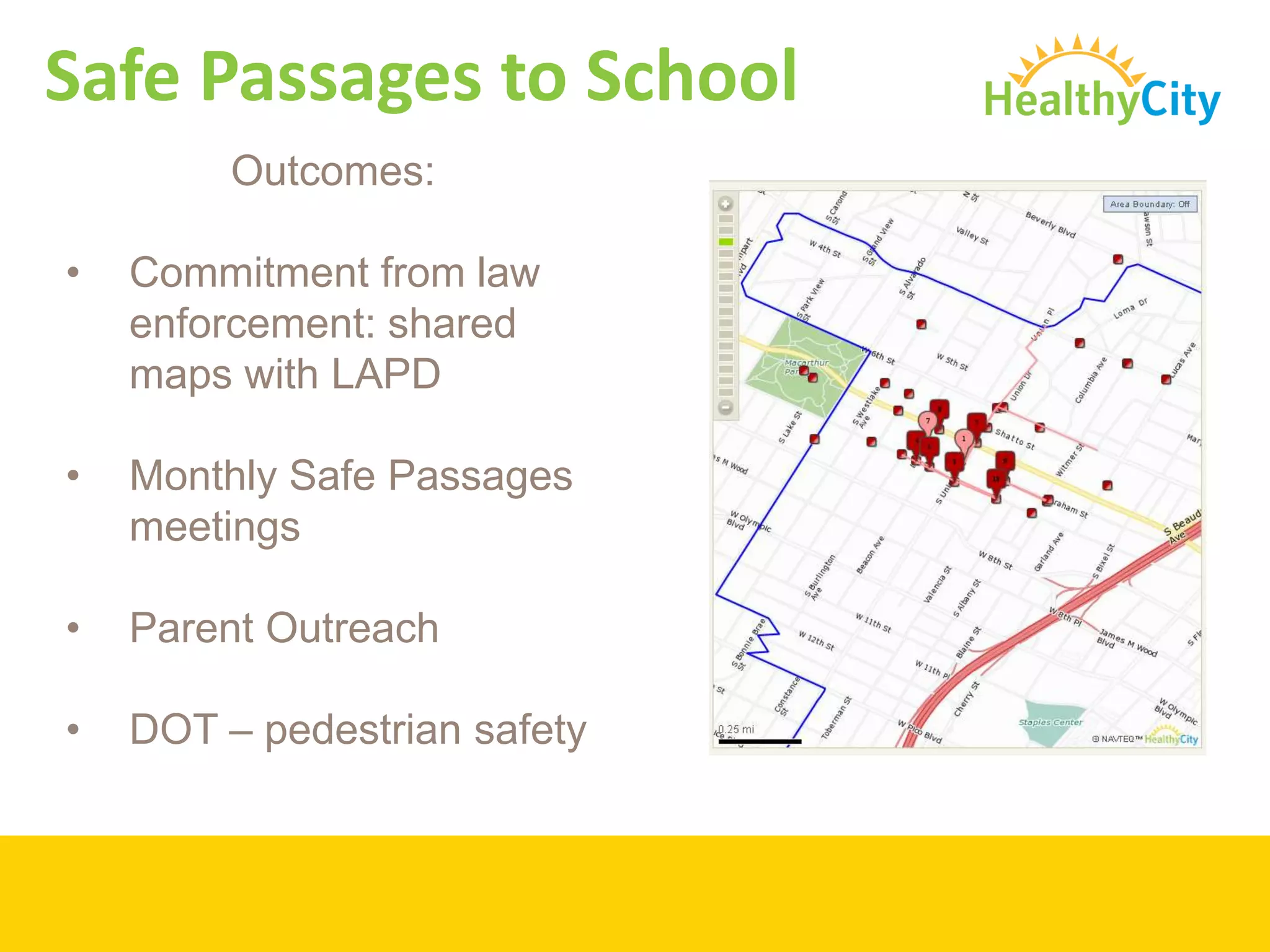
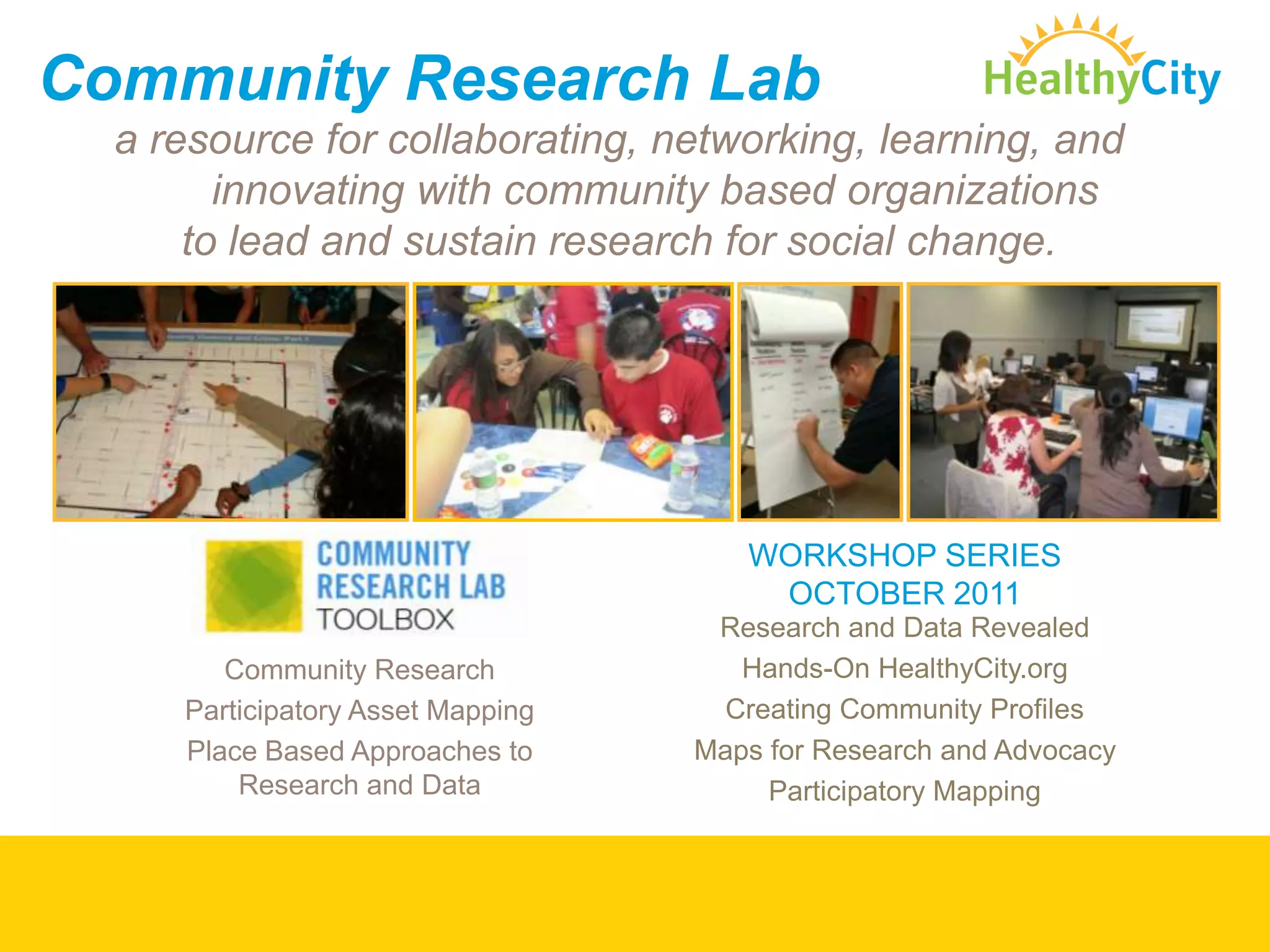
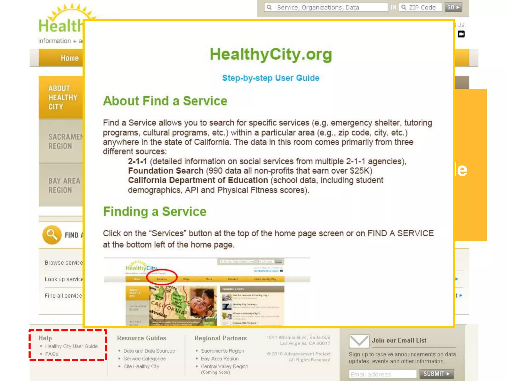
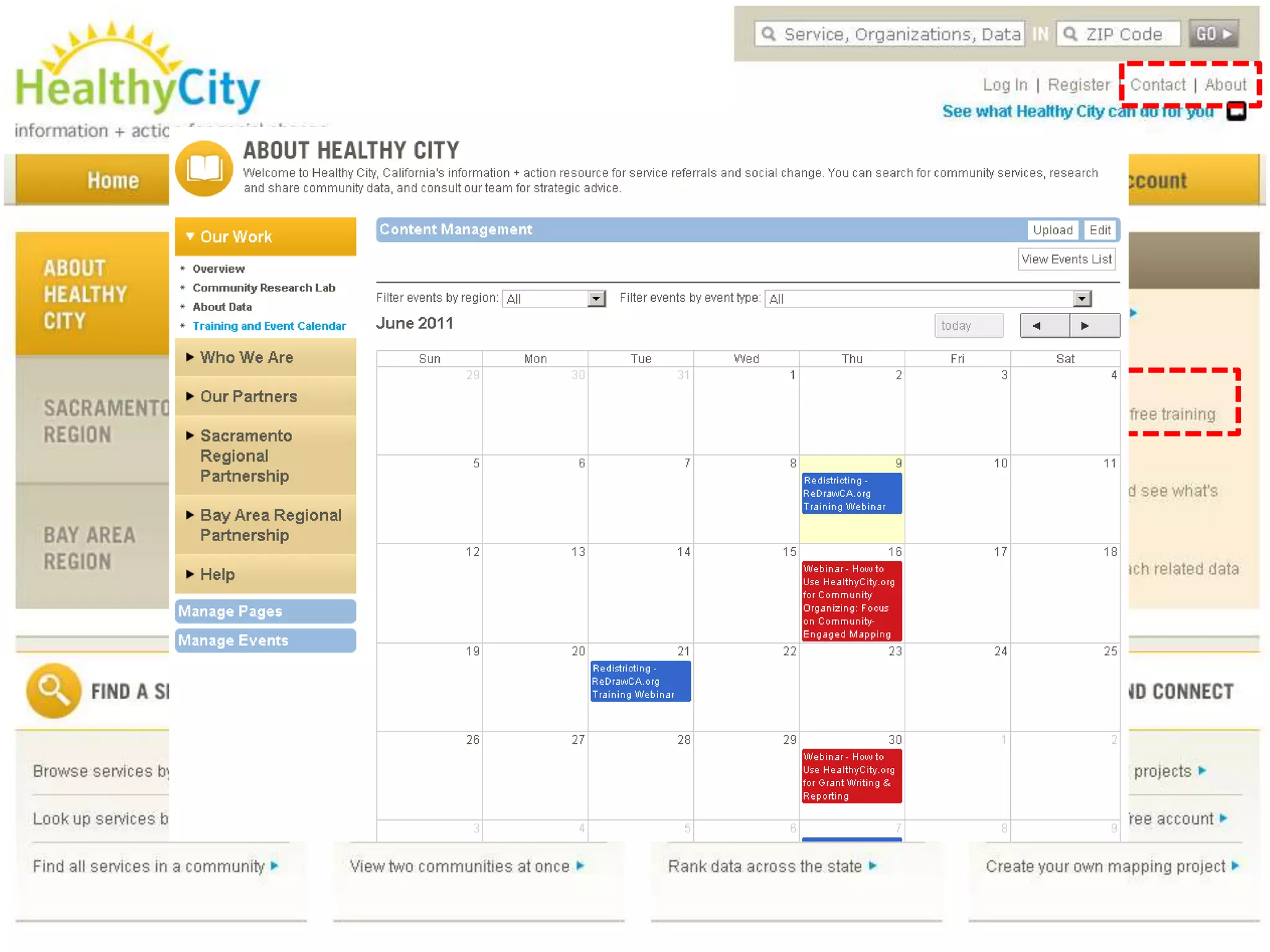

The document provides detailed guidance on using HealthyCity.org for community organizing, particularly through community-engaged mapping to identify assets and challenges within local areas. Participants learn how to access datasets, engage communities, and utilize mapping features to advocate for social change and improve conditions. It includes examples, resources, and information about partnerships to support various community initiatives and the importance of gathering qualitative data.


