Downloaded 25 times
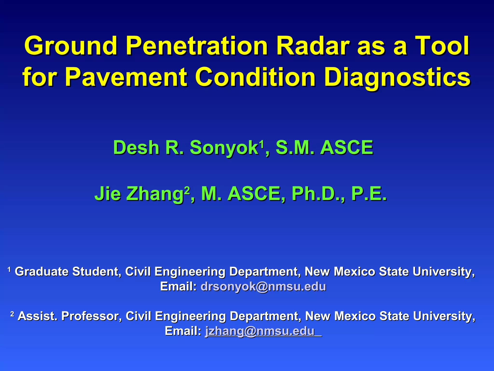

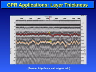
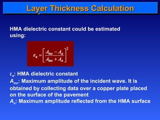
![GGGGPPPPRRRR LLLLaaaayyyyeeeerrrr AAAApppppppplllliiiiccccaaaattttiiiioooonnnnssss:::: TTTThhhhiiiicccckkkknnnneeeessssssss LLLLaaaayyyyeeeerrrr CCCCaaaallllccccuuuullllaaaattttiiiioooonnnn
TTTThhhhiiiicccckkkknnnneeeessssssss
AAll--QQaaddii eett aall.. 22000066 [[11]]::
r i
i
d ct
i
, 2 e
=
( ) ( ) , 1 , , 1 , / i r i r i r i r i A e e e e + + = - +
a 1.69
s
e
r
=
Ao
A0
Surface
Base
Subgrade
t1
t2
A2
A3
Time
r,1 e
r,2 e
r,3 e
t3
d = depth; c = speed of light in free space (m/s)
t = two-way travel time; ε= dielectric constant
A = amplitude; i = number of layers; a = attenuation (db/m);
σ = electrical conductivity in mS/m](https://image.slidesharecdn.com/gprasatoolforhighwayinfrastructurediagnosticsfinal-141119181901-conversion-gate02/85/Ground-Penetration-Radar-as-a-Tool-for-Pavement-Condition-Diagnostics-9-320.jpg)
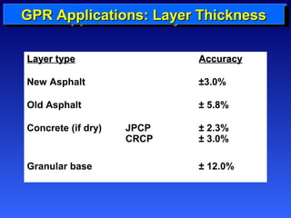


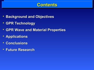
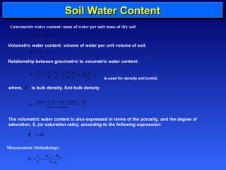
![LLLLaaaayyyyeeeerrrr TTTThhhhiiiicccckkkknnnneeeessssssss CCCCaaaallllccccuuuullllaaaattttiiiioooonnnn
2
1 ,
1
1
ö
÷ ÷ ÷ ÷ ÷
ø
æ
ç ç ç ç ç
è
+
-
=
A
o
p
A
A
o
p
r
A
e
2
1
å
2
1
2
1
2
1
2
, , 1
1
1
ö
÷ ÷ ÷ ÷ ÷ ÷
ø
æ
ç ç ç ç ç ç
è
ö
ö
A
i
A
g
- + ÷ ÷
ø
æ
-
æ
-
ç ç
è
+ + ÷ ÷ ø
ç ç
è
=
-
-
=
-
-
=
-
å
p
A
A
n
i
p
n
i
i
A
o
A
o
p
p
n
p
n
i
i
p
r n r n
A
A
A
A
A
A
g
e e
+
e -
e
r i r i
, , 1
+
i e +
e
, , 1
=
r i r i
g
εr,1 = dielectric
constant of the top
layer
Ao = amplitude of
the surface
reflection
Ap = amplitude of
the reflected signal
collected over flat
metal plate
γi represents the reflection
coefficients between the
ith, and (i+1)th
((22))
((33))
((44))
AAll--QQaaddii eett aall.. 22000066 [[11]]::](https://image.slidesharecdn.com/gprasatoolforhighwayinfrastructurediagnosticsfinal-141119181901-conversion-gate02/85/Ground-Penetration-Radar-as-a-Tool-for-Pavement-Condition-Diagnostics-26-320.jpg)

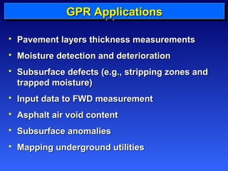
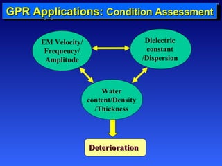
Ground Penetration Radar (GPR) is a reliable and high performance nondestructive testing tool for pavement management in a network level, which requires pavement condition assessment and deterioration modeling. GPR can determine the layer thickness, detect voids, and estimate moisture content of the in-situ soil underlying the pavement. Therefore, it is considered to be a promising tool for the assessment of pavement conditions. Pavement condition information obtained by GPR is very useful to predict the pavement structural capacity and performance. This will further help improve pavement maintenance and rehabilitation strategies and also provide rationalities in allocating available funds. However, the application of GPR in pavement is limited due to incomplete understanding of dielectric properties of pavement materials. This paper presents the state-of-the-art GPR applications in pavement condition assessment and its future development.