Francisco_Javier_Intl_Innovation_EuroFocus_Media_HR

Dr. F Javier Hernández-Molina's research focuses on deep marine sedimentation, particularly identifying bottom currents' depositional and erosional features in the ocean and relating them to oceanographic processes. These bottom-current deposits can potentially serve as hydrocarbon reservoirs or seals. His research aims to better understand these deposits and their implications for paleoclimatology, paleoceanography, slope stability, and hydrocarbon exploration. His background includes a degree in marine geology and over 25 years of research experience studying ancient and modern examples of bottom-current deposits around the world. His research collaborates with oil companies and could help improve prospects for deeper hydrocarbon exploration.

Recommended
Recommended
More Related Content
What's hot
What's hot (20)
Similar to Francisco_Javier_Intl_Innovation_EuroFocus_Media_HR
Similar to Francisco_Javier_Intl_Innovation_EuroFocus_Media_HR (20)
Francisco_Javier_Intl_Innovation_EuroFocus_Media_HR
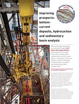
- 1. Could you explain what your research focuses on, and why this is important? Our research has been focused on deep marine sedimentation. Some of our most interesting findings have centred on our identification of bottom currents’ depositional and erosional features in the ocean, their deposits, and their relation to different oceanographic processes. The growing recognition of these deposits also affects their increasing significance with respect to palaeoclimatology and palaeoceanography, slope stability and hydrocarbon exploration. An enormous quantity and extensive distribution of contourite sands and/or reworked sands has been reported. These sand deposits can potentially serve as reservoir units, as well as muddy contourites that may function as hydrocarbon seals or source rocks and/or unconventional reservoirs. These represent a completely new and important exploration Marine Geology researcher and contourite expert Dr F Javier Hernández-Molina drills deep into the detail of his work looking at the sedimentary record of ocean basins, and explains how such studies could be invaluable to hydrocarbon companies and sedimentary basin analysis alike Improving prospects: bottom- current deposits, hydrocarbon and sedimentary basin analysis The view from the derrick of the JOIDES Resolution drilling ship in the Gulf of Cadiz during IODP Expedition 339. Credit: John Beck, IODP/TAMU. INTERNATIONAL INNOVATION EARTH SCIENCES 1
- 2. target for potential oil and gas reservoirs for prospectors, who are increasingly looking deeper and deeper into the ocean where these bottom-current deposits are common. Could you describe the experience and professional background that brought you into this field of research? Well, I’ve always been fascinated by the ocean – how it behaves, how it might have been different in the past and how it’s evolved. That’s why I started studying geology and specialised in Marine Geology, and it is what motivated me to pursue research in the field. I finished my degree in 1993, and then I had a grant to continue studying at the Spanish Institute of Oceanography. I later moved onto actively working in the Marine Science Faculties of Cadiz and Vigo (Spain) with many research stages spent in other scientific institutions abroad. So I’ve spent a long time in the field – 25 years! Why is it important to better understand the sedimentological and oceanographic processes governing contourites? By definition, contourites are any kind of sediments deposited or substantially reworked by the persistent action of bottom currents. In the ocean it is normal to have the influence of the movement of the water masses against the sea floor – so we are working on the present features of the seafloor, but also getting an insight into the long-term geological past. That is important, because if we characterise how the water moved against the ocean floor in the past, we can decode what the ocean circulation was like and really understand ancient ocean dynamics and palaeoclimate. Understanding these details would provide us with an overview of the oceans’ evolution over time, and therefore its likely future course. There are also potential implications for companies; different types of deposit, some of them potentially economically valuable, are associated with different geological features. What are the implications of your research for the oil industry? We have been collaborating with different companies. From December 2011 into 2012 we developed an international project group, and collaboration towards our present objectives began. Since then, we have been collaborating with several companies, including Repsol and Gas Natural in Spain, Petrobras in Brazil, ANCAP in Uruguay, the BP Group/Shell and ExxonMobil in the UK, and Total in France. These companies benefit from our consultation, while we benefit from having access to a unique dataset and eventually permissions for using it for publication and research. However, we are developing something new in the coming years, a Joint Industry Project (JIP). Your work has highlighted the need for further, detailed investigations. In what direction are you planning to take your research? We are working mainly in Marine Geology. From time to time we go to the sea to collect data, and we are working in different areas – but we are also going into the field to study ancient outcrops with deep-water sedimentation and bottom-current deposits (e.g. Cyprus and Morocco). We try to understand the enormous variability in the spatial and temporal facies changes in depositional systems affected by bottom currents, and their role in determining the morphology and sedimentary stacking pattern on continental margins. Future detailed work on contourite sediments will allow us to better understand the nature of bottom-current processes and associated contourite deposition. For example, ichnofabric and ichnofacies analyses are useful for identifying bottom-current deposits. This approach has an impact on palaeoenvironmental reconstructions and reservoir characterisation, as bioturbation impacts on permeability and porosity, implementing effective strategies in exploitation from reservoir strata. Another way to gain insights into the complex interplay of seafloor processes and bottom currents is to build computer models that allow us to ‘play God’ and see what happens if we move currents, change the bathymetry or cut off the sediment supply. Professor David Waltham has been writing sediment-modelling programmes for 30 years and is excited by the prospect of tackling the new topic of contourite deposition. Where do you see your research moving in the next five to 10 years? Research on bottom-current deposits will improve our understanding of diagnostic criteria and facies recognition from other deep-water deposits. Furthermore, it will provide advanced comprehension of the sedimentary budget for contourite drifts, their sediments sources and recognition of fossil contourites in the ancient record onshore. This new facies models should be included in current models for deep-water sedimentary record. The ‘Drifter’ research group comprises several institutions, some of them in the UK and some from other countries. We would like to continue expanding the group with the aim of fully understanding bottom-current deposits, especially the sandy deposits because of their genetic implications and the fact they are more interesting for industries. Therefore, it is necessary to approach this research from different points of view. What lies beneath Decoding the mysteries of deep-sea sediment is a unique research goal in that it is beneficial both to academia and industry. Now, world-leading experts att Royal Holloway, University of London, UK, are in pursuit of fresh goals in this field THE BOTTOM OF the deep ocean is considered by many scientists to be a featureless place, dominated by fine grain sedimentation. Far below the reach of the rich surface waters, this zone supports a more limited range of life; in appearance, it is reminiscent of the surface of the Moon – and indeed, our knowledge of this deep environment is as incomplete as our understanding of the lunar surface. For some investigators, however, this undersea landscape is neither bland nor featureless – quite the opposite. Marine geologists, petrochemical prospectors, palaeontologists, (palaeo) climatologists, physical oceanographers and deep-water ecologists all operate in this domain, deriving knowledge that is both economically and academically valuable from their investigations of the deep ocean floor. Part of the secret lies in the formation of the geological deposits and erosional features that can be observed here. Just as the waves at the beach create distinctive ridged patterns in the sand, so too do the bottom currents in the deep ocean on the sea-floor – and, by examining the stratification and specific characteristics of previous layers of sediment, geologists can gain a clear insight into the past. The tectonic, climate and sea-level changes all affect the movement of ocean currents, and in turn, this movement of ocean currents dictates sediment deposition and erosion – so the deep ocean floor can represent a pristine record of many of the processes and products of the ancient world, for those with the ability to read it. THE READER Dr F Javier Hernández-Molina is just such a person. Reader in Sedimentary Geology at Royal Holloway University of London (RHUL), Hernández-Molina is an academic whose work is strongly aligned with industry. He is involved with the Continental Margins Research Group (CMRG) in the Department of Earth Sciences (RHUL) and his present research team ‘Drifters’ conducts detailed studies into bottom- currents deposition (contourites) and erosion. Contourites are defined as sediments deposited or substantially reworked by the persistent action of bottom currents on the deep ocean floor – and have attracted interest from collaborators both in academia and industry. www.internationalinnovation.com 2
- 3. “It’s important conceptually and because we can understand the evolution of the ocean and climate in the past, and how the morphology and the evolution of marine basins have been controlled by the ocean currents. But it’s also important because bottom currents accumulate thick sandy deposits in specific settings with enormous potential interest for hydrocarbon exploration,” Hernández-Molina says of their work. He has been involved in some International Ocean Discovery Program (IODP, www.iodp.org) drilling proposals related to this topic. In addition, he was a principal scientist for IODP Expedition 339 (Mediterranean Outflow) and, at present, is involved in two IODP drilling proposals (732 and 771), which are both related to the theme of better understanding bottom-current deposits. Hernández-Molina is also collaborating on other projects, such as the IMMAGE, Argentine and Scotia Sea proposals. GEOLOGY GLOBAL TOUR Investigations undertaken by Hernández- Molina and his collaborators’ have taken them to continental margins in the Antarctic, Argentina, Uruguay, Brazil, Namibia, Mozambique Channel, Tanzania, Morocco and Iberian margins. They have been collaborating with many national and international researchers from myriad institutions, including ECOSSE, Heriot-Watt University, BAS and NOCS (UK); IGME, IEO, University of Vigo and CSIC (Spain); IPMA and University of Lisbon (Portugal); Naval Research Laboratory, USA; SHN, University of Buenos Aires and CONICET (Argentina); University of Bordeaux (France); IFM-GEOMAR and University of Bremen (Germany) and GEUS (Denmark). Moreover, the Drifter team has been collaborating with oil companies such as REPSOL and Gas Natural (Spain), PETROBRAS (Brazil), ANCAP (Uruguay); EXXONMobil (UK); BG Group/Shell (UK) and TOTAL (France) on the characterisation of deep-water deposits. ROCK STARS Since the high-profile outputs of IODP Expedition 339 and associated research projects, Hernández-Molina and his colleagues have focused their efforts on widening the geographical scope of their work. Further papers since the project have investigated other margins in South America, Antarctica and Europe, and have involved enhanced academic collaboration, resulting in comprehensive outputs that benefit the fundamental science and other investigators, as well as industry partners. The Drifters research team is currently working on a project supported by BG Group/ Shell (2014-2017) – now Shell – which is examining the interaction between contourite and turbidite deposits on the Uruguayan Margin. The project is a speculative study of the implications of such interactions in these deep ocean systems for hydrocarbon exploration. A second three-year project funded by TOTAL, which commenced at the beginning of 2016, focuses specifically on contourites on the African and South-East American margins. Currently, this world- leading team is seeking new partners with whom to collaboratively develop the field of contourite research. DRIFTER RESEARCH GROUP The research group from RHUL is currently working on a number of projects, focused on contourite formations along continental margins, which are the areas extending from the coast, over the continental shelf, to the floor of the deep ocean trough and the continental slope, and rising towards the abyssal plains. It is these last settings in which most contourites are formed. Similarly to previous authors (Heezen, BC, Hollister, CD; Mc Cave, IN; Faugeres, J-C; Viana, A; Stow, DAV; Shanmugam, G and Rebesco, M; among many others), Hernández- Molina and his team observed that a range of erosional and depositional features could be created by bottom currents, often with quantifiable relationships to the current velocity, the sediment grain size and the sea floor irregularities. This prompted the acquisition of new data, subsequently augmented by synthesis with other published studies. The group became interested in the last years on sandy bottom-current deposits, bottom-current reworked sands (BCRSs) and their link to the behaviour of the bottom currents immediately above the sea floor (the benthic boundary layer). The Drifter team therefore routinely collaborates with high-profile industry partners who provide the funding for much of its cutting-edge work – but in fact, Hernández-Molina cemented his position as an expert in this field many years ago. In 2001, the team (Llave et al) published the first in a long sequence of influential papers that shared the findings of their expert studies into contourites depositional systems (CDS). JIP AND ATLAS OF CONTOURITES SYSTEMS A Joint Industry Project (JIP) about contourites – seismic recognition and sediment characterisation of deep-water Deep-water sandy contourites. ROV photograph from the middle slope (450 metre water depth) in the Porcupine Seabight. Courtesy of MARUM, Bremen, Germany. INTERNATIONAL INNOVATION3
- 4. contourite depositional systems and their implication for the oil industry – is being organised by Principal Investigators, Hernández-Molina and Professor Dorrik A V Stow (ECOSSE, Heriot-Watt University, UK). The project will enhance existing knowledge of contourite systems, and will focus on the applications of this knowledge in commercial contexts. The researchers consider this an essential ingredient for deep-water hydrocarbon exploration. In relation to this JIP, the Drifter team is co-organising a specific session on the 100th American Association of Petroleum Geologists ACE: ‘Non-turbidite deepwater units as reservoirs, seals and trap elements – Towards a Paradigm Shift’ (Houston, April 2-5, 2017). As part of the JIP, and associated activities of the Drifter research group, the publication of an Atlas of Contourites Systems is planned, synthesising contourite systems worldwide, with examples from both present and recent continental margins, as well as from the ancient record. The Atlas will include key examples of contourite systems from outcrops as well as from seismic and well data. If you are interested in the development of Atlas or would like to contribute to it, please contact Javier at: javier.hernandez-molina@rhul.ac.uk. DEEP-WATER CONTOURITE DEPOSITIONAL SYSTEMS OBJECTIVES • To understand bottom currents and associated oceanographic processes, and to study depositional systems affected by bottom currents to evaluate their role in determining the morphology and sedimentary stacking pattern on continental margins • To develop criteria for identifying contourite deposits and their sedimentary/seismic facies association, ichonofrabric, etc, with special focus on sandy deposits from modern to ancient records • To discover reservoir characteristics of contourites and mixed systems and contourite play prediction KEY COLLABORATORS Dr D A V Stow, Heriot-Watt University, UK • Dr E Llave, Instituto Geológico y Minero de España (IGME), Spain • Dr F J Sierro, University of Salamanca, Spain • Dr D Van Rooij, Ghent University, Belgium • J R F Gerard, Repsol Exploracion SA, Spain • F Raisson, TOTAL SA, France • Dr A R Viana, Petrobras, Brazil • Dr F J Rodríguez-Tovar, University of Granada, Spain FUNDING / DATABASE Spanish, British and EU projects and IODP proposals / Expeditions • Projects subsidised by oil companies CONTACT Dr Francisco Javier Hernández-Molina Reader in Sedimentary Geology Department of Earth Sciences Royal Holloway University of London Egham, Surrey, TW20 0EX, UK T +44 1784 443 582 E javier.hernandez-molina@rhul.ac.uk http://bit.ly/Hernández-Molina DR FRANCISCO JAVIER HERNÁNDEZ-MOLINA is Reader in the Department of Earth Sciences at Royal Holloway, University of London. He is a specialist in seismic stratigraphy, sedimentary processes and basin analysis, and is experienced in general core description and sediment structures identification. His research has special emphasis on the influence of bottom currents along continental margins, as well as the study of Contourite Depositional Systems. RHUL’S DRIFTERS RESEARCH GROUP CURRENTLY COMPRISES: Dr F Javier Hernández-Molina (Seismic analysis, Sedimentology) Dr David Waltham (Computer modelling) Dr Domenico Chiarella (Sedimentology, tides and bedforms in marine environments) Dr Nicola Scarselli (Subsurface imaging and evaluation) Dr Anxo Mena (PostDoc, Sedimentology, paleoceanography) Adam Creaser, PhD Student (Mixed System. Uruguayan margin. Funded by BGGroup-Shell) Antoine Thieblemont, PhD Student (Contourite. Mozambique channel & South Atlantic. Funded by TOTAL) Lucia Perez Días, PhD Student (Plate tectonic reconstructions and global circulation) Claudia Jones, MRes student (Sandy contourites. Gulf of Cadiz) Amelia Evans, MRes student (Sandy contourites. Gulf of Cadiz) Sataphon Suklap, MSc student (Ancient contourites, Cyprus) Brian Docherty, MSc student (Ancient contourites, Cyprus) Jun Sasamura, MSc student (Contourites, Algarve Basin, Gulf of Cadiz) Jamie Beagle, MSc student (Contourites, Alentejo Basin. West of Portugal) Leona Hyslop, MSc student (Mixed System) Paleobathymetric reconstruction for late Cretaceous (Perez-Diaz and Eagle, in prep.). Contourite drift (Hernández-Molina et al, 2016). Contourites (Cyprus, 2015). www.internationalinnovation.com 4