Downloaded 25 times


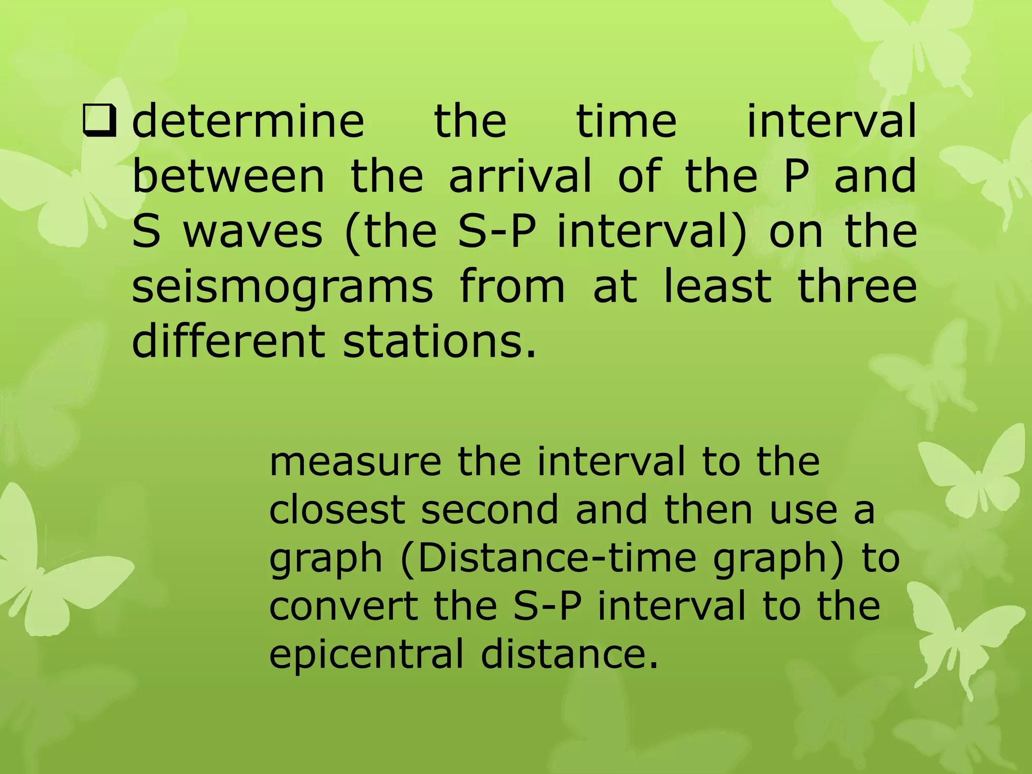

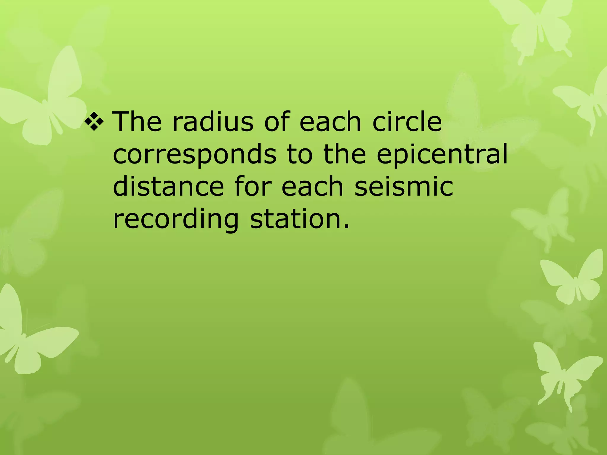
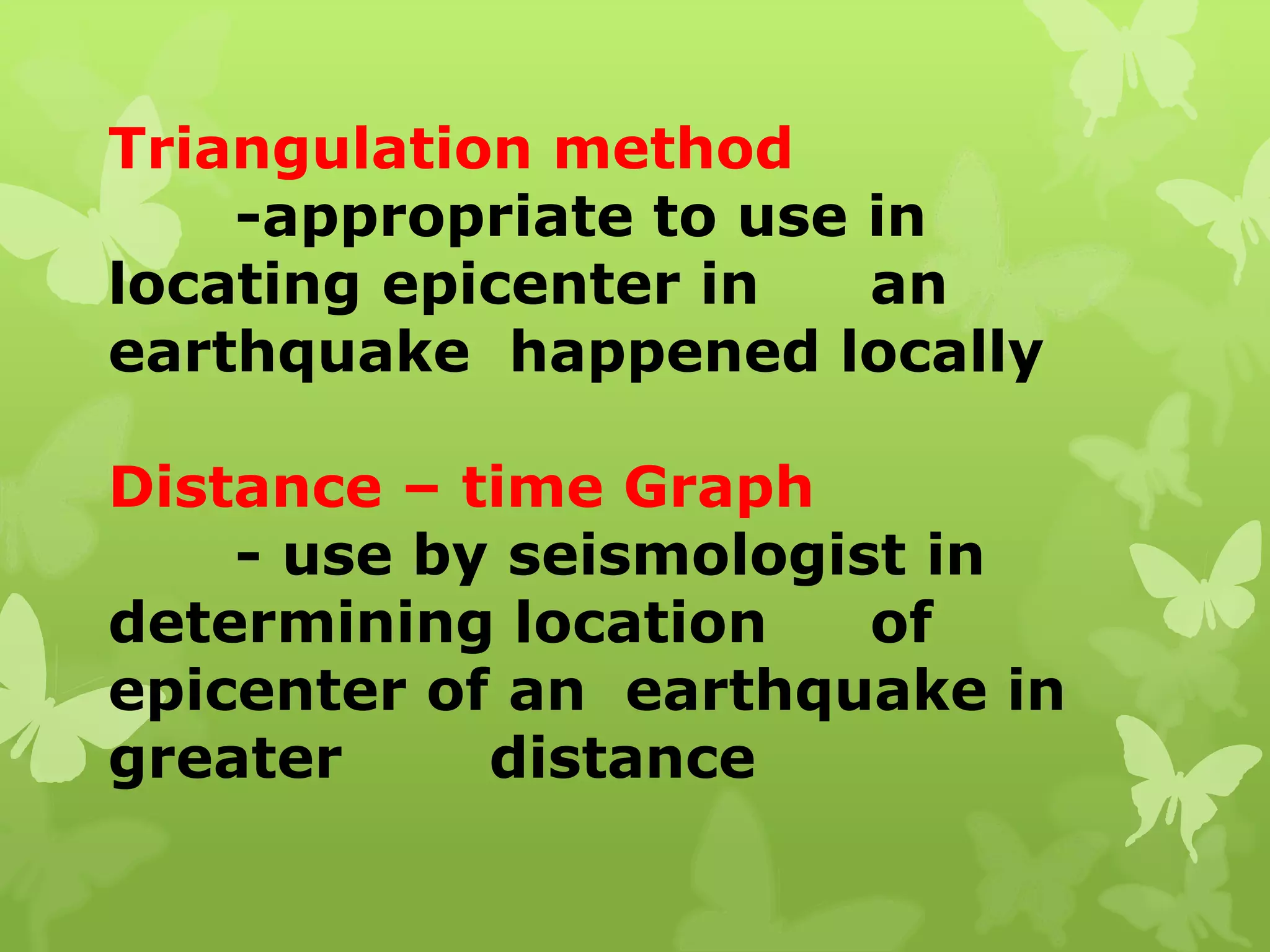
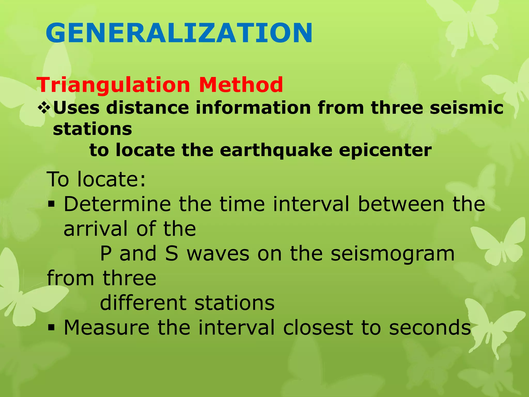
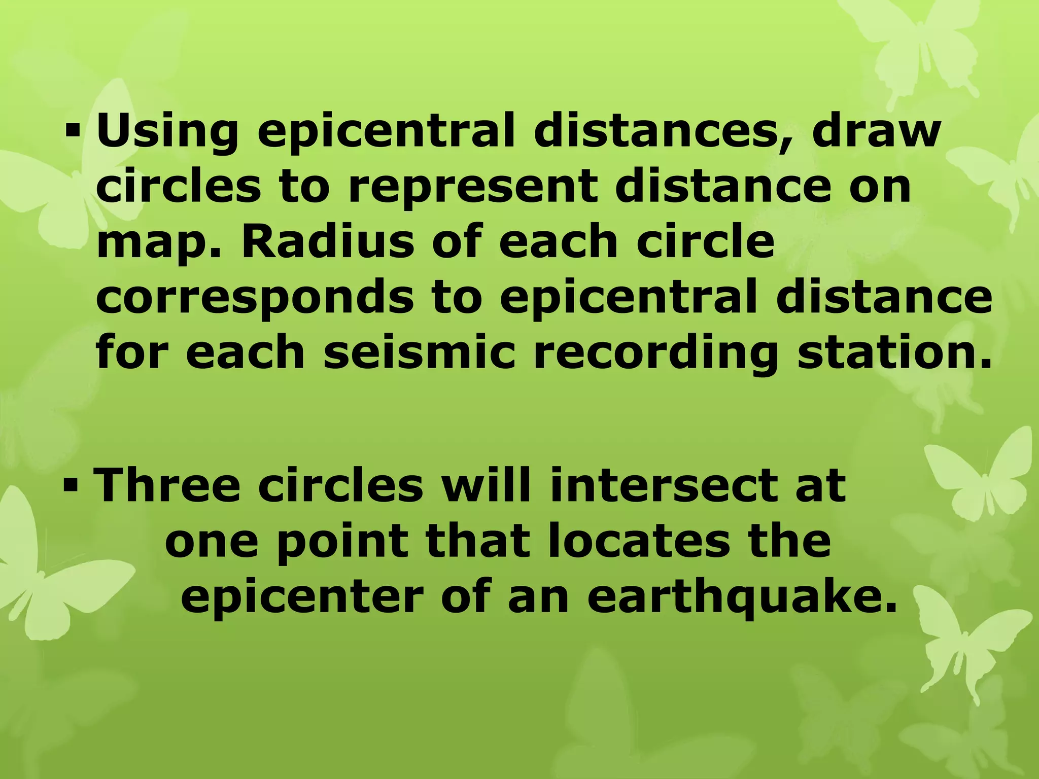

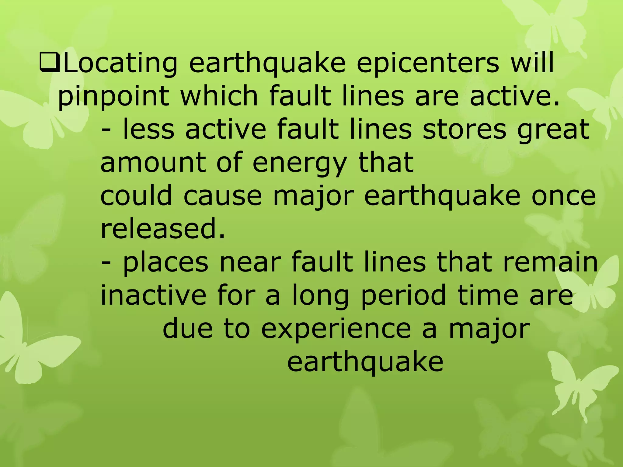


To locate an earthquake epicenter using triangulation, seismologists determine the S-P interval from seismograms of at least three seismic stations. This interval is converted to epicentral distance and circles are drawn on a map with radii equal to these distances. The intersection of these circles identifies the epicenter. Triangulation is suitable for local quakes, while distance-time graphs are used for more distant quakes. Locating epicenters helps identify active fault lines and areas at risk for future major quakes due to long periods of inactivity on certain faults.


![Earth and Space W2 D2 - 3 [Autosaved].pptx](https://cdn.slidesharecdn.com/ss_thumbnails/earthandspacew2d2-3autosaved-250710040541-de452520-thumbnail.jpg?width=640&height=640&fit=bounds)


