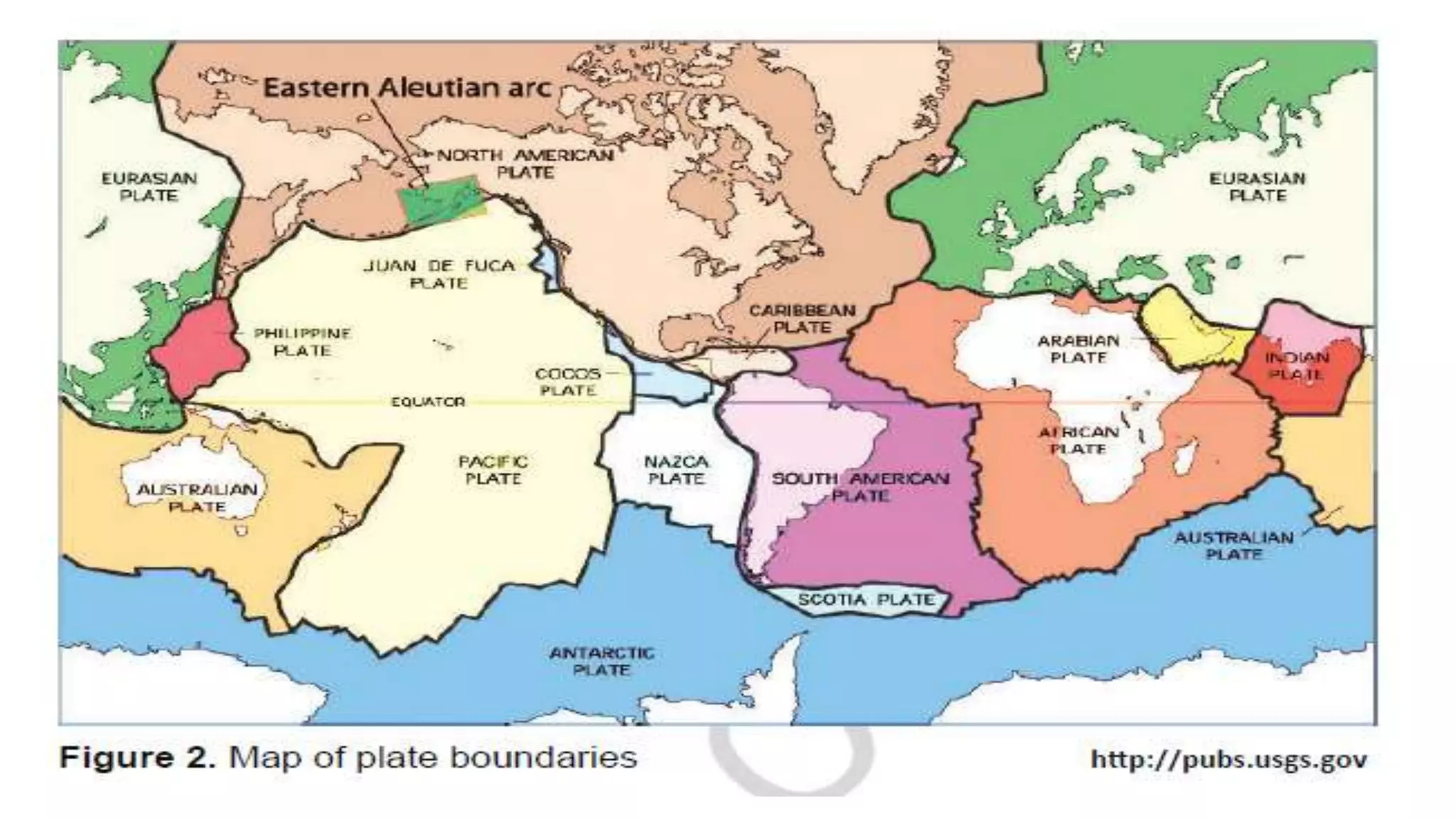
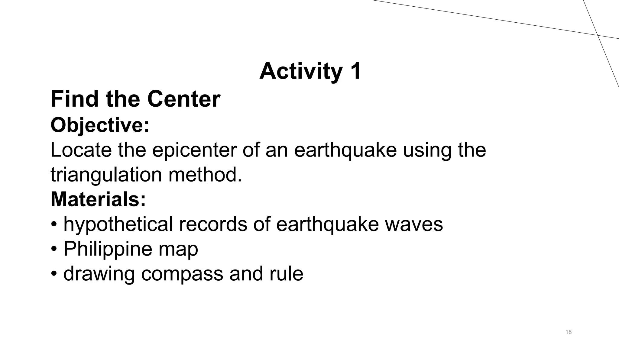
This document discusses plate tectonics and earthquakes. It outlines learning objectives about plate boundaries and the distribution of volcanoes, quakes, and mountains. It then discusses determining an earthquake's epicenter using triangulation of arrival times at three seismic stations. An activity is described to locate the epicenter of a hypothetical quake using this method. The importance of determining the epicenter is to help emergency response and preparedness for future quakes.
In 1977, after decades of tediously collecting and mapping ocean sonar data, scientists began to see a fairly accurate picture of the seafloor emerge. The Tharp-Heezen map illustrated the geological features that characterize the seafloor and became a crucial factor in the acceptance of the theories of plate tectonics and continental drift. Today, these theories serve as the foundation upon which we understand the geologic processes that shape the Earth.
https://www.nationalgeographic.org/media/plate-tectonics/#:~:text=The%20theory%20of%20plate%20tectonics,upper%20portion%20of%20the%20mantle.&text=Thus%2C%20at%20divergent%20boundaries%2C%20oceanic%20crust%20is%20created.
The October 2004 Mw=7.1 Nicaragua earthquake: Rupture process, aftershock loc...Gus Alex Reyes
The subduction zone off the Nicaragua
coastline has been the site of several large
earthquakes in the past decades, including
the 1992 tsunami earthquake that was
anomalous in the size of the tsunami relative
to moment release [Kanamori and
Kikuchi, 1993]. As a focus site for both
the MARGINS-SEIZE and SubFac initiatives,
it is an area of keen interest for
scientists interested in earthquake rupture
and volcanic processes.
ESA SMOS (Soil Moisture and Ocean Salinity) Mission: Principles of Operation ...adrianocamps
SMOS basic principles and description of some products developed at the SMOS Barcelona Expert Center.
Disclaimer: these materials were prepared for Eduacational purposes only.
In this presentation the following topics are covered:
- Active debris removal techniques
- Tethered space tug
- Mathematical model
- Numerical simulation and analysis
- Results and conclusion
Presentation for the 5th Eucass - European Conference for Aerospace Sciences - Munich, Germany, 1-4 July 2013.
Class 11 important questions for physics Friction in Soilds and LiquidsInfomatica Academy
Here you can get Class 11 Important Questions for Physics based on NCERT Textbook for Class XI. Physics Class 11 Important Questions are very helpful to score high marks in board exams. Here we have covered Important Questions on Friction in Solids and Liquids for Class 11 Physics subject.
The Effect of Latent Heat on the Extratropical Transition of Typhoon Sinlaku ...Skylar Hernandez
Masters Thesis work on "What is the sensitivity of Extratropical Transition onset and completion to latent heating from the storm and surrounding area?"
Airborne and underground matter-wave interferometers: geodesy, navigation and...Philippe Bouyer
The remarkable success of atom coherent manipulation techniques has motivated competitive research and development in precision metrology. Matter-wave inertial sensors – accelerometers, gyrometers, gravimeters – based on these techniques are all at the forefront of their respective measurement classes. Atom inertial sensors provide nowadays about the best accelerometers and gravimeters and allow, for instance, to make the most precise monitoring of gravity or to device precise tests of the weak equivalence principle (WEP). I present here some recent advances in these fields
Türkiye'nin doğusunda en büyük tehlike kaynaklarından birisi SINIR ZONU olarak görünüyor. Bölgede ki en güvenilir tarihsel veri Ambraseys'den geliyor. Büyük sismolog. Ambraseys makaleleri okudukça yeni şeyler keşfedilen makaleler. Türkiye'de Sınır Deprem Kuşağını çok net göstermiş.
This project is about the seismic wave signal Parameter enhancement with vibration analysis and
geomagnetic signal anomalies. In this project, we are going to detect the seismic signal using seismograph. The
ghosting effects were occurring and it will be suppressed using the filters. We propose to show the benefit of 1D
convolutional filter, to remove all the non-energetic wave-field in order to provide a better imaging of the
reflecting wave-field. In this paper, wave signals are decomposed into intrinsic (characteristic) modes via Discrete
Wavelet Transform [4] (DWT), Empirical Mode Decomposition [1] (EMD) and the relationship between seismic
activities are investigated.
Lightning as an alternative fuel source an analysis of the viability to use l...Luis O Maymí
This paper discusses the viability in using lightning as a new
source of energy considering thunderstorms behavior, a
hypothetical lightning facility and the economic aspect
involved. Results shows that lightning could be able to
produce a large amount of energy, but in order to get this
energy there will be a need for many Lightning Storage
Facilities around the world which we prove in several ways
impractical. Results also demonstrate that lightning is not
necessarily inefficient because of the low energy it gives. Most
of its inefficiency is in the economic aspect, making it
inefficient or non competitive in the energy market.
Honest Reviews of Tim Han LMA Course Program.pptxtimhan337
Personal development courses are widely available today, with each one promising life-changing outcomes. Tim Han’s Life Mastery Achievers (LMA) Course has drawn a lot of interest. In addition to offering my frank assessment of Success Insider’s LMA Course, this piece examines the course’s effects via a variety of Tim Han LMA course reviews and Success Insider comments.
How to Make a Field invisible in Odoo 17Celine George
It is possible to hide or invisible some fields in odoo. Commonly using “invisible” attribute in the field definition to invisible the fields. This slide will show how to make a field invisible in odoo 17.
Biological screening of herbal drugs: Introduction and Need for
Phyto-Pharmacological Screening, New Strategies for evaluating
Natural Products, In vitro evaluation techniques for Antioxidants, Antimicrobial and Anticancer drugs. In vivo evaluation techniques
for Anti-inflammatory, Antiulcer, Anticancer, Wound healing, Antidiabetic, Hepatoprotective, Cardio protective, Diuretics and
Antifertility, Toxicity studies as per OECD guidelines
Safalta Digital marketing institute in Noida, provide complete applications that encompass a huge range of virtual advertising and marketing additives, which includes search engine optimization, virtual communication advertising, pay-per-click on marketing, content material advertising, internet analytics, and greater. These university courses are designed for students who possess a comprehensive understanding of virtual marketing strategies and attributes.Safalta Digital Marketing Institute in Noida is a first choice for young individuals or students who are looking to start their careers in the field of digital advertising. The institute gives specialized courses designed and certification.
for beginners, providing thorough training in areas such as SEO, digital communication marketing, and PPC training in Noida. After finishing the program, students receive the certifications recognised by top different universitie, setting a strong foundation for a successful career in digital marketing.
Welcome to TechSoup New Member Orientation and Q&A (May 2024).pdfTechSoup
In this webinar you will learn how your organization can access TechSoup's wide variety of product discount and donation programs. From hardware to software, we'll give you a tour of the tools available to help your nonprofit with productivity, collaboration, financial management, donor tracking, security, and more.
Model Attribute Check Company Auto PropertyCeline George
In Odoo, the multi-company feature allows you to manage multiple companies within a single Odoo database instance. Each company can have its own configurations while still sharing common resources such as products, customers, and suppliers.
Unit 8 - Information and Communication Technology (Paper I).pdfThiyagu K
This slides describes the basic concepts of ICT, basics of Email, Emerging Technology and Digital Initiatives in Education. This presentations aligns with the UGC Paper I syllabus.
The French Revolution, which began in 1789, was a period of radical social and political upheaval in France. It marked the decline of absolute monarchies, the rise of secular and democratic republics, and the eventual rise of Napoleon Bonaparte. This revolutionary period is crucial in understanding the transition from feudalism to modernity in Europe.
For more information, visit-www.vavaclasses.com
2. Content Standard:
The learner demonstrates understanding of
the relationship among the locations of
volcanoes,
earthquake epicenter, and mountain ranges
20XX PRESENTATION TITLE 2
3. Performance Standard:
The Learners shall be able to
demonstrate ways to ensure disaster
preparedness during earthquakes,
tsunami, and volcanic eruption
20XX PRESENTATION TITLE 3
4. LEARNING
COMPETENCIES/OBJECTIVES
20XX PRESENTATION TITLE 4
1. Describe the distribution of active volcanoes,
earthquake epicenters,
and major mountain belts.
2. Describe the different types of plate
boundaries.
3. Explain the different processes that occur
along the plate boundaries.
8. MAJOR EARTHQUAKE IN THE PHILIPPINES
20XX PRESENTATION TITLE 8
Moro gulf Earthquake ( MAGNITUDE 8.1)
9. MAJOR EARTHQUAKE IN THE PHILIPPINES
20XX PRESENTATION TITLE 9
Moro gulf Earthquake ( MAGNITUDE 8.1)
1976
10. MAJOR EARTHQUAKE IN THE PHILIPPINES
20XX PRESENTATION TITLE 10
Luzon Earthquake ( MAGNITUDE 7.8)
1990
11. MAJOR EARTHQUAKE IN THE PHILIPPINES
20XX PRESENTATION TITLE 11
Lanao Earthquake ( MAGNITUDE 7.5)
1955
12. MAJOR EARTHQUAKE IN THE PHILIPPINES
20XX PRESENTATION TITLE 12
Casiguran Earthquake ( MAGNITUDE 7.3)
1368
13. 20XX PRESENTATION TITLE 13
3 types of seismic wave
PRIMARY WAVE
SECONDARY WAVE
LONG SURFACE WAVES
• Love waves
• Rayleigh wave
14. HOW DO WE LOCATE THE EPICENTER?
20XX PRESENTATION TITLE 14
If we have at least three recording stations
that can tell how far away
from them the earthquake occurred, the
epicenter can be determined using the
TRIANGULATION METHOD
18. 18
Activity 1
Find the Center
Objective:
Locate the epicenter of an earthquake using the
triangulation method.
Materials:
• hypothetical records of earthquake waves
• Philippine map
• drawing compass and rule
20. 20XX PRESENTATION TITLE 20
Where: d = distance (km)
Td = time difference in the arrival time of P-wave and
S-wave (seconds)
This formula is suited because 8 seconds is the
interval between the
times of arrival of the P-wave and S-wave at a
distance of 100 km.
Lithosphere consists of crust and the upper portion of the mantle. Figure 1 in the LM shows two types of crust, the continental crust and the oceanic crust. The continental crust is thicker but less dense than the oceanic crust. Because of the difference in density, continental crust floats higher than the oceanic crust.
Derived from the Greek word LITHOS meaning Rocky/Stone. This word is coined by JOSEPH BARRELL (1914) WHO FIRST STUDY THE MOTION OF LITHOSPHERE OVER MOLTEN LAYER.
Figure 2 in the LM is a map showing the lithosphere of the Earth divided into the segments called plates. But what are the Basis of scientists imn dividing the lithosphere is such manner?
The plates move very slowly but constantly, and this movement is called tectonics; thus the theory of moving lithospheric plates is called plate tectonics.
in your Grade 8 Science that an earthquake releases three types of seismic waves; Primary (P-waves), Secondary (S-waves), and Long surface waves (L-waves).
The first two travel into the Earth’s interior while the last one on the surface
. These waves travel at different velocities; thus, do not arrive at a seismic recording station at the same time. The farther
the recording instrument is from the focus, the greater the difference in arrival times of the first P-wave compared to the first S-wave. The difference in the arrival time will tell us the distance of the earthquake’s focus from the seismic recording station. However, it does not tell in which direction it came from.
. It uses distance information from three seismic stations to locate the earthquake epicenter. On a map, circles are drawn around each seismic station.
. The radii of the circles are scaled to the estimated distance from the station to the earthquake. The three circles will intersect at one point that locates the earthquake.
The three circles will intersect at one point that locates the earthquake. The point of intersection is the location of the epicenter.
Cebu is the epicenter
Assuming that the two circle will intersect the circle will intersect at two point , it means there are two epicenter
But, if the earthquake
took place at a far greater distance, seismologists use the distance-time graph
similar to the figure below in determining the location of the epicenter.
S-P interval is 10 minutes
What is the distance of the epicenter from the seismic station?
Answer: 9000 km
Determining the location of earthquake epicenters plays a vital role
in laying the foundations of plate tectonics
Locating earthquake epicenters will pinpoint which fault lines are active.
Usually, the less active fault line stores great amount of potential energy
that could cause major earthquake once released. Therefore, places near
fault lines that remain inactive for a long period of time are due to experience
a major earthquake.