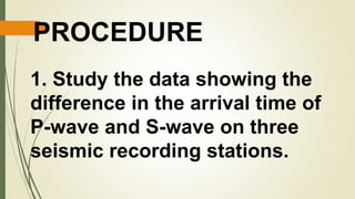
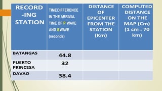
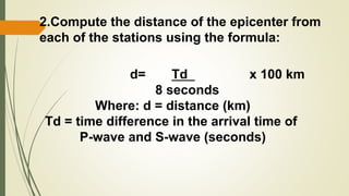
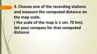
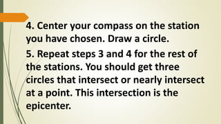
Scientists use data from at least three seismic stations collected at different locations to triangulate the epicenter of an earthquake. The time difference between the P and S waves recorded at each station is used to compute the distance from the station to the epicenter. Circles are drawn on a map centered at each station with radii equal to the computed distances. The intersection of the three circles identifies the epicenter location.


![Earth and Space W2 D2 - 3 [Autosaved].pptx](https://cdn.slidesharecdn.com/ss_thumbnails/earthandspacew2d2-3autosaved-250710040541-de452520-thumbnail.jpg?width=640&height=640&fit=bounds)


